Extended Description of the Vector Map
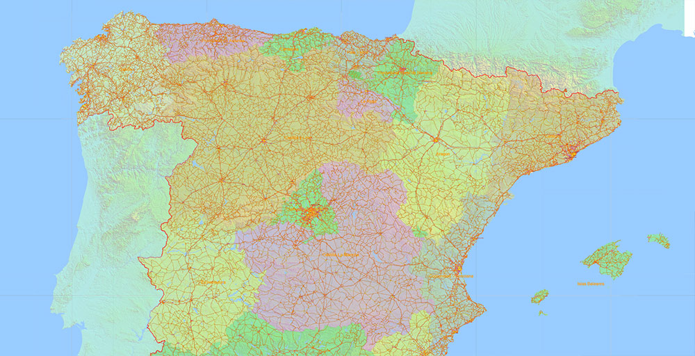
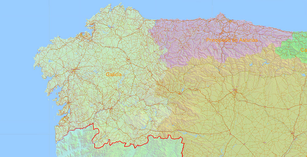
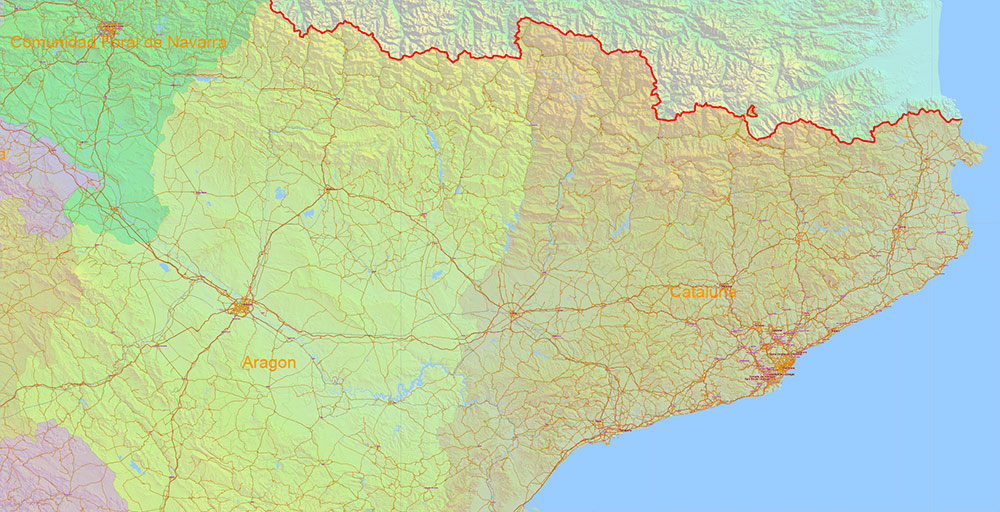
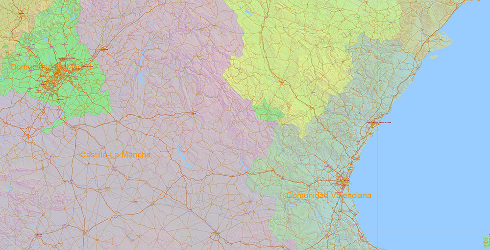
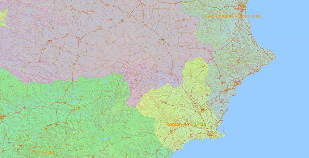
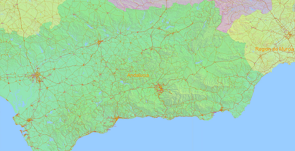
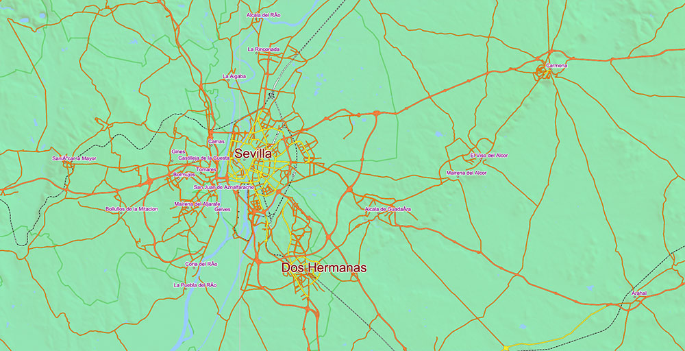
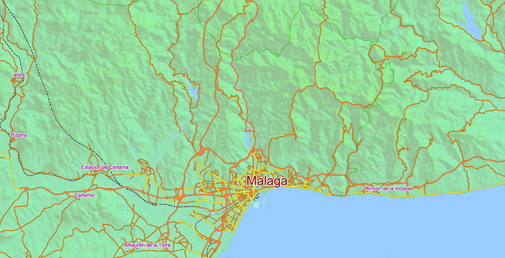
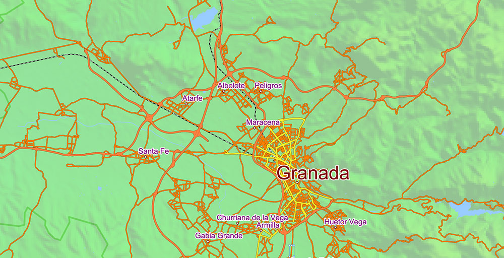
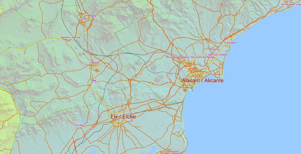
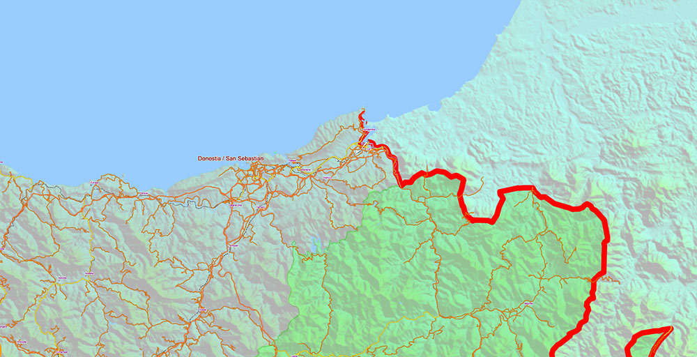
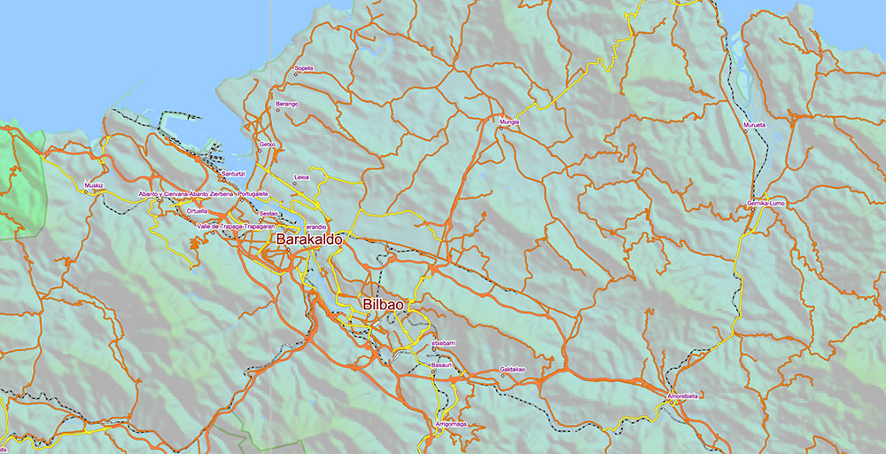
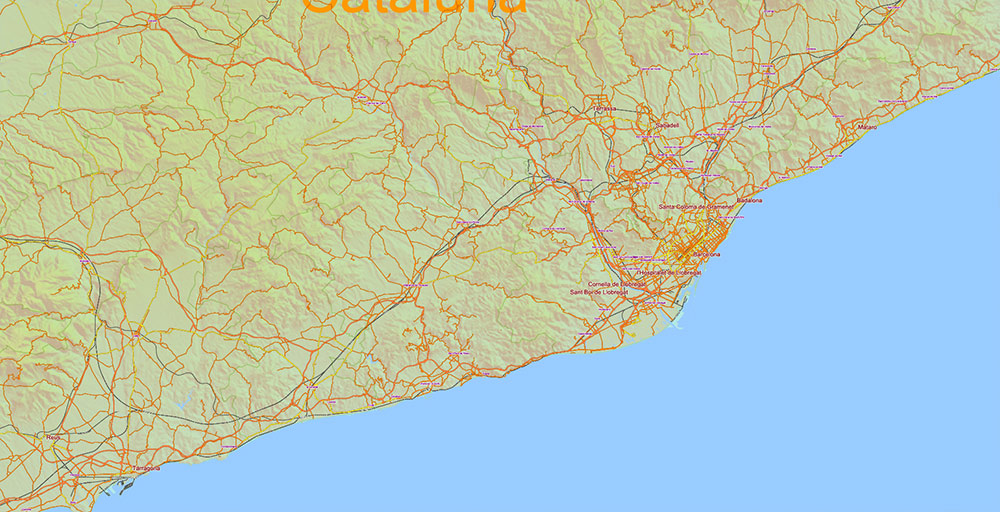
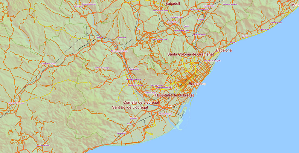
Printable Vector Map Spain, – Roads, Relief and Admin High Detailed Map in Mercator Projection fully editable, Adobe Illustrator in layers, full vector, scalable, curves/text format names, 237 mb ZIP
Main and secondary roads, railroads, Shaded Relief Raster. Map for design, printing, arts, projects, presentations, for architects, designers and builders, business, logistics, education.
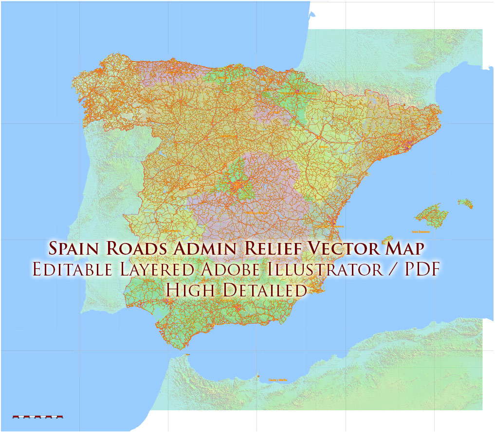
Spain Vector Map – Main Roads, Relief and Admin High Detailed Map, printable vector map Adobe Illustrator editable Layered
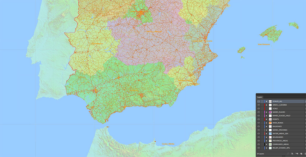
Layers:
- Legend
- Grids 3 degrees
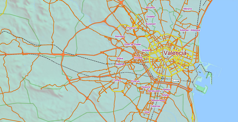
- Cities points
- Cities names from 5.000 population
Sorted by font size
- Admin Areas names (provinces level)
- Principal roads 1, 2
- Railroads
- Water objects (areas)
- Country boundaries
- Admin areas (colored areas) (transparent 20%)
- Relief Shaded Topo (transparent 30%)
- Background
Spain Vector Map – Main Roads, Relief and Admin High Detailed Map, printable vector map Adobe Illustrator editable Layered
Spain Vector Map – Main Roads, Relief and Admin High Detailed Map, printable vector map Adobe Illustrator editable Layered
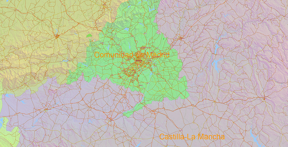
AO BRIEF — Spain
Overview
- major Western European state occupying most of the Iberian Peninsula
- strategic position between Atlantic Ocean and Mediterranean Sea
- key land bridge between Europe and North Africa (via Strait of Gibraltar)
- highly urbanized, with strong regional identities
Geography / Terrain
- central Meseta Plateau (600–800 m) — dominant interior feature
- surrounded by mountain systems:
- Pyrenees (NE) — barrier to France
- Cantabrian Mountains (N)
- Iberian System (E interior)
- Sierra Morena (S plateau edge)
- Baetic System / Sierra Nevada (S)
- major river basins:
- Ebro (NE → Mediterranean)
- Tagus (central → Portugal)
- Duero (NW → Portugal)
- Guadalquivir (S → Atlantic)
- climate zones:
- Mediterranean (E, S coasts)
- Oceanic (N coast)
- Continental (interior plateau)
Primary Cities (Urban Nodes)
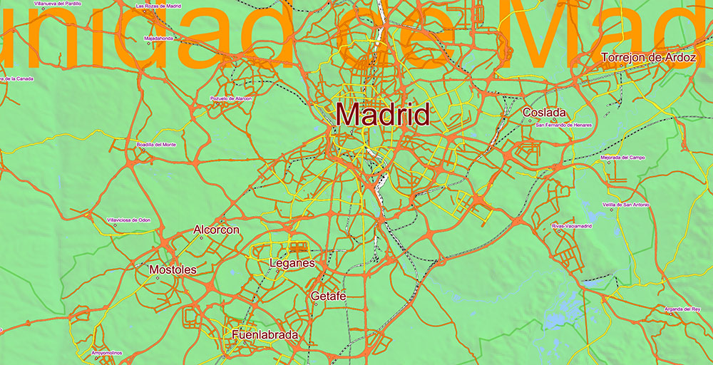
- Madrid — central political and transport hub (interior)
- Barcelona — NE coastal economic and industrial hub
- Valencia — E coastal port and logistics node
- Seville — S administrative and cultural center
- Bilbao — N industrial and port hub
- Zaragoza — NE inland junction (Ebro corridor)
- secondary nodes: Málaga, Alicante, Murcia, Valladolid
Primary Roads / Lines of Communication
- radial network centered on Madrid (national hub model)
Core corridors:
- A-1 → Madrid–Burgos–Basque Country (N)
- A-2 → Madrid–Zaragoza–Barcelona (NE)
- A-3 → Madrid–Valencia (E)
- A-4 → Madrid–Córdoba–Seville (S)
- A-5 → Madrid–Badajoz–Portugal (W)
- A-6 → Madrid–Galicia (NW)
Secondary / coastal axes:
- AP-7 / A-7 → Mediterranean corridor (France → Barcelona → Valencia → Málaga)
- A-8 → northern coastal corridor (Basque Country → Galicia)
👉 Pattern: centralized radial + coastal longitudinal axes
Transport / Infrastructure
- extensive highway (autovía/autopista) network — one of Europe’s densest
- high-speed rail (AVE) centered on Madrid with spokes to major cities
- major ports:
- Barcelona, Valencia, Algeciras, Bilbao
- major airports:
- Madrid-Barajas (primary hub)
- Barcelona-El Prat
- logistics concentrated along Madrid hub + Mediterranean corridor
Demography / Human Terrain
- population: ~47 million
- high urban concentration in:
- Madrid metropolitan area
- Mediterranean coast (Barcelona → Valencia → Alicante)
- Andalusia (Seville–Málaga axis)
- interior plateau = low density (“empty Spain”)
- regional identities:
- Catalonia, Basque Country, Galicia, Andalusia
- aging population with low growth rate
Urban Pattern
- strong monocentric national structure (Madrid)
- secondary coastal urban belts
- inland cities spaced along river valleys and transport corridors
- industrial/logistics clusters near ports and major junctions
Operational Constraints
- mountainous terrain fragments internal connectivity
- interior depopulation → uneven spatial development
- seasonal tourism pressure on coastal infrastructure
- water scarcity in southern and eastern regions
Command Takeaways
- Madrid = central node controlling national transport geometry
- Mediterranean corridor = primary economic axis
- terrain creates natural compartmentalization (mountain barriers)
- population and logistics concentrated in limited corridors
- control of Madrid + coastal axes ensures national-level mobility control
Spain Vector Map – Main Roads, Relief and Admin High Detailed Map, printable vector map Adobe Illustrator editable Layered
Spain Vector Map – Main Roads, Relief and Admin High Detailed Map, printable vector map Adobe Illustrator editable Layered
Spain Vector Map – Main Roads, Relief and Admin High Detailed Map, printable vector map Adobe Illustrator editable Layered
Spain Vector Map – Main Roads, Relief and Admin High Detailed Map, printable vector map Adobe Illustrator editable Layered
Spain Vector Map – Main Roads, Relief and Admin High Detailed Map, printable vector map Adobe Illustrator editable Layered
Spain Vector Map – Main Roads, Relief and Admin High Detailed Map, printable vector map Adobe Illustrator editable Layered
Spain Vector Map – Main Roads, Relief and Admin High Detailed Map, printable vector map Adobe Illustrator editable Layered
Spain Vector Map – Main Roads, Relief and Admin High Detailed Map, printable vector map Adobe Illustrator editable Layered
Spain Vector Map – Main Roads, Relief and Admin High Detailed Map, printable vector map Adobe Illustrator editable Layered
Spain Vector Map – Main Roads, Relief and Admin High Detailed Map, printable vector map Adobe Illustrator editable Layered
Spain Vector Map – Main Roads, Relief and Admin High Detailed Map, printable vector map Adobe Illustrator editable Layered
Spain Vector Map – Main Roads, Relief and Admin High Detailed Map, printable vector map Adobe Illustrator editable Layered
Spain Vector Map – Main Roads, Relief and Admin High Detailed Map, printable vector map Adobe Illustrator editable Layered
Spain Vector Map – Main Roads, Relief and Admin High Detailed Map, printable vector map Adobe Illustrator editable Layered
Spain Vector Map – Main Roads, Relief and Admin High Detailed Map, printable vector map Adobe Illustrator editable Layered
Spain Vector Map – Main Roads, Relief and Admin High Detailed Map, printable vector map Adobe Illustrator editable Layered

 Author: Kirill Shrayber, Ph.D. FRGS


