Extended Description of the Vector Map
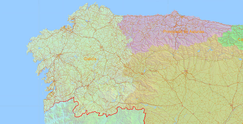
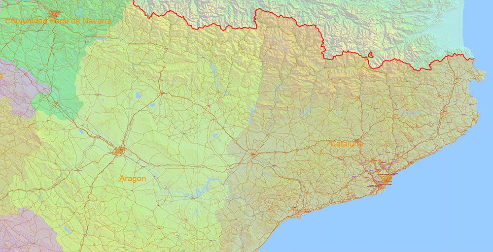
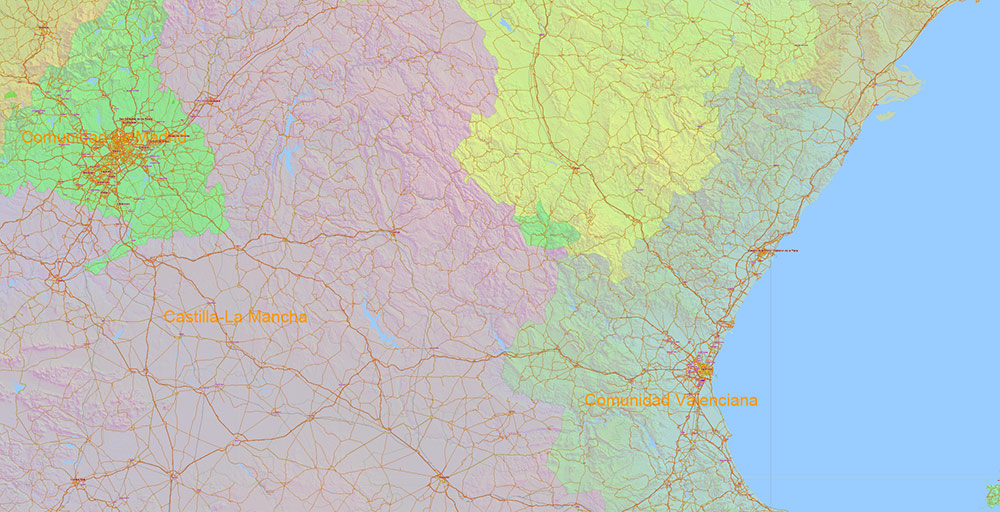
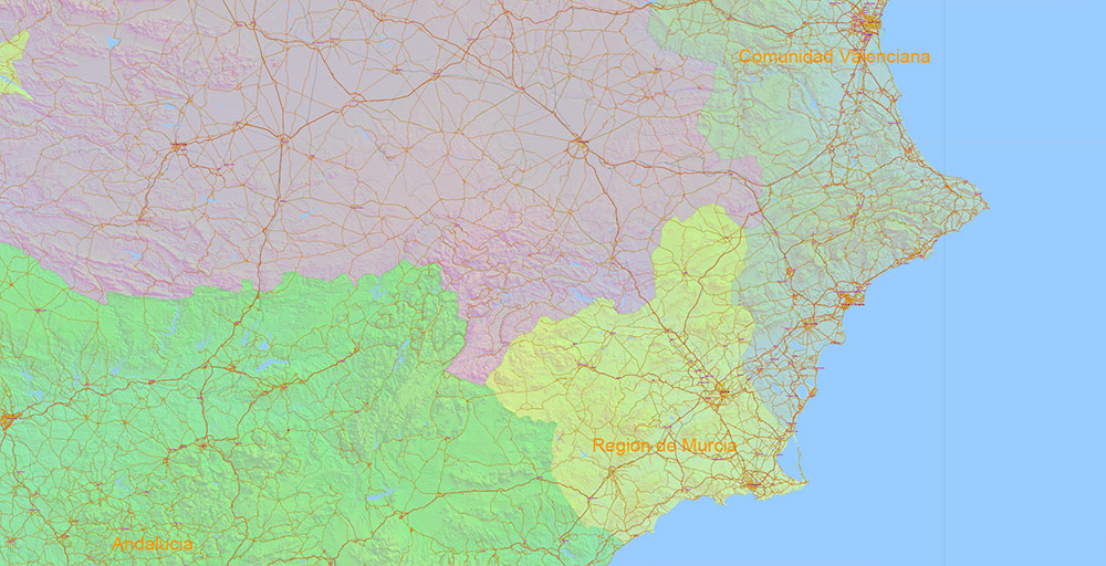
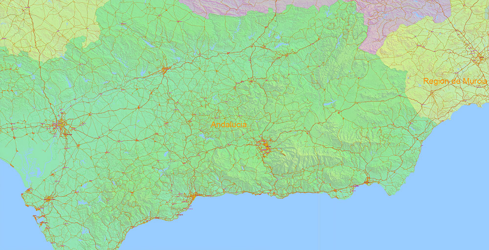
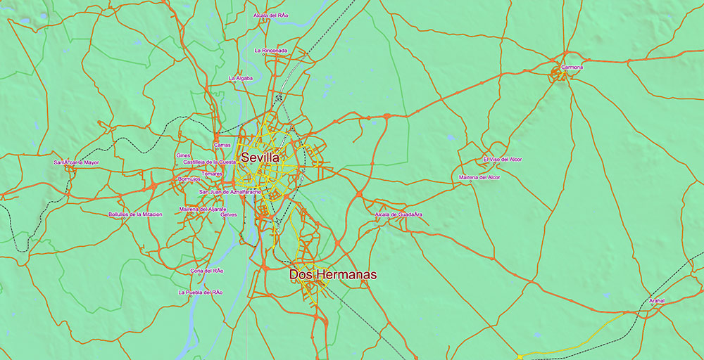
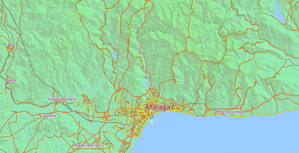
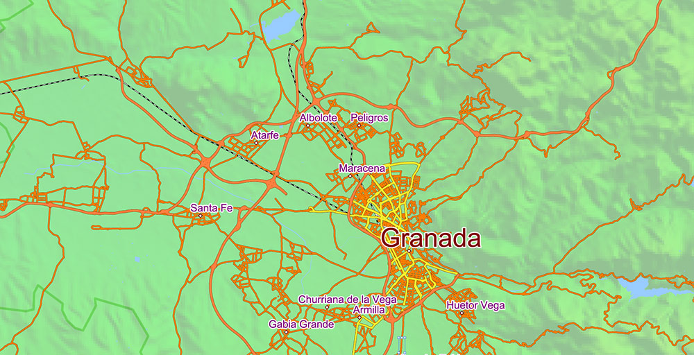
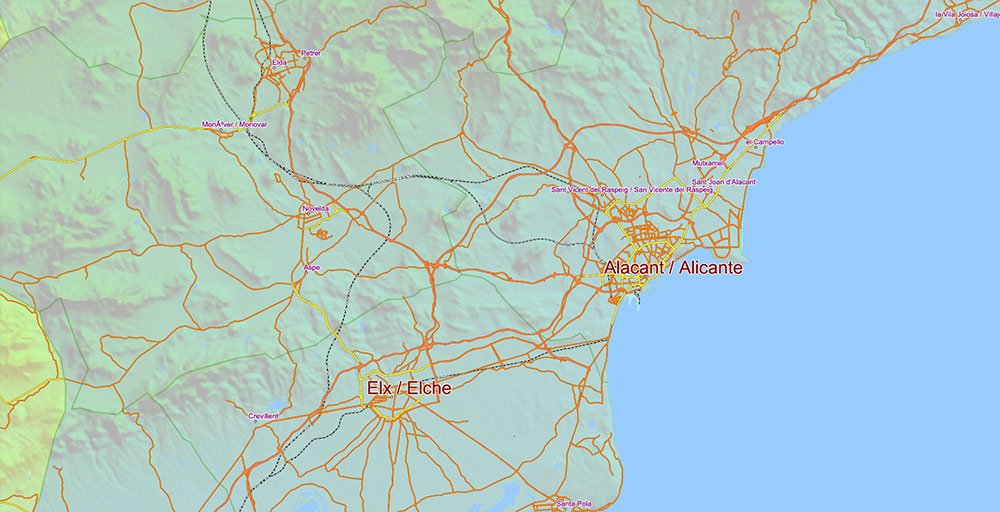
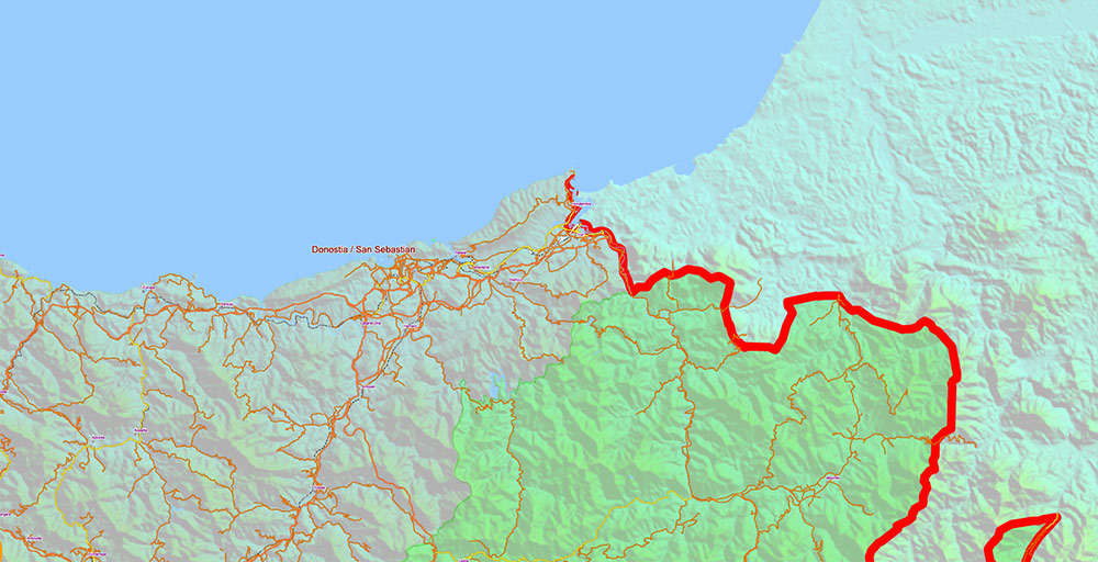
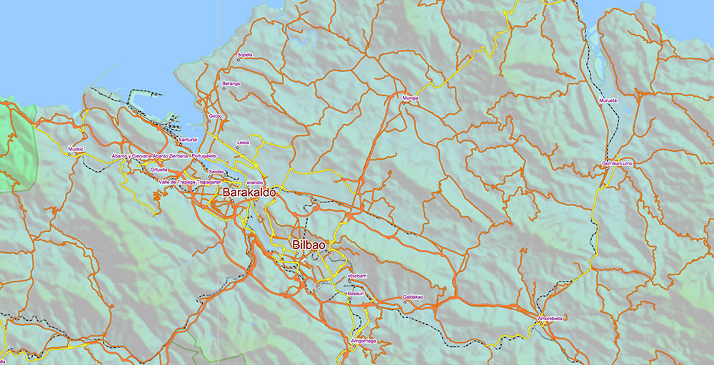
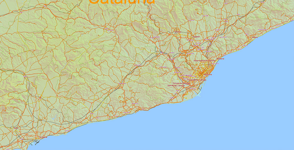
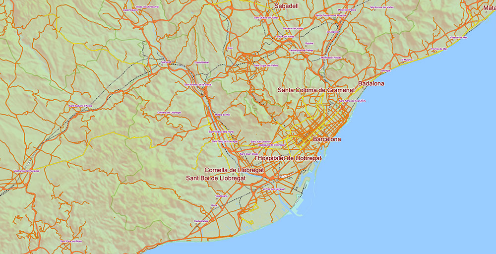
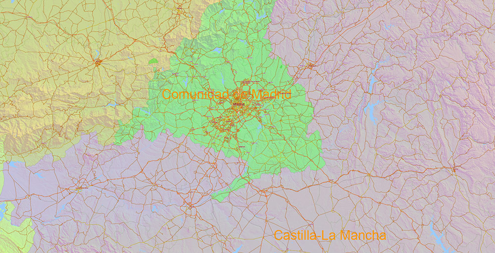
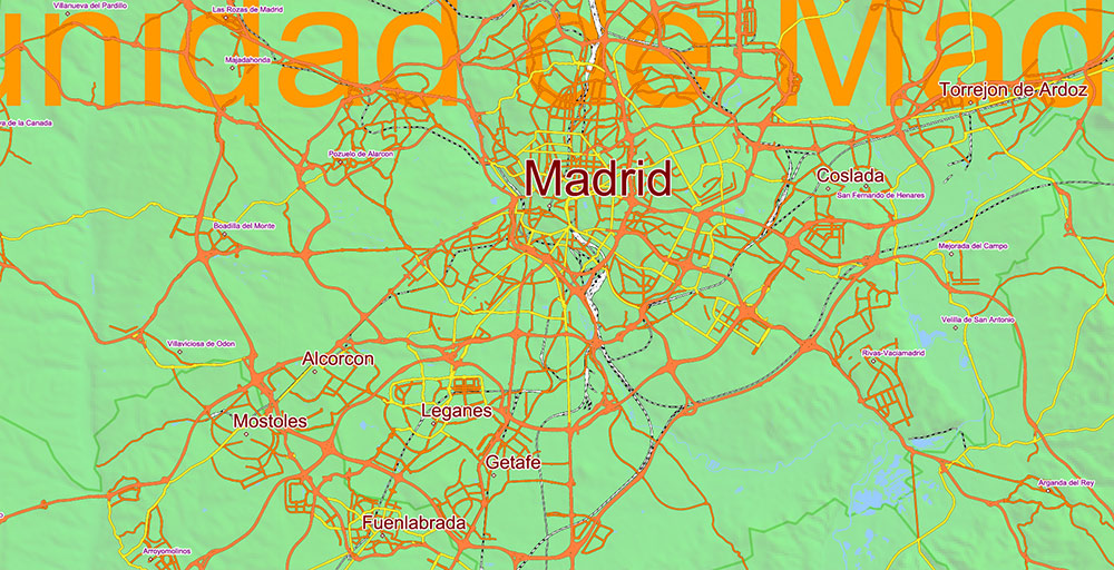
Printable PDF Vector Map Spain, – Roads, Relief and Admin High Detailed Map in Mercator Projection fully editable, Adobe PDF in layers, full vector, scalable, curves/text format names, 471 mb ZIP
Main and secondary roads, railroads, Shaded Relief Raster. Map for design, printing, arts, projects, presentations, for architects, designers and builders, business, logistics, education.
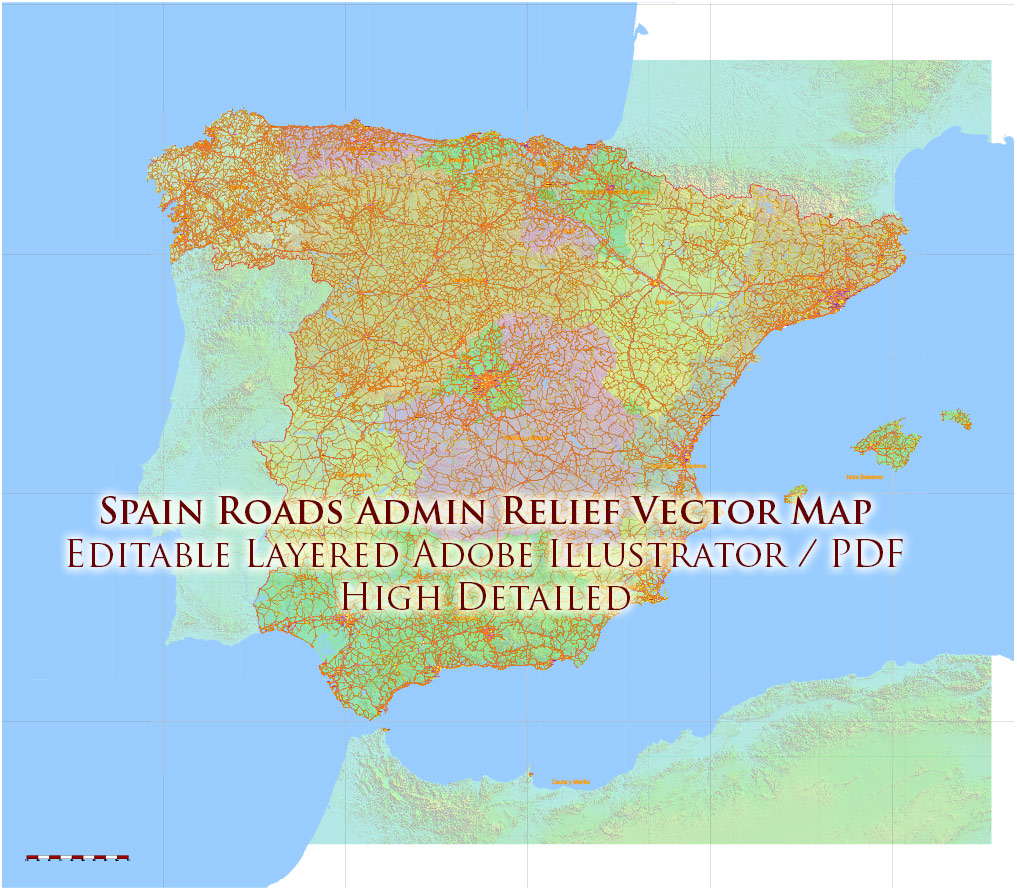
Spain PDF Vector Map – Main Roads, Relief and Admin High Detailed Map, printable vector map Adobe PDF editable Layered
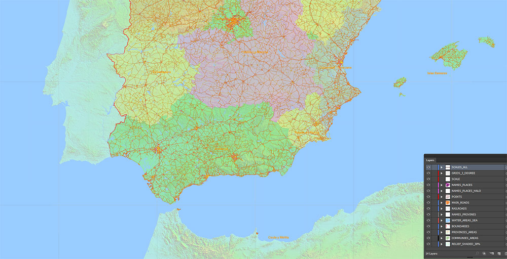
Layers:
- Legend
- Grids 3 degrees
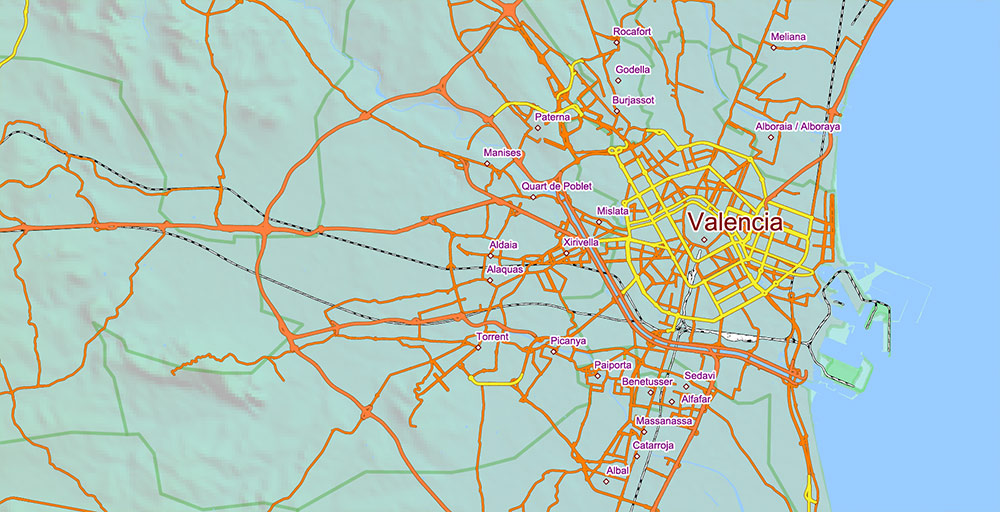
- Cities points
- Cities names from 5.000 population
Sorted by font size
- Admin Areas names (provinces level)
- Principal roads 1, 2
- Railroads
- Water objects (areas)
- Country boundaries
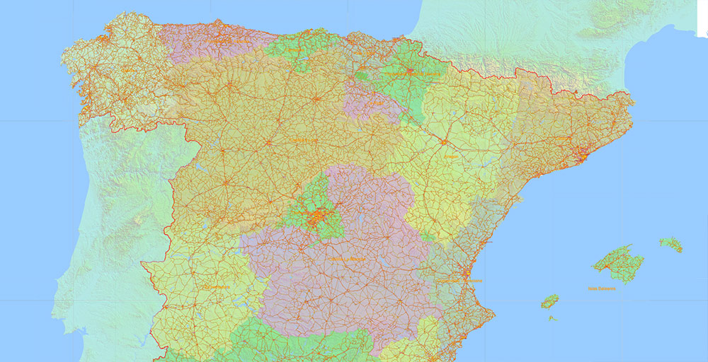
- Admin areas (colored areas) (transparent 20%)
- Relief Shaded Topo (transparent 30%)
- Background
Spain PDF Vector Map – Main Roads, Relief and Admin High Detailed Map, printable vector map Adobe PDF editable Layered
Spain PDF Vector Map – Main Roads, Relief and Admin High Detailed Map, printable vector map Adobe PDF editable Layered
AO BRIEF — Spain (Cartographic Edition)
AO Geometry
- occupies ~85% of the Iberian Peninsula
- bounded by:
- N — Bay of Biscay
- E / SE — Mediterranean Sea
- SW — Atlantic Ocean
- S — Strait of Gibraltar (narrow maritime chokepoint)
- internal structure: elevated central plateau (Meseta) encircled by mountain systems
- average elevation high relative to Western Europe
Relief Framework (Terrain Skeleton)
- Meseta Central — dominant interior block (600–800 m)
- enclosing barriers:
- Pyrenees (NE) — primary hard barrier to France
- Cantabrian Range (N) — coastal wall
- Iberian System (E interior) — divides Ebro vs interior basins
- Sierra Morena (S edge of Meseta) — threshold to Andalusia
- Baetic System / Sierra Nevada (S) — high-relief southern arc
- lowland corridors:
- Ebro Basin (NE) — open corridor to Mediterranean
- Guadalquivir Basin (S) — major agricultural lowland
- Atlantic NW valleys (Galicia) — fragmented terrain
Hydrography (Flow Structure)
- Atlantic-draining systems (dominant):
- Duero, Tagus, Guadiana, Guadalquivir → W/SW flow
- Mediterranean system:
- river valleys act as natural transport alignments
Primary Axes (Lines of Communication)
Radial Core (Madrid-centric geometry):
- A-1 → N (Madrid–Burgos–Basque corridor)
- A-2 → NE (Madrid–Zaragoza–Barcelona via Ebro axis)
- A-3 → E (Madrid–Valencia)
- A-4 → S (Madrid–Córdoba–Seville via Guadalquivir basin)
- A-5 → W (Madrid–Extremadura–Portugal)
- A-6 → NW (Madrid–Galicia)
Longitudinal Axes:
- Mediterranean Corridor (AP-7 / A-7) — continuous coastal spine (France → Catalonia → Levante → Andalusia)
- Cantabrian Corridor (A-8) — northern coastal belt (Basque Country → Galicia)
👉 Structure: central radial hub + dual coastal belts
Transport Nodes (Urban Anchors)
- Madrid — central hub (all radial convergence; AVE core)
- Barcelona — NE coastal node (Mediterranean + Ebro junction)
- Valencia — E coastal logistics node
- Seville — S basin node (Guadalquivir)
- Bilbao — N industrial-port node
- Zaragoza — inland hinge (Ebro corridor)
Ports: Barcelona / Valencia / Algeciras / Bilbao
Air hubs: Madrid-Barajas (primary), Barcelona-El Prat
Urban & Population Distribution
- dense clusters:
- Madrid metro (central concentration)
- Mediterranean strip (Barcelona → Valencia → Alicante)
- Andalusian lowlands (Seville–Málaga axis)
- sparse interior:
- Meseta (“low-density core”)
- linear settlement patterns along:
- coastal corridors
- major river valleys
- transport axes
Mobility Structure
- dominant flows: radial toward Madrid + longitudinal along coasts
- AVE high-speed rail mirrors road geometry (hub-and-spoke)
- freight concentrated on:
- Mediterranean corridor
- Madrid distribution hub
Constraints / Barriers
- mountain chains fragment east–west movement
- Pyrenees = external barrier (limited crossing points)
- water scarcity in SE limits expansion capacity
- seasonal coastal overload (tourism-driven spikes)
Command Takeaways
- Madrid = geometric and logistical center of gravity
- Ebro corridor = primary NE penetration route
- Mediterranean axis = highest economic density line
- mountain systems enforce corridor-based movement
- control of radial network + coastal corridors = full territorial mobility control
Spain PDF Vector Map – Main Roads, Relief and Admin High Detailed Map, printable vector map Adobe PDF editable Layered
Spain PDF Vector Map – Main Roads, Relief and Admin High Detailed Map, printable vector map Adobe PDF editable Layered
Spain PDF Vector Map – Main Roads, Relief and Admin High Detailed Map, printable vector map Adobe PDF editable Layered
Spain PDF Vector Map – Main Roads, Relief and Admin High Detailed Map, printable vector map Adobe PDF editable Layered
Spain PDF Vector Map – Main Roads, Relief and Admin High Detailed Map, printable vector map Adobe PDF editable Layered
Spain PDF Vector Map – Main Roads, Relief and Admin High Detailed Map, printable vector map Adobe PDF editable Layered
Spain PDF Vector Map – Main Roads, Relief and Admin High Detailed Map, printable vector map Adobe PDF editable Layered
Spain PDF Vector Map – Main Roads, Relief and Admin High Detailed Map, printable vector map Adobe PDF editable Layered
Spain PDF Vector Map – Main Roads, Relief and Admin High Detailed Map, printable vector map Adobe PDF editable Layered
Spain PDF Vector Map – Main Roads, Relief and Admin High Detailed Map, printable vector map Adobe PDF editable Layered
Spain PDF Vector Map – Main Roads, Relief and Admin High Detailed Map, printable vector map Adobe PDF editable Layered
SSpain PDF Vector Map – Main Roads, Relief and Admin High Detailed Map, printable vector map Adobe PDF editable Layered
Spain PDF Vector Map – Main Roads, Relief and Admin High Detailed Map, printable vector map Adobe PDF editable Layered
Spain PDF Vector Map – Main Roads, Relief and Admin High Detailed Map, printable vector map Adobe PDF editable Layered
Spain PDF Vector Map – Main Roads, Relief and Admin High Detailed Map, printable vector map Adobe PDF editable Layered
Spain PDF Vector Map – Main Roads, Relief and Admin High Detailed Map, printable vector map Adobe PDF editable Layered

 Author: Kirill Shrayber, Ph.D. FRGS


