Extended Description of the Vector Map
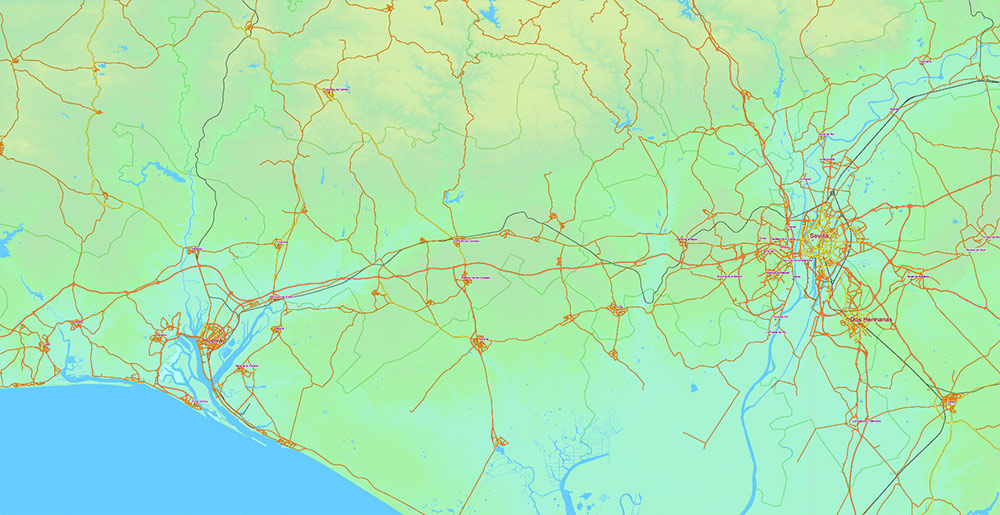
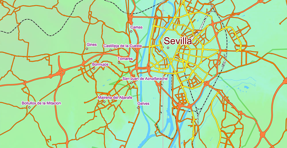
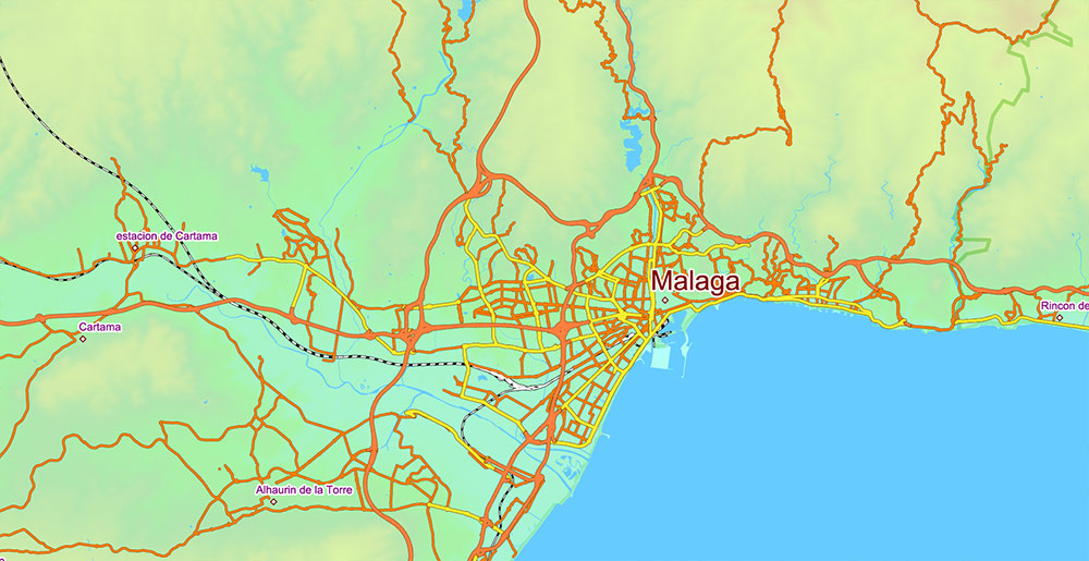
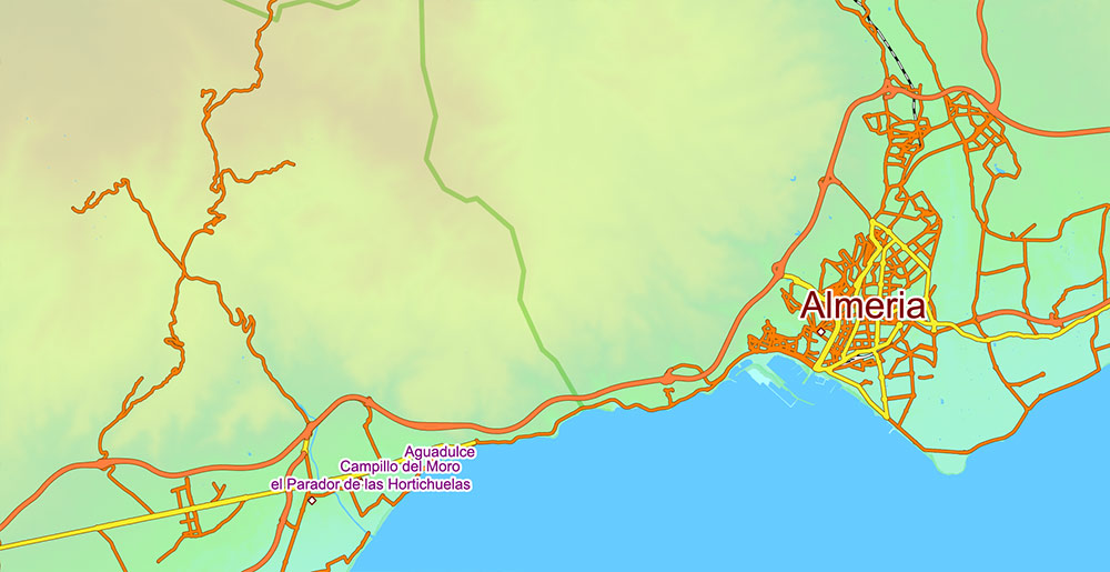
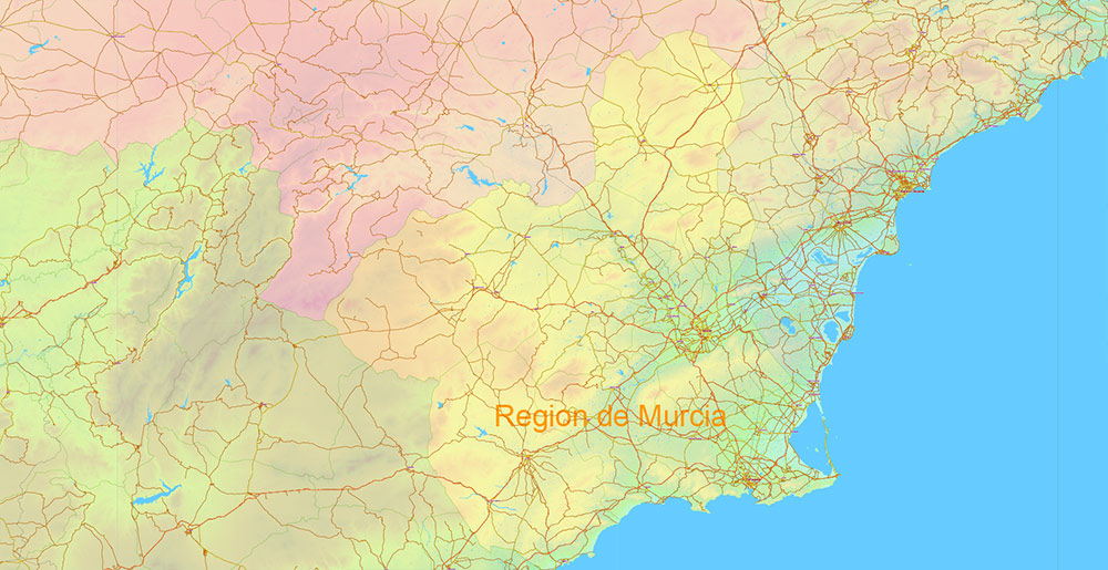
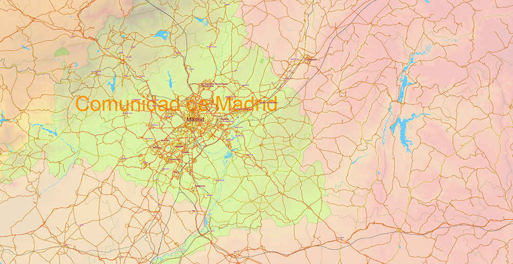
Printable PDF Vector Map of Spain, – Roads, Colored Relief and Admin High Detailed Map in Mercator Projection fully editable, Adobe PDF in layers, full vector, scalable, curves/text format names, 743 mb ZIP
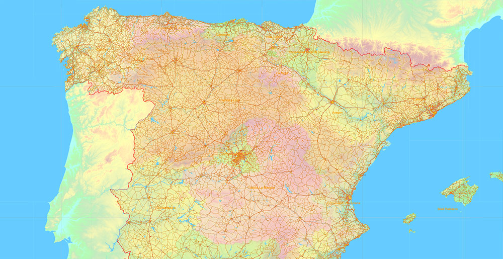
Main and secondary roads, railroads, Colored Relief Raster. Map for design, printing, arts, projects, presentations, for architects, designers and builders, business, logistics, education.
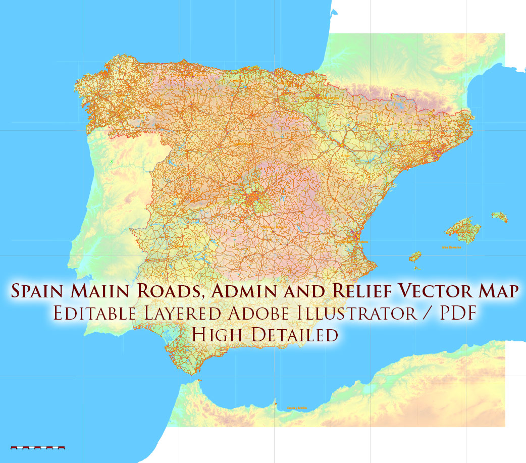
Spain PDF Vector Map – Main Roads, Colored Relief and Admin High Detailed Map, printable vector map Adobe PDF editable Layered
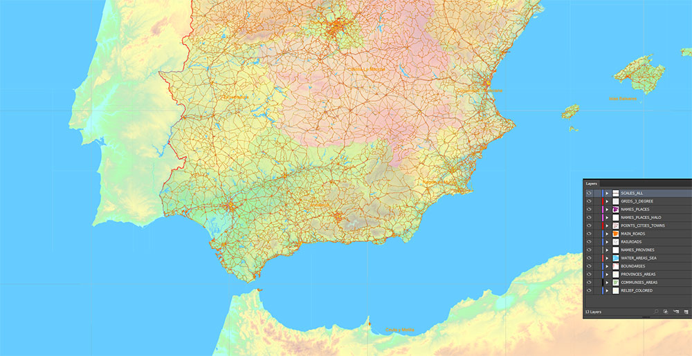
Layers:
- Legend
- Grids 3 degrees
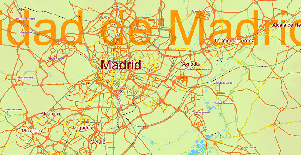
- Cities points
- Cities names from 5.000 population
Sorted by font size
- Admin Areas names (provinces level)
- Principal roads 1, 2
- Railroads
- Water objects (areas)
- Country boundaries
- Admin areas (colored areas) (transparent 20%)
- Relief Colored Topo (transparent 50%)
- Background
AO BRIEF — Spain (Alt Cartographic Version)
Overview
- Iberian Peninsula–dominant state linking Atlantic Ocean and Mediterranean Sea basins
- Strategic hinge at Strait of Gibraltar (Europe–North Africa interface)
- Polycentric economic geography with Madrid-centric control layer
- Strong regional fragmentation despite unified transport grid
Geography / Terrain
- Meseta Central — elevated core plateau (~600–800 m), dominant landmass
- Peripheral mountain ring creates compartmentalized basins:
- Pyrenees (NE barrier)
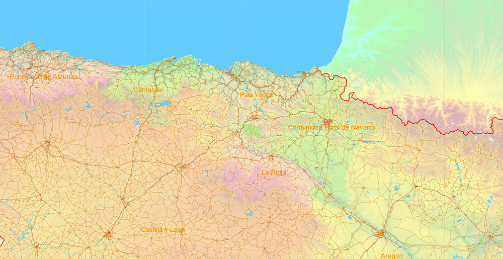
- Cantabrian Mountains (N coastal wall)
- Iberian System (E interior divider)
- Sierra Morena (Meseta–Andalusia break)
- Sierra Nevada (S high relief)
- Hydro-axes (map-structuring lines):
- Ebro River → NE corridor
- Tagus River → central-west axis
- Duero River → NW basin
- Guadalquivir River → Andalusian lowland
- Climate segmentation directly maps to terrain:
- Oceanic (north fringe)
- Mediterranean (east/south littoral)
- Continental (interior plateau)
Primary Urban Nodes (Hierarchy)
- Tier 1 (national control nodes):
- Madrid — core hub (transport + governance)
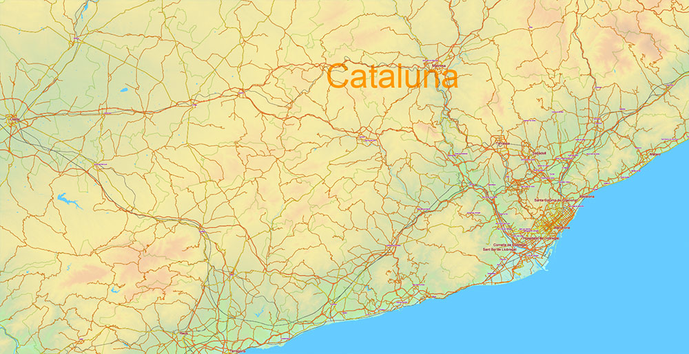
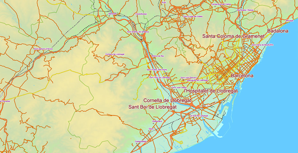
- Barcelona — industrial + maritime gateway
- Tier 2 (regional anchors):
- Valencia — east logistics port
- Seville — south administrative center
- Bilbao — north industrial node
- Zaragoza — inland corridor junction
- Tier 3 (support nodes): Málaga, Alicante, Murcia, Valladolid
👉 Pattern: central dominance + coastal reinforcement
Primary Roads / Lines of Communication
- Radial backbone (Madrid-centric geometry):
- A-1 → North (Basque axis)
- A-2 → NE (Zaragoza–Barcelona corridor)
- A-3 → East (Valencia link)
- A-4 → South (Andalusia axis)
- A-5 → West (Portugal interface)
- A-6 → NW (Galicia corridor)
- Longitudinal corridors (non-radial):
- Mediterranean axis (AP-7 / A-7): France → Barcelona → Valencia → Málaga
- Northern coastal axis (A-8): Basque Country → Galicia
👉 Pattern: radial core + dual coastal belts
Transport / Infrastructure
- Dense autovía/autopista mesh — near full national coverage
- AVE high-speed rail = Madrid hub-and-spoke dominance
- Key maritime nodes:
- Barcelona
- Valencia
- Algeciras
- Bilbao
- Air hubs:
- Adolfo Suárez Madrid–Barajas Airport
- Barcelona–El Prat Airport
👉 Logistics gravity: Madrid + Mediterranean strip
Demography / Human Terrain
- ~47M population
- High-density belts:
- Madrid metro region
- Mediterranean arc (Catalonia → Valencia → Alicante)
- Andalusian urban triangle
- Low-density interior = “empty Spain”
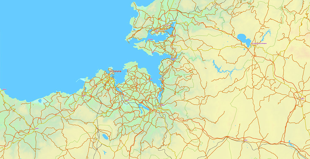
- Strong regional-cultural zones: Catalonia, Basque Country, Galicia, Andalusia
- Aging demographic profile
Urban / Spatial Pattern
- Monocentric command (Madrid)
- Secondary coastal megaregions
- Linear development along transport corridors
- Port-driven industrial clusters
Operational Constraints
- Mountain barriers → fragmented connectivity
- Interior depopulation → weak inland demand
- Seasonal coastal overload (tourism)
- Water stress (south + east basins)
Command Takeaways
- Madrid = network control pivot
- Mediterranean corridor = primary economic artery
- Terrain enforces regional compartmentalization
- Effective national coverage = control of radials + coastal axes
Spain PDF Vector Map – Main Roads, Colored Relief and Admin High Detailed Map, printable vector map Adobe PDF editable Layered
Spain PDF Vector Map – Main Roads, Colored Relief and Admin High Detailed Map, printable vector map Adobe PDF editable Layered
Spain PDF Vector Map – Main Roads, Colored Relief and Admin High Detailed Map, printable vector map Adobe PDF editable Layered
Spain PDF Vector Map – Main Roads, Colored Relief and Admin High Detailed Map, printable vector map Adobe PDF editable Layered
Spain PDF Vector Map – Main Roads, Colored Relief and Admin High Detailed Map, printable vector map Adobe PDF editable Layered
Spain PDF Vector Map – Main Roads, Colored Relief and Admin High Detailed Map, printable vector map Adobe PDF editable Layered
Spain PDF Vector Map – Main Roads, Colored Relief and Admin High Detailed Map, printable vector map Adobe PDF editable Layered
Spain PDF Vector Map – Main Roads, Colored Relief and Admin High Detailed Map, printable vector map Adobe PDF editable Layered
Spain PDF Vector Map – Main Roads, Colored Relief and Admin High Detailed Map, printable vector map Adobe PDF editable Layered
Spain PDF Vector Map – Main Roads, Colored Relief and Admin High Detailed Map, printable vector map Adobe PDF editable Layered
Spain PDF Vector Map – Main Roads, Colored Relief and Admin High Detailed Map, printable vector map Adobe PDF editable Layered
Spain PDF Vector Map – Main Roads, Colored Relief and Admin High Detailed Map, printable vector map Adobe PDF editable Layered
Spain PDF Vector Map – Main Roads, Colored Relief and Admin High Detailed Map, printable vector map Adobe PDF editable Layered

 Author: Kirill Shrayber, Ph.D. FRGS


