Frequently asked questions about vector graphics maps and city plans

Difference Vector and Raster

Difference Vector and Raster

Vector graphics are digital art that is rendered by a computer using a mathematical formula.
Raster images are made up of tiny pixels, making them resolution-dependent and best used for creating photos. …
Raster images are made of pixels or tiny dots that use color and tone to produce the image.

FAQ:

Do you have any other maps of this place?
In most cases – yes, there are other maps of this place. Use the search (above), just enter the name of the city, state, country.

Is this exactly a vector map? How much can I zoom in or out?
Yes, it really is a vector map. You can zoom in or out as much as you like without affecting the resolution. Note that when you zoom in or out of the map (the entire map), ALL objects zoom in proportionally and dimensionally.
All objects on the map – roads (by type), street names, names of places (cities) and others – are divided into layers. When working with a map, a good solution will be to block all layers that you do not work with.
If you need to increase only the inscriptions (for example, street names) – this is possible. But, if you enlarge, for example, only street names with the operations “select all objects in the layer”, than click “objects” -> “transform” -> “transform each (for example, 200%)” – some street names can begin to intersect, also may go out of the curved street lines.
This will need to be edited manually.
Try one of our free map samples to see the maps in action >>>

The map preview below shows only bitmaps (JPG) of vector map fragments, and for practical reasons the preview is limited to certain levels of scaling.

Is the map completely editable?
Yes, everything you see on the map can be edited and stylized in different ways. You can try one of our free map samples to see how the map works.

I don’t need certain features of the map, can I hide them?
Yes, objects in your map are organized into layers that you can hide, delete, or edit individually.
You can try one of our free map samples to see the typical layers on our map >>>

Does the map not cover the area I need?
Of course, we can make a map for you that covers another area, quickly and at affordable prices.
Please contact us! >>>

Can I edit vector files with Adobe Photoshop??
Vector files cannot be edited in Photoshop. Photoshop is an editor for RASTER files. When you import a vector file (Illustrator or PDF) into Photoshop, the program turns it into a raster (that is, a set of colored pixels with coordinates) and of course, Photoshop does not understand layers in Illustrator.
When importing a file (For example, vector PDF) into Photoshop – you can specify the RESOLUTION – for example, 150 dpi, or 300, or 600 dpi. But it will still be a raster file.
To edit and print vector files, you can use vector editors – Illustrator, CorelDraw, Adobe Acrobat, and some others.
ALSO: As I understand it, you do not have any vector editor. I would advise you to buy a 1-month subscription to Adobe Illustrator – you will have full legal software for only $20 per month. https://www.adobe.com/products/illustrator/plans.html
ALSO: There are free vector editors that are almost a complete replacement for Adobe Illustrator, for example, InkScape and some others. ( see here: https://mailchimp.com/resources/adobe-illustrator-free-alternative/ )
NOTE: Free programs don’t work well with large files.

Regarding the difference between vector images and raster images – please look at the image above

EN: Most of the maps and plans of cities – very large in size, and contain a great many curves. To facilitate the further work with the files and ease of installation, all the large maps are divided into squares. Typically, this allows the user to not very powerful computer – quickly and effectively work with the files in preparation for printing.

ES: La mayoría de los mapas y planos de ciudades – muy grande en tamaño y contienen una gran cantidad de curvas. Para facilitar el trabajo futuro con los archivos y facilitar la instalación, todos los grandes mapas están divididos en cuadrados. Típicamente, esto permite que el usuario no muy potente ordenador – rápida y eficazmente trabajar con los archivos en la preparación para la impresión.

RU: Большинство географических карт и планов городов – весьма велики по объему, и содержат огромное множество кривых. Для облегчения дальнейшей работы с файлами и удобства монтажа, все большие карты разделены на квадраты. Обычно это позволяет пользователю с не очень мощным компьютером – быстро и эффективно работать с файлами при подготовке к печати.

Simple Video Guide – How to work with Vector Maps – chande colors. add Halo etc. in Adobe Illustrator

You can: Mass select objects by type and color – for example, the objects type “building” (they are usually dark gray) – and remove them from the map, if you do not need them in your print or design project. You can also easily change the thickness of lines (streets), just bulk selection the road by the line color.

The streets are separated by type, for example, type “residential road” are usually white with a gray stroke. Highway usually orange with a brown or dark gray stroke.

It is easy to change the font of inscriptions, all or each individually. Also, just can be make and any other manipulation of objects on the vector map in Adobe illustrator format.

Important: All the proportions on the map are true, that is, the relative sizes of the objects are true, because Map is based on an accurate GPS projection, and It transated into the (usual for all) the Mercator projection.

You can easily change the color, stroke and fill of any object on the map, zoom without loss of quality Image Verification.

Small guide: How to work with the vector map?

Some users have problems with payment by bank cards

It’s very simple, the purchase is made in 3 steps.
You do not need to have a PayPal Account!
All payments on the site are made through a reliable and secure PayPal checkout.
Any cards of any bank in any currency are served.

Step 1.  Select the map you need and go to the page with the map.

Click on the button “Buy Map Now”,  the Checkout page will open.
Please, be sure to read the description before buying and see the previews (images).

step_to_buy_1
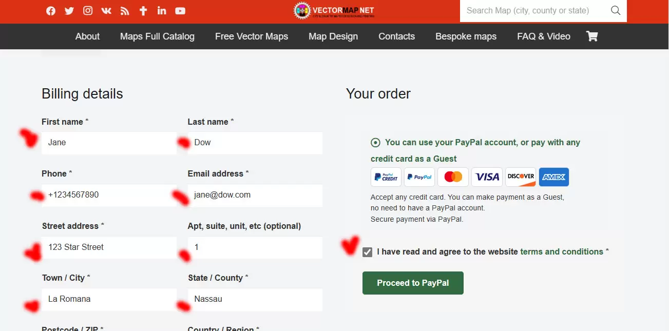
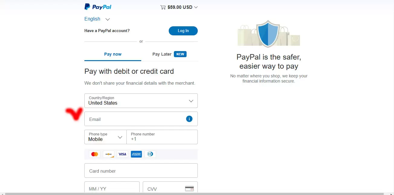
Step 2. On the Checkout window:

Just fill the form (email and other fields) and click the button “Proceed to PayPal”.
The PayPal window will open.

step_to_buy_2

Step 3. Payment by any bank card window:

Fill the form (name, number of your bank card and CCV) and push button “Agree & Pay”
Note: all transactions are FULLY secured by PayPal, your private data do not store on the site.
Immediately after payment, the system will redirect you to the map archive download page.
Additionally, an email with a link to download the archive of the map will be sent to the email you specified.

step_to_buy_3

Immediately after payment, you will be redirected to the archive download page.
Additionally: a notification and a link to download the archive will be sent to your email.

I have another question

Fill out this field
Please enter a valid email address.
Fill out this field
Menu