Spain relief vector map in Corel Draw (CDR). Europe
Archive size: 3 Mb, zipped .CDR
DPI: 300
This vector maps of Spain is created using 2015 data.
License: Royalty Free
Spain relief vector maps in Corel Draw format (.CDR) features (check the preview images):
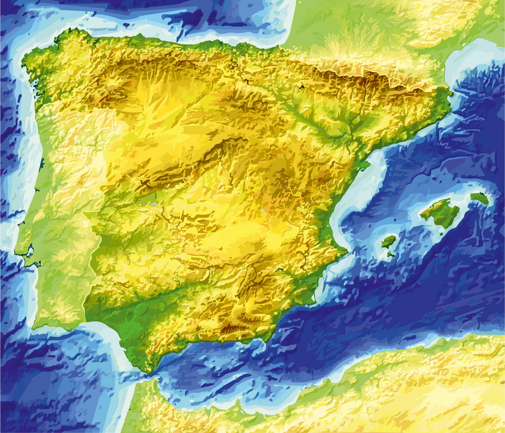
Relief only
Need this map of Spain with highways?
By request, if needed:
Region subdivision. POI (Points of Interest) like: airports, restaurants, hospital, shops, drugstores, military objects or tourist attractive points.
Spain.
This vector map of Spain is used as a basis for design, editing, and further printing.
This is the most detailed, exact map of Spain for high-quality printing and polygraphy. You can always clarify the map development date by contacting us.
For your convenience, all objects on Spain vector map are divided into layers. And the editing is very easy – colors, lines, etc.
You can easily add any objects needed (e.g. shops, salons, sale points, gas station or attraction) on any layer of Spain vector map.
Spain is a country mostly located on the Iberian Peninsula in Europe. Its territory also includes two archipelagoes: the Canary Islands off the coast of Africa, and the Balearic Islands in the Mediterranean Sea. The African enclaves of Ceuta and Melilla make Spain the only European country to have a physical border with an African country (Morocco). Several small islands in the Alboran Sea are also part of Spanish territory. The country’s mainland is bordered to the south and east by the Mediterranean Sea except for a small land boundary with Gibraltar; to the north and northeast by France, Andorra, and the Bay of Biscay; and to the west and northwest by Portugal and the Atlantic Ocean.
One of the advantages of Spain vector maps of our production is the relevance of cartographic data, we constantly update all our products.
This vector map of Spain is used by:
designers, layout designers, printers, advertisers and architects. Our product – vector maps – is designed for further editing and printing in large formats – from @Wall format (a few meters) to A-0 and A-1, A-2, A-3.
The Spain map in vector format is used for design, urban planning, presentations and media visualizations.
The advertising and presentation map of Spain (usually the final designer marks the routes, and puts the client’s objects (shops, saloons, gas stations etc.)
The undoubted advantage is that people will NEVER throw out this advertising product – the map. In fact, as an advertising medium, a map is the most “long-playing” of the well-known polygraphic advertising media, with the longest lifespan, and the maximum number of interactions with the customer.
For travelers, maps are sold at the airports and gas stations around the world. Often the source is our vector maps.
Take a look, who purchases our vector maps of Spain in “Our Clients and Friends” page – these are large and small companies, from super-brands like Volvo and Starbucks, to small design studios and printing houses.
It’s very easy to work with vector maps of Spain city, even for a not very experienced designer who can turn on and off the map layers, add new objects, change the colors of fill and lines according to customer requirements.
The undoubted advantage of Spain vector maps in printing is an excellent and detailed visualization, when customer can expand a large paper map and instantly define his location, find a landmark, an object or address on map, unlike using the popular electronic formats of Google and Yandex maps for example.
Printable vector maps of Spain are much more convenient and efficient than any electronic maps on your smartphone, because ALL DETAILS are displayed in the entire space of Spain map.
Useful tips on working with vector maps of cities and countries in Adobe Illustrator.
«V» – launches the Selection tool (cursor, black arrow), which makes active any vector line.
«А» – launches the Direct Selection tool (white cursor), allows you to select curve elements and drag them to the desired place.
«R» – activates the Rotate tool, which helps you rotating selected objects around the center point by 360 degrees.
«E» – gives you the opportunity to use the Eraser tool and erase unnecessary parts.
«X» – switches between Fill and Stroke in the Tools section. Try to get used to this hot key and
you will quickly understand that you can’t live and work without it.
Guides are not limited to vertical and horizontal in Adobe Illustrator. You can also create a diagonal guide for example. Moreover, you can turn any contours into guides. Select the outline and go to View > Guides > Make Guides (Create Guides), or simply press Cmd/Ctrl + 5. You can also turn the guides back into an editable object. Go to menu, View > Guides > Unlock Guides (Release Guides), select the guide you want to edit and select View > Guides > Release Guides (Reset Guides), or just press Cmd/Ctrl + Option / Alt + 5).
You will probably want to change the color scheme used on our Spain vector map.
To quickly and effectively play with colors.
Of course, you can do it manually, all objects in our Spain vector map are divided according to types and layers, and you can easily change the color gamma of vector objects in groups and layers.
But there is more effective way of working with the whole VECTOR MAP of Spain and all layers:
The overview dialog «Edit colors»/«Repaint Graphic Object» (this dialog box name can change depending on the context):
If you have selected a part or a layer of Spain vector map and open the dialog box by clicking the icon in the Control panel, on the Samples palette or the Color Catalog, or if you choose Edit > Edit Colors> Repaint Graphic Object, then the «Repaint Graphic Object» dialog box appears, and you get access to «Assign» and «Edit» tabs.
If a picture or a map fragment is not selected, and you open the dialog box by clicking the icon in the Control panel, on the Samples palette or in the Color Catalog, the «Edit Colors» dialog box appears and you can only access the «Edit» tab.
Regardless of the name at the top of the dialog box, the right-hand side always displays the color group of the current document, as well as two default color groups: Print Color and Grayscale. These color groups can be selected and used any time.
Create and edit color groups of Spain vector map, and also assign colors using the «Edit Colors»/ а «Repaint Graphic Object» dialog box.
A. Creating and editing of a color group on the «Edit» tab
B. Assigning colors on the «Assign» tab
C. Select a group of colors from the «Color groups» list
The option «Repaint a graphic object» in the lower part of the dialog box allows you to preview the colors on a selected layer of Vector map, or a group of elements, and specify whether its colors will be redefined when the dialog box is closed.
The main areas of the dialog box are:
«Edit»
The «Edit» tab is designed to create a new or edit the existing color groups.
The harmony rules Menu and the Color Wheel are used to conduct experiments with color harmonies. The color wheel shows how colors are related in color harmony, and the color bars allow you to view and manipulate an individual color values. In addition, you can adjust the brightness, add and remove colors, save color groups and view colors on the selected Vector Map of Spain or a separated layers.
«Assign»
The «Assign» tab is used to view and control on how the original colors are replaced with colors from the color group like your corporate colors in the Vector Map of Spain city.
The assign color ability is provided only if the entire map, layer or fragment is selected in the document. You can specify which of new colors replace the current colors, whether the spot colors should be preserved and how colors are replaced (for example, you can replace colors completely or changing the color tone while maintaining the brightness). The «Assign» tab allows you to redefine colors in the Vector Map of Spain city, or in separate layers and fragments using the current color group or reducing the number of colors in the current Vector Map.
Color groups
Is a list of all saved color groups for current document (the same groups appear in the «Samples» palette). You can edit and delete the existing color groups, as well as creating a new ones using the list of “Color Groups” in the dialog box. All changes appear in the «Samples» palette.
The highlighted color group shows, which color group is currently edited.
Any color group can be selected and edited, or used to redefine the colors in the selected vector map of Spain city, its fragments or elements.
Saving a color group adds this group to the specified list.
Opening the «Edit Colors»/«Repaint Graphic Object» dialog box.
Open the «Edit Colors»/«Repaint Graphic Object» dialog box using one of the following methods:
«Edit»> «Edit Colors»> «Repaint Graphic object» or «Repaint With Style».
Use these commands if you need to edit the colors in the selected vector map of Spain city.
«Repaint Graphic object» button on the «Control» panel.
Use this button if you need to adjust colors of Spain vector map using the а «Repaint graphic object» dialog box.
The specified button is available if the selected vector map or its fragment contains two or more colors.
Note. This color editing method is convenient for global color adjustment in a vector map, if global colors were not used when creating a Map of Spain.
The «Edit colors» button or «Edit or apply colors» on the «Color Catalog» palette
Click this button if you need to edit colors on the «Color Catalog» palette or edit and then apply them to the selected Vector Map of Spain or its fragment.
The «Edit color group» button or «Edit or apply color group» on the «Samples» palette.
Click this button if you need to edit the colors in the specific color group or edit and apply them to the selected Vector Map of Spain or a group of its elements, for example, the whole layer “Streets and lines”. You can also double-click the color group in the Samples panel to open the dialog box.
If the map file is too large and your computer freezes or even can’t open it quickly:
1. Try to reduce the color resolution of the video card (display) to 256 colors while working with a large map.
2. Using Windows Task Manager, select all the application you don’t need, while working with map, just turn them off.
3. Launch Adobe Illustrator. (DO NOT OPEN the vector map file)
4. Start the Windows Task Manager using administrator rights > Find the “Illustrator” process > set the «real time» priority,
5. Open the file. When you see the LEGACY FONT popup window – click “OK” (do not update). You can restore the TEXT later.
6. Can also be useful: When file is opened – Edit > Settings > Basic Settings > disable smoothing. /// It looks scary, but works quickly)))
We recommend saving the file in Adobe Illustrator 10 version. It’s much more stable when working with VERY BIG size files.
With an area of 505,990 km2 (195,360 sq mi), Spain is the largest country in Southern Europe, the second largest country in Western Europe and the European Union, and the fourth largest country in the European continent. By population, Spain is the sixth largest in Europe and the fifth in the European Union. Spain’s capital and largest city is Madrid; other major urban areas include Barcelona, Valencia, Seville, Málaga and Bilbao.
Modern humans first arrived in the Iberian Peninsula around 35,000 years ago. Iberian cultures along with ancient Phoenician, Greek, Celtic and Carthaginian settlements developed on the peninsula until it came under Roman rule around 200 BCE, after which the region was named Hispania, based on the earlier Phoenician name Sp(a)n or Spania. At the end of the Western Roman Empire the Germanic tribal confederations migrated from Central Europe, invaded the Iberian peninsula and established relatively independent realms in its western provinces, including the Suebi, Alans and Vandals. Eventually, the Visigoths would forcibly integrate all remaining independent territories in the peninsula, including Byzantine provinces, into the Kingdom of Toledo, which more or less unified politically, ecclesiastically and legally all the former Roman provinces or successor kingdoms of what was then documented as Hispania.
In the early eighth century the Visigothic Kingdom fell to the Moors, who arrived to rule most of the peninsula in the year 726, leaving only a handful of small Christian realms in the north, lasting up to seven centuries in the Kingdom of Granada. This led to many wars during a long reconquering period across the Iberian Peninsula, which led to the creation of Kingdom of Leon, Kingdom of Castille, Kingdom of Aragon and Kingdom of Navarre as the main Christian kingdoms to face the invasion. Following the Moorish conquest, Europeans began a gradual process of retaking the region known as the Reconquista, which by the late 15th century culminated in the emergence of Spain as a unified country under the Catholic Monarchs.
In the early modern period, Spain became the world’s first global empire and the most powerful country in the world, leaving a large cultural and linguistic legacy that includes +570 million Hispanophones, making Spanish the world’s second-most spoken native language, after Mandarin Chinese. During the Golden Age there were also many advancements in the arts, with world-famous painters such as Diego Velázquez. The most famous Spanish literary work, Don Quixote, was also published during the Golden Age. Spain hosts the world’s third-largest number of UNESCO World Heritage Sites.
Spain is a secular parliamentary democracy and a parliamentary monarchy, with King Felipe VI as head of state. It is a major developed country and a high income country, with the world’s fourteenth largest economy by nominal GDP and sixteenth largest by purchasing power parity. It is a member of the United Nations (UN), the European Union (EU), the Eurozone, the Council of Europe (CoE), the Organization of Ibero-American States (OEI), the Union for the Mediterranean, the North Atlantic Treaty Organization (NATO), the Organisation for Economic Co-operation and Development (OECD), Organization for Security and Co-operation in Europe (OSCE), the Schengen Area, the World Trade Organization (WTO) and many other international organisations. While not an official member, Spain has a “Permanent Invitation” to the G20 summits, participating in every summit, which makes Spain a de facto member of the group.
Geography
At 505,992 km2 (195,365 sq mi), Spain is the world’s fifty-second largest country and Europe’s fourth largest country. It is some 47,000 km2 (18,000 sq mi) smaller than France and 81,000 km2 (31,000 sq mi) larger than the US state of California. Mount Teide (Tenerife) is the highest mountain peak in Spain and is the third largest volcano in the world from its base. Spain is a transcontinental country, having territory in both Europe and Africa.
Spain lies between latitudes 26° and 44° N, and longitudes 19° W and 5° E.
On the west, Spain is bordered by Portugal; on the south, it is bordered by Gibraltar (a British overseas territory) and Morocco, through its exclaves in North Africa (Ceuta and Melilla, and the peninsula of Vélez de la Gomera). On the northeast, along the Pyrenees mountain range, it is bordered by France and the Principality of Andorra. Along the Pyrenees in Girona, a small exclave town called Llívia is surrounded by France.
Extending to 1,214 km (754 mi), the Portugal–Spain border is the longest uninterrupted border within the European Union.
Islands
Spain also includes the Balearic Islands in the Mediterranean Sea, the Canary Islands in the Atlantic Ocean and a number of uninhabited islands on the Mediterranean side of the Strait of Gibraltar, known as plazas de soberanía (“places of sovereignty”, or territories under Spanish sovereignty), such as the Chafarinas Islands and Alhucemas. The peninsula of Vélez de la Gomera is also regarded as a plaza de soberanía. The isle of Alborán, located in the Mediterranean between Spain and North Africa, is also administered by Spain, specifically by the municipality of Almería, Andalusia. The little Pheasant Island in the River Bidasoa is a Spanish-French condominium.
Geography of Spain
Spain is a country located in southwestern Europe occupying most (about 85 percent) of the Iberian Peninsula and includes a small exclave inside France called Llívia as well as the Balearic Islands in the Mediterranean, the Canary Islands in the Atlantic Ocean 108 km (67 mi) off northwest Africa, and five places of sovereignty (plazas de soberanía) on and off the coast of North Africa: Ceuta, Melilla, Islas Chafarinas, Peñón de Alhucemas, and Peñón de Vélez de la Gomera.
The Spanish mainland is bordered to the south and east almost entirely by the Mediterranean Sea (except for a small land boundary with Gibraltar); to the north by France, Andorra, and the Bay of Biscay; and to the west by the Atlantic Ocean and Portugal. With an area of 504,030 km2, Spain is the largest country in Southern Europe, the second largest country in Western Europe (behind France) and the fourth largest country in the European continent (behind Russia, Ukraine and France). It has an average altitude of 650 m.
Its total area is 504,782 km2 (194,897 sq mi) of which 499,542 km2 (192,874 sq mi) is land and 5,240 km2 (2,023 sq mi) is water. Spain lies between latitudes 36° and 44° N, and longitudes 19° W and 5° E. Its Atlantic coast is 710 km (441 mi) long. The Pyrenees mountain range, extends 435 km (270 mi) from the Mediterranean to the Bay of Biscay. In the extreme south of Spain lie the Straits of Gibraltar, which separate the Iberian peninsula and the rest of Europe from Ceuta and Morocco in North Africa; at its narrowest extent, mainland Spain and Morocco are separated by only 13 km (8.1 mi).
Most of Spain’s boundaries are water: the Mediterranean Sea on the south to the French border and the Atlantic Ocean on the northwest and southwest (in the south as the Golfo de Cádiz and in the north as the Bay of Biscay). Spain also shares land boundaries with France and Andorra along the Pyrenees in the northeast, with Portugal on the west, and with the small British Overseas Territory of Gibraltar near the southernmost tip. The affiliation of Gibraltar has continued to be a contentious issue between Spain and Britain. The sovereignty of the plazas de soberanía on the Mediterranean coast of Morocco is disputed by Morocco.
Spain also has a small exclave inside France called Llívia.
The majority of Spain’s peninsular region consists of the Meseta Central, a highland plateau rimmed and dissected by mountain ranges. Other landforms include narrow coastal plains and some lowland river valleys, the most prominent of which is the Andalusian Plain in the southwest. The country can be divided into ten natural regions or subregions: the dominant Meseta Central, the Cantabrian Mountains (Cordillera Cantabrica) and the northwest region, the Ibérico region, the Pyrenees, the Penibético region in the southeast, the Andalusian Plain, the Ebro Basin, the coastal plains, the Balearic Islands, and the Canary Islands. These are commonly grouped into four types: the Meseta Central and associated mountains, other mountainous regions, lowland regions, and islands.
Our maps can be suited to any size needed. Perfect for presentation or large size printing, like office walls (we are sure, Big Boss wants one of this) or bigboards. We provide detailed maps of Spain in .CDR. Being vector maps, they are completely editable, you can add your company logo or change fonts style, line thickness or borders. Need more objects (POI) on map? We can add it with no extra fee. Separated layers, you can turn on or off layer needed.
Please also check other vector maps of Spain we have.
You can customize all map data using different vector graphics editors like: Adobe Illustrator, Freehand or CorelDraw, Autocad or Freehand. And also is a fully scalable map, no matter what size you need.
This relief vector map of Spain is available in different vector formats (the same price): .AI, .CDR .DWG, .DXF, .EPS, .PDF.
Royalty Free license. You don`t pay extra: per volume sold; for each use; for period of use.
Spain relief map with big “zoom” without quality degradation. The difference between raster and vector is that vector can be adjusted to any size you need with NO quality loss. Perfect for large-size printing (walls & billboards).
Probably, you need more objects to be added? Just tell us, we don`t charge for this work.
Relief vector map of Spain (Europe). Cities and counties near
Our vector map of Spain includes maps of the nearest areas (see the preview):
Madrid, Barcelona, Valencia, Alicante, Sevilla, Málaga, Murcia, Cádiz, Biscay, La Coruña, Balearic Islands, Las Palmas, Asturias, Santa Cruz de Tenerife, Zaragoza, Pontevedra, Granada, Tarragona, Córdoba, Girona, Gipuzkoa, Toledo, Almería, Badajoz, Jaén, Navarre, Castellón, Cantabria, Valladolid, Ciudad Real, Huelva, León, Lleida, Cáceres, Albacete, Burgos, Lugo, Salamanca, Ourense, La Rioja, Álava, Guadalajara, Huesca, Cuenca, Zamora, Palencia, Ávila, Segovia, Teruel, Soria, Ceuta, Melilla, Spain.
Relief Spain vector map for Corel Draw. Purchasing and downloading.
Credit Card and PayPal payment accepted. After the payment you will be redirected to the download page.
See more Printable and editable maps of Spain cities
For example: Full Spain printable vector map adm-phys, full editable
Sevilla, Spain, printable vector street City Plan map
Toledo, España, calle de vectores mapa imprimible
PDF Map Zaragoza, Spain, printable vector street City Plan map
Spain, Spanish: España, officially the Kingdom of Spain (Spanish: Reino de España), is a sovereign state largely located on the Iberian Peninsula in southwestern Europe, with two large archipelagos, the Balearic Islands in the Mediterranean Sea and the Canary Islands off the North African Atlantic coast, two cities Ceuta and Melilla in the North African mainland and several small islands in the Alboran Sea near the Moroccan coast. Its mainland is bordered to the south and east by the Mediterranean Sea except for a small land boundary with Gibraltar; to the north and northeast by France, Andorra, and the Bay of Biscay; and to the west and northwest by Portugal and the Atlantic Ocean. It is the only European country to have a border with an African country (Morocco) and its African territory accounts for nearly 5% of its population, mostly in the Canary Islands but also in Ceuta and Melilla. Along with France and Morocco, it is one of only three countries to have both Atlantic and Mediterranean coastlines.
With an area of 505,990 km2 (195,360 sq mi), Spain is the largest country in Southern Europe, the second largest country in Western Europe and the European Union, and the fourth largest country in the European continent. By population, Spain vector map is the sixth largest in Europe and the fifth in the European Union, after Italy. Spain’s capital and largest city is Madrid, other major urban areas include Barcelona, Valencia, Seville, Bilbao and Málaga.
Modern humans first arrived in the Iberian Peninsula around 35,000 years ago. Iberian cultures along with ancient Phoenician, Greek and Carthaginian settlements developed on the peninsula until it came under Roman rule around 200 BCE, after which the region was named Hispania, based on the earlier Phoenician name Span or Spania. In the Middle Ages, the area was conquered by Germanic tribes and later by the Moors. Spain emerged as a unified country in the 15th century, following the marriage of the Catholic Monarchs and the completion of the centuries-long reconquest, or Reconquista, of the peninsula from the Moors in 1492. In the early modern period, Spain printable map became one of history’s first global colonial empires, leaving a vast cultural and linguistic legacy that includes over 500 million Spanish speakers, making Spanish the world’s second most spoken first language, after Chinese and before English.
Spain is a democracy organised in the form of a parliamentary government under a constitutional monarchy. It is a middle power and a developed country with the world’s fourteenth largest economy by nominal GDP and sixteenth largest by purchasing power parity. It is a member of the United Nations (UN), the European Union (EU), the Council of Europe (CoE), the Organization of Ibero-American States (OEI), the North Atlantic Treaty Organization (NATO), the Organisation for Economic Co-operation and Development (OECD), the World Trade Organization (WTO) and many other international organisations.
Geography of Spain
Spain is a country located in southwestern Europe occupying most (about 85 percent) of the Iberian Peninsula and includes a small exclave inside France called Llívia as well as the Balearic Islands in the Mediterranean, the Canary Islands in the Atlantic Ocean 108 km (67 mi) off northwest Africa, and five places of sovereignty (plazas de soberanía) on and off the coast of North Africa: Ceuta, Melilla, Islas Chafarinas, Peñón de Alhucemas, and Peñón de Vélez de la Gomera.
The Spanish mainland is bordered to the south and east almost entirely by the Mediterranean Sea (except for a small land boundary with Gibraltar); to the north by France, Andorra, and the Bay of Biscay; and to the west by the Atlantic Ocean and Portugal. With an area of 504,030 km², Spain is the fourth largest country in Western Europe (behind France) and with an average altitude of 650 m.
Its total area is 504,782 km2 (194,897 sq mi) of which 499,542 km2 (192,874 sq mi) is land and 5,240 km2 (2,023 sq mi) is water. Spain lies between latitudes 36° and 44° N, and longitudes 19° W and 5° E. Its Atlantic coast is 710 km (441 mi) long. The Pyrenees mountain range, extends 435 km (270 mi) from the Mediterranean to the Bay of Biscay. In the extreme south of Spain editable map lie the Straits of Gibraltar, which separate the Iberian peninsula and the rest of Europe from Ceuta and Morocco in north Africa; at its narrowest extent, Spain and Morocco are separated by only 13 km (8.1 mi).
External boundaries and landform regions
Spain’s exclaves in north Africa
Map of Spain
Hypsometric curve of Spain
Most of Spain’s boundaries are water: the Mediterranean Sea on the south to the French border and the Atlantic Ocean on the northwest and southwest (in the south as the Golfo de Cádiz and in the north as the Bay of Biscay). Spain also shares land boundaries with France and Andorra along the Pyrenees in the northeast, with Portugal on the west, and with the small British Overseas Territory of Gibraltar near the southernmost tip. The affiliation of Gibraltar has continued to be a contentious issue between Spain and Britain. The sovereignty of the plazas de soberanía on the Mediterranean coast of Morocco is disputed by Morocco.
Spain also has a small exclave inside France called Llívia.
The majority of Spain’s peninsular region consists of the Meseta Central, a highland plateau rimmed and dissected by mountain ranges. Other landforms include narrow coastal plains and some lowland river valleys, the most prominent of which is the Andalusian Plain in the southwest. The country can be divided into ten natural regions or subregions: the dominant Meseta Central, the Cantabrian Mountains (Cordillera Cantabrica) and the northwest region, the Ibérico region, the Pyrenees, the Penibético region in the southeast, the Andalusian Plain, the Ebro Basin, the coastal plains, the Balearic Islands, and the Canary Islands. These are commonly grouped into four types: the Meseta Central and associated mountains, other mountainous regions, lowland regions, and islands.
The Inner Plateau and associated mountains
The Meseta Central (“Inner Plateau”) is a vast plateau in the heart of peninsular Spain, which has elevations that range from 610 to 760 m. Rimmed by mountains, the Meseta Central slopes gently to the west and to the series of rivers that form some of the border with Portugal. The Sistema Central, described as the “dorsal spine” of the Meseta Central, divides the Meseta into northern and southern subregions, the former higher in elevation and smaller in area than the latter. The Sistema Central rims the capital city of Madrid with peaks that rise to 2,400 m north of the city and to lower elevations south of it. West of Madrid, the Sistema Central shows its highest peak, Pico Almanzor, of 2,592 m. The mountains of the Sistema Central, which continue westward into Portugal, display some glacial features; the highest of the peaks are snow-capped for most of the year. Despite their height, however, the mountain system does not create a major barrier between the northern and the southern portions of the Meseta Central because several passes permit road and railroad transportation to the northwest and the northeast.
The southern portion of the Meseta (Spanish: Submeseta Sur) is further divided by twin mountain ranges, the Montes de Toledo running to the east with the Sierra de Guadalupe, to the west. Their peaks do not rise much higher than 1,500 m. With many easy passes, including those that connect the Meseta with the Andalusian Plain, the Montes de Toledo do not present an obstacle to transportation and communication. This chain of lower mountain ranges is separated from the Sistema Central to the north by the longest river in the Iberian Peninsula: the Tagus River.
The Picos de Europa in Northern Spain
The mountain regions that rim the Meseta Central and are associated with it are the Sierra Morena, the Cordillera Cantábrica, and the Sistema Ibérico. Forming the southern edge of the Meseta Central, the Sierra Morena merges in the east with the southern extension of the Sistema Iberico and reaches westward along the northern edge of the Rio Guadalquivir valley to join the mountains in southern Portugal. The massif of the Sierra Morena extends northward to the Río Guadiana, which separates it from the Sistema Central. Despite their relatively low elevations, seldom surpassing 1,300 m, the mountains of the Sierra Morena are rugged at their southern edge.
The Cordillera Cantábrica, a limestone formation, runs parallel to, and close to, the northern coast near the Bay of Biscay. Its highest points are the Picos de Europa, surpassing 2,600 m. The Cordillera Cantábrica extends 182 km and abruptly drops 1,500 m some 30 km from the coast. To the west lie the hills of the northwest region and to the east the Basque mountains that link them to the Pyrenees.
The Sistema Ibérico extends from the Cordillera Cantábrica southeastward and, close to the Mediterranean, spreads out from the Río Ebro to the Río Júcar. The barren, rugged slopes of this mountain range cover an area of close to 21,000 square kilometers. The mountains exceed 2,000 m in their northern region and reach a maximum height of over 2,300 m east of the headwaters of the Rio Duero. The extremely steep mountain slopes in this range are often cut by deep, narrow gorges.
Other mountainous regions
External to the Meseta Central lie the Pyrenees in the northeast and the Sistema Penibético in the southeast. The Pyrenees, extending from the eastern edge of the Cordillera Cantábrica to the Mediterranean Sea, form a solid barrier that separates Spain, France and Andorra and has acted as a natural border throughout history, which has effectively isolated the countries from each other. Passage is easy in the relatively low terrain at the eastern and western extremes of the mountain range; it is here that international railroads and roadways cross the border. In the central section of the Pyrenees, however, passage is difficult. In several places, peaks rise above 3,000 m; the highest, Pico de Aneto, surpasses 3,400 m.
The Sistema Penibético extends northeast from the southern tip of Spain, running parallel to the coast until it merges with the southern extension of the Sistema Ibérico near the Rio Júcar and with the eastern extension of the Sierra Morena. The Sierra Nevada, part of the Sistema Penibético south of Granada, includes the highest mountain on the peninsula and continental Spain, Mulhacén, which rises to 3,479 m. Other peaks in the range also surpass 3,000 m.
Lowland regions
The major lowland regions are the Andalusian Plain in the southwest, the Ebro Basin in the northeast, and the coastal plains. The Andalusian Plain is essentially a wide river valley through which the Río Guadalquivir flows. The river broadens out along its course, reaching its widest point at the Golfo de Cadiz. The Andalusian Plain is bounded on the north by the Sierra Morena and on the south by the Sistema Penibético; it to an apex in the east where these two mountain chains meet. The Ebro Basin is formed by the Río Ebro valley, contained by mountains on three sides—the Sistema Ibérico to the south and west, the Pyrenees to the north and east, and their coastal extensions paralleling the shore to the east. Minor low-lying river valleys close to the Portuguese border are located on the Tagus and the Río Guadiana.
The Coastal Plains regions are narrow strips between the coastal mountains and the seas. They are broadest along the Golfo de Cádiz, where the coastal plain adjoins the Andalusian Plain, and along the southern and central eastern coasts. The narrowest coastal plain runs along the Bay of Biscay, where the Cordillera Cantábrica ends close to shore.
Teide, the highest mountain in Spain (Tenerife, Canary Islands)
The islands
The remaining regions of Spain are the Balearic and the Canary Islands, the former located in the Mediterranean Sea and the latter in the Atlantic Ocean. The Balearic Islands, encompassing a total area of 5,000 square kilometers, lie 80 kilometers off Spain’s central eastern coast. The mountains that rise up above the Mediterranean Sea to form these islands are an extension of the Sistema Penibetico. The archipelago’s highest points, which reach 1,400 meters, are in northwestern Mallorca, close to the coast. The central portion of Majorca is a plain, bounded on the east and the southeast by broken hills.
The Canary Islands, ninety kilometers off the west coast of Africa, are of volcanic origin. The large central islands, Tenerife and Gran Canaria, have the highest peaks. Pico de Las Nieves, on Gran Canaria, rises to 1,949 meters, and the Teide, on Tenerife, to 3,718 meters. Teide, a dormant volcano, is the highest peak of Spain and the third largest volcano in the world from its base.
Drainage, floods and water stress
See also: List of rivers of Spain
River basins of continental Spain
Of the roughly 1,800 rivers and streams in Spain, only the Tagus is more than 960 kilometers long; all but 90 extend less than 96 kilometers. These shorter rivers carry small volumes of water on an irregular basis, and they have seasonally dry river beds; however, when they do flow, they often are swift and torrential. Most major rivers rise in the mountains rimming or dissecting the Meseta Central and flow westward across the plateau through Portugal to empty into the Atlantic Ocean. One significant exception is the river with the most abundant flow in Spain, the Ebro, which flows eastward to the Mediterranean. Rivers in the extreme northwest and in the narrow northern coastal plain drain directly into the Atlantic Ocean. The northwestern coastline is also truncated by rias, waterbodies similar to fjords.[citation needed]
The major rivers flowing westward through the Meseta Central include the Duero, the Tagus, the Guadiana, and the Guadalquivir. The Rio Guadalquivir is one of the most significant rivers in Spain because it irrigates a fertile valley, thus creating a rich agricultural area, and because it is navigable inland, making Seville the only inland river port for ocean-going traffic in Spain. The major river in the northwest region is the Miño.[citation needed]
El Atazar Dam is a major dam built near Madrid to provide a water supply
Source
Geografía de España
Spain-CIA WFB Map.png
Continente Europa,y África
Región Europa mediterránea (Península Ibérica), Norte de África
Área
Total 504.782 km2
Tierra 499.542 km²
Agua 5.240 km²
Fronteras
Territorial 1.917,8 km
• Flag of Portugal.svg Portugal 1.214 km
• Flag of France.svg Francia 623 km
• Flag of Andorra.svg Andorra 63,7 km
• Bandera de Marruecos Marruecos 9,6 km (Melilla)
6,3 km (Ceuta)
• Bandera de Reino Unido Reino Unido 1,2 km (Gibraltar)
Extremos de elevación
Elevación mínima Se alcanzan los -1 m en los arrozales de La Séquia Nova, en Alfafar, Albufera de Valencia. Sin embargo, las grandes canteras a cielo abierto, abandonadas, de Reocín (Cantabria) y Abanto y Ciérvana (Vizcaya) alcanzan los -72 m y los -28 m respectivamente (datos del Instituto Geográfico Nacional de España mapa en vectores comprobados en su Mapa Topográfico Nacional). La vieja cantera de Reocín es considerada, de hecho, como el actual punto más bajo de Europa
Elevación máxima 3.718 m (Teide)
[editar datos en Wikidata]
España (nombre oficial: “Reino de España”) es un país transcontinental situado en el sur-oeste de Europa y en el norte de África. Además de ocupar la mayor parte de la Península Ibérica, España está formada por dos archipiélagos (el de las Islas Canarias en el océano Atlántico y el de las Islas Baleares en el mar Mediterráneo) y dos ciudades autónomas (Ceuta y Melilla) en el norte de África, aparte de varias islas menores en esta zona y otras cercanas a la península, como el Peñón de Vélez de la Gomera, el Peñón de Alhucemas, las Islas Chafarinas y la Isla del Perejil. España limita al oeste con el océano Atlántico y Portugal; al norte con el mar Cantábrico, al noreste con Francia y Andorra, al otro lado de la cordillera de los Pirineos; al este con el mar Mediterráneo y al sur con Marruecos, en las fronteras de Ceuta y de Melilla, en el continente africano.
Geografía física de España
Se encuentra en dos continentes en Europa y África y entre dos áreas de influencia, la del Mediterráneo y la del Atlántico que dará lugar a una importante variedad:
Relieve: se manifiestan todos los ciclos orogénicos y de sedimentación que se han dado a lo largo de la historia por lo que se manifiestan los materiales y formas propias de cada ciclo orogénico.
Clima: deriva de su situación peninsular que estaría expuesta a masas de aire frío y caliente, el predominio de cada una de ellas dará un tipo climático, en el norte habrá un clima oceánico (más frío y húmedo) propiciado por las borrascas y mediterráneo en el meridional dando un clima seco y cálido.
Vegetación: influida por el clima, especies adaptadas a la aridez (xerófilas) comunes en el sur de España, adaptadas a la humedad (hidrófilas) en el norte.
Humana: poblaciones que han hecho incursiones en España mapa imprimible como romanos o los musulmanes con mejoras en el cultivo. La confluencia de estos pueblos es lo que ha determinado la cultura y valores humanos.
Hitos geográficos
Punto más septentrional: Estaca de Bares, Mañón, La Coruña.
Punto más meridional: La Restinga, El Pinar de El Hierro, Isla de El Hierro, Santa Cruz de Tenerife.
Punto más occidental: Punta de la Orchilla, Frontera y El Pinar, Isla de El Hierro, Santa Cruz de Tenerife.
Punto más oriental: Punta de La Mola, Mahón, Baleares
Relieve
Artículo principal: Relieve de España
Relieve de España peninsular y Baleares.
El relieve de la Península Ibérica se articula alrededor de una gran unidad central, la Meseta Central, de elevada altitud media (650 m).
La Meseta Central está casi totalmente rodeada de sistemas montañosos:
Cordillera Cantábrica, al norte.
Cordillera Ibérica, al este.
Sierra Morena, al sur.
Costas de España
Artículo principal: Costas de España
En la vista desde el satélite de la Península Ibérica se aprecia que la mayor parte de su costa es abierta y rectilínea.
La parte peninsular de España mapa pdf posee unos 3.167 km de costa. A los que habría que añadir los 956 del litoral portugués, para completar el litoral peninsular. En este trazado, si prescindimos de la costa bastante articulada de Galicia, y a pesar de los óvalos mediterráneos, no hay grandes entrantes ni recovecos.
Ya los antiguos observaron la diferente tonalidad de las aguas costeras, en el mar Mediterráneo, azul intenso: en el océano Atlántico, verde; pero la oposición también se da en la forma de la costa: por una parte en el Atlántico predomina la línea recta, la marea amplia, hay largos sectores de ríos y cañones submarinos. En el mediterráneo, los arcos sustituyen a las líneas rectas, no hay mareas apreciables, solo algunas rías o calas, pero muchos deltas y largas playas.
El cabo de San Vicente puede considerarse como el punto de separación de una forma de costa y otra, incluyendo el golfo de Cádiz en las mediterráneas por sus especiales características más próximas a estas que a las atlánticas.
En el Cantábrico, a lo largo de unos 770 km la costa tiene dirección este-oeste, es rectilínea, y su trazado refleja un gran accidente geológico orientado en la misma dirección, la Cordillera Cantábrica. En Galicia describe un giro de 90° y toma la dirección norte-sur, hasta la punta del cabo de San Vicente, en Portugal. Dicha costa es también rectilínea en otros 800 km. A partir de aquí el contorno litoral es más sinuoso y empiezan los óvalos mediterráneos o grandes arcos que se inician con el golfo de Cádiz, sigue el óvalo del mar de Alborán, aquí la costa tuerce hacia el nordeste y dibuja otros dos óvalos muy abiertos entre los cabos de Gata y Palos y entre este y el de la Nao y finalmente el dilatado y abierto golfo de Valencia, que podemos considerar que termina con el saliente del delta del Ebro. A partir de aquí la costa vuelve a ser bastante rectilínea y corre casi paralela a la Cadena Costera Catalana hasta el cabo de Begur, en donde se adentra para formar el golfo de Rosas, extendido hasta el cabo de Creus.
Source

 Author: Kirill Shrayber, Ph.D. FRGS


