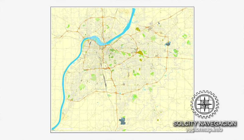
Louisville, Kentucky,US printable vector street City Plan map, full editable, Adobe Illustrator, full vector, scalable, editable, text format street names, 7,4 mb ZIP
All streets, NO buildings. Map for design, print, arts, projects, presentations,
for architects, designers and builders.
PDF, DXF, DWG, CDR and other formats – on request, same price, please, contact
Louisville, Kentucky, USA.
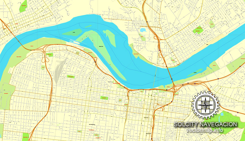
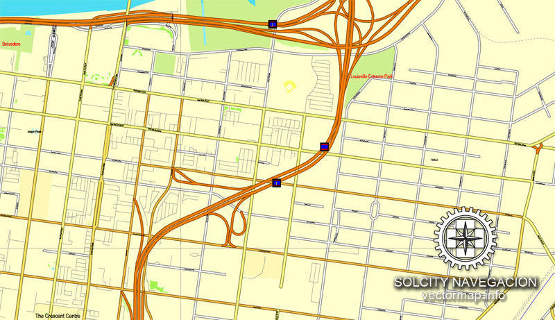
This vector map of Louisville is used as a basis for design, editing, and further printing.
This is the most detailed, exact map of Louisville for high-quality printing and polygraphy. You can always clarify the map development date by contacting us.
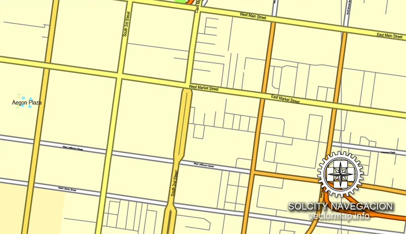
For your convenience, all objects on Louisville vector map are divided into layers. And the editing is very easy – colors, lines, etc.
You can easily add any objects needed (e.g. shops, salons, sale points, gas station or attraction) on any layer of Louisville vector map.
Louisville is the largest city in the Commonwealth of Kentucky and the 29th most-populous city in the United States. It is one of two cities in Kentucky designated as first-class, the other being Lexington, the state’s second-largest city. Louisville is the historical seat and, since 2003, the nominal seat of Jefferson County.
One of the advantages of Louisville vector maps of our production is the relevance of cartographic data, we constantly update all our products.
This vector map of Louisville is used by:
designers, layout designers, printers, advertisers and architects. Our product – vector maps – is designed for further editing and printing in large formats – from @Wall format (a few meters) to A-0 and A-1, A-2, A-3.
Louisville map in vector format is used for design, urban planning, presentations and media visualizations.
Advertising and presentation map of Louisville (usually the final designer marks the routes, and puts the client’s objects (shops, saloons, gas stations etc.)
The undoubted advantage is that people will NEVER throw out this advertising product – the map. In fact, as an advertising medium, a map is the most “long-playing” of the well-known polygraphic advertising media, with the longest lifespan, and the maximum number of interactions with the customer.
For travelers, maps are sold at the airports and gas stations around the world. Often the source is our vector maps.
Take a look, who purchases our vector maps of Louisville in “Our Clients and Friends” page – these are large and small companies, from super-brands like Volvo and Starbucks, to small design studios and printing houses.
It’s very easy to work with vector maps of Louisville, even for a not very experienced designer who can turn on and off the map layers, add new objects, change the colors of fill and lines according to customer requirements.
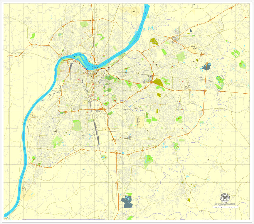
The undoubted advantage of Louisville vector maps in printing is an excellent and detailed visualization, when customer can expand a large paper map and instantly define his location, find a landmark, an object or address on map, unlike using the popular electronic formats of Google and Yandex maps for example.
Printable vector maps of Louisville are much more convenient and efficient than any electronic maps on your smartphone, because ALL DETAILS are displayed in the entire space of Louisville map.
Louisville was founded in 1778 by George Rogers Clark, making it one of the oldest cities west of the Appalachian Mountains. It is named after King Louis XVI of France. Sited beside the Falls of the Ohio, the only major obstruction to river traffic between the upper Ohio River and the Gulf of Mexico, the settlement first grew as a portage site. It was the founding city of the Louisville and Nashville Railroad, which grew into a 6,000-mile (9,700 km) system across 13 states. Today, the city is known as the home of legendary boxer Muhammad Ali, the Kentucky Derby, Kentucky Fried Chicken (KFC), the University of Louisville and its Louisville Cardinals athletic teams, Louisville Slugger baseball bats, and three of Kentucky’s six Fortune 500 companies. Its main airport is also the site of United Parcel Service’s worldwide air hub.
Since 2003, Louisville’s borders have been the same as those of Jefferson County, after a city-county merger. The official name of this consolidated city-county government is the Louisville/Jefferson County Metro Government, abbreviated to Louisville Metro. Despite the merger and renaming, the term “Jefferson County” continues to be used in some contexts in reference to Louisville Metro, particularly including the incorporated cities outside the “balance” which make up Louisville proper. The city’s total consolidated population as of the 2017 census estimate was 771,158. However, the balance total of 621,349 excludes other incorporated places and semiautonomous towns within the county and is the population listed in most sources and national rankings.
The Louisville-Jefferson County, KY-IN Metropolitan Statistical Area (MSA), sometimes also referred to as Kentuckiana, includes Louisville-Jefferson County and 12 surrounding counties, seven in Kentucky and five in Southern Indiana. As of 2017, the MSA had a population of 1,293,953, ranking 45th nationally.
Louisville is located at 38°13′31″N 85°44′30″WCoordinates: 38°13′31″N 85°44′30″W. According to the U.S. Census Bureau, Louisville Metro (in 2015 measurements for Jefferson County) has a total area of 397.68 square miles (1,030.0 km2), of which 380.46 square miles (985.4 km2) is land and 17.23 square miles (44.6 km2) (4.33%) is covered by water.
Topography and geomorphology
The Jefferson Memorial Forest is the largest municipal urban forest in the United States.
Although the soils and underlying rocks officially put Louisville in the outer Bluegrass region, the city’s landscape is better described as being in a very wide part of the Ohio River flood plain. Louisville’s part of the valley is located between two plateaus, the karst plateau of Southern Indiana and the Bluegrass plateau of Kentucky, both with an elevation of around 900 feet. Elevations drop off the Indiana plateau very sharply via the Muldraugh Escarpment, whereas the rise in elevation up to the Bluegrass plateau is done more gradually.
The flood plain is much longer north to south than it is east to west. For example, within several miles of downtown, the Highlands sitting at 540 feet is out of the thousand year flood plain, whereas areas 10 miles from downtown such as Fairdale and Okolona (both between seven and 11 miles from the river) have the same elevation as downtown Louisville. Most areas in the east end have an elevation from 600 to 700 feet, which, with the typically east bound winds, trap in heat and pollutants.
Areas along and west of the south fork of Beargrass Creek (and more generally, I-65) are located where the Ohio River once ran, so the land here is very flat and is composed of harder rocks. Prior to urbanization much of this area was composed of wetlands, and early roads through these were made of wooden planks. This history is occasionally still readily evident in street names, for example the spoke road Poplar Level, whose name describes its original construction on planks of poplar. 3rd Street was formerly called Central Plank Road for the same reason. As industry, namely Standiford Field airport, moved into the area in the 1950s most creeks through the area were rerouted into ditches to alleviate the area’s poor drainage and constant flooding.
Areas east of I-65 were generally not in the flood plain and thus are mostly gentle rollings hills composed of soft loess soils, hence the reason roads here (such as Eastern Parkway) are very prone to potholes. The southern quarter of Jefferson County is in the scenic and rugged Knobs region. This is the only part of Jefferson County to not have experienced any urbanization and is today almost entirely parkland for the Jefferson Memorial Forest. The eastern third is in the Eden Shale Hills section of the Bluegrass region and has also experienced less urbanization than the flood plain, although that is starting to change.
Small guide: How to work with the vector map?
You can: Mass select objects by type and color – for example, the objects type “building” (they are usually dark gray) – and remove them from the map, if you do not need them in your print or design project. You can also easily change the thickness of lines (streets), just bulk selection the road by the line color.
The streets are separated by type, for example, type “residential road” are usually white with a gray stroke. Highway usually orange with a brown or dark gray stroke.
It is easy to change the font of inscriptions, all or each individually. Also, just can be make and any other manipulation of objects on the vector map in Adobe illustrator format.
Important: All the proportions on the map are true, that is, the relative sizes of the objects are true, because Map is based on an accurate GPS projection, and It transated into the (usual for all) the Mercator projection.
You can easily change the color, stroke and fill of any object on the map, zoom without loss of quality Image Verification.
Select object

Bulk selection the same objects on the vector map

See the bulk selected objects on the vector map

Bulk delete buildungs from the vector map

Select residencial road (small street) on the vector map

Bulk selection the same lines (streets, roads) on the full map

Create fat lines of the streets on the vector maps (bulk action) 1

Create fat lines of the streets on the vector maps (bulk action) 2

Create fat lines of the streets on the vector maps (bulk action) 3

You can easily change the color, stroke and fill of any object on the map, zoom without loss of quality Image Verification.

 Author: Kirill Shrayber, Ph.D. FRGS
 + Admin Areas editable Adobe Illustrator in layers")
 + Admin Areas + Relief Shaded Raster, editable Adobe Illustrator in layers")