The area of the state of Kentucky – 104,659 km2 (37th place in the United States)
Length of the State of Kentucky:
from north to south-225 km
from east to west-610 km
Region of the state of Kentucky – Southeastern Central States of the United States
The highest point in the state of Kentucky – 1263 meters above sea level
The lowest point of the state of Kentucky – 78 meters above sea level
The abbreviation of the state of Kentucky is KY
The capital of Kentucky is Frankfort
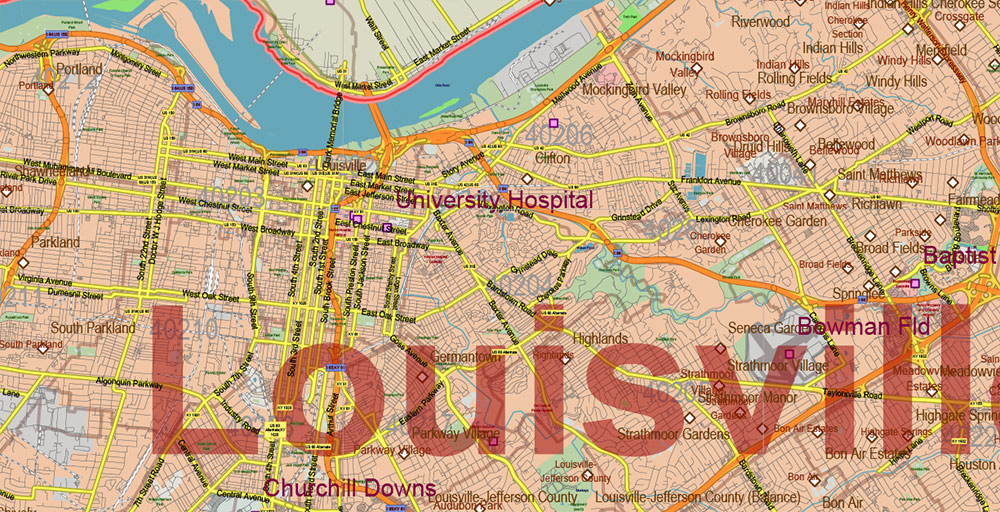
The largest city in Kentucky is Louisville
Date of formation of the state of Kentucky – June 1, 1792 (15 in the United States)
The population of the state of Kentucky is about 4,340,000 people (26th place in the United States)
The population density in Kentucky is 41 people per km2 (22nd in the United States)
The motto of the state of Kentucky – “United we stand, divided we fall”
The nickname of the state of Kentucky – “Bluegrass State”, ” Tobacco State”
The state of Kentucky is located in the Southern United States and belongs to the southeastern central States (“Upper South of the United States“). The territory of the state of Kentucky is 104,659 km2 (37th place among the US states).
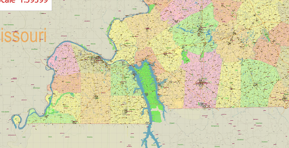
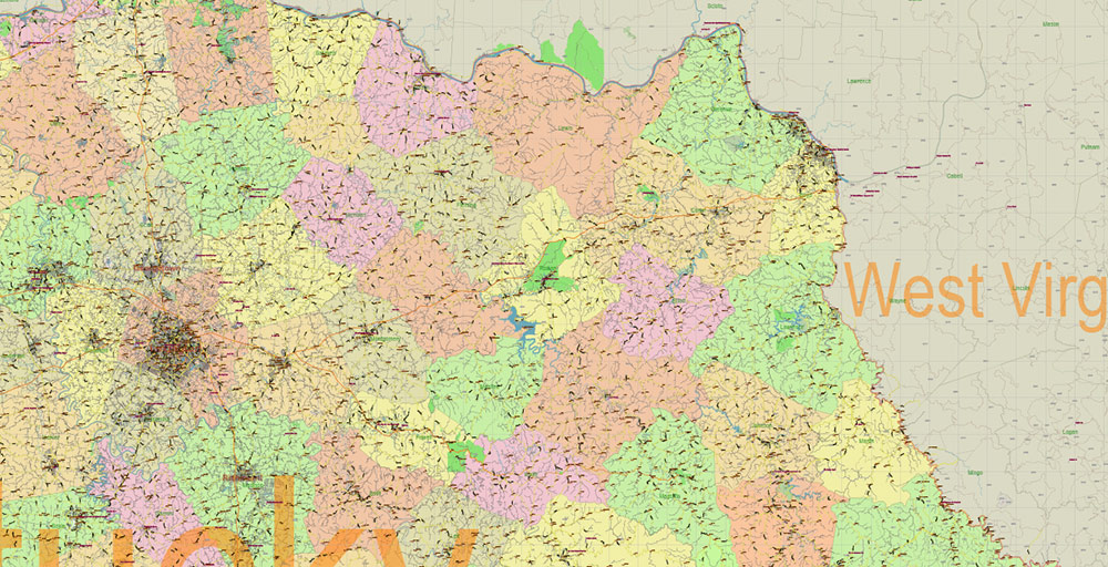
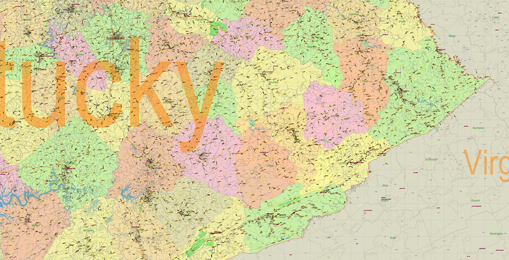
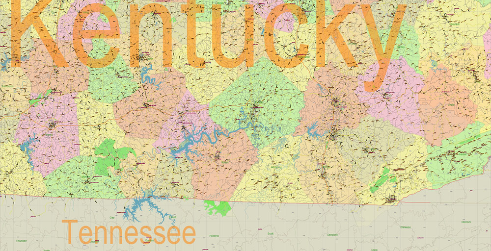
Kentucky is bordered by seven states – Illinois to the northwest, Indiana and Ohio to the north, West Virginia to the east, Virginia to the southeast, Tennessee to the south, and Missouri to the west.
Kentucky is the only state in the United States that is bounded on three sides of the world by rivers. The western border of Kentucky is the Great Mississippi River, the northern border is the Ohio River, and the eastern border is the Big Sandy and Tag Fork Rivers.
In Kentucky, there are usually several regions: the Cumberland Plateau, the outer and inner Bluegrass, the Mississippi Plateau, the Western coalfields, and the”Jackson Purchase“.
In eastern Kentucky is the Cumberland Plateau, part of the Appalachian Mountains. This is a plateau cut by gorges and ravines with numerous rock outcrops, it is here that the highest point of the state – Black Mountain (1263 meters above sea level) is located.
The Cumberland Plateau is covered with forests, both deciduous and coniferous, including the Daniel Boone National Forest, named after the famous pioneer who explored Kentucky in the late 18th century. Daniel Boone Forest is one of the state’s tourist attractions, with many caves, beautiful lakes, gorges, and hiking trails.
Several rivers and streams flow along the plateau, and the picturesque Cumberland Falls on the river of the same name is called “little Niagara” or “Niagara of the South“. It is known for the fact that a lunar rainbow is often visible in its spray.
West of the Cumberland Plateau, separated from it by a rocky cliff known as the “Pottsville escarpment”, is the Bluegrass district – the “heart” of Kentucky.
“Bluegrass“, the region got its name from the hilly plains overgrown with bluegrass grass, one of the symbols of the state of Kentucky. Bluegrass is steppe with very fertile land, perfectly suitable for pasture. Distinguish between ” inner “(around the city of Lexington) and” outer ” Bluegrass.
In the south of the state is the Mississippi Plateau, which is also called the” mint plateau “or”Pennyrail“. It is bounded by the Pottsville escarpment to the east and the Muldraw Hills to the north, a “transition” between the Bluegrass Steppes and the higher reaches of the Cumberland Plateau.
Rivers have washed hundreds of kilometers of caves into the limestones of central Kentucky. It is here that the longest in the world is located (more than 630 kilometers) karst cave system – Mammoth Cave. This unique natural formation is protected by the US government as a national park. Every year, about half a million tourists visit the Mammoth Cave. There are several other huge caves nearby, including Fisher Ridge (over 180 km) and Martin Ridge (about 55 km).
The Western Coalfield district of Kentucky owes its name to numerous coal deposits. The westernmost part of the state, the “Jackson purchase” (this unusual name is due to historical reasons), is an alluvial (that is, formed by river sediments) lowland stretching along the Mississippi River.
In addition to the Mississippi, Ohio, and Big Sandy border rivers, several other rivers flow through Kentucky, the largest of which are the Ohio tributaries of the Tennessee, Kentucky, Green River, Cumberland, and Likin River. Kentucky ranks second (after Alaska) in the United States in terms of the length of navigable waterways.
The state has the largest reservoirs east of the Mississippi by area (Kentucky Lake on the Tennessee River) and by volume (Cumberland Lake on the Cumberland River).
The state of Kentucky is characterized by a humid subtropical climate with well-defined seasons. Winter is usually mild and cool, with precipitation falling in the form of rain and snow. The average January temperature in the state’s largest city, Louisville, ranges from -4°C to 5°C, in the second-largest city, Lexington, from -5°C to 4°C.
Summers in Kentucky are usually hot and humid, with frequent fogs. The average temperature of the hottest month, July, in Louisville is from 214°C to 31°C, and in Lexington from 19°C to 30°C.
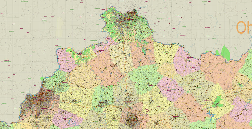
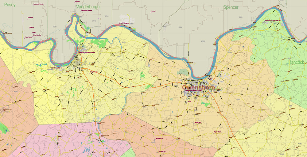
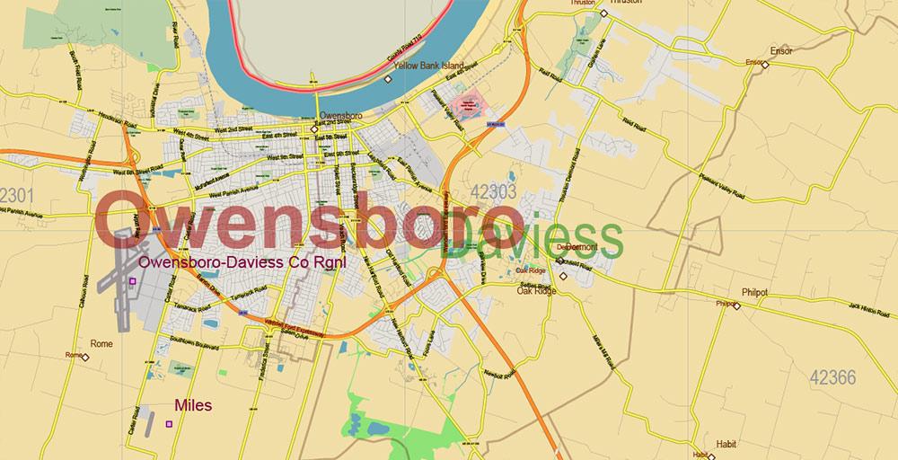
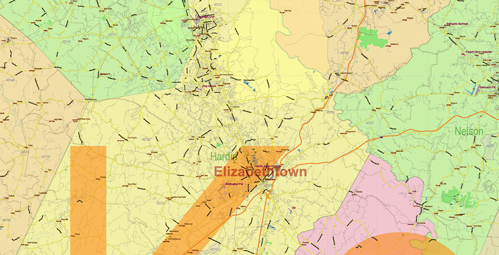
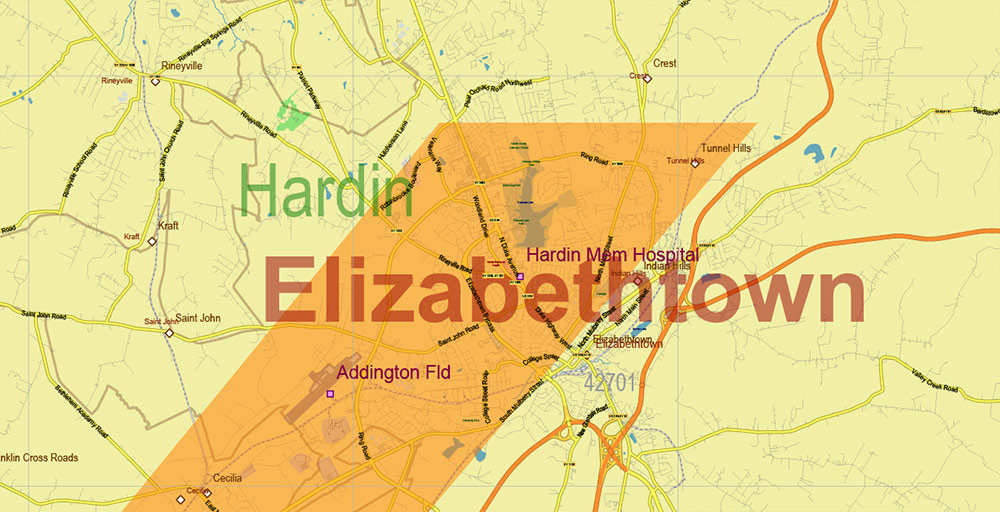
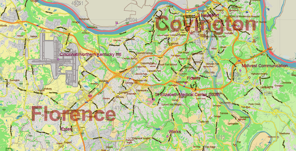
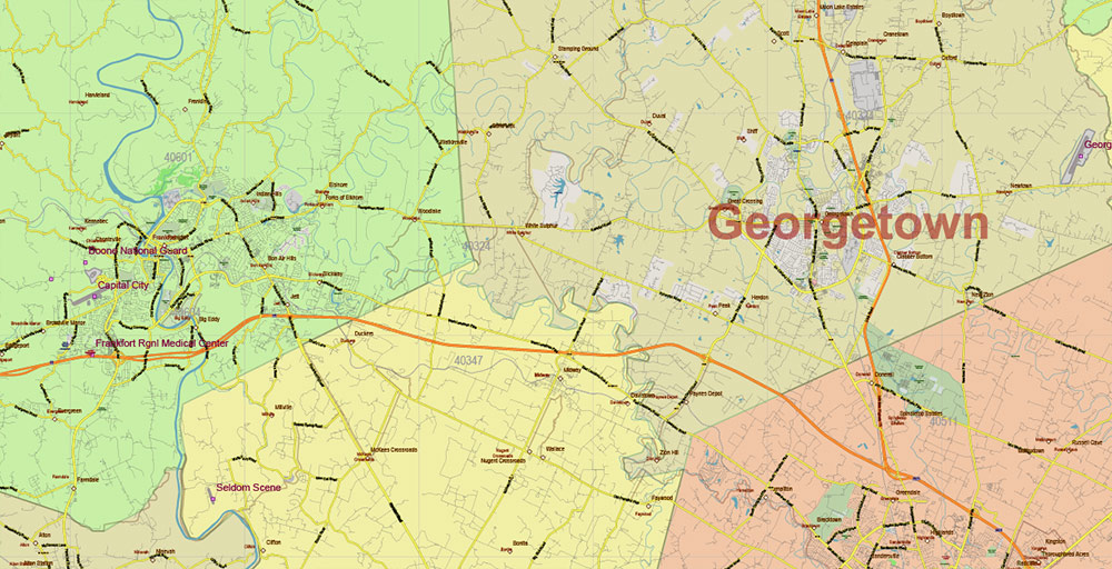
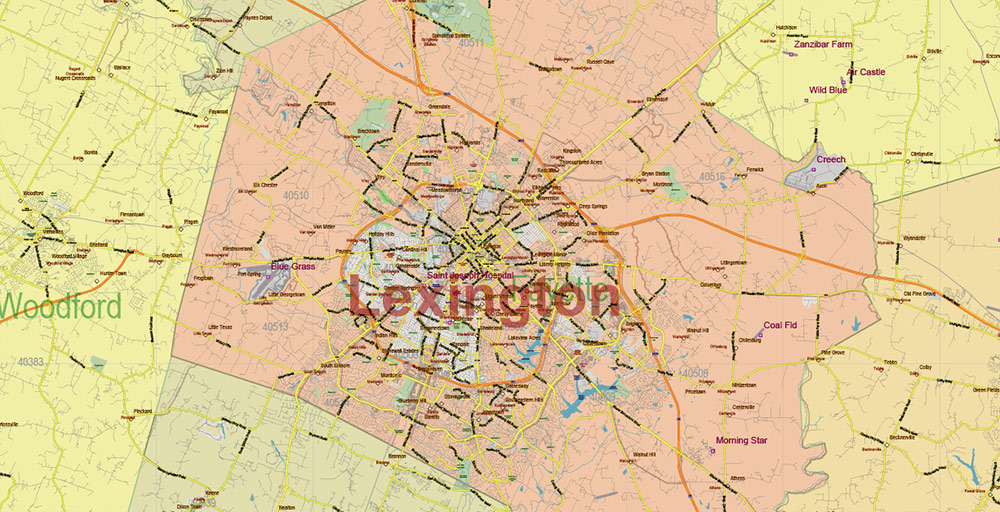
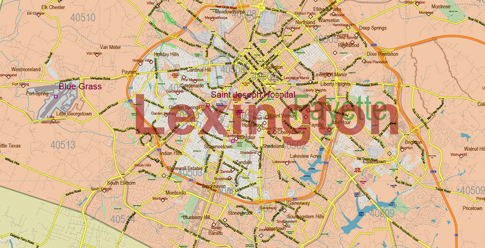
Printable PDF Vector Map of Kentucky Full State US: All Streets and Roads + counties areas + zip-codes areas, fully editable Adobe PDF Map in layers, scalable, 244 MB ZIP
Scale: 1:59399
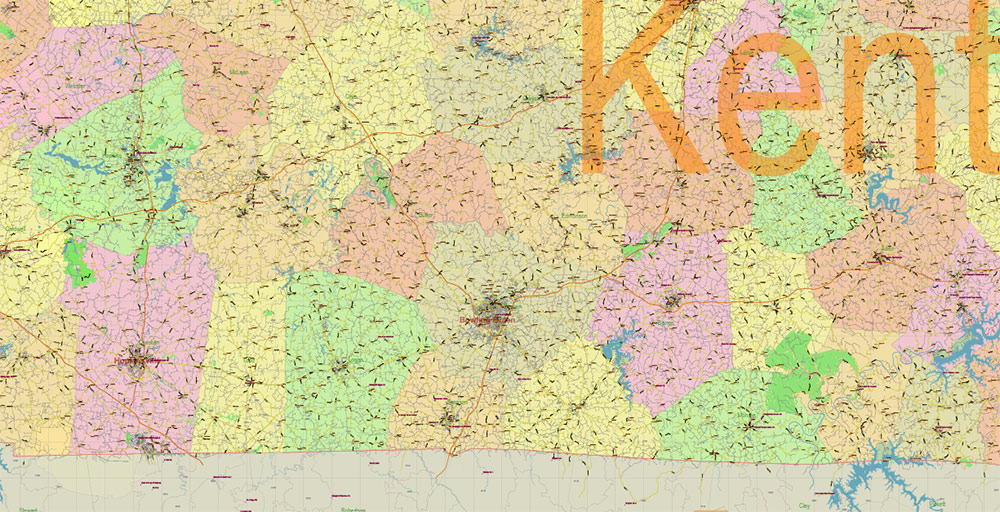
All streets and roads, Names of Principal streets, All Cities and Towns, Counties, All Geonames, airports, and heliports. Map for design, printing, arts, projects, presentations, for architects, designers, and builders, business, logistics.
NOTE! All objects are located on separate layers by type. The preview shows them all together. When you work with this map, just turn off or delete those layers that are not needed for your project.
For Editing and High-Quality Printing, Royalty free
Need AutoCAD DWG / DXF, CDR, or any other format? Please, contact us!
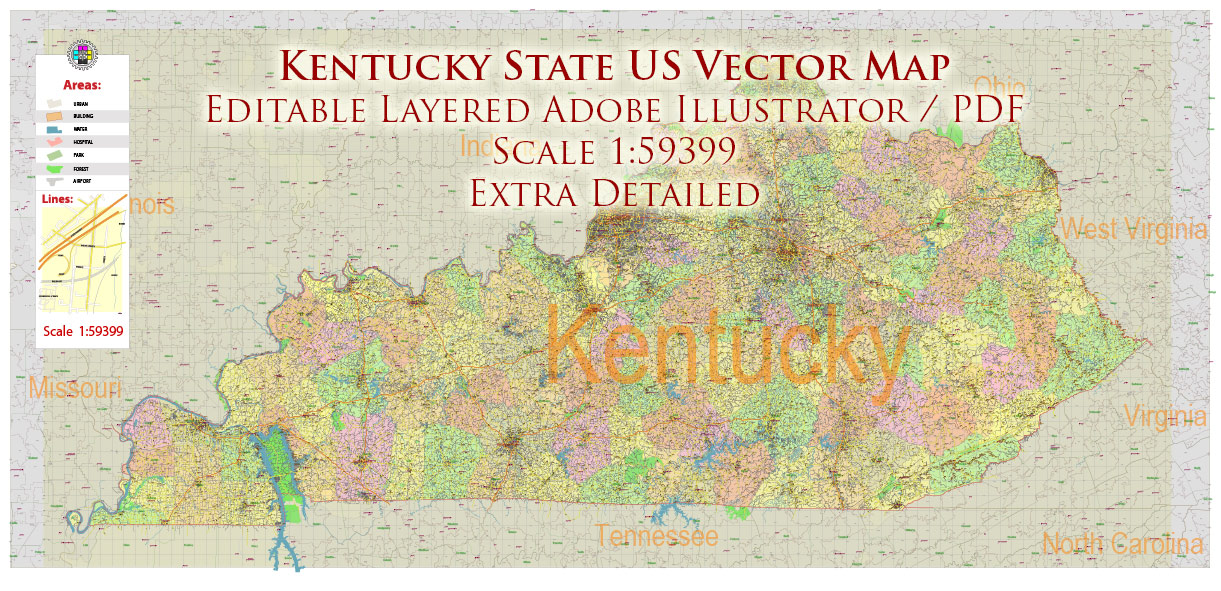
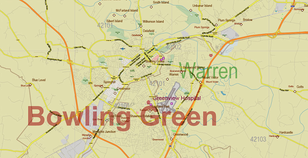
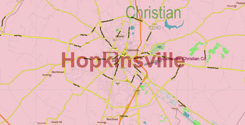
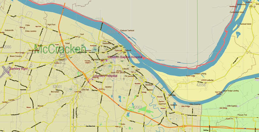
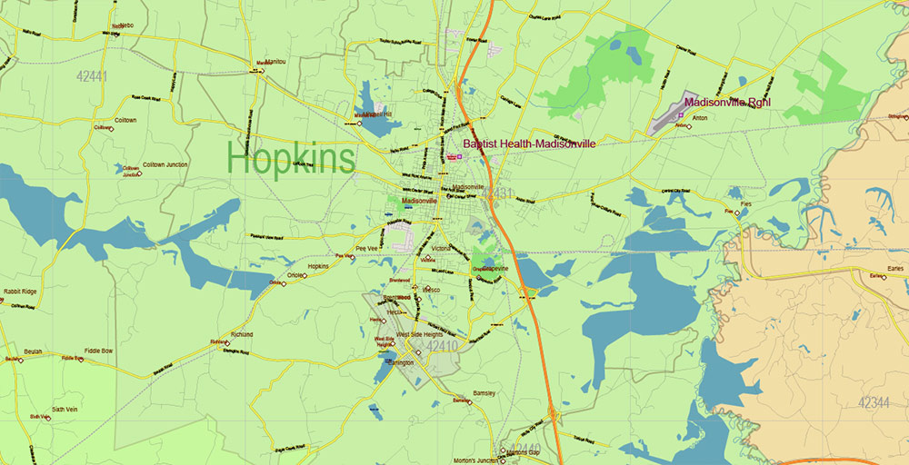
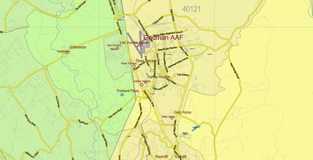
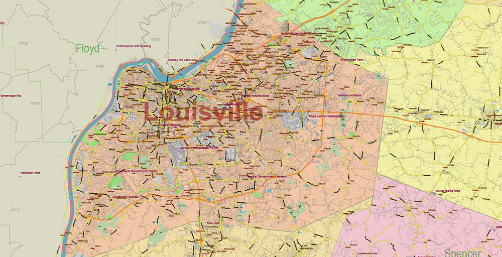
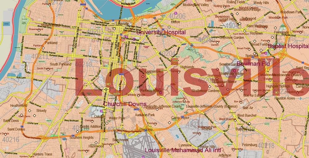
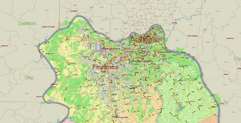
Kentucky Full State US PDF Vector Map: Full Extra High Detailed (all roads, zipcodes, airports) + Admin Areas editable Adobe PDF in layers
Layers list:
- Legend
- Grids
- Labels of roads (numbers) – highways, interstate
- All Geonames (cities, towns, villages, hamlets, islands)
- Points of the Geonames (cities, towns, villages, hamlets, islands)
- Names places: Names of all Cities, towns, villages and hamlets
- Names of the Airports and Heliports
- Points of the Airports and Heliports
- Numbers of ZIP codes
- Names of objects (water, park, hospital)
- Names of States
- Names of Counties
- Names of the Main Streets
- Major Roads and Streets – Highways
- Minor Roads and residential streets
- Railroads
- State boundaries
- Water objects (rivers, lakes, ponds, swamps, reefs)
- Waterways
- Ground objects (urban areas, parks, hospitals, etc.)
- ZIP-codes areas
- Counties areas (colored)
- States areas
- Background
Kentucky Full State US PDF Vector Map: Full Extra High Detailed (all roads, zipcodes, airports) + Admin Areas editable Adobe PDF in layers
Kentucky Full State US PDF Vector Map: Full Extra High Detailed (all roads, zipcodes, airports) + Admin Areas editable Adobe PDF in layers
Kentucky Full State US PDF Vector Map: Full Extra High Detailed (all roads, zipcodes, airports) + Admin Areas editable Adobe PDF in layers

Kentucky Full State US PDF Vector Map: Full Extra High Detailed (all roads, zipcodes, airports) + Admin Areas editable Adobe PDF in layers
Kentucky Full State US PDF Vector Map: Full Extra High Detailed (all roads, zipcodes, airports) + Admin Areas editable Adobe PDF in layers
Kentucky Full State US PDF Vector Map: Full Extra High Detailed (all roads, zipcodes, airports) + Admin Areas editable Adobe PDF in layers
Kentucky Full State US PDF Vector Map: Full Extra High Detailed (all roads, zipcodes, airports) + Admin Areas editable Adobe PDF in layers
Kentucky Full State US PDF Vector Map: Full Extra High Detailed (all roads, zipcodes, airports) + Admin Areas editable Adobe PDF in layers
Kentucky Full State US PDF Vector Map: Full Extra High Detailed (all roads, zipcodes, airports) + Admin Areas editable Adobe PDF in layers
Kentucky Full State US PDF Vector Map: Full Extra High Detailed (all roads, zipcodes, airports) + Admin Areas editable Adobe PDF in layers
Kentucky Full State US PDF Vector Map: Full Extra High Detailed (all roads, zipcodes, airports) + Admin Areas editable Adobe PDF in layers
Kentucky Full State US PDF Vector Map: Full Extra High Detailed (all roads, zipcodes, airports) + Admin Areas editable Adobe PDF in layers
Kentucky Full State US PDF Vector Map: Full Extra High Detailed (all roads, zipcodes, airports) + Admin Areas editable Adobe PDF in layers
Kentucky Full State US PDF Vector Map: Full Extra High Detailed (all roads, zipcodes, airports) + Admin Areas editable Adobe PDF in layers
Kentucky Full State US PDF Vector Map: Full Extra High Detailed (all roads, zipcodes, airports) + Admin Areas editable Adobe PDF in layers
Kentucky Full State US PDF Vector Map: Full Extra High Detailed (all roads, zipcodes, airports) + Admin Areas editable Adobe PDF in layers
Kentucky Full State US PDF Vector Map: Full Extra High Detailed (all roads, zipcodes, airports) + Admin Areas editable Adobe PDF in layers
Kentucky Full State US PDF Vector Map: Full Extra High Detailed (all roads, zipcodes, airports) + Admin Areas editable Adobe PDF in layers
Kentucky Full State US PDF Vector Map: Full Extra High Detailed (all roads, zipcodes, airports) + Admin Areas editable Adobe PDF in layers
Kentucky Full State US PDF Vector Map: Full Extra High Detailed (all roads, zipcodes, airports) + Admin Areas editable Adobe PDF in layers
Kentucky Full State US PDF Vector Map: Full Extra High Detailed (all roads, zipcodes, airports) + Admin Areas editable Adobe PDF in layers
Kentucky Full State US PDF Vector Map: Full Extra High Detailed (all roads, zipcodes, airports) + Admin Areas editable Adobe PDF in layers
Kentucky Full State US PDF Vector Map: Full Extra High Detailed (all roads, zipcodes, airports) + Admin Areas editable Adobe PDF in layers
Kentucky Full State US PDF Vector Map: Full Extra High Detailed (all roads, zipcodes, airports) + Admin Areas editable Adobe PDF in layers

 Author: Kirill Shrayber, Ph.D. FRGS
 + Admin Areas + Relief Shaded Raster, editable Adobe Illustrator in layers")
 + Admin Areas editable Adobe Illustrator in layers")
