The main industries of the state of Kentucky are industry, mining, agriculture, and tourism.
Kentucky produces oil and natural gas, but the ” main ” mineral of the state remains coal. The coal extracted in Kentucky, as well as fuel cells produced by the state-based and only uranium enrichment plant in the United States for nuclear power plants, is believed to generate almost a quarter of the U.S. electricity.
Kentucky’s industry is primarily concentrated in the north of the state, along the Ohio River, where most of Kentucky’s population lives. The state has a very well-developed automotive industry, the state ranks fourth in the United States in terms of the number of cars assembled, providing more than 10% of the production of cars in the United States. Kentucky factories assemble Fords, Chevys, Cadillacs, and Toyotas.
In addition to cars, the state produces electric cars, clothing, food, and printing products.
Kentucky agriculture is primarily known for producing high-quality tobacco (second only to North Carolina in the United States) and for its thoroughbred horses. For horse breeding, the Bluegrass region is perfectly suitable, due to the peculiarities of the soil, it is here that most of the farms engaged in horse breeding are concentrated.
Important agricultural crops in Kentucky are also corn (ranked fourteenth in the United States), soybeans, wheat, and various fruits.
In addition to horses, the state’s livestock breeders also raise goats (fifth among US states), cattle for meat (eighth in the US), and milk, and pigs.
Tourism is an important sector of the state’s economy. In Kentucky, they joke: “Bourbon, horses, and cigars that’s what attracts tourists to the “Bluegrass State” (although, of course, in addition to bourbon and horse racing, Kentucky is also interesting for its unique natural objects, such as, for example, Mammoth Cave), as well as numerous historical attractions).
Kentucky is the birthplace of bourbon, a traditional American whiskey and one of the symbols of the United States. Even the name of this drink is derived from the county of Bourbon in Kentucky. Although bourbon is produced in several US states, the “real” American whiskey is bourbon from Kentucky (although the residents of Tennessee may not agree with this:).
To promote their drinks and attract tourists, the Kentucky Whiskey Producers Association has created a special tourist program – the “Kentucky Bourbon Trail“, in which tourists are offered not only tours of bourbon-producing distilleries and stories about their history, but also tasting of various whiskey varieties.
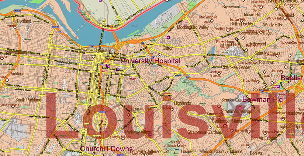
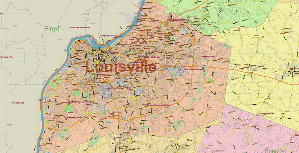
Every year in early May, Louisville hosts the Kentucky Derby, the most popular and prestigious horse race in the United States. The Kentucky Derby is preceded by a two-week festival that attracts tens of thousands of tourists. The festival program includes the “Thunder over Louisville” fireworks display, which claims to be the largest in the United States, balloon and steamboat races, a parade, and many other interesting events.
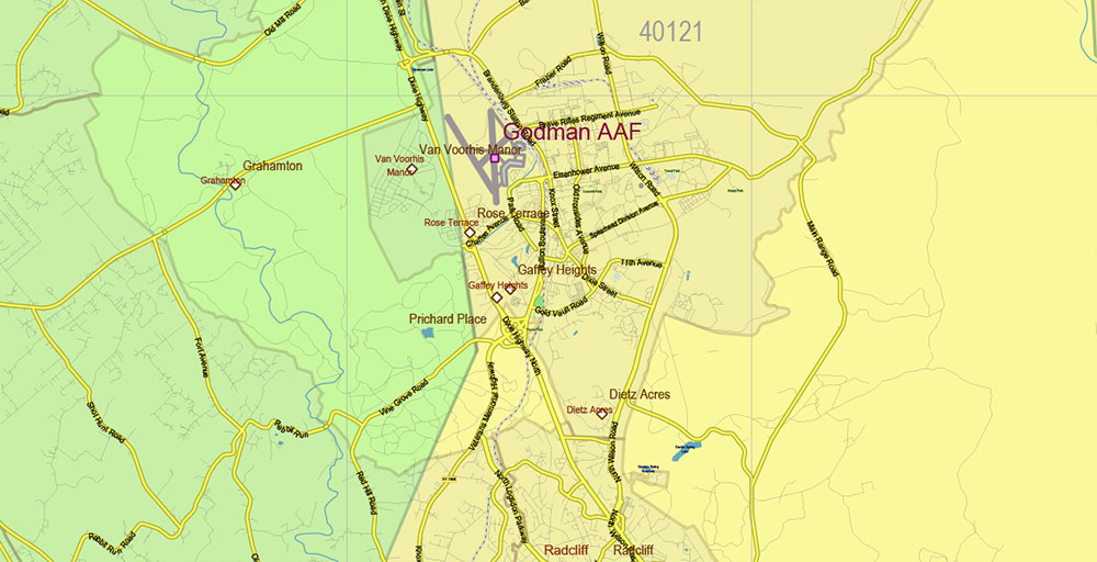
South of Louisville is a major U.S. Army base – Fort Knox. This is a large training center, for decades it has trained tankers for the US Army and Marine Corps. In 2010, the tank training school was relocated to Fort Benning, Georgia, and Fort Knox is undergoing reconstruction. Also on the base is the George Patton Museum, dedicated to the memory of the famous American tank general and the history of the US armored forces.
Fort Knox is known all over the world due to the fact that the US Treasury depository is located on the territory of the base. Built-in 1937, the special building is used to store a significant part of the US gold and foreign exchange reserves, mainly in the form of gold bars and coins. Under the protection of the US Mint police and behind doors more than half a meter thick and weighing about twenty tons, more than four and a half thousand tons of gold are stored.
During World War II, it was in the Fort Knox depository that the originals of the Declaration of Independence and the U.S. Constitution were kept.
Although Fort Knox is not the largest gold storage facility in the world (the Federal Reserve Bank of New York holds about seven thousand tons of gold, including those belonging to other states), it is probably the most famous “warehouse” in the world.
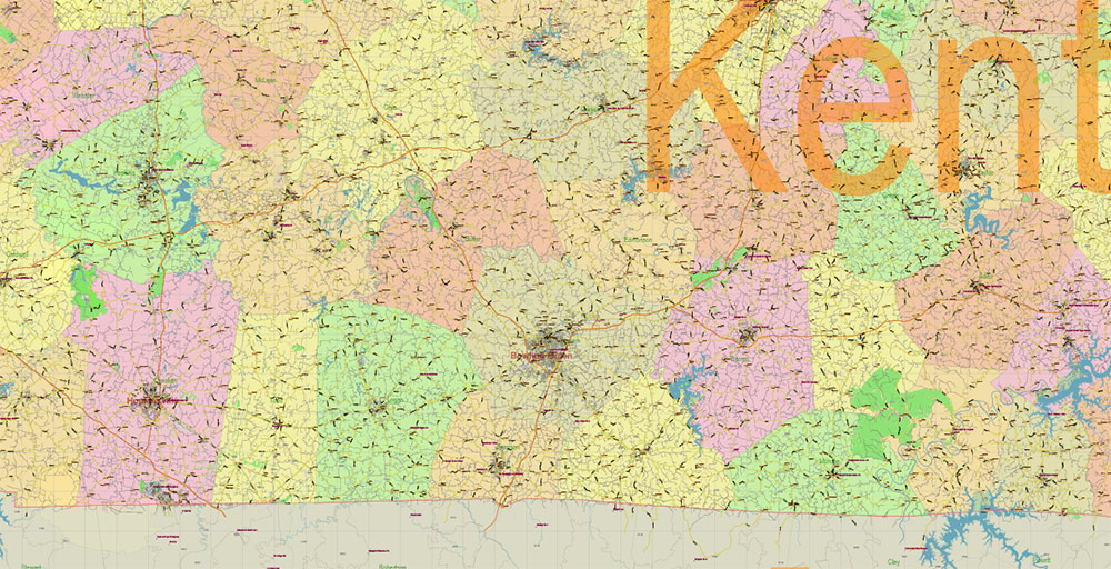
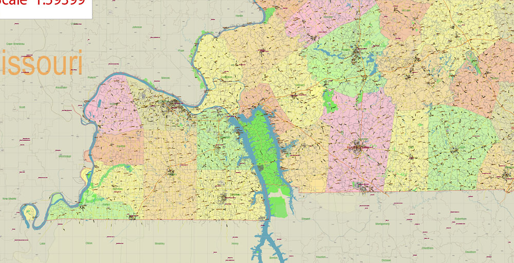
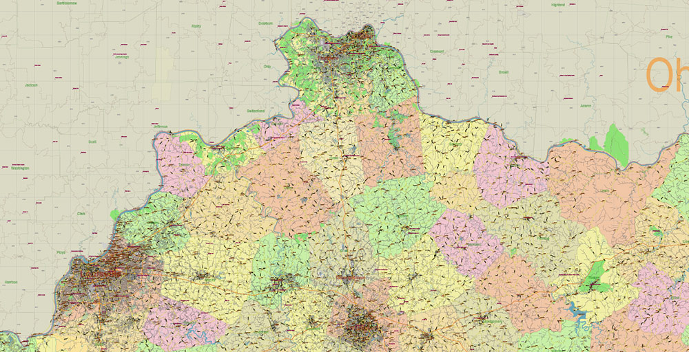
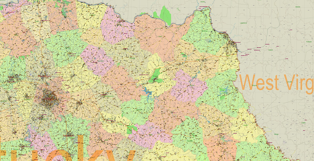
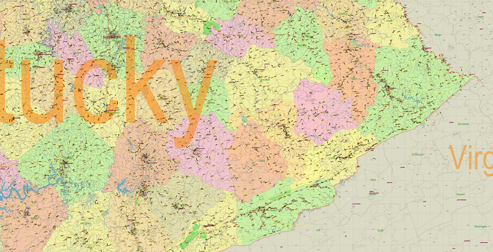
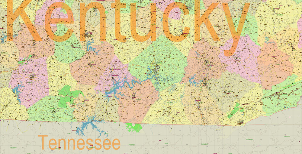
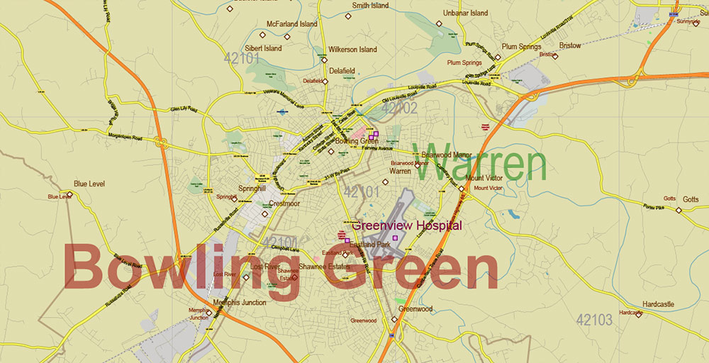
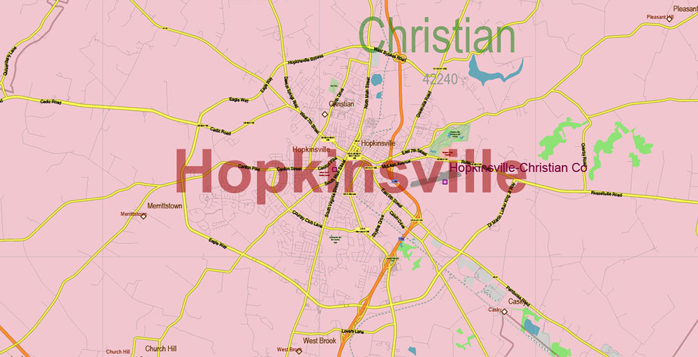
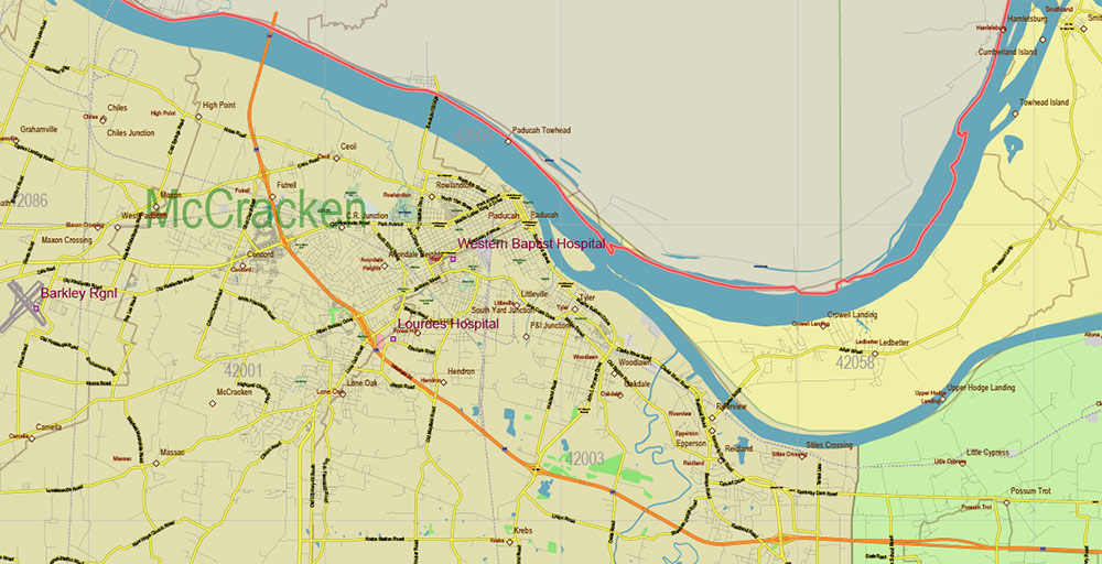
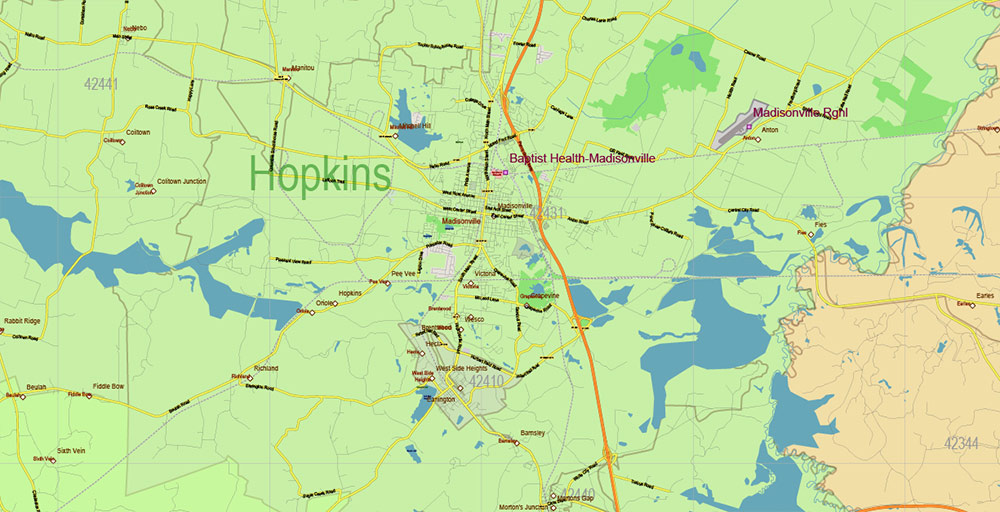
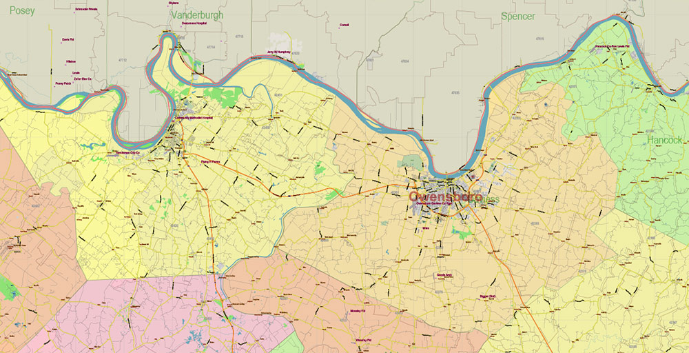
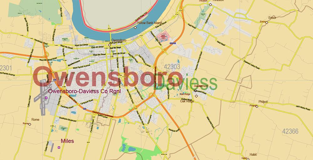
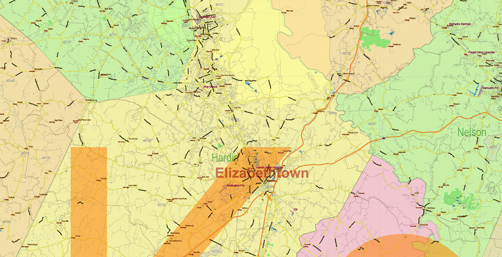
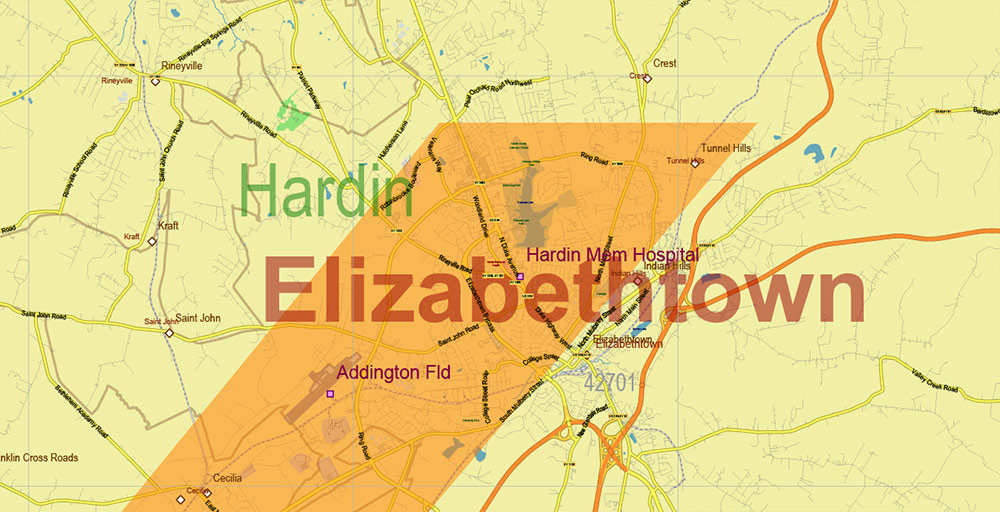
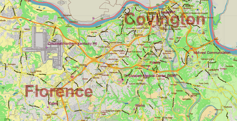
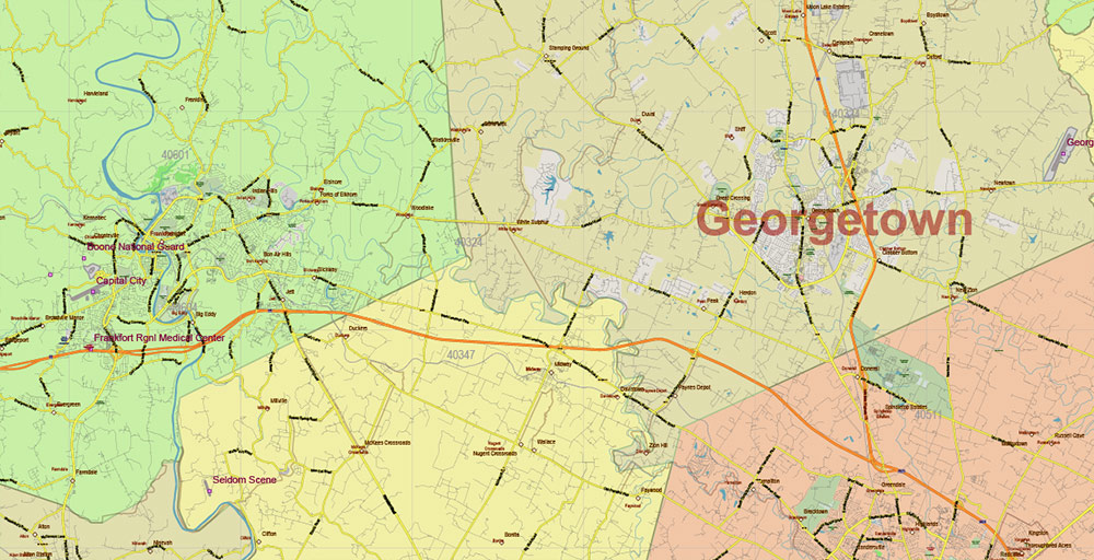
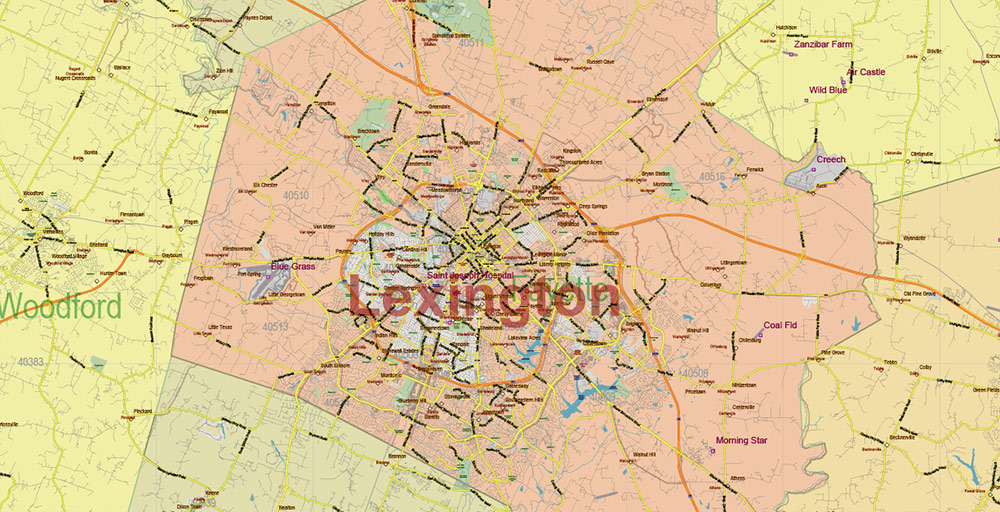
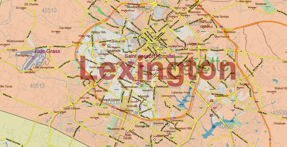
Printable Vector Map of Kentucky Full State US: All Streets and Roads + counties areas + zip-codes areas, fully editable Adobe Illustrator Map in layers, scalable, 85 MB ZIP
Scale: 1:59399
All streets and roads, Names of Principal streets, All Cities and Towns, Counties, All Geonames, airports, and heliports. Map for design, printing, arts, projects, presentations, for architects, designers, and builders, business, logistics.
NOTE! All objects are located on separate layers by type. The preview shows them all together. When you work with this map, just turn off or delete those layers that are not needed for your project.
For Editing and High-Quality Printing, Royalty free
Need AutoCAD DWG / DXF, CDR, or any other format? Please, contact us!
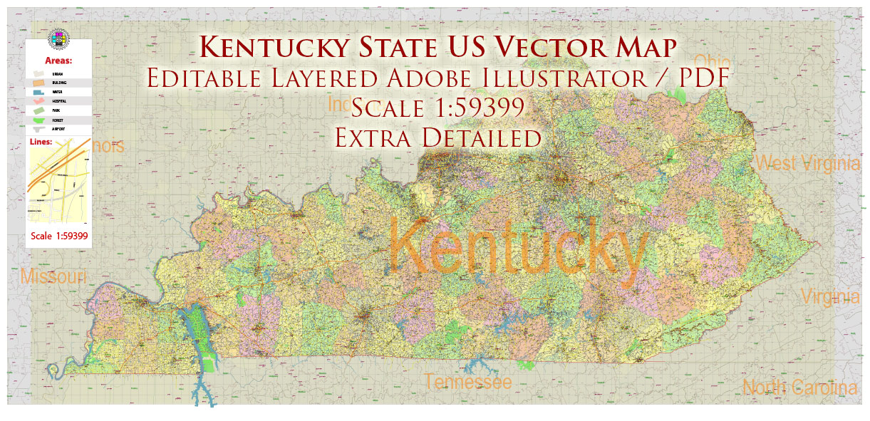
Kentucky Full State US Vector Map: Full Extra High Detailed (all roads, zipcodes, airports) + Admin Areas editable Adobe Illustrator in layers
Layers list:
- Legend
- Grids
- Labels of roads (numbers) – highways, interstate
- All Geonames (cities, towns, villages, hamlets, islands)
- Points of the Geonames (cities, towns, villages, hamlets, islands)
- Names places: Names of all Cities, towns, villages and hamlets
- Names of the Airports and Heliports
- Points of the Airports and Heliports
- Numbers of ZIP codes
- Names of objects (water, park, hospital)
- Names of States
- Names of Counties
- Names of the Main Streets
- Major Roads and Streets – Highways
- Minor Roads and residential streets
- Railroads
- State boundaries
- Water objects (rivers, lakes, ponds, swamps, reefs)
- Waterways
- Ground objects (urban areas, parks, hospitals, etc.)
- ZIP-codes areas
- Counties areas (colored)
- States areas
- Background
Kentucky Full State US Vector Map: Full Extra High Detailed (all roads, zipcodes, airports) + Admin Areas editable Adobe Illustrator in layers
Kentucky Full State US Vector Map: Full Extra High Detailed (all roads, zipcodes, airports) + Admin Areas editable Adobe Illustrator in layers
Kentucky Full State US Vector Map: Full Extra High Detailed (all roads, zipcodes, airports) + Admin Areas editable Adobe Illustrator in layers

Kentucky Full State US Vector Map: Full Extra High Detailed (all roads, zipcodes, airports) + Admin Areas editable Adobe Illustrator in layers
Kentucky Full State US Vector Map: Full Extra High Detailed (all roads, zipcodes, airports) + Admin Areas editable Adobe Illustrator in layers
Kentucky Full State US Vector Map: Full Extra High Detailed (all roads, zipcodes, airports) + Admin Areas editable Adobe Illustrator in layers
Kentucky Full State US Vector Map: Full Extra High Detailed (all roads, zipcodes, airports) + Admin Areas editable Adobe Illustrator in layers
Kentucky Full State US Vector Map: Full Extra High Detailed (all roads, zipcodes, airports) + Admin Areas editable Adobe Illustrator in layers
Kentucky Full State US Vector Map: Full Extra High Detailed (all roads, zipcodes, airports) + Admin Areas editable Adobe Illustrator in layers
Kentucky Full State US Vector Map: Full Extra High Detailed (all roads, zipcodes, airports) + Admin Areas editable Adobe Illustrator in layers
Kentucky Full State US Vector Map: Full Extra High Detailed (all roads, zipcodes, airports) + Admin Areas editable Adobe Illustrator in layers
Kentucky Full State US Vector Map: Full Extra High Detailed (all roads, zipcodes, airports) + Admin Areas editable Adobe Illustrator in layers
Kentucky Full State US Vector Map: Full Extra High Detailed (all roads, zipcodes, airports) + Admin Areas editable Adobe Illustrator in layers
Kentucky Full State US Vector Map: Full Extra High Detailed (all roads, zipcodes, airports) + Admin Areas editable Adobe Illustrator in layers
Kentucky Full State US Vector Map: Full Extra High Detailed (all roads, zipcodes, airports) + Admin Areas editable Adobe Illustrator in layers
Kentucky Full State US Vector Map: Full Extra High Detailed (all roads, zipcodes, airports) + Admin Areas editable Adobe Illustrator in layers
Kentucky Full State US Vector Map: Full Extra High Detailed (all roads, zipcodes, airports) + Admin Areas editable Adobe Illustrator in layers
Kentucky Full State US Vector Map: Full Extra High Detailed (all roads, zipcodes, airports) + Admin Areas editable Adobe Illustrator in layers
Kentucky Full State US Vector Map: Full Extra High Detailed (all roads, zipcodes, airports) + Admin Areas editable Adobe Illustrator in layers
Kentucky Full State US Vector Map: Full Extra High Detailed (all roads, zipcodes, airports) + Admin Areas editable Adobe Illustrator in layers
Kentucky Full State US Vector Map: Full Extra High Detailed (all roads, zipcodes, airports) + Admin Areas editable Adobe Illustrator in layers
Kentucky Full State US Vector Map: Full Extra High Detailed (all roads, zipcodes, airports) + Admin Areas editable Adobe Illustrator in layers
Kentucky Full State US Vector Map: Full Extra High Detailed (all roads, zipcodes, airports) + Admin Areas editable Adobe Illustrator in layers
Kentucky Full State US Vector Map: Full Extra High Detailed (all roads, zipcodes, airports) + Admin Areas editable Adobe Illustrator in layers

 Author: Kirill Shrayber, Ph.D. FRGS
 + Admin Areas editable Adobe Illustrator in layers")
 + Admin Areas + Relief Shaded Raster, editable Adobe Illustrator in layers")
