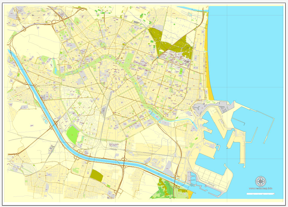
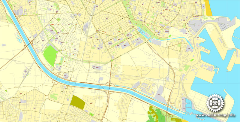
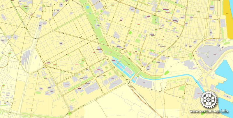
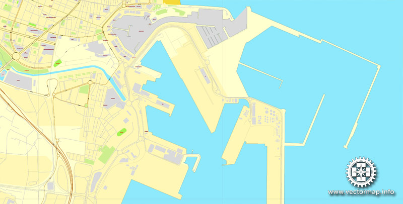
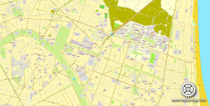
Valencia, Spain, printable vector street map, City Plan V.2, full editable, Adobe Illustrator, Royalty free, full vector, scalable, editable, text format street names, 3,3 mb ZIP
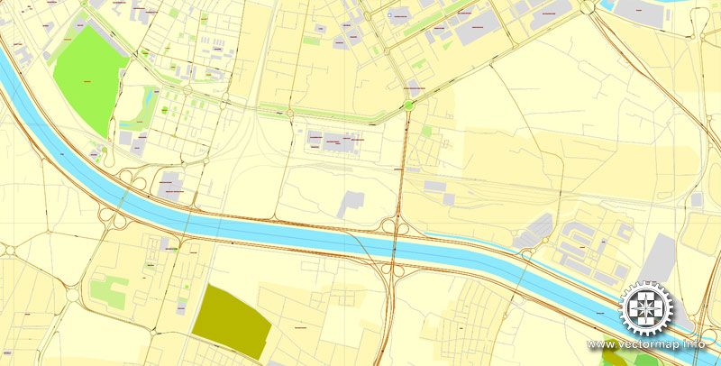
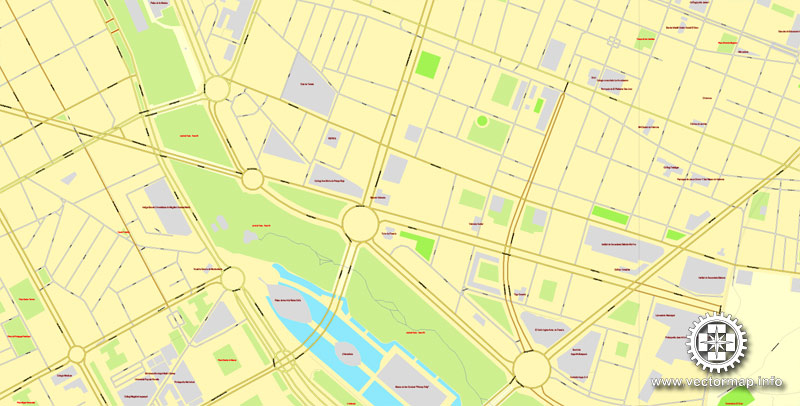
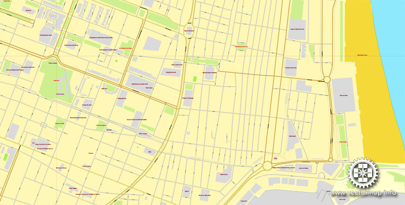
All streets, some more buildings.
Map for design, print, arts, projects, presentations, for architects, designers and builders.
Different font colors of the street names (black); object names by type (brown, red).
DXF, DWG, CDR and other formats – on request, same price, please, contact
Valencia, Spain.
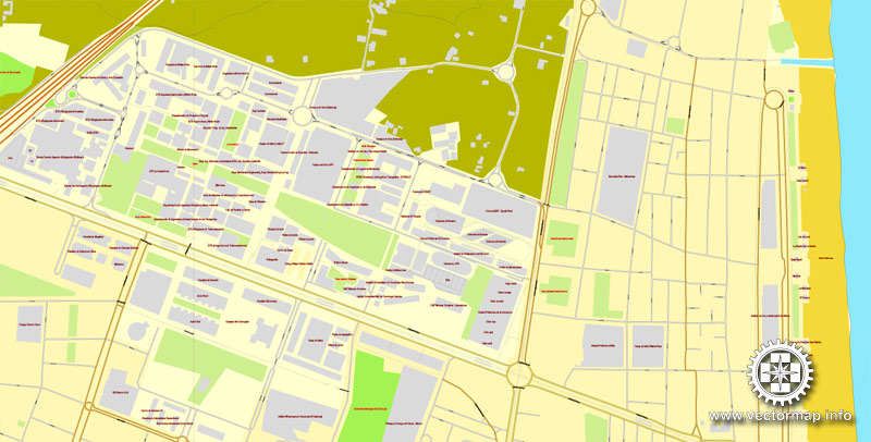
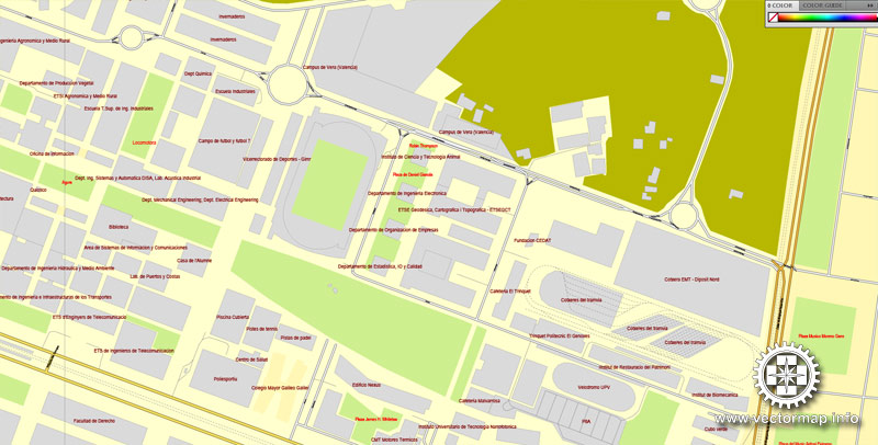
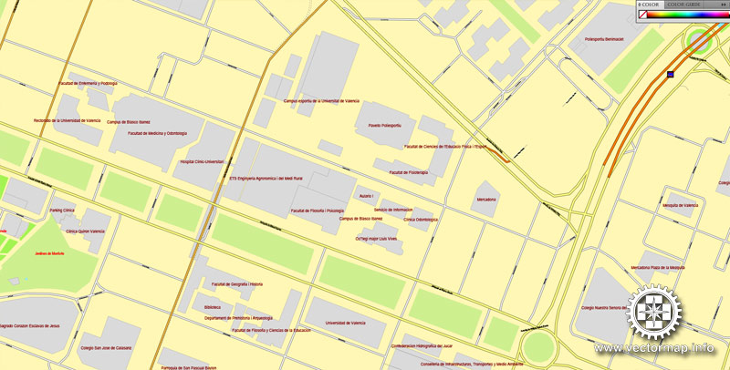
This vector map of Valencia is used as a basis for design, editing, and further printing.
This is the most detailed, exact map of Valencia for high-quality printing and polygraphy. You can always clarify the map development date by contacting us.
For your convenience, all objects on Valencia vector map are divided into layers. And the editing is very easy – colors, lines, etc.
You can easily add any objects needed (e.g. shops, salons, sale points, gas station or attraction) on any layer of Valencia vector map.
Valencia on the east coast of Spain, is the capital of the autonomous community of Valencia and the third-largest city in Spain after Madrid and Barcelona, with around 800,000 inhabitants in the administrative centre. Its urban area extends beyond the administrative city limits with a population of around 1.5–1.6 million people. Valencia is Spain’s third largest metropolitan area, with a population ranging from 1.7 to 2.5 million depending on how the metropolitan area is defined. The Port of Valencia is the 5th busiest container port in Europe and the busiest container port on the Mediterranean Sea. The city is ranked at Gamma+ in the Globalization and World Cities Research Network. Valencia is integrated into an industrial area on the Costa del Azahar (Orange Blossom Coast).
One of the advantages of Valencia vector maps of our production is the relevance of cartographic data, we constantly update all our products.
This vector map of Valencia is used by:
designers, layout designers, printers, advertisers and architects. Our product – vector maps – is designed for further editing and printing in large formats – from @Wall format (a few meters) to A-0 and A-1, A-2, A-3.
Valencia map in vector format is used for design, urban planning, presentations and media visualizations.
Advertising and presentation map of Valencia (usually the final designer marks the routes, and puts the client’s objects (shops, saloons, gas stations etc.)
The undoubted advantage is that people will NEVER throw out this advertising product – the map. In fact, as an advertising medium, a map is the most “long-playing” of the well-known polygraphic advertising media, with the longest lifespan, and the maximum number of interactions with the customer.
For travelers, maps are sold at the airports and gas stations around the world. Often the source is our vector maps.
Take a look, who purchases our vector maps of Valencia in “Our Clients and Friends” page – these are large and small companies, from super-brands like Volvo and Starbucks, to small design studios and printing houses.
It’s very easy to work with vector maps of Valencia, even for a not very experienced designer who can turn on and off the map layers, add new objects, change the colors of fill and lines according to customer requirements.
The undoubted advantage of Valencia vector maps in printing is an excellent and detailed visualization, when customer can expand a large paper map and instantly define his location, find a landmark, an object or address on map, unlike using the popular electronic formats of Google and Yandex maps for example.
Printable vector maps of Valencia are much more convenient and efficient than any electronic maps on your smartphone, because ALL DETAILS are displayed in the entire space of Valencia map.
Useful tips on working with vector maps of cities and countries in Adobe Illustrator.
«V» – launches the Selection tool (cursor, black arrow), which makes active any vector line.
«А» – launches the Direct Selection tool (white cursor), allows you to select curve elements and drag them to the desired place.
«R» – activates the Rotate tool, which helps you rotating selected objects around the center point by 360 degrees.
«E» – gives you the opportunity to use the Eraser tool and erase unnecessary parts.
«X» – switches between Fill and Stroke in the Tools section. Try to get used to this hot key and
you will quickly understand that you can’t live and work without it.
Guides are not limited to vertical and horizontal in Adobe Illustrator. You can also create a diagonal guide for example. Moreover, you can turn any contours into guides. Select the outline and go to View > Guides > Make Guides (Create Guides), or simply press Cmd/Ctrl + 5. You can also turn the guides back into an editable object. Go to menu, View > Guides > Unlock Guides (Release Guides), select the guide you want to edit and select View > Guides > Release Guides (Reset Guides), or just press Cmd/Ctrl + Option / Alt + 5).

You will probably want to change the color scheme used on our Valencia vector map.
To quickly and effectively play with colors.
Of course, you can do it manually, all objects in our Valencia vector map are divided according to types and layers, and you can easily change the color gamma of vector objects in groups and layers.
But there is more effective way of working with the whole VECTOR MAP of Valencia and all layers:
The overview dialog «Edit colors»/«Repaint Graphic Object» (this dialog box name can change depending on the context):
If you have selected a part or a layer of Valencia vector map and open the dialog box by clicking the icon in the Control panel, on the Samples palette or the Color Catalog, or if you choose Edit > Edit Colors> Repaint Graphic Object, then the «Repaint Graphic Object» dialog box appears, and you get access to «Assign» and «Edit» tabs.
If a picture or a map fragment is not selected, and you open the dialog box by clicking the icon in the Control panel, on the Samples palette or in the Color Catalog, the «Edit Colors» dialog box appears and you can only access the «Edit» tab.
Regardless of the name at the top of the dialog box, the right-hand side always displays the color group of the current document, as well as two default color groups: Print Color and Grayscale. These color groups can be selected and used any time.
Create and edit color groups of Valencia vector map, and also assign colors using the «Edit Colors»/ а «Repaint Graphic Object» dialog box.
A. Creating and editing of a color group on the «Edit» tab
B. Assigning colors on the «Assign» tab
C. Select a group of colors from the «Color groups» list
The option «Repaint a graphic object» in the lower part of the dialog box allows you to preview the colors on a selected layer of Vector map, or a group of elements, and specify whether its colors will be redefined when the dialog box is closed.
The main areas of the dialog box are:
«Edit»
The «Edit» tab is designed to create a new or edit the existing color groups.
The harmony rules Menu and the Color Wheel are used to conduct experiments with color harmonies. The color wheel shows how colors are related in color harmony, and the color bars allow you to view and manipulate an individual color values. In addition, you can adjust the brightness, add and remove colors, save color groups and view colors on the selected Vector Map of Valencia or a separated layers.
«Assign»
The «Assign» tab is used to view and control on how the original colors are replaced with colors from the color group like your corporate colors in the Vector Map of Valencia.
The assign color ability is provided only if the entire map, layer or fragment is selected in the document. You can specify which of new colors replace the current colors, whether the spot colors should be preserved and how colors are replaced (for example, you can replace colors completely or changing the color tone while maintaining the brightness). The «Assign» tab allows you to redefine colors in the Vector Map of Valencia, or in separate layers and fragments using the current color group or reducing the number of colors in the current Vector Map.
Color groups
Is a list of all saved color groups for current document (the same groups appear in the «Samples» palette). You can edit and delete the existing color groups, as well as creating a new ones using the list of “Color Groups” in the dialog box. All changes appear in the «Samples» palette.
The highlighted color group shows, which color group is currently edited.
Valencia was founded as a Roman colony by the consul Decimus Junius Brutus Callaicus in 138 BC, and called Valentia Edetanorum. In 714 Moroccan and Arab Moors occupied the city, introducing their language, religion and customs; they implemented improved irrigation systems and the cultivation of new crops as well. Valencia was the capital of the Taifa of Valencia. In 1238 the Christian king James I of Aragon conquered the city and divided the land among the nobles who helped him conquer it, as witnessed in the Llibre del Repartiment. He also created a new law for the city, the Furs of Valencia, which were extended to the rest of the Kingdom of Valencia. In the 18th century Philip V of Spain abolished the privileges as punishment to the kingdom of Valencia for aligning with the Habsburg side in the War of the Spanish Succession. Valencia was the capital of Spain when Joseph Bonaparte moved the Court there in the summer of 1812. It also served as capital between 1936 and 1937, during the Second Spanish Republic.
Any color group can be selected and edited, or used to redefine the colors in the selected vector map of Valencia, its fragments or elements.
Saving a color group adds this group to the specified list.
Opening the «Edit Colors»/«Repaint Graphic Object» dialog box.
Open the «Edit Colors»/«Repaint Graphic Object» dialog box using one of the following methods:
«Edit»> «Edit Colors»> «Repaint Graphic object» or «Repaint With Style».
Use these commands if you need to edit the colors in the selected vector map of Valencia.
«Repaint Graphic object» button on the «Control» panel.
Use this button if you need to adjust colors of Valencia vector map using the а «Repaint graphic object» dialog box.
The specified button is available if the selected vector map or its fragment contains two or more colors.
Note. This color editing method is convenient for global color adjustment in a vector map, if global colors were not used when creating a Map of Valencia.
The «Edit colors» button or «Edit or apply colors» on the «Color Catalog» palette
Click this button if you need to edit colors on the «Color Catalog» palette or edit and then apply them to the selected Vector Map of Valencia or its fragment.
The «Edit color group» button or «Edit or apply color group» on the «Samples» palette.
Click this button if you need to edit the colors in the specific color group or edit and apply them to the selected Vector Map of Valencia or a group of its elements, for example, the whole layer “Streets and lines”. You can also double-click the color group in the Samples panel to open the dialog box.
If the map file is too large and your computer freezes or even can’t open it quickly:
1. Try to reduce the color resolution of the video card (display) to 256 colors while working with a large map.
2. Using Windows Task Manager, select all the application you don’t need, while working with map, just turn them off.
3. Launch Adobe Illustrator. (DO NOT OPEN the vector map file)
4. Start the Windows Task Manager using administrator rights > Find the “Illustrator” process > set the «real time» priority,
5. Open the file. When you see the LEGACY FONT popup window – click “OK” (do not update). You can restore the TEXT later.
6. Can also be useful: When file is opened – Edit > Settings > Basic Settings > disable smoothing. /// It looks scary, but works quickly)))
We recommend saving the file in Adobe Illustrator 10 version. It’s much more stable when working with VERY BIG size files.
The city is situated on the banks of the Turia, on the east coast of the Iberian Peninsula, fronting the Gulf of Valencia on the Mediterranean Sea. Its historic centre is one of the largest in Spain, with approximately 169 ha (420 acres); this heritage of ancient monuments, views and cultural attractions makes Valencia one of the country’s most popular tourist destinations.
Due to its long history, this is a city with numerous popular celebrations and traditions, such as the Fallas (featuring the traditional Spanish dish paella), which were declared as Fiestas of National Tourist Interest of Spain in 1965 and Intangible cultural heritage by UNESCO in November 2016. From 1991 to 2015, Rita Barberá Nolla was the mayor of the city, yet in 2015, Joan Ribó from Coalició Compromís, became mayor.
Valencia stands on the banks of the Turia River, located on the eastern coast of the Iberian Peninsula and the western part of the Mediterranean Sea, fronting the Gulf of Valencia. At its founding by the Romans, it stood on a river island in the Turia, 6.4 kilometres (4.0 mi) from the sea. The Albufera, a freshwater lagoon and estuary about 11 km (7 mi) south of the city, is one of the largest lakes in Spain. The City Council bought the lake from the Crown of Spain for 1,072,980 pesetas in 1911, and today it forms the main portion of the Parc Natural de l’Albufera (Albufera Nature Reserve), with a surface area of 21,120 hectares (52,200 acres). In 1976, because of its cultural, historical, and ecological value, the Generalitat Valenciana declared it a natural park.

Valencia
City in Spain
The port city of Valencia is on Spain’s southeastern Orange Blossom Coast, where the Turia River meets the Mediterranean Sea. It’s known for its City of Arts and Sciences, with futuristic structures including a planetarium, an oceanarium and an interactive museum. Valencia also has several beaches, including some within nearby Albufera park, a wetlands reserve with a lake, walking trails and bird-watching.
Population: 786,424 (2014) Instituto Nacional de Estadística
Sports teams: Valencia CF, Levante UD, Ros Casares Valencia
Valencia is the capital of the autonomous community of Valencia and the third largest city in Spain after Madrid and Barcelona, with around 800,000 inhabitants in the administrative centre. Its urban area extends beyond the administrative city limits with a population of around 1.5 million people. Valencia is Spain’s third largest metropolitan area, with a population ranging from 1.7 to 2.5 million. The Port of Valencia is the 5th busiest container port in Europe and the busiest container port on the Mediterranean Sea. The city is ranked at Gamma in the Globalization and World Cities Research Network.
Valencia was founded as a Roman colony in 138 BC. The city is situated on the banks of the Turia, on the east coast of the Iberian Peninsula, fronting the Gulf of Valencia on the Mediterranean Sea. Its historic centre is one of the largest in Spain, with approximately 169 hectares; this heritage of ancient monuments, views and cultural attractions makes Valencia one of the country’s most popular tourist destinations.
Valencia is integrated into an industrial area on the Costa del Azahar (Orange Blossom Coast). Valencia’s main festival is the Falles. The traditional Spanish dish, paella, originated in Valencia.
Source Wiki

Free vector map World, Adobe Illustrator, download now maps vector clipart Map for design, projects, presentation free to use as you like. World map vector, Vector world map, World vector map, Map western europe, West europe maps, Map of the world modifiable, High resolution world map, World map illustrator, World map PDF editable, World vector map download,
Free vector map World, Adobe Illustrator, download now maps vector clipart
Map for design, projects, presentation free to use as you like.
Free Download All World Vector Maps here >>>>>
See also: TERMS & CONDITIONS: SOFTWARE LICENSE AGREEMENT FOR DIGITAL CARTOGRAPHIC DATA
Small guide: How to work with the vector map?
You can: Mass select objects by type and color – for example, the objects type “building” (they are usually dark gray) – and remove them from the map, if you do not need them in your print or design project. You can also easily change the thickness of lines (streets), just bulk selection the road by the line color.
The streets are separated by type, for example, type “residential road” are usually white with a gray stroke. Highway usually orange with a brown or dark gray stroke.
All objects are divided by types: different types of roads and streets, polygons of buildings, landfills, urban areas, parks and more other.
It is easy to change the font of inscriptions, all or each individually. Also, just can be make and any other manipulation of objects on the vector map in Adobe illustrator format.
Important: All the proportions on the map are true, that is, the relative sizes of the objects are true, because Map is based on an accurate GPS projection, and It transated into the (usual for all) the Mercator projection.
You can easily change the color, stroke and fill of any object on the map, zoom without loss of quality Image Verification.
Select object

Bulk selection the same objects on the vector map

See the bulk selected objects on the vector map

Bulk delete buildungs from the vector map

Select residencial road (small street) on the vector map

Bulk selection the same lines (streets, roads) on the full map

Create fat lines of the streets on the vector maps (bulk action) 1

Create fat lines of the streets on the vector maps (bulk action) 2

Create fat lines of the streets on the vector maps (bulk action) 3

You can easily change the color, stroke and fill of any object on the map, zoom without loss of quality Image Verification.
See more Spain cities street maps in vector
For example Street plan of Madrid city in Adobe Illustrator
Barcelona, Spain printable map

 Author: Kirill Shrayber, Ph.D. FRGS

