Extended Description of the Vector Map
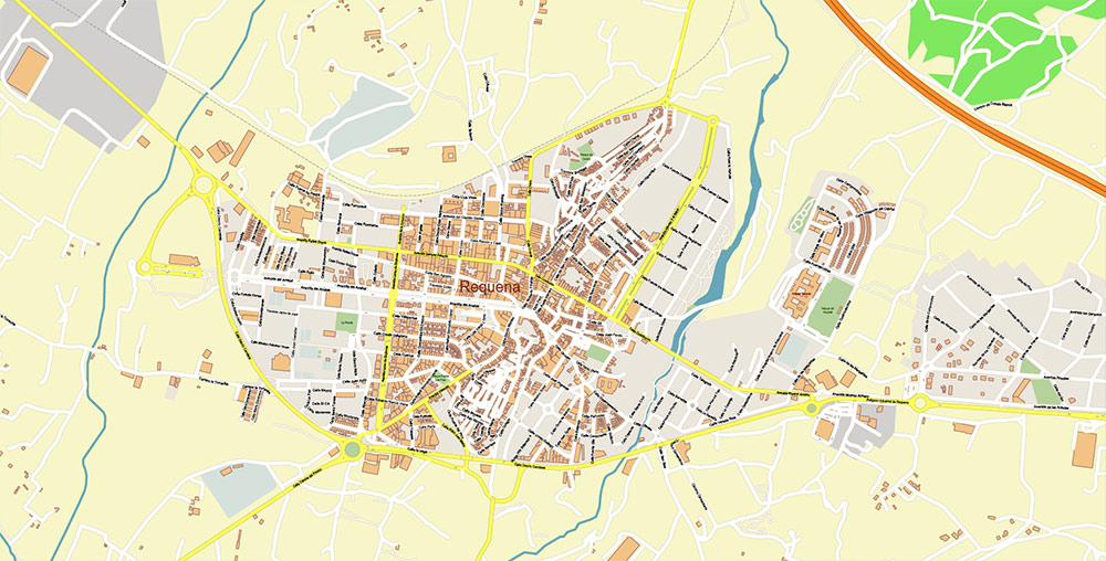
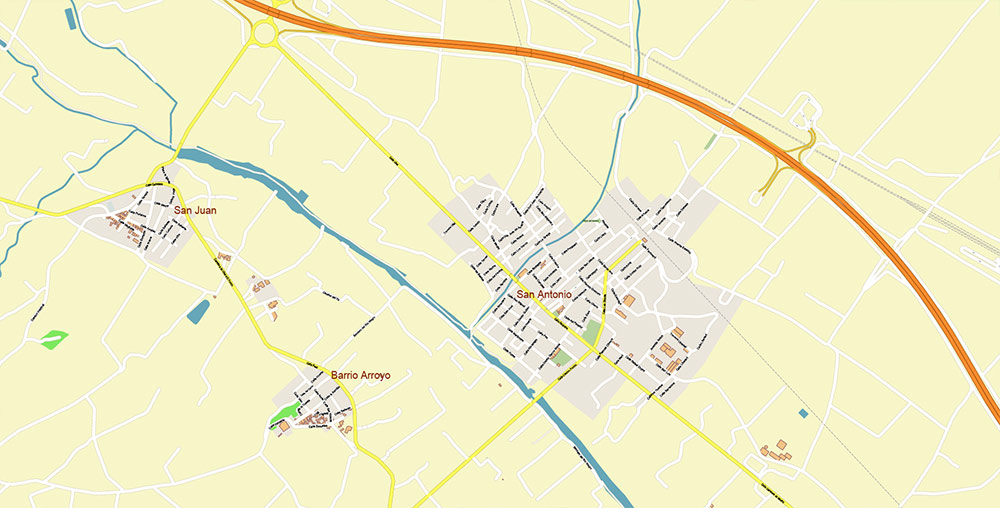
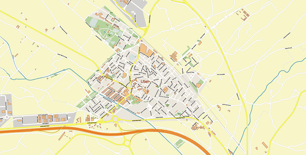
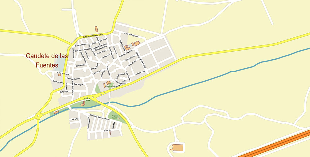
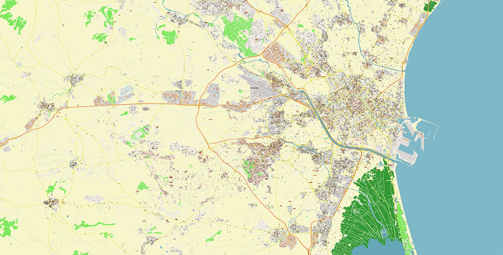
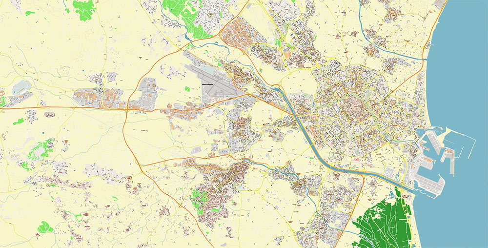
Printable Vector Map of Valencia Spain Grande Area detailed street map scale 1:3627 fully editable Adobe Illustrator scalable, text/curves all names, 79 MB ZIP
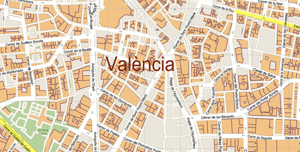
All street names, Main Objects, Buildings. Map for design, printing, arts, projects, presentations, for architects, designers, and builders, business, logistics.
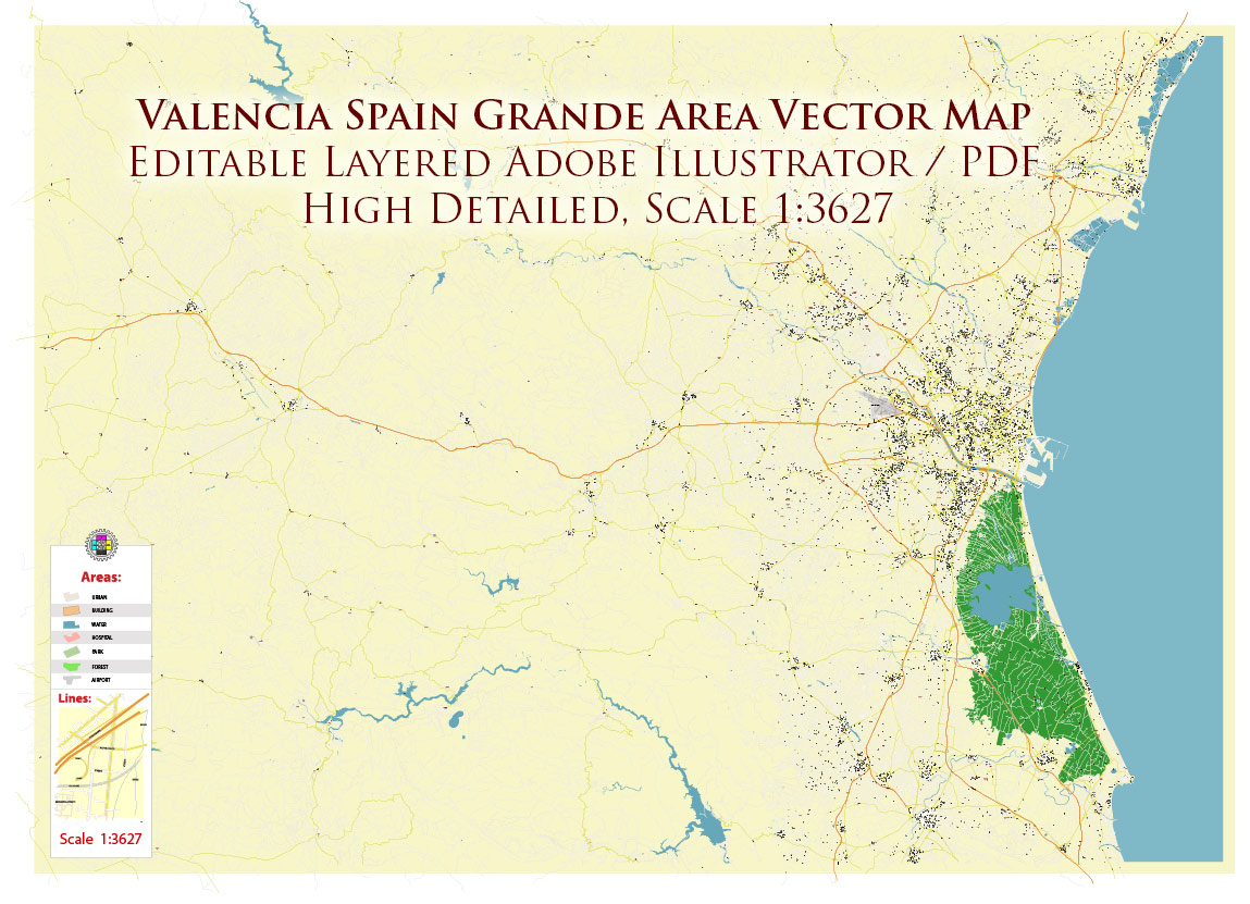
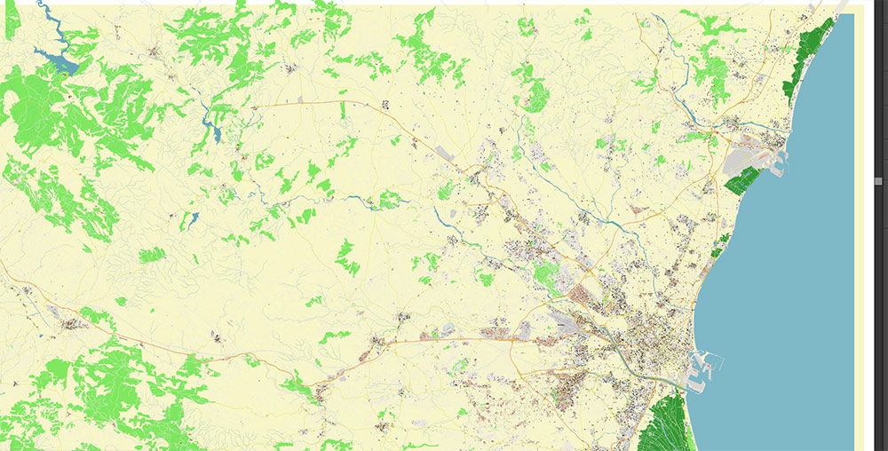
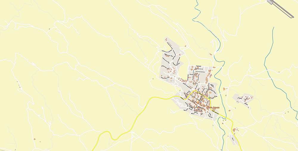
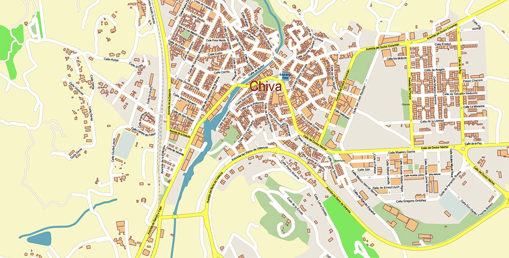
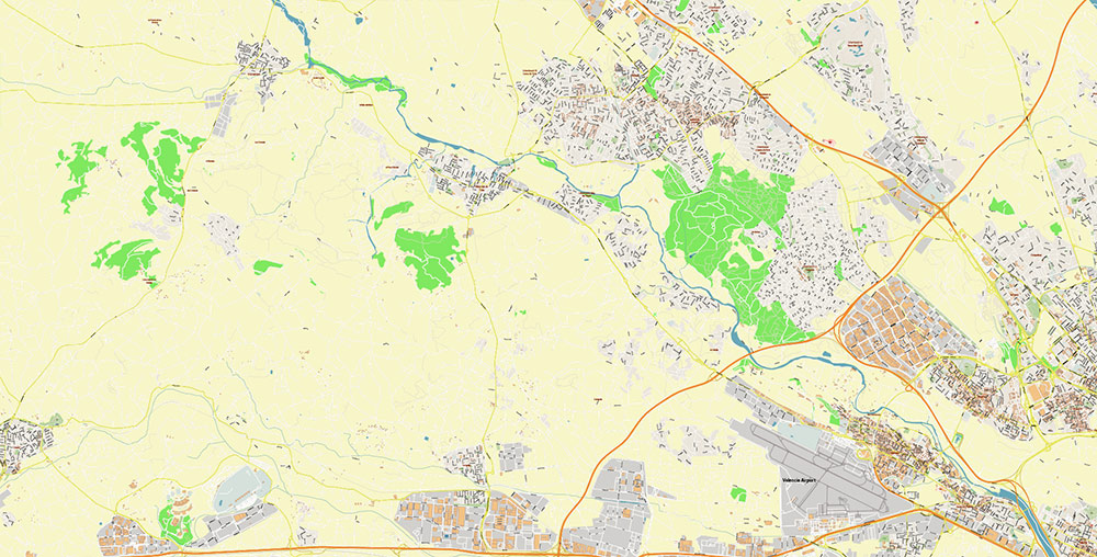
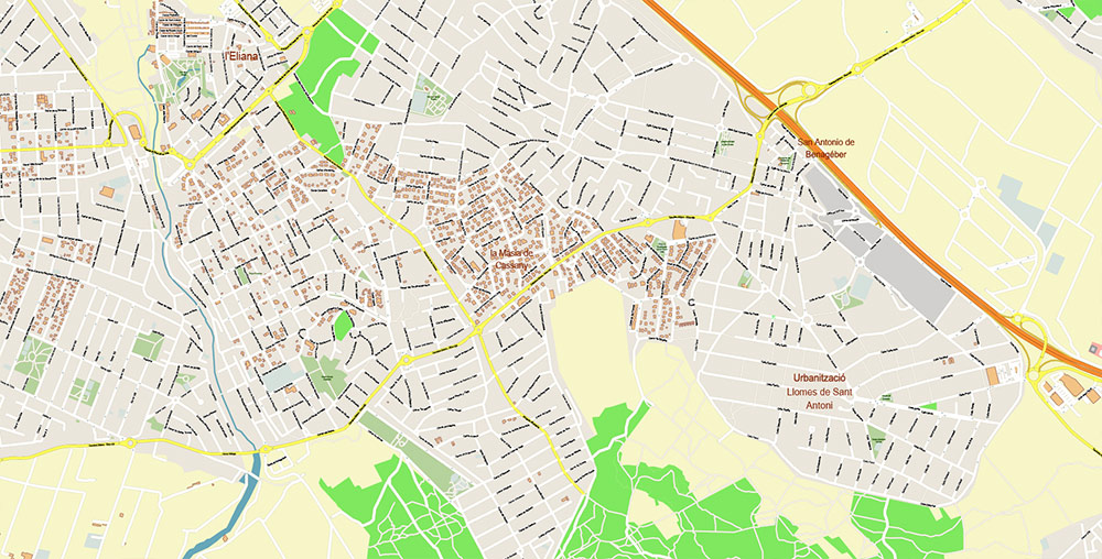
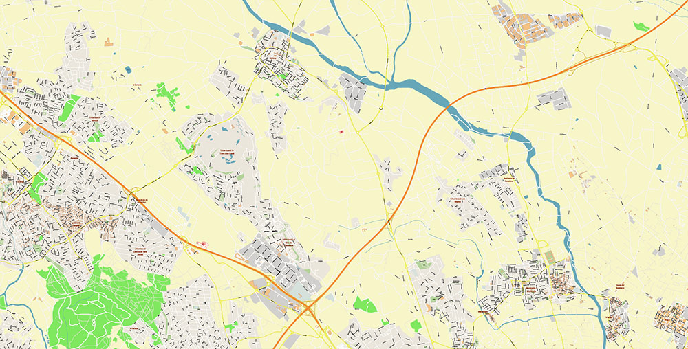
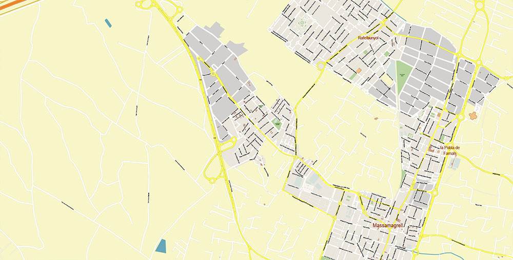
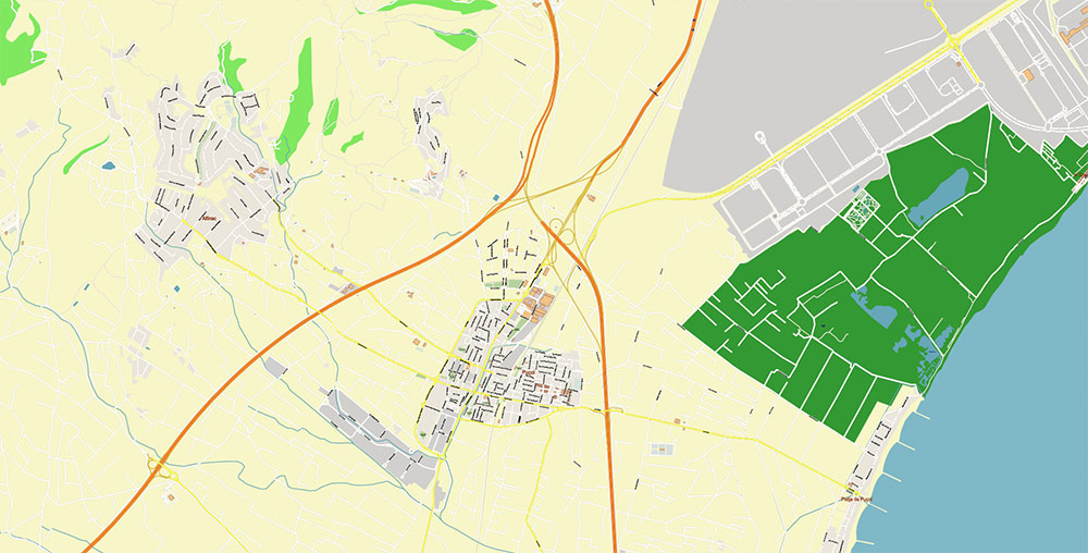
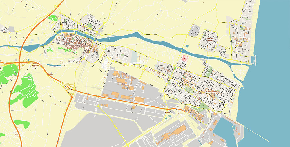
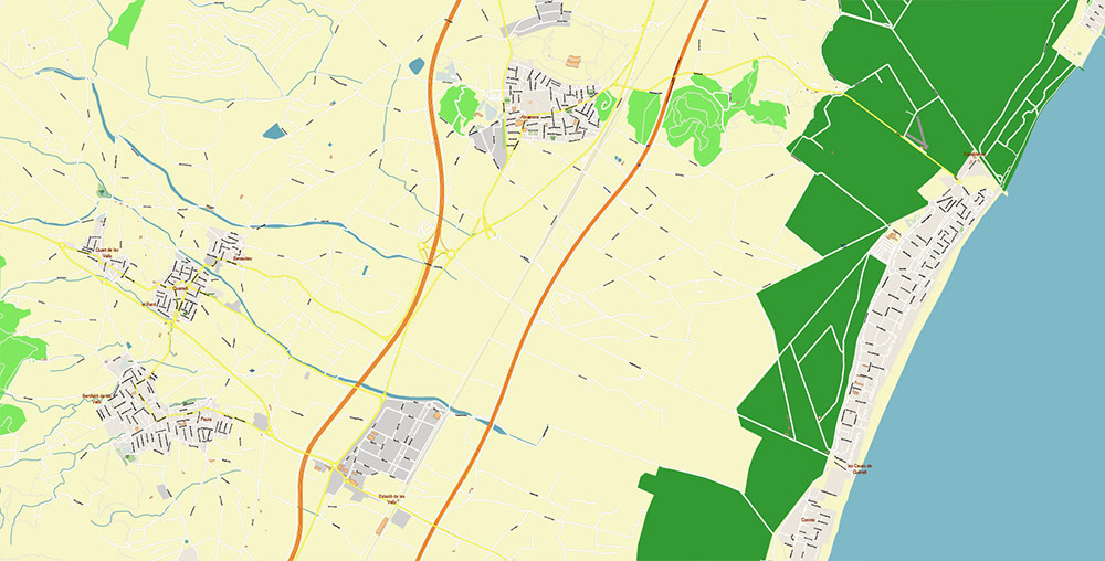
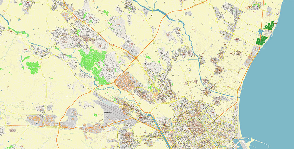
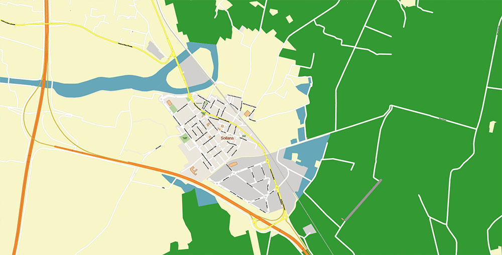
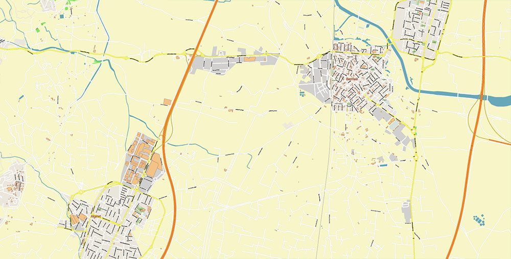
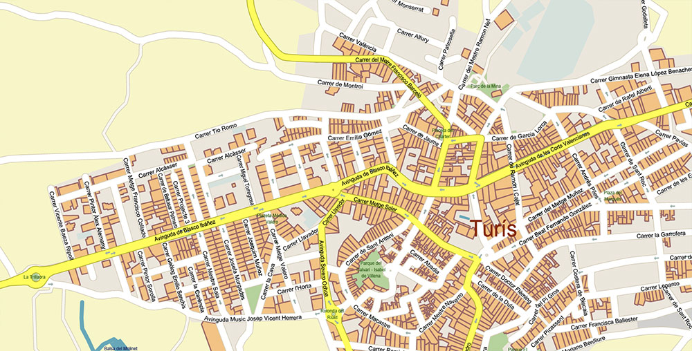
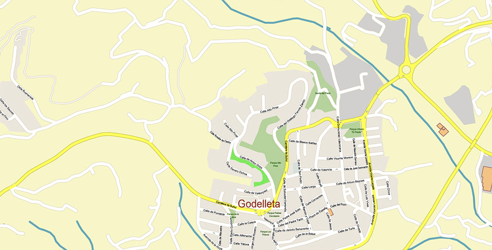
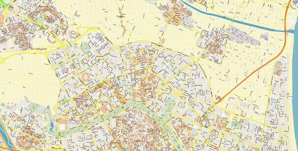
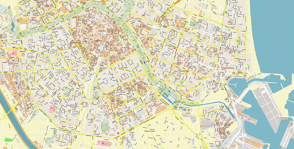
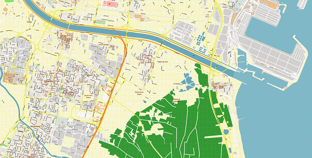
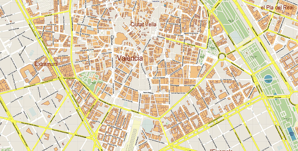
Valencia Spain Grande Area Map Vector Exact City Plan High Detailed Street Map editable Adobe Illustrator in layers
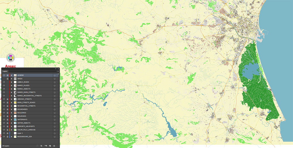
Layers list:
- Legend
- Grids
- Labels of roads
- Names of places (city, hamlet, etc.)
- Names of objects (parks, water, hospitals)
- Names of main streets
- Names of residential streets
- Arrows of streets
- Main Streets, roads
- Residential streets
- Railroads
- Boundaries
- Buildings
- Airports and Heliports
- Water objects (rivers, lakes, ponds, wetlands)
- Waterways
- Color fills (parks, hospital areas, land use, etc.)
- Islands
- Background and sea
The most exact and detailed map of the city in scale.
For Editing and High-Quality Printing
Valencia Spain Grande Area Map Vector Exact City Plan High Detailed Street Map editable Adobe Illustrator in layers
Valencia Spain Grande Area Map Vector Exact City Plan High Detailed Street Map editable Adobe Illustrator in layers
Valencia Spain Grande Area Map Vector Exact City Plan High Detailed Street Map editable Adobe Illustrator in layers
VALENCIA (SPAIN) — AO BRIEF (URBAN / METRO AREA)
1. OVERVIEW (AO)
- Location: Eastern Spain, Mediterranean coast; at the mouth of the Turia River.
- Role: 3rd largest city in Spain; major port, logistics hub, and regional capital.
- Urban scale: ~800K city / ~1.6M metro (Horta de Valencia)
- Terrain: Flat coastal plain (Huerta farmland) → rising inland hills and mountains
- Climate: Mediterranean — hot dry summers, mild winters, episodic heavy autumn rains
Operational note: Coastal urban belt with dense peri-urban sprawl; high mobility, high tourism load.
2. GEOGRAPHY / TERRAIN
- Core terrain:
- Flat alluvial plain (Turia River delta zone)
- Extensive irrigated agricultural belt (Huerta) surrounding city
- Water features:
- Former Turia riverbed (now urban green corridor)
- Albufera lagoon (south) — wetlands, rice fields, flood-prone
- Coastline: Sandy beaches (Malvarrosa, Patacona), port-industrial shoreline
- Constraints:
- Flood risk (historically severe, e.g. 1957 flood → river diversion)
- Wetland zones south limit expansion
3. KEY ROADS / LINES OF COMMUNICATION
Urban structure: radial + concentric ring system
Primary Rings:
- Inner ring: historic city perimeter (former walls → main boulevards)
- Tránsito ring: Pérez Galdós – Peris y Valero – Primado Reig axis
- Outer rings:
- North ring: Ronda Norte (link to universities/coast)
- South ring: Ronda Sur (industrial/logistics access)
Radial Axes (critical corridors):
- Av. del Cid → Madrid direction (A-3 corridor)
- Av. Cortes Valencianas → NW suburbs (Burjassot, Paterna)
- Av. Blasco Ibáñez → university → coast
- Av. del Puerto → port access (high logistics importance)
- Av. Ausiàs March → southern industrial zones
Highways / Strategic links:
- A-3: Valencia – Madrid (primary inland artery)
- AP-7 / A-7: Mediterranean corridor (Barcelona ↔ Alicante)
- V-30 / V-31: urban bypass / port-industrial belt
Operational takeaway:
Highly developed ring-radial system; congestion peaks on port axis and southern industrial approaches.
4. URBAN DISTRICTS (HUMAN TERRAIN)
Core zones:
- Ciutat Vella – historic center, dense, tourism-heavy
- Eixample / Extramurs – 19th–20th c. expansion, mixed residential-commercial
- El Pla del Real – institutional / university
- Camins al Grau – transition to port/coastal modern zones
Coastal / new development:
- Poblats Marítims – port districts (Cabanyal, Malvarrosa)
- Quatre Carreres – modern expansion incl. City of Arts & Sciences
Western / northern residential-industrial:
- Benicalap / Campanar – mixed density
- Patraix / Jesús – working-class districts
5. SUBURBS / METROPOLITAN BELT (HORTA)
- North (Horta Nord):
- Alboraya, Tavernes Blanques (commuter + coastal spillover)
- West (Horta Oest):
- Paterna, Burjassot, Manises (airport, logistics, industry)
- South (Horta Sud):
- Torrent, Catarroja, Alfafar (dense dormitory + industrial zones)
Pattern:
Former agricultural villages → continuous urbanized belt; strong commuting flows.
6. DEMOGRAPHY
- City: ~824K; metro ~1.5–2.0M
- Density: ~5,800/km² (urban core)
- Structure:
- Native Spanish majority
- Significant immigrant share (~15–18%)
- Key groups: Latin American, Romanian, Italian, Chinese
Trend:
- Growth driven by migration + suburban expansion
- Strong service economy + logistics + port activity
7. TRANSPORT SYSTEM
Urban transit:
- Metrovalencia:
- ~160 km network, metro + tram hybrid
- Deep integration with suburbs
- Bus network: dense, citywide coverage
Rail:
- Intercity + commuter rail (Madrid, Barcelona, Alicante corridors)
- High-speed AVE link to Madrid
Air:
- Valencia Airport (Manises) — west of city
Sea:
- Port of Valencia — one of крупнейших in Mediterranean, major container hub
Road:
- развитая motorway сеть (autovía/autopista system)
Mobility pattern insight:
- Historically rail-driven growth → now car-dominated suburban spread
8. HAZARDS / CONSTRAINTS
- Flooding (especially south + Turia basin)
- Coastal erosion / wetland protection limits
- Urban congestion (port + southern belt)
- Heat stress in summer (urban heat island)
9. LOGISTICS / SUSTAINMENT
- Strong supply chain via:
- Major seaport
- A-3 inland corridor
- Mediterranean AP-7 axis
- Agricultural hinterland (Huerta + Albufera rice zone)
- High tourism infrastructure load (seasonal spikes)
10. COMMAND TAKEAWAYS
- Coastal megacity with logistics + port dominance
- Clear ring-radial urban structure — predictable movement patterns
- Suburban belt fully integrated (Horta system)
- Critical choke points: port access, southern corridors
- Terrain favorable (flat), but hydrological risk significant
Valencia Spain Grande Area Map Vector Exact City Plan High Detailed Street Map editable Adobe Illustrator in layers
Valencia Spain Grande Area Map Vector Exact City Plan High Detailed Street Map editable Adobe Illustrator in layers
Valencia Spain Grande Area Map Vector Exact City Plan High Detailed Street Map editable Adobe Illustrator in layers
Valencia Spain Grande Area Map Vector Exact City Plan High Detailed Street Map editable Adobe Illustrator in layers
Valencia Spain Grande Area Map Vector Exact City Plan High Detailed Street Map editable Adobe Illustrator in layers
Valencia Spain Grande Area Map Vector Exact City Plan High Detailed Street Map editable Adobe Illustrator in layers
Valencia Spain Grande Area Map Vector Exact City Plan High Detailed Street Map editable Adobe Illustrator in layers
Valencia Spain Grande Area Map Vector Exact City Plan High Detailed Street Map editable Adobe Illustrator in layers
Valencia Spain Grande Area Map Vector Exact City Plan High Detailed Street Map editable Adobe Illustrator in layers
Valencia Spain Grande Area Map Vector Exact City Plan High Detailed Street Map editable Adobe Illustrator in layers
Valencia Spain Grande Area Map Vector Exact City Plan High Detailed Street Map editable Adobe Illustrator in layers
Valencia Spain Grande Area Map Vector Exact City Plan High Detailed Street Map editable Adobe Illustrator in layers
Valencia Spain Grande Area Map Vector Exact City Plan High Detailed Street Map editable Adobe Illustrator in layers
Valencia Spain Grande Area Map Vector Exact City Plan High Detailed Street Map editable Adobe Illustrator in layers
Valencia Spain Grande Area Map Vector Exact City Plan High Detailed Street Map editable Adobe Illustrator in layers
Valencia Spain Grande Area Map Vector Exact City Plan High Detailed Street Map editable Adobe Illustrator in layers
Valencia Spain Grande Area Map Vector Exact City Plan High Detailed Street Map editable Adobe Illustrator in layers
Valencia Spain Grande Area Map Vector Exact City Plan High Detailed Street Map editable Adobe Illustrator in layers
Valencia Spain Grande Area Map Vector Exact City Plan High Detailed Street Map editable Adobe Illustrator in layers
Valencia Spain Grande Area Map Vector Exact City Plan High Detailed Street Map editable Adobe Illustrator in layers
Valencia Spain Grande Area Map Vector Exact City Plan High Detailed Street Map editable Adobe Illustrator in layers
Valencia Spain Grande Area Map Vector Exact City Plan High Detailed Street Map editable Adobe Illustrator in layers
Valencia Spain Grande Area Map Vector Exact City Plan High Detailed Street Map editable Adobe Illustrator in layers
Valencia Spain Grande Area Map Vector Exact City Plan High Detailed Street Map editable Adobe Illustrator in layers

 Author: Kirill Shrayber, Ph.D. FRGS


