Extended Description of the Vector Map
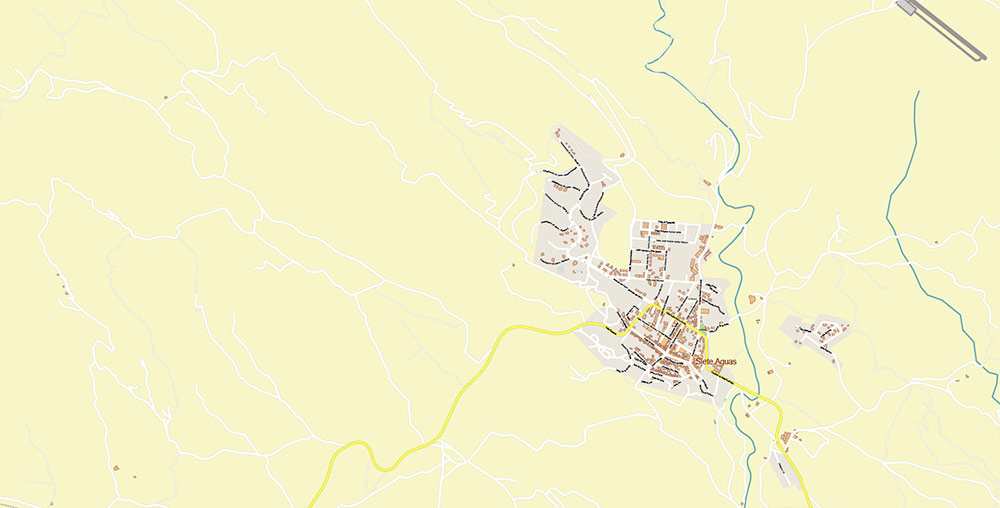
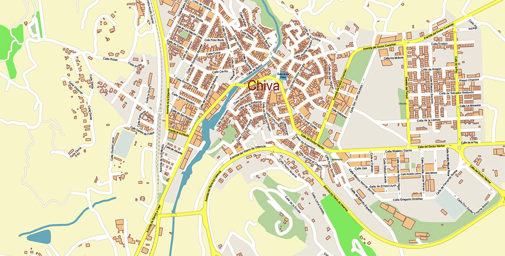
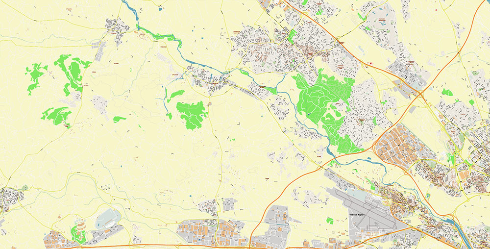
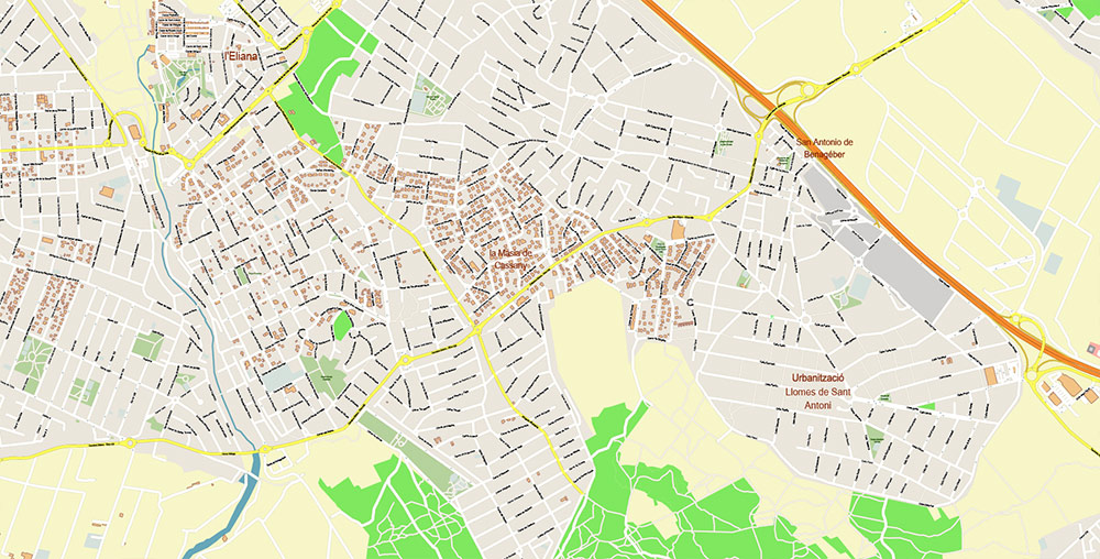
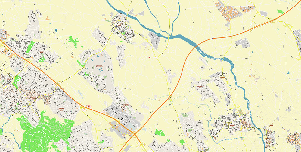
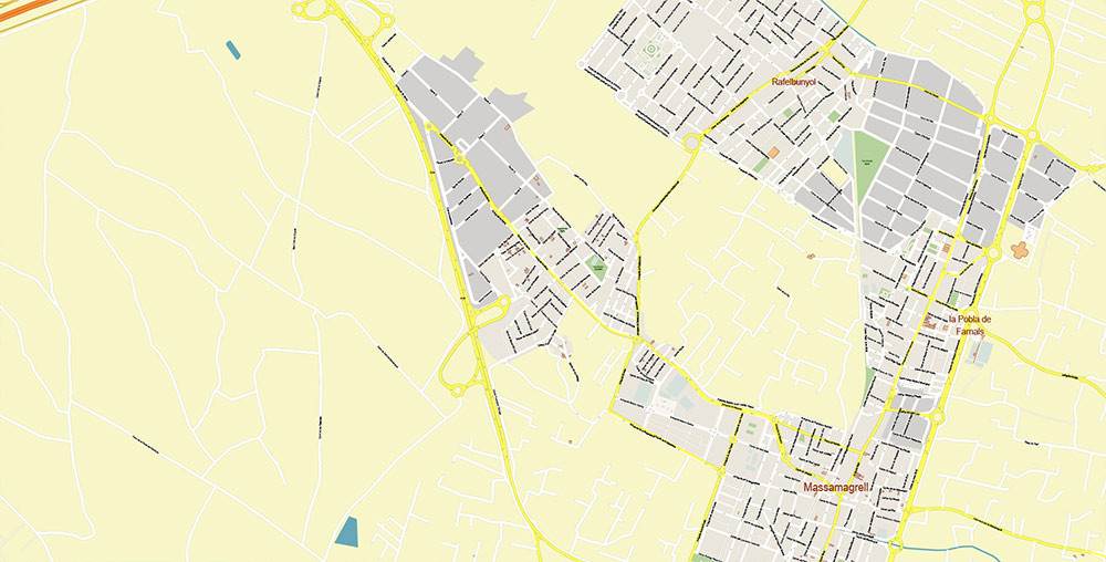
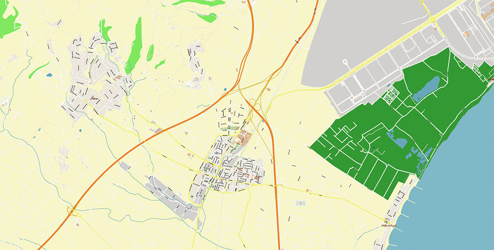
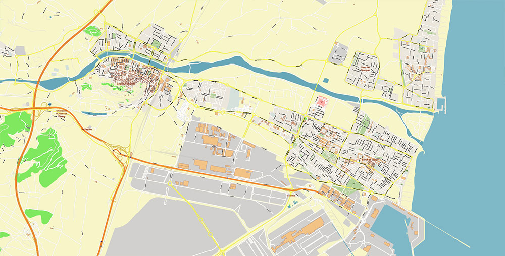
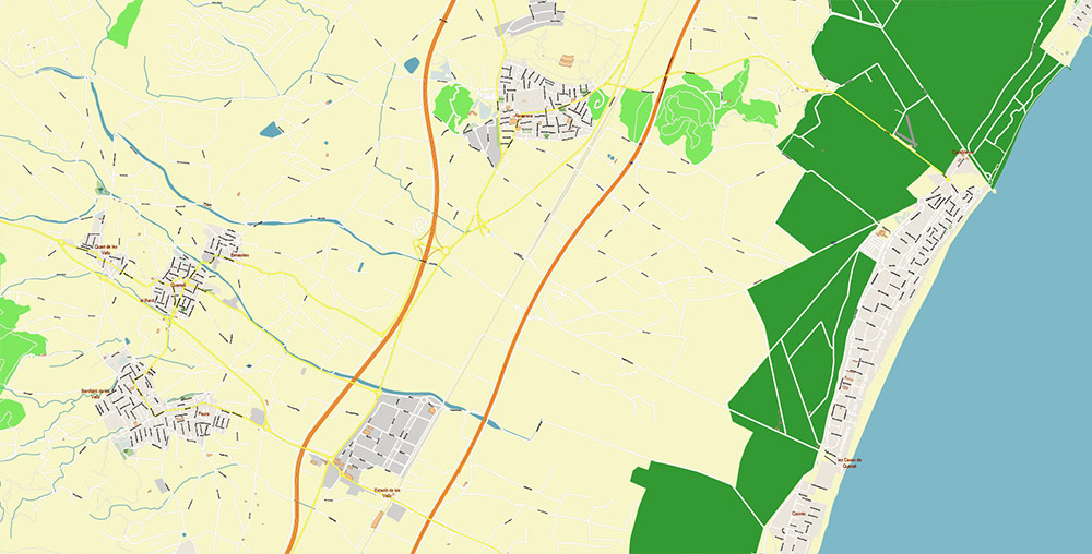
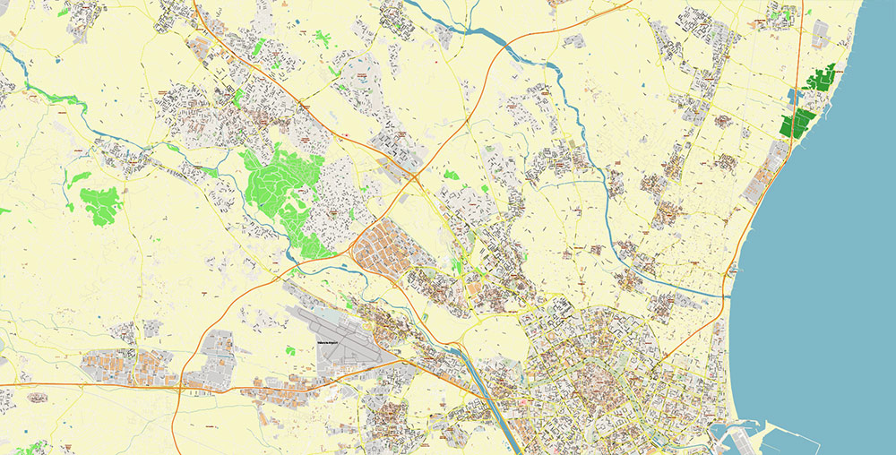
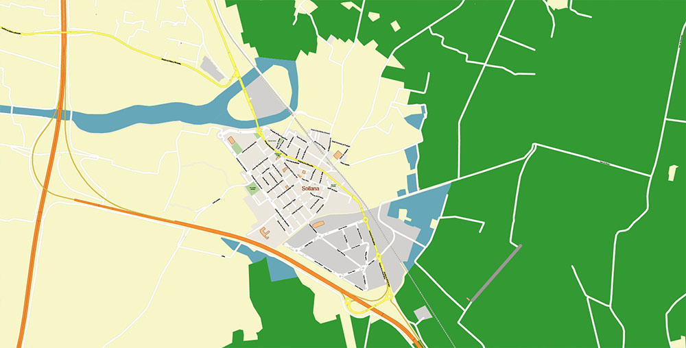
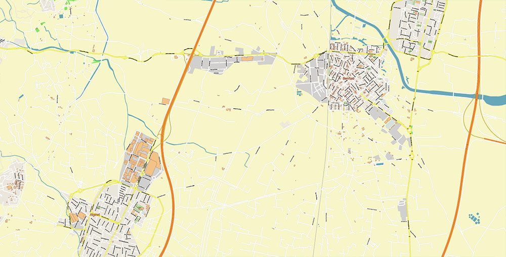
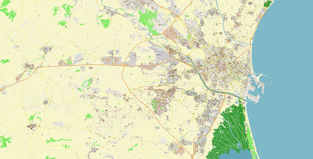
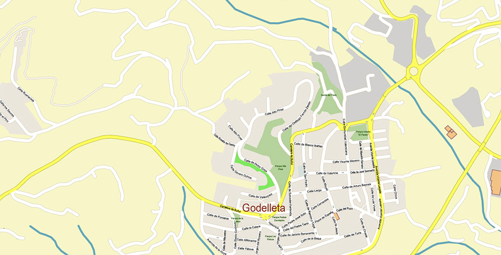
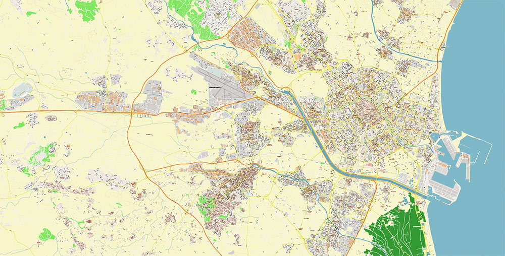
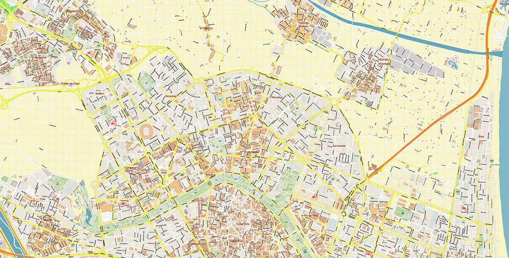
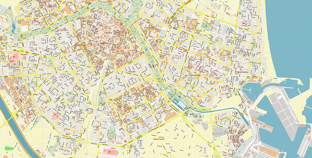
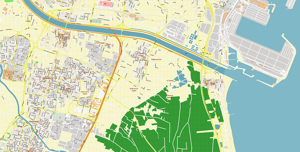
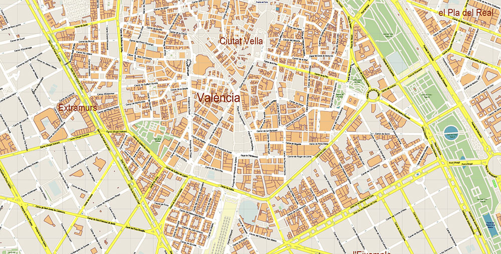
Printable PDF Vector Map of Valencia Spain Grande Area detailed street map scale 1:3627 fully editable Adobe PDF scalable, text/curves all names, 214 MB ZIP
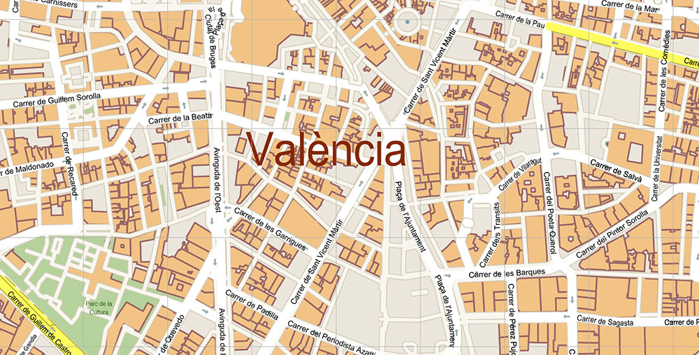
All street names, Main Objects, Buildings. Map for design, printing, arts, projects, presentations, for architects, designers, and builders, business, logistics.
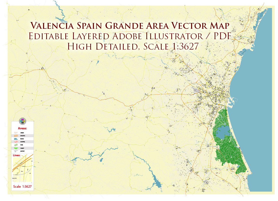
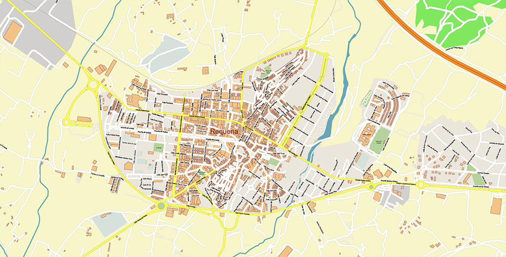
Valencia Spain Grande Area PDF Map Vector Exact City Plan High Detailed Street Map editable Adobe PDF in layers
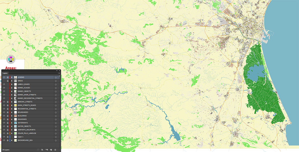
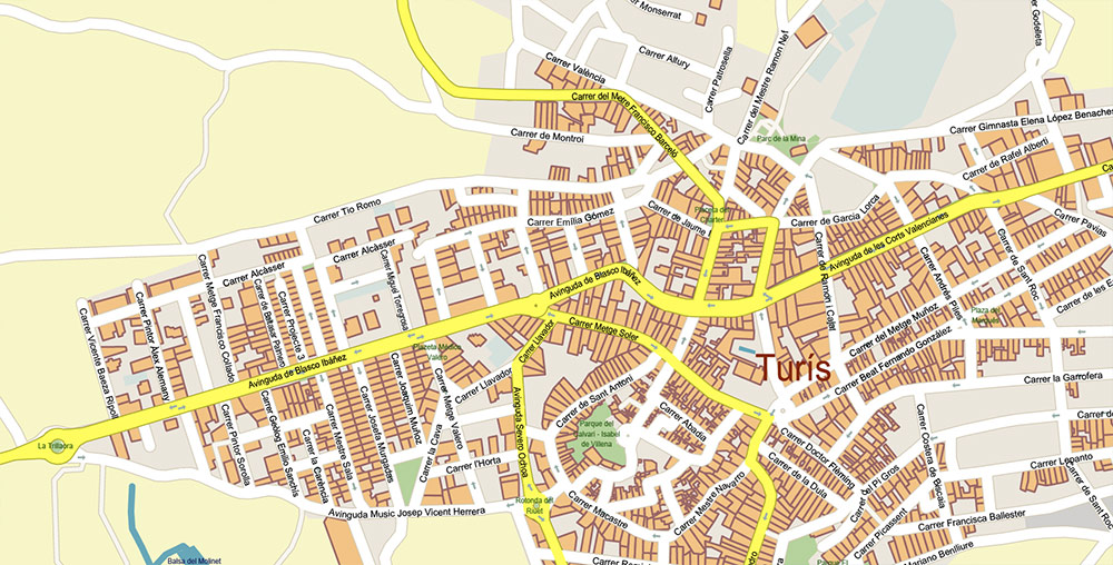
Layers list:
- Legend
- Grids
- Labels of roads
- Names of places (city, hamlet, etc.)
- Names of objects (parks, water, hospitals)
- Names of main streets
- Names of residential streets
- Arrows of streets
- Main Streets, roads
- Residential streets
- Railroads
- Boundaries
- Buildings
- Airports and Heliports
- Water objects (rivers, lakes, ponds, wetlands)
- Waterways
- Color fills (parks, hospital areas, land use, etc.)
- Islands
- Background and sea
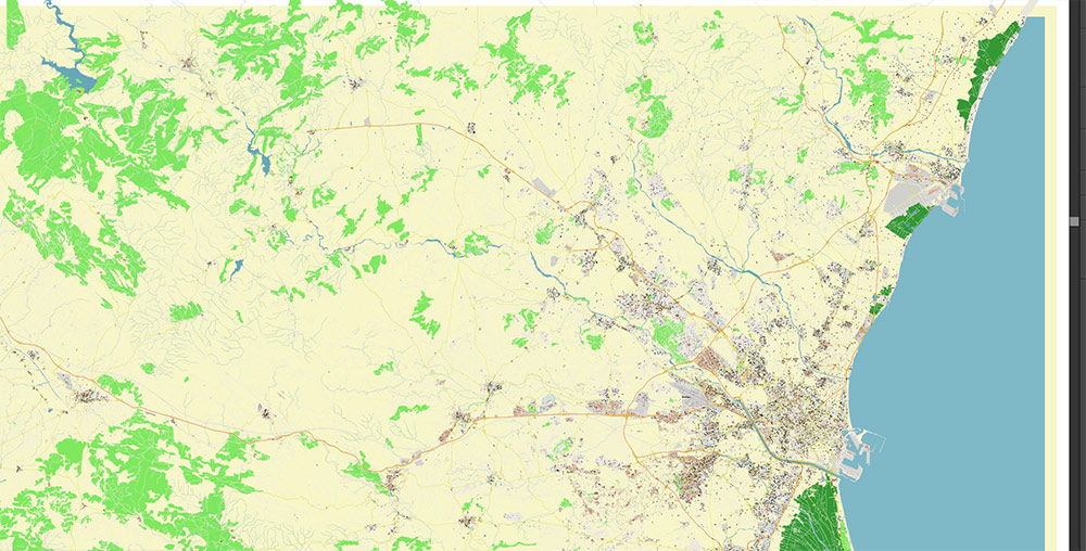
The most exact and detailed map of the city in scale.
For Editing and High-Quality Printing
Valencia Spain Grande Area PDF Map Vector Exact City Plan High Detailed Street Map editable Adobe PDF in layers
Valencia Spain Grande Area PDF Map Vector Exact City Plan High Detailed Street Map editable Adobe PDF in layers
Valencia Spain Grande Area PDF Map Vector Exact City Plan High Detailed Street Map editable Adobe PDF in layers
VALENCIA (SPAIN) — AO BRIEF (CARTOGRAPHIC / MAPPING FORMAT)
AO OVERVIEW (SPATIAL FRAME)
- Type: Coastal metropolitan system (Mediterranean littoral)
- Structure: Radial–concentric urban form with continuous peri-urban belt (Horta)
- Extent (practical mapping AO): ~35–40 km N–S / ~30 km W–E
- Reference anchor: Former Turia riverbed (central east–west green corridor)
PHYSIOGRAPHY / BASE LAYERS
- Relief:
- Coastal plain (0–50 m ASL), near-flat
- Gradual inland rise toward Iberian foothills (W–NW)
- Hydrography:
- Turia River (diverted; old channel = linear urban park)
- Albufera lagoon (S): shallow wetland system, rice fields, canals
- Land cover (mapping logic):
- Urban continuous (core + suburbs)
- Agricultural grid (Huerta — high-density irrigation parcels)
- Wetlands (south)
- Constraints for mapping:
- Flood-prone zones (Turia basin, Albufera perimeter)
- Coastal linearity limits expansion eastward
URBAN MORPHOLOGY (STRUCTURAL GRID)
1. Central Core (Ciutat Vella):
- Irregular medieval grid
- High density, narrow streets
- Landmark-dominant geometry
2. Expansion Zones (Eixample / Extramurs):
- Orthogonal grid (19th–20th c.)
- Wide boulevards, regular block structure
3. Modern периферия:
- Mixed geometry (grid + superblocks + open layouts)
- Large-scale developments (SE: City of Arts and Sciences axis)
4. Coastal strip:
- Linear development parallel to shoreline
- Port-industrial + residential beach zones
ROAD NETWORK (HIERARCHY / CLASSIFICATION)
PRIMARY STRUCTURE: radial + rings
A. RING SYSTEMS
- Inner ring (historic): former wall alignment → central boulevards
- Mid ring:
- Pérez Galdós – Peris y Valero – Primado Reig axis
- Outer rings:
- Ronda Norte (N sector)
- Ronda Sur (S sector)
- Bypass / orbital:
- V-30 / V-31 corridor (logistics + port interface)
B. RADIAL AXES (HIGH PRIORITY CARTO LINES)
- A-3 axis (W): Madrid corridor (Av. del Cid)
- NW axis: Cortes Valencianas → Paterna / Burjassot
- E axis: Blasco Ibáñez → coast
- Port axis: Av. del Puerto (critical freight flow)
- S axis: Ausiàs March → southern industrial belt
C. REGIONAL CONNECTORS
- AP-7 / A-7: Mediterranean longitudinal corridor (N–S)
- Secondary autovías: dense suburban connectors
Mapping takeaway:
Clear hierarchical differentiation; ring-radial geometry strongly выражена и легко читается на любом масштабе VPL-13+.
METROPOLITAN BELT (HORTA SYSTEM)
Pattern: former villages → continuous urban fabric
- Horta Nord (N):
- Coastal + commuter towns (Alboraya)
- Horta Oest (W):
- Industrial/logistics (Paterna, Manises — airport)
- Horta Sud (S):
- High-density dormitory belt (Torrent, Catarroja, Alfafar)
Agricultural matrix:
- Irrigation grid remains visible between settlements (important for map texture)
TRANSPORT LAYERS (MULTIMODAL)
Rail / Metro:
- Metrovalencia network: radial + cross links
- Strong suburban penetration (key for commuter mapping)
Intercity rail:
- High-speed (Madrid) + conventional corridors
Airport:
- Manises (W) — integrated via metro + highway
Port:
- Valencia Port (E):
- Major container hub
- Direct linkage to V-30 / V-31
Bus:
- Dense urban mesh; secondary for cartographic emphasis
DEMOGRAPHIC / DENSITY PATTERN (MAPPING VIEW)
- Core density: high (historic + Eixample)
- Intermediate belt: medium-high continuous urban fabric
- Outer belt: mixed density (residential + industrial)
- South sector: denser, more industrialized
- West: logistics + airport-driven growth
Special note:
Clear gradient from dense historic core → structured expansion → fragmented suburban-industrial mix.
HAZARDS / LIMITING FACTORS (MAP ANNOTATION)
- Flood zones (Turia + Albufera perimeter)
- Wetland protection (S)
- Port-industrial congestion (E–SE corridors)
- Heat exposure (summer, dense zones)
LOGISTICS STRUCTURE
- Primary nodes:
- Port (E)
- Airport (W)
- A-3 inland corridor
- Flow directions:
- West ↔ East (Madrid ↔ Port) — dominant axis
- North–South coastal corridor (AP-7)
COMMAND TAKEAWAYS (CARTOGRAPHIC)
- Strong radial-ring geometry → high map legibility
- Turia corridor = central linear reference axis
- Huerta grid adds unique agricultural texture layer
- Port + A-3 axis = primary strategic spine
- South sector = most constrained (wetlands + density)
Valencia Spain Grande Area PDF Map Vector Exact City Plan High Detailed Street Map editable Adobe PDF in layers
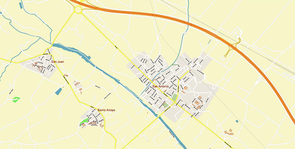
Valencia Spain Grande Area PDF Map Vector Exact City Plan High Detailed Street Map editable Adobe PDF in layers
Valencia Spain Grande Area PDF Map Vector Exact City Plan High Detailed Street Map editable Adobe PDF in layers
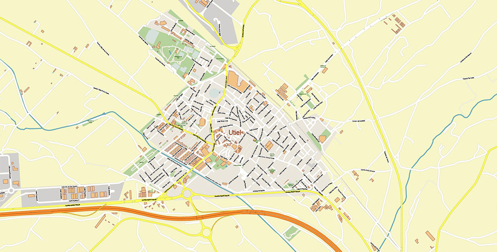
Valencia Spain Grande Area PDF Map Vector Exact City Plan High Detailed Street Map editable Adobe PDF in layers
Valencia Spain Grande Area PDF Map Vector Exact City Plan High Detailed Street Map editable Adobe PDF in layers
Valencia Spain Grande Area PDF Map Vector Exact City Plan High Detailed Street Map editable Adobe PDF in layers
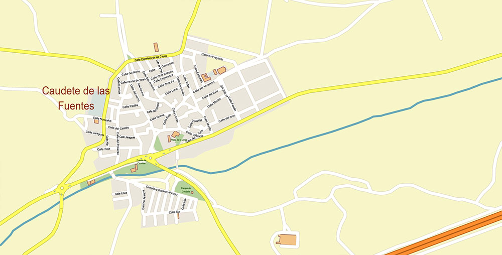
Valencia Spain Grande Area PDF Map Vector Exact City Plan High Detailed Street Map editable Adobe PDF in layers
Valencia Spain Grande Area PDF Map Vector Exact City Plan High Detailed Street Map editable Adobe PDF in layers
Valencia Spain Grande Area PDF Map Vector Exact City Plan High Detailed Street Map editable Adobe PDF in layers
Valencia Spain Grande Area PDF Map Vector Exact City Plan High Detailed Street Map editable Adobe PDF in layers
Valencia Spain Grande Area PDF Map Vector Exact City Plan High Detailed Street Map editable Adobe PDF in layers
Valencia Spain Grande Area PDF Map Vector Exact City Plan High Detailed Street Map editable Adobe PDF in layers
Valencia Spain Grande Area PDF Map Vector Exact City Plan High Detailed Street Map editable Adobe PDF in layers
Valencia Spain Grande Area PDF Map Vector Exact City Plan High Detailed Street Map editable Adobe PDF in layers
Valencia Spain Grande Area PDF Map Vector Exact City Plan High Detailed Street Map editable Adobe PDF in layers
Valencia Spain Grande Area PDF Map Vector Exact City Plan High Detailed Street Map editable Adobe PDF in layers
Valencia Spain Grande Area PDF Map Vector Exact City Plan High Detailed Street Map editable Adobe PDF in layers
Valencia Spain Grande Area PDF Map Vector Exact City Plan High Detailed Street Map editable Adobe PDF in layers
Valencia Spain Grande Area PDF Map Vector Exact City Plan High Detailed Street Map editable Adobe PDF in layers
Valencia Spain Grande Area PDF Map Vector Exact City Plan High Detailed Street Map editable Adobe PDF in layers
Valencia Spain Grande Area PDF Map Vector Exact City Plan High Detailed Street Map editable Adobe PDF in layers
Valencia Spain Grande Area PDF Map Vector Exact City Plan High Detailed Street Map editable Adobe PDF in layers
Valencia Spain Grande Area PDF Map Vector Exact City Plan High Detailed Street Map editable Adobe PDF in layers
Valencia Spain Grande Area PDF Map Vector Exact City Plan High Detailed Street Map editable Adobe PDF in layers

 Author: Kirill Shrayber, Ph.D. FRGS


