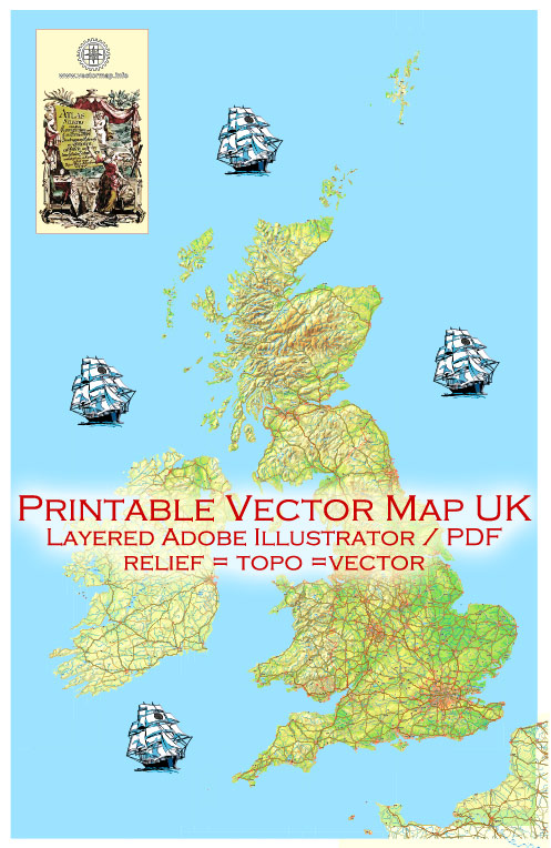
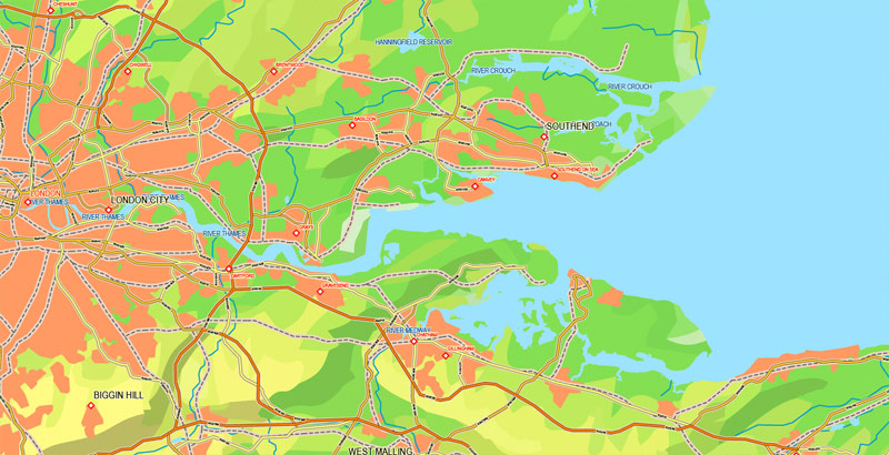
Printable PDF Map UK + Full Ireland, exact vector relief road map, full editable, Layered Adobe PDF, full vector, scalable, editable text format of names, 66 Mb ZIP.
All Major roads named, Main objects, Urban Areas, Map for publishing, design, printing, publications, arts, projects, presentations, for architects, designers and builders, business, logistics. The most exact and detailed map of the city.
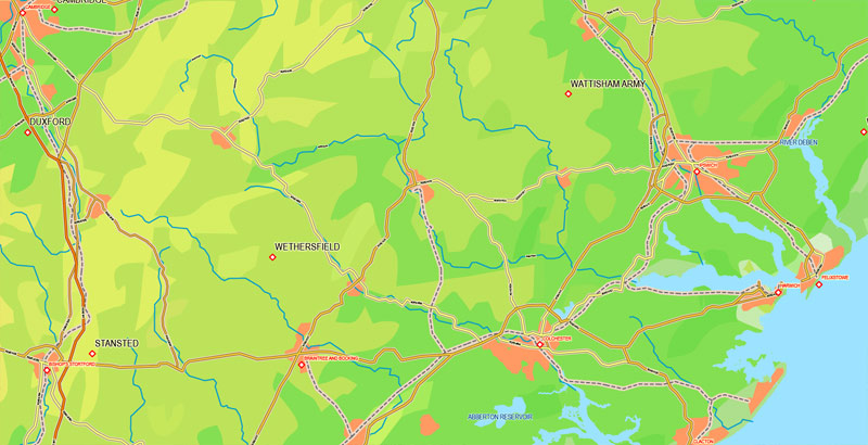
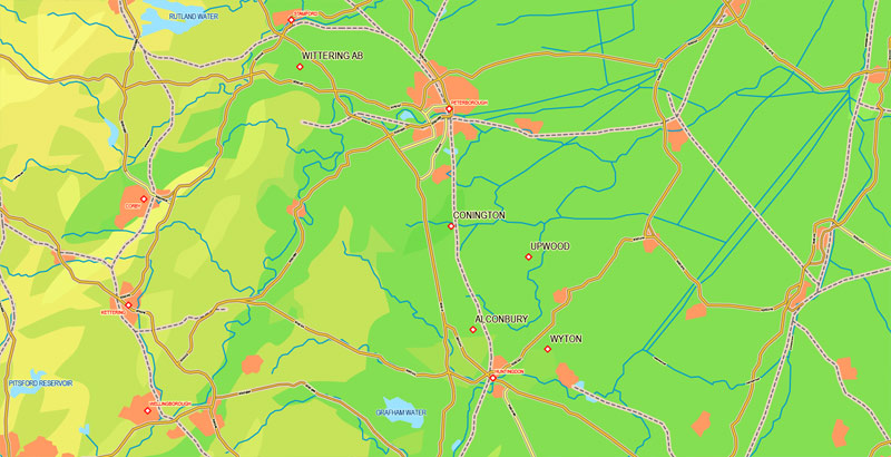
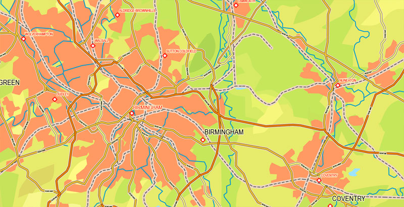
Layers: roads+railroads, waterways, lakes and rivers, names cities and labels roads, objects, names lakes, names places, relief topo(vector!), smooth, mask, halo names, legend.
For printing LARGE (WALL) format
You can edit this file by Adobe Illustrator, Adobe Acrobat, Corel Draw.
DWG, DXF, CDR, ESRI Shapes, and other formats – by request, same price, please contact.
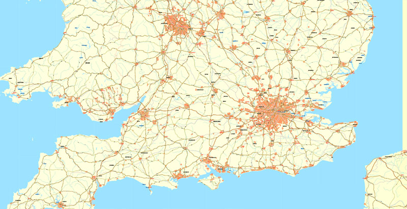
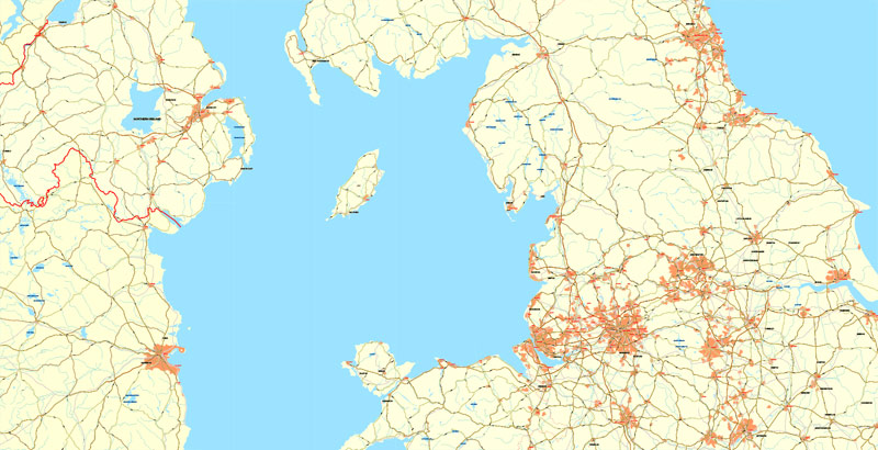
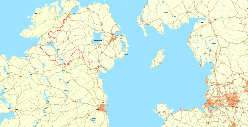
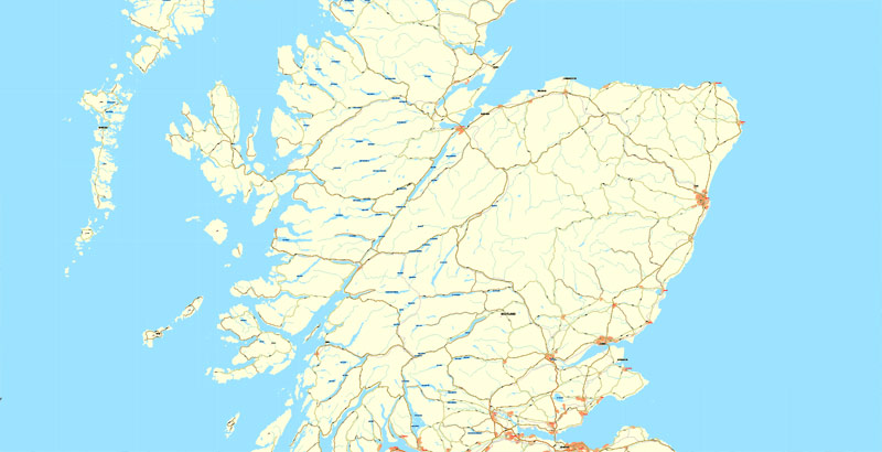
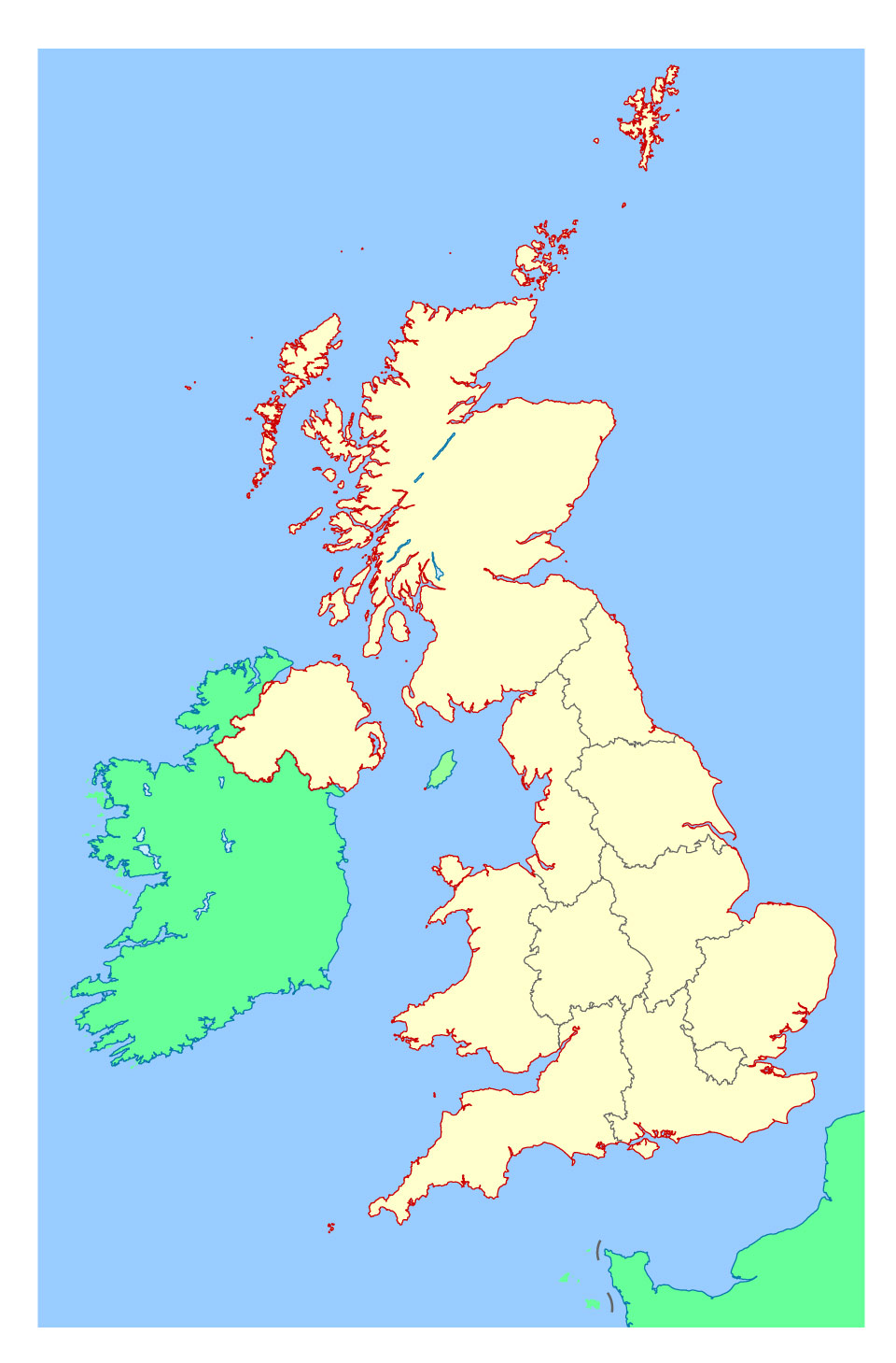
Great Britain + Ireland.
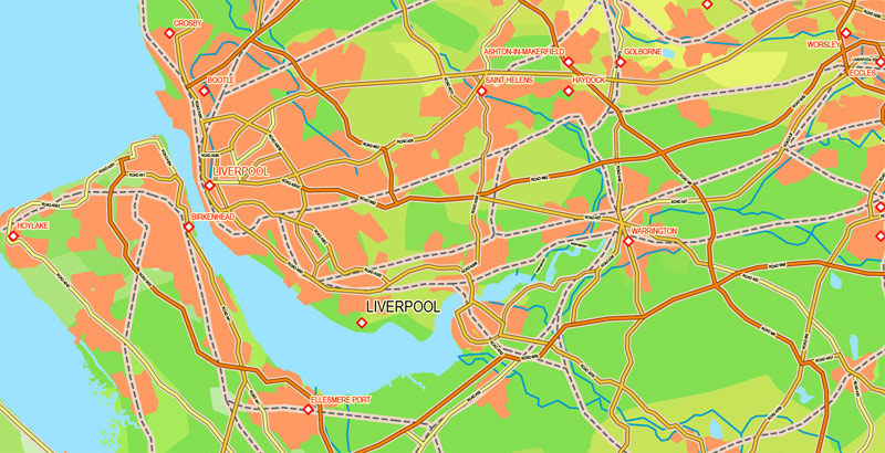
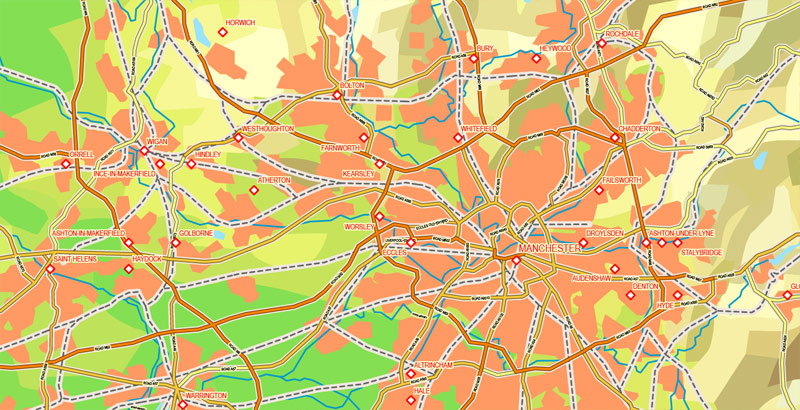
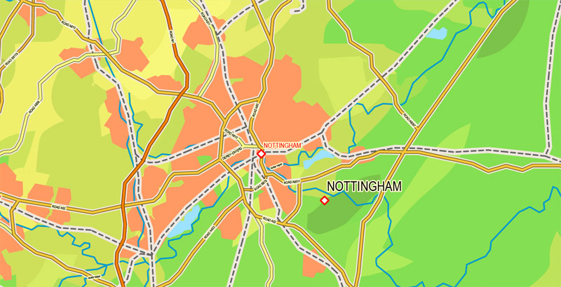
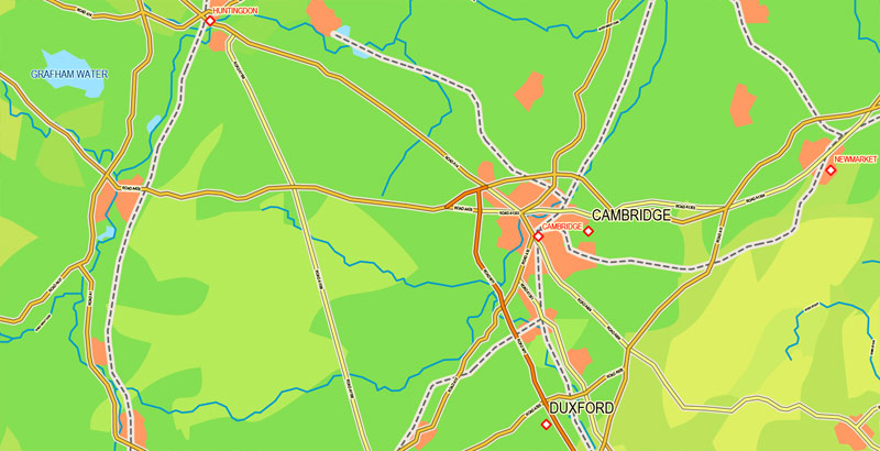
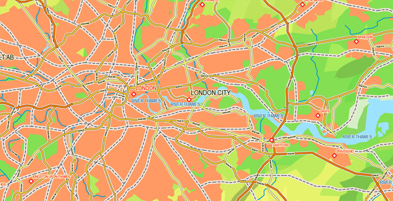
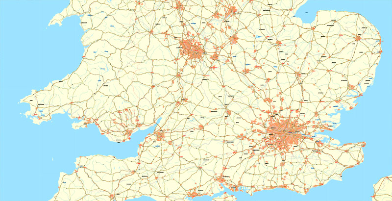
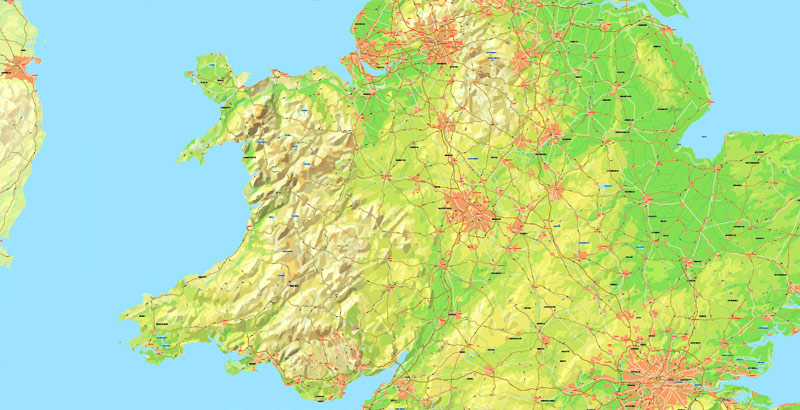
This vector map of Great Britain is used as a basis for design, editing, and further printing.
This is the most detailed, exact map of Great Britain for high-quality printing and polygraphy. You can always clarify the map development date by contacting us.
For your convenience, all objects on Great Britain vector map are divided into layers. And the editing is very easy – colors, lines, etc.
You can easily add any objects needed (e.g. shops, salons, sale points, gas station or attraction) on any layer of Great Britain vector map.
Great Britain is an island in the North Atlantic Ocean off the northwest coast of continental Europe. With an area of 209,331 km2 (80,823 sq mi), it is the largest of the British Isles, the largest European island, and the ninth-largest island in the world. In 2011, Great Britain had a population of about 61 million people, making it the world’s third-most populous island after Java in Indonesia and Honshu in Japan. The island of Ireland is situated to the west of Great Britain, and together these islands, along with over 1,000 smaller surrounding islands, form the British Isles archipelago.
One of the advantages of Great Britain vector maps of our production is the relevance of cartographic data, we constantly update all our products.
This vector map of Great Britain is used by:
designers, layout designers, printers, advertisers and architects. Our product – vector maps – is designed for further editing and printing in large formats – from @Wall format (a few meters) to A-0 and A-1, A-2, A-3.
The Great Britain map in vector format is used for design, urban planning, presentations and media visualizations.
The advertising and presentation map of Great Britain (usually the final designer marks the routes, and puts the client’s objects (shops, saloons, gas stations etc.)
The undoubted advantage is that people will NEVER throw out this advertising product – the map. In fact, as an advertising medium, a map is the most “long-playing” of the well-known polygraphic advertising media, with the longest lifespan, and the maximum number of interactions with the customer.
For travelers, maps are sold at the airports and gas stations around the world. Often the source is our vector maps.
Take a look, who purchases our vector maps of Great Britain in “Our Clients and Friends” page – these are large and small companies, from super-brands like Volvo and Starbucks, to small design studios and printing houses.
It’s very easy to work with vector maps of Great Britain city, even for a not very experienced designer who can turn on and off the map layers, add new objects, change the colors of fill and lines according to customer requirements.
The undoubted advantage of Great Britain vector maps in printing is an excellent and detailed visualization, when customer can expand a large paper map and instantly define his location, find a landmark, an object or address on map, unlike using the popular electronic formats of Google and Yandex maps for example.
Printable vector maps of Great Britain are much more convenient and efficient than any electronic maps on your smartphone, because ALL DETAILS are displayed in the entire space of Great Britain map.
Useful tips on working with vector maps of cities and countries in Adobe Illustrator.
«V» – launches the Selection tool (cursor, black arrow), which makes active any vector line.
«А» – launches the Direct Selection tool (white cursor), allows you to select curve elements and drag them to the desired place.
«R» – activates the Rotate tool, which helps you rotating selected objects around the center point by 360 degrees.
«E» – gives you the opportunity to use the Eraser tool and erase unnecessary parts.
«X» – switches between Fill and Stroke in the Tools section. Try to get used to this hot key and
you will quickly understand that you can’t live and work without it.
Guides are not limited to vertical and horizontal in Adobe Illustrator. You can also create a diagonal guide for example. Moreover, you can turn any contours into guides. Select the outline and go to View > Guides > Make Guides (Create Guides), or simply press Cmd/Ctrl + 5. You can also turn the guides back into an editable object. Go to menu, View > Guides > Unlock Guides (Release Guides), select the guide you want to edit and select View > Guides > Release Guides (Reset Guides), or just press Cmd/Ctrl + Option / Alt + 5).
You will probably want to change the color scheme used on our Great Britain vector map.
To quickly and effectively play with colors.
Of course, you can do it manually, all objects in our Great Britain vector map are divided according to types and layers, and you can easily change the color gamma of vector objects in groups and layers.
But there is more effective way of working with the whole VECTOR MAP of Great Britain and all layers:
The overview dialog «Edit colors»/«Repaint Graphic Object» (this dialog box name can change depending on the context):
If you have selected a part or a layer of Great Britain vector map and open the dialog box by clicking the icon in the Control panel, on the Samples palette or the Color Catalog, or if you choose Edit > Edit Colors> Repaint Graphic Object, then the «Repaint Graphic Object» dialog box appears, and you get access to «Assign» and «Edit» tabs.
If a picture or a map fragment is not selected, and you open the dialog box by clicking the icon in the Control panel, on the Samples palette or in the Color Catalog, the «Edit Colors» dialog box appears and you can only access the «Edit» tab.
Regardless of the name at the top of the dialog box, the right-hand side always displays the color group of the current document, as well as two default color groups: Print Color and Grayscale. These color groups can be selected and used any time.
Create and edit color groups of Great Britain vector map, and also assign colors using the «Edit Colors»/ а «Repaint Graphic Object» dialog box.
A. Creating and editing of a color group on the «Edit» tab
B. Assigning colors on the «Assign» tab
C. Select a group of colors from the «Color groups» list
The option «Repaint a graphic object» in the lower part of the dialog box allows you to preview the colors on a selected layer of Vector map, or a group of elements, and specify whether its colors will be redefined when the dialog box is closed.
The main areas of the dialog box are:
«Edit»
The «Edit» tab is designed to create a new or edit the existing color groups.
The harmony rules Menu and the Color Wheel are used to conduct experiments with color harmonies. The color wheel shows how colors are related in color harmony, and the color bars allow you to view and manipulate an individual color values. In addition, you can adjust the brightness, add and remove colors, save color groups and view colors on the selected Vector Map of Great Britain or a separated layers.
«Assign»
The «Assign» tab is used to view and control on how the original colors are replaced with colors from the color group like your corporate colors in the Vector Map of Great Britain city.
The assign color ability is provided only if the entire map, layer or fragment is selected in the document. You can specify which of new colors replace the current colors, whether the spot colors should be preserved and how colors are replaced (for example, you can replace colors completely or changing the color tone while maintaining the brightness). The «Assign» tab allows you to redefine colors in the Vector Map of Great Britain city, or in separate layers and fragments using the current color group or reducing the number of colors in the current Vector Map.
Color groups
Is a list of all saved color groups for current document (the same groups appear in the «Samples» palette). You can edit and delete the existing color groups, as well as creating a new ones using the list of “Color Groups” in the dialog box. All changes appear in the «Samples» palette.
The highlighted color group shows, which color group is currently edited.
Any color group can be selected and edited, or used to redefine the colors in the selected vector map of Great Britain city, its fragments or elements.
Saving a color group adds this group to the specified list.
Opening the «Edit Colors»/«Repaint Graphic Object» dialog box.
Open the «Edit Colors»/«Repaint Graphic Object» dialog box using one of the following methods:
«Edit»> «Edit Colors»> «Repaint Graphic object» or «Repaint With Style».
Use these commands if you need to edit the colors in the selected vector map of Great Britain city.
«Repaint Graphic object» button on the «Control» panel.
Use this button if you need to adjust colors of Great Britain vector map using the а «Repaint graphic object» dialog box.
The specified button is available if the selected vector map or its fragment contains two or more colors.
Note. This color editing method is convenient for global color adjustment in a vector map, if global colors were not used when creating a Map of Great Britain.
The «Edit colors» button or «Edit or apply colors» on the «Color Catalog» palette
Click this button if you need to edit colors on the «Color Catalog» palette or edit and then apply them to the selected Vector Map of Great Britain or its fragment.
The «Edit color group» button or «Edit or apply color group» on the «Samples» palette.
Click this button if you need to edit the colors in the specific color group or edit and apply them to the selected Vector Map of Great Britain or a group of its elements, for example, the whole layer “Streets and lines”. You can also double-click the color group in the Samples panel to open the dialog box.
If the map file is too large and your computer freezes or even can’t open it quickly:
1. Try to reduce the color resolution of the video card (display) to 256 colors while working with a large map.
2. Using Windows Task Manager, select all the application you don’t need, while working with map, just turn them off.
3. Launch Adobe Illustrator. (DO NOT OPEN the vector map file)
4. Start the Windows Task Manager using administrator rights > Find the “Illustrator” process > set the «real time» priority,
5. Open the file. When you see the LEGACY FONT popup window – click “OK” (do not update). You can restore the TEXT later.
6. Can also be useful: When file is opened – Edit > Settings > Basic Settings > disable smoothing. /// It looks scary, but works quickly)))
We recommend saving the file in Adobe Illustrator 10 version. It’s much more stable when working with VERY BIG size files.

The island is dominated by a maritime climate with quite narrow temperature differences between seasons. Politically, Great Britain is part of the United Kingdom of Great Britain and Northern Ireland, and constitutes most of its territory. Most of England, Scotland, and Wales are on the island. The term “Great Britain” is often used to include the whole of England, Scotland and Wales including their component adjoining islands; and is also occasionally but contentiously applied to the UK as a whole in some contexts.
A single Kingdom of Great Britain resulted from the union of the Kingdom of England (which had already comprised the present-day countries of England and Wales) and the Kingdom of Scotland by the 1707 Acts of Union. More than a hundred years before, in 1603, King James VI, King of Scots, had inherited the throne of England, but it was not until 1707 that the two countries’ parliaments agreed to form a political union. In 1801, Great Britain united with the neighbouring Kingdom of Ireland, forming the United Kingdom of Great Britain and Ireland, which was renamed the “United Kingdom of Great Britain and Northern Ireland” after the Irish Free State seceded in 1922.
Geography
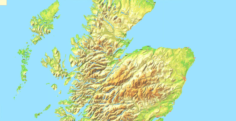
Great Britain lies on the European continental shelf, part of the Eurasian Plate. Situated off the north-west coast of continental Europe, it is separated from the mainland by the North Sea and by the English Channel, which narrows to 34 km (18 nmi; 21 mi) at the Straits of Dover. It stretches over about ten degrees of latitude on its longer, north-south axis and occupies an area of 209,331 km2 (80,823 sq mi), excluding the smaller surrounding islands. The North Channel, Irish Sea, St George’s Channel and Celtic Sea separate the island from the island of Ireland to its west. The island is physically connected with continental Europe via the Channel Tunnel, the longest undersea rail tunnel in the world, completed in 1993. The island is marked by low, rolling countryside in the east and south, while hills and mountains predominate in the western and northern regions. It is surrounded by over 1,000 smaller islands and islets. The greatest distance between two points is 968.0 km (601 1⁄2 mi) (between Land’s End, Cornwall and John o’ Groats, Caithness), 838 miles (1,349 km) by road.
The English Channel is thought to have been created between 450,000 and 180,000 years ago by two catastrophic glacial lake outburst floods caused by the breaching of the Weald-Artois Anticline, a ridge that held back a large proglacial lake, now submerged under the North Sea. Around 10,000 years ago, during the Devensian glaciation with its lower sea level, Great Britain was not an island, but an upland region of continental northwestern Europe, lying partially underneath the Eurasian ice sheet. The sea level was about 120 metres (390 ft) lower than today, and the bed of the North Sea was dry and acted as a land bridge, now known as Doggerland, to the Continent. It is generally thought that as sea levels gradually rose after the end of the last glacial period of the current ice age, Doggerland became submerged beneath the North Sea, cutting off what was previously the British peninsula from the European mainland by around 6500 BC.
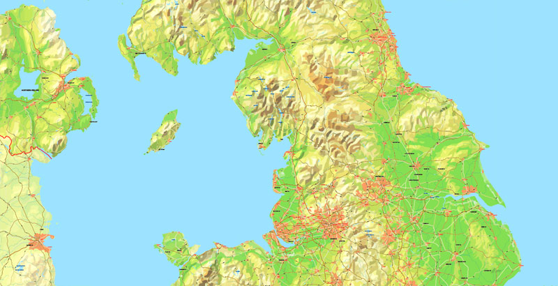
England comprises most of the central and southern two-thirds of the island of Great Britain, in addition to a number of small islands of which the largest is the Isle of Wight. England is bordered to the north by Scotland and to the west by Wales. It is closer to continental Europe than any other part of mainland Britain, divided from France only by a 33 km (21 mi) sea gap, the English Channel. The 50 km (31 mi) Channel Tunnel, near Folkestone, directly links England to mainland Europe. The English/French border is halfway along the tunnel.
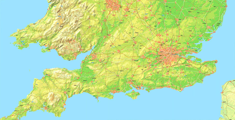
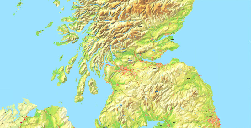
Much of England consists of low hills and plains, with upland and mountainous terrain in the north and west. Uplands in the north include the Pennines, an upland chain dividing east and west, the Lake District, containing the highest mountains in the country, the Cheviot Hills across the Anglo-Scottish border, and the North York Moors near the North Sea. Uplands in the west include Dartmoor and Exmoor in the south west and the Shropshire Hills near Wales. The approximate dividing line between terrain types is often indicated by the Tees-Exe line. To the south of that line, there are larger areas of flatter land, including East Anglia and the Fens, although hilly areas include the Cotswolds, the Chilterns, and the North and South Downs.
The largest natural harbour in England is at Poole, on the south-central coast. Some regard it as the second largest harbour in the world, after Sydney, Australia, although this fact is disputed (see harbours for a list of other large natural harbours).
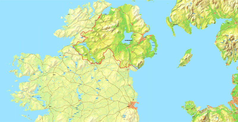
Ireland is an island in the North Atlantic. It is separated from Great Britain to its east by the North Channel, the Irish Sea, and St George’s Channel. Ireland is the second-largest island of the British Isles, the third-largest in Europe, and the twentieth-largest on Earth.
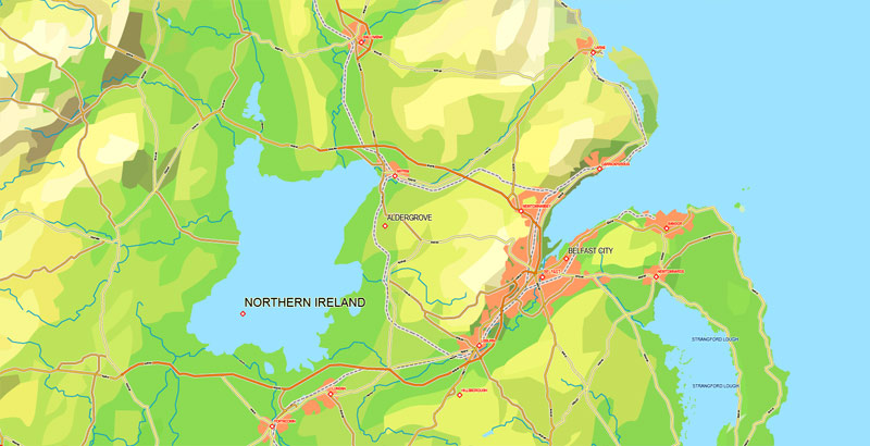
Politically, Ireland is divided between the Republic of Ireland (officially named Ireland), which covers five-sixths of the island, and Northern Ireland, which is part of the United Kingdom. In 2011, the population of Ireland was about 6.6 million, ranking it the second-most populous island in Europe after Great Britain. Just under 4.8 million live in the Republic of Ireland and just over 1.8 million live in Northern Ireland.

The island’s geography comprises relatively low-lying mountains surrounding a central plain, with several navigable rivers extending inland. Its lush vegetation is a product of its mild but changeable climate which is free of extremes in temperature. It was covered by thick woodlands until the Middle Ages. As of 2013, the amount of land that is wooded in Ireland is about 11% of the total, compared with a European average of 35%. There are twenty-six extant mammal species native to Ireland. The Irish climate is influenced by the Atlantic Ocean and thus very moderate, and winters are milder than expected for such a northerly area, although summers are cooler than those in Continental Europe. Rainfall and cloud cover are abundant.
The earliest evidence of human presence in Ireland is dated at 10,500 BC (12,500 years ago). Gaelic Ireland had emerged by the 1st century AD. The island was Christianised from the 5th century onward. Following the 12th century Norman invasion, England claimed sovereignty. However, English rule did not extend over the whole island until the 16th–17th century Tudor conquest, which led to colonisation by settlers from Britain. In the 1690s, a system of Protestant English rule was designed to materially disadvantage the Catholic majority and Protestant dissenters, and was extended during the 18th century.
With the Acts of Union in 1801, Ireland became a part of the United Kingdom. A war of independence in the early 20th century was followed by the partition of the island, creating the Irish Free State, which became increasingly sovereign over the following decades, and Northern Ireland, which remained a part of the United Kingdom. Northern Ireland saw much civil unrest from the late 1960s until the 1990s. This subsided following a political agreement in 1998. In 1973 the Republic of Ireland joined the European Economic Community while the United Kingdom, and Northern Ireland, as part of it, did the same.

Irish culture has had a significant influence on other cultures, especially in the fields of literature. Alongside mainstream Western culture, a strong indigenous culture exists, as expressed through Gaelic games, Irish music and the Irish language. The island’s culture shares many features with that of Great Britain, including the English language, and sports such as association football, rugby, horse racing, and golf.
Geography
Ireland is located in the north-west of Europe, between latitudes 51° and 56° N, and longitudes 11° and 5° W. It is separated from Great Britain by the Irish Sea and the North Channel, which has a width of 23 kilometres (14 mi) at its narrowest point. To the west is the northern Atlantic Ocean and to the south is the Celtic Sea, which lies between Ireland and Brittany, in France. Ireland has a total area of 84,421 km2 (32,595 sq mi), of which the Republic of Ireland occupies 83 percent. Ireland and Great Britain, together with many nearby smaller islands, are known collectively as the British Isles. As the term British Isles is controversial in relation to Ireland, the alternate term Britain and Ireland is often used as a neutral term for the islands.
A ring of coastal mountains surround low plains at the centre of the island. The highest of these is Carrauntoohil (Irish: Corrán Tuathail) in County Kerry, which rises to 1,038 m (3,406 ft) above sea level. The most arable land lies in the province of Leinster. Western areas can be mountainous and rocky with green panoramic vistas. The River Shannon, the island’s longest river at 386 km (240 mi) long, rises in County Cavan in the north west and flows 113 kilometres (70 mi) to Limerick city in the mid west.
The island consists of varied geological provinces. In the west, around County Galway and County Donegal, is a medium to high grade metamorphic and igneous complex of Caledonide affinity, similar to the Scottish Highlands. Across southeast Ulster and extending southwest to Longford and south to Navan is a province of Ordovician and Silurian rocks, with similarities to the Southern Uplands province of Scotland. Further south, along the County Wexford coastline, is an area of granite intrusives into more Ordovician and Silurian rocks, like that found in Wales.
In the southwest, around Bantry Bay and the mountains of Macgillicuddy’s Reeks, is an area of substantially deformed, but only lightly metamorphosed, Devonian-aged rocks. This partial ring of “hard rock” geology is covered by a blanket of Carboniferous limestone over the centre of the country, giving rise to a comparatively fertile and lush landscape. The west-coast district of the Burren around Lisdoonvarna has well-developed karst features. Significant stratiform lead-zinc mineralisation is found in the limestones around Silvermines and Tynagh.
Hydrocarbon exploration is ongoing following the first major find at the Kinsale Head gas field off Cork in the mid-1970s. In 1999, economically significant finds of natural gas were made in the Corrib Gas Field off the County Mayo coast. This has increased activity off the west coast in parallel with the “West of Shetland” step-out development from the North Sea hydrocarbon province. In 2000, the Helvick oil field was discovered, which was estimated to contain over 28 million barrels (4,500,000 m3) of oil.
Ireland is an island in Northwestern Europe in the north Atlantic Ocean. The island lies on the European continental shelf, part of the Eurasian Plate. The island’s main geographical features include low central plains surrounded by coastal mountains. The highest peak is Carrauntoohil (Irish: Corrán Tuathail), which is 1,041 meters (3,415 ft) above sea level. The western coastline is rugged, with many islands, peninsulas, headlands and bays. The island is bisected by the River Shannon, which at 360.5 km (224 mi) with a 102.1 km (63 mi) estuary is the longest river in Ireland and flows south from County Cavan in Ulster to meet the Atlantic just south of Limerick. There are a number of sizeable lakes along Ireland’s rivers, of which Lough Neagh is the largest.
Politically, the island consists of the Republic of Ireland, with jurisdiction over about five-sixths of the island; and Northern Ireland, a constituent country (and an unconfirmed “practical” exclave) of the United Kingdom, with jurisdiction over the remaining sixth. Located west of the island of Great Britain, it is located at approximately 53°N 8°WCoordinates: 53°N 8°W. It has a total area of 84,421 km2 (32,595 sq mi). It is separated from Great Britain by the Irish Sea and from mainland Europe by the Celtic Sea. Ireland and Great Britain, together with nearby islands, are known collectively as the British Isles; as the term British Isles is controversial in relation to Ireland, the alternative term ‘Britain and Ireland’ is increasingly preferred.
United Kingdom
Country in Europe
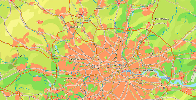
The United Kingdom, made up of England, Scotland, Wales and Northern Ireland, is an island nation in northwestern Europe. England – birthplace of Shakespeare and The Beatles – is home to the capital, London, a globally influential centre of finance and culture. England is also site of Neolithic Stonehenge, Bath’s Roman spa and centuries-old universities at Oxford and Cambridge.
Capital: London
Dialing code: +44
Area
• Total 242,495 km2 (93,628 sq mi)[4] (78th)
• Water (%) 1.34
Population
• 2016 estimate 65,648,000
• Density 270.7/km2 (701.1/sq mi) (50th)
The United Kingdom of Great Britain and Northern Ireland, commonly known as the United Kingdom (UK) or Britain, is a sovereign country in western Europe. Lying off the north-western coast of the European mainland, the United Kingdom includes the island of Great Britain, the north-eastern part of the island of Ireland and many smaller islands. Northern Ireland is the only part of the United Kingdom that shares a land border with another sovereign state—the Republic of Ireland.[note 9] Apart from this land border, the United Kingdom is surrounded by the Atlantic Ocean, with the North Sea to its east, the English Channel to its south and the Celtic Sea to its south-south-west, giving it the 12th-longest coastline in the world. The Irish Sea lies between Great Britain and Ireland. With an area of 242,500 square kilometres (93,600 sq mi), the United Kingdom is the 78th-largest sovereign state in the world and the 11th-largest in Europe. It is also the 21st-most populous country, with an estimated 65.1 million inhabitants. Together, this makes it the fourth-most densely populated country in the European Union (EU).
See also: Other printable maps England and Scotland
Free Vector maps downloads:
free_vector_map_england_scotland_ireland_ai free_vector_map_england_scotland_ireland_pdf
Small guide: How to work with the vector map?
You can: Mass select objects by type and color – for example, the objects type “building” (they are usually dark gray) – and remove them from the map, if you do not need them in your print or design project. You can also easily change the thickness of lines (streets), just bulk selection the road by the line color.
The streets are separated by type, for example, type “residential road” are usually white with a gray stroke. Highway usually orange with a brown or dark gray stroke.
It is easy to change the font of inscriptions, all or each individually. Also, just can be make and any other manipulation of objects on the vector map in Adobe illustrator format.
Important: All the proportions on the map are true, that is, the relative sizes of the objects are true, because Map is based on an accurate GPS projection, and It transated into the (usual for all) the Mercator projection.
You can easily change the color, stroke and fill of any object on the map, zoom without loss of quality Image Verification.
Select object

Bulk selection the same objects on the vector map

See the bulk selected objects on the vector map

Bulk delete buildungs from the vector map

Select residencial road (small street) on the vector map

Bulk selection the same lines (streets, roads) on the full map

Create fat lines of the streets on the vector maps (bulk action) 1

Create fat lines of the streets on the vector maps (bulk action) 2

Create fat lines of the streets on the vector maps (bulk action) 3

You can easily change the color, stroke and fill of any object on the map, zoom without loss of quality Image Verification.

 Author: Kirill Shrayber, Ph.D. FRGS


