Extended Description of the Vector Map
Printable PDF Vector Map of Alaska State (Full Area) + Relief Raster HD, US detailed fully editable Adobe PDF Road Map in layers, scalable, text/curves format all names, 991 MB ZIP
All streets and roads, Main Objects, Railroads, Airports, Zipcodes, Counties, Raster JPG Shaded Relief HD. Map for design, printing, arts, projects, presentations, for architects, designers, and builders, business, logistics.
Also: We can add (additional layer for this map), any other objects for you. It’s free for our customers.
If you need any OTHER format – DWG, DXF, Corel, or something else – please, email us

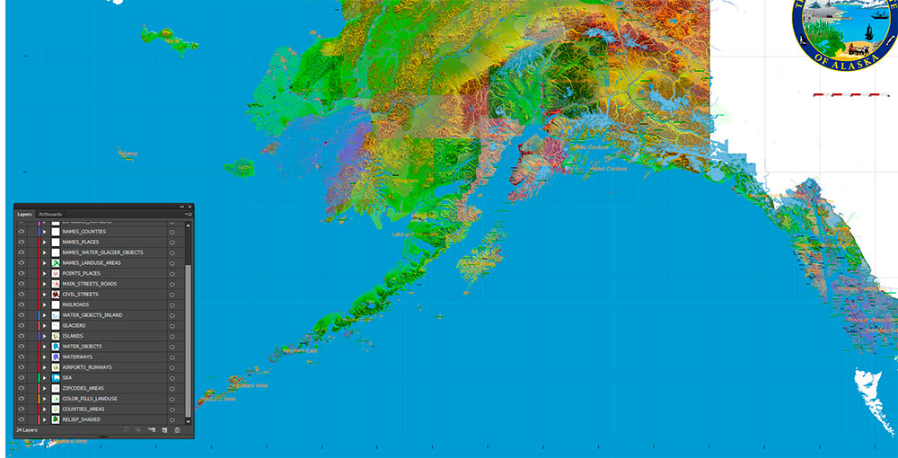
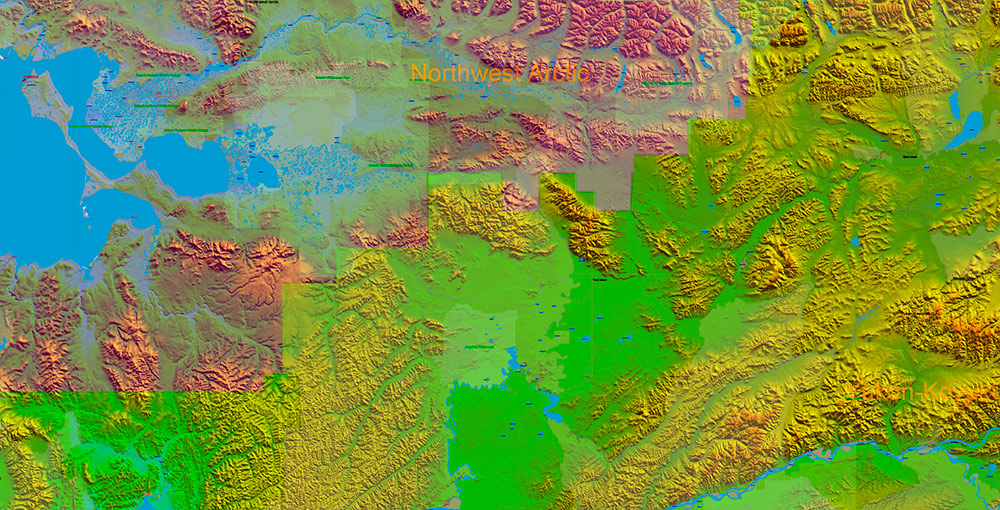
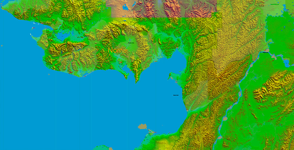
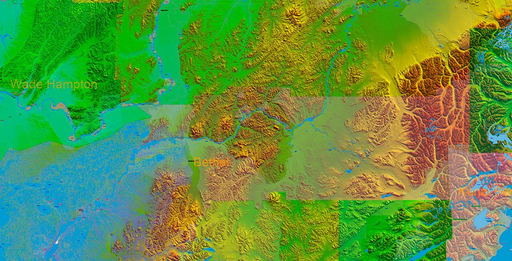
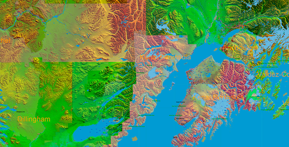
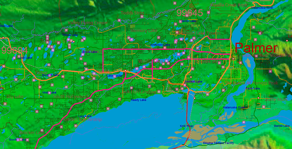
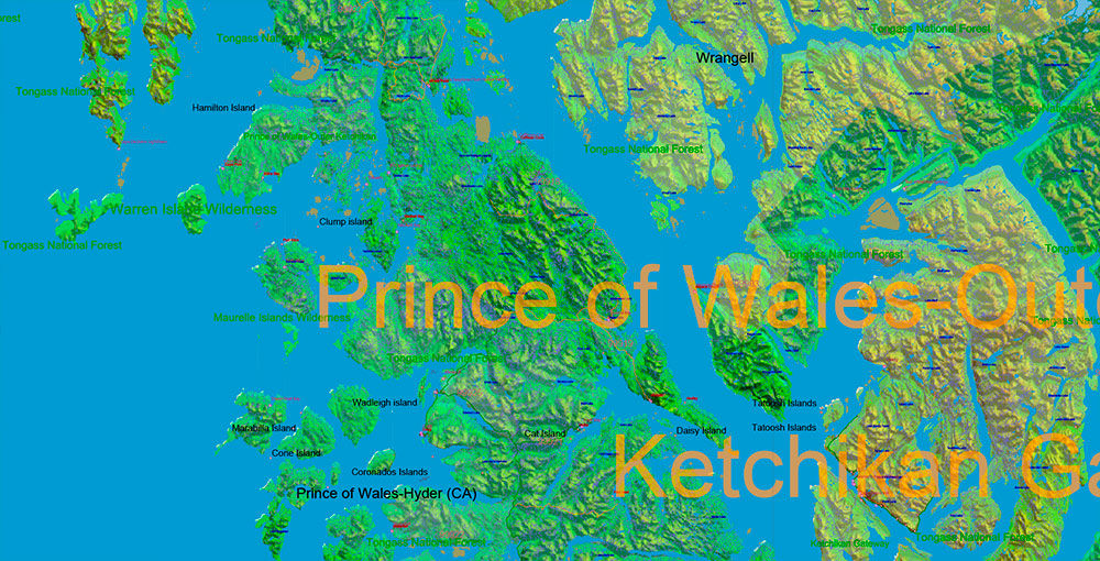
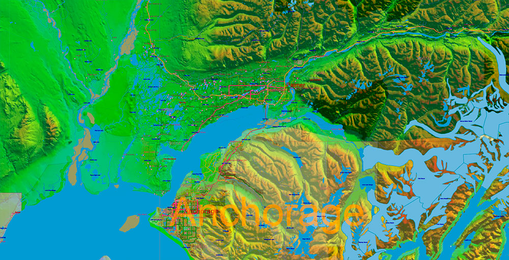
Alaska State US PDF Map Vector Exact Shaded Relief Roads Street High Detailed Map + Counties + Zipcodes editable Adobe PDF in layers
Layers list:
- Legend
- Grids
- Names of Airports
- Points Airports
- Names of places (city, hamlet, etc.)
- Points of places
- Names of water objects (rivers, lakes, ponds, glaciers)
- Numbers of Zipcodes
- Names of Counties
- Main streets and roads
- Residential streets and roads
- Railroads
- Names of land use areas
- Land use areas
- Water objects (areas)
- Waterways
- Airport runways
- Zipcodes areas
- Counties areas
- Islands
- Sea / ocean
- Shaded Relief (raster JPG HD)
Alaska State US PDF Map Vector Exact Shaded Relief Roads Street High Detailed Map + Counties + Zipcodes editable Adobe PDF in layers
ALASKA, USA — STRATEGIC RECON BRIEF
1. Geographic Overview
-
Location: Alaska is the northernmost, westernmost, and largest U.S. state, separated from the contiguous United States by Canada. It borders the Arctic Ocean, Pacific Ocean, and Bering Sea.
-
Size & Scale: Vast territory (~1.7 million km²), larger than Texas, California, and Montana combined.
-
Terrain:
-
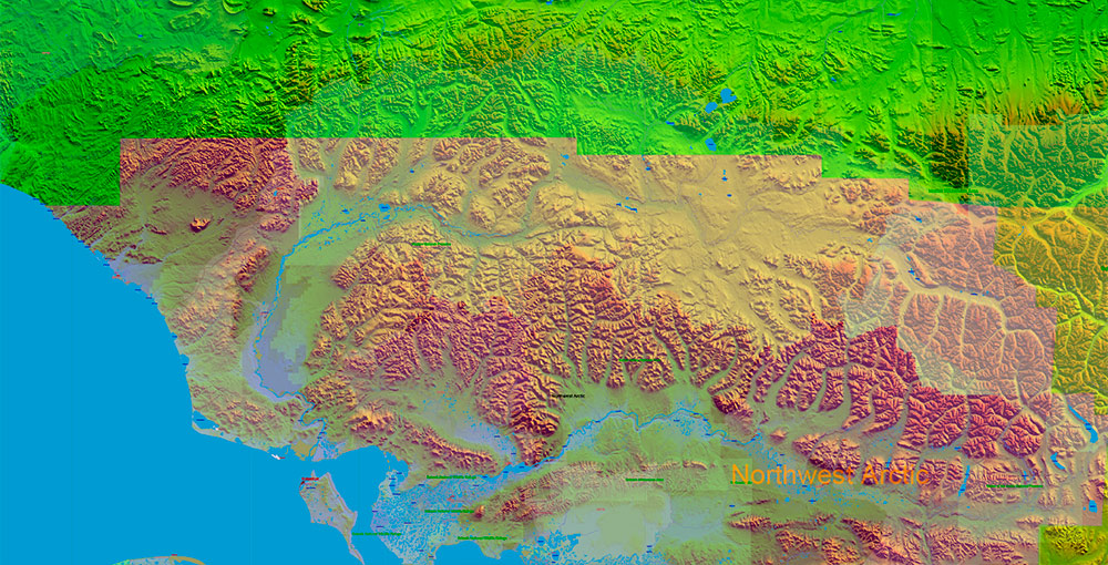
Mountain ranges (Alaska Range, Brooks Range)
-
Extensive tundra, glaciers, boreal forests
-
Long, rugged coastline with islands and fjords
-
Climate:
-
Natural Constraints: Extreme cold, long winters, permafrost, seismic activity, volcanic zones.
2. Transportation & Road Network
Primary Highways
-
Alaska Highway (ALCAN): Main overland route connecting Alaska to Canada and the continental U.S.; enters Alaska near Tok.
-
Parks Highway: Connects Anchorage to Fairbanks, passing near Denali.
-
Glenn Highway: Anchorage ↔ interior Alaska (Palmer, Glennallen).
-
Seward Highway: Anchorage ↔ Seward; key coastal and freight corridor.
-
Richardson Highway: Fairbanks ↔ Valdez; parallels the Trans-Alaska Pipeline.
Transport Reality
-
No statewide road connectivity to many regions.
-
Aviation is critical: bush planes, regional airports, cargo airlift.
-
Marine transport essential for coastal and island communities.
-
Rail: Limited network (Anchorage–Fairbanks–Seward).
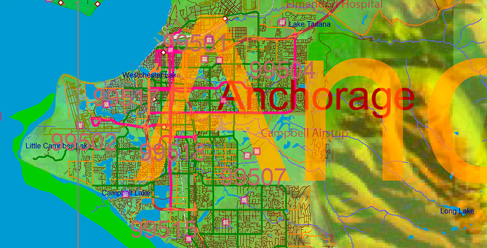
3. Major Cities & Population Centers
-
Anchorage – Largest city (~40% of state population); logistics, military, business hub.
-
Fairbanks – Interior hub; military, research, Arctic operations.
-
Juneau – State capital; no road access, reachable by air or sea.
-
Wasilla – Rapidly growing commuter city.
-
Sitka – Southeast coastal city; maritime focus.
-
Hundreds of small, remote villages, many accessible only by air or water.
4. Landmarks & Strategic Points
-
Denali – Highest peak in North America; dominant terrain feature.
-
Denali National Park – Vast protected wilderness.
-
Trans-Alaska Pipeline System (TAPS): Critical energy infrastructure running ~1,300 km from Prudhoe Bay to Valdez.
-
Arctic Coast / North Slope: Energy extraction zone and strategic Arctic access.
-
Aleutian Islands: Volcanic chain extending toward Asia; geostrategic importance.
5. Economy & Business
-
Energy:
-
Fishing & Seafood:
-
Mining:
-
Military Presence:
-
Tourism:
-
Logistics:
6. Demographics
7. Strategic Characteristics
-
Advantages:
-
Constraints:
-
Operational Reality:
Operational Summary
Alaska is a resource-rich, strategically critical, and logistically complex territory defined by extreme geography, limited ground transport, dispersed population, and high dependence on energy, aviation, and maritime systems.
Alaska State US PDF Map Vector Exact Shaded Relief Roads Street High Detailed Map + Counties + Zipcodes editable Adobe PDF in layers
Alaska State US PDF Map Vector Exact Shaded Relief Roads Street High Detailed Map + Counties + Zipcodes editable Adobe PDF in layers
Alaska State US PDF Map Vector Exact Shaded Relief Roads Street High Detailed Map + Counties + Zipcodes editable Adobe PDF in layers
Alaska State US PDF Map Vector Exact Shaded Relief Roads Street High Detailed Map + Counties + Zipcodes editable Adobe PDF in layers
Alaska State US PDF Map Vector Exact Shaded Relief Roads Street High Detailed Map + Counties + Zipcodes editable Adobe PDF in layers
Alaska State US PDF Map Vector Exact Shaded Relief Roads Street High Detailed Map + Counties + Zipcodes editable Adobe PDF in layers
Alaska State US PDF Map Vector Exact Shaded Relief Roads Street High Detailed Map + Counties + Zipcodes editable Adobe PDF in layers
Alaska State US PDF Map Vector Exact Shaded Relief Roads Street High Detailed Map + Counties + Zipcodes editable Adobe PDF in layers
Alaska State US PDF Map Vector Exact Shaded Relief Roads Street High Detailed Map + Counties + Zipcodes editable Adobe PDF in layers
Alaska State US PDF Map Vector Exact Shaded Relief Roads Street High Detailed Map + Counties + Zipcodes editable Adobe PDF in layers

 Author: Kirill Shrayber, Ph.D. FRGS


