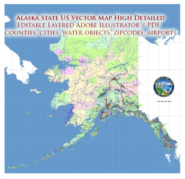
Alaska, the largest state in the United States, is known for its vast and rugged terrain, remote communities, and challenging weather conditions. Due to its unique geographical features and isolation, maritime and air transportation play crucial roles in connecting different regions of the state and providing essential services.
Maritime Transportation: Alaska has a vast coastline and numerous ports that are vital for maritime transportation. The state’s major ports include Anchorage, Juneau, Ketchikan, and Nome. The maritime industry facilitates the shipment of goods, resources, and supplies to various communities, especially those not connected by road or rail.
The Inside Passage, a coastal route along the southeastern part of the state, is a key maritime corridor for both cargo and passenger vessels. It offers sheltered waters and scenic views, making it a popular route for cruise ships and ferries.
Alaska’s maritime transportation is also influenced by the seasonal ice conditions, particularly in the northern regions. The state has ice-free ports, such as the Port of Anchorage, that remain accessible year-round.
Air Transportation: Given Alaska’s vast and challenging geography, air transportation is a lifeline for many communities, particularly in remote areas where road access is limited or nonexistent. The state has a network of airports and airstrips that serve as vital links for transporting people, goods, and emergency services.
The Ted Stevens Anchorage International Airport is a major hub, serving as a crucial connection point for both domestic and international flights. It plays a key role in transporting goods, including seafood and other products, between Alaska and other parts of the world.
In rural and remote areas, smaller aircraft, including bush planes and helicopters, are commonly used for transportation. These aircraft provide access to isolated communities, medical services, and resource-rich areas.
Challenges: Alaska faces several challenges in its transportation infrastructure. Harsh weather conditions, such as heavy snowfall, ice, and low visibility, can impact both maritime and air travel. Additionally, the vast distances and remote locations make maintaining and upgrading transportation infrastructure a continuous challenge.
Despite these challenges, Alaska’s maritime and air transportation systems are critical for the state’s economic activities, tourism, and overall connectivity. Advances in technology and ongoing infrastructure improvements aim to enhance the efficiency and reliability of transportation in this unique and dynamic part of the United States.
Resources and power
Since 1880 hard-rock ore minerals have been mined in Alaska, more than nine-tenths of which yield gold,
copper, zinc, and silver. Prospecting has continued with modern scientific technology and aerial exploration.
Among the important mines are the Fort Knox and Pogo gold mines near Fairbanks and the Red Dog zinc mine near
Kotzebue. A major molybdenum deposit exists near Ketchikan but has not been developed.
The Greens Creek Mine near Juneau is one of the largest sources of silver in the United States
and also produces lead, zinc, copper, and gold.
Newer initiatives include the Kensington gold mine, located about 45 miles (72 km) north-northwest of Juneau,
and the Pebble Project, a mineral exploration plan in the Bristol Bay region, about 200 miles (320 km)
southwest of Anchorage. Small-scale mining is prevalent in much of the interior and elsewhere,
but it is constrained by environmental concerns. Copper mining as a major industry ended with the
closing of the Kennecott Mine in 1938, although there are new prospects elsewhere.
Oil seeps were discovered as early as the 1880s in what is now the National Petroleum Reserve–Alaska,
and petroleum was first extracted and refined between 1917 and 1933 in Katalla near Cordova. However,
it was not until the development of the Kenai oil field in 1961 that the petroleum and natural
gas industry surpassed the other types of Alaskan mineral production. In the late 1960s another
major oil field was discovered, at Prudhoe Bay, near the mouth of the Colville River, on the North Slope.
A natural gas pipeline connects the Kenai gas fields to Anchorage, and the Trans-Alaska Pipeline delivers
oil from Prudhoe Bay to ice-free tanker terminals at Valdez and to refineries near Fairbanks.
Petroleum production peaked in the 1990s and has been steadily decreasing since then.
(Alaska’s potential oil reserves are still very large; however, attempts to drill for petroleum along
the Beaufort Sea coast of the Arctic National Wildlife Refuge as well as in the National Petroleum Reserve–Alaska
have been met with continuing environmental opposition.) Similarly, the production of natural gas has declined
significantly in Kenai and Cook Inlet. Prudhoe Bay also contains a major deposit of natural gas; plans for its
development and export were discussed in the early 21st century.
Alaska has large coal reserves at the Beluga Coal Field in south-central Alaska, about 45 miles
(72 km) west of Anchorage, and in the National Petroleum Reserve–Alaska. The only operating coal
mine in Alaska, however, is the Usibelli mine near the town of Healy, located about 115 miles
(185 km) south of Fairbanks. The low-sulfur coal produced there is transported to local power plants
and is exported to South Korea through the port of Seward.
Alaska’s immense hydropower potential is virtually untapped, but dams have been constructed that
supply power to most of the major cities. The region from Homer, at the south of the Kenai Peninsula,
up to Fairbanks, a route known as the Railbelt, is tied together so that electrical power is generated
from three sources: coal at Healy, natural gas at Anchorage, and hydropower from the dams at Bradley and
Eklutna lakes. Outside those areas that are served by coal, natural gas, or hydropower, electricity is
generated by diesel fuel. The state of Alaska subsidizes electrical production in smaller communities
through the Power Cost Equalization Fund.


 Author: Kirill Shrayber, Ph.D.