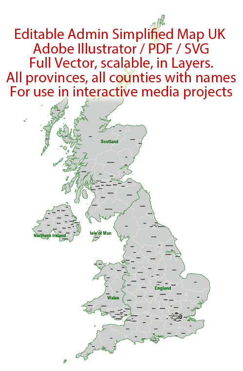
Administrative Vector Map UK Great Britain Adobe Illustrator Editable PDF SVG layers simplified Provinces Counties for use in the interactive media projects special edition
Layers: Counties_with_names, Borders_provinces, Names_provinces.
Text format all names
Ready for use in interactive media projects such as http://jvectormap.com/ or jQuery Mapael https://www.vincentbroute.fr/mapael/ https://github.com/neveldo/jQuery-Mapael
Text format all names
Great Britain.
This vector map of Great Britain is used as a basis for design, editing, and further printing.
This is the most detailed, exact map of Great Britain for high-quality printing and polygraphy. You can always clarify the map development date by contacting us.
For your convenience, all objects on Great Britain vector map are divided into layers. And the editing is very easy – colors, lines, etc.
You can easily add any objects needed (e.g. shops, salons, sale points, gas station or attraction) on any layer of Great Britain vector map.
Great Britain is an island in the North Atlantic Ocean off the northwest coast of continental Europe. With an area of 209,331 km2 (80,823 sq mi), it is the largest of the British Isles, the largest European island, and the ninth-largest island in the world. In 2011, Great Britain had a population of about 61 million people, making it the world’s third-most populous island after Java in Indonesia and Honshu in Japan. The island of Ireland is situated to the west of Great Britain, and together these islands, along with over 1,000 smaller surrounding islands, form the British Isles archipelago.
One of the advantages of Great Britain vector maps of our production is the relevance of cartographic data, we constantly update all our products.
This vector map of Great Britain is used by:
designers, layout designers, printers, advertisers and architects. Our product – vector maps – is designed for further editing and printing in large formats – from @Wall format (a few meters) to A-0 and A-1, A-2, A-3.
The Great Britain map in vector format is used for design, urban planning, presentations and media visualizations.
The advertising and presentation map of Great Britain (usually the final designer marks the routes, and puts the client’s objects (shops, saloons, gas stations etc.)
The undoubted advantage is that people will NEVER throw out this advertising product – the map. In fact, as an advertising medium, a map is the most “long-playing” of the well-known polygraphic advertising media, with the longest lifespan, and the maximum number of interactions with the customer.
For travelers, maps are sold at the airports and gas stations around the world. Often the source is our vector maps.
Take a look, who purchases our vector maps of Great Britain in “Our Clients and Friends” page – these are large and small companies, from super-brands like Volvo and Starbucks, to small design studios and printing houses.
It’s very easy to work with vector maps of Great Britain city, even for a not very experienced designer who can turn on and off the map layers, add new objects, change the colors of fill and lines according to customer requirements.
The undoubted advantage of Great Britain vector maps in printing is an excellent and detailed visualization, when customer can expand a large paper map and instantly define his location, find a landmark, an object or address on map, unlike using the popular electronic formats of Google and Yandex maps for example.
Printable vector maps of Great Britain are much more convenient and efficient than any electronic maps on your smartphone, because ALL DETAILS are displayed in the entire space of Great Britain map.
Useful tips on working with vector maps of cities and countries in Adobe Illustrator.
«V» – launches the Selection tool (cursor, black arrow), which makes active any vector line.
«А» – launches the Direct Selection tool (white cursor), allows you to select curve elements and drag them to the desired place.
«R» – activates the Rotate tool, which helps you rotating selected objects around the center point by 360 degrees.
«E» – gives you the opportunity to use the Eraser tool and erase unnecessary parts.
«X» – switches between Fill and Stroke in the Tools section. Try to get used to this hot key and
you will quickly understand that you can’t live and work without it.
Guides are not limited to vertical and horizontal in Adobe Illustrator. You can also create a diagonal guide for example. Moreover, you can turn any contours into guides. Select the outline and go to View > Guides > Make Guides (Create Guides), or simply press Cmd/Ctrl + 5. You can also turn the guides back into an editable object. Go to menu, View > Guides > Unlock Guides (Release Guides), select the guide you want to edit and select View > Guides > Release Guides (Reset Guides), or just press Cmd/Ctrl + Option / Alt + 5).
You will probably want to change the color scheme used on our Great Britain vector map.
To quickly and effectively play with colors.
Of course, you can do it manually, all objects in our Great Britain vector map are divided according to types and layers, and you can easily change the color gamma of vector objects in groups and layers.
But there is more effective way of working with the whole VECTOR MAP of Great Britain and all layers:
The overview dialog «Edit colors»/«Repaint Graphic Object» (this dialog box name can change depending on the context):
If you have selected a part or a layer of Great Britain vector map and open the dialog box by clicking the icon in the Control panel, on the Samples palette or the Color Catalog, or if you choose Edit > Edit Colors> Repaint Graphic Object, then the «Repaint Graphic Object» dialog box appears, and you get access to «Assign» and «Edit» tabs.
If a picture or a map fragment is not selected, and you open the dialog box by clicking the icon in the Control panel, on the Samples palette or in the Color Catalog, the «Edit Colors» dialog box appears and you can only access the «Edit» tab.
Regardless of the name at the top of the dialog box, the right-hand side always displays the color group of the current document, as well as two default color groups: Print Color and Grayscale. These color groups can be selected and used any time.
Create and edit color groups of Great Britain vector map, and also assign colors using the «Edit Colors»/ а «Repaint Graphic Object» dialog box.
A. Creating and editing of a color group on the «Edit» tab
B. Assigning colors on the «Assign» tab
C. Select a group of colors from the «Color groups» list
The option «Repaint a graphic object» in the lower part of the dialog box allows you to preview the colors on a selected layer of Vector map, or a group of elements, and specify whether its colors will be redefined when the dialog box is closed.
The main areas of the dialog box are:
«Edit»
The «Edit» tab is designed to create a new or edit the existing color groups.
The harmony rules Menu and the Color Wheel are used to conduct experiments with color harmonies. The color wheel shows how colors are related in color harmony, and the color bars allow you to view and manipulate an individual color values. In addition, you can adjust the brightness, add and remove colors, save color groups and view colors on the selected Vector Map of Great Britain or a separated layers.
«Assign»
The «Assign» tab is used to view and control on how the original colors are replaced with colors from the color group like your corporate colors in the Vector Map of Great Britain city.
The assign color ability is provided only if the entire map, layer or fragment is selected in the document. You can specify which of new colors replace the current colors, whether the spot colors should be preserved and how colors are replaced (for example, you can replace colors completely or changing the color tone while maintaining the brightness). The «Assign» tab allows you to redefine colors in the Vector Map of Great Britain city, or in separate layers and fragments using the current color group or reducing the number of colors in the current Vector Map.
Color groups
Is a list of all saved color groups for current document (the same groups appear in the «Samples» palette). You can edit and delete the existing color groups, as well as creating a new ones using the list of “Color Groups” in the dialog box. All changes appear in the «Samples» palette.
The highlighted color group shows, which color group is currently edited.
Any color group can be selected and edited, or used to redefine the colors in the selected vector map of Great Britain city, its fragments or elements.
Saving a color group adds this group to the specified list.
Opening the «Edit Colors»/«Repaint Graphic Object» dialog box.
Open the «Edit Colors»/«Repaint Graphic Object» dialog box using one of the following methods:
«Edit»> «Edit Colors»> «Repaint Graphic object» or «Repaint With Style».
Use these commands if you need to edit the colors in the selected vector map of Great Britain city.
«Repaint Graphic object» button on the «Control» panel.
Use this button if you need to adjust colors of Great Britain vector map using the а «Repaint graphic object» dialog box.
The specified button is available if the selected vector map or its fragment contains two or more colors.
Note. This color editing method is convenient for global color adjustment in a vector map, if global colors were not used when creating a Map of Great Britain.
The «Edit colors» button or «Edit or apply colors» on the «Color Catalog» palette
Click this button if you need to edit colors on the «Color Catalog» palette or edit and then apply them to the selected Vector Map of Great Britain or its fragment.
The «Edit color group» button or «Edit or apply color group» on the «Samples» palette.
Click this button if you need to edit the colors in the specific color group or edit and apply them to the selected Vector Map of Great Britain or a group of its elements, for example, the whole layer “Streets and lines”. You can also double-click the color group in the Samples panel to open the dialog box.
If the map file is too large and your computer freezes or even can’t open it quickly:
1. Try to reduce the color resolution of the video card (display) to 256 colors while working with a large map.
2. Using Windows Task Manager, select all the application you don’t need, while working with map, just turn them off.
3. Launch Adobe Illustrator. (DO NOT OPEN the vector map file)
4. Start the Windows Task Manager using administrator rights > Find the “Illustrator” process > set the «real time» priority,
5. Open the file. When you see the LEGACY FONT popup window – click “OK” (do not update). You can restore the TEXT later.
6. Can also be useful: When file is opened – Edit > Settings > Basic Settings > disable smoothing. /// It looks scary, but works quickly)))
We recommend saving the file in Adobe Illustrator 10 version. It’s much more stable when working with VERY BIG size files.
The island is dominated by a maritime climate with quite narrow temperature differences between seasons. Politically, Great Britain is part of the United Kingdom of Great Britain and Northern Ireland, and constitutes most of its territory.[11] Most of England, Scotland, and Wales are on the island. The term “Great Britain” is often used to include the whole of England, Scotland and Wales including their component adjoining islands; and is also occasionally but contentiously applied to the UK as a whole in some contexts.
A single Kingdom of Great Britain resulted from the union of the Kingdom of England (which had already comprised the present-day countries of England and Wales) and the Kingdom of Scotland by the 1707 Acts of Union. More than a hundred years before, in 1603, King James VI, King of Scots, had inherited the throne of England, but it was not until 1707 that the two countries’ parliaments agreed to form a political union. In 1801, Great Britain united with the neighbouring Kingdom of Ireland, forming the United Kingdom of Great Britain and Ireland, which was renamed the “United Kingdom of Great Britain and Northern Ireland” after the Irish Free State seceded in 1922.
Geography
Great Britain lies on the European continental shelf, part of the Eurasian Plate. Situated off the north-west coast of continental Europe, it is separated from the mainland by the North Sea and by the English Channel, which narrows to 34 km (18 nmi; 21 mi) at the Straits of Dover.[43] It stretches over about ten degrees of latitude on its longer, north-south axis and occupies an area of 209,331 km2 (80,823 sq mi), excluding the smaller surrounding islands. The North Channel, Irish Sea, St George’s Channel and Celtic Sea separate the island from the island of Ireland to its west. The island is physically connected with continental Europe via the Channel Tunnel, the longest undersea rail tunnel in the world, completed in 1993. The island is marked by low, rolling countryside in the east and south, while hills and mountains predominate in the western and northern regions. It is surrounded by over 1,000 smaller islands and islets. The greatest distance between two points is 968.0 km (601 1⁄2 mi) (between Land’s End, Cornwall and John o’ Groats, Caithness), 838 miles (1,349 km) by road.
The English Channel is thought to have been created between 450,000 and 180,000 years ago by two catastrophic glacial lake outburst floods caused by the breaching of the Weald-Artois Anticline, a ridge that held back a large proglacial lake, now submerged under the North Sea. Around 10,000 years ago, during the Devensian glaciation with its lower sea level, Great Britain was not an island, but an upland region of continental northwestern Europe, lying partially underneath the Eurasian ice sheet. The sea level was about 120 metres (390 ft) lower than today, and the bed of the North Sea was dry and acted as a land bridge, now known as Doggerland, to the Continent. It is generally thought that as sea levels gradually rose after the end of the last glacial period of the current ice age, Doggerland became submerged beneath the North Sea, cutting off what was previously the British peninsula from the European mainland by around 6500 BC.
England comprises most of the central and southern two-thirds of the island of Great Britain, in addition to a number of small islands of which the largest is the Isle of Wight. England is bordered to the north by Scotland and to the west by Wales. It is closer to continental Europe than any other part of mainland Britain, divided from France only by a 33 km (21 mi) sea gap, the English Channel. The 50 km (31 mi) Channel Tunnel, near Folkestone, directly links England to mainland Europe. The English/French border is halfway along the tunnel.
Much of England consists of low hills and plains, with upland and mountainous terrain in the north and west. Uplands in the north include the Pennines, an upland chain dividing east and west, the Lake District, containing the highest mountains in the country, the Cheviot Hills across the Anglo-Scottish border, and the North York Moors near the North Sea. Uplands in the west include Dartmoor and Exmoor in the south west and the Shropshire Hills near Wales. The approximate dividing line between terrain types is often indicated by the Tees-Exe line. To the south of that line, there are larger areas of flatter land, including East Anglia and the Fens, although hilly areas include the Cotswolds, the Chilterns, and the North and South Downs.
The largest natural harbour in England is at Poole, on the south-central coast. Some regard it as the second largest harbour in the world, after Sydney, Australia, although this fact is disputed (see harbours for a list of other large natural harbours).
Great Britain
Island in the United Kingdom
Great Britain is an island separated from the European mainland by the English Channel and North Sea. It comprises the nations of England, Scotland and Wales. Its long history is evident in prehistoric sites such as Neolithic Stonehenge and medieval castles like those at Warwick, Dover and Caernarfon. Roman ruins include Hadrian’s Wall, which once divided Roman Britain from the northern Scottish Lowlands.
Area: 209,331 km²
Largest city: London (pop. 8,615,246)
Location: Northwestern Europe
Highest point: Ben Nevis

 Author: Kirill Shrayber, Ph.D. FRGS

