Extended Description of the Vector Map
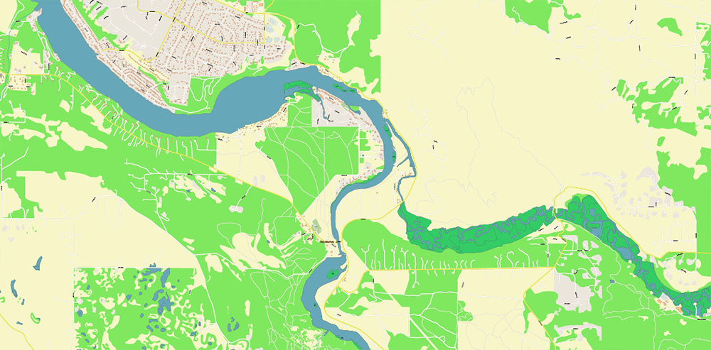
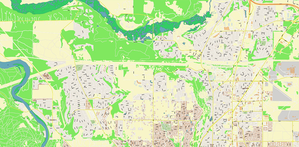
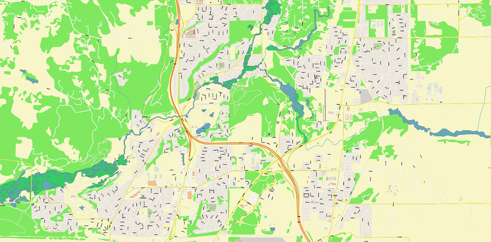
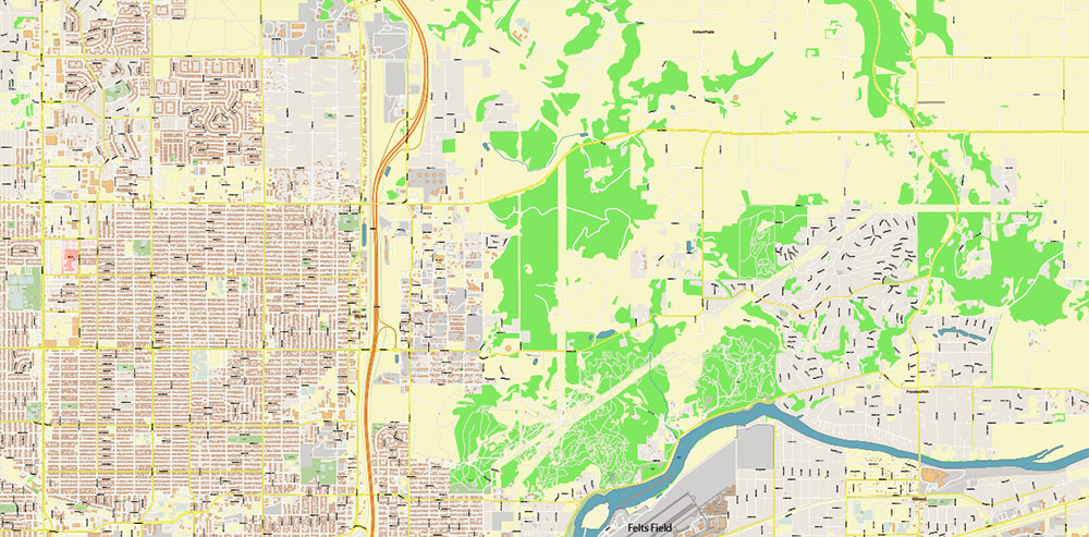
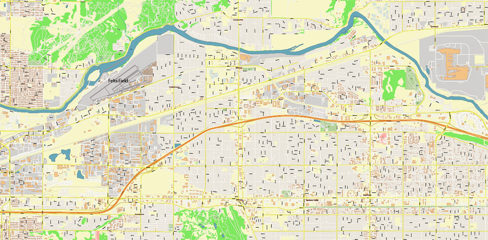
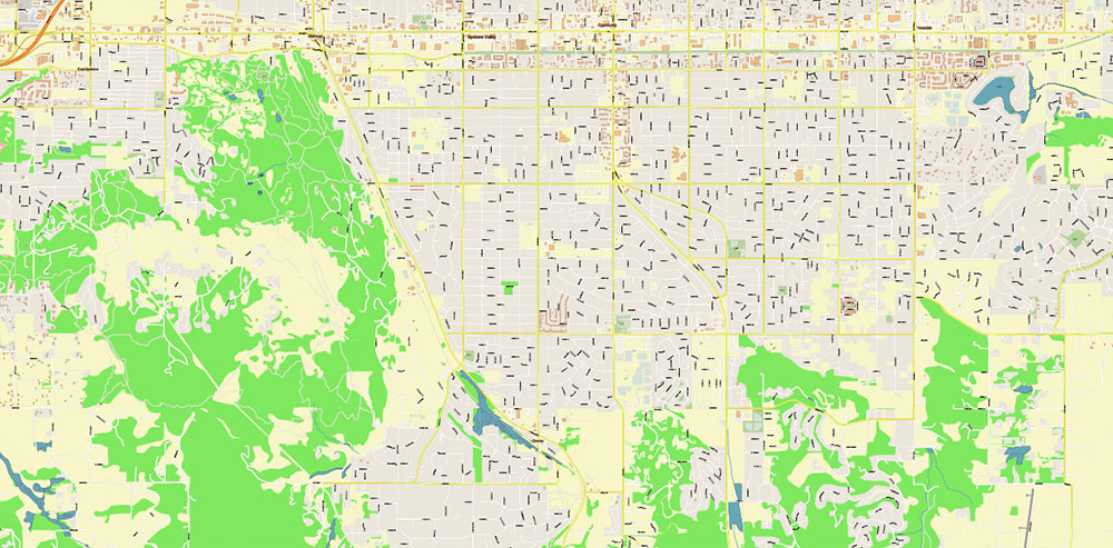
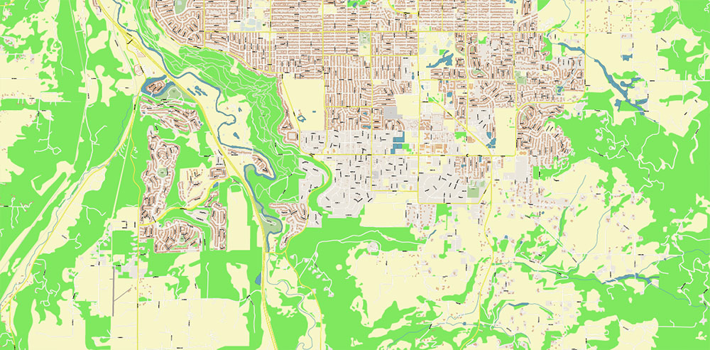
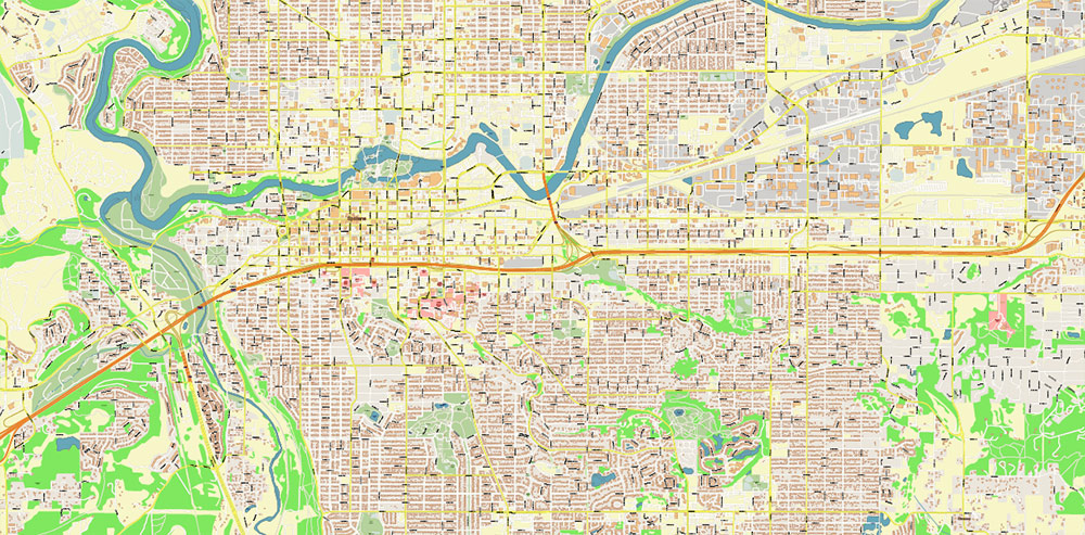
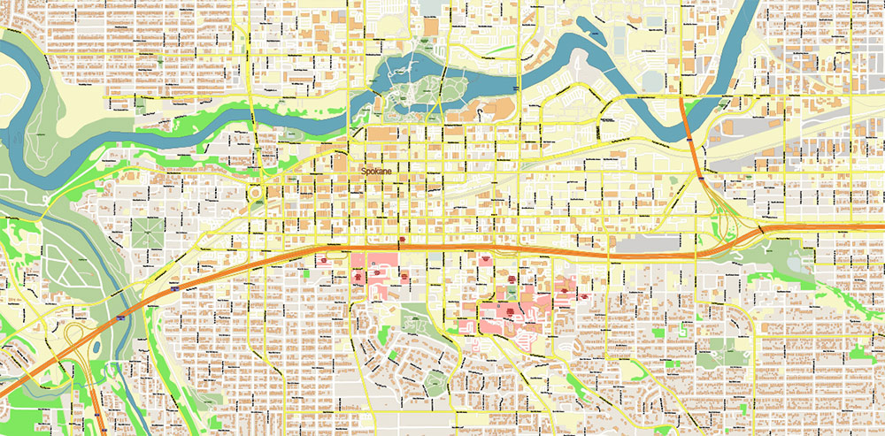
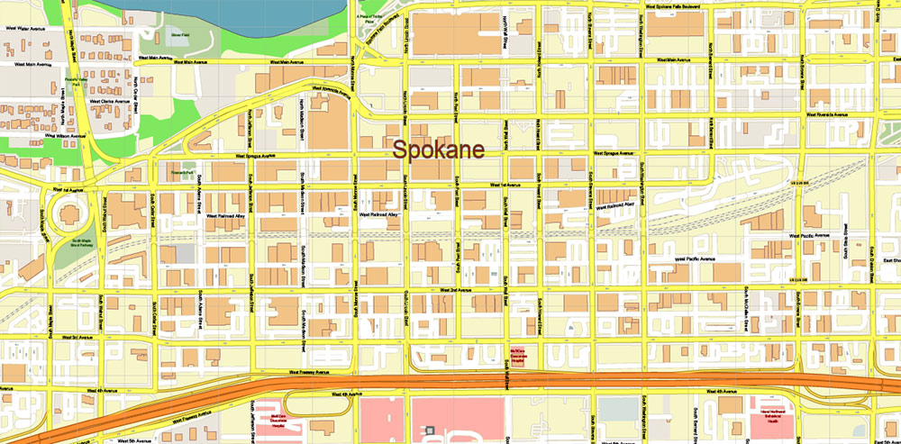
Printable PDF Vector Map of Spokane Washington US High Detailed scale 1:3162 fully editable Adobe PDF Street Map in layers, scalable, text/curves format all names, 80 MB ZIP
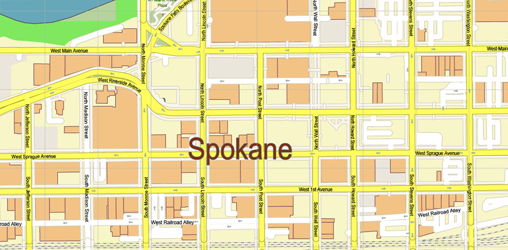
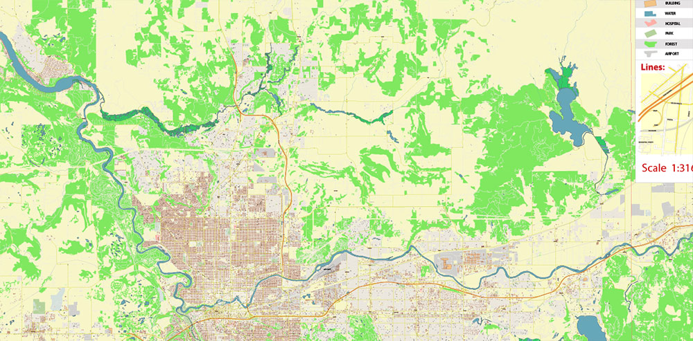
All street names, Main Objects,Buildings. Map for design, printing, arts, projects, presentations, for architects, designers, and builders, business, logistics.
Also: We can add (additional layer for this map), any other objects for you. It’s free for our customers.
If you need any OTHER format – or something else – please, email us
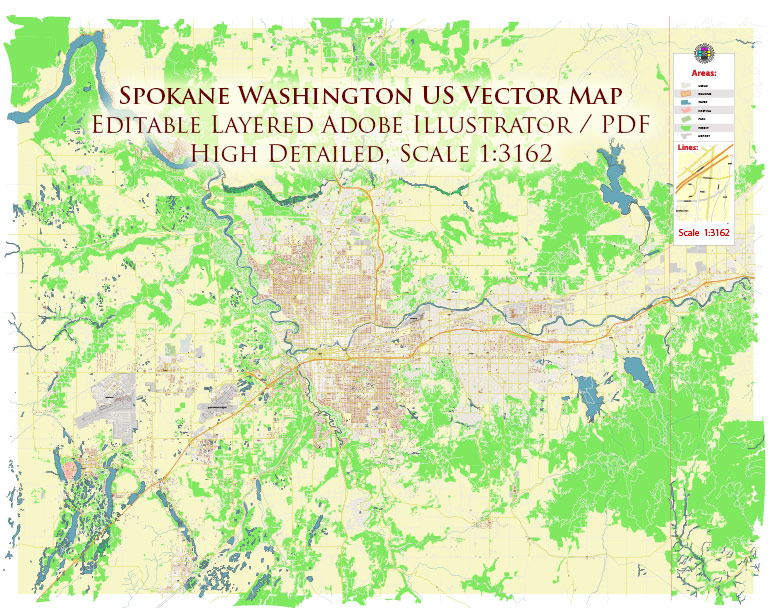
Spokane Washington US PDF Map Vector High Detailed Street Map editable Adobe PDF in layers
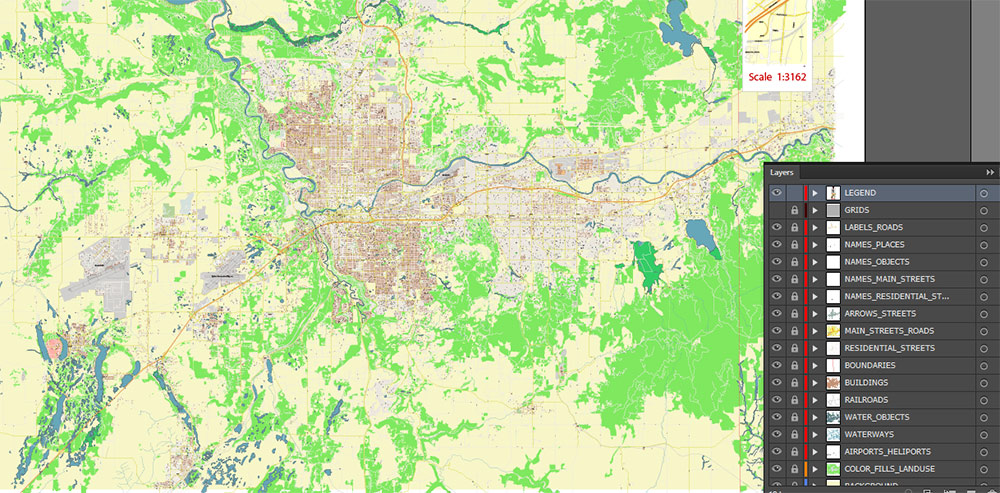
Layers list:
- Legend
- Grids
- Labels of roads 1, 2
- Names of places / objects
- Names of objects (hospitals, parks, water)
- Names main streets
- Names local streets
- Arrows of street directions
- Main streets and roads
- Local streets and roads
- Boundaries
- Railroads
- Buildings
- Waterways
- Water and wetland areas
- Land use areas
- Background
Spokane Washington US PDF Map Vector High Detailed Street Map editable Adobe PDF in layers
GEO-BRIEF: Spokane, Washington, USA
🌍 GEOGRAPHIC OVERVIEW
-
Region: Inland Northwest, eastern Washington State
-
Coordinates: ~47.66°N, 117.43°W
-
Elevation: ~560–600 m (1,850–2,000 ft) above sea level
-
Terrain: Transitional zone between Columbia Plateau drylands and forested foothills of the Rocky Mountain outliers
-
Hydrology: City split by the Spokane River (major regional drainage system feeding into the Columbia Basin)
-
Topography: Rolling basalt plains, river gorges, glacial outwash terrain; forest cover increases north/east
-
Climate: Dry continental
🛣️ PRIMARY ROAD NETWORK (STRATEGIC MOBILITY)
| Corridor |
Function |
Direction |
| Interstate 90 |
Main transcontinental artery |
E–W (Seattle ↔ Chicago) |
| U.S. Route 2 |
Regional connector |
W–E (Everett ↔ Montana) |
| U.S. Route 395 |
North–south spine |
Canada ↔ Nevada |
| U.S. Route 195 |
Agricultural corridor |
Spokane ↔ Pullman |
| Washington State Route 290 |
Urban/eastern suburbs |
Spokane Valley axis |
Operational note: Spokane is the transport hinge between Pacific Northwest and northern Rockies — freight consolidation point.
👥 DEMOGRAPHIC PROFILE
-
City population: ~230,000
-
Metro area: ~600,000
-
Urban type: Mid-size regional hub
-
Population density: Moderate; suburban sprawl eastward (Spokane Valley)
-
Ethnic composition (approx.):
-
Median age: ~36 years
-
Economy drivers:
🧭 STRATEGIC CHARACTER
-
Acts as eastern Washington command node
-
Only major urban center for hundreds of km in Inland Northwest
-
Gateway between agricultural plateau and mountain resource zones
-
Critical winter logistics due to snow-prone corridors
📌 COMMAND TAKEAWAYS
-
River divides urban terrain → bridge crossings are key chokepoints
-
I-90 corridor = lifeline artery
-
Terrain shifts quickly from open plains to forested highlands
-
Climate variability impacts mobility seasonally
Spokane Washington US PDF Map Vector High Detailed Street Map editable Adobe PDF in layers
Spokane Washington US PDF Map Vector High Detailed Street Map editable Adobe PDF in layers
Spokane Washington US PDF Map Vector High Detailed Street Map editable Adobe PDF in layers
Spokane Washington US PDF Map Vector High Detailed Street Map editable Adobe PDF in layers
Spokane Washington US PDF Map Vector High Detailed Street Map editable Adobe PDF in layers
Spokane Washington US PDF Map Vector High Detailed Street Map editable Adobe PDF in layers
Spokane Washington US PDF Map Vector High Detailed Street Map editable Adobe PDF in layers
Spokane Washington US PDF Map Vector High Detailed Street Map editable Adobe PDF in layers
Spokane Washington US PDF Map Vector High Detailed Street Map editable Adobe PDF in layers
Spokane Washington US PDF Map Vector High Detailed Street Map editable Adobe PDF in layers
Spokane Washington US PDF Map Vector High Detailed Street Map editable Adobe PDF in layers
Spokane Washington US PDF Map Vector High Detailed Street Map editable Adobe PDF in layers

 Author: Kirill Shrayber, Ph.D. FRGS

