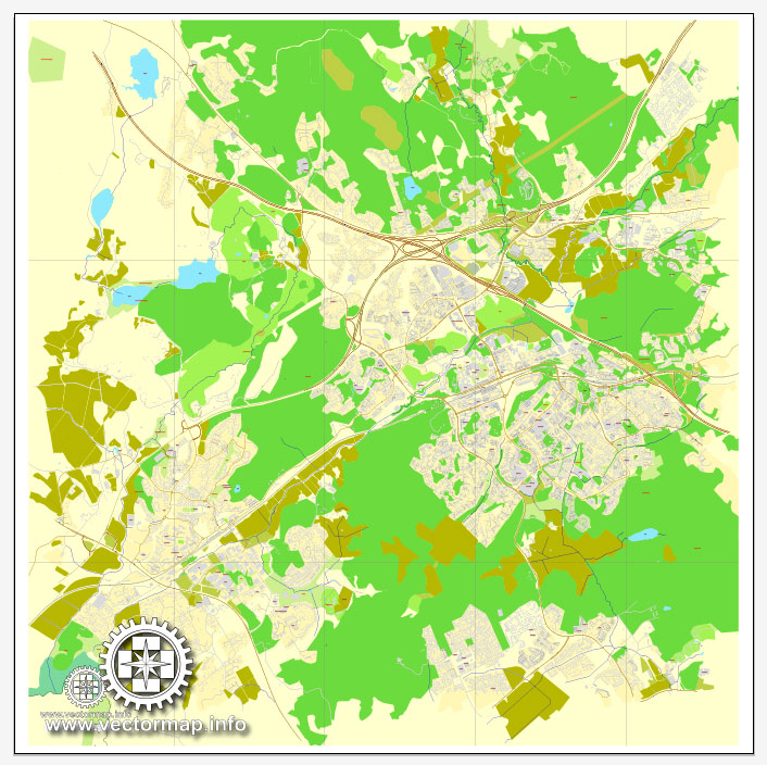
Espoo, Finland, printable vector City Plan map, full editable, Adobe PDF, full vector, scalable, editable, text format street names, 4 mb ZIP
All streets, All buildings. Map for design, print, arts, projects, presentations.
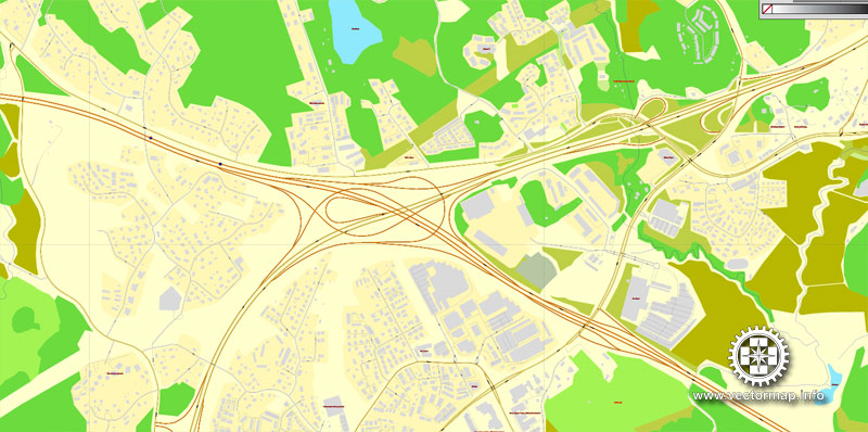
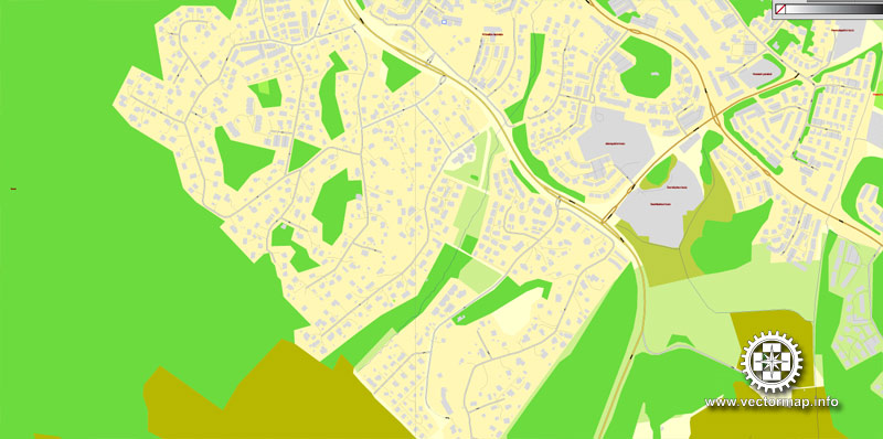
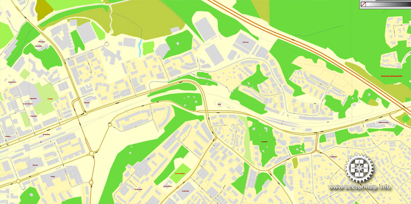
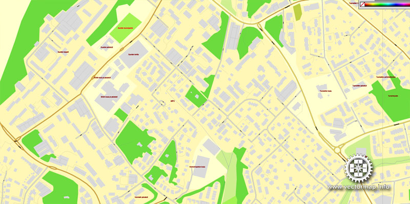
The most accurate and detailed map of the city.
Different font colors of the street names (black); object names by type (brown, red).
You can edit this file by Adobe Illustrator, Adobe Acrobat, Corel Draw.
DXF, DWG, CDR and other formats – on request, same price, please, contact
Espoo, Finland.
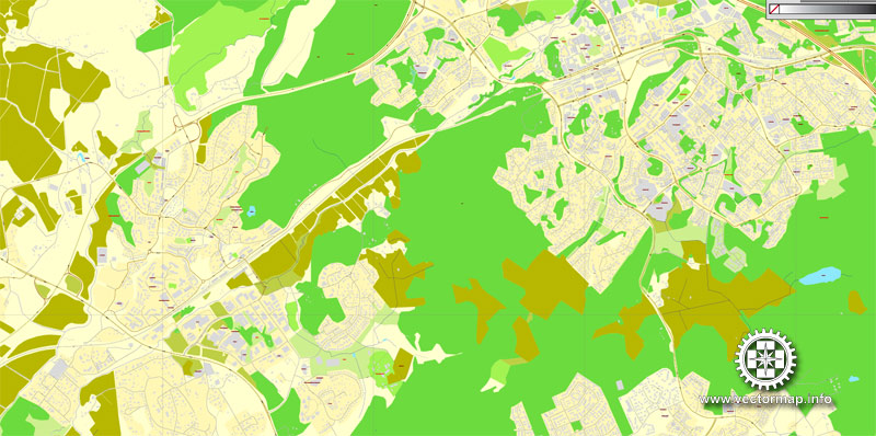
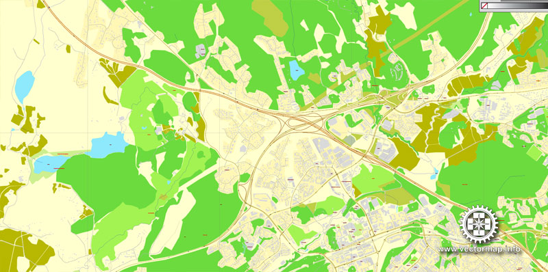
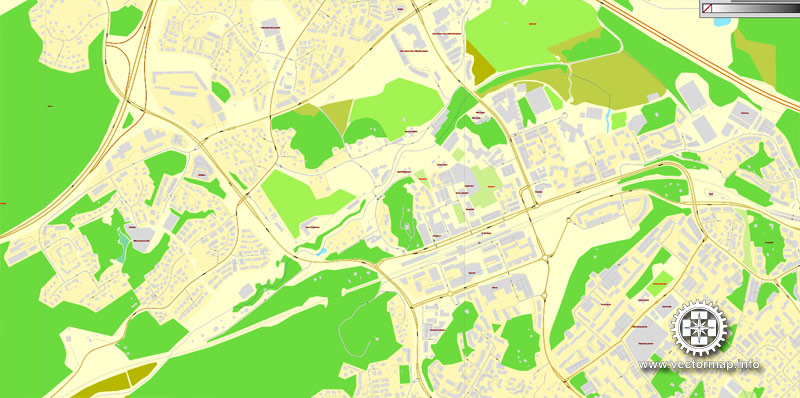
This vector map of Espoo is used as a basis for design, editing, and further printing.
This is the most detailed, exact map of Espoo for high-quality printing and polygraphy. You can always clarify the map development date by contacting us.
For your convenience, all objects on Espoo vector map are divided into layers. And the editing is very easy – colors, lines, etc.
You can easily add any objects needed (e.g. shops, salons, sale points, gas station or attraction) on any layer of Espoo vector map.
Espoo is the second largest city and municipality in Finland. It is part of the Finnish Capital Region, and most of its population lives in the inner urban core of the Helsinki metropolitan area, along with the cities of Helsinki, Vantaa, and Kauniainen. Espoo shares its eastern border with Helsinki and Vantaa, while enclosing Kauniainen. The city is located on the shore of the Gulf of Finland, in the region of Uusimaa and has a population of 281,886.
One of the advantages of Espoo vector maps of our production is the relevance of cartographic data, we constantly update all our products.
This vector map of Espoo is used by:
designers, layout designers, printers, advertisers and architects. Our product – vector maps – is designed for further editing and printing in large formats – from @Wall format (a few meters) to A-0 and A-1, A-2, A-3.
Espoo map in vector format is used for design, urban planning, presentations and media visualizations.
Advertising and presentation map of Espoo (usually the final designer marks the routes, and puts the client’s objects (shops, saloons, gas stations etc.)
The undoubted advantage is that people will NEVER throw out this advertising product – the map. In fact, as an advertising medium, a map is the most “long-playing” of the well-known polygraphic advertising media, with the longest lifespan, and the maximum number of interactions with the customer.
For travelers, maps are sold at the airports and gas stations around the world. Often the source is our vector maps.
Take a look, who purchases our vector maps of Espoo in “Our Clients and Friends” page – these are large and small companies, from super-brands like Volvo and Starbucks, to small design studios and printing houses.
It’s very easy to work with vector maps of Espoo, even for a not very experienced designer who can turn on and off the map layers, add new objects, change the colors of fill and lines according to customer requirements.
The undoubted advantage of Espoo vector maps in printing is an excellent and detailed visualization, when customer can expand a large paper map and instantly define his location, find a landmark, an object or address on map, unlike using the popular electronic formats of Google and Yandex maps for example.
Printable vector maps of Espoo are much more convenient and efficient than any electronic maps on your smartphone, because ALL DETAILS are displayed in the entire space of Espoo map.
Useful tips on working with vector maps of cities and countries in Adobe Illustrator.
«V» – launches the Selection tool (cursor, black arrow), which makes active any vector line.
«А» – launches the Direct Selection tool (white cursor), allows you to select curve elements and drag them to the desired place.
«R» – activates the Rotate tool, which helps you rotating selected objects around the center point by 360 degrees.
«E» – gives you the opportunity to use the Eraser tool and erase unnecessary parts.
«X» – switches between Fill and Stroke in the Tools section. Try to get used to this hot key and
you will quickly understand that you can’t live and work without it.
Guides are not limited to vertical and horizontal in Adobe Illustrator. You can also create a diagonal guide for example. Moreover, you can turn any contours into guides. Select the outline and go to View > Guides > Make Guides (Create Guides), or simply press Cmd/Ctrl + 5. You can also turn the guides back into an editable object. Go to menu, View > Guides > Unlock Guides (Release Guides), select the guide you want to edit and select View > Guides > Release Guides (Reset Guides), or just press Cmd/Ctrl + Option / Alt + 5).
You will probably want to change the color scheme used on our Espoo vector map.
To quickly and effectively play with colors.
Of course, you can do it manually, all objects in our Espoo vector map are divided according to types and layers, and you can easily change the color gamma of vector objects in groups and layers.
But there is more effective way of working with the whole VECTOR MAP of Espoo and all layers:
The overview dialog «Edit colors»/«Repaint Graphic Object» (this dialog box name can change depending on the context):
If you have selected a part or a layer of Espoo vector map and open the dialog box by clicking the icon in the Control panel, on the Samples palette or the Color Catalog, or if you choose Edit > Edit Colors> Repaint Graphic Object, then the «Repaint Graphic Object» dialog box appears, and you get access to «Assign» and «Edit» tabs.
If a picture or a map fragment is not selected, and you open the dialog box by clicking the icon in the Control panel, on the Samples palette or in the Color Catalog, the «Edit Colors» dialog box appears and you can only access the «Edit» tab.
Regardless of the name at the top of the dialog box, the right-hand side always displays the color group of the current document, as well as two default color groups: Print Color and Grayscale. These color groups can be selected and used any time.
Other bordering municipalities of Espoo are Nurmijärvi and Vihti in the north, and Kirkkonummi in the west. The national park of Nuuksio is situated in northwestern Espoo.
Espoo encompasses 528 square kilometres (204 sq mi), of which 312 km2 (120 sq mi) is land.
Espoo does not have a traditional city center, having instead several local regional centers. Espoo is thus divided into seven major areas (Finnish: suuralueet, Swedish: storområden): Vanha-Espoo (with administrative center), Suur-Espoonlahti, Pohjois-Espoo, Suur-Kauklahti, Suur-Leppävaara, Suur-Matinkylä, and Suur-Tapiola.
Create and edit color groups of Espoo vector map, and also assign colors using the «Edit Colors»/ а «Repaint Graphic Object» dialog box.
A. Creating and editing of a color group on the «Edit» tab
B. Assigning colors on the «Assign» tab
C. Select a group of colors from the «Color groups» list
The option «Repaint a graphic object» in the lower part of the dialog box allows you to preview the colors on a selected layer of Vector map, or a group of elements, and specify whether its colors will be redefined when the dialog box is closed.
The main areas of the dialog box are:
«Edit»
The «Edit» tab is designed to create a new or edit the existing color groups.
The harmony rules Menu and the Color Wheel are used to conduct experiments with color harmonies. The color wheel shows how colors are related in color harmony, and the color bars allow you to view and manipulate an individual color values. In addition, you can adjust the brightness, add and remove colors, save color groups and view colors on the selected Vector Map of Espoo or a separated layers.
«Assign»
The «Assign» tab is used to view and control on how the original colors are replaced with colors from the color group like your corporate colors in the Vector Map of Espoo.
The assign color ability is provided only if the entire map, layer or fragment is selected in the document. You can specify which of new colors replace the current colors, whether the spot colors should be preserved and how colors are replaced (for example, you can replace colors completely or changing the color tone while maintaining the brightness). The «Assign» tab allows you to redefine colors in the Vector Map of Espoo, or in separate layers and fragments using the current color group or reducing the number of colors in the current Vector Map.
Color groups
Is a list of all saved color groups for current document (the same groups appear in the «Samples» palette). You can edit and delete the existing color groups, as well as creating a new ones using the list of “Color Groups” in the dialog box. All changes appear in the «Samples» palette.
The highlighted color group shows, which color group is currently edited.
Any color group can be selected and edited, or used to redefine the colors in the selected vector map of Espoo, its fragments or elements.
Saving a color group adds this group to the specified list.
Opening the «Edit Colors»/«Repaint Graphic Object» dialog box.
Open the «Edit Colors»/«Repaint Graphic Object» dialog box using one of the following methods:
«Edit»> «Edit Colors»> «Repaint Graphic object» or «Repaint With Style».
Use these commands if you need to edit the colors in the selected vector map of Espoo.
«Repaint Graphic object» button on the «Control» panel.
Use this button if you need to adjust colors of Espoo vector map using the а «Repaint graphic object» dialog box.
The specified button is available if the selected vector map or its fragment contains two or more colors.
Aalto University is based in Otaniemi, Espoo, along with a thriving science community that includes numerous startups and organizations such as VTT – the Technical Research Center of Finland. Several major companies are based in Espoo, including Nokia, HMD Global, Tieto, KONE, Neste, Fortum, Orion Corporation, and Outokumpu, as well as video game developers Rovio and Remedy Entertainment.
The city of Espoo is officially bilingual. The majority of the population, 83.6%, speaks Finnish as their mother tongue, while a minority of 8.3% speaks Swedish. 8% of Espoo’s population has a first language other than Finnish or Swedish.
Note. This color editing method is convenient for global color adjustment in a vector map, if global colors were not used when creating a Map of Espoo.
The «Edit colors» button or «Edit or apply colors» on the «Color Catalog» palette
Click this button if you need to edit colors on the «Color Catalog» palette or edit and then apply them to the selected Vector Map of Espoo or its fragment.
The «Edit color group» button or «Edit or apply color group» on the «Samples» palette.
Click this button if you need to edit the colors in the specific color group or edit and apply them to the selected Vector Map of Espoo or a group of its elements, for example, the whole layer “Streets and lines”. You can also double-click the color group in the Samples panel to open the dialog box.
If the map file is too large and your computer freezes or even can’t open it quickly:
1. Try to reduce the color resolution of the video card (display) to 256 colors while working with a large map.
2. Using Windows Task Manager, select all the application you don’t need, while working with map, just turn them off.
3. Launch Adobe Illustrator. (DO NOT OPEN the vector map file)
4. Start the Windows Task Manager using administrator rights > Find the “Illustrator” process > set the «real time» priority,
5. Open the file. When you see the LEGACY FONT popup window – click “OK” (do not update). You can restore the TEXT later.
6. Can also be useful: When file is opened – Edit > Settings > Basic Settings > disable smoothing. /// It looks scary, but works quickly)))
We recommend saving the file in Adobe Illustrator 10 version. It’s much more stable when working with VERY BIG size files.
Location
Espoo is located in southern Finland, along the shore of the Gulf of Finland, and in the region of Uusimaa and the Helsinki sub-region. Prior to the abolition of Finnish provinces in 2009, Espoo was a part of the Southern Finland Province.
The city borders Helsinki, the Finnish capital, which is to the east. Other neighbouring municipalities are Vantaa to the east and northeast, Nurmijärvi to the north, Vihti to the northwest, and Kirkkonummi to the west and southwest. Espoo is a part of the Finnish Capital Region, which is the inner core of the Greater Helsinki metropolitan area.
Subdivision
Main article: Districts of Espoo
Espoo is divided into seven major areas (Finnish: suuralueet, Swedish: storområden): Vanha-Espoo (with administrative center), Suur-Espoonlahti, Pohjois-Espoo, Suur-Kauklahti, Suur-Leppävaara, Suur-Matinkylä, and Suur-Tapiola. These major areas are then divided into a total of 56 districts.
Features
Although Espoo is relatively highly populated, it has large amounts of natural wilderness, particularly in the city’s western and northern portions. The city has a total of 71 lakes, the largest of which are Lake Bodom, Nuuksion Pitkäjärvi, Vanhankylän Pitkäjärvi, Loojärvi, Velskolan Pitkäjärvi, Saarijärvi, Matalajärvi, Siikajärvi, and Lippajärvi. The city has a large coastline on the Gulf of Finland.
Espoo has six Natura 2000 protected areas: Bånberget forests, Espoonlahti–Saunalahti bay area (partially in Kirkkonummi), Laajalahti bay, Matalajärvi lake, Nuuksio National Park (partially in Kirkkonummi and Vihti), as well as forests in Vestra (partially in Vantaa).
The official animal of Espoo is the Siberian flying squirrel, the official bird is the common blackbird, and the official plant is Anemone nemorosa.
Espoo
City in Finland
Espoo is the second largest city and municipality in Finland. The population of the city of Espoo was 268,924 as of 30 September 2015. Wikipedia
Land area: 312 km²
Region: Uusimaa
Population: 254,632 (2012) UNdata
University: Aalto University
Espoo is the second largest city and municipality in Finland. The population of the city of Espoo was 268,924 as of 30 September 2015. It is part of the Finnish Capital Region, and most of its population lives in the inner urban core of the Helsinki metropolitan area, along with the cities of Helsinki, Vantaa, and Kauniainen. Espoo shares its eastern border with Helsinki and Vantaa, while enclosing Kauniainen. The city is on the shore of the Gulf of Finland, in the region of Uusimaa.
Other bordering municipalities of Espoo are Nurmijärvi and Vihti in the north, and Kirkkonummi in the west. The national park of Nuuksio is situated in northwestern Espoo.
Espoo encompasses 528 square kilometres (204 sq mi), of which 312 km2 (120 sq mi) is land.
Espoo has several local regional centers. Espoo is thus divided into seven major areas : Vanha-Espoo (with administrative center), Suur-Espoonlahti, Pohjois-Espoo, Suur-Kauklahti, Suur-Leppävaara, Suur-Matinkylä, and Suur-Tapiola.
Aalto University is based in Otaniemi, Espoo, along with a thriving science community that includes numerous startups and organizations such as VTT – the Technical Research Center of Finland. Several major companies are based in Espoo, including Nokia Solutions and Networks, Microsoft Mobile, KONE, Neste Oil, Fortum, Orion Corporation, and Outokumpu, as well as video game developers Rovio and Remedy Entertainment.
The city of Espoo is officially bilingual. The majority of the population, 83.6%, speaks Finnish as their mother tongue, while a minority of 8.3% speaks Swedish. 8% of Espoo’s population has a first language other than Finnish or Swedish.
Small guide: How to work with the vector map?
You can: Mass select objects by type and color – for example, the objects type “building” (they are usually dark gray) – and remove them from the map, if you do not need them in your print or design project. You can also easily change the thickness of lines (streets), just bulk selection the road by the line color.
The streets are separated by type, for example, type “residential road” are usually white with a gray stroke. Highway usually orange with a brown or dark gray stroke.
It is easy to change the font of inscriptions, all or each individually. Also, just can be make and any other manipulation of objects on the vector map in Adobe illustrator format.
Important: All the proportions on the map are true, that is, the relative sizes of the objects are true, because Map is based on an accurate GPS projection, and It transated into the (usual for all) the Mercator projection.
You can easily change the color, stroke and fill of any object on the map, zoom without loss of quality Image Verification.
Select object

Bulk selection the same objects on the vector map

See the bulk selected objects on the vector map

Bulk delete buildungs from the vector map

Select residencial road (small street) on the vector map

Bulk selection the same lines (streets, roads) on the full map

Create fat lines of the streets on the vector maps (bulk action) 1

Create fat lines of the streets on the vector maps (bulk action) 2

Create fat lines of the streets on the vector maps (bulk action) 3

You can easily change the color, stroke and fill of any object on the map, zoom without loss of quality Image Verification.

 Author: Kirill Shrayber, Ph.D. FRGS
