Extended Description of the Vector Map
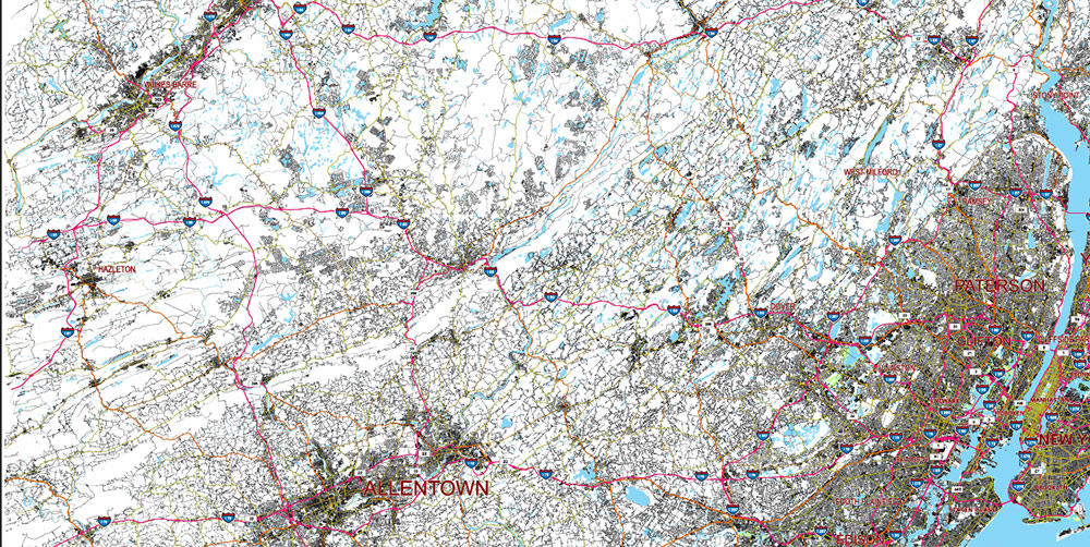
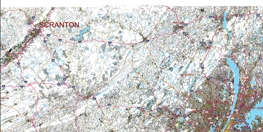
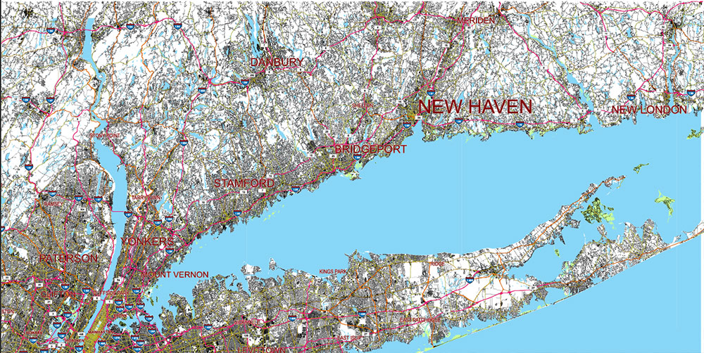
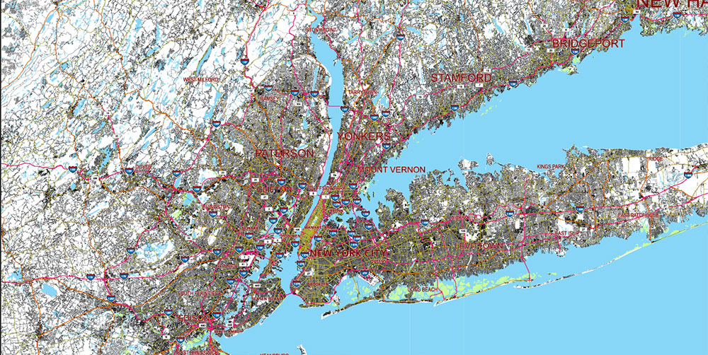
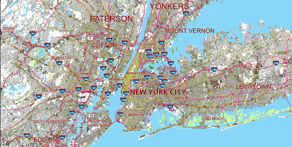
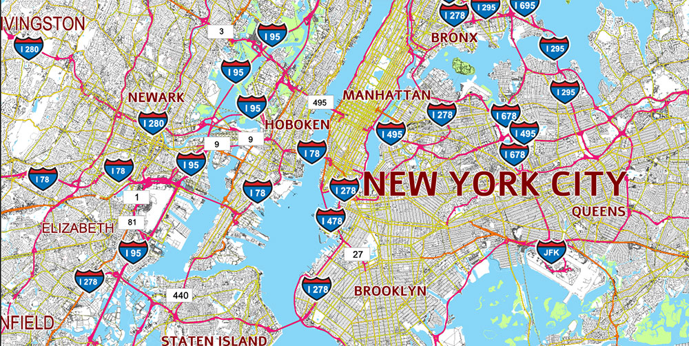
Printable Vector Map of New York City Area USA High detailed road map fully editable Layered Adobe Illustrator scalable, curves format all names, 155 MB ZIP
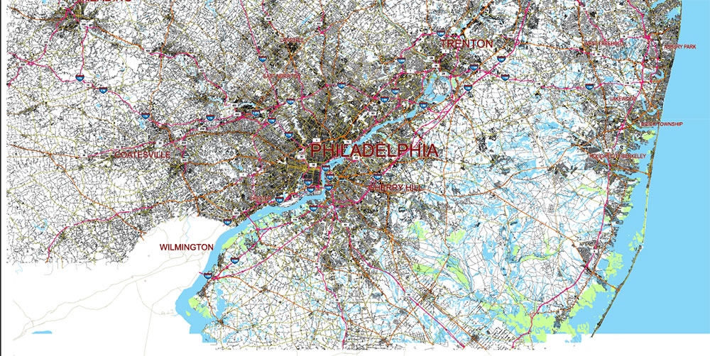
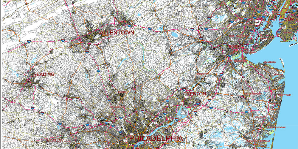
Large Area: Includes east part of Pennsylvania, South part of New Yorl state, South part of Connecticut, North part of New Jersey. Road shields and numbers.
All street and roads, Water Objects, Railroads, Main cities and towns. Map for design, printing, arts, projects, presentations, for architects, designers, and builders, business, logistics.
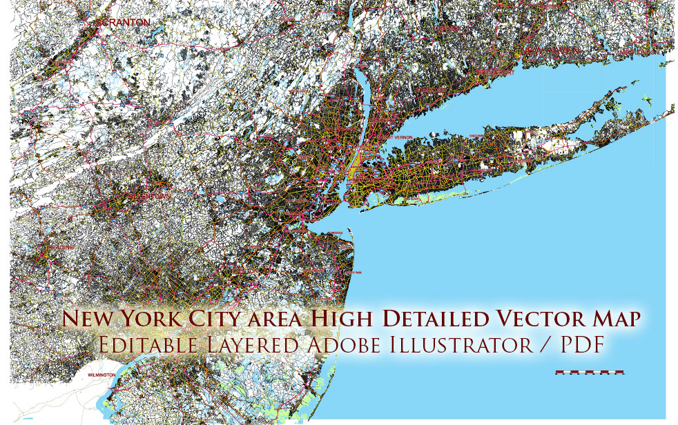
New York City Area Large USA Map Vector Exact City Plan High Detailed Street Map editable Adobe Illustrator in layers
Layers list:
- Scale.
- Names of places (city, town, etc.)
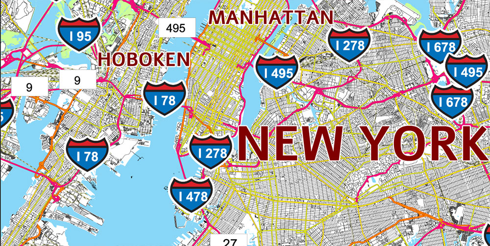
- Numbers of roads (shields)
- Main Streets, roads
- Residential streets
- Railroads
- Airports and Heliports
- Water objects (rivers, lakes, ponds)
- Islands
- Background and Sea
The most exact and detailed map of the city in scale.
For Editing and High-Quality Printing
New York City Area Large USA Map Vector Exact City Plan High Detailed Street Map editable Adobe Illustrator in layers
New York City Area Large USA Map Vector Exact City Plan High Detailed Street Map editable Adobe Illustrator in layers
New York City Area Large USA Map Vector Exact City Plan High Detailed Street Map editable Adobe Illustrator in layers
New York City Area Large USA Map Vector Exact City Plan High Detailed Street Map editable Adobe Illustrator in layers
New York City Area Large USA Map Vector Exact City Plan High Detailed Street Map editable Adobe Illustrator in layers
New York City Area Large USA Map Vector Exact City Plan High Detailed Street Map editable Adobe Illustrator in layers
New York City Area Large USA Map Vector Exact City Plan High Detailed Street Map editable Adobe Illustrator in layers
New York City Area Large USA Map Vector Exact City Plan High Detailed Street Map editable Adobe Illustrator in layers
New York City Area Large USA Map Vector Exact City Plan High Detailed Street Map editable Adobe Illustrator in layers

 Author: Kirill Shrayber, Ph.D. FRGS

