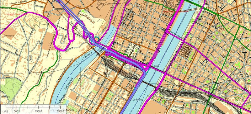
About scalable vector map of Lyon (France) map in vector format (.AI) for Adobe Illustrator
Archive size: 282 Mb, zipped .AI
DPI: 300
License: Royalty Free
Content: Atlas 100 parts map
This vector map of Lyon (France) is compatible with all vector formats: Freehand, Corel Draw, AutoCad and other. Fully editable, you can change all names, line thickness, colors, filling, fonts or add objects needed.
We provide very detailed vector maps of France, perfect for large size printing, like office walls or billboards.
Also available in other formats at the same price: DWG, DXF AutoCAD, Corel Draw, EPS, PDF.
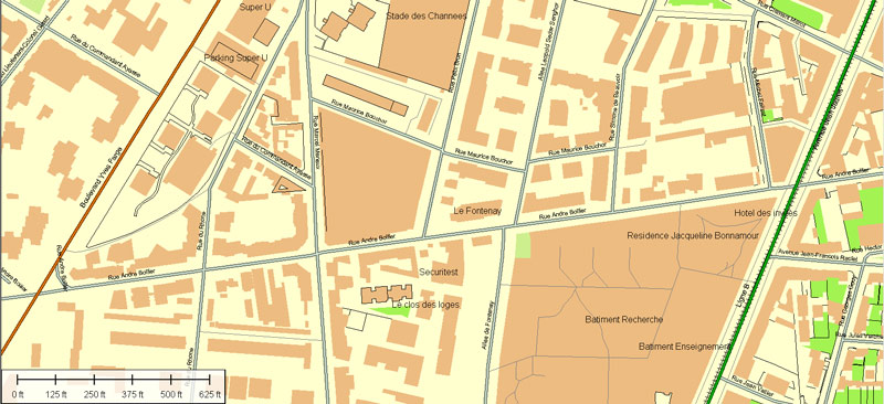
This Lyon AI vector map features:
Highways with names,
Major Roads,
National Park Borders,
Railway lines,
Cemeteries,
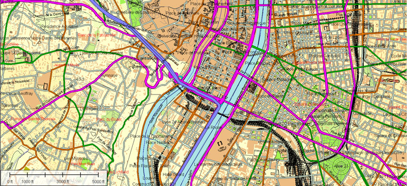
Big and small Rivers, small streams also,
Lake, ponds and other water bodies,
Landmark fill,
Recreation zones,
County Borders with fill,
Parks.
Lyon, France.
This vector map of Lyon is used as a basis for design, editing, and further printing.
This is the most detailed, exact map of Lyon for high-quality printing and polygraphy. You can always clarify the map development date by contacting us.
For your convenience, all objects on Lyon vector map are divided into layers. And the editing is very easy – colors, lines, etc.
You can easily add any objects needed (e.g. shops, salons, sale points, gas station or attraction) on any layer of Lyon vector map.
Lyon is the third-largest city and second-largest urban area of France. It is located in the country’s east-central part at the confluence of the rivers Rhône and Saône, about 470 km (292 mi) south from Paris, 320 km (199 mi) north from Marseille and 56 km (35 mi) northeast from Saint-Étienne. Inhabitants of the city are called Lyonnais.
One of the advantages of Lyon vector maps of our production is the relevance of cartographic data, we constantly update all our products.
This vector map of Lyon is used by:
designers, layout designers, printers, advertisers and architects. Our product – vector maps – is designed for further editing and printing in large formats – from @Wall format (a few meters) to A-0 and A-1, A-2, A-3.
Lyon map in vector format is used for design, urban planning, presentations and media visualizations.
Advertising and presentation map of Lyon (usually the final designer marks the routes, and puts the client’s objects (shops, saloons, gas stations etc.)
The undoubted advantage is that people will NEVER throw out this advertising product – the map. In fact, as an advertising medium, a map is the most “long-playing” of the well-known polygraphic advertising media, with the longest lifespan, and the maximum number of interactions with the customer.
For travelers, maps are sold at the airports and gas stations around the world. Often the source is our vector maps.
Take a look, who purchases our vector maps of Lyon in “Our Clients and Friends” page – these are large and small companies, from super-brands like Volvo and Starbucks, to small design studios and printing houses.
It’s very easy to work with vector maps of Lyon, even for a not very experienced designer who can turn on and off the map layers, add new objects, change the colors of fill and lines according to customer requirements.
The undoubted advantage of Lyon vector maps in printing is an excellent and detailed visualization, when customer can expand a large paper map and instantly define his location, find a landmark, an object or address on map, unlike using the popular electronic formats of Google and Yandex maps for example.
Printable vector maps of Lyon are much more convenient and efficient than any electronic maps on your smartphone, because ALL DETAILS are displayed in the entire space of Lyon map.
Useful tips on working with vector maps of cities and countries in Adobe Illustrator.
«V» – launches the Selection tool (cursor, black arrow), which makes active any vector line.
«А» – launches the Direct Selection tool (white cursor), allows you to select curve elements and drag them to the desired place.
«R» – activates the Rotate tool, which helps you rotating selected objects around the center point by 360 degrees.
«E» – gives you the opportunity to use the Eraser tool and erase unnecessary parts.
«X» – switches between Fill and Stroke in the Tools section. Try to get used to this hot key and
you will quickly understand that you can’t live and work without it.
Guides are not limited to vertical and horizontal in Adobe Illustrator. You can also create a diagonal guide for example. Moreover, you can turn any contours into guides. Select the outline and go to View > Guides > Make Guides (Create Guides), or simply press Cmd/Ctrl + 5. You can also turn the guides back into an editable object. Go to menu, View > Guides > Unlock Guides (Release Guides), select the guide you want to edit and select View > Guides > Release Guides (Reset Guides), or just press Cmd/Ctrl + Option / Alt + 5).
You will probably want to change the color scheme used on our Lyon vector map.
To quickly and effectively play with colors.
Of course, you can do it manually, all objects in our Lyon vector map are divided according to types and layers, and you can easily change the color gamma of vector objects in groups and layers.
But there is more effective way of working with the whole VECTOR MAP of Lyon and all layers:
The overview dialog «Edit colors»/«Repaint Graphic Object» (this dialog box name can change depending on the context):
If you have selected a part or a layer of Lyon vector map and open the dialog box by clicking the icon in the Control panel, on the Samples palette or the Color Catalog, or if you choose Edit > Edit Colors> Repaint Graphic Object, then the «Repaint Graphic Object» dialog box appears, and you get access to «Assign» and «Edit» tabs.
If a picture or a map fragment is not selected, and you open the dialog box by clicking the icon in the Control panel, on the Samples palette or in the Color Catalog, the «Edit Colors» dialog box appears and you can only access the «Edit» tab.
Regardless of the name at the top of the dialog box, the right-hand side always displays the color group of the current document, as well as two default color groups: Print Color and Grayscale. These color groups can be selected and used any time.
Create and edit color groups of Lyon vector map, and also assign colors using the «Edit Colors»/ а «Repaint Graphic Object» dialog box.
A. Creating and editing of a color group on the «Edit» tab
B. Assigning colors on the «Assign» tab
C. Select a group of colors from the «Color groups» list
The option «Repaint a graphic object» in the lower part of the dialog box allows you to preview the colors on a selected layer of Vector map, or a group of elements, and specify whether its colors will be redefined when the dialog box is closed.
The main areas of the dialog box are:
«Edit»
The «Edit» tab is designed to create a new or edit the existing color groups.
The harmony rules Menu and the Color Wheel are used to conduct experiments with color harmonies. The color wheel shows how colors are related in color harmony, and the color bars allow you to view and manipulate an individual color values. In addition, you can adjust the brightness, add and remove colors, save color groups and view colors on the selected Vector Map of Lyon or a separated layers.
Lyon had a population of 513,275 in 2015. It is the capital of the Metropolis of Lyon and the region of Auvergne-Rhône-Alpes. The Lyon metropolitan area had a population of 2,265,375 in 2014, the second-largest urban area in France. The city is known for its cuisine and gastronomy, and historical and architectural landmarks; part of it is a registered as a UNESCO World Heritage site. Lyon was historically an important area for the production and weaving of silk. Lyon played a significant role in the history of cinema: it is where Auguste and Louis Lumière invented the cinematograph. It is also known for its light festival, the Fête des Lumières, which begins every 8 December and lasts for four days, earning Lyon the title of Capital of Lights.
«Assign»
The «Assign» tab is used to view and control on how the original colors are replaced with colors from the color group like your corporate colors in the Vector Map of Lyon.
The assign color ability is provided only if the entire map, layer or fragment is selected in the document. You can specify which of new colors replace the current colors, whether the spot colors should be preserved and how colors are replaced (for example, you can replace colors completely or changing the color tone while maintaining the brightness). The «Assign» tab allows you to redefine colors in the Vector Map of Lyon, or in separate layers and fragments using the current color group or reducing the number of colors in the current Vector Map.
Color groups
Is a list of all saved color groups for current document (the same groups appear in the «Samples» palette). You can edit and delete the existing color groups, as well as creating a new ones using the list of “Color Groups” in the dialog box. All changes appear in the «Samples» palette.
The highlighted color group shows, which color group is currently edited.
Any color group can be selected and edited, or used to redefine the colors in the selected vector map of Lyon , its fragments or elements.
Saving a color group adds this group to the specified list.
Opening the «Edit Colors»/«Repaint Graphic Object» dialog box.
Open the «Edit Colors»/«Repaint Graphic Object» dialog box using one of the following methods:
«Edit»> «Edit Colors»> «Repaint Graphic object» or «Repaint With Style».
Use these commands if you need to edit the colors in the selected vector map of Lyon.
«Repaint Graphic object» button on the «Control» panel.
Use this button if you need to adjust colors of Lyon vector map using the а «Repaint graphic object» dialog box.
The specified button is available if the selected vector map or its fragment contains two or more colors.
Note. This color editing method is convenient for global color adjustment in a vector map, if global colors were not used when creating a Map of Lyon.
The «Edit colors» button or «Edit or apply colors» on the «Color Catalog» palette
Click this button if you need to edit colors on the «Color Catalog» palette or edit and then apply them to the selected Vector Map of Lyon or its fragment.
The «Edit color group» button or «Edit or apply color group» on the «Samples» palette.
Click this button if you need to edit the colors in the specific color group or edit and apply them to the selected Vector Map of Lyon or a group of its elements, for example, the whole layer “Streets and lines”. You can also double-click the color group in the Samples panel to open the dialog box.
If the map file is too large and your computer freezes or even can’t open it quickly:
1. Try to reduce the color resolution of the video card (display) to 256 colors while working with a large map.
2. Using Windows Task Manager, select all the application you don’t need, while working with map, just turn them off.
3. Launch Adobe Illustrator. (DO NOT OPEN the vector map file)
4. Start the Windows Task Manager using administrator rights > Find the “Illustrator” process > set the «real time» priority,
5. Open the file. When you see the LEGACY FONT popup window – click “OK” (do not update). You can restore the TEXT later.
6. Can also be useful: When file is opened – Edit > Settings > Basic Settings > disable smoothing. /// It looks scary, but works quickly)))
We recommend saving the file in Adobe Illustrator 10 version. It’s much more stable when working with VERY BIG size files.
Economically, Lyon is a major centre for banking, as well as for the chemical, pharmaceutical, and biotech industries. The city contains a significant software industry with a particular focus on video games, and in recent years has fostered a growing local start-up sector. Lyon hosts the international headquarters of Interpol, the International Agency for Research on Cancer and Euronews. It was ranked 19th globally and second in France for innovation in 2014. It ranked second in France and 39th globally in Mercer’s 2015 liveability rankings.
Geography
The Rhône and Saône converge to the south of the historic city centre forming a peninsula – the “Presqu’île” – bounded by two large hills to the west and north and a large plain eastward. Place Bellecour is located on the Presqu’île between the two rivers and is the third-largest public square in France. The broad, pedestrian-only Rue de la République leads north from Place Bellecour.
The northern hill is La Croix-Rousse, known as “the hill that works” because it is traditionally home to many small silk workshops, an industry for which the city has long been renowned.
The western hill is the Fourvière, known as “the hill that prays” because it is the location for the basilica of Notre-Dame de Fourvière, several convents, and the residence of the Archbishop. The district, Vieux Lyon, also hosts the Tour métallique (a highly visible TV tower, replicating the last stage of the Eiffel Tower) and one of the city’s funicular railways. Fourvière, along with portions of the Presqu’île and much of La Croix-Rousse, is designated as a UNESCO World Heritage site.
East of the Rhône from the Presqu’île is a large flat area upon which sits much of modern Lyon and contains most of the city’s population. Situated in this area is the urban centre of La Part-Dieu which clusters the landmark structures Tour Part-Dieu, Tour Oxygène, and Tour Swiss Life, as well as the city’s primary railway station, Gare de Lyon-Part-Dieu.
North of this district is the sixth arrondissement, which is home to one of Europe’s largest urban parks, the Parc de la Tête d’or, as well as Lycée du Parc and Interpol’s world headquarters.
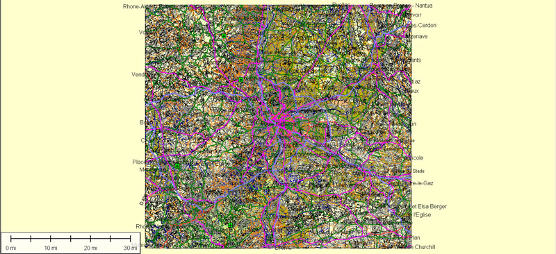
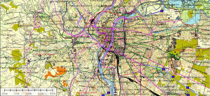
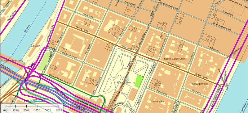
Cities and counties near or inside Lyon vectorial map, France
This vector map of Lyon includes maps of the nearest areas (see the preview):
Grange Rouge Viviani, Grand Clement, Gratte Ciel, 3RD Arr, Gerland, Port de Lyon Edouard Herriot, Saint-Fons, Ctre Chassagnon, Minguette Ouest, Minguette Est, Bron, Venissieux, Piere Benite, Saint-Irenee, Gorge De Loup, Vaise, La Duchere, Serin, St Clair, Caluire-et-Cuire, Grand Champ – Jean Perrin, Montessuy, Villeurbanne.
Purchasing and downloading of Illustrator Lyon (France) vector map
We accept PayPal and Credit Card payment. After the payment you will be redirected to the download page. We guarantee 100% satisfaction. Royalty Free license.
See more Printable and Editable vector street maps of France
For example: Paris vector street map, France
Nice France Printable Vector Street city plan
Lille France Printable Vector Street map
Marseille Printable vector street map


 Author: Kirill Shrayber, Ph.D. FRGS

 map, full editable, Adobe illustrator")