Extended Description of the Vector Map
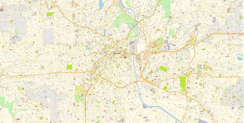
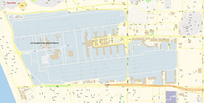
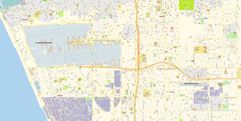
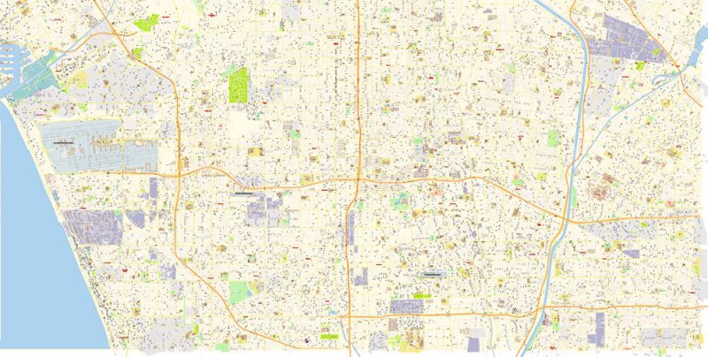
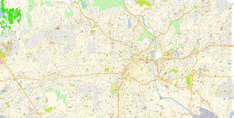
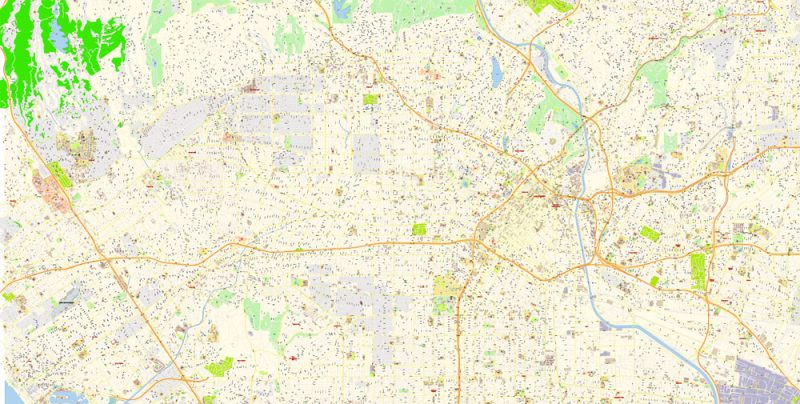
Printable Vector Map of Los Angeles City Center California US detailed City Plan scale 100 m 1:3894 full editable Adobe Illustrator Street Map in layers, scalable, text format all names, 22 MB ZIP
All street names, Main Objects, Buildings. Map for design, printing, arts, projects, presentations, for architects, designers, and builders, business, logistics.
Layers list:
- Legend
- Grids
- Labels of roads
- Names of places (city, hamlet, etc.)
- Names of objects (hospitals, schools, parks)
- Water objects (rivers, lakes)
- Names of streets
- Objects (icons)
- Arrows of streets
- Streets, roads, railroads, lines
- Buildings
- Color fills (parks, hospital areas, school areas, etc.)
- Islands
- Back and sea
The most exact and detailed map of the city in scale.
IF YOU NEED: We can add the layer areas and numbers zip (postal) codes. Free for you.
ALSO: DWG, DXF, CDR and other formats: free convert for our customers.
For Editing and High-Quality Printing
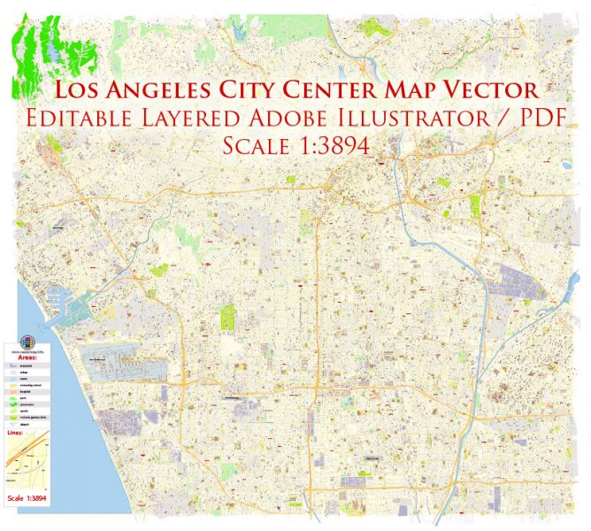
Los Angeles City Center California US Map Vector Exact City Plan High Detailed Street Map editable Adobe Illustrator in layers
Los Angeles
Los Angeles is a city in Southern California, the largest cultural center of the United States. The world capital of the show business industry.
In 1542, the ships San Salvador and La Victoria, led by Juan Rodriguez Cabrillo, entered San Diego Bay. Thus the world learned of this beautiful region, which in the time of the Spanish navigators was inhabited by the tongue and Chumash Indians. However, the first settlement was founded here only in 1781 and received the long name El Pueblo de Nuestra Señora la Reina de Los Ángeles Sobre El Río Porciúncula, which means in Spanish “the Village of the virgin Mary, Queen of Angels, on the river Porciuncula”. During the Mexican war, Los Angeles briefly belonged to Mexico, but in 1850 it became part of the United States by a Peace Treaty.
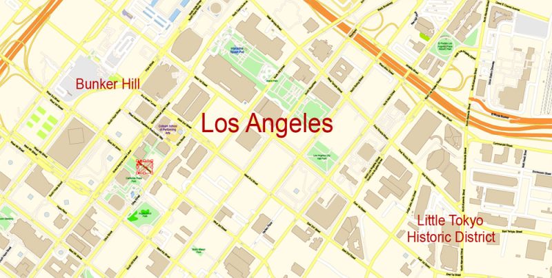
Los Angeles City Center California US Map Vector Exact City Plan High Detailed Street Map editable Adobe Illustrator in layers
In 1876, the Southern Pacific railroad was laid, which contributed to the prosperity of citrus cultivation and sale and the influx of population. In 1892, an oil field was discovered near Los Angeles. During the Second world war, the city hospitably received outstanding figures of science and art who fled from Nazi repression. Among them were Lyon Feuchtwanger, Thomas Mann, Fritz Lang, Berthold Brecht, and many others.
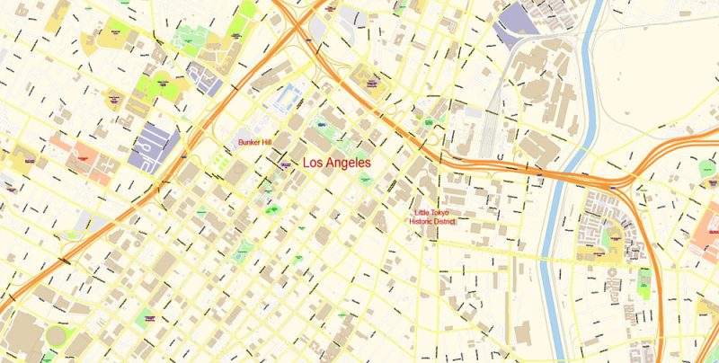
Los Angeles City Center California US Map Vector Exact City Plan High Detailed Street Map editable Adobe Illustrator in layers
Currently, Los Angeles has grown into a huge metropolis. The last time the authorities are trying to reconstruct some districts, with the aim to enhance they’re upscale, which generally improved the situation in the city.
Los Angeles City Center California US Map Vector Exact City Plan High Detailed Street Map editable Adobe Illustrator in layers
The most famous area of Los Angeles is Hollywood. From afar, you can see the huge Hollywood inscription on mount Lee. Behind it, tourists are waiting for the seething passions, mysterious and attractive world of the world film industry. On the Walk of Stars, you can walk on the pavement, dotted with stars with the names of the most famous celebrities, and on the Walk of Fame in the courtyard of the Grauman’s Chinese theater left handprints and footprints of Hollywood celebrities.
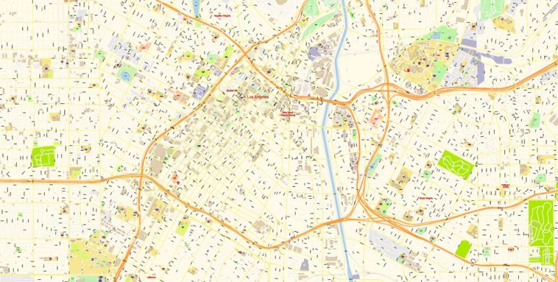
Los Angeles City Center California US Map Vector Exact City Plan High Detailed Street Map editable Adobe Illustrator in layers
Los Angeles is known for its cultural facilities. Among them is the Museum of Modern Art with its rich collection and the futuristic building of the Walt Disney Concert hall.
Los Angeles City Center California US Map Vector Exact City Plan High Detailed Street Map editable Adobe Illustrator in layers
The Los Angeles area has some of the best beaches in the world: Orange County’s beaches attract clear yellow sand and blue water, and Dockweiler state beach’s three-mile-long beaches are the least crowded of any in the County.
Los Angeles City Center California US Map Vector Exact City Plan High Detailed Street Map editable Adobe Illustrator in layers
Los Angeles City Center California US Map Vector Exact City Plan High Detailed Street Map editable Adobe Illustrator in layers
Los Angeles City Center California US Map Vector Exact City Plan High Detailed Street Map editable Adobe Illustrator in layers
Los Angeles City Center California US Map Vector Exact City Plan High Detailed Street Map editable Adobe Illustrator in layers


 Author: Kirill Shrayber, Ph.D. FRGS

