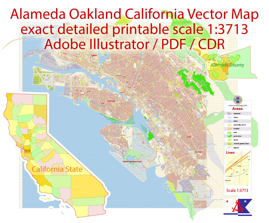
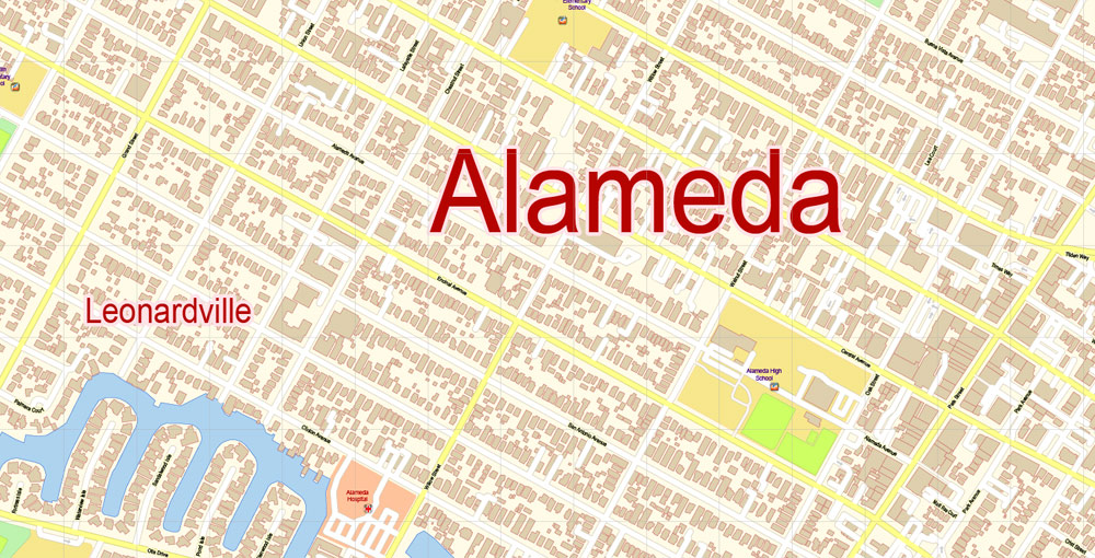
Printable PDF Vector Map Alameda Oakland California US extra detailed City Plan scale 1:3713 full editable Adobe PDF Street Map in layers with buildings, scalable, editable text format all names, 40 mb ZIP
All streets names, Main Objects, All Buildings. Map for design, printing, arts, projects, presentations, for architects, designers and builders, business, logistics.
Layers: color_fills, streets_roads, labels_roads, names_objects, names_streets, names_places, grids, halo 1-2, buildings, legend.
The most exact and detailed map of the city in scale.
For High Quality Printing
DWG, DXF and other formats – on request, same price, please, contact
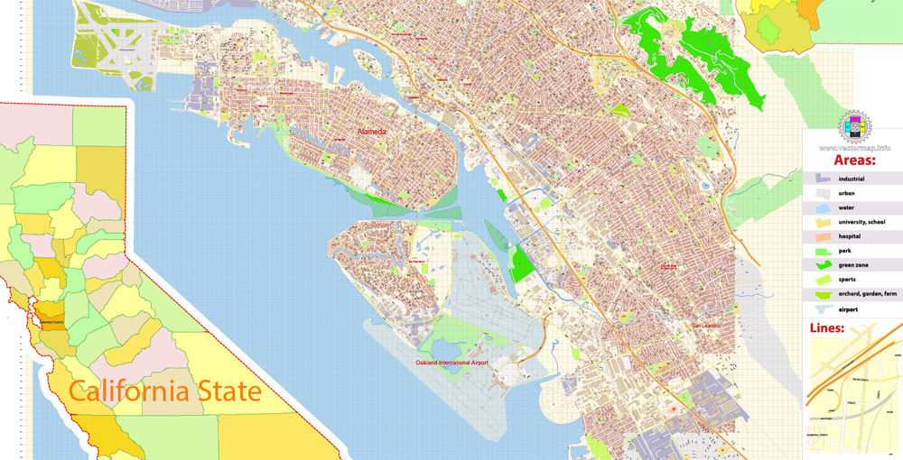
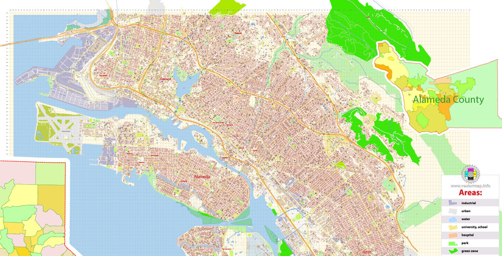
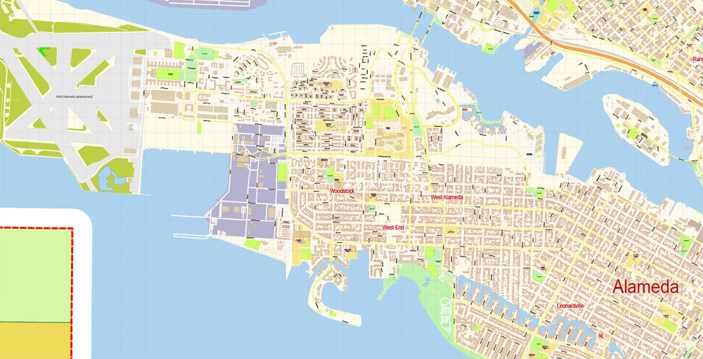
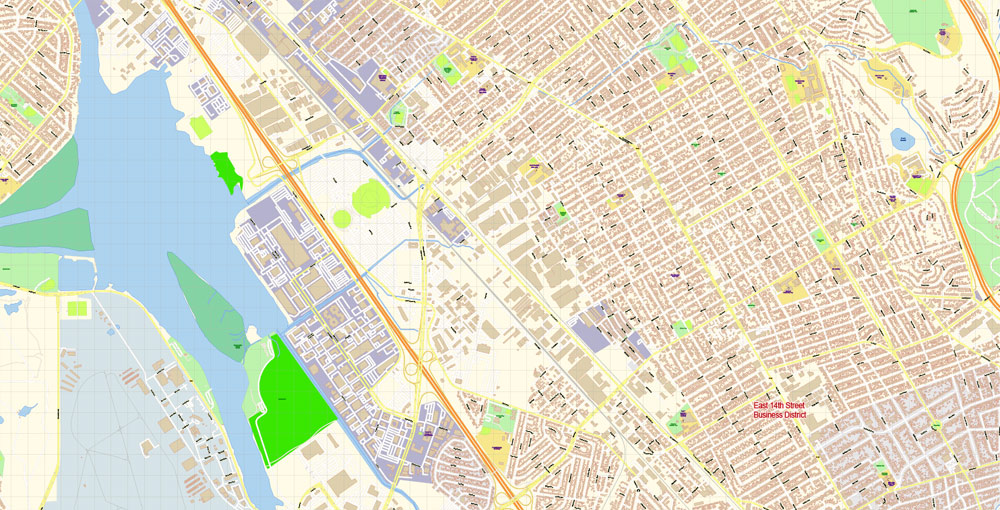
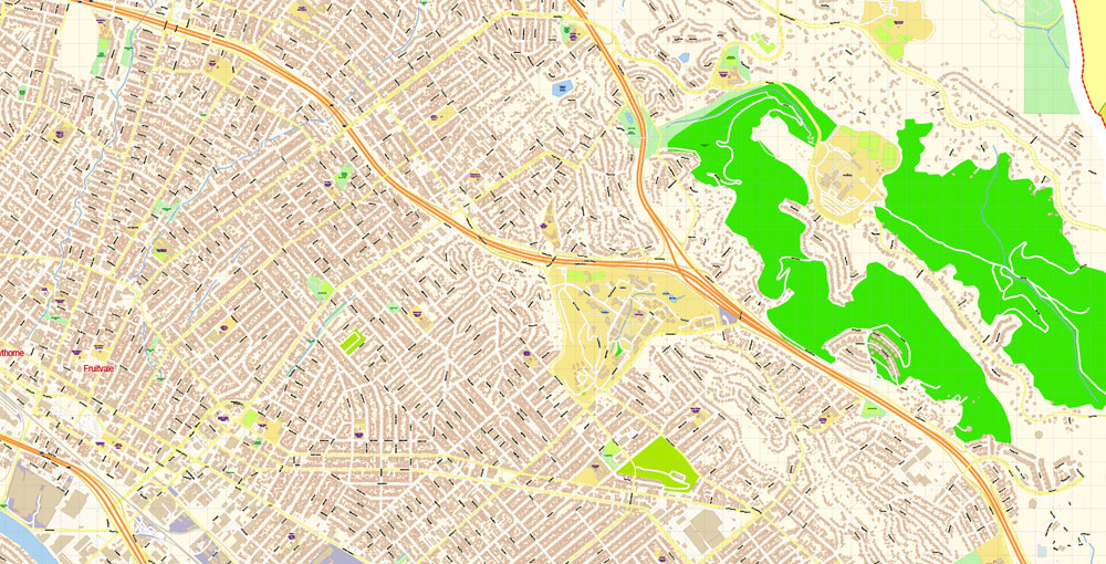
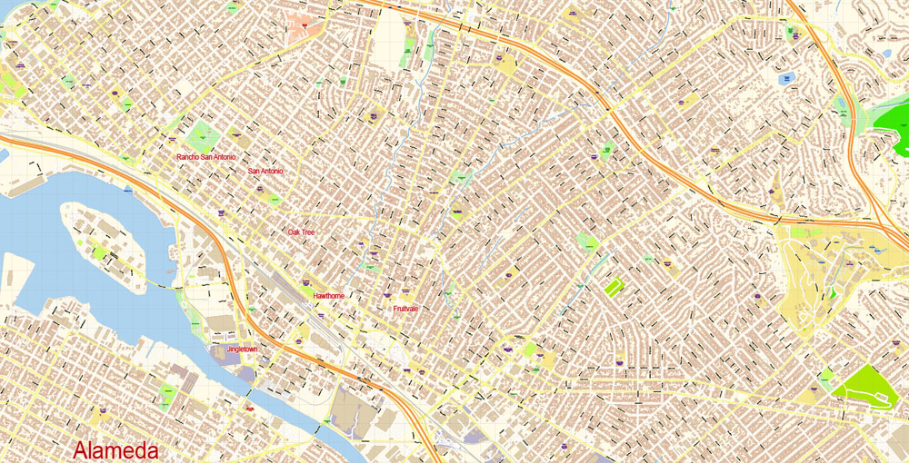
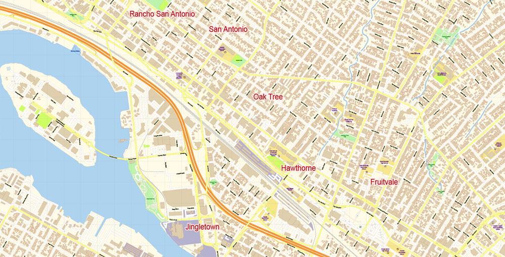
Alameda, Oakland, California, USA.
This vector map of Alameda city is used as a basis for design, editing, and further printing.
This is the most detailed, exact map of Alameda city for high-quality printing and polygraphy. You can always clarify the map development date by contacting us.
For your convenience, all objects on Alameda vector city map are divided into layers. And the editing is very easy – colors, lines, etc.
You can easily add any objects needed (e.g. shops, salons, sale points, gas station or attraction) on any layer of Alameda vector map.
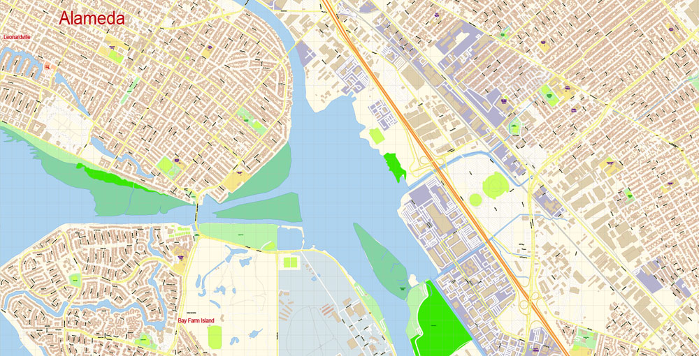
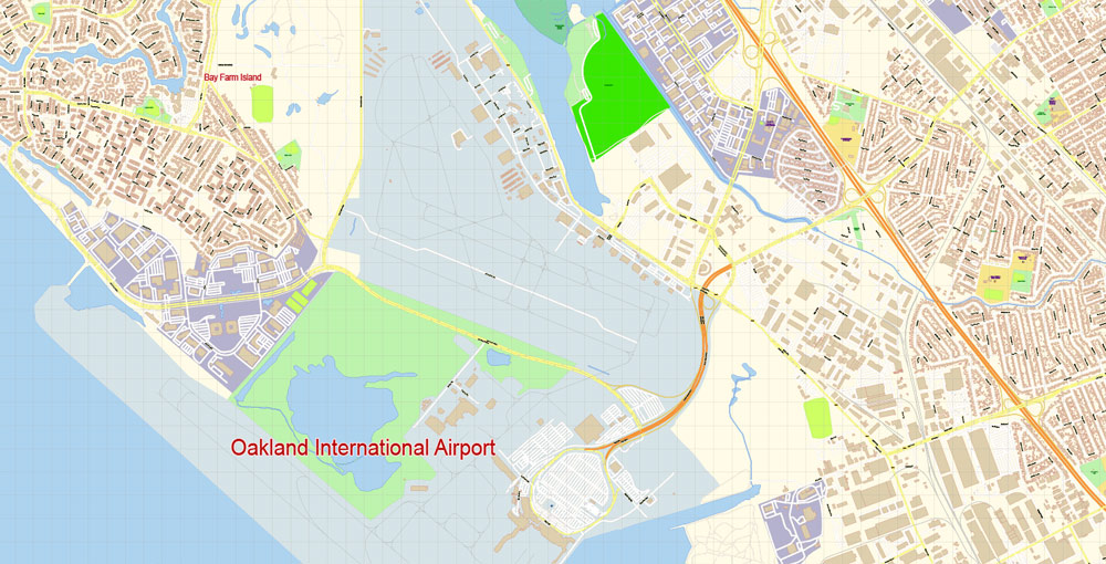
Alameda is a city in Alameda County, California, United States. It is located on Alameda Island and Bay Farm Island, and is adjacent to and south of Oakland and east of San Francisco across the San Francisco Bay.
One of the advantages of Alameda city vector maps of our production is the relevance of cartographic data, we constantly update all our products.
This vector map of Alameda city is used by:
designers, layout designers, printers, advertisers and architects. Our product – vector maps – is designed for further editing and printing in large formats – from @Wall format (a few meters) to A-0 and A-1, A-2, A-3.
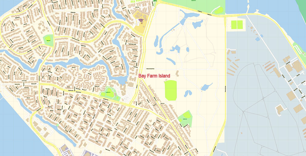
Bay Farm Island, a portion of which is also known as “Harbor Bay Isle”, is not actually an island, and is part of the mainland adjacent to the Oakland International Airport. The city’s estimated 2017 population was 79,928. Alameda is a charter city, rather than a general law city, allowing the city to provide for any form of government. Alameda became a charter city and adopted a council–manager government in 1916, which it retains to the present.
The Alameda city map in vector format is used for design, urban planning, presentations and media visualizations.
The advertising and presentation map of Alameda city (usually the final designer marks the routes, and puts the client’s objects (shops, saloons, gas stations etc.)
The undoubted advantage is that people will NEVER throw out this advertising product – the map. In fact, as an advertising medium, a city map is the most “long-playing” of the well-known polygraphic advertising media, with the longest lifespan, and the maximum number of interactions with the customer.
Map Area.
Geography
Aerial view of Alameda Island (center), with Oakland in the foreground and San Francisco behind
According to the United States Census Bureau, the city has a total area of 23.0 square miles (60 km2), of which 10.6 square miles (27 km2) is land and 12.3 square miles (32 km2) (53.79%) is water.
For travelers, maps are sold at the airports and gas stations around the world. Often the source is our vector maps.
Take a look, who purchases our vector maps of Alameda city in “Our Clients and Friends” page – these are large and small companies, from super-brands like Volvo and Starbucks, to small design studios and printing houses.
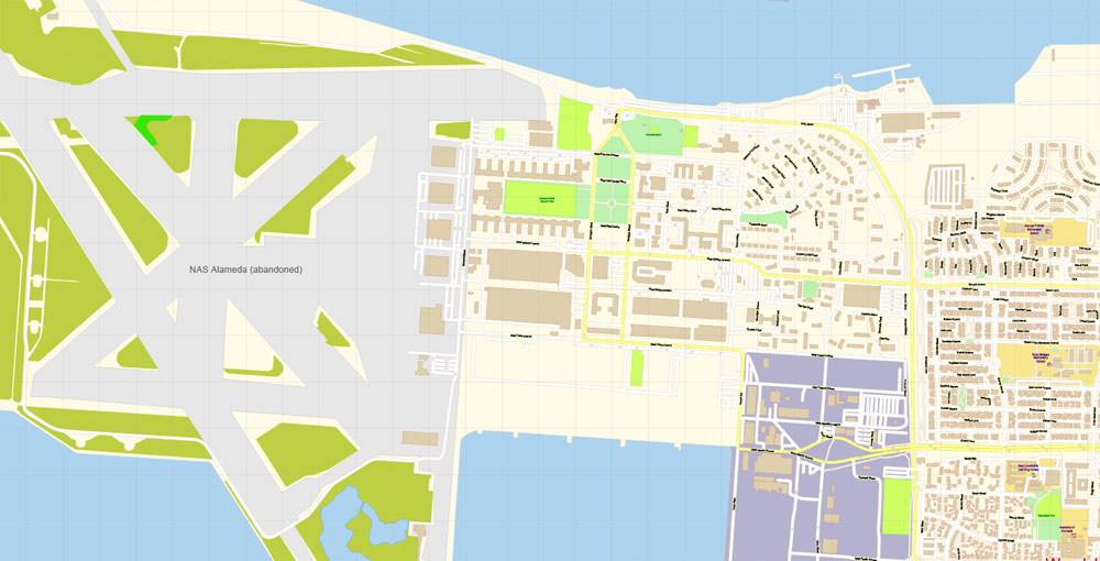
Although Alameda’s nickname is “The Island City” (or simply “the island”), the current city occupies two islands as well as a small section of the mainland. Today, the city consists of the main original section, with the former Naval Air Station Alameda (NAS Alameda) at the west end of Alameda Island, Southshore along the southern side of Alameda Island, and Bay Farm Island, which is part of the mainland proper.
It’s very easy to work with vector maps of Alameda city, even for a not very experienced designer who can turn on and off the map layers, add new objects, change the colors of fill and lines according to customer requirements.
The undoubted advantage of Alameda city vector maps in printing is an excellent and detailed visualization, when customer can expand a large paper map and instantly define his location, find a landmark, an object or address on map, unlike using the popular electronic formats of Google and Yandex maps for example.
Printable vector maps of Alameda city are much more convenient and efficient than any electronic maps on your smartphone, because ALL DETAILS are displayed in the entire space of Alameda city map.
Useful tips on working with vector maps of cities and countries in Adobe Illustrator.
«V» – launches the Selection tool (cursor, black arrow), which makes active any vector line.
«А» – launches the Direct Selection tool (white cursor), allows you to select curve elements and drag them to the desired place.
«R» – activates the Rotate tool, which helps you rotating selected objects around the center point by 360 degrees.
«E» – gives you the opportunity to use the Eraser tool and erase unnecessary parts.
«X» – switches between Fill and Stroke in the Tools section. Try to get used to this hot key and
you will quickly understand that you can’t live and work without it.
The area of the former NAS is now known as “Alameda Point.” The Southshore area is separated from the main part of Alameda Island by a lagoon; the north shore of the lagoon is located approximately where the original south shore of the island was. Alameda Point and Southshore are built on bay fill.
Guides are not limited to vertical and horizontal in Adobe Illustrator. You can also create a diagonal guide for example. Moreover, you can turn any contours into guides. Select the outline and go to View > Guides > Make Guides (Create Guides), or simply press Cmd/Ctrl + 5. You can also turn the guides back into an editable object. Go to menu, View > Guides > Unlock Guides (Release Guides), select the guide you want to edit and select View > Guides > Release Guides (Reset Guides), or just press Cmd/Ctrl + Option / Alt + 5).
Not all of Alameda Island is part of the City of Alameda. Although nearly all of the island is in Alameda city limits, a small portion of a dump site west of the former runways at Alameda Point extends far enough into San Francisco Bay that it is over the county line and part of the City and County of San Francisco.
You will probably want to change the color scheme used on our Alameda vector city map.
To quickly and effectively play with colors.
Of course, you can do it manually, all objects in our Alameda city vector map are divided according to types and layers, and you can easily change the color gamma of vector objects in groups and layers.
But there is more effective way of working with the whole VECTOR MAP of Alameda city and all layers:
The overview dialog «Edit colors»/«Repaint Graphic Object» (this dialog box name can change depending on the context):
If you have selected a part or a layer of Alameda city vector map and open the dialog box by clicking the icon in the Control panel, on the Samples palette or the Color Catalog, or if you choose Edit > Edit Colors> Repaint Graphic Object, then the «Repaint Graphic Object» dialog box appears, and you get access to «Assign» and «Edit» tabs.
Coast Guard Island, a small island between Alameda Island and Oakland, is also part of Alameda and is the home of Integrated Support Command Alameda
If a picture or a map fragment is not selected, and you open the dialog box by clicking the icon in the Control panel, on the Samples palette or in the Color Catalog, the «Edit Colors» dialog box appears and you can only access the «Edit» tab.
Regardless of the name at the top of the dialog box, the right-hand side always displays the color group of the current document, as well as two default color groups: Print Color and Grayscale. These color groups can be selected and used any time.
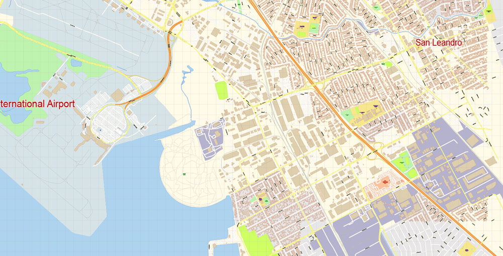
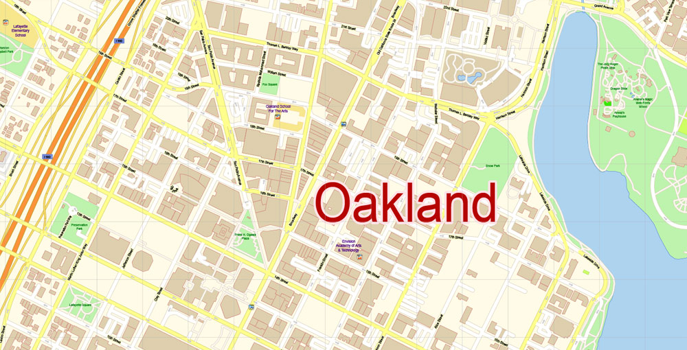
Oakland is the largest city and the county seat of Alameda County, California, United States. A major West Coast port city, Oakland is the largest city in the East Bay region of the San Francisco Bay Area, the third largest city overall in the San Francisco Bay Area, the eighth most populated city in California, and the 45th largest city in the United States.
Create and edit color groups of Alameda city vector map, and also assign colors using the «Edit Colors»/ а «Repaint Graphic Object» dialog box.
A. Creating and editing of a color group on the «Edit» tab
B. Assigning colors on the «Assign» tab
C. Select a group of colors from the «Color groups» list
The option «Repaint a graphic object» in the lower part of the dialog box allows you to preview the colors on a selected layer of Vector map, or a group of elements, and specify whether its colors will be redefined when the dialog box is closed.
With a population of 412,040 as of 2016, it serves as a trade center for the San Francisco Bay Area; its Port of Oakland is the busiest port in the San Francisco Bay, the entirety of Northern California, and the fifth busiest in the United States of America. An act to incorporate the city was passed on May 4, 1852, and incorporation was later approved on March 25, 1854, which officially made Oakland a city. Oakland is a charter city.
The main areas of the dialog box are:
«Edit»
The «Edit» tab is designed to create a new or edit the existing color groups.
The harmony rules Menu and the Color Wheel are used to conduct experiments with color harmonies. The color wheel shows how colors are related in color harmony, and the color bars allow you to view and manipulate an individual color values. In addition, you can adjust the brightness, add and remove colors, save color groups and view colors on the selected Vector Map of Alameda city or a separated layers.
Oakland’s territory covers what was once a mosaic of California coastal terrace prairie, oak woodland, and north coastal scrub. Its land served as a rich resource when its hillside oak and redwood timber were logged to build San Francisco. Oakland’s fertile flatland soils helped it become a prolific agricultural region.
«Assign»
The «Assign» tab is used to view and control on how the original colors are replaced with colors from the color group like your corporate colors in the Vector Map of Alameda city.
The assign color ability is provided only if the entire map, layer or fragment is selected in the document. You can specify which of new colors replace the current colors, whether the spot colors should be preserved and how colors are replaced (for example, you can replace colors completely or changing the color tone while maintaining the brightness). The «Assign» tab allows you to redefine colors in the Vector Map of Alameda city, or in separate layers and fragments using the current color group or reducing the number of colors in the current Vector Map.
In the late 1860s, Oakland was selected as the western terminal of the Transcontinental Railroad. Following the 1906 San Francisco earthquake, many San Francisco citizens moved to Oakland, enlarging the city’s population, increasing its housing stock and improving its infrastructure. It continued to grow in the 20th century with its busy port, shipyards, and a thriving automobile manufacturing industry.

Saving a color group adds this group to the specified list.
Opening the «Edit Colors»/«Repaint Graphic Object» dialog box.
Open the «Edit Colors»/«Repaint Graphic Object» dialog box using one of the following methods:
«Edit»> «Edit Colors»> «Repaint Graphic object» or «Repaint With Style».
Use these commands if you need to edit the colors in the selected vector map of Alameda city.
Geography
Oakland is in the eastern region of the San Francisco Bay. In 1991 the City Hall tower was at 37.805302°N 122.272539°W (NAD83). (The building still exists, but like the rest of the Bay Area, it has shifted northwest perhaps 0.6 meters in the last twenty years.)
«Repaint Graphic object» button on the «Control» panel.
Use this button if you need to adjust colors of Alameda city vector map using the а «Repaint graphic object» dialog box.
The specified button is available if the selected vector map or its fragment contains two or more colors.
Note. This color editing method is convenient for global color adjustment in a vector map, if global colors were not used when creating a City Map of Alameda.
The United States Census Bureau says the city’s total area is 78.0 square miles (202 km2), including 55.8 square miles (145 km2) of land and 22.2 square miles (57 km2) (28.48 percent) of water.
Oakland’s highest point is near Grizzly Peak Blvd, east of Berkeley, just over 1,760 feet (540 m) above sea level at about 37.8786°N 122.2241°W. Oakland has 19 miles (31 km) of shoreline, but Radio Beach is the only beach in Oakland.

The «Edit colors» button or «Edit or apply colors» on the «Color Catalog» palette
Click this button if you need to edit colors on the «Color Catalog» palette or edit and then apply them to the selected Vector Map of Alameda city or its fragment.
The «Edit color group» button or «Edit or apply color group» on the «Samples» palette.
Click this button if you need to edit the colors in the specific color group or edit and apply them to the selected Vector Map of Alameda city or a group of its elements, for example, the whole layer “Streets and lines”. You can also double-click the color group in the Samples panel to open the dialog box.
Oaklanders refer to their city’s terrain as “the flatlands” and “the hills”. Until recent waves of gentrification, these terms also symbolized Oakland’s deep economic divide, with “the hills” being more affluent communities. About two-thirds of Oakland lies in the flat plain of the East Bay, with one-third rising into the foothills and hills of the East Bay range.
If the map file is too large and your computer freezes or even can’t open it quickly:
1. Try to reduce the color resolution of the video card (display) to 256 colors while working with a large map.
2. Using Windows Task Manager, select all the application you don’t need, while working with map, just turn them off.
3. Launch Adobe Illustrator. (DO NOT OPEN the vector map file)
4. Start the Windows Task Manager using administrator rights > Find the “Illustrator” process > set the «real time» priority,
5. Open the file. When you see the LEGACY FONT popup window – click “OK” (do not update). You can restore the TEXT later.
6. Can also be useful: When file is opened – Edit > Settings > Basic Settings > disable smoothing. /// It looks scary, but works quickly)))
We recommend saving the file in Adobe Illustrator 10 version. It’s much more stable when working with VERY BIG size files.
Ruptures along the nearby San Andreas Fault caused severe earth movement in the San Francisco Bay Area in 1906 and 1989. San Andreas quakes induces creep (movement occurring on earthquake faults) in the Hayward fault, which runs directly through Oakland, Berkeley, San Jose and other Bay Area cities.
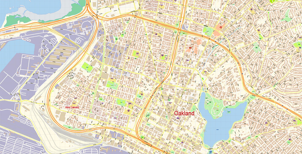
Neighborhoods
Oakland has more than 50 distinct neighborhoods. The city’s greater divisions include downtown Oakland and its greater Central Business District, Lake Merritt, East Oakland, North Oakland, West Oakland, and the Oakland Hills. East Oakland, which includes the East Oakland Hills, encompasses more than half of Oakland’s land area, stretching from Lakeshore Avenue on the east shore of Lake Merritt southeast to the San Leandro border. North Oakland encompasses the neighborhoods between downtown and Berkeley and Emeryville. West Oakland is the area between downtown and the Bay, partially surrounded by the Oakland Point, and encompassing the Port of Oakland. In 2011, Oakland was ranked the 10th most walkable city in the United States.
Lake Merritt, an urban estuary near downtown, is a mix of fresh and salt water draining in and out from the Oakland Harbor at the San Francisco Bay and one of Oakland’s most notable features. It was designated the United States’ first official wildlife refuge in 1870.
Originally a marsh-lined wildlife haven, Lake Merritt was dredged and bordered with parks from the 1890s to the 1910s. Despite this reduction in habitat, Oakland is home to a number of rare and endangered species, many of which are localized to serpentine soils and bedrock. Lake Merritt is surrounded by residential and business districts, including downtown and Grand Lake.
Alameda
City in California
Alameda is a city in Alameda County, California (see other California Cities Maps), United States. It is located on Alameda Island and Bay Farm Island, and is adjacent to and south of Oakland and east of San Francisco across the San Francisco Bay.
Area
• Total 23.10 sq mi (59.82 km2)
• Land 10.44 sq mi (27.05 km2)
• Water 12.66 sq mi (32.78 km2) 53.79%
Elevation 33 ft (10 m)
Population
• Total 73,812
• Estimate 78,906
• Density 7,556.60/sq mi (2,917.53/km2)
Oakland
City in California
Oakland is a city on the east side of San Francisco Bay, in California (see other California Cities Maps). Jack London Square has a statue of the writer, who frequented the area. Nearby, Old Oakland features restored Victorian architecture and boutiques. Near Chinatown, the Oakland Museum of California covers state history, nature and art. Uptown contains the art deco Fox and Paramount theaters, restaurants, bars and galleries.
Area
• Total 77.86 sq mi (201.66 km2)
• Land 55.89 sq mi (144.76 km2)
• Water 21.97 sq mi (56.90 km2) 28.48%
Elevation 43 ft (13 m)
Population
• Total 390,724
• Estimate 412,040
• Rank 1st in Alameda County
8th in California
45th in the United States
• Density 7,514.45/sq mi (2,901.34/km2)
Free US vector maps

Free Download Vector Map US County and State Adobe Illustrator
Free_Vector_Map_US_States_County_Map.ai
Free Download Vector Map US County and State Adobe PDF
Free_Vector_Map_US_States_County_Map.pdf

Free Download Vector Map US With States Names, Adobe Illustrator
Free_Map_of_USA_with_state_names_en.ai
Free Download Vector Map US With States Names, Adobe PDF
Free_Map_of_USA_with_state_names_en.pdf
From WIKI
Free vector map World, Adobe Illustrator, download now maps vector clipart
Map for design, projects, presentation free to use as you like.
See also: TERMS & CONDITIONS: SOFTWARE LICENSE AGREEMENT FOR DIGITAL CARTOGRAPHIC DATA.
Need more USA Vector Maps, printable and editable?

 Author: Kirill Shrayber, Ph.D. FRGS


