Extended Description of the Vector Map
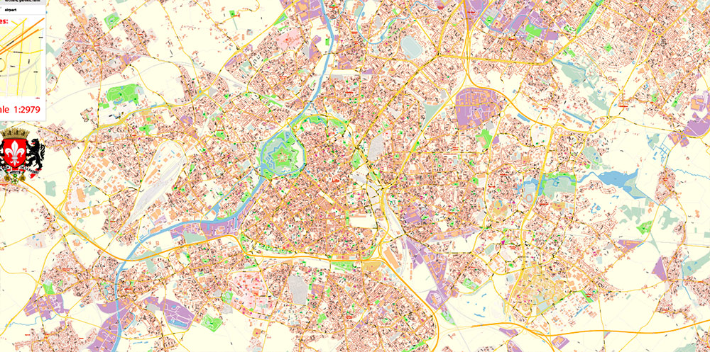
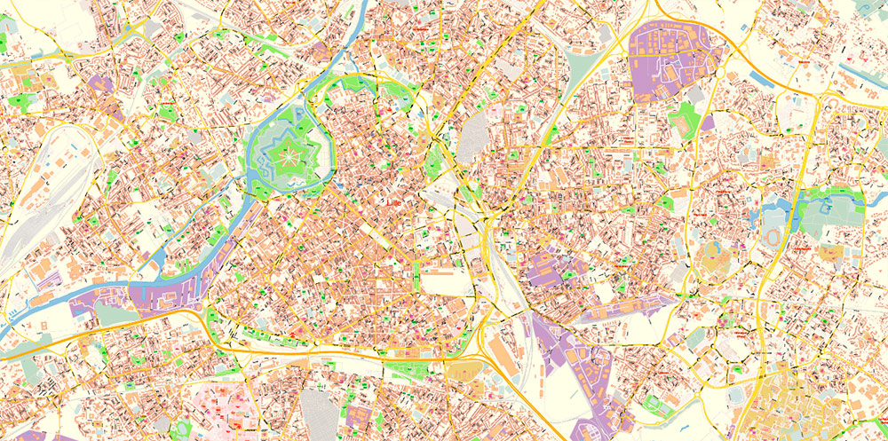
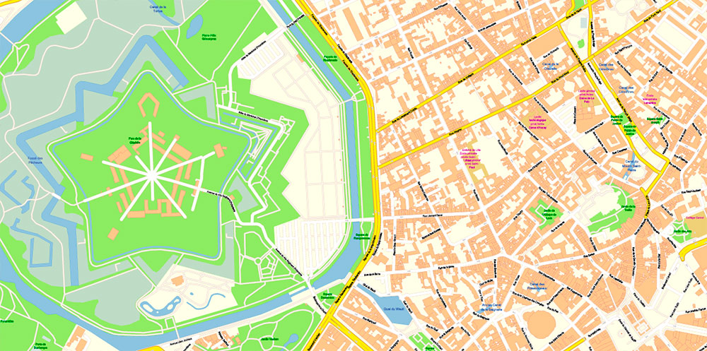
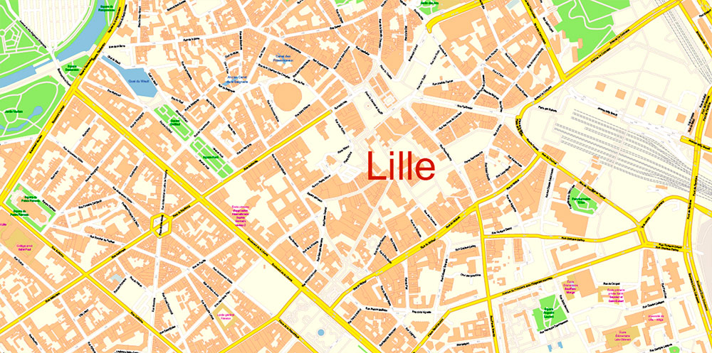
Printable Vector Map of Lille France detailed City Plan scale 1:2979 full editable Adobe Illustrator Street Map in layers, scalable, text format all names, 42 MB ZIP
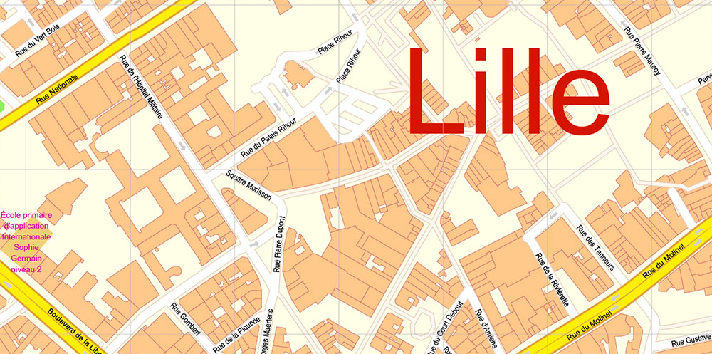
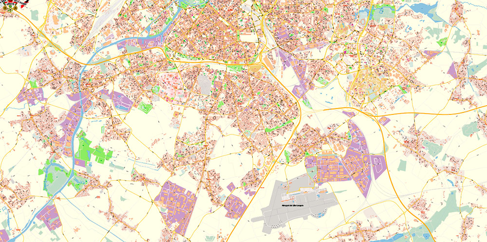
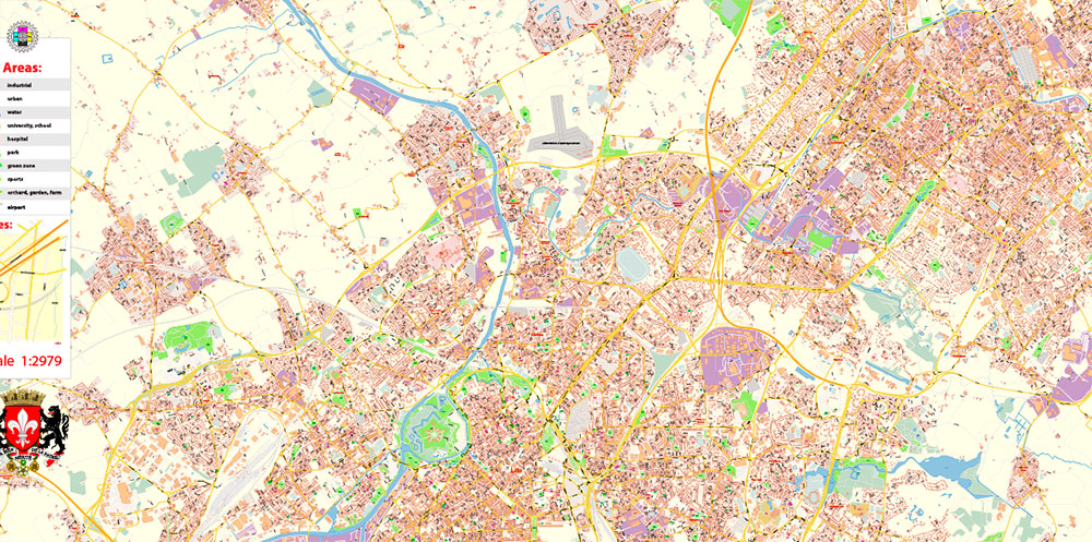
All street names, Main Objects, Buildings. Map for design, printing, arts, projects, presentations, for architects, designers, and builders, business, logistics.
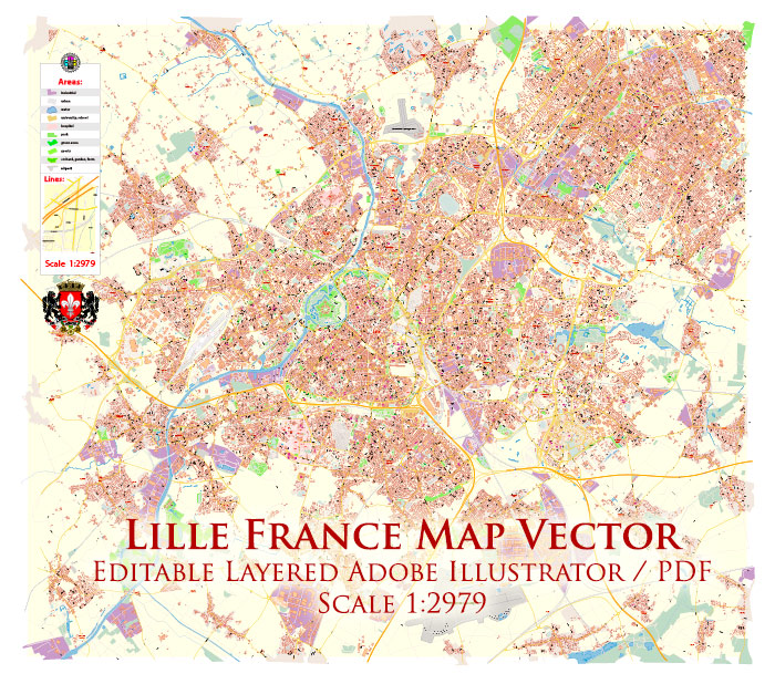
Lille France Map Vector Exact City Plan High Detailed Street Map editable Adobe Illustrator in layers
Layers list:
- Legend
- Grids
- Labels of roads
- Names of places (city, hamlet, etc.)
- Names of objects (hospitals, schools, parks, water)
- Names of main streets
- Names of civil streets
- Arrows of streets
- Main Streets, roads, railroads, lines
- Civil streets
- Railroads
- Buildings
- Airports and heliports
- Water objects (rivers, lakes, ponds)
- Waterways
- Color fills (parks, hospital areas, school areas, land use, etc.)
- Background
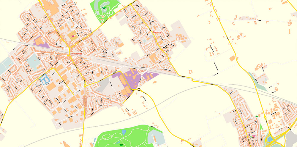
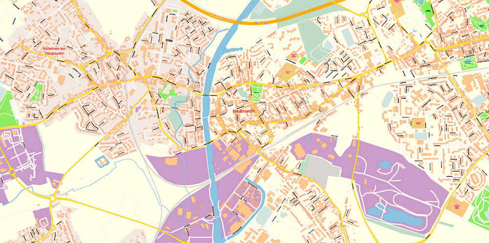
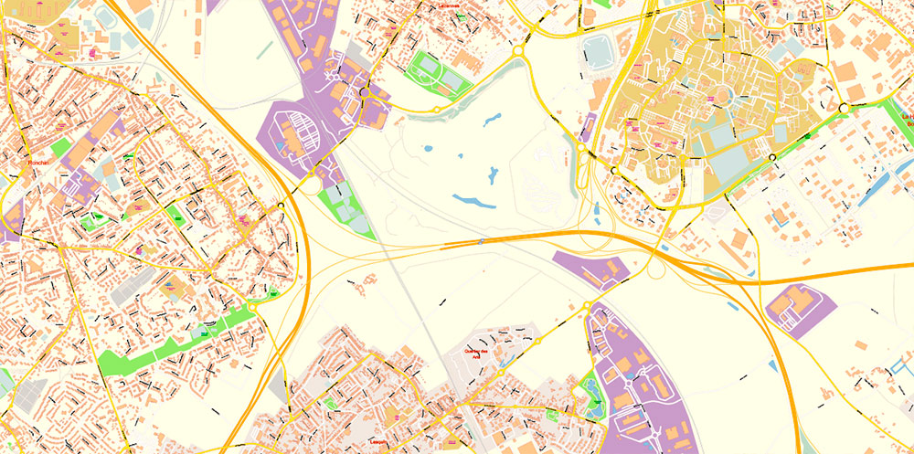
Lille France Map Vector Exact City Plan High Detailed Street Map editable Adobe Illustrator in layers
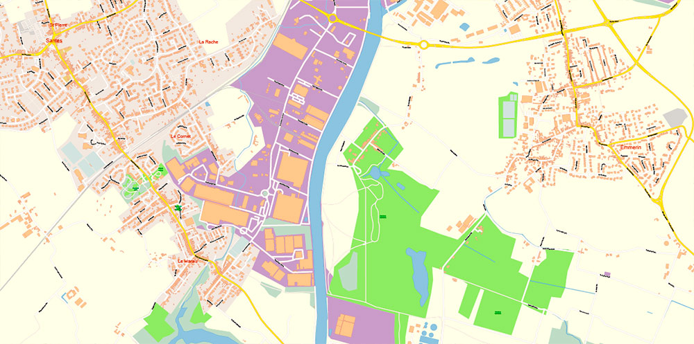
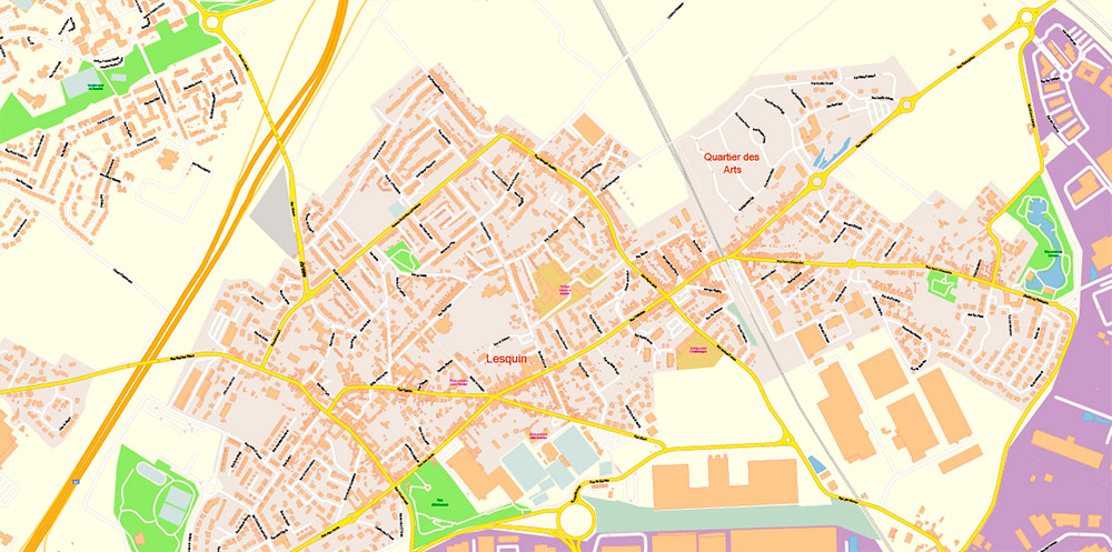
Lille France Map Vector Exact City Plan High Detailed Street Map editable Adobe Illustrator in layers
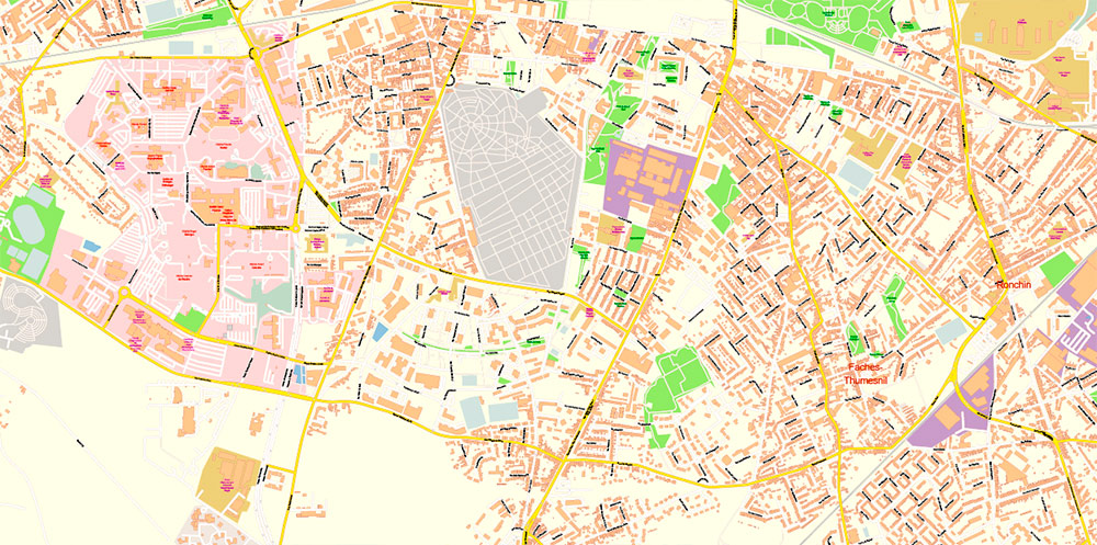
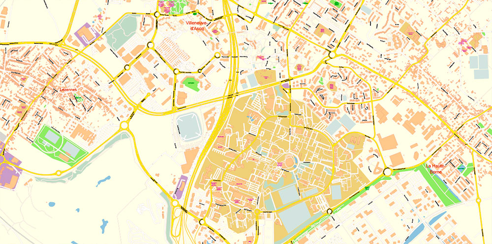
Lille France Map Vector Exact City Plan High Detailed Street Map editable Adobe Illustrator in layers
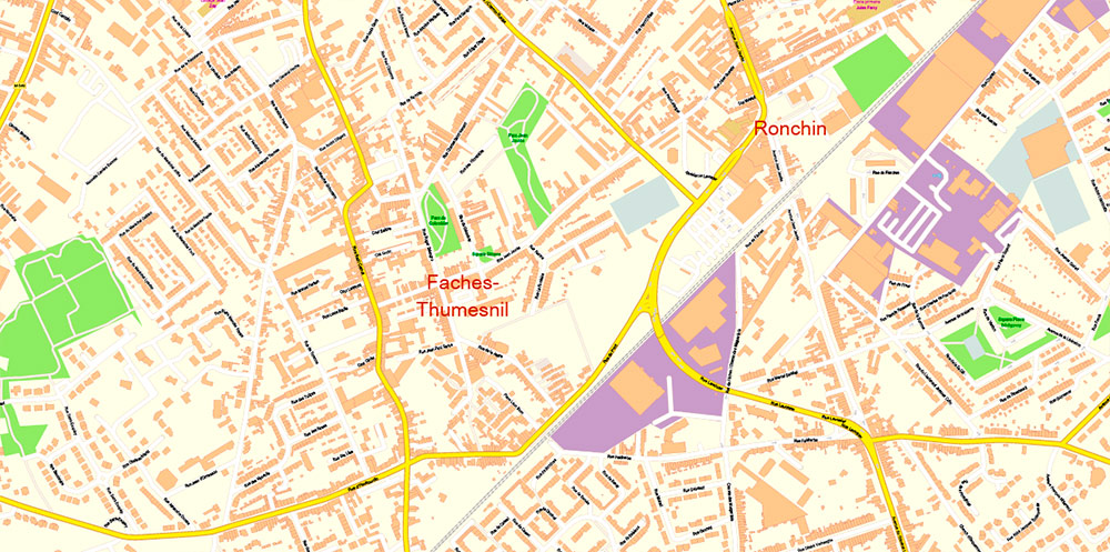
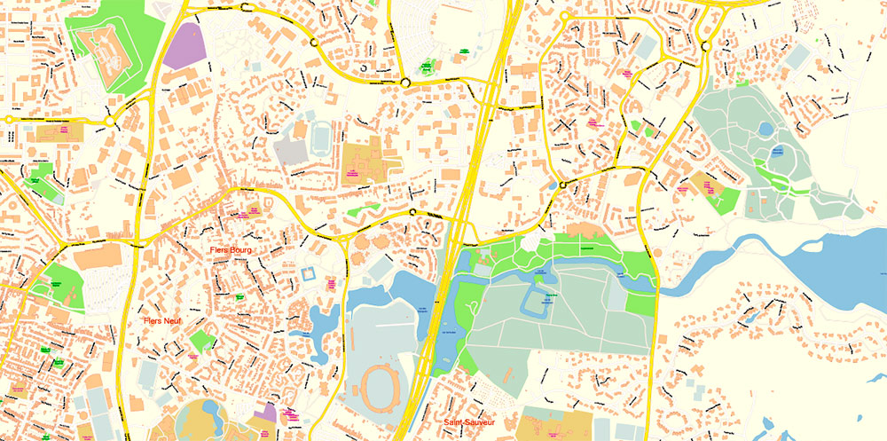
Lille France Map Vector Exact City Plan High Detailed Street Map editable Adobe Illustrator in layers
Lille France Map Vector Exact City Plan High Detailed Street Map editable Adobe Illustrator in layers
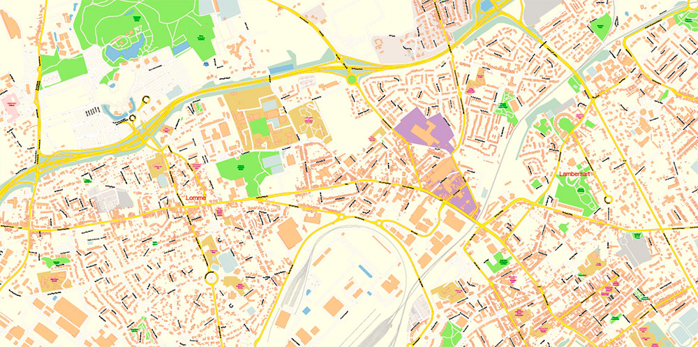
Lille France Map Vector Exact City Plan High Detailed Street Map editable Adobe Illustrator in layers

Lille France Map Vector Exact City Plan High Detailed Street Map editable Adobe Illustrator in layers
Lille France Map Vector Exact City Plan High Detailed Street Map editable Adobe Illustrator in layers
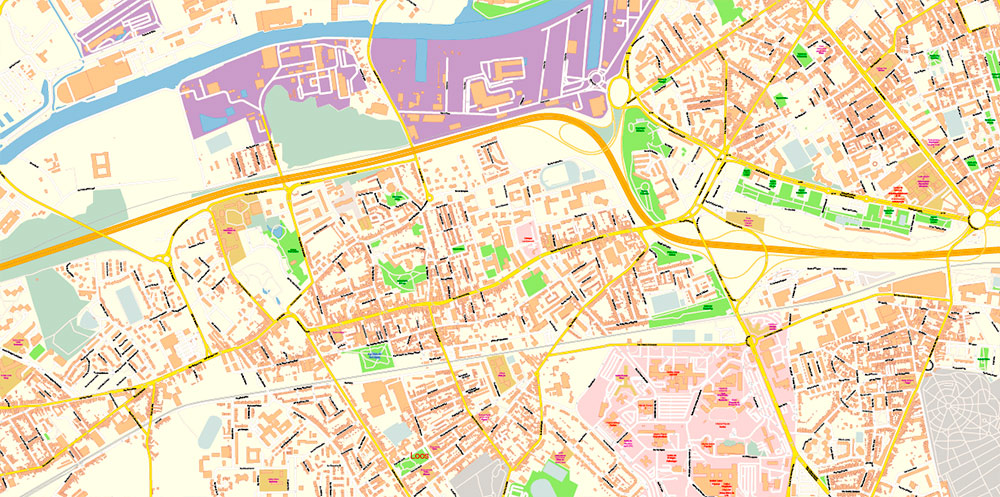
Lille France Map Vector Exact City Plan High Detailed Street Map editable Adobe Illustrator in layers
Lille France Map Vector Exact City Plan High Detailed Street Map editable Adobe Illustrator in layers
Lille France Map Vector Exact City Plan High Detailed Street Map editable Adobe Illustrator in layers
Lille France Map Vector Exact City Plan High Detailed Street Map editable Adobe Illustrator in layers
Lille France Map Vector Exact City Plan High Detailed Street Map editable Adobe Illustrator in layers
Lille France Map Vector Exact City Plan High Detailed Street Map editable Adobe Illustrator in layers
Lille France Map Vector Exact City Plan High Detailed Street Map editable Adobe Illustrator in layers
Lille France Map Vector Exact City Plan High Detailed Street Map editable Adobe Illustrator in layers
Lille France Map Vector Exact City Plan High Detailed Street Map editable Adobe Illustrator in layers

Lille France Map Vector Exact City Plan High Detailed Street Map editable Adobe Illustrator in layers
Lille France Map Vector Exact City Plan High Detailed Street Map editable Adobe Illustrator in layers
Lille France Map Vector Exact City Plan High Detailed Street Map editable Adobe Illustrator in layers

 Author: Kirill Shrayber, Ph.D. FRGS


 map, fully editable, Adobe Illustrator")