Extended Description of the Vector Map
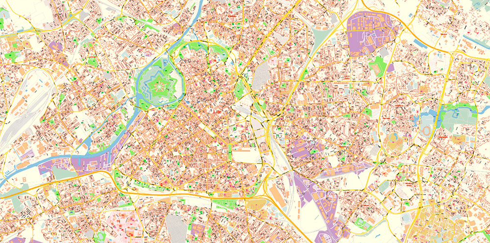
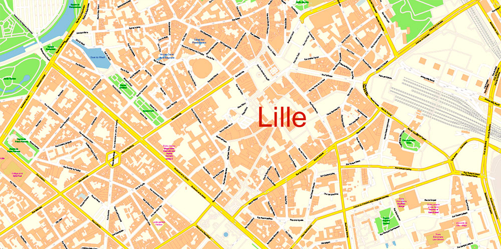
Printable PDF Vector Map of Lille France detailed City Plan scale 1:2979 full editable Adobe PDF Street Map in layers, scalable, text format all names, 102 MB ZIP
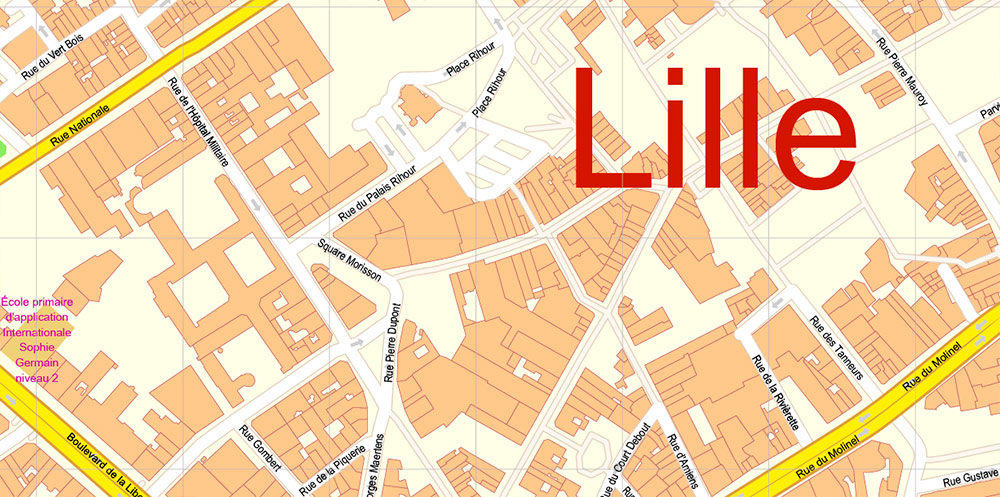
All street names, Main Objects, Buildings. Map for design, printing, arts, projects, presentations, for architects, designers, and builders, business, logistics.
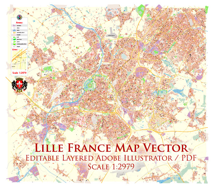
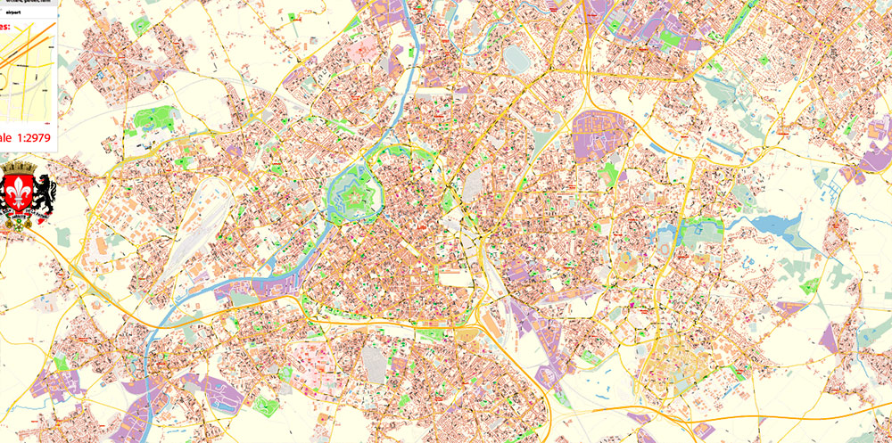
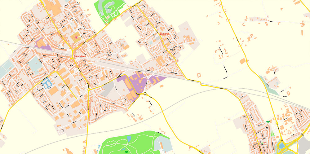
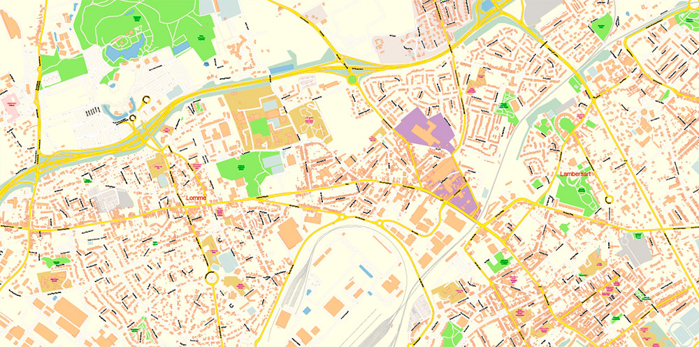
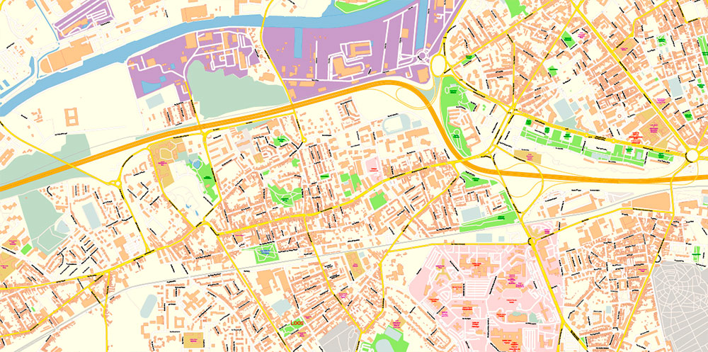
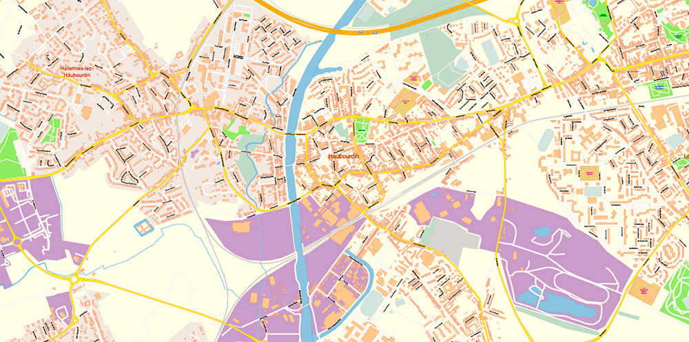
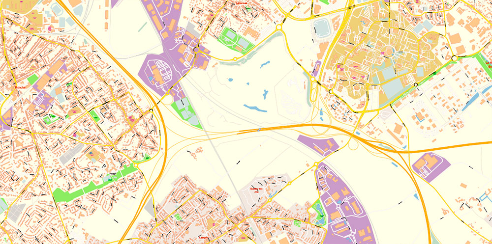
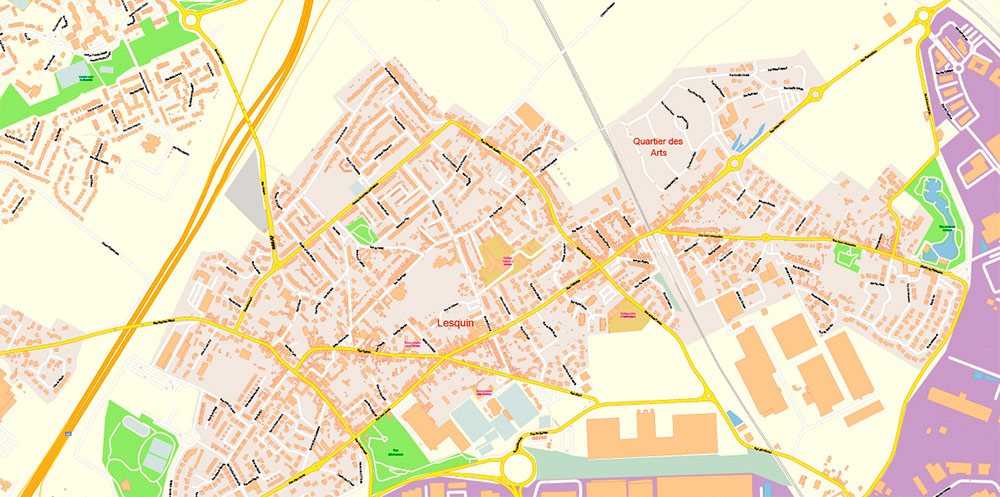
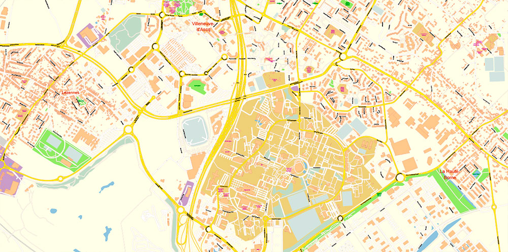
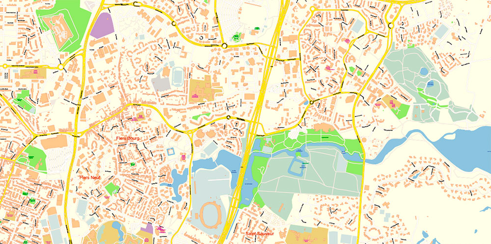
Lille France PDF Map Vector Exact City Plan High Detailed Street Map editable Adobe PDF in layers
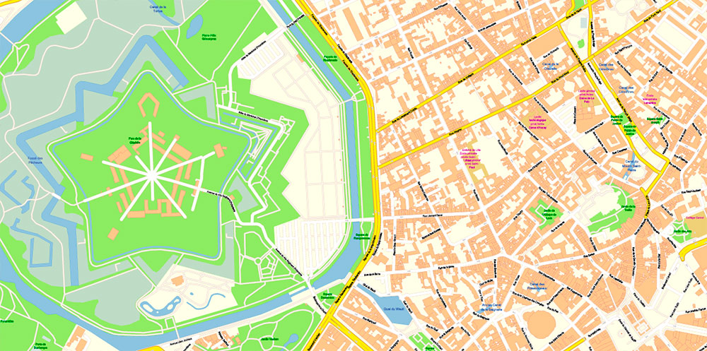
Layers list:
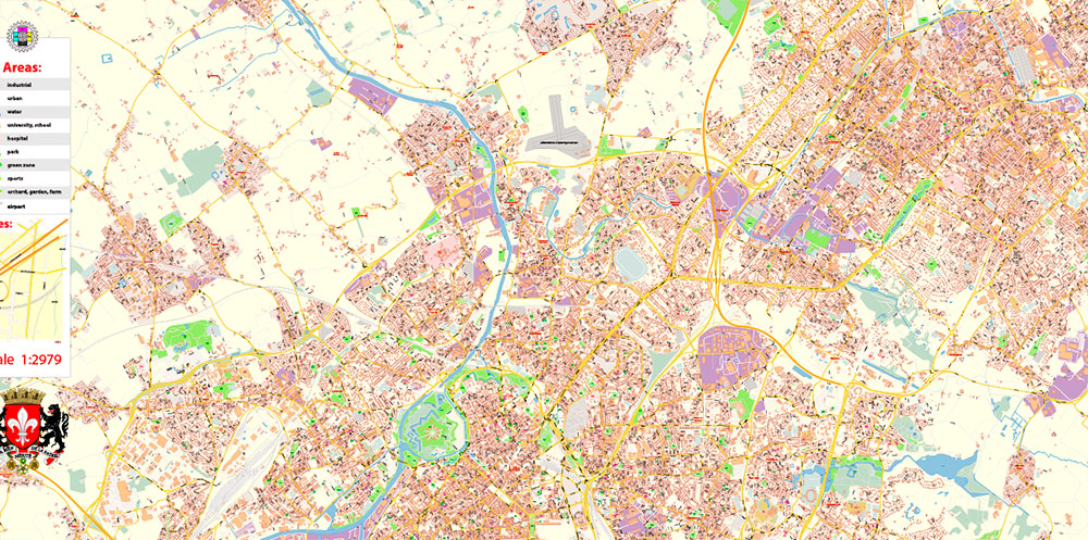
- Legend
- Grids
- Labels of roads
- Names of places (city, hamlet, etc.)
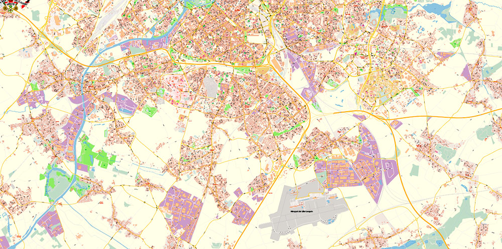
- Names of objects (hospitals, schools, parks, water)
- Names of main streets
- Names of civil streets
- Arrows of streets
- Main Streets, roads, railroads, lines
- Civil streets
- Railroads
- Buildings
- Airports and heliports
- Water objects (rivers, lakes, ponds)
- Waterways
- Color fills (parks, hospital areas, school areas, land use, etc.)
- Background
The history of the French city of Lille begins in 1054 when it was first mentioned in historical chronicles. Local legends relate the Foundation of the city to more ancient times, but this is not confirmed archaeologically. At that time, it was a feudal castle, around which a small settlement of artisans and merchants, as well as a market, gradually began to form. It was a very well-fortified castle that managed to withstand the siege of the troops of Emperor Henry III. Since the castle was located in Flanders, known for its cloth industry, it became rapidly rich. This was due to the growing popularity of local fairs, the location of the city on important trade routes, as well as the richness of the soil, which gave a great harvest. Later, the weaving and cloth industry will make Lille one of the richest cities in Flanders and all of France. But the development of the city was repeatedly interrupted by numerous wars, during which Lille was repeatedly captured, burned, and ravaged. It was especially difficult during the Hundred-years ‘ War when Lille was ravaged by the French, English, and Flemings in turn. In the future, the city was part of the Spanish Habsburg Empire, and only in the XVII century, it finally fell to France. It is interesting that for some time the commandant of Lille was Charles de Batz de Castelmore d’Artagnan, one of the prototypes of the hero of the novel Dumas.
Despite all the hardships and problems, the people of Lille never stopped weaving and cloth-making, which always brought a good income. In the 19th century, after the beginning of the continental blockade of England, this served as a surge for Lille. A little later, the city became the most important industrial center in France. In addition to traditional textile production, mechanical engineering, metallurgy, and the chemical industry developed. Since the city is close to the border, it was badly damaged during the First World war.
The city has many attractions. Many ancient temples and churches delight tourists with their variety of architectural forms and solutions. Preserved Noble tower, according to legend, built during the hundred Years ‘ war to protect the city. There are several gates and a citadel. The building of the Old Exchange impresses with its beauty. In addition, the building of the Opera and the Prefecture attracts attention.
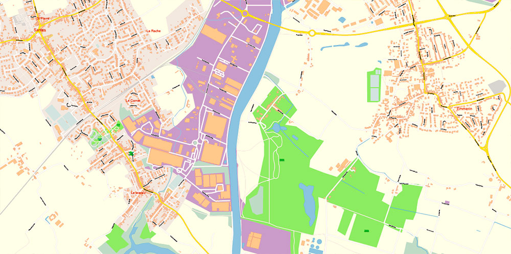
Lille France PDF Map Vector Exact City Plan High Detailed Street Map editable Adobe PDF in layers
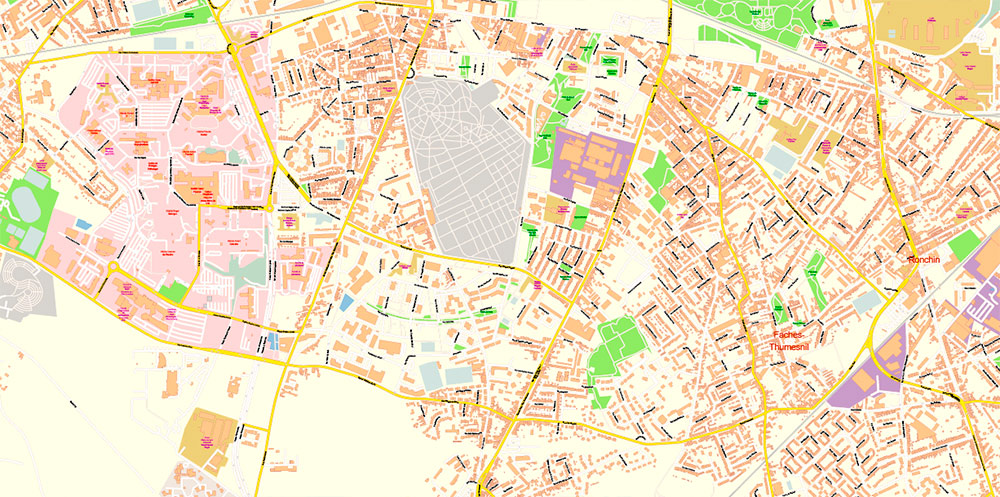
Lille France PDF Map Vector Exact City Plan High Detailed Street Map editable Adobe PDF in layers
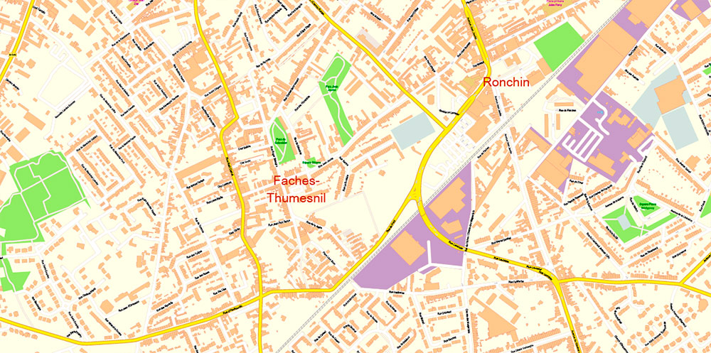
Lille France PDF Map Vector Exact City Plan High Detailed Street Map editable Adobe PDF in layers
Lille France PDF Map Vector Exact City Plan High Detailed Street Map editable Adobe PDF in layers
Lille France PDF Map Vector Exact City Plan High Detailed Street Map editable Adobe PDF in layers
Lille France PDF Map Vector Exact City Plan High Detailed Street Map editable Adobe PDF in layers

Lille France PDF Map Vector Exact City Plan High Detailed Street Map editable Adobe PDF in layers
Lille France PDF Map Vector Exact City Plan High Detailed Street Map editable Adobe PDF in layers
Lille France PDF Map Vector Exact City Plan High Detailed Street Map editable Adobe PDF in layers
Lille France PDF Map Vector Exact City Plan High Detailed Street Map editable Adobe PDF in layers
Lille France PDF Map Vector Exact City Plan High Detailed Street Map editable Adobe PDF in layers
Lille France PDF Map Vector Exact City Plan High Detailed Street Map editable Adobe PDF in layers
Lille France PDF Map Vector Exact City Plan High Detailed Street Map editable Adobe PDF in layers
Lille France PDF Map Vector Exact City Plan High Detailed Street Map editable Adobe PDF in layers
Lille France PDF Map Vector Exact City Plan High Detailed Street Map editable Adobe PDF in layers
Lille France PDF Map Vector Exact City Plan High Detailed Street Map editable Adobe PDF in layers
Lille France PDF Map Vector Exact City Plan High Detailed Street Map editable Adobe PDF in layers

Lille France PDF Map Vector Exact City Plan High Detailed Street Map editable Adobe PDF in layers
Lille France PDF Map Vector Exact City Plan High Detailed Street Map editable Adobe PDF in layers
Lille France PDF Map Vector Exact City Plan High Detailed Street Map editable Adobe PDF in layers

 Author: Kirill Shrayber, Ph.D. FRGS


 map, fully editable, Adobe Illustrator")