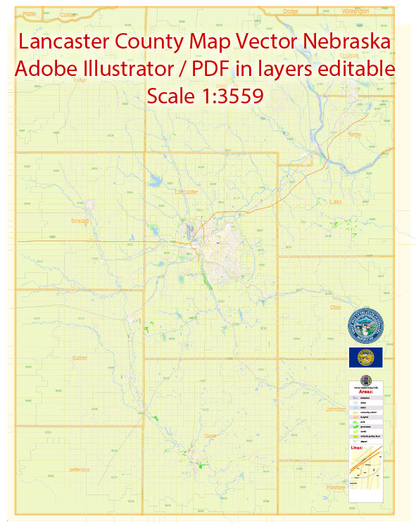
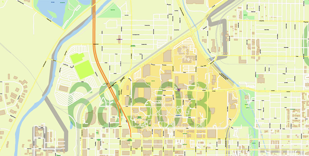
Printable Vector Map of Lancaster County Nebraska US detailed County Plan + Lincoln City scale 1:3559 full editable Adobe Illustrator Street Map in layers + zipcodes areas + counties bounds , scalable, editable text format all names, 16 mb ZIP
All streets names, Main Objects, Principal Buildings, ZIP Codes areas with numbers. Map for design, printing, arts, projects, presentations, for architects, designers and builders, business, logistics.
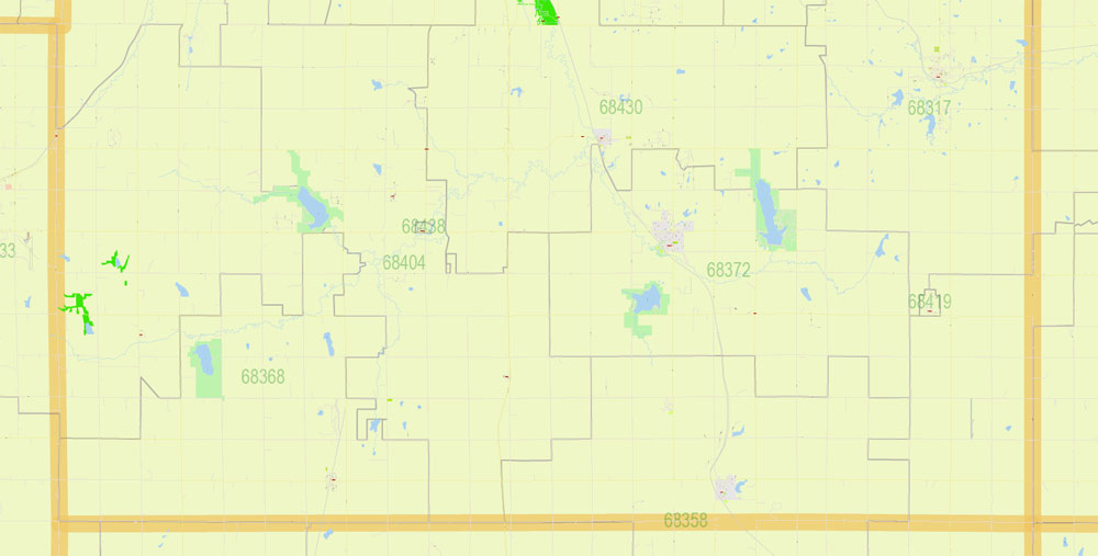
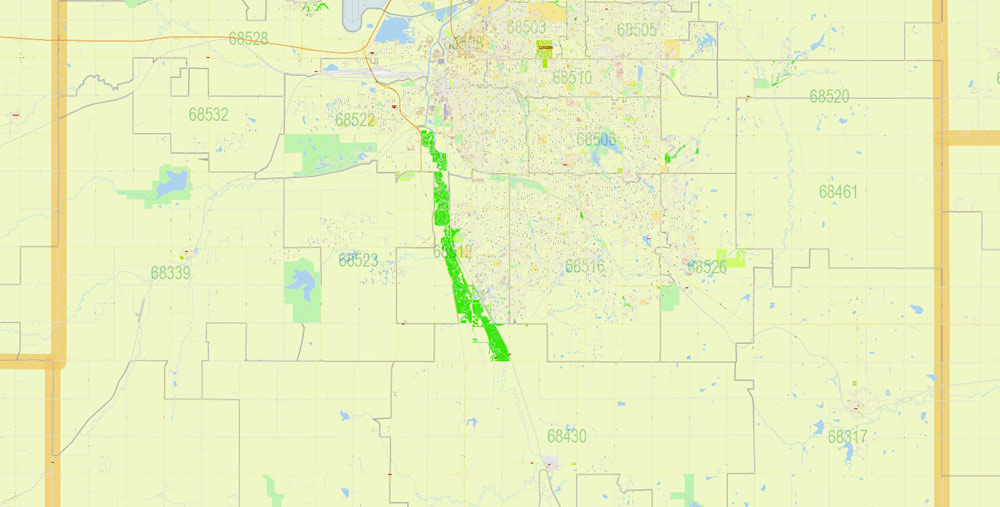
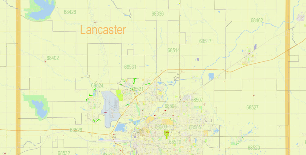
Layers: color_fills, streets_roads, labels_roads, names_objects, names_streets, names_places, water, buildings, counties, zipcodes areas, grids, legend, etc.
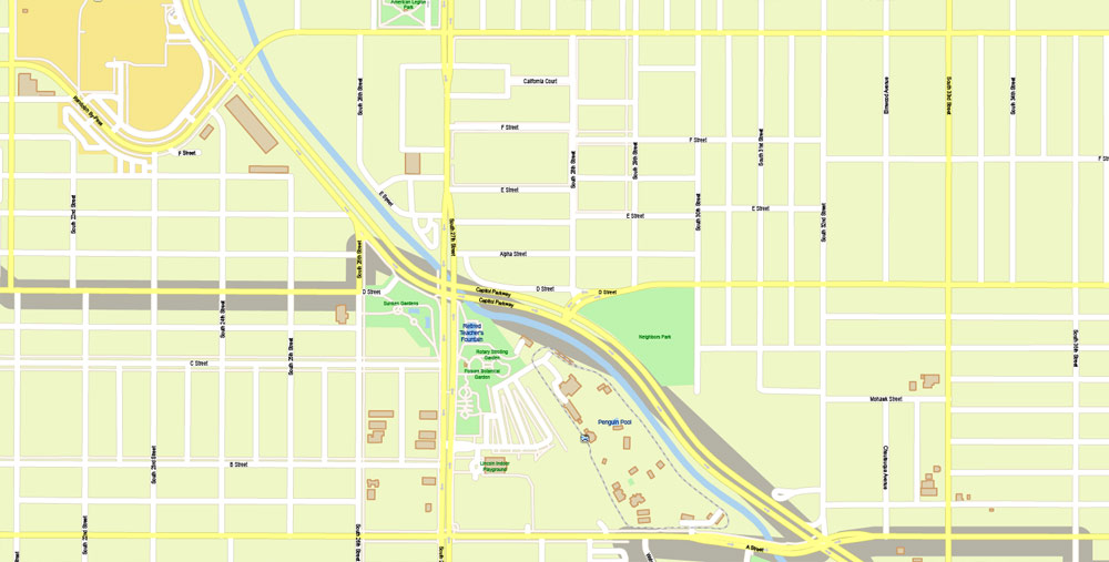
The most exact and detailed map of the Lincoln County map in scale.
For Editing and High Quality Printing
DWG, DXF and other formats – on request, same price, please, contact
Lincoln, Nebraska
Lincoln is the capital of the U.S. state of Nebraska and the county seat of Lancaster County. The city covers 94.267 square miles (244.150 km2) with a population of 284,736 in 2017.
This vector map of Lincoln (Lancaster county) city is used as a basis for design, editing, and further printing.
This is the most detailed, exact map of Lincoln (Lancaster county) city for high-quality printing and polygraphy. You can always clarify the map development date by contacting us. For your convenience, all objects on Lincoln (Lancaster county) vector city map are divided into layers. And the editing is very easy – colors, lines, etc.
You can easily add any objects needed (e.g. shops, salons, sale points, gas station or attraction) on any layer of Lincoln (Lancaster county) vector map.
It is the second-most populous city in Nebraska and the 71st-largest in the United States. The city is the economic and cultural anchor of a substantially larger metropolitan area in the southeastern part of the state called the Lincoln Metropolitan and Lincoln-Beatrice Combined Statistical Areas.
One of the advantages of Lincoln (Lancaster county) city vector maps of our production is the relevance of cartographic data, we constantly update all our products.
This vector map of Lincoln (Lancaster county) city is used by:
designers, layout designers, printers, advertisers and architects. Our product – vector maps – is designed for further editing and printing in large formats – from @Wall format (a few meters) to A-0 and A-1, A-2, A-3.
The statistical area is home to 353,120 people, making it the 106th-largest combined statistical area in the United States.
The city was founded in 1856 as the village of Lancaster on the wild salt marshes of what was to become Lancaster County. In 1867, the village of Lancaster became Nebraska’s state capital and was renamed Lincoln. The undoubted advantage of Lincoln (Lancaster county) city vector maps in printing is an excellent and detailed visualization, when customer can expand a large paper map and instantly define his location, find a landmark, an object or address on map, unlike using the popular electronic formats of Google and Yandex maps for example. The Bertram G. Goodhue designed state capitol building was completed in 1932 and is the second tallest capitol in the United States.
Take a look, who purchases our vector maps of Lincoln (Lancaster county) city in “Our Clients and Friends” page – these are large and small companies, from super-brands like Volvo and Starbucks, to small design studios and printing houses.
As the city is the seat of government for the state of Nebraska, the state and the United States government are major employers. The University of Nebraska was founded in Lincoln in 1867. The university is the largest in Nebraska with 26,079 students enrolled and is the city’s third-largest employer. Other primary employers fall within the service and manufacturing industries, including a growing high-tech sector. The region makes up a part of what is known as the greater Midwest Silicon Prairie. For travelers, maps are sold at the airports and gas stations around the world. Often the source is our vector maps.
Designated as a “refugee-friendly” city by the U.S. Department of State in the 1970s, the city was the twelfth-largest resettlement site per capita in the United States by 2000.
Guides are not limited to vertical and horizontal in Adobe Illustrator. You can also create a diagonal guide for example. Moreover, you can turn any contours into guides. Select the outline and go to View > Guides > Make Guides (Create Guides), or simply press Cmd/Ctrl + 5. You can also turn the guides back into an editable object. Go to menu, View > Guides > Unlock Guides (Release Guides), select the guide you want to edit and select View > Guides > Release Guides (Reset Guides), or just press Cmd/Ctrl + Option / Alt + 5).
Refugee Vietnamese, Karen (Burmese ethnic minority), Sudanese and Yazidi (Iraqi ethnic minority) people, as well as other refugees from Iraq & the Middle East, have been resettled in the city. Lincoln Public Schools during the school year of 2017–18 provided support for approximately 3,100 students from 100 countries, who spoke 50 different languages.
Saving a color group adds this group to the specified list.
Opening the «Edit Colors»/«Repaint Graphic Object» dialog box.
Open the «Edit Colors»/«Repaint Graphic Object» dialog box using one of the following methods:
«Edit»> «Edit Colors»> «Repaint Graphic object» or «Repaint With Style».
Use these commands if you need to edit the colors in the selected vector map of Lincoln (Lancaster county) city.
«Repaint Graphic object» button on the «Control» panel.
Use this button if you need to adjust colors of Lincoln (Lancaster county) city vector map using the а «Repaint graphic object» dialog box.
The specified button is available if the selected vector map or its fragment contains two or more colors.
Geography
refer to caption
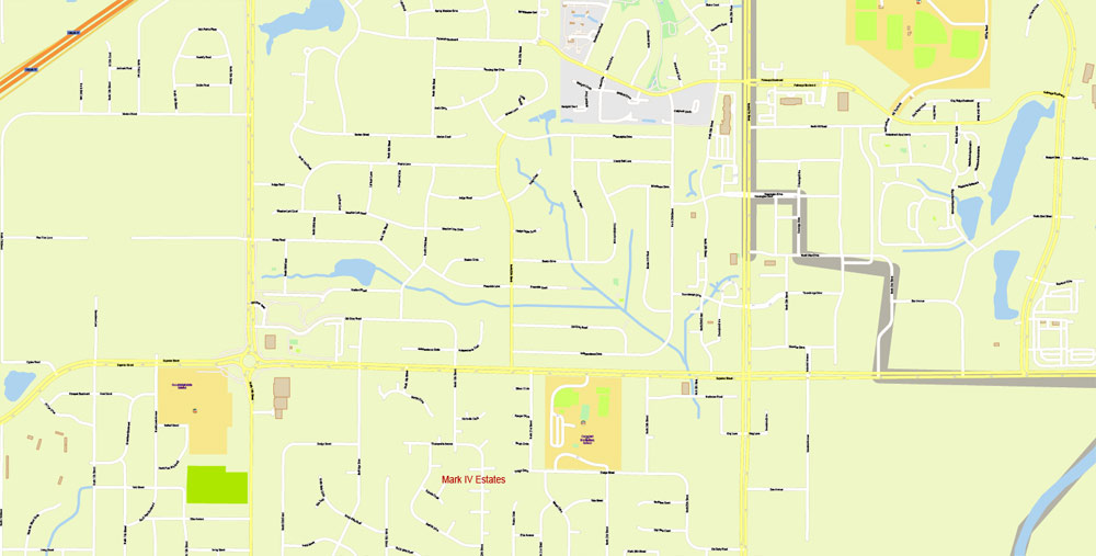
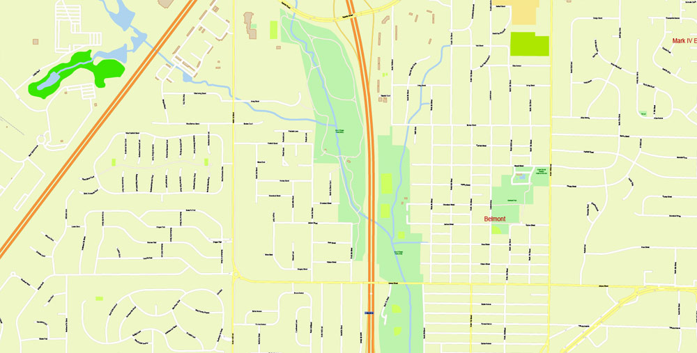
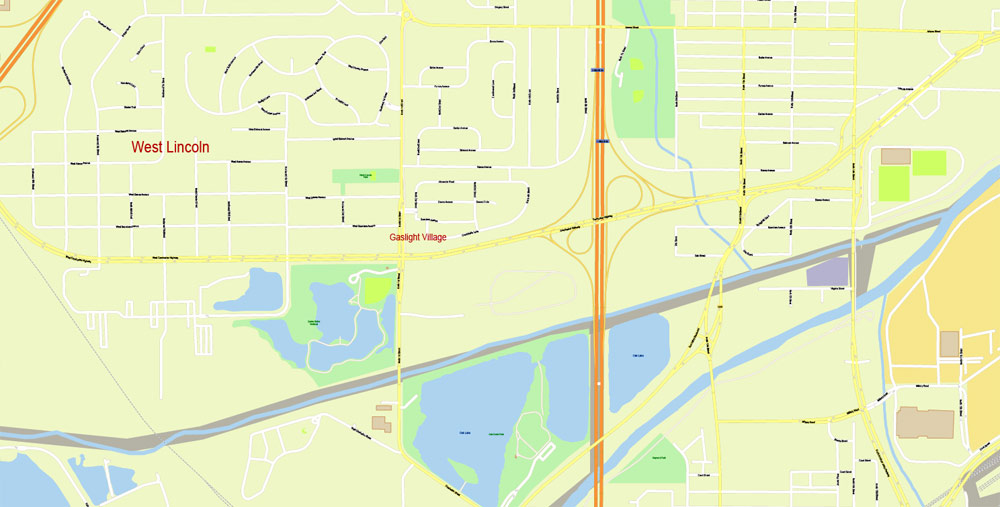
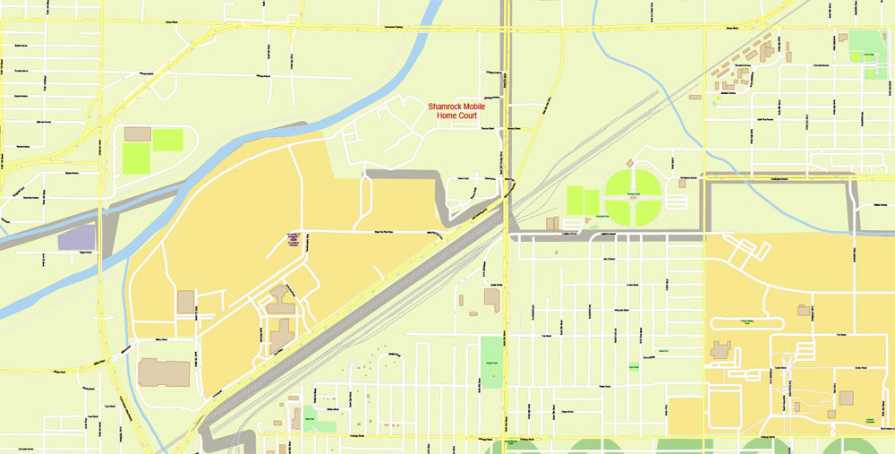
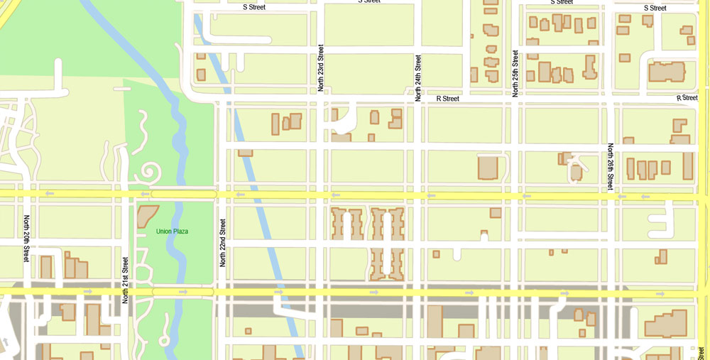
Detailed map of Lincoln streets and features
refer to caption
View from the International Space Station (ISS, 2007); photo centered on northeast Lincoln.
Lincoln has a total area of 94.267 square miles (244.150 km2), of which 92.913 square miles (240.644 km2) of it is land and 1.354 square miles (3.507 km2) is water, according to the United States Census Bureau in 2017.
Lincoln is one of the few large cities of Nebraska not located along either the Platte River or the Missouri River. The city was originally laid out near Salt Creek and among the nearly flat saline wetlands of northern Lancaster County. The city’s growth over the years has led to development of the surrounding land, much of which is composed of gently rolling hills. In recent years, Lincoln’s northward growth has encroached on the habitat of the endangered Salt Creek tiger beetle.
If a picture or a map fragment is not selected, and you open the dialog box by clicking the icon in the Control panel, on the Samples palette or in the Color Catalog, the «Edit Colors» dialog box appears and you can only access the «Edit» tab.
Regardless of the name at the top of the dialog box, the right-hand side always displays the color group of the current document, as well as two default color groups: Print Color and Grayscale. These color groups can be selected and used any time. The main areas of the dialog box are:
«Edit»
The «Edit» tab is designed to create a new or edit the existing color groups.
The harmony rules Menu and the Color Wheel are used to conduct experiments with color harmonies. The color wheel shows how colors are related in color harmony, and the color bars allow you to view and manipulate an individual color values. In addition, you can adjust the brightness, add and remove colors, save color groups and view colors on the selected Vector Map of Lincoln (Lancaster county) city or a separated layers.
Create and edit color groups of Lincoln (Lancaster county) city vector map, and also assign colors using the «Edit Colors»/ а «Repaint Graphic Object» dialog box.
A. Creating and editing of a color group on the «Edit» tab
B. Assigning colors on the «Assign» tab
C. Select a group of colors from the «Color groups» list
The option «Repaint a graphic object» in the lower part of the dialog box allows you to preview the colors on a selected layer of Vector map, or a group of elements, and specify whether its colors will be redefined when the dialog box is closed.
Metropolitan area
Lincoln is in two metropolitan statistical areas as defined by the United States Census Bureau. The Lincoln Metropolitan Statistical Area consists of Lancaster County and Seward County. Seward County was added to the metropolitan area in 2003.
It’s very easy to work with vector maps of Lincoln (Lancaster county) city, even for a not very experienced designer who can turn on and off the map layers, add new objects, change the colors of fill and lines according to customer requirements.
Lincoln is also in the Lincoln-Beatrice Combined Statistical Area which consists of the Lincoln metropolitan area and the micropolitan area of Beatrice. The city of Beatrice is the county seat of Gage County. The Lincoln-Beatrice combined statistical area is home to 353,120 people (2017 estimated) making it the 106th-largest combined statistical area in the United States.
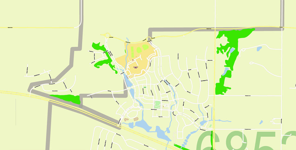
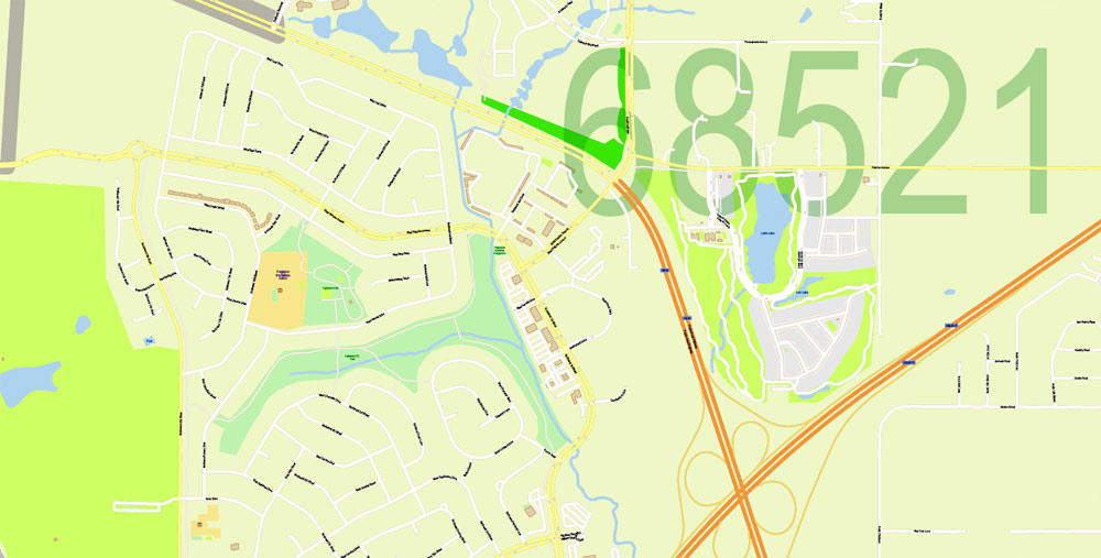
Neighborhoods
Lincoln’s neighborhoods include both old and new development. Some neighborhoods in Lincoln were formerly small towns that Lincoln later annexed, including University Place in 1926, Belmont, Bethany (Bethany Heights) in 1922, College View in 1929, Havelock in 1930, and West Lincoln in 1966.
The Lincoln (Lancaster county) city map in vector format is used for design, urban planning, presentations and media visualizations.
The advertising and presentation map of Lincoln (Lancaster county) city (usually the final designer marks the routes, and puts the client’s objects (shops, saloons, gas stations etc.)
The undoubted advantage is that people will NEVER throw out this advertising product – the map. In fact, as an advertising medium, a city map is the most “long-playing” of the well-known polygraphic advertising media, with the longest lifespan, and the maximum number of interactions with the customer.
A number of Historic Districts are located near downtown Lincoln, while newer neighborhoods have appeared primarily in the south and east. As of December 2013, Lincoln had 45 registered neighborhood associations within the city limits.
One core neighborhood that has seen rapid residential growth in recent years is the downtown Lincoln area. In 2010, there were 1,200 downtown Lincoln residents; in 2016, there were 3,000 (an increase of 140%). Around the middle of the same decade, demand for housing and rent units began outpacing supply. With Lincoln’s population expected to grow to more than 311,000 people by 2020, prices for homes and rent costs have risen. Home prices rose 10% from the first quarter of 2015 to the first quarter of 2016; rent prices rose 30% from 2007 to 2017 with a 5–8% increase in 2016 alone.
Printable vector maps of Lincoln (Lancaster county) city are much more convenient and efficient than any electronic maps on your smartphone, because ALL DETAILS are displayed in the entire space of Lincoln (Lancaster county) city map.
Useful tips on working with vector maps of cities and countries in Adobe Illustrator.
«V» – launches the Selection tool (cursor, black arrow), which makes active any vector line.
«А» – launches the Direct Selection tool (white cursor), allows you to select curve elements and drag them to the desired place.
«R» – activates the Rotate tool, which helps you rotating selected objects around the center point by 360 degrees.
«E» – gives you the opportunity to use the Eraser tool and erase unnecessary parts.
«X» – switches between Fill and Stroke in the Tools section. Try to get used to this hot key and
you will quickly understand that you can’t live and work without it.
You will probably want to change the color scheme used on our Lincoln (Lancaster county) vector city map.
To quickly and effectively play with colors.
Of course, you can do it manually, all objects in our Lincoln (Lancaster county) city vector map are divided according to types and layers, and you can easily change the color gamma of vector objects in groups and layers.
But there is more effective way of working with the whole VECTOR MAP of Lincoln (Lancaster county) city and all layers:
The overview dialog «Edit colors»/«Repaint Graphic Object» (this dialog box name can change depending on the context):
If you have selected a part or a layer of Lincoln (Lancaster county) city vector map and open the dialog box by clicking the icon in the Control panel, on the Samples palette or the Color Catalog, or if you choose Edit > Edit Colors> Repaint Graphic Object, then the «Repaint Graphic Object» dialog box appears, and you get access to «Assign» and «Edit» tabs.
Assign
The «Assign» tab is used to view and control on how the original colors are replaced with colors from the color group like your corporate colors in the Vector Map of Lincoln (Lancaster county) city.
The assign color ability is provided only if the entire map, layer or fragment is selected in the document. You can specify which of new colors replace the current colors, whether the spot colors should be preserved and how colors are replaced (for example, you can replace colors completely or changing the color tone while maintaining the brightness). The «Assign» tab allows you to redefine colors in the Vector Map of Lincoln (Lancaster county) city, or in separate layers and fragments using the current color group or reducing the number of colors in the current Vector Map.
Color groups
Is a list of all saved color groups for current document (the same groups appear in the «Samples» palette). You can edit and delete the existing color groups, as well as creating a new ones using the list of “Color Groups” in the dialog box. All changes appear in the «Samples» palette.
The highlighted color group shows, which color group is currently edited.
Any color group can be selected and edited, or used to redefine the colors in the selected vector map of Lincoln (Lancaster county) city, its fragments or elements.
Note. This color editing method is convenient for global color adjustment in a vector map, if global colors were not used when creating a City Map of Lincoln (Lancaster county).
The «Edit colors» button or «Edit or apply colors» on the «Color Catalog» palette
Click this button if you need to edit colors on the «Color Catalog» palette or edit and then apply them to the selected Vector Map of Lincoln (Lancaster county) city or its fragment.
The «Edit color group» button or «Edit or apply color group» on the «Samples» palette.
Click this button if you need to edit the colors in the specific color group or edit and apply them to the selected Vector Map of Lincoln (Lancaster county) city or a group of its elements, for example, the whole layer “Streets and lines”. You can also double-click the color group in the Samples panel to open the dialog box.
If the map file is too large and your computer freezes or even can’t open it quickly:
1. Try to reduce the color resolution of the video card (display) to 256 colors while working with a large map.
2. Using Windows Task Manager, select all the application you don’t need, while working with map, just turn them off.
3. Launch Adobe Illustrator. (DO NOT OPEN the vector map file)
4. Start the Windows Task Manager using administrator rights > Find the “Illustrator” process > set the «real time» priority,
5. Open the file. When you see the LEGACY FONT popup window – click “OK” (do not update). You can restore the TEXT later.
6. Can also be useful: When file is opened – Edit > Settings > Basic Settings > disable smoothing. /// It looks scary, but works quickly)))
We recommend saving the file in Adobe Illustrator 10 version. It’s much more stable when working with VERY BIG size files.
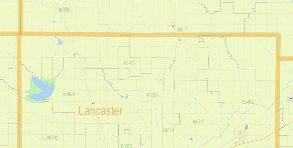
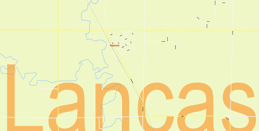
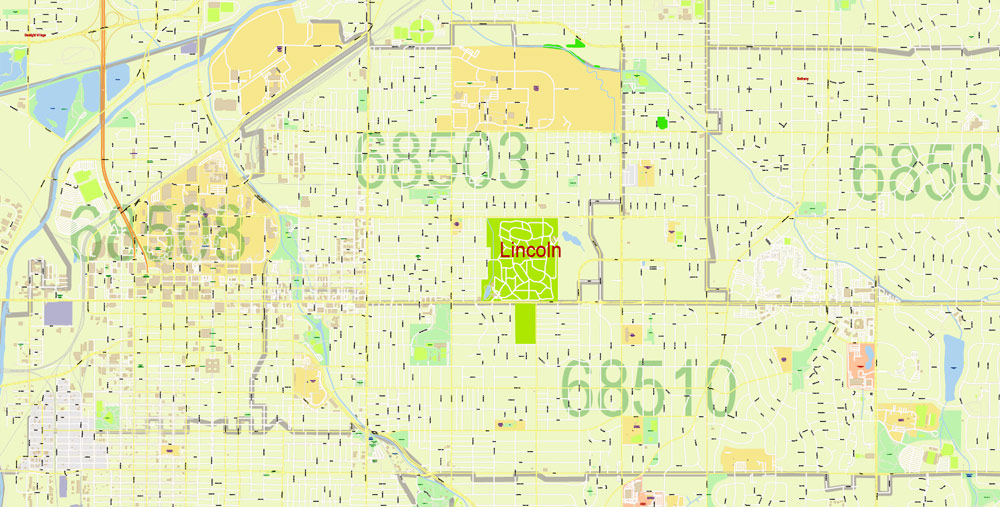
Lancaster County, Nebraska
Lancaster County is a county located in the U.S. state of Nebraska. As of the 2010 census, the population was 285,407, making it the second-most populous county in Nebraska. Its county seat is Lincoln, the state capital.
Area
• Total 846 sq mi (2,191 km2)
• Land 838 sq mi (2,170 km2)
• Water 8.8 sq mi (23 km2), 1.0%
Population
• (2010) 285,407
• Density 341/sq mi (132/km2)
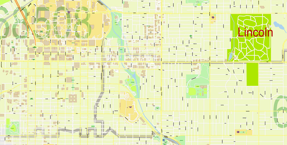
Lincoln
City in Nebraska
Lincoln is the capital city of Nebraska. The Nebraska State Capitol has a domed tower with observation decks. Built in 1930, the Sunken Gardens features themed gardens, sculptures and lily ponds. Up-close animal encounters and a zoo train are among the draws of the Lincoln Children’s Zoo. Sheldon Museum of Art, on the University of Nebraska campus, has a notable collection of American art and a sculpture garden.
Area
• State capital and city 94.267 sq mi (244.150 km2)
• Land 92.913 sq mi (240.644 km2)
• Water 1.354 sq mi (3.507 km2) 1.5%
• Urban 89.610 sq mi (232.089 km2)
• Metro 1,422.269 sq mi (3,683.660 km2)
• CSA 2,282.229 sq mi (5,910.95 km2)
Elevation 1,176 ft (358 m)
Population
• State capital and city 258,379 (US: 73rd)
• Estimate 284,736
• Density 3,020.5/sq mi (1,166.2/km2)
• Urban 258,719 (US: 145th)
• Urban density 2,887.2/sq mi (1,114.8/km2)
• Metro 331,519 (US: 154th)
• Metro density 233.1/sq mi (90.0/km2)
• CSA 353,120 (US: 106th)
• CSA density 154.7/sq mi (59.7/km2)
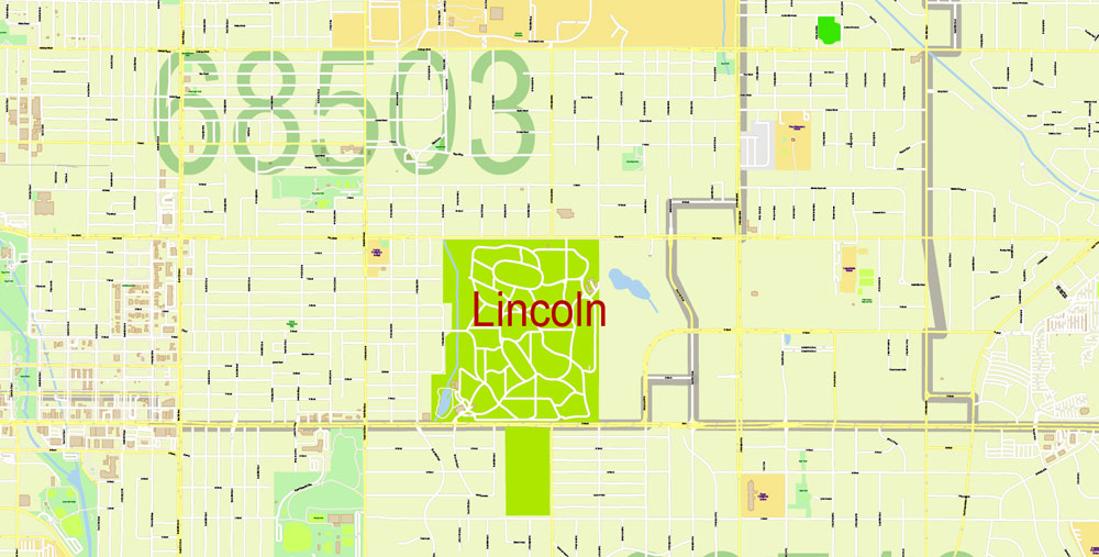
Map coverage area
Free US vector maps

Free Download Vector Map US County and State Adobe Illustrator
Free_Vector_Map_US_States_County_Map.ai
Free Download Vector Map US County and State Adobe PDF
Free_Vector_Map_US_States_County_Map.pdf

Free Download Vector Map US With States Names, Adobe Illustrator
Free_Map_of_USA_with_state_names_en.ai
Free Download Vector Map US With States Names, Adobe PDF
Free_Map_of_USA_with_state_names_en.pdf
From WIKI
Free vector map World, Adobe Illustrator, download now maps vector clipart
Map for design, projects, presentation free to use as you like.
See also: TERMS & CONDITIONS: SOFTWARE LICENSE AGREEMENT FOR DIGITAL CARTOGRAPHIC DATA.
Need more USA Vector Maps, printable and editable?

 Author: Kirill Shrayber, Ph.D. FRGS

