Lincoln PDF map, Nebraska, US printable vector street City Plan map, full editable, Adobe PDF, V3.10, full vector, scalable, editable, text format street names, 12 Mb ZIP.
All streets, primary buildings. Map for design, print, arts, projects, presentations,
for architects, designers and builders.
PDF, DXF, DWG, CDR and other formats – on request, same price, please, contact.
You can edit this file in Adobe Illustrator, Adobe Acrobat, Corel Draw.
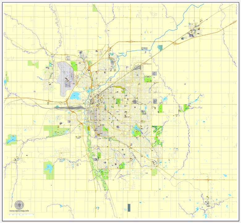
Lincoln, Nebraska, USA.
This vector map of Lincoln city is used as a basis for design, editing, and further printing.
This is the most detailed, exact map of Lincoln city for high-quality printing and polygraphy. You can always clarify the map development date by contacting us.
For your convenience, all objects on Lincoln vector city map are divided into layers. And the editing is very easy – colors, lines, etc.
You can easily add any objects needed (e.g. shops, salons, sale points, gas station or attraction) on any layer of Lincoln vector map.
Lincoln is the capital of the U.S. state of Nebraska and the county seat of Lancaster County. The city covers 94.267 square miles (244.150 km2) with a population of 284,736 in 2017. It is the second-most populous city in Nebraska and the 71st-largest in the United States. The city is the economic and cultural anchor of a substantially larger metropolitan area in the southeastern part of the state called the Lincoln Metropolitan and Lincoln-Beatrice Combined Statistical Areas. The statistical area is home to 353,120 people, making it the 106th-largest combined statistical area in the United States.
One of the advantages of Lincoln city vector maps of our production is the relevance of cartographic data, we constantly update all our products.
This vector map of Lincoln city is used by:
designers, layout designers, printers, advertisers and architects. Our product – vector maps – is designed for further editing and printing in large formats – from @Wall format (a few meters) to A-0 and A-1, A-2, A-3.
The Lincoln city map in vector format is used for design, urban planning, presentations and media visualizations.
The advertising and presentation map of Lincoln city (usually the final designer marks the routes, and puts the client’s objects (shops, saloons, gas stations etc.)
The undoubted advantage is that people will NEVER throw out this advertising product – the map. In fact, as an advertising medium, a city map is the most “long-playing” of the well-known polygraphic advertising media, with the longest lifespan, and the maximum number of interactions with the customer.
The city was founded in 1856 as the village of Lancaster on the wild salt marshes of what was to become Lancaster County. In 1867, the village of Lancaster became Nebraska’s state capital and was renamed Lincoln. The Bertram G. Goodhue designed state capitol building was completed in 1932 and is the second tallest capitol in the United States. As the city is the seat of government for the state of Nebraska, the state and the United States government are major employers.
Free vector maps:

Free download Vector Map US Interstate roads, Adobe PDF, V.2 Free_Map_US_Interstates_Roads_2.pdf
Free download Vector Map US Interstate roads, Adobe Illustrator, V.2 Free_Map_US_Interstates_Roads_2.ai

Free Download Vector Map US County and State Adobe Illustrator
Free_Vector_Map_US_States_County_Map.ai
Free Download Vector Map US County and State Adobe PDF
Free_Vector_Map_US_States_County_Map.pdf

Free Vector Map US Census Data Top US Ancestries by County Adobe Illustrator
Free_Vector_Map_US_Census-Data-Top-US-Ancestries-by-County.ai
Free Vector Map US Census Data Top US Ancestries by County Adobe PDF
Free_Vector_Map_US_Census-Data-Top-US-Ancestries-by-County.pdf
Small guide: How to work with the vector map?
You can: Mass select objects by type and color – for example, the objects type “building” (they are usually dark gray) – and remove them from the map, if you do not need them in your print or design project. You can also easily change the thickness of lines (streets), just bulk selection the road by the line color.
The streets are separated by type, for example, type “residential road” are usually white with a gray stroke. Highway usually orange with a brown or dark gray stroke.
It is easy to change the font of inscriptions, all or each individually. Also, just can be make and any other manipulation of objects on the vector map in Adobe illustrator format.
Important: All the proportions on the map are true, that is, the relative sizes of the objects are true, because Map is based on an accurate GPS projection, and It transated into the (usual for all) the Mercator projection.
You can easily change the color, stroke and fill of any object on the map, zoom without loss of quality Image Verification.
Select object

Bulk selection the same objects on the vector map

See the bulk selected objects on the vector map

Bulk delete buildungs from the vector map

Select residencial road (small street) on the vector map

Bulk selection the same lines (streets, roads) on the full map

Create fat lines of the streets on the vector maps (bulk action) 1

Create fat lines of the streets on the vector maps (bulk action) 2

Create fat lines of the streets on the vector maps (bulk action) 3

You can easily change the color, stroke and fill of any object on the map, zoom without loss of quality Image Verification.
Lincoln, Nebraska, USA
Lincoln is the capital of the U.S. state of Nebraska and the county seat of Lancaster County. The city covers 92.81 square miles (240.38 km2) with a population of 277,348 in 2015. It is the second-most populous city in Nebraska and the 72nd-largest in the United States. The city is the economic and cultural anchor of a substantially larger metropolitan area in the southeastern part of the state called the Lincoln-Beatrice Metropolitan Area. The metropolitan area is home to 345,478 people, making it the 105th-largest combined statistical area in the United States.
The city was founded in 1856 as the village of Lancaster on the wild salt marshes of what was to become Lancaster County. In 1867, the village of Lancaster became Nebraska’s state capital and was renamed Lincoln. Bertram G. Goodhue designed state capitol building was completed in 1932 and is the second tallest capitol in the United States. As the city is the seat of government for the state of Nebraska, the state and the United States government are major employers. The University of Nebraska was founded in Lincoln in 1867. The university is the largest in Nebraska with 25,006 students enrolled and is the city’s third-largest employer. Other primary employers fall within the service and manufacturing industries, including a growing high-tech sector. The region makes up a part of what is known as the greater Midwest Silicon Prairie.
Geography of Lincoln, Nebraska, USA
Lincoln has a total area of 92.81 square miles (240.38 km2), of which 91.45 square miles (236.85 km2) of it is land and 1.35 square miles (3.50 km2) is water, according to the United States Census Bureau in 2015.
Lincoln is one of the few large cities of Nebraska not located along either the Platte River or the Missouri River. The city was originally laid out near Salt Creek and among the nearly flat saline wetlands of northern Lancaster County. The city’s growth over the years has led to development of the surrounding land, much of which is composed of gently rolling hills. In recent years, Lincoln’s northward growth has encroached on the habitat of the endangered Salt Creek tiger beetle.
Metropolitan area of Lincoln, Nebraska, USA
Lincoln is in two metropolitan statistical areas as defined by the United States Census Bureau. The Lincoln Metropolitan Statistical Area consists of Lancaster County and Seward County. Seward county was added to the metropolitan area in 2003. Lincoln is also in the Lincoln-Beatrice Combined Statistical Area which consists of the Lincoln metropolitan area and the micropolitan area of Beatrice. The city of Beatrice is the county seat of Gage County. The Lincoln-Beatrice metropolitan area is home to 345,478 people (2015 estimated) making it the one-hundred-fifth-largest combined statistical area in the United States.
Neighborhoods of Lincoln, Nebraska, USA
Lincoln’s neighborhoods include both old and new development. Some neighborhoods in Lincoln were formerly small towns that Lincoln later annexed, including University Place in 1926, Belmont, Bethany (Bethany Heights) in 1922, College View in 1929, Havelock in 1930, and West Lincoln in 1966. A number of Historic Districts are located near downtown Lincoln, while newer neighborhoods have appeared primarily in the south and east. As of December 2013, Lincoln had 45 registered neighborhood associations within the city limits.
One core neighborhood that has seen rapid residential growth in recent years is the downtown Lincoln area. In 2010, there were 1,200 downtown Lincoln residents; in 2016, there were 3,000 (an increase of 140%).
https://en.wikipedia.org/wiki/Lincoln,_Nebraska#Geography

 Author: Kirill Shrayber, Ph.D. FRGS


