Extended Description of the Vector Map
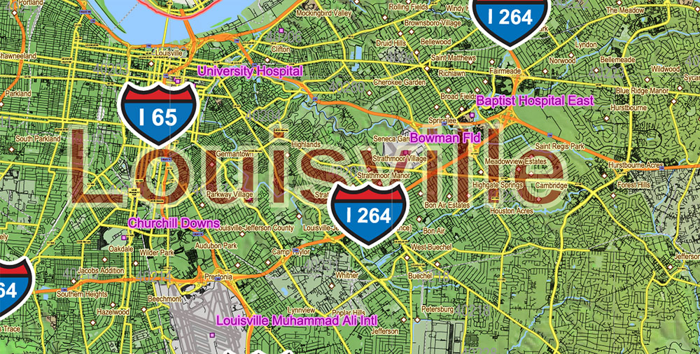
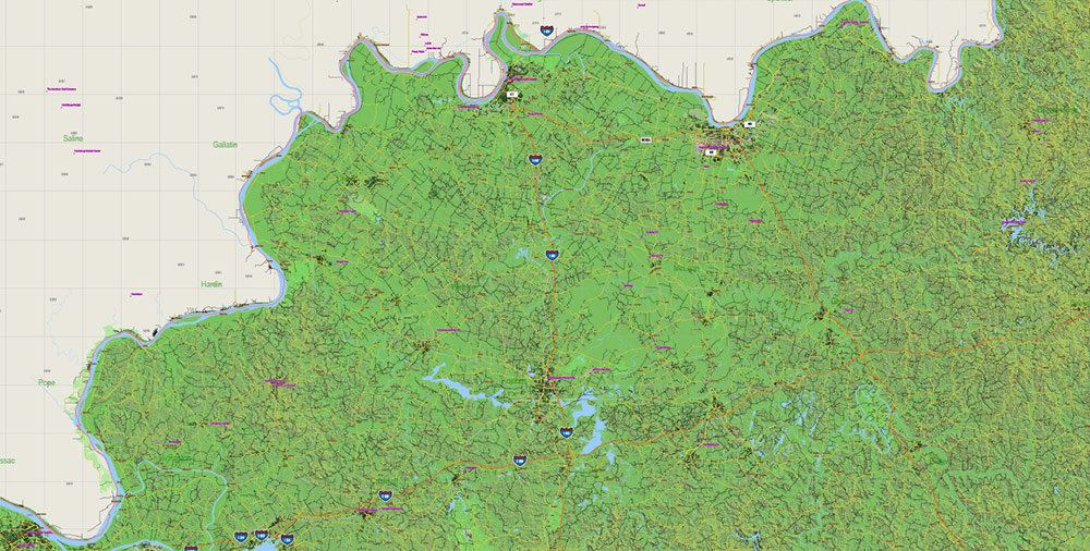
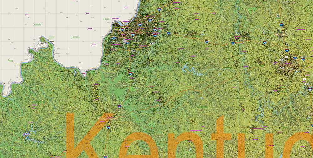
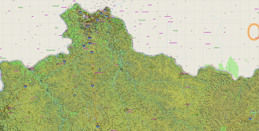
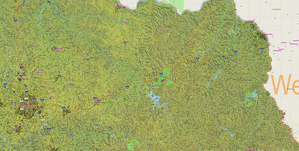
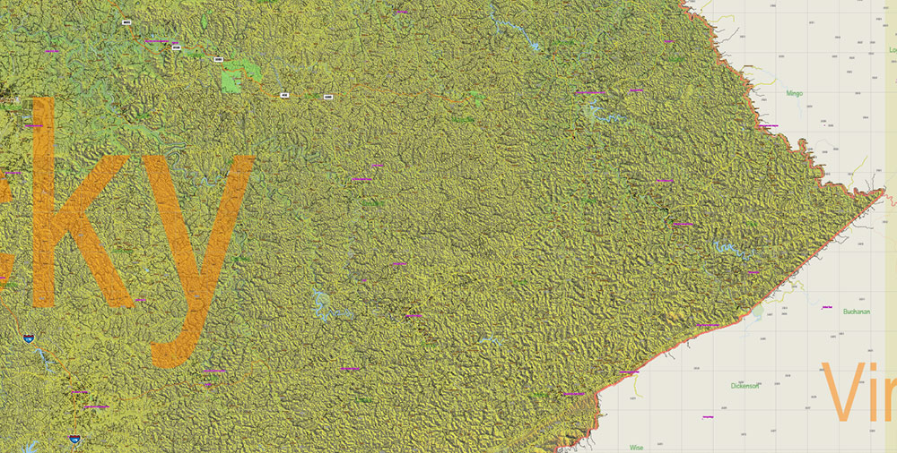
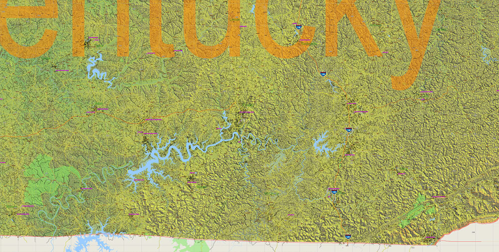
Printable Relief Vector Map of Kentucky Full State US: All Streets and Roads + counties areas + zip-codes areas + Relief Shaded Raster, fully editable Adobe Illustrator Map in layers, scalable, 237 MB ZIP
Scale: 1:59399
All streets and roads, Names of Principal streets, All Cities and Towns, Counties, All Geonames, airports, and heliports. Map for design, printing, arts, projects, presentations, for architects, designers, and builders, business, logistics.
NOTE! All objects are located on separate layers by type. The preview shows them all together. When you work with this map, just turn off or delete those layers that are not needed for your project.
For Editing and High-Quality Printing, Royalty free
Need AutoCAD DWG / DXF, CDR, or any other format? Please, contact us!
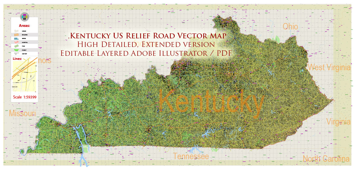
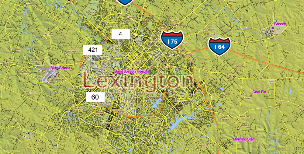
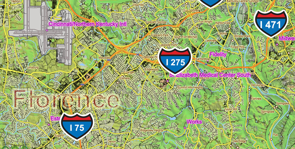
Kentucky Full State US Relief Vector Map: Full Extra High Detailed (all roads, zipcodes, airports) + Admin Areas + Relief Shaded Raster, editable Adobe Illustrator in layers
Layers list:
- Legend
- Grids
- Labels of roads (numbers) – highways, interstate
- Classic Road Labels (shields)
- All Geonames (cities, towns, villages, hamlets, islands)
- Points of the Geonames (cities, towns, villages, hamlets, islands)
- Names places: Names of all Cities, towns, villages and hamlets
- Names of the Airports and Heliports
- Points of the Airports and Heliports
- Numbers of ZIP codes
- Names of objects (water, park, hospital)
- Names of States
- Names of Counties
- Names of the Main Streets
- Major Roads and Streets – Highways
- Minor Roads and residential streets
- Railroads
- State boundaries
- Water objects (rivers, lakes, ponds, swamps, reefs)
- Waterways
- Ground objects (urban areas, parks, hospitals, etc.)
- ZIP-codes areas
- Counties areas (colored, transparence 10%)
- State area
- Raster Shaded Relief
- Background
Kentucky Full State US Relief Vector Map: Full Extra High Detailed (all roads, zipcodes, airports) + Admin Areas + Relief Shaded Raster, editable Adobe Illustrator in layers

Kentucky Full State US Relief Vector Map: Full Extra High Detailed (all roads, zipcodes, airports) + Admin Areas + Relief Shaded Raster, editable Adobe Illustrator in layers
Kentucky Full State US Relief Vector Map: Full Extra High Detailed (all roads, zipcodes, airports) + Admin Areas + Relief Shaded Raster, editable Adobe Illustrator in layers
Kentucky Full State US Relief Vector Map: Full Extra High Detailed (all roads, zipcodes, airports) + Admin Areas + Relief Shaded Raster, editable Adobe Illustrator in layers
Kentucky Full State US Relief Vector Map: Full Extra High Detailed (all roads, zipcodes, airports) + Admin Areas + Relief Shaded Raster, editable Adobe Illustrator in layers
Kentucky Full State US Relief Vector Map: Full Extra High Detailed (all roads, zipcodes, airports) + Admin Areas + Relief Shaded Raster, editable Adobe Illustrator in layers
Kentucky Full State US Relief Vector Map: Full Extra High Detailed (all roads, zipcodes, airports) + Admin Areas + Relief Shaded Raster, editable Adobe Illustrator in layers
Kentucky Full State US Relief Vector Map: Full Extra High Detailed (all roads, zipcodes, airports) + Admin Areas + Relief Shaded Raster, editable Adobe Illustrator in layers
Kentucky Full State US Relief Vector Map: Full Extra High Detailed (all roads, zipcodes, airports) + Admin Areas + Relief Shaded Raster, editable Adobe Illustrator in layersKentucky Full State US Relief Vector Map: Full Extra High Detailed (all roads, zipcodes, airports) + Admin Areas + Relief Shaded Raster, editable Adobe Illustrator in layers

Kentucky Full State US Relief Vector Map: Full Extra High Detailed (all roads, zipcodes, airports) + Admin Areas + Relief Shaded Raster, editable Adobe Illustrator in layers
Kentucky Full State US Relief Vector Map: Full Extra High Detailed (all roads, zipcodes, airports) + Admin Areas + Relief Shaded Raster, editable Adobe Illustrator in layers

Kentucky Full State US Relief Vector Map: Full Extra High Detailed (all roads, zipcodes, airports) + Admin Areas + Relief Shaded Raster, editable Adobe Illustrator in layers

 Author: Kirill Shrayber, Ph.D. FRGS
 + Admin Areas editable Adobe Illustrator in layers")
 + Admin Areas + Relief Shaded Raster, editable Adobe Illustrator in layers")
