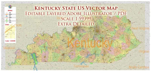
Kentucky is a state located in the southeastern region of the United States. It is known for its diverse geography, including rolling hills, forests, and the Appalachian Mountains in the eastern part of the state. Here are some of the main cities and roads in Kentucky:
Main Cities:
- Louisville:
- Located in the north-central part of the state, Louisville is the largest city in Kentucky.
- Known for the Kentucky Derby, a famous horse race held annually at Churchill Downs.
- Has a vibrant arts and cultural scene, including the Louisville Slugger Museum & Factory.
- Lexington:
- Situated in the heart of the Bluegrass region, Lexington is known for its horse farms and racing.
- Home to the University of Kentucky and Keeneland Race Course.
- Frankfort:
- The state capital, located in the central part of Kentucky along the Kentucky River.
- Known for its historic architecture and government buildings.
- Bowling Green:
- Located in south-central Kentucky, known for the National Corvette Museum and production plant.
- Home to Western Kentucky University.
- Owensboro:
- Situated in western Kentucky along the Ohio River.
- Known for its bluegrass music scene and the International Bluegrass Music Museum.
Main Roads:
- Interstate 64 (I-64):
- Runs east-west through the northern part of the state, connecting Louisville and Lexington.
- Interstate 65 (I-65):
- Runs north-south through the central part of the state, connecting Louisville and Bowling Green.
- Interstate 71 (I-71):
- Runs north-south through the northern part of the state, connecting Louisville and Covington.
- Bluegrass Parkway (I-64):
- Connects Louisville and Lexington, providing a scenic route through the Bluegrass region.
- Western Kentucky Parkway (I-69):
- Connects Henderson in the west to Elizabethtown in the central part of the state.
- Cumberland Parkway:
- Runs east-west in the southern part of the state, connecting Bowling Green and Somerset.
We provide you with the most accurate and up-to-date vector maps in Adobe Illustrator, PDF and other formats, designed for editing and printing. Please read the vector map descriptions carefully.
These are just a few of the main cities and roads in Kentucky. The state’s transportation network includes a mix of interstates, parkways, and scenic byways that offer access to its diverse landscapes and attractions.


 Author: Kirill Shrayber, Ph.D.