Idaho is located in the Western United States and belongs to the Mountain States.
Idaho is bordered by the states of Washington and Oregon to the west, Nevada, and Utah to the south, and Montana and Wyoming to the east. To the north of Idaho is the Canadian province of British Columbia.
In Idaho, you can see vast areas untouched by human activity: snow-capped mountain ranges, turbulent rivers, rapids, large lakes, and deep canyons. Most of Idaho is occupied by the Rocky Mountains. The highest point in the state is Bora Peak (3,862 m). The largest river in Idaho is the Snake, a major tributary of the Columbia River.
The Snake River on the border of Idaho and Oregon forms the Hells Canyon – the deepest (2436 m) canyon in the United States (although not as famous as one of the most popular attractions in the United States – the Grand Canyon in Arizona). Three hydroelectric power stations have been built in the canyon. Interestingly, during their construction, “fish ladders” were provided, allowing salmon fish to climb upstream during spawning. On the same river, you can see the Shoshone Falls waterfall. Its height is 64.7 meters, more than that of Niagara Falls.
The modern state of Idaho is characterized by the rapid development of high-tech technologies, which provide more than a quarter of the state’s total income.
The state of Idaho has very limited resources of fossil fuels, but it is very promising to increase the use of renewable energy sources, primarily hydropower.
In 2005, 48% of Idaho’s electricity was generated from hydroelectric power, 42% from coal burning, and 9% from natural gas burning. Idaho does not have its own sources of oil and gas, and there is not enough existing power generation capacity.
Given the very high rate of population growth and industrial development in the state, it is necessary to plan for the development of hydropower or the construction of nuclear power plants in the coming decades.
Although the mining industry has lost its leading position in the economy to other industries, Idaho continues to produce some minerals. Idaho is one of only two places in the world where star grenades can be found (the second such place in the Himalayas, in India ) and the only one where grenades with six-pointed stars have been found.
Agriculture is very well developed in the state. Idaho produces about a third of the potatoes that are grown in the United States. Wheat, wine grapes, and other crops are also grown in the state.
An important industry for the state of Idaho is the food industry. The city of Gooding is home to the world’s largest factory for the production of so-called barrel cheese-raw materials for the production of processed cheeses. Idaho produces most of the malt used in U.S. breweries. Although there are no large beer factories in the state itself, there are many small breweries.
Idaho produces significant amounts of wood and its processed products: lumber, paper.
The main direction of the development of the modern economy of Idaho is high-tech production.
Since the late 1970s, the state capital city of Boise has become a center of semiconductor manufacturing. It is here that the factories of the world leaders in the computer industry are located. The Micron Technology Inc factory produces memory chips for computers. Hewlett Packard manufactures laser printers at its Boise plant.
Pocatello is home to the headquarters of Semiconductor, a leading semiconductor manufacturing company.
The largest software development firm, Oracle, has an office in Boise.
2300 km2 in the east of the state is occupied by the Idaho National Laboratory, one of the largest research centers in the United States. It develops projects related to the development of nuclear energy, cybersecurity, robotics, and others.
Idaho is home to several popular ski resorts, the most famous of which is Sun Valley.
A significant income to the state is provided by the holding of state lotteries, the profits from which are used to finance schools.
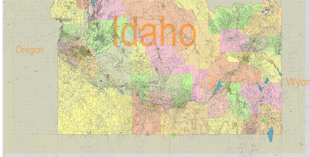
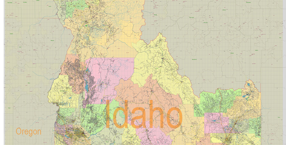
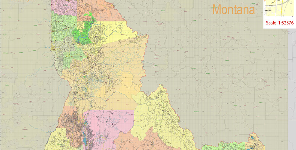
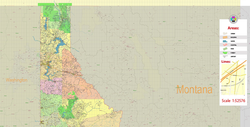
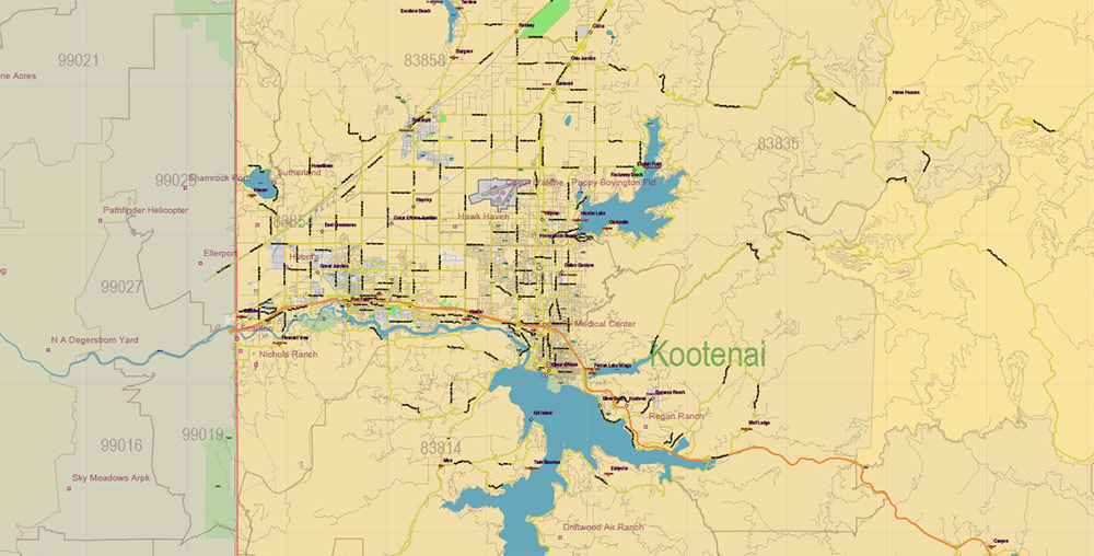
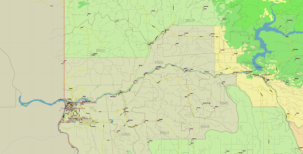
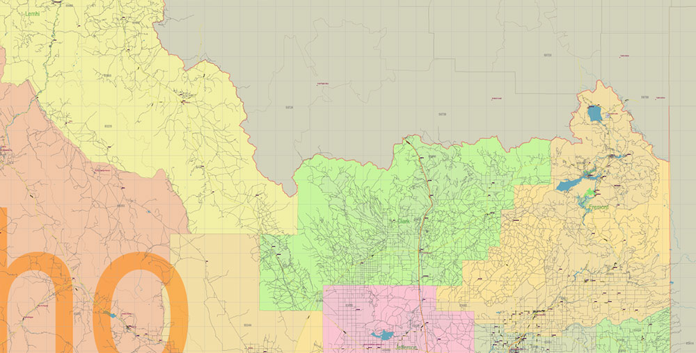
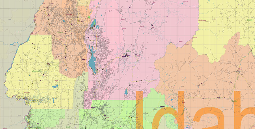
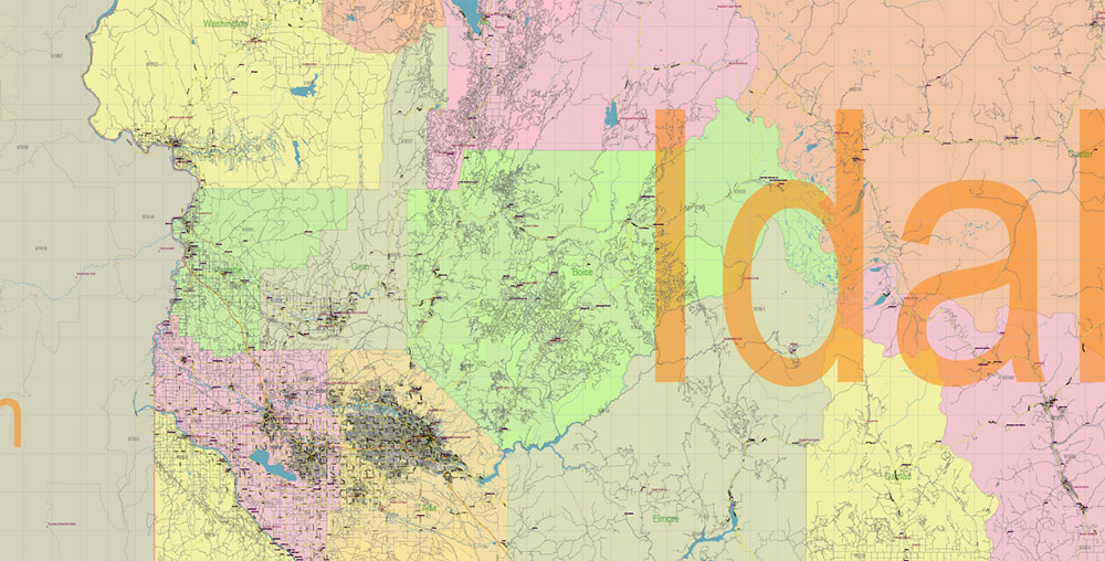
Printable Vector Map of Idaho Full State US: All Streets and Roads + counties areas + zip-codes areas, fully editable Adobe Illustrator Map in layers, scalable, 64 MB ZIP
Scale: 1:52576
All streets and roads, Names of Principal streets, All Cities and Towns, Counties, All Geonames, airports, and heliports. Map for design, printing, arts, projects, presentations, for architects, designers, and builders, business, logistics.
NOTE! All objects are located on separate layers by type. The preview shows them all together. When you work with this map, just turn off or delete those layers that are not needed for your project.
For Editing and High-Quality Printing, Royalty free
Need AutoCAD DWG / DXF, CDR, or any other format? Please, contact us!
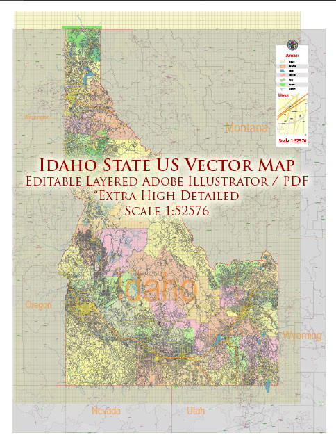
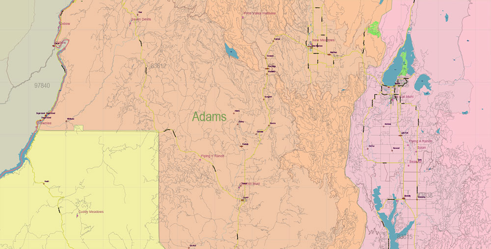
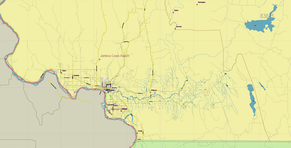
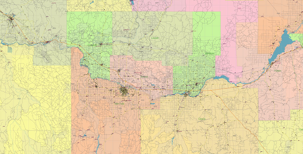
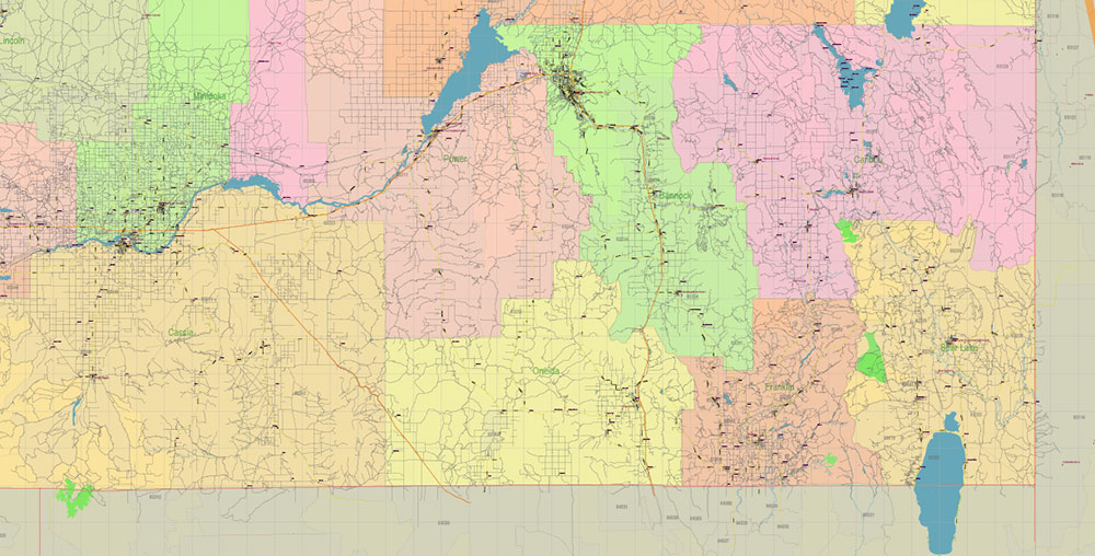
Idaho Full State US Vector Map: Full Extra High Detailed (all roads, zipcodes, airports) + Admin Areas editable Adobe Illustrator in layers
Layers list:
- Legend
- Grids
- Labels of roads (numbers) – highways, interstate
- All Geonames (cities, towns, villages, hamlets, islands)
- Points of the Geonames (cities, towns, villages, hamlets, islands)
- Names places: Names of all Cities, towns, villages and hamlets
- Names of the Airports and Heliports
- Points of the Airports and Heliports
- Numbers of ZIP codes
- Names of objects (water, park, hospital)
- Names of States
- Names of Counties
- Names of the Main Streets
- Major Roads and Streets – Highways
- Minor Roads and residential streets
- Railroads
- State boundaries
- Water objects (rivers, lakes, ponds, swamps, reefs)
- Waterways
- Ground objects (urban areas, parks, hospitals, etc.)
- ZIP-codes areas
- Counties areas (colored)
- States areas
- Background
Idaho Full State US Vector Map: Full Extra High Detailed (all roads, zipcodes, airports) + Admin Areas editable Adobe Illustrator in layers
Idaho Full State US Vector Map: Full Extra High Detailed (all roads, zipcodes, airports) + Admin Areas editable Adobe Illustrator in layers
Idaho Full State US Vector Map: Full Extra High Detailed (all roads, zipcodes, airports) + Admin Areas editable Adobe Illustrator in layers
Idaho Full State US Vector Map: Full Extra High Detailed (all roads, zipcodes, airports) + Admin Areas editable Adobe Illustrator in layers
Idaho Full State US Vector Map: Full Extra High Detailed (all roads, zipcodes, airports) + Admin Areas editable Adobe Illustrator in layers
Idaho Full State US Vector Map: Full Extra High Detailed (all roads, zipcodes, airports) + Admin Areas editable Adobe Illustrator in layers
Idaho Full State US Vector Map: Full Extra High Detailed (all roads, zipcodes, airports) + Admin Areas editable Adobe Illustrator in layers
Idaho Full State US Vector Map: Full Extra High Detailed (all roads, zipcodes, airports) + Admin Areas editable Adobe Illustrator in layers
Idaho Full State US Vector Map: Full Extra High Detailed (all roads, zipcodes, airports) + Admin Areas editable Adobe Illustrator in layers

Idaho Full State US Vector Map: Full Extra High Detailed (all roads, zipcodes, airports) + Admin Areas editable Adobe Illustrator in layers

Idaho Full State US Vector Map: Full Extra High Detailed (all roads, zipcodes, airports) + Admin Areas editable Adobe Illustrator in layers

Idaho Full State US Vector Map: Full Extra High Detailed (all roads, zipcodes, airports) + Admin Areas editable Adobe Illustrator in layers
Idaho Full State US Vector Map: Full Extra High Detailed (all roads, zipcodes, airports) + Admin Areas editable Adobe Illustrator in layers
Idaho Full State US Vector Map: Full Extra High Detailed (all roads, zipcodes, airports) + Admin Areas editable Adobe Illustrator in layers

Idaho Full State US Vector Map: Full Extra High Detailed (all roads, zipcodes, airports) + Admin Areas editable Adobe Illustrator in layers
Idaho Full State US Vector Map: Full Extra High Detailed (all roads, zipcodes, airports) + Admin Areas editable Adobe Illustrator in layers
Idaho Full State US Vector Map: Full Extra High Detailed (all roads, zipcodes, airports) + Admin Areas editable Adobe Illustrator in layers
Idaho Full State US Vector Map: Full Extra High Detailed (all roads, zipcodes, airports) + Admin Areas editable Adobe Illustrator in layers

Idaho Full State US Vector Map: Full Extra High Detailed (all roads, zipcodes, airports) + Admin Areas editable Adobe Illustrator in layers

 Author: Kirill Shrayber, Ph.D. FRGS