The area of the state of Idaho – 216,632 km2 (14th place in the United States)
The length of the state of Idaho:
from north to south-771 km
from east to west-491 km
The Idaho Region – Mountain States of the United States
The highest point in Idaho – 3,862 meters above sea level
The lowest point in Idaho – 217 meters above sea level
The abbreviation of the state of Idaho – ID
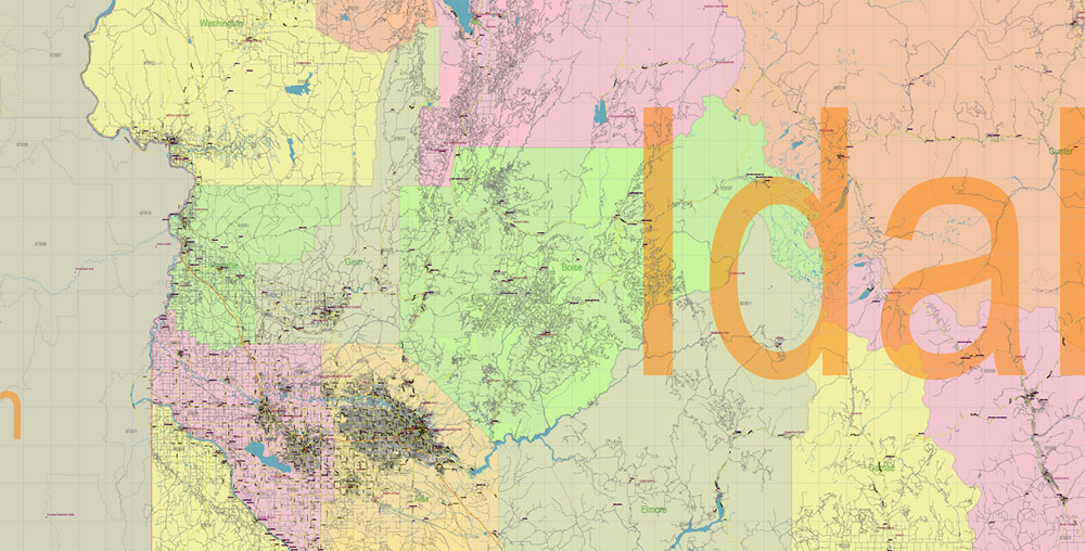
The capital and largest city of Idaho is Boise
Date of formation of the state of Idaho – July 3, 1890 (43 state in the United States)
Idaho has a population of about 1,570,000 (39th in the United States)
The population density in Idaho is 6 people per km2 (44th in the United States)
The Idaho state motto is “Esto Perpetua “(“So be it forever”)
Idaho’s nickname is “The Gem State”
Idaho has a population of about 1,570,000 (39th among U.S. states). The population density is about 6 people per km2 (44th among US states).
Idaho’s population is growing very rapidly, both through natural growth and immigration. Idaho ranks third in the United States in terms of population growth, behind only the states of Nevada and Arizona.
The largest ethnic groups among the population of Idaho:
Germans – 18.9%
English – 18.1%
Irish – 10%
The largest groups among the Idaho population by religious affiliation:
Church of Jesus Christ of Latter-day Saints (Mormons) – 23%
Evangelical Christians – 22%
Catholics – 18%
The largest city and capital of Idaho are Boise. The population of Boise is over 200 thousand people. The second most populous city (about 80 thousand) and the fastest growing city in the state is Nampa.
Boise, Nampa, and the city of Meridian (about 65 thousand) are the core of the urban agglomeration of Boise-Nampa with a population of over six hundred thousand people (the third place in the northwestern United States after Seattle and Portland).
Moscow, Idaho, USA
Interestingly, the city of Moscow is located in the north of Idaho. The city was founded in 1871. There is no direct connection between the name of the city and Russia, but it is known that one of the founders of the city, Postmaster Samuel Neff was born in Moscow, Pennsylvania, and then lived in Moscow, Iowa.
In the city of Moscow, Idaho, live today about twenty-five thousand people. It is home to the oldest university in the state – the University of Idaho, founded in 1889.
Two other public universities operate in Pocatello and Boise. Among the private institutions of higher education in Idaho, the most famous is Brigham Young University in Rexburg, founded in 1888.
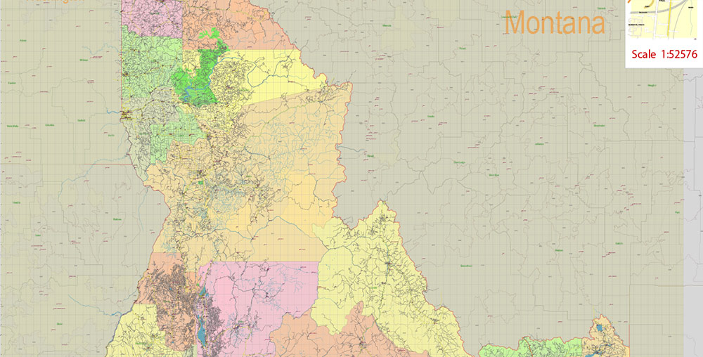
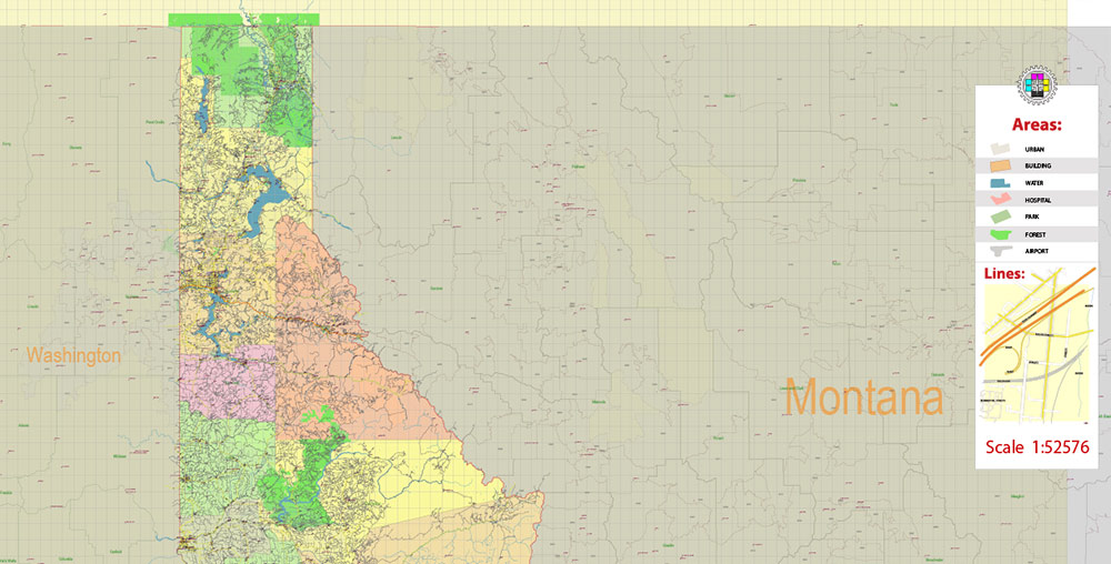
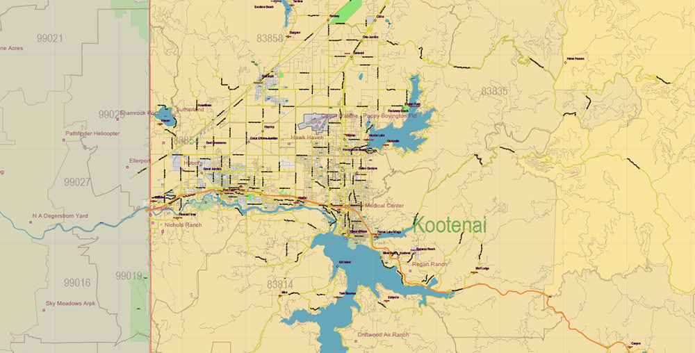
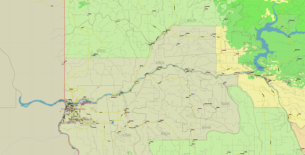
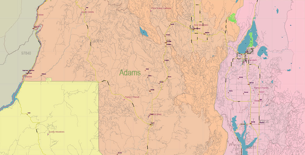
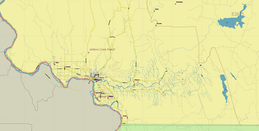
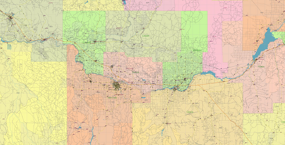
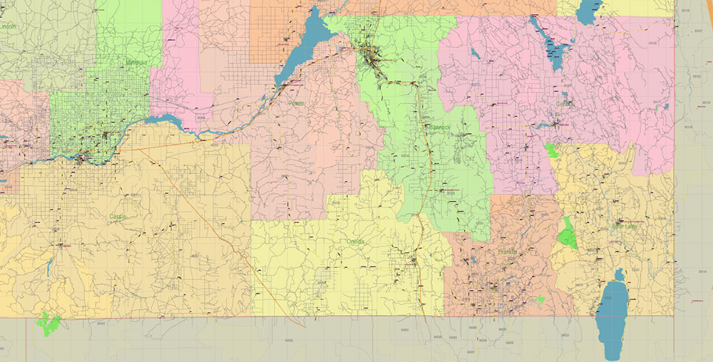
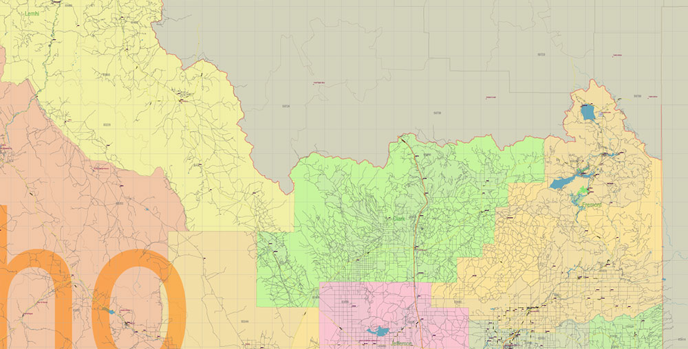
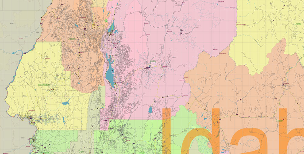
Printable PDF Vector Map of Idaho Full State US: All Streets and Roads + counties areas + zip-codes areas, fully editable Adobe PDF Map in layers, scalable, 151 MB ZIP
Scale: 1:52576
All streets and roads, Names of Principal streets, All Cities and Towns, Counties, All Geonames, airports, and heliports. Map for design, printing, arts, projects, presentations, for architects, designers, and builders, business, logistics.
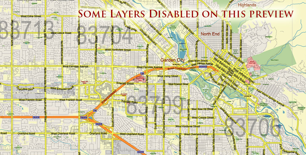
NOTE! All objects are located on separate layers by type. The preview shows them all together. When you work with this map, just turn off or delete those layers that are not needed for your project.
For Editing and High-Quality Printing, Royalty free
Need AutoCAD DWG / DXF, CDR, or any other format? Please, contact us!
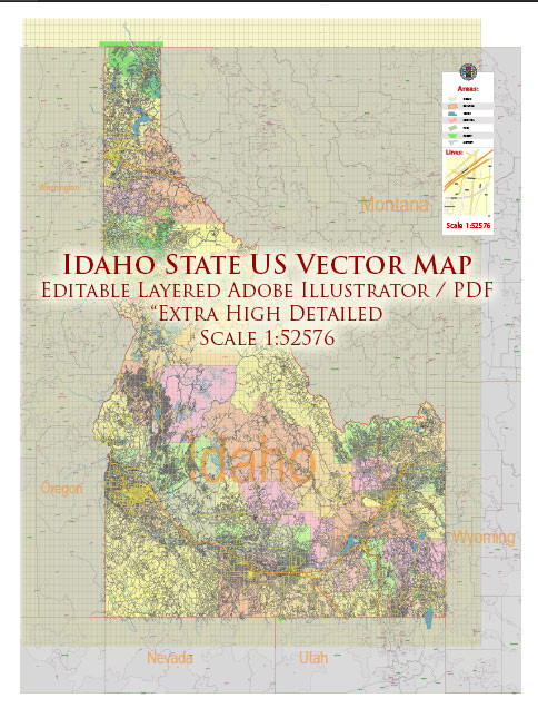
Idaho Full State US PDF Vector Map: Full Extra High Detailed (all roads, zipcodes, airports) + Admin Areas editable Adobe PDF in layers
Layers list:
- Legend
- Grids
- Labels of roads (numbers) – highways, interstate
- All Geonames (cities, towns, villages, hamlets, islands)
- Points of the Geonames (cities, towns, villages, hamlets, islands)
- Names places: Names of all Cities, towns, villages and hamlets
- Names of the Airports and Heliports
- Points of the Airports and Heliports
- Numbers of ZIP codes
- Names of objects (water, park, hospital)
- Names of States
- Names of Counties
- Names of the Main Streets
- Major Roads and Streets – Highways
- Minor Roads and residential streets
- Railroads
- State boundaries
- Water objects (rivers, lakes, ponds, swamps, reefs)
- Waterways
- Ground objects (urban areas, parks, hospitals, etc.)
- ZIP-codes areas
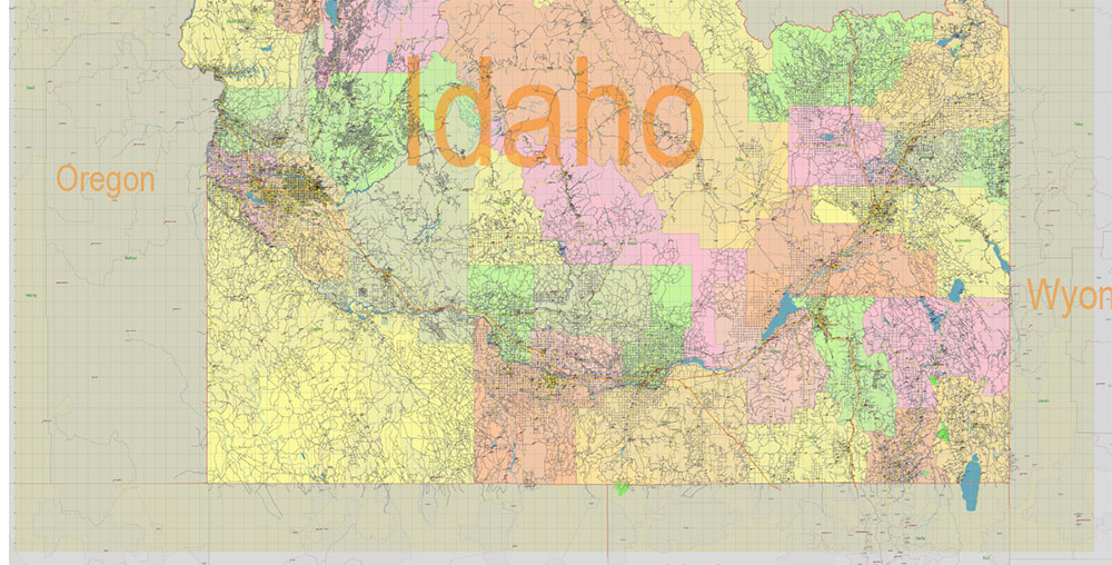
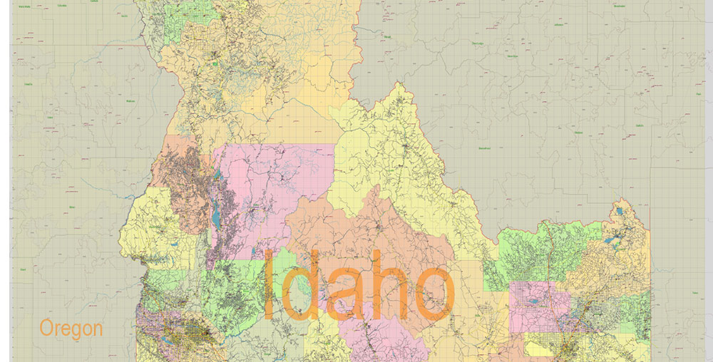
- Counties areas (colored)
- States areas
- Background
Idaho Full State US PDF Vector Map: Full Extra High Detailed (all roads, zipcodes, airports) + Admin Areas editable Adobe PDF in layers
Idaho Full State US PDF Vector Map: Full Extra High Detailed (all roads, zipcodes, airports) + Admin Areas editable Adobe PDF in layers
Idaho Full State US PDF Vector Map: Full Extra High Detailed (all roads, zipcodes, airports) + Admin Areas editable Adobe PDF in layers
Idaho Full State US PDF Vector Map: Full Extra High Detailed (all roads, zipcodes, airports) + Admin Areas editable Adobe PDF in layers
Idaho Full State US PDF Vector Map: Full Extra High Detailed (all roads, zipcodes, airports) + Admin Areas editable Adobe PDF in layers
Idaho Full State US PDF Vector Map: Full Extra High Detailed (all roads, zipcodes, airports) + Admin Areas editable Adobe PDF in layers
Idaho Full State US PDF Vector Map: Full Extra High Detailed (all roads, zipcodes, airports) + Admin Areas editable Adobe PDF in layers
Idaho Full State US PDF Vector Map: Full Extra High Detailed (all roads, zipcodes, airports) + Admin Areas editable Adobe PDF in layers
Idaho Full State US PDF Vector Map: Full Extra High Detailed (all roads, zipcodes, airports) + Admin Areas editable Adobe PDF in layers

Idaho Full State US PDF Vector Map: Full Extra High Detailed (all roads, zipcodes, airports) + Admin Areas editable Adobe PDF in layers

Idaho Full State US PDF Vector Map: Full Extra High Detailed (all roads, zipcodes, airports) + Admin Areas editable Adobe PDF in layers

Idaho Full State US PDF Vector Map: Full Extra High Detailed (all roads, zipcodes, airports) + Admin Areas editable Adobe PDF in layers
Idaho Full State US PDF Vector Map: Full Extra High Detailed (all roads, zipcodes, airports) + Admin Areas editable Adobe PDF in layers
Idaho Full State US PDF Vector Map: Full Extra High Detailed (all roads, zipcodes, airports) + Admin Areas editable Adobe PDF in layers

Idaho Full State US PDF Vector Map: Full Extra High Detailed (all roads, zipcodes, airports) + Admin Areas editable Adobe PDF in layers
Idaho Full State US PDF Vector Map: Full Extra High Detailed (all roads, zipcodes, airports) + Admin Areas editable Adobe PDF in layers
Idaho Full State US PDF Vector Map: Full Extra High Detailed (all roads, zipcodes, airports) + Admin Areas editable Adobe PDF in layers
Idaho Full State US PDF Vector Map: Full Extra High Detailed (all roads, zipcodes, airports) + Admin Areas editable Adobe PDF in layers

Idaho Full State US PDF Vector Map: Full Extra High Detailed (all roads, zipcodes, airports) + Admin Areas editable Adobe PDF in layers

 We accept PayPal and all Debit or Credit Cards | Instantly Download Your Map after payment.
 Author: Kirill Shrayber, Ph.D.