Extended Description of the Vector Map
Hawaiian Archipelago
Geography of the Hawaiian Islands
The Hawaiian Islands are an archipelago of twenty-four islands and atolls, as well as many small islets, located in the North Pacific Ocean. The archipelago is of volcanic origin; it got its name from the name of the largest island — Hawaii. Most of the islands of the archipelago make up the fiftieth state of the United States.
The total land area of the Hawaiian Islands is 16,636 km2. The coastline stretches for 1,700 km. The 8 largest islands are located in the south-east of the archipelago, they make up 99 % of the total area.
Hawai’i — “Big Island”. The area is 10,438 km2. The island was formed 600 thousand years ago.
Maui – “Island Valley” (1,883 km2). The age of 1.8 million years. It is famous for a large extinct volcano, beaches and fertile slopes.
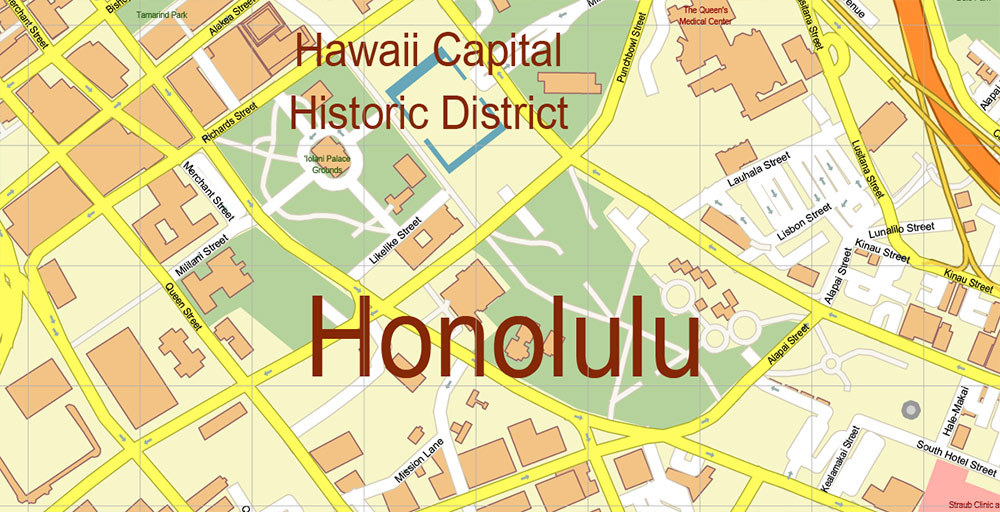
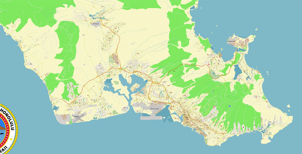
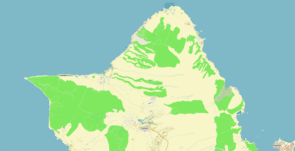
O’ahu — “Main Island” (1,545 km2). 4 million years. The most crowded island with the famous Pearl Harbor Bay and the state capital — Honolulu. The island is famous for its business activities, marine base, museums, pineapples, and large waves.
Kaua’i – “Garden Island” (1,431 km2). 5.3 million years old. The wettest island with steep mountain slopes.
Moloka’i — “Friendly Island” (673 km2). 2.1 million years. A long, narrow island with the highest coastal cliff, up to 1.19 km deep.
Lāna’i — “Pineapple Island” (364 km2). 1.6 million years. A former private island with the largest pineapple plantation.
Ni’ihau — “Forbidden Island” (180 km2). 5.6 million years. A private island, with no cars, roads, or shops. The local population speaks the Hawaiian language.
Kaho’olawe – “Target Island” (116 km2). 1 million years. Island reserve, a former military bombing range.
Behind them, a long line of 124 “northern” islets, atolls, reefs, and shoals continues. These are the remains of ancient sections of Hawaiian land destroyed by rain, wind, and waves. Their age ranges from 8 to 28 million years.
In 2006, the largest marine reserve with an area of about 360 thousand km2 was created on these uninhabited reefs.
Hawaii is the largest and youngest island in the chain, consisting of seven different volcanoes. Mauna Loa volcano, which makes up more than half of the island, is the largest shield volcano on the planet. The height of the volcano from the seafloor (Hawaiian Basin) to the peak is more than 10 kilometers.
State structure
Hawaii is the fiftieth state of the Republic of the United States. According to the Constitution, the legislative power is exercised by a bicameral Congress. Executive power in the United States, including in the Hawaiian Islands, is exercised by the President.
Language
Official language: English
The native language – Hawaiian – exists for the exotic. They love it, teach it in colleges, tell tourists about it, but in everyday life, they use only individual words.
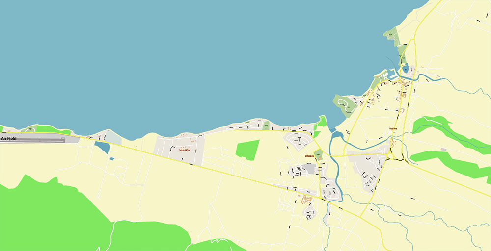
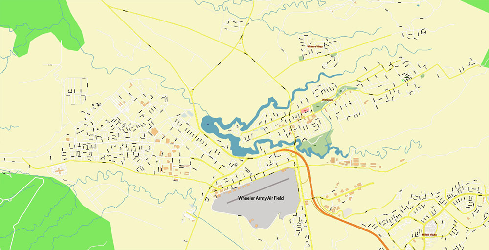
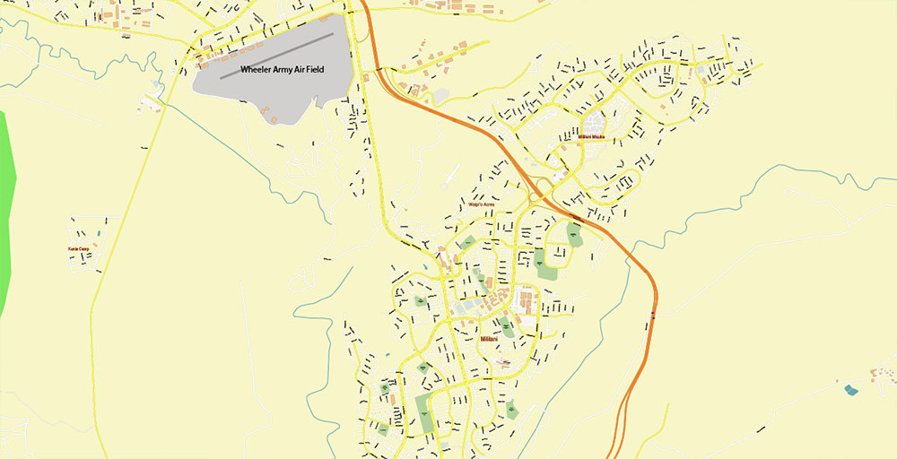
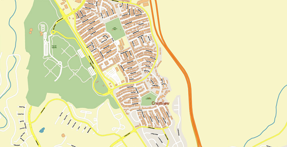
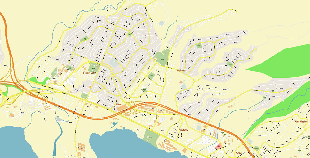
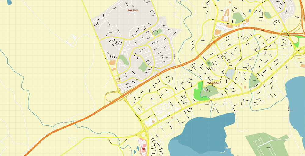
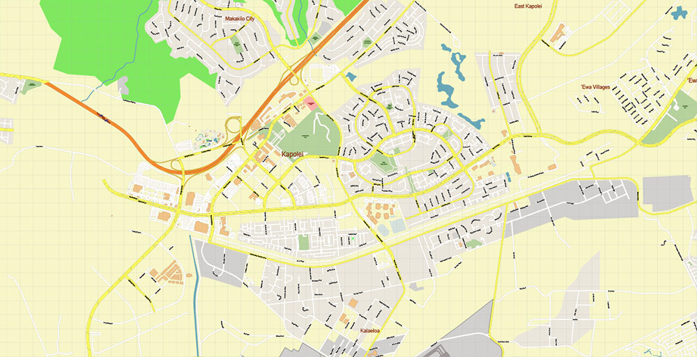
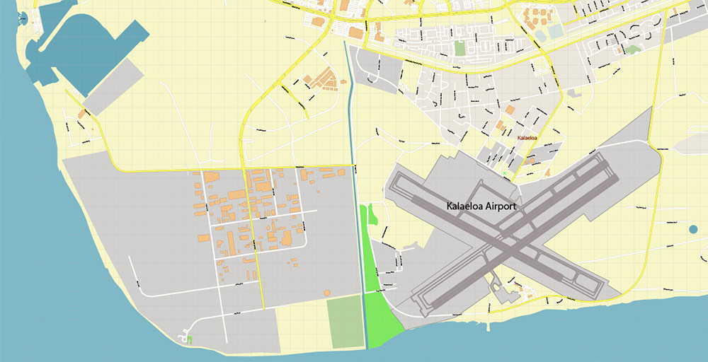
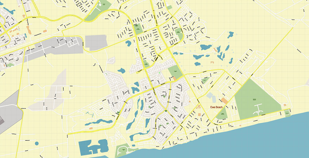
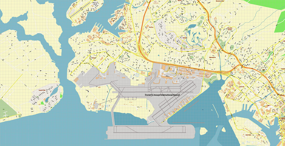
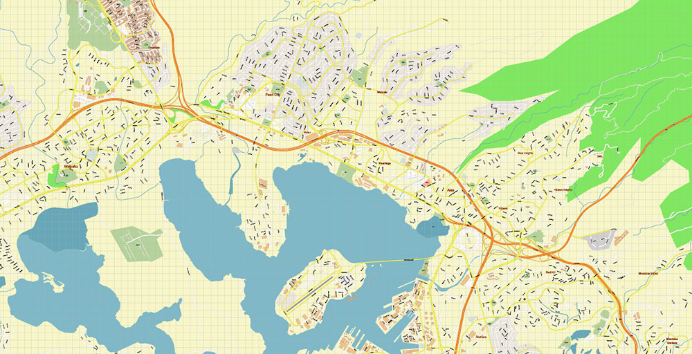
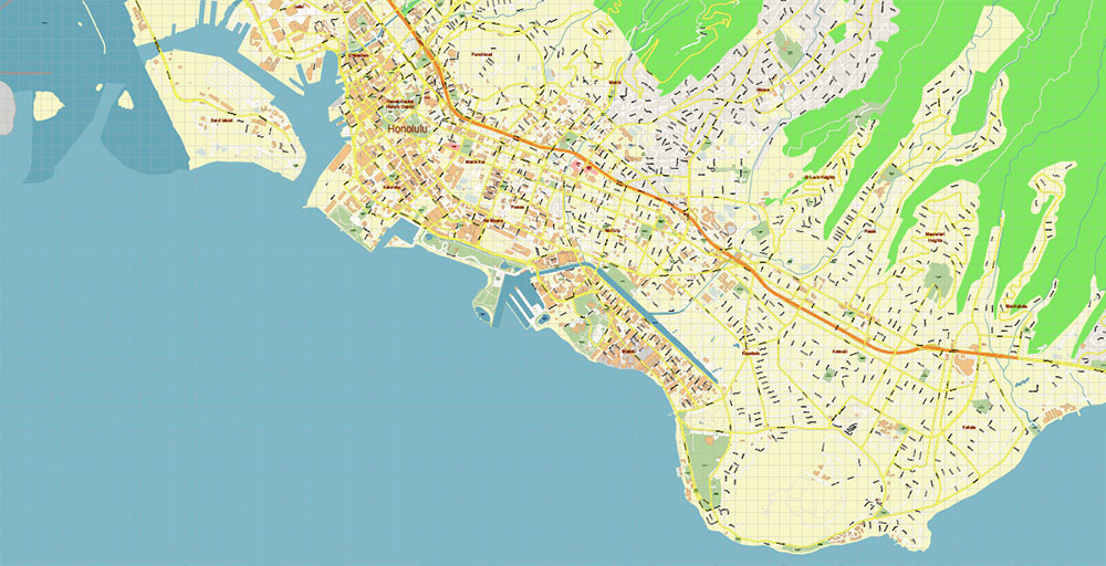
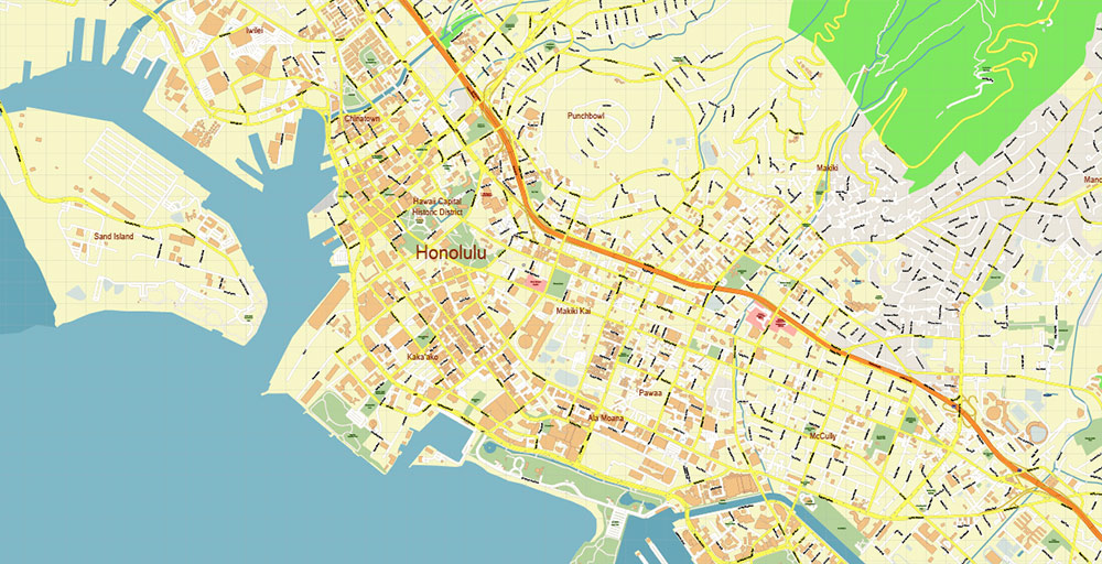
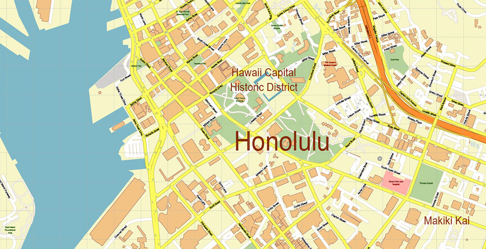
Printable Vector Map of Honolulu Oahu Hawaii US detailed City Plan scale 1:4371 full editable Adobe Illustrator Street Map in layers, scalable, text format all names, 7 MB ZIP
All street names, Main Objects, Buildings. Map for design, printing, arts, projects, presentations, for architects, designers, and builders, business, logistics.
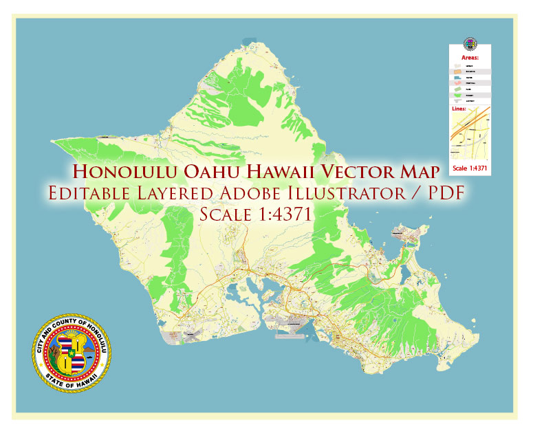
Honolulu Oahu Hawaii US Map Vector Exact City Plan High Detailed Street Map editable Adobe Illustrator in layers
Layers list:
- Legend
- Grids
- Labels of roads
- Names of places (city, hamlet, etc.)
- Names of objects (hospitals, parks, water)
- Names of main streets
- Names of civil streets
- Direction arrows
- Main Streets, roads
- Civil streets
- Buildings
- Airports and heliports
- Water objects (rivers, lakes, ponds)
- Waterways
- Color fills (parks, hospital areas, land use, etc.)
- Islands
- Background and sea
Honolulu Oahu Hawaii US Map Vector Exact City Plan High Detailed Street Map editable Adobe Illustrator in layers
Honolulu Oahu Hawaii US Map Vector Exact City Plan High Detailed Street Map editable Adobe Illustrator in layers
Honolulu Oahu Hawaii US Map Vector Exact City Plan High Detailed Street Map editable Adobe Illustrator in layers
Honolulu Oahu Hawaii US Map Vector Exact City Plan High Detailed Street Map editable Adobe Illustrator in layers
Honolulu Oahu Hawaii US Map Vector Exact City Plan High Detailed Street Map editable Adobe Illustrator in layers
Honolulu Oahu Hawaii US Map Vector Exact City Plan High Detailed Street Map editable Adobe Illustrator in layers
Honolulu Oahu Hawaii US Map Vector Exact City Plan High Detailed Street Map editable Adobe Illustrator in layers
Honolulu Oahu Hawaii US Map Vector Exact City Plan High Detailed Street Map editable Adobe Illustrator in layers
Honolulu Oahu Hawaii US Map Vector Exact City Plan High Detailed Street Map editable Adobe Illustrator in layers

Honolulu Oahu Hawaii US Map Vector Exact City Plan High Detailed Street Map editable Adobe Illustrator in layers
Honolulu Oahu Hawaii US Map Vector Exact City Plan High Detailed Street Map editable Adobe Illustrator in layers
Honolulu Oahu Hawaii US Map Vector Exact City Plan High Detailed Street Map editable Adobe Illustrator in layers
Honolulu Oahu Hawaii US Map Vector Exact City Plan High Detailed Street Map editable Adobe Illustrator in layers
Honolulu Oahu Hawaii US Map Vector Exact City Plan High Detailed Street Map editable Adobe Illustrator in layers
Honolulu Oahu Hawaii US Map Vector Exact City Plan High Detailed Street Map editable Adobe Illustrator in layers
Honolulu Oahu Hawaii US Map Vector Exact City Plan High Detailed Street Map editable Adobe Illustrator in layers
Honolulu Oahu Hawaii US Map Vector Exact City Plan High Detailed Street Map editable Adobe Illustrator in layers
Honolulu Oahu Hawaii US Map Vector Exact City Plan High Detailed Street Map editable Adobe Illustrator in layers

 Author: Kirill Shrayber, Ph.D. FRGS
 Street Map editable Adobe Illustrator in layers")

