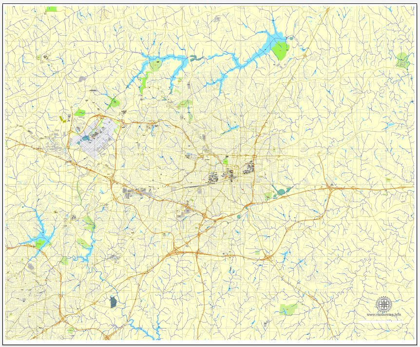
Greensboro PDF map, North Carolina, US, vector street City Plan map, fully editable, Adobe PDF, V3.10 full vector, scalable, editable, text format street names, 16 Mb ZIP.
All streets, some buildings. Map for design, print, arts, projects, presentations.
PDF, DXF, CDR and other formats – on request, same price, please, contact.
You can edit this file in Adobe Illustrator, Adobe Acrobat, Corel Draw.
Greensboro, North Carolina, USA.
This vector map of Greensboro is used as a basis for design, editing, and further printing.
This is the most detailed, exact map of Greensboro for high-quality printing and polygraphy. You can always clarify the map development date by contacting us.
For your convenience, all objects on Greensboro vector map are divided into layers. And the editing is very easy – colors, lines, etc.
You can easily add any objects needed (e.g. shops, salons, sale points, gas station or attraction) on any layer of Greensboro vector map.
Greensboro is a city in the U.S. state of North Carolina. It is the 3rd-most populous city in North Carolina, the 68th-most populous city in the United States, and the county seat and largest city in Guilford County and the surrounding Piedmont Triad metropolitan region. As of the 2010 census, the city population was 269,666, and in 2015 the estimated population was 285,342. Three major interstate highways (Interstate 40, Interstate 85, and Interstate 73) in the Piedmont region of central North Carolina were built to intersect at this city.
One of the advantages of Greensboro vector maps of our production is the relevance of cartographic data, we constantly update all our products.
This vector map of Greensboro is used by:
designers, layout designers, printers, advertisers and architects. Our product – vector maps – is designed for further editing and printing in large formats – from @Wall format (a few meters) to A-0 and A-1, A-2, A-3.
Greensboro map in vector format is used for design, urban planning, presentations and media visualizations.
Advertising and presentation map of Greensboro (usually the final designer marks the routes, and puts the client’s objects (shops, saloons, gas stations etc.)
The undoubted advantage is that people will NEVER throw out this advertising product – the map. In fact, as an advertising medium, a map is the most “long-playing” of the well-known polygraphic advertising media, with the longest lifespan, and the maximum number of interactions with the customer.
For travelers, maps are sold at the airports and gas stations around the world. Often the source is our vector maps.
Take a look, who purchases our vector maps of Greensboro in “Our Clients and Friends” page – these are large and small companies, from super-brands like Volvo and Starbucks, to small design studios and printing houses.
It’s very easy to work with vector maps of Greensboro, even for a not very experienced designer who can turn on and off the map layers, add new objects, change the colors of fill and lines according to customer requirements.
The undoubted advantage of Greensboro vector maps in printing is an excellent and detailed visualization, when customer can expand a large paper map and instantly define his location, find a landmark, an object or address on map, unlike using the popular electronic formats of Google and Yandex maps for example.
Printable vector maps of Greensboro are much more convenient and efficient than any electronic maps on your smartphone, because ALL DETAILS are displayed in the entire space of Greensboro map.
Useful tips on working with vector maps of cities and countries in Adobe Illustrator.
«V» – launches the Selection tool (cursor, black arrow), which makes active any vector line.
«А» – launches the Direct Selection tool (white cursor), allows you to select curve elements and drag them to the desired place.
«R» – activates the Rotate tool, which helps you rotating selected objects around the center point by 360 degrees.
«E» – gives you the opportunity to use the Eraser tool and erase unnecessary parts.
«X» – switches between Fill and Stroke in the Tools section. Try to get used to this hot key and
you will quickly understand that you can’t live and work without it.
Guides are not limited to vertical and horizontal in Adobe Illustrator. You can also create a diagonal guide for example. Moreover, you can turn any contours into guides. Select the outline and go to View > Guides > Make Guides (Create Guides), or simply press Cmd/Ctrl + 5. You can also turn the guides back into an editable object. Go to menu, View > Guides > Unlock Guides (Release Guides), select the guide you want to edit and select View > Guides > Release Guides (Reset Guides), or just press Cmd/Ctrl + Option / Alt + 5).
You will probably want to change the color scheme used on our Greensboro vector map.
To quickly and effectively play with colors.
Of course, you can do it manually, all objects in our Greensboro vector map are divided according to types and layers, and you can easily change the color gamma of vector objects in groups and layers.
But there is more effective way of working with the whole VECTOR MAP of Greensboro and all layers:
The overview dialog «Edit colors»/«Repaint Graphic Object» (this dialog box name can change depending on the context):
If you have selected a part or a layer of Greensboro vector map and open the dialog box by clicking the icon in the Control panel, on the Samples palette or the Color Catalog, or if you choose Edit > Edit Colors> Repaint Graphic Object, then the «Repaint Graphic Object» dialog box appears, and you get access to «Assign» and «Edit» tabs.
If a picture or a map fragment is not selected, and you open the dialog box by clicking the icon in the Control panel, on the Samples palette or in the Color Catalog, the «Edit Colors» dialog box appears and you can only access the «Edit» tab.
Regardless of the name at the top of the dialog box, the right-hand side always displays the color group of the current document, as well as two default color groups: Print Color and Grayscale. These color groups can be selected and used any time.
Create and edit color groups of Greensboro vector map, and also assign colors using the «Edit Colors»/ а «Repaint Graphic Object» dialog box.
A. Creating and editing of a color group on the «Edit» tab
B. Assigning colors on the «Assign» tab
C. Select a group of colors from the «Color groups» list
The option «Repaint a graphic object» in the lower part of the dialog box allows you to preview the colors on a selected layer of Vector map, or a group of elements, and specify whether its colors will be redefined when the dialog box is closed.
The main areas of the dialog box are:
«Edit»
The «Edit» tab is designed to create a new or edit the existing color groups.
The harmony rules Menu and the Color Wheel are used to conduct experiments with color harmonies. The color wheel shows how colors are related in color harmony, and the color bars allow you to view and manipulate an individual color values. In addition, you can adjust the brightness, add and remove colors, save color groups and view colors on the selected Vector Map of Greensboro or a separated layers.
«Assign»
The «Assign» tab is used to view and control on how the original colors are replaced with colors from the color group like your corporate colors in the Vector Map of Greensboro.
The assign color ability is provided only if the entire map, layer or fragment is selected in the document. You can specify which of new colors replace the current colors, whether the spot colors should be preserved and how colors are replaced (for example, you can replace colors completely or changing the color tone while maintaining the brightness). The «Assign» tab allows you to redefine colors in the Vector Map of Greensboro, or in separate layers and fragments using the current color group or reducing the number of colors in the current Vector Map.
Color groups
Is a list of all saved color groups for current document (the same groups appear in the «Samples» palette). You can edit and delete the existing color groups, as well as creating a new ones using the list of “Color Groups” in the dialog box. All changes appear in the «Samples» palette.
The highlighted color group shows, which color group is currently edited.
Any color group can be selected and edited, or used to redefine the colors in the selected vector map of Greensboro , its fragments or elements.
Saving a color group adds this group to the specified list.
Opening the «Edit Colors»/«Repaint Graphic Object» dialog box.
Open the «Edit Colors»/«Repaint Graphic Object» dialog box using one of the following methods:
«Edit»> «Edit Colors»> «Repaint Graphic object» or «Repaint With Style».
Use these commands if you need to edit the colors in the selected vector map of Greensboro city.
«Repaint Graphic object» button on the «Control» panel.
Use this button if you need to adjust colors of Greensboro vector map using the а «Repaint graphic object» dialog box.
The specified button is available if the selected vector map or its fragment contains two or more colors.
Note. This color editing method is convenient for global color adjustment in a vector map, if global colors were not used when creating a Map of Greensboro.
The «Edit colors» button or «Edit or apply colors» on the «Color Catalog» palette
Click this button if you need to edit colors on the «Color Catalog» palette or edit and then apply them to the selected Vector Map of Greensboro or its fragment.
The «Edit color group» button or «Edit or apply color group» on the «Samples» palette.
Click this button if you need to edit the colors in the specific color group or edit and apply them to the selected Vector Map of Greensboro or a group of its elements, for example, the whole layer “Streets and lines”. You can also double-click the color group in the Samples panel to open the dialog box.
If the map file is too large and your computer freezes or even can’t open it quickly:
1. Try to reduce the color resolution of the video card (display) to 256 colors while working with a large map.
2. Using Windows Task Manager, select all the application you don’t need, while working with map, just turn them off.
3. Launch Adobe Illustrator. (DO NOT OPEN the vector map file)
4. Start the Windows Task Manager using administrator rights > Find the “Illustrator” process > set the «real time» priority,
5. Open the file. When you see the LEGACY FONT popup window – click “OK” (do not update). You can restore the TEXT later.
6. Can also be useful: When file is opened – Edit > Settings > Basic Settings > disable smoothing. /// It looks scary, but works quickly)))
We recommend saving the file in Adobe Illustrator 10 version. It’s much more stable when working with VERY BIG size files.
In 1808, “Greensborough” (the spelling before 1895) was planned around a central courthouse square to succeed Guilford Court House as the county seat. The county courts were thus placed closer to the geographical center of the county, a location more easily reached at the time by the majority of the county’s citizens, who depended on horse and foot for travel.
In 2003, the previous Greensboro – Winston-Salem – High Point metropolitan statistical area (MSA) was re-defined by the U.S. Office of Management and Budget. This region was separated into the Greensboro–High Point MSA and the Winston-Salem MSA. The 2010 population for the Greensboro–High Point MSA was 723,801. The combined statistical area (CSA) of Greensboro–Winston-Salem–High Point, popularly referred to as the Piedmont Triad, had a population of 1,599,477.
Among Greensboro’s many notable attractions, some of the most popular include the Wet ‘n Wild Emerald Pointe water park, the Greensboro Science Center, the International Civil Rights Museum, the Weatherspoon Art Museum, the Greensboro Symphony, the Greensboro Ballet, Triad Stage, the Wyndham Golf Championship, the headquarters of the Atlantic Coast Conference, the Greensboro Coliseum Complex which hosts various sporting events, concerts, and other events, the Greensboro Grasshoppers of the South Atlantic Baseball League, the Carolina Dynamo of the Premier Development Soccer League, the Greensboro Swarm of the NBA G League, the Greensboro Roller Derby, and the National Folk Festival.
Geography
According to the United States Census Bureau, the city has a total area of 131.8 square miles (341.4 km2), of which 126.5 square miles (327.7 km2) is land and 5.3 square miles (13.7 km2), or 4.01%, is water.
Greensboro is located among the rolling hills of North Carolina’s Piedmont, situated midway between the state’s Blue Ridge and Great Smoky Mountains to the west and the Atlantic beaches and Outer Banks to the east. The view of the city from its highest building—the Lincoln Financial tower (commonly known as the Jefferson-Pilot Building after its previous owner)—shows an expanse of shade trees in the city. Interstates 40, 85, and 73 intersect at the city.
Free vector maps:

Free download Vector Map US Interstate roads, Adobe PDF, V.2 Free_Map_US_Interstates_Roads_2.pdf
Free download Vector Map US Interstate roads, Adobe Illustrator, V.2 Free_Map_US_Interstates_Roads_2.ai

Free Download Vector Map US County and State Adobe Illustrator
Free_Vector_Map_US_States_County_Map.ai
Free Download Vector Map US County and State Adobe PDF
Free_Vector_Map_US_States_County_Map.pdf

Free Vector Map US Census Data Top US Ancestries by County Adobe Illustrator
Free_Vector_Map_US_Census-Data-Top-US-Ancestries-by-County.ai
Free Vector Map US Census Data Top US Ancestries by County Adobe PDF
Free_Vector_Map_US_Census-Data-Top-US-Ancestries-by-County.pdf
Small guide: How to work with the vector map?
You can: Mass select objects by type and color – for example, the objects type “building” (they are usually dark gray) – and remove them from the map, if you do not need them in your print or design project. You can also easily change the thickness of lines (streets), just bulk selection the road by the line color.
The streets are separated by type, for example, type “residential road” are usually white with a gray stroke. Highway usually orange with a brown or dark gray stroke.
It is easy to change the font of inscriptions, all or each individually. Also, just can be make and any other manipulation of objects on the vector map in Adobe illustrator format.
Important: All the proportions on the map are true, that is, the relative sizes of the objects are true, because Map is based on an accurate GPS projection, and It transated into the (usual for all) the Mercator projection.
You can easily change the color, stroke and fill of any object on the map, zoom without loss of quality Image Verification.
Select object

Bulk selection the same objects on the vector map

See the bulk selected objects on the vector map

Bulk delete buildungs from the vector map

Select residencial road (small street) on the vector map

Bulk selection the same lines (streets, roads) on the full map

Create fat lines of the streets on the vector maps (bulk action) 1

Create fat lines of the streets on the vector maps (bulk action) 2

Create fat lines of the streets on the vector maps (bulk action) 3

You can easily change the color, stroke and fill of any object on the map, zoom without loss of quality Image Verification.
Greensboro, North Carolina
Greensboro (formerly Greensborough) is a city in the U.S. state of North Carolina. It is the third-largest city by population in North Carolina and the county seat and largest city in Guilford County and the surrounding Piedmont Triad metropolitan region. According to the 2012 U.S. Census Estimate, Greensboro’s population is 277,080. Three major interstate highways (Interstate 85, Interstate 40 and Interstate 73) in the Piedmont region of central North Carolina were built to intersect at this city.
In 1808, Greensborough (the spelling before 1895) was planned around a central courthouse square to succeed Guilford Court House as the county seat. This county courts were thus placed closer to the geographical center of the county, a location more easily reached at the time by the majority of the county’s citizens, who depended on horse and foot for travel.
In 2003, the previous Greensboro – Winston-Salem – High Point metropolitan statistical area (MSA) was re-defined by the U.S. Office of Management and Budget. This region was separated into the Greensboro-High Point MSA and the Winston-Salem MSA. The 2010 population for the Greensboro-High Point MSA was 723,801. The combined statistical area (CSA) of Greensboro–Winston-Salem–High Point, popularly referred to as the Piedmont Triad, had a population of 1,599,477.
Among Greensboro’s many notable attractions, some of the most popular include the Wet ‘n Wild Emerald Pointe water park, the Greensboro Science Center, the International Civil Rights Center and Museum, the Weatherspoon Art Museum, the Greensboro Symphony, the Greensboro Ballet, Triad Stage, the Wyndham Golf Championship, the headquarters of the Atlantic Coast Conference, the Greensboro Coliseum Complex which hosts various sporting events, concerts, and other events, the Greensboro Grasshoppers of the South Atlantic Baseball League, the Carolina Dynamo of the Premier Development Soccer League, the Gate City FC of the National Premier Soccer League, the Greensboro Swarm of the NBA Development League, the Greensboro Roller Derby, and the National Folk Festival.
Geography of Greensboro, North Carolina
According to the United States Census Bureau, the city has a total area of 109.2 square miles (283 km2), of which, 104.7 square miles (271 km2) of it is land and 4.5 square miles (12 km2) of it (4.16%) is water.
Greensboro is located among the rolling hills of North Carolina’s Piedmont, situated midway between the state’s Blue Ridge and Great Smoky mountains to the west and the Atlantic beaches and Outer Banks to the east. The view of the city from its highest building — the Lincoln Financial tower (commonly known as the Jefferson-Pilot Building after the local newspaper) — shows an expanse of shade trees in the city. Interstates 40 and 85 intersect at the city, and the planned I-73 is to pass through its borders.
Downtown area of Greensboro, North Carolina
Downtown Greensboro has attracted development investment in recent years with such new construction as Yadkin Bank Park, and residential and offices. The Southside neighborhood downtown exemplifies central-city reinvestment. The formerly economically depressed neighborhood has been redeveloped as an award-winning neotraditional-style neighborhood featuring walkability, compact blocks and local amenities and services. Downtown Greensboro has an active nightlife with numerous nightclubs, bars and restaurants.
The redevelopment of the downtown was stimulated by the 2006 opening of the Elon University School of Law. The law school is credited with attracting student dollars to the downtown both day and night.
Greensboro NC skyline.
Four Seasons/Coliseum Area
Sheraton Four Seasons – Joseph S. Koury Convention Center
The Four Seasons Town Centre is a three-story shopping mall with 1,141,000 square feet of shopping space that was developed by the Koury Corporation. Located at 410 Four Seasons Town Centre, it is adjacent to the Koury Convention Center and Sheraton Hotel. Boasting over 250,000 square feet (20,000 m2) of flexible meeting space, the Joseph S. Koury Convention Center is the largest convention center in the Southeast between Atlanta, Georgia and Washington, D.C.. The hotel has more than 1,000 rooms.
The Greensboro Coliseum is located at 1921 W. Gate City Boulevard. This multi-purpose complex consists of the 22,000-seat Greensboro Coliseum, 2,400-seat War Memorial Auditorium, 300-seat Odeon Theatre, and the 167,000-square foot Special Events Center, which includes three exhibition halls, a 4,500-seat mini-arena and eight meeting rooms. The 30,000-square foot Pavilion is located adjacent. The Coliseum’s website notes the complex hosts “a broad range of activities, including athletic events, cultural arts, concerts, theater, educational activities, fairs, exhibits, and public and private events of all kinds including conventions, convocations and trade and consumer shows.”
The War Memorial Auditorium has been demolished.
Airport area
In 1998, FedEx built a $300 million mid-Atlantic air-cargo and sorting hub at Piedmont Triad International Airport, following an intensive competition for the hub among other regions of the state, as well as locations in South Carolina. The project was challenged in court based on the quality of planned noise and pollution abatements from neighborhoods near the planned hub site. The hub opened in 2009. Originally projected by FedEx to employ 750 people in its first two years of operation and eventually 1,500, local FedEx employment has been nearly the same as before the facility was constructed.
In March 2015 HondaJet, with a manufacturing facility in Greensboro, announced that it had received provisional type certification (PTC) from the United States Federal Aviation Administration (FAA). This achievement indicates the FAA’s approval of the HondaJet design based on certification testing, design reviews, and analyses completed to date.
https://en.wikipedia.org/wiki/Greensboro,_North_Carolina#Geography

 Author: Kirill Shrayber, Ph.D. FRGS

