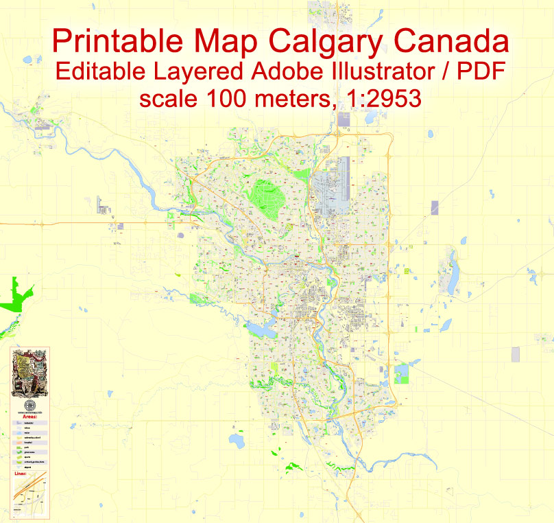
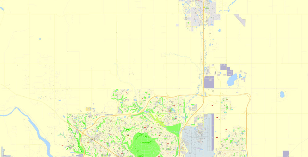
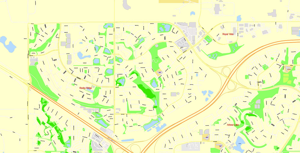
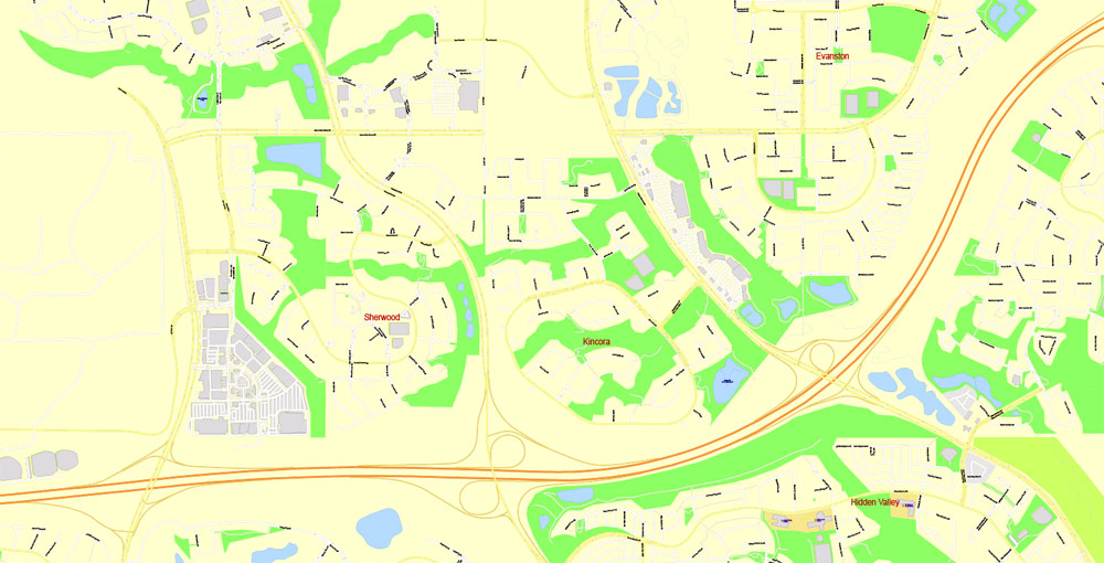
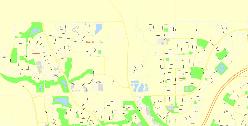
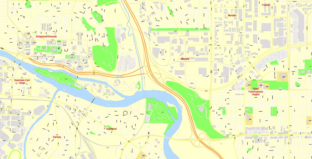
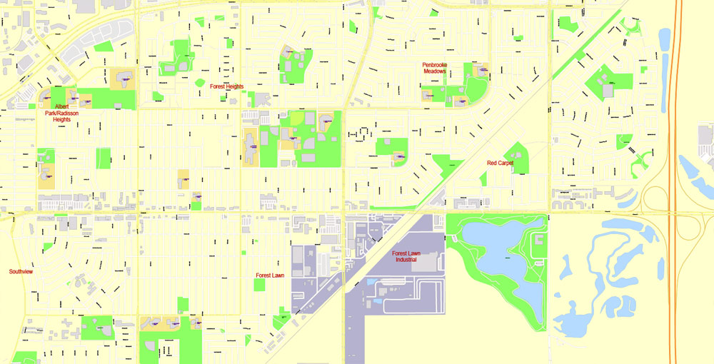
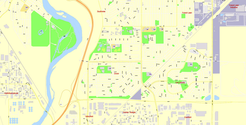
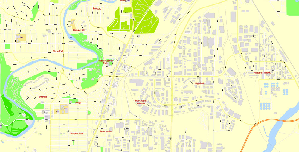
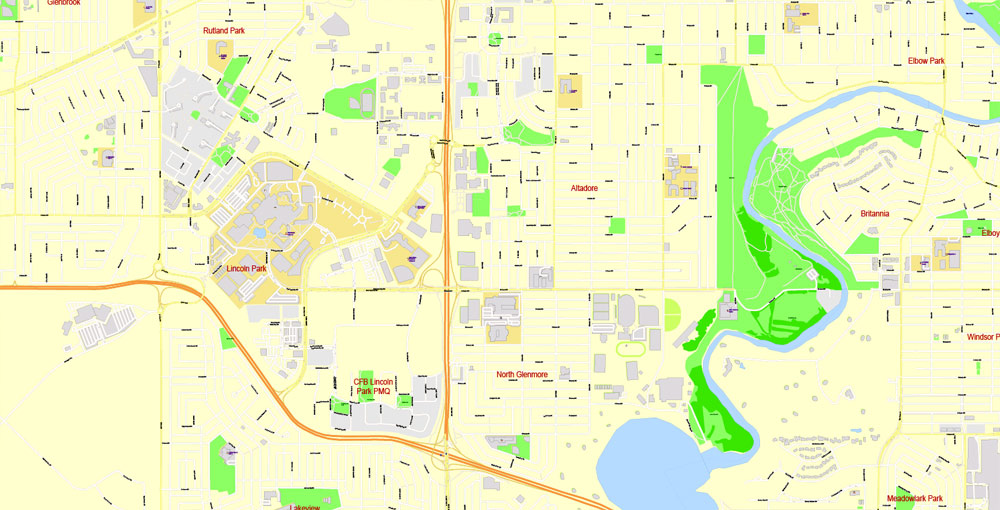
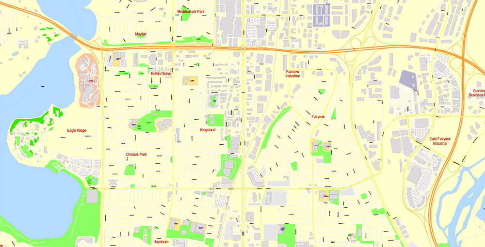
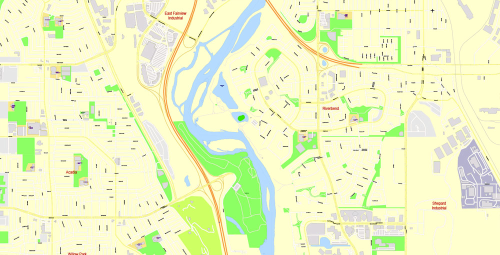
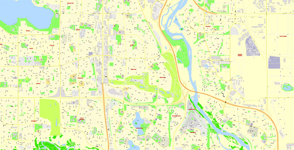
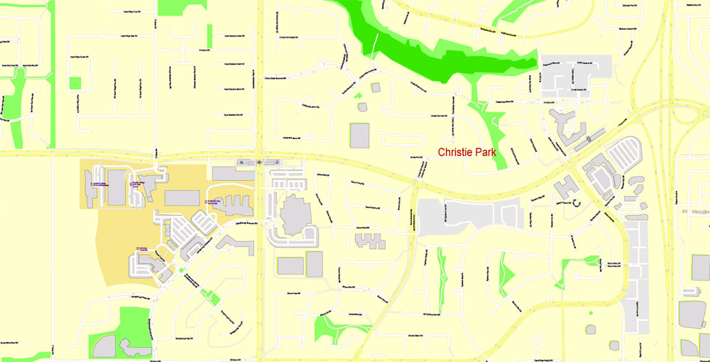
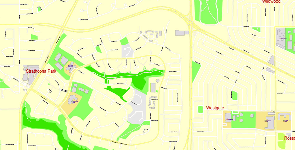
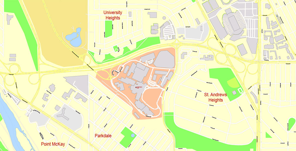
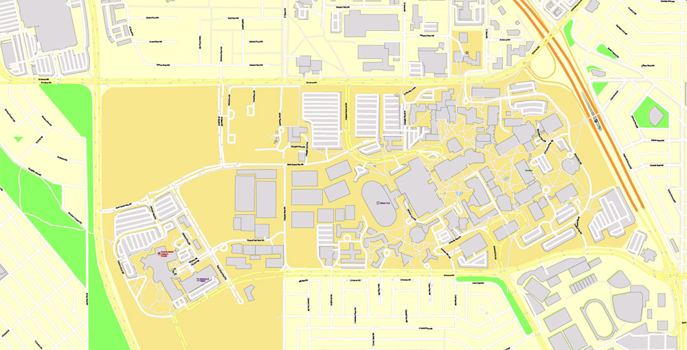
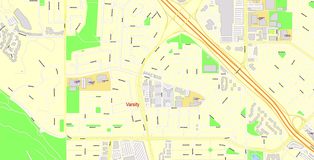
Editable PDF Map Calgary City Large Area, Canada, exact Map City Plan Level G-View 17 (100 meters scale) full editable, Adobe PDF, full vector, scalable, editable text format street names, 59 mb ZIP
All streets named, Main Objects, All buildings. Map for design, printing, arts, projects, presentations, for architects, designers and builders, business, logistics.
Layers: color_fills , streets_roads, arrows_streets, labels_roads, objects (parks, water objects, hospitals, schools), names_objects, names_streets, names_places, grids, legend, names_buildings.
The most exact and detailed map of the city.
You can edit this file by Adobe Illustrator, Adobe Acrobat, Corel Draw.
For print LARGE (WALL) format.
DWG, DXF, CDR and other formats – on request, same price, please, contact
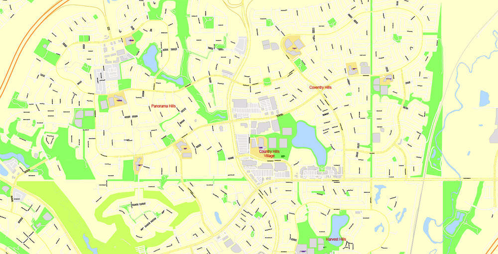
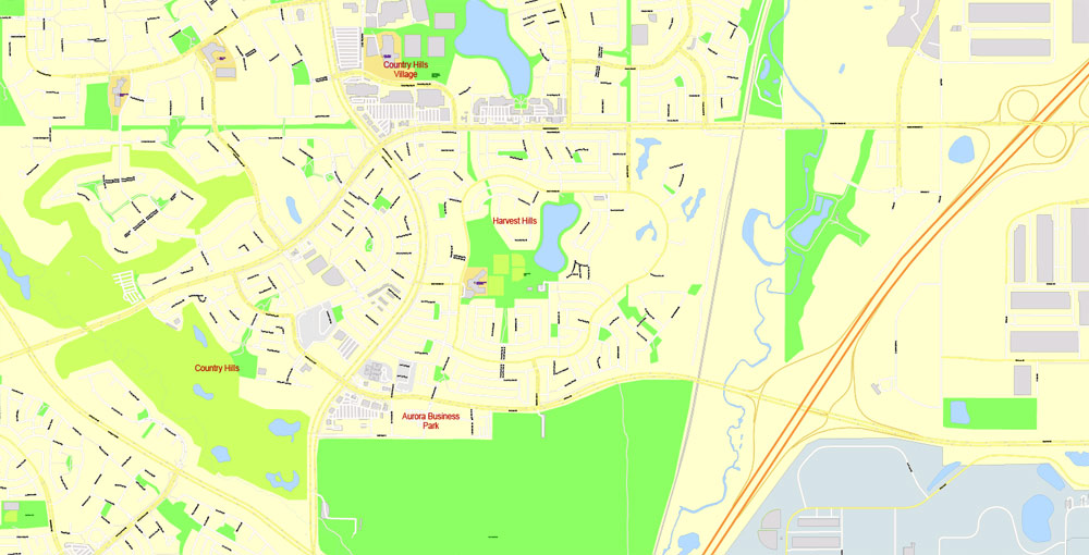
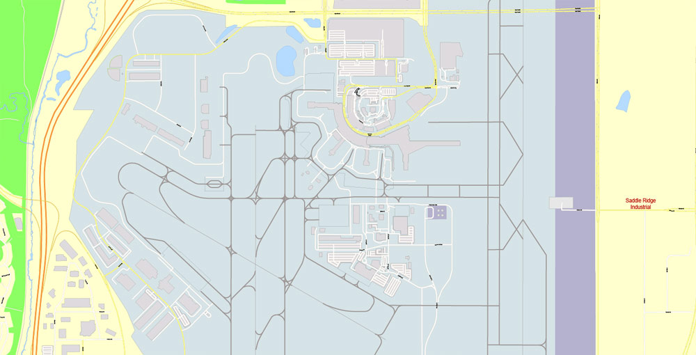
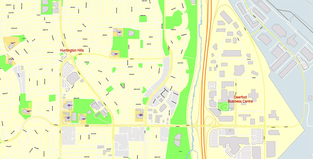
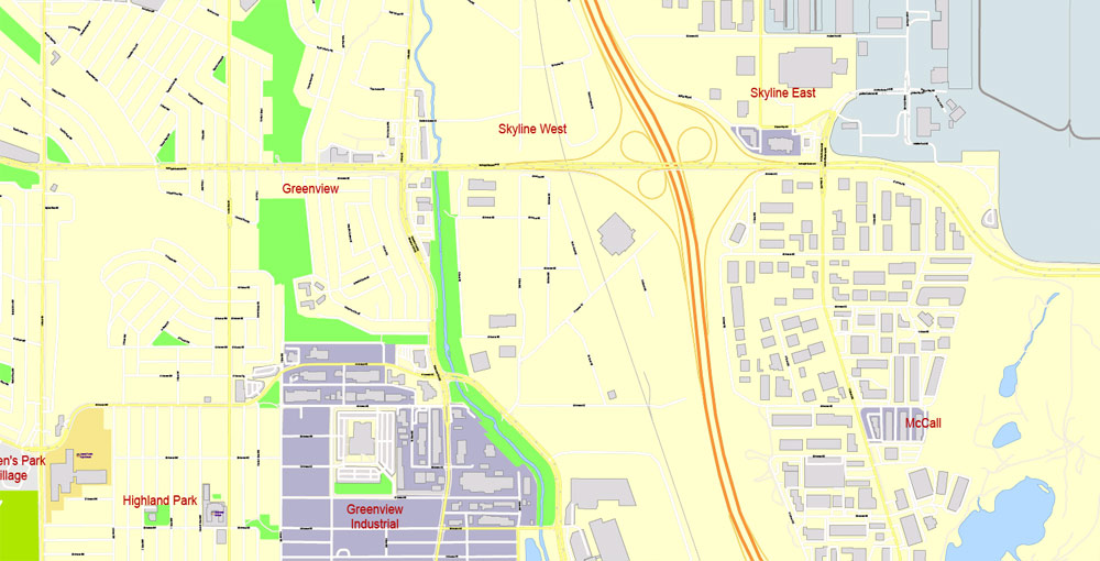
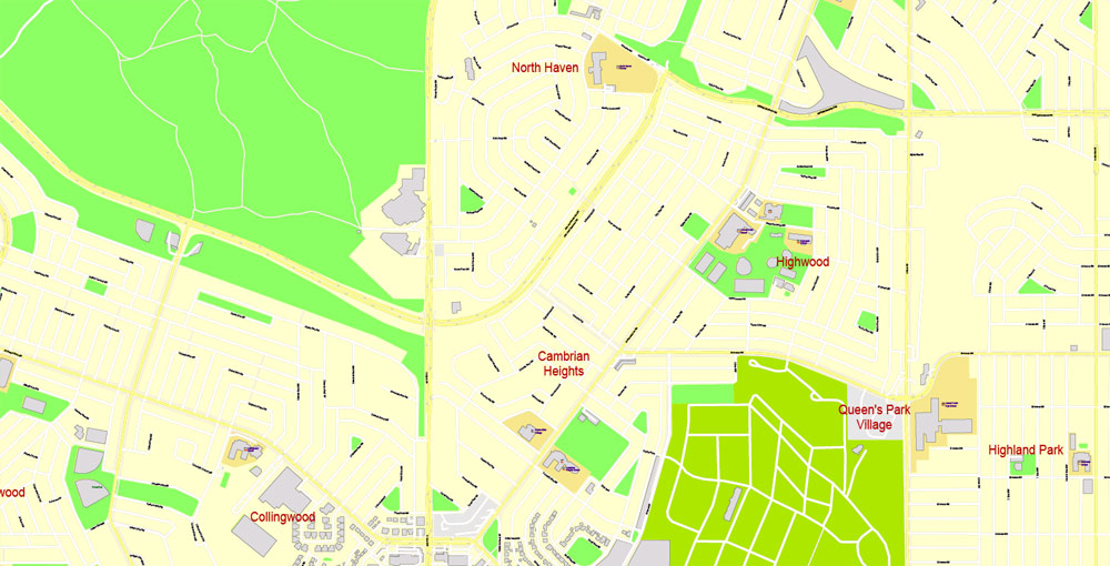
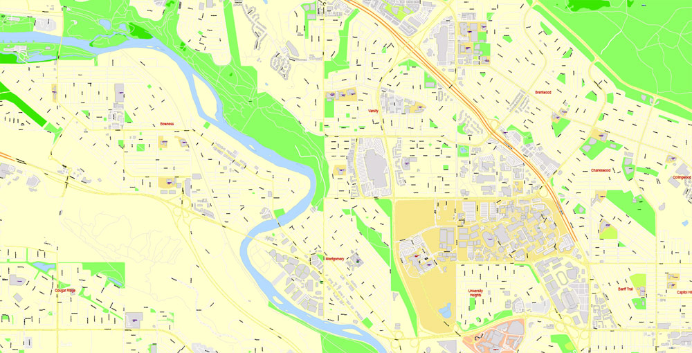
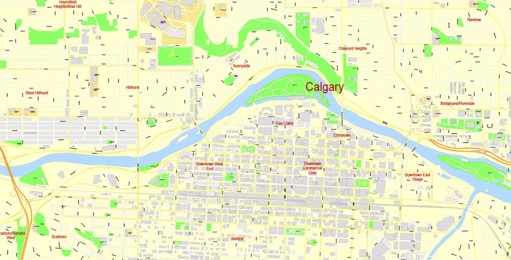
Calgary, Canada.
This vector map of Calgary city is used as a basis for design, editing, and further printing.
This is the most detailed, exact map of Calgary city for high-quality printing and polygraphy. You can always clarify the map development date by contacting us.
For your convenience, all objects on Calgary vector city map are divided into layers. And the editing is very easy – colors, lines, etc.
You can easily add any objects needed (e.g. shops, salons, sale points, gas station or attraction) on any layer of Calgary vector map.
Calgary is a city in the Canadian province of Alberta. It is situated at the confluence of the Bow River and the Elbow River in the south of the province, in an area of foothills and prairie, about 80 km (50 mi) east of the front ranges of the Canadian Rockies. The city anchors the south end of what Statistics Canada defines as the “Calgary–Edmonton Corridor”.
One of the advantages of Calgary city vector maps of our production is the relevance of cartographic data, we constantly update all our products.
This vector map of Calgary city is used by:
designers, layout designers, printers, advertisers and architects. Our product – vector maps – is designed for further editing and printing in large formats – from @Wall format (a few meters) to A-0 and A-1, A-2, A-3.
The Calgary city map in vector format is used for design, urban planning, presentations and media visualizations.
The advertising and presentation map of Calgary city (usually the final designer marks the routes, and puts the client’s objects (shops, saloons, gas stations etc.)
The undoubted advantage is that people will NEVER throw out this advertising product – the map. In fact, as an advertising medium, a city map is the most “long-playing” of the well-known polygraphic advertising media, with the longest lifespan, and the maximum number of interactions with the customer.
For travelers, maps are sold at the airports and gas stations around the world. Often the source is our vector maps.
Take a look, who purchases our vector maps of Calgary city in “Our Clients and Friends” page – these are large and small companies, from super-brands like Volvo and Starbucks, to small design studios and printing houses.
It’s very easy to work with vector maps of Calgary city, even for a not very experienced designer who can turn on and off the map layers, add new objects, change the colors of fill and lines according to customer requirements.
The undoubted advantage of Calgary city vector maps in printing is an excellent and detailed visualization, when customer can expand a large paper map and instantly define his location, find a landmark, an object or address on map, unlike using the popular electronic formats of Google and Yandex maps for example.
Printable vector maps of Calgary city are much more convenient and efficient than any electronic maps on your smartphone, because ALL DETAILS are displayed in the entire space of Calgary city map.
Useful tips on working with vector maps of cities and countries in Adobe Illustrator.
«V» – launches the Selection tool (cursor, black arrow), which makes active any vector line.
«А» – launches the Direct Selection tool (white cursor), allows you to select curve elements and drag them to the desired place.
«R» – activates the Rotate tool, which helps you rotating selected objects around the center point by 360 degrees.
«E» – gives you the opportunity to use the Eraser tool and erase unnecessary parts.
«X» – switches between Fill and Stroke in the Tools section. Try to get used to this hot key and
you will quickly understand that you can’t live and work without it.
Guides are not limited to vertical and horizontal in Adobe Illustrator. You can also create a diagonal guide for example. Moreover, you can turn any contours into guides. Select the outline and go to View > Guides > Make Guides (Create Guides), or simply press Cmd/Ctrl + 5. You can also turn the guides back into an editable object. Go to menu, View > Guides > Unlock Guides (Release Guides), select the guide you want to edit and select View > Guides > Release Guides (Reset Guides), or just press Cmd/Ctrl + Option / Alt + 5).
The city had a population of 1,239,220 in 2016, making it Alberta’s largest city and Canada’s third-largest municipality. Also in 2016, Calgary had a metropolitan population of 1,392,609, making it the fourth-largest census metropolitan area (CMA) in Canada.
You will probably want to change the color scheme used on our Calgary vector city map.
To quickly and effectively play with colors.
Of course, you can do it manually, all objects in our Calgary city vector map are divided according to types and layers, and you can easily change the color gamma of vector objects in groups and layers.
But there is more effective way of working with the whole VECTOR MAP of Calgary city and all layers:
The overview dialog «Edit colors»/«Repaint Graphic Object» (this dialog box name can change depending on the context):
If you have selected a part or a layer of Calgary city vector map and open the dialog box by clicking the icon in the Control panel, on the Samples palette or the Color Catalog, or if you choose Edit > Edit Colors> Repaint Graphic Object, then the «Repaint Graphic Object» dialog box appears, and you get access to «Assign» and «Edit» tabs.
If a picture or a map fragment is not selected, and you open the dialog box by clicking the icon in the Control panel, on the Samples palette or in the Color Catalog, the «Edit Colors» dialog box appears and you can only access the «Edit» tab.
Regardless of the name at the top of the dialog box, the right-hand side always displays the color group of the current document, as well as two default color groups: Print Color and Grayscale. These color groups can be selected and used any time.
Create and edit color groups of Calgary city vector map, and also assign colors using the «Edit Colors»/ а «Repaint Graphic Object» dialog box.
A. Creating and editing of a color group on the «Edit» tab
B. Assigning colors on the «Assign» tab
C. Select a group of colors from the «Color groups» list
The option «Repaint a graphic object» in the lower part of the dialog box allows you to preview the colors on a selected layer of Vector map, or a group of elements, and specify whether its colors will be redefined when the dialog box is closed.
The main areas of the dialog box are:
«Edit»
The «Edit» tab is designed to create a new or edit the existing color groups.
The harmony rules Menu and the Color Wheel are used to conduct experiments with color harmonies. The color wheel shows how colors are related in color harmony, and the color bars allow you to view and manipulate an individual color values. In addition, you can adjust the brightness, add and remove colors, save color groups and view colors on the selected Vector Map of Calgary city or a separated layers.
The economy of Calgary includes activity in the energy, financial services, film and television, transportation and logistics, technology, manufacturing, aerospace, health and wellness, retail, and tourism sectors. The Calgary CMA is home to the second-highest number of corporate head offices in Canada among the country’s 800 largest corporations. In 2015, Calgary had the highest number of millionaires per capita of any major city in Canada. In 1988, Calgary became the first Canadian city to host the Winter Olympic Games.
«Assign»
The «Assign» tab is used to view and control on how the original colors are replaced with colors from the color group like your corporate colors in the Vector Map of Calgary city.
The assign color ability is provided only if the entire map, layer or fragment is selected in the document. You can specify which of new colors replace the current colors, whether the spot colors should be preserved and how colors are replaced (for example, you can replace colors completely or changing the color tone while maintaining the brightness). The «Assign» tab allows you to redefine colors in the Vector Map of Calgary city, or in separate layers and fragments using the current color group or reducing the number of colors in the current Vector Map.
Color groups
Is a list of all saved color groups for current document (the same groups appear in the «Samples» palette). You can edit and delete the existing color groups, as well as creating a new ones using the list of “Color Groups” in the dialog box. All changes appear in the «Samples» palette.
The highlighted color group shows, which color group is currently edited.
Any color group can be selected and edited, or used to redefine the colors in the selected vector map of Calgary city, its fragments or elements.
Saving a color group adds this group to the specified list.
Opening the «Edit Colors»/«Repaint Graphic Object» dialog box.
Open the «Edit Colors»/«Repaint Graphic Object» dialog box using one of the following methods:
«Edit»> «Edit Colors»> «Repaint Graphic object» or «Repaint With Style».
Use these commands if you need to edit the colors in the selected vector map of Calgary city.
«Repaint Graphic object» button on the «Control» panel.
Use this button if you need to adjust colors of Calgary city vector map using the а «Repaint graphic object» dialog box.
The specified button is available if the selected vector map or its fragment contains two or more colors.
Note. This color editing method is convenient for global color adjustment in a vector map, if global colors were not used when creating a City Map of Calgary.
The «Edit colors» button or «Edit or apply colors» on the «Color Catalog» palette
Click this button if you need to edit colors on the «Color Catalog» palette or edit and then apply them to the selected Vector Map of Calgary city or its fragment.
The «Edit color group» button or «Edit or apply color group» on the «Samples» palette.
Click this button if you need to edit the colors in the specific color group or edit and apply them to the selected Vector Map of Calgary city or a group of its elements, for example, the whole layer “Streets and lines”. You can also double-click the color group in the Samples panel to open the dialog box.
If the map file is too large and your computer freezes or even can’t open it quickly:
1. Try to reduce the color resolution of the video card (display) to 256 colors while working with a large map.
2. Using Windows Task Manager, select all the application you don’t need, while working with map, just turn them off.
3. Launch Adobe Illustrator. (DO NOT OPEN the vector map file)
4. Start the Windows Task Manager using administrator rights > Find the “Illustrator” process > set the «real time» priority,
5. Open the file. When you see the LEGACY FONT popup window – click “OK” (do not update). You can restore the TEXT later.
6. Can also be useful: When file is opened – Edit > Settings > Basic Settings > disable smoothing. /// It looks scary, but works quickly)))
We recommend saving the file in Adobe Illustrator 10 version. It’s much more stable when working with VERY BIG size files.
Calgary has consistently been recognized for its high quality of life. In 2018, The Economist magazine ranked Calgary the fourth most liveable city in the world in their Global Liveability Ranking. A 2018 report by German relocation company Movinga listed Calgary as the third-best city in the world in which to find a job.
Geography
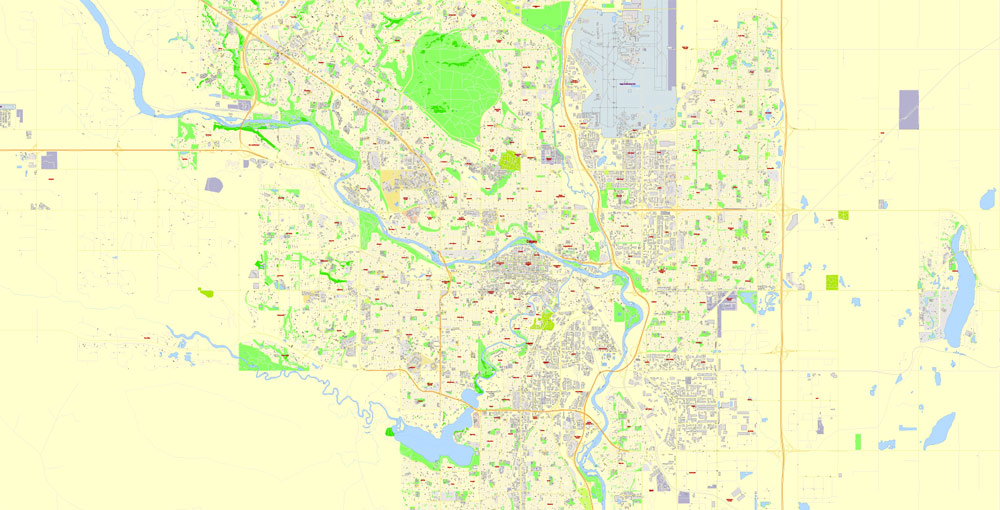
Calgary is located at the transition zone between the Canadian Rockies foothills and the Canadian Prairies. The city lies within the foothills of the Parkland Natural Region and the Grasslands Natural Region. Downtown Calgary is about 1,042.4 m (3,420 ft) above sea level, and the airport is 1,076 m (3,531 ft). In 2011, the city covered a land area of 825.29 km2 (318.65 sq mi).
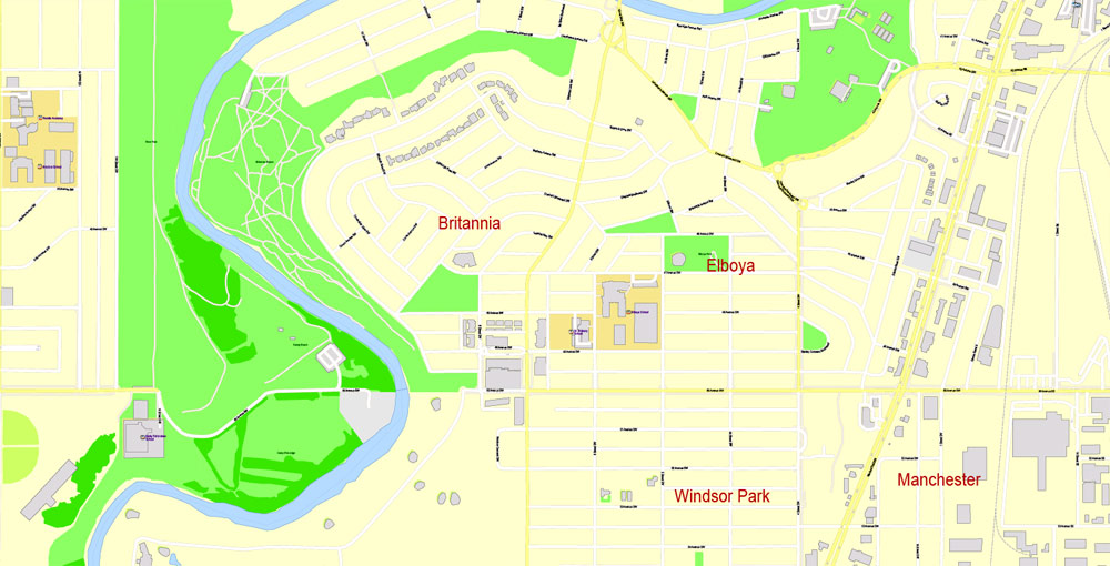
Two rivers run through the city. The Bow River is the larger and it flows from the west to the south. The Elbow River flows northwards from the south until it converges with the Bow River at the historic site of Fort Calgary near downtown. Since the climate of the region is generally dry, dense vegetation occurs naturally only in the river valleys, on some north-facing slopes, and within Fish Creek Provincial Park.
The City of Calgary, 848 km2 (327 sq mi) in size, consists of an inner city surrounded by suburban communities of various density. The city is immediately surrounded by two municipal districts – the Municipal District of Foothills No. 31 to the south and Rocky View County to the north, west and east. Proximate urban communities beyond the city within the Calgary Region include: the City of Airdrie to the north; the City of Chestermere, the Town of Strathmore and the Hamlet of Langdon to the east; the towns of Okotoks and High River to the south; and the Town of Cochrane to the northwest. Numerous rural subdivisions are located within the Elbow Valley, Springbank and Bearspaw areas to the west and northwest. The Tsuu T’ina Nation Indian Reserve No. 145 borders Calgary to the southwest.
Over the years, the city has made many land annexations to facilitate growth. In the most recent annexation of lands from Rocky View County, completed in July 2007, the city annexed Shepard, a former hamlet, and placed its boundaries adjacent to the Hamlet of Balzac and City of Chestermere, and very close to the City of Airdrie.
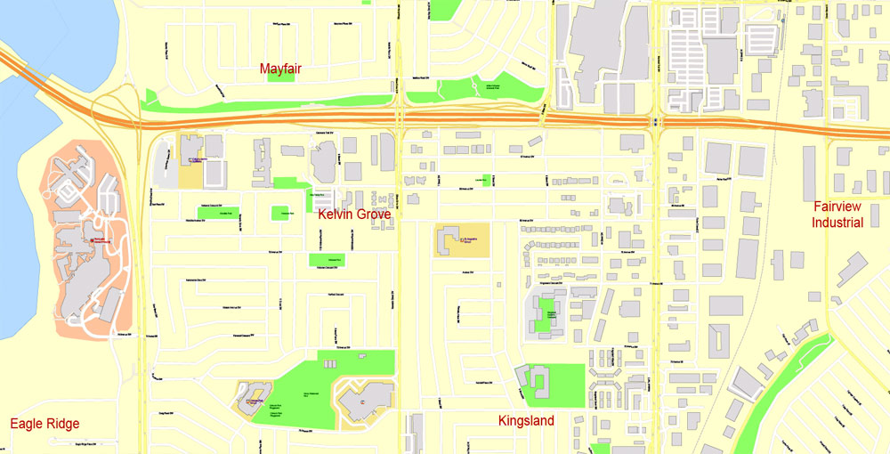
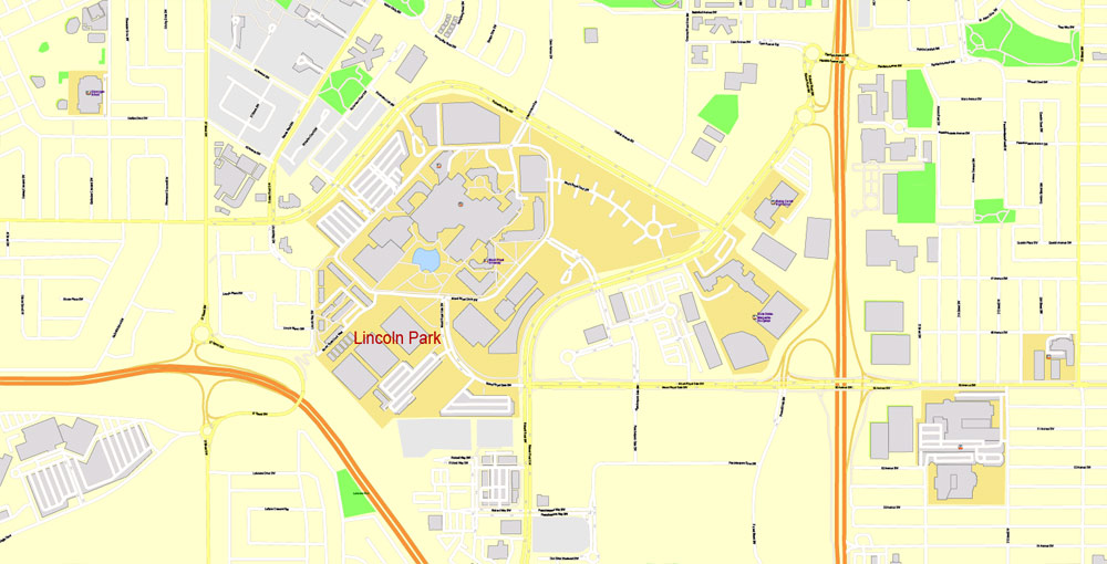
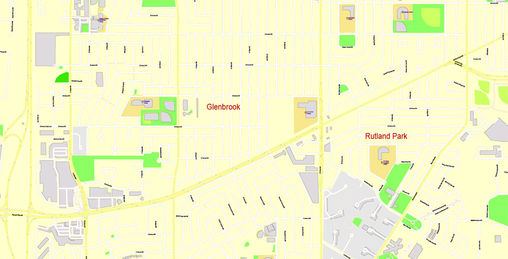
Neighbourhoods
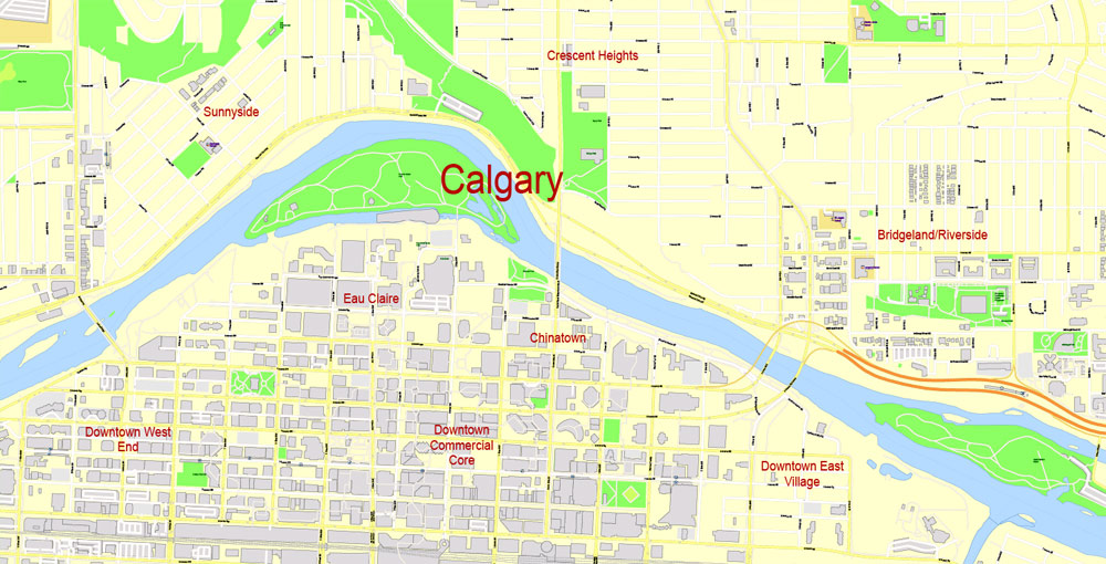
The downtown region of the city consists of five neighbourhoods: Eau Claire (including the Festival District), the Downtown West End, the Downtown Commercial Core, Chinatown, and the Downtown East Village (also part of the Rivers District). The commercial core is itself divided into a number of districts including the Stephen Avenue Retail Core, the Entertainment District, the Arts District and the Government District. Distinct from downtown and south of 9th Avenue is Calgary’s densest neighbourhood, the Beltline. The area includes a number of communities such as Connaught, Victoria Crossing and a portion of the Rivers District. The Beltline is the focus of major planning and rejuvenation initiatives on the part of the municipal government to increase the density and liveliness of Calgary’s centre.
Adjacent to, or directly radiating from the downtown are the first of the inner-city communities. These include Crescent Heights, Hounsfield Heights/Briar Hill, Hillhurst/Sunnyside (including Kensington BRZ), Bridgeland, Renfrew, Mount Royal, Scarboro, Sunalta, Mission, Ramsay and Inglewood and Albert Park/Radisson Heights directly to the east.
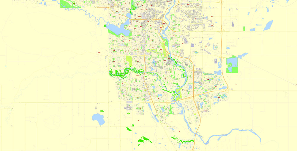
The inner city is, in turn, surrounded by relatively dense and established neighbourhoods such as Rosedale and Mount Pleasant to the north; Bowness, Parkdale and Glendale to the west; Park Hill, South Calgary (including Marda Loop), Bankview, Altadore, and Killarney to the south; and Forest Lawn/International Avenue to the east. Lying beyond these, and usually separated from one another by highways, are suburban communities including Evergreen, Somerset, Auburn Bay Country Hills, Sundance, Riverbend, and McKenzie Towne. In all, there are over 180 distinct neighbourhoods within the city limits.
Several of Calgary’s neighbourhoods were initially separate municipalities that were annexed by the city as it grew. These include Bowness, Montgomery, and Forest Lawn.

Calgary
City in Alberta, Canada
Calgary, a cosmopolitan Alberta city with numerous skyscrapers, owes its rapid growth to its status as the centre of Canada’s oil industry. However, it’s still steeped in the western culture that earned it the nickname “Cowtown,” evident in the Calgary Stampede, its massive July rodeo and festival that grew out of the farming exhibitions once presented here.
Area
• Land 825.56 km2 (318.75 sq mi)
• Urban 586.08 km2 (226.29 sq mi)
• Metro 5,110.21 km2 (1,973.06 sq mi)
Elevation 1,045 m (3,428 ft)
Population
• City 1,239,220
• Density 1,501.1/km2 (3,888/sq mi)
• Urban 1,237,656
• Urban density 2,111.8/km2 (5,470/sq mi)
• Metro 1,392,609 (4th)
• Metro density 272.5/km2 (706/sq mi)
• Municipal census 1,235,171
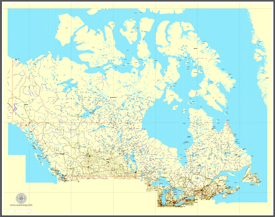
Download Free vector Map Canada, mainroads, cities, borders, province borders, Adobe Illustrator Text format street names, full editable, Layers: grownd, nombres, borders, symbols, halo
vector_map_canada_mainroads_mercator_projection_ai-ai
Download Free PDF Map Canada, mainroads, cities, borders, province borders, Adobe PDF Text format street names, full editable, Layers: grownd, nombres, borders, symbols, halo
vector_map_canada_mainroads_mercator_projection_pdf-pdf
Small guide: How to work with the vector map?
You can: Mass select objects by type and color – for example, the objects type “building” (they are usually dark gray) – and remove them from the map, if you do not need them in your print or design project. You can also easily change the thickness of lines (streets), just bulk selection the road by the line color.
The streets are separated by type, for example, type “residential road” are usually white with a gray stroke. Highway usually orange with a brown or dark gray stroke.
It is easy to change the font of inscriptions, all or each individually. Also, just can be make and any other manipulation of objects on the vector map in Adobe illustrator format.
Important: All the proportions on the map are true, that is, the relative sizes of the objects are true, because Map is based on an accurate GPS projection, and It transated into the (usual for all) the Mercator projection.
You can easily change the color, stroke and fill of any object on the map, zoom without loss of quality Image Verification.
Select object

Bulk selection the same objects on the vector map

See the bulk selected objects on the vector map

Bulk delete buildungs from the vector map

Select residencial road (small street) on the vector map

Bulk selection the same lines (streets, roads) on the full map

Create fat lines of the streets on the vector maps (bulk action) 1

Create fat lines of the streets on the vector maps (bulk action) 2

Create fat lines of the streets on the vector maps (bulk action) 3

You can easily change the color, stroke and fill of any object on the map, zoom without loss of quality Image Verification.
Free vector map World, Adobe Illustrator, download now maps vector clipart
Map for design, projects, presentation free to use as you like.
See also: TERMS & CONDITIONS: SOFTWARE LICENSE AGREEMENT FOR DIGITAL CARTOGRAPHIC DATA.
Need more USA Vector Maps, printable and editable?

 Author: Kirill Shrayber, Ph.D. FRGS
 Street Map editable Adobe Illustrator in layers")

