Printable PDF Vector Map of Dallas Texas Metro Area, detailed City Plan scale 1:3950 full editable Adobe PDF Street Map in layers, scalable, text format all names, 285 MB ZIP
All street names, Main Objects, Buildings. Map for design, printing, arts, projects, presentations, for architects, designers, and builders, business, logistics.
If you need: We can add some objects to this map (add-on layers).
Free for our customers.
Need AutoCAD DWG / DXF or any other format? Please, contact us!
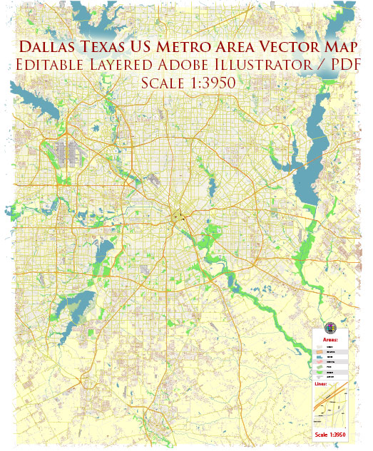
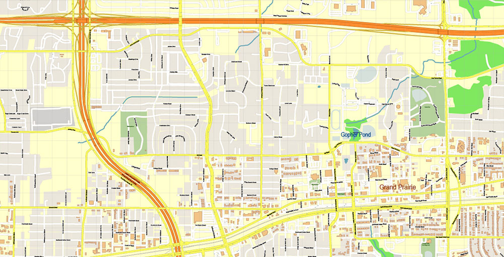
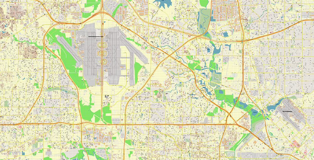
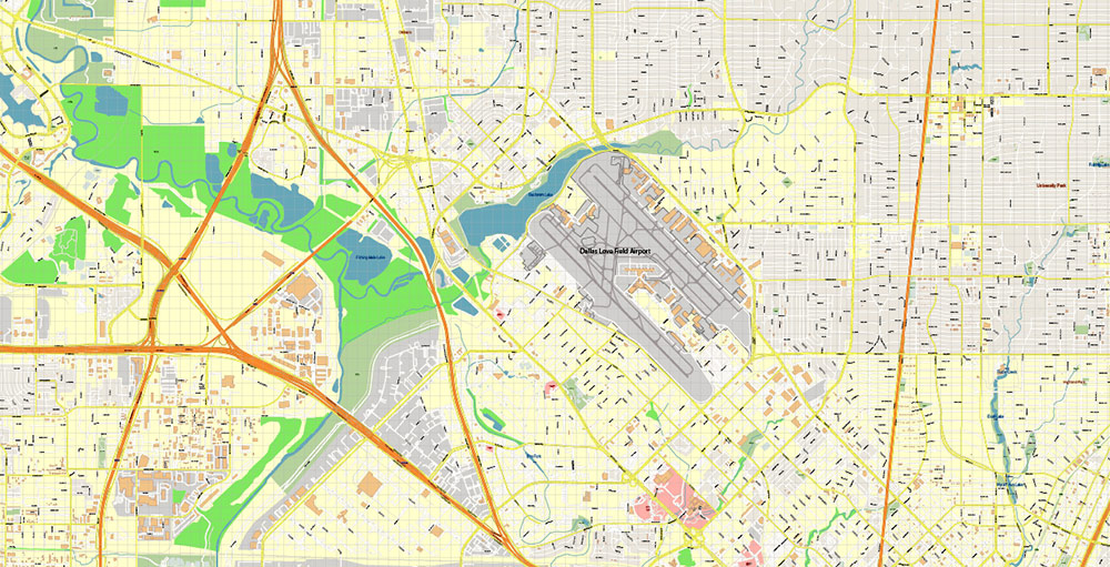
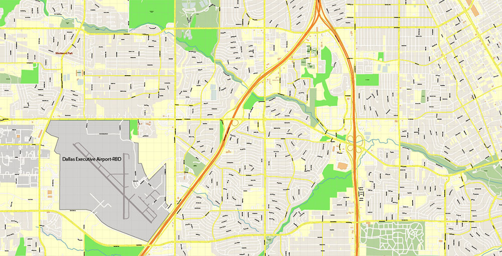
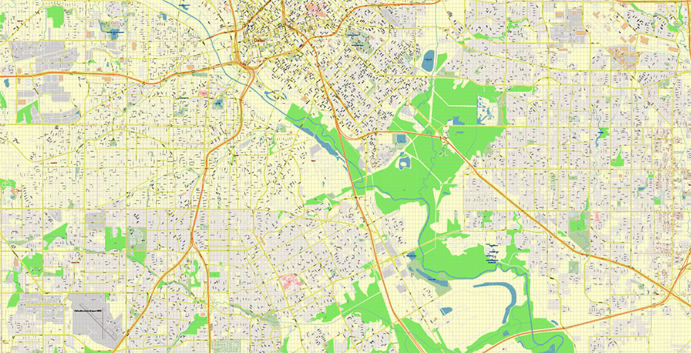
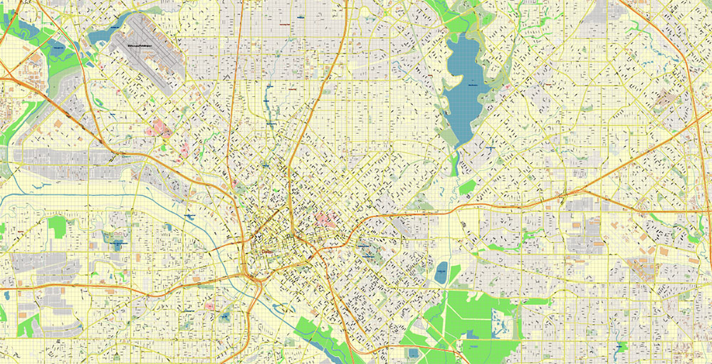
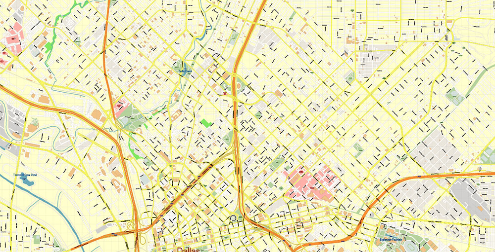
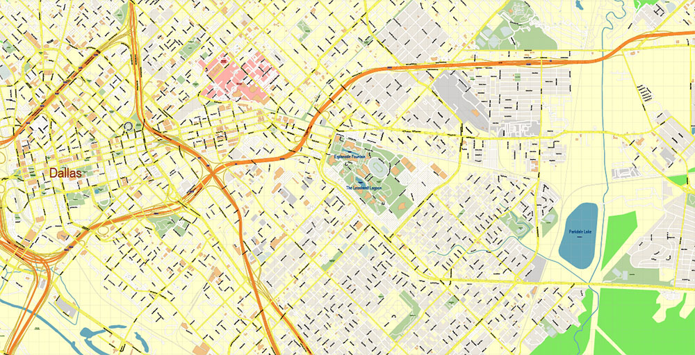
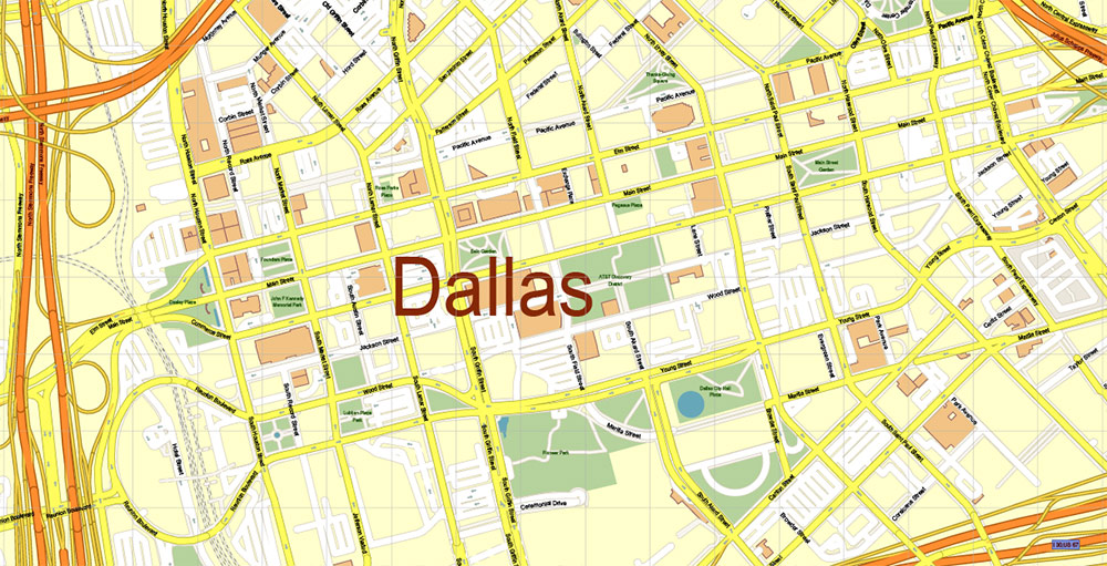
Dallas Texas US PDF Vector Map Metro Area Accurate High Detailed City Plan editable Adobe PDF Street Map in layers
Dallas, Texas, United States of America, North America
Founded: 1841
Location: North-central Texas; southern United States, North America
Slogan: “Dallas, the Texas Star”
Flag: White star with yellow emblem centered over stripes of red, white, and blue (top to bottom).
Flower: Bluebonnet (Texas state flower)
Time Zone: 6 am Central Standard Time (CST) = noon Greenwich Mean Time (GMT)
Ethnic Composition: White 65%; Black 14%; Hispanic origin (of any race) 17%; other, including Native Americans and Asian/Pacific Islanders, 21%.
Elevation: 150–250 m (500–800 ft) above sea level
Latitude and Longitude: 32°50’N, 96°50’W
Climate: Hot, humid summers and mild winters.
Annual Mean Temperature: January 1°C (34°F); July 37°C (98°F)
Average Annual Precipitation: Snowfall is rare; precipitation is 750 mm (29.5 in).
Government: Council-manager, with an 11-member council, 8 of whom are elected from single-member districts; the remaining 2 and the mayor are chosen by voters in a nonpartisan election.
Weights and Measures: Standard U.S.
Monetary Units: Standard U.S.
Telephone Area Codes: 214 and 972
Postal Codes: 75201–75398
Introduction
Dallas is located on the rolling prairies of northeast Texas, where the three branches of the Trinity River merge. It is the second-largest city in Texas and the eighth-largest city in the United States.
Founded in 1841 by John Neely Bryan, who chose the site along the river for his trading post, Dallas grew slowly at first. However, significant expansion occurred during the Civil War years (1861–65), when Dallas was used as a supply depot for Confederate troops. In 1872 the Texas Central Railroad was routed through town, and a year later the Texas Pacific Railroad arrived.
The 1930 oil strike in east Texas caused a boom in the Dallas economy, with the city becoming a financial and freight center serving the oil wells. Dallas entered the twenty-first century a center for banking, oil, cotton, and high technology, as well as a rapidly expanding city, both in terms of population and economy.
Getting There
Highways
Several major highways lead into Dallas. Interstate-20 runs east to west. I-30 runs from the northeast into the city. Running northeast to southwest is I-35, the major route from Dallas to Austin and San Antonio. I-45 runs from Dallas southeast to Houston. US 75 (North Central Expressway) comes into Dallas from the North. I-635 forms a loop around Dallas and the neighboring cities of Arlington and Fort Worth. Driving time to Houston is three hours and 40 minutes, while it takes four-anda-half hours to drive to San Antonio.
Bus and Railroad Service
Both buses and passenger trains serve Dallas. The Greyhound bus station is located downtown at 205 S. Lamar Street, and in addition to Greyhound, several other smaller bus lines run out of this location, including El Conejo and Euro-Coach. Trains arrive at Amtrak’s Union Station, 400 S. Houston Street.
Airports
Dallas has two airports: Dallas-Forth Worth International Airport (DFW) and the smaller Love Field, which offers commuter transit. DFW is located 29 kilometers (18 miles) northwest of downtown. Transportation to and from the airport is available by bus, airport shuttle, rental car, or taxi. Most major domestic airlines fly into Dallas, including American, Continental, Delta, and TWA. Regional airlines include America West, Atlantic Southeast, Southwest, and Sun Country. Several international airlines also service Dallas, such as Aeromexico, British Airways, Japan Airlines, and Korean Air. Flight times from major U.S. cities are as follows: New York, four hours; Chicago, two-and-a-half hours; Los Angeles, three hours.
Dallas Population Profile
City Proper
Population: 1,068,880
Area: 980 sq km (378 sq mi)
Ethnic composition: 65% white; 14% black; 17% Hispanic descent, any race; remainder Native American and Asian or Pacific Islander descent
Nicknames: Big D
Metropolitan Area
Population: 3,912,000
Description: Includes Dallas and suburbs (the area known as DFW Metroplex also includes Forth Worth, Arlington, and suburbs)
Area: 16,800 sq km (6,490 sq mi)
World population rank 1: 62
Percentage of national population 2: 1.4%
Average yearly growth rate: 1.6%
Getting Around
Major highways converge in the center of the city, just east of the Trinity River, forming a loose, lopsided rectangle. Due to rapid expansion in the latter half of the twentieth century, roads sprawl haphazardly in many directions, making it difficult to tell Dallas proper from surrounding suburbs and cities.
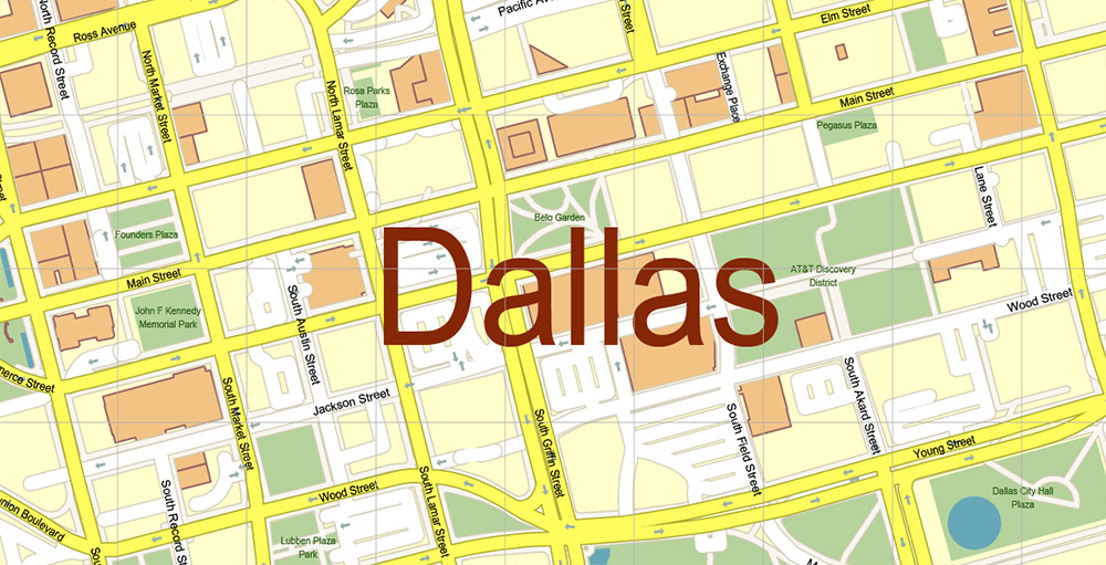
Streets do not form a traditional grid, making travel confusing. The main roads downtown are Main Street, Elm Street, and Commerce Street.
Buses and Commuter Rail Service
Dallas Area Rapid Transit System (DART) offers bus and light rail transportation to the city and 12 surrounding suburban communities. DART provides 130 bus routes, while the light rail services major sites, with free parking at most rail terminals. A trolley line circulates downtown. Fares for DART range from 50 cents to two dollars.
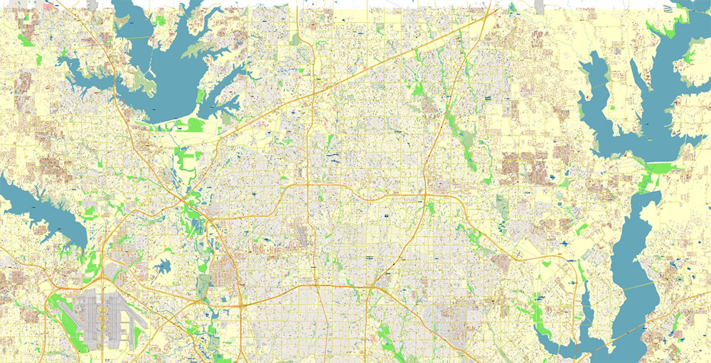
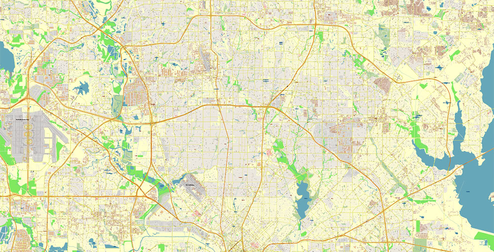
Layers list:
- Legend
- Grids
- Labels of roads
- Names of places (city, hamlet, etc.)
- Names of objects (hospitals, parks, water)
- Names of main streets
- Names of civil streets
- Arrows of street drive direction
- Main Streets, roads
- Civil streets
- Railroads
- Buildings
- Airports and heliports
- Water objects (rivers, lakes, ponds)
- Waterways
- Color fills (parks, hospital areas, land use, etc.)
- Background
Dallas Texas US PDF Vector Map Metro Area Accurate High Detailed City Plan editable Adobe PDF Street Map in layers

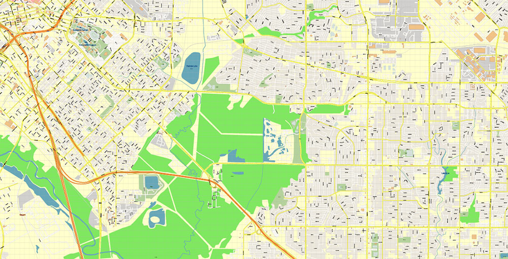
Dallas Texas US PDF Vector Map Metro Area Accurate High Detailed City Plan editable Adobe PDF Street Map in layers
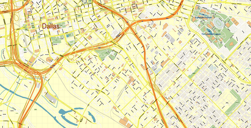
Dallas Texas US PDF Vector Map Metro Area Accurate High Detailed City Plan editable Adobe PDF Street Map in layers

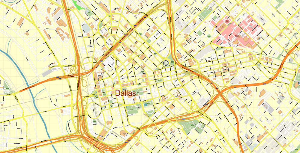
Dallas Texas US PDF Vector Map Metro Area Accurate High Detailed City Plan editable Adobe PDF Street Map in layers
Dallas Texas US PDF Vector Map Metro Area Accurate High Detailed City Plan editable Adobe PDF Street Map in layers
Dallas Texas US PDF Vector Map Metro Area Accurate High Detailed City Plan editable Adobe PDF Street Map in layers
Dallas Texas US PDF Vector Map Metro Area Accurate High Detailed City Plan editable Adobe PDF Street Map in layers
Dallas Texas US PDF Vector Map Metro Area Accurate High Detailed City Plan editable Adobe PDF Street Map in layers
Dallas Texas US PDF Vector Map Metro Area Accurate High Detailed City Plan editable Adobe PDF Street Map in layers
Dallas Texas US PDF Vector Map Metro Area Accurate High Detailed City Plan editable Adobe PDF Street Map in layers
Dallas Texas US PDF Vector Map Metro Area Accurate High Detailed City Plan editable Adobe PDF Street Map in layers
Dallas Texas US PDF Vector Map Metro Area Accurate High Detailed City Plan editable Adobe PDF Street Map in layers
Dallas Texas US PDF Vector Map Metro Area Accurate High Detailed City Plan editable Adobe PDF Street Map in layers
Dallas Texas US PDF Vector Map Metro Area Accurate High Detailed City Plan editable Adobe PDF Street Map in layers
Dallas Texas US PDF Vector Map Metro Area Accurate High Detailed City Plan editable Adobe PDF Street Map in layers
Dallas Texas US PDF Vector Map Metro Area Accurate High Detailed City Plan editable Adobe PDF Street Map in layers
Dallas Texas US PDF Vector Map Metro Area Accurate High Detailed City Plan editable Adobe PDF Street Map in layers
Dallas Texas US PDF Vector Map Metro Area Accurate High Detailed City Plan editable Adobe PDF Street Map in layers

 Author: Kirill Shrayber, Ph.D. FRGS

