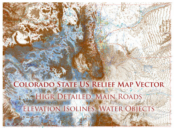
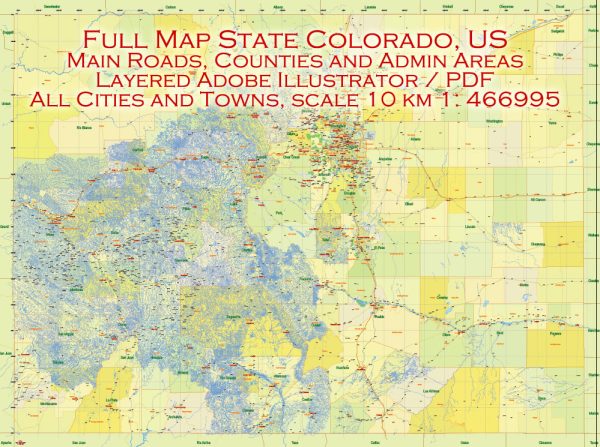
Printable PDF Vector Relief Map of Colorado Full State, US: Main Roads + Shaded Relief (2), fully editable Map in layers, scalable, 769 MB ZIP
Principal roads, Places, Water objects, Numbers of Principal streets, All Cities and Towns, Shaded Relief + Isolines. Map for design, printing, arts, projects, presentations, for architects, designers, and builders, business, logistics.
ATTN! All objects are located on separate layers by type. The preview shows them all together. When you work with this map, just turn off or delete those layers that are not needed for your project.
For Editing and High-Quality Printing, Royalty free
Need AutoCAD DWG / DXF, CDR or any other format? Please, contact us!

Colorado Full State US Relief PDF Vector Map: Full Extra High Detailed (main roads, water objects, relief isolines) editable Adobe PDF in layers
Layers list:
- Legend (scale in miles)
- Labels of roads (numbers) – highways, interstate
- Names places: Names of all Cities, towns, villages, and hamlets
- Points of Places
- Names of Water objects
- Major Roads and Streets – Highways
- Water objects (rivers, lakes, ponds)
- Names Urban Areas
- Waterways
- Urban Areas
- Relief Isolines
- Elevation isolines label (feet)
- Raster (shaded relief grey) transparent 50%
- Raster (shaded relief Atlas colored) transparent 50%
Detailed Geographical Description of Colorado
Location and General Overview
Colorado is a landlocked state located in the western United States. It is bordered by Wyoming to the north, Nebraska to the northeast, Kansas to the east, Oklahoma to the southeast, New Mexico to the south, Utah to the west, and touches Arizona at its southwestern corner. Covering an area of 104,094 square miles (269,837 square kilometers), Colorado ranks as the 8th largest state in the U.S.
The state is renowned for its dramatic landscapes, which range from rugged mountain peaks to expansive plains, high plateaus, and desert canyons. Colorado lies primarily within the Mountain Time Zone and is home to Denver, its capital and largest city.
Relief and Topography
Mountain Ranges
Colorado’s most defining geographic feature is the Rocky Mountains, which dominate the western part of the state. This region is characterized by towering peaks, alpine valleys, and deep gorges.
- Front Range: This prominent range runs north-south along the eastern edge of the Rockies and includes notable peaks such as Longs Peak (14,259 ft / 4,346 m) and Pikes Peak (14,115 ft / 4,302 m). Denver and Colorado Springs lie along this range.
- Sawatch Range: Home to Mount Elbert, the tallest peak in Colorado at 14,440 feet (4,401 meters). The range contains many of the state’s “Fourteeners” (peaks over 14,000 feet).
- San Juan Mountains: Located in the southwestern part of the state, these mountains are known for their rugged beauty and historic mining towns like Silverton and Ouray.
- Sangre de Cristo Mountains: A dramatic range in southern Colorado, characterized by sharp ridges and high peaks like Blanca Peak (14,351 ft / 4,374 m).
Plains
The eastern third of Colorado consists of the Great Plains, a flat to gently rolling region of grasslands. This area lies at an elevation of approximately 3,500 to 6,000 feet (1,067 to 1,829 meters) above sea level. It is predominantly agricultural, with crops like wheat and corn.
Plateaus and Canyons
The western and southwestern parts of the state feature high plateaus and canyons.
- Colorado Plateau: Includes red rock formations, mesas, and desert landscapes, with areas like the Grand Junction and Colorado National Monument.
- Black Canyon of the Gunnison: A steep-walled gorge carved by the Gunnison River.
Drainage Systems and Water Bodies
Major Rivers
- Colorado River: Originates in the Rocky Mountains and flows westward, carving iconic canyons as it moves toward Utah.
- South Platte River: Runs through Denver and flows northeast, joining the Platte River in Nebraska.
- Arkansas River: Originates near Leadville and flows southeast through the plains.
- Rio Grande: Begins in the San Juan Mountains and flows southward into New Mexico and beyond.
Lakes and Reservoirs
Colorado has relatively few natural lakes due to its mountainous terrain but boasts numerous reservoirs. Key ones include:
- Blue Mesa Reservoir: The largest body of water in the state, located in the Gunnison River basin.
- Lake Dillon: A major reservoir near Summit County.
- Hanging Lake: A picturesque natural lake in Glenwood Canyon.
Climate
Colorado’s climate varies widely due to its diverse topography. Generally, the state experiences a semi-arid to alpine climate.
- Plains: Hot summers and cold winters, with average precipitation of 12-18 inches (300-460 mm) annually.
- Mountains: Cooler temperatures year-round, heavy snowfall in winter, and summer thunderstorms.
- Western Plateaus: Arid conditions with warm summers and mild winters.
Vegetation and Wildlife
Colorado’s ecosystems range from grasslands in the east to alpine tundra in the mountains. Forests of pine, spruce, and aspen dominate the mid-elevations, while the plains feature prairie grasses and wildflowers. Wildlife includes elk, bighorn sheep, black bears, mountain lions, and prairie dogs.
Administrative and Urban Areas
Colorado has 64 counties, with major cities including:
- Denver: The state capital and largest city, located in the Front Range Urban Corridor.
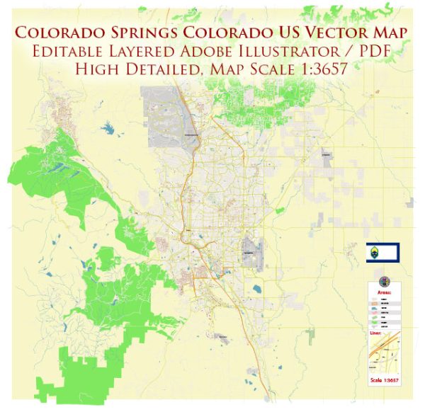
- Colorado Springs: Known for its proximity to Pikes Peak and the Garden of the Gods.
- Boulder: A hub for outdoor activities and home to the University of Colorado.
- Fort Collins: A center for agriculture and education.
Unique Features
- Great Sand Dunes National Park: Home to the tallest dunes in North America.
- Rocky Mountain National Park: Showcases alpine ecosystems and iconic mountain landscapes.
- Mesa Verde National Park: Preserves ancient cliff dwellings of the Ancestral Puebloans.
Colorado’s geography combines dramatic mountain relief, expansive plains, and unique desert landscapes, making it one of the most geographically diverse states in the U.S.

Colorado Full State US Relief PDF Vector Map: Full Extra High Detailed (main roads, water objects, relief isolines) editable Adobe PDF in layers

Colorado Full State US Relief PDF Vector Map: Full Extra High Detailed (main roads, water objects, relief isolines) editable Adobe PDF in layers

Colorado Full State US Relief PDF Vector Map: Full Extra High Detailed (main roads, water objects, relief isolines) editable Adobe PDF in layers

Colorado Full State US Relief PDF Vector Map: Full Extra High Detailed (main roads, water objects, relief isolines) editable Adobe PDF in layers

Colorado Full State US Relief PDF Vector Map: Full Extra High Detailed (main roads, water objects, relief isolines) editable Adobe PDF in layers

Colorado Full State US Relief PDF Vector Map: Full Extra High Detailed (main roads, water objects, relief isolines) editable Adobe PDF in layers

Colorado Full State US Relief PDF Vector Map: Full Extra High Detailed (main roads, water objects, relief isolines) editable Adobe PDF in layers

Colorado Full State US Relief PDF Vector Map: Full Extra High Detailed (main roads, water objects, relief isolines) editable Adobe PDF in layers

Colorado Full State US Relief PDF Vector Map: Full Extra High Detailed (main roads, water objects, relief isolines) editable Adobe PDF in layers

Colorado Full State US Relief PDF Vector Map: Full Extra High Detailed (main roads, water objects, relief isolines) editable Adobe PDF in layers

Colorado Full State US Relief PDF Vector Map: Full Extra High Detailed (main roads, water objects, relief isolines) editable Adobe PDF in layers

Colorado Full State US Relief PDF Vector Map: Full Extra High Detailed (main roads, water objects, relief isolines) editable Adobe PDF in layers

Colorado Full State US Relief PDF Vector Map: Full Extra High Detailed (main roads, water objects, relief isolines) editable Adobe PDF in layers

Colorado Full State US Relief PDF Vector Map: Full Extra High Detailed (main roads, water objects, relief isolines) editable Adobe PDF in layers

Colorado Full State US Relief PDF Vector Map: Full Extra High Detailed (main roads, water objects, relief isolines) editable Adobe PDF in layers

Colorado Full State US Relief PDF Vector Map: Full Extra High Detailed (main roads, water objects, relief isolines) editable Adobe PDF in layers

Colorado Full State US Relief PDF Vector Map: Full Extra High Detailed (main roads, water objects, relief isolines) editable Adobe PDF in layers


 Author: Kirill Shrayber, Ph.D. FRGS


