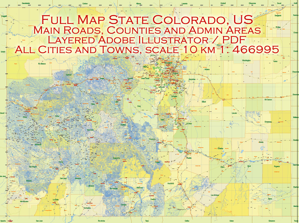
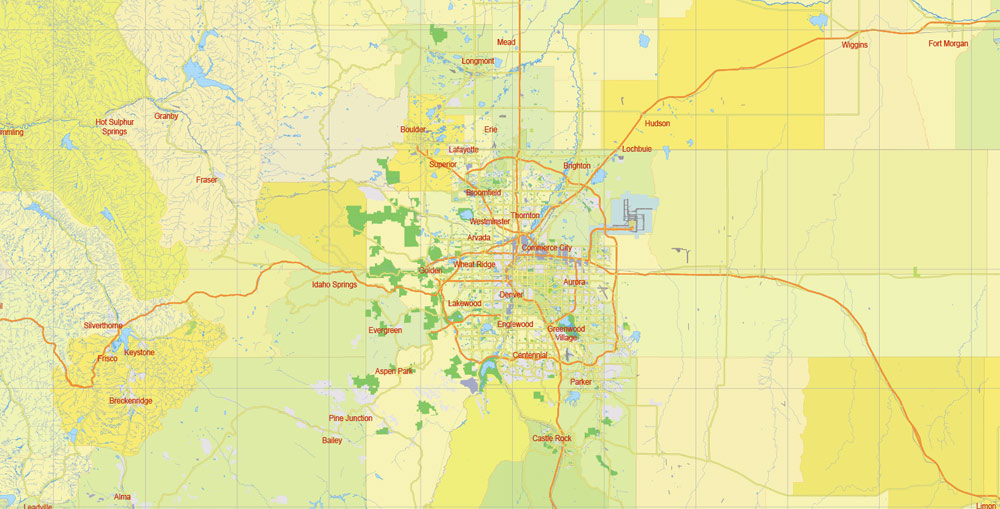
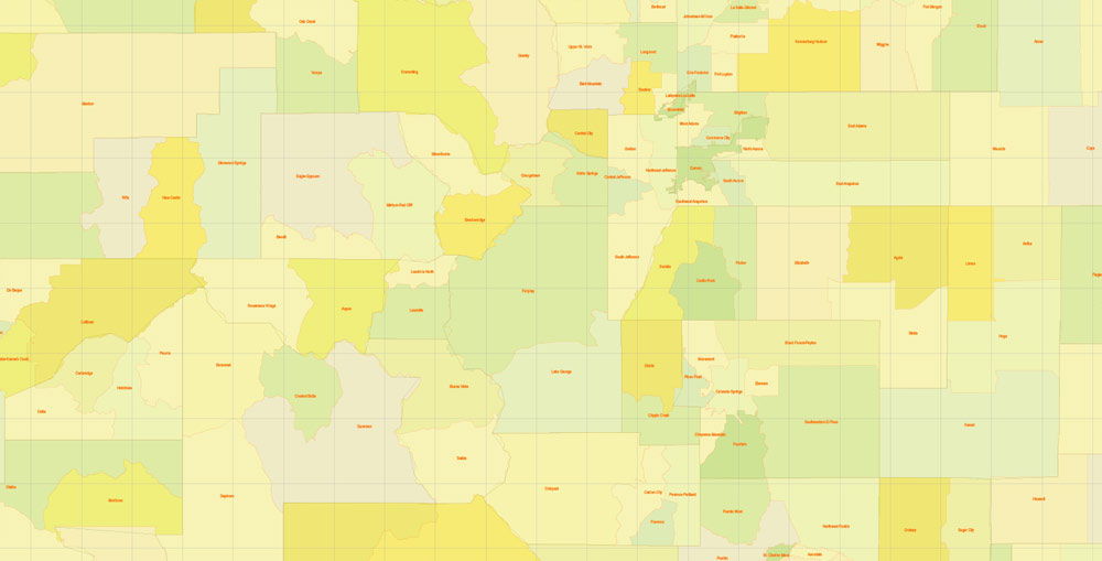
Printable PDF Vector Map Full State of Colorado US, MAIN ROADS, detailed, exact vector Map 10 km scale full editable, Adobe PDF, full vector, scalable, editable text format names, 34 mb ZIP
The map included:
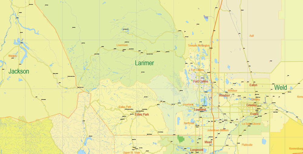
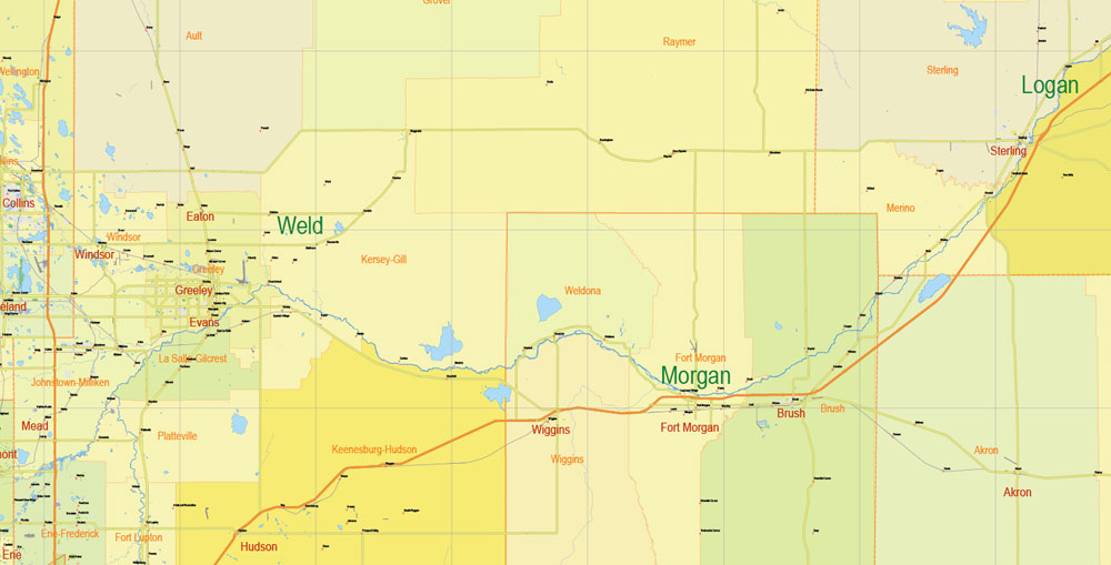
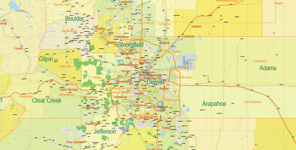
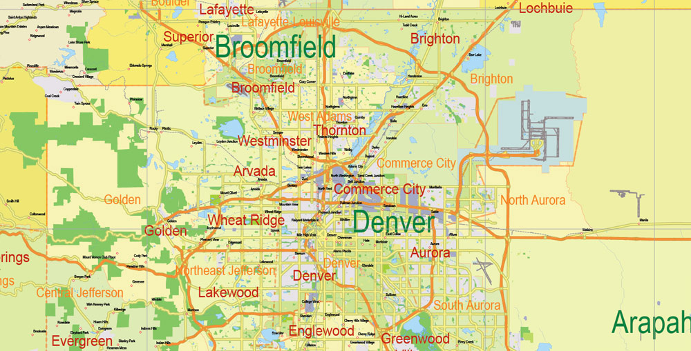
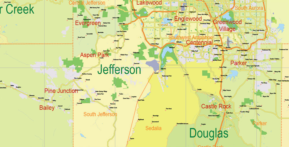
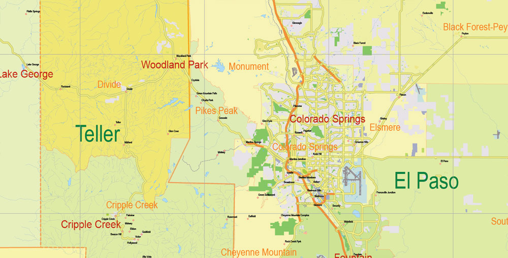
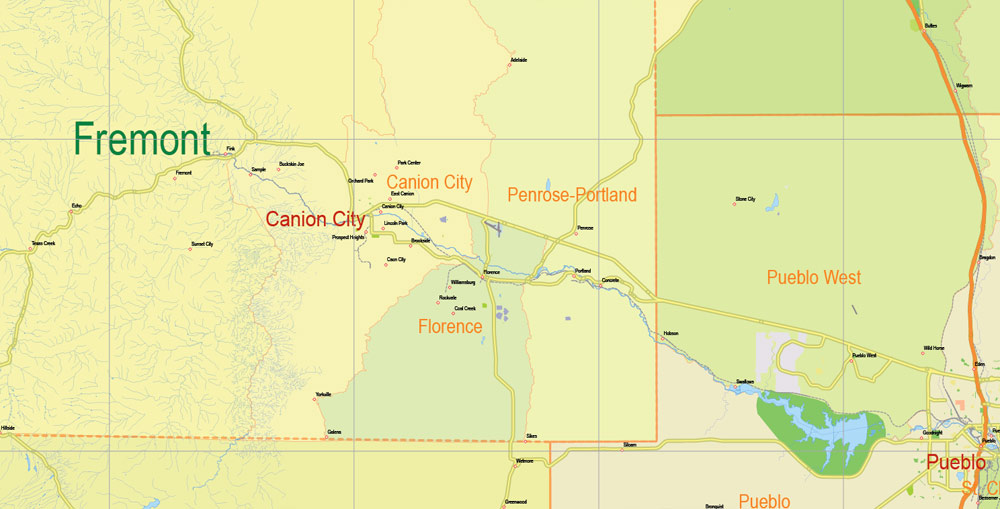
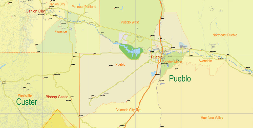
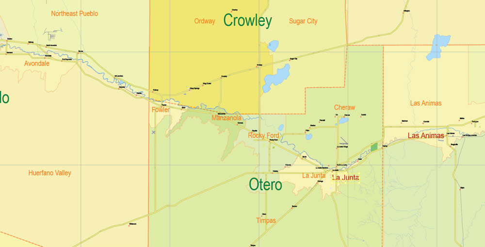
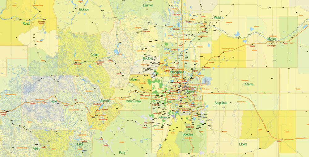
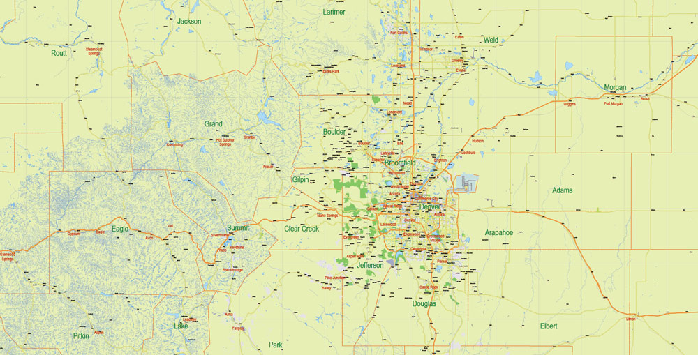
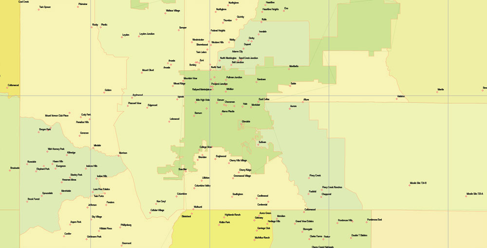
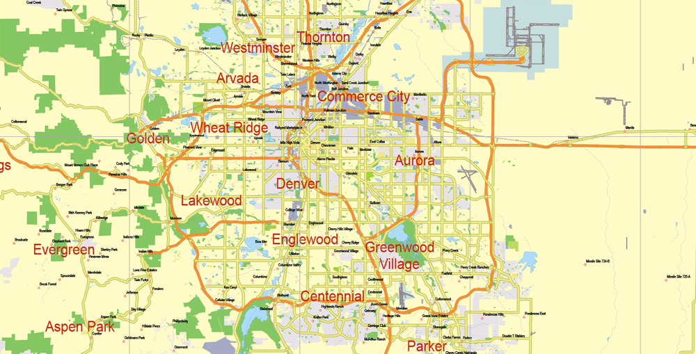
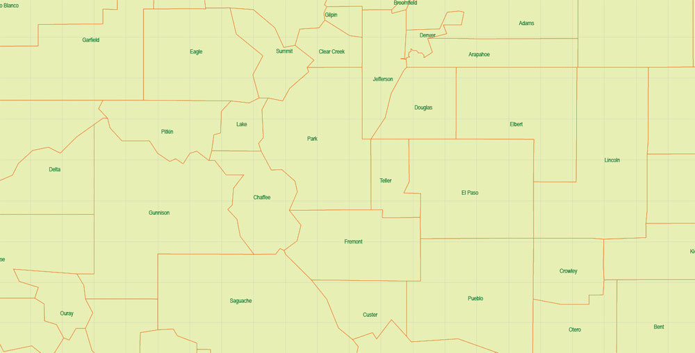
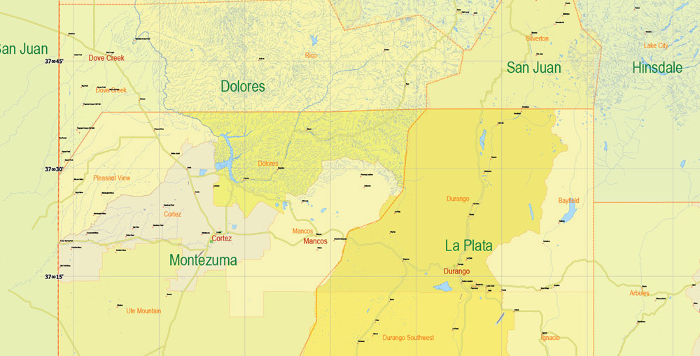
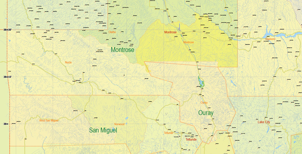
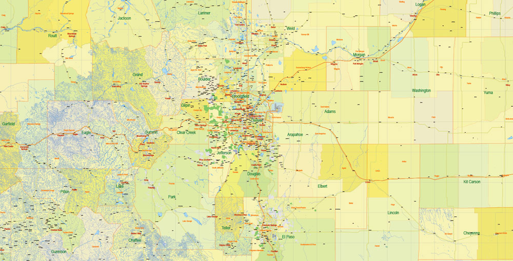
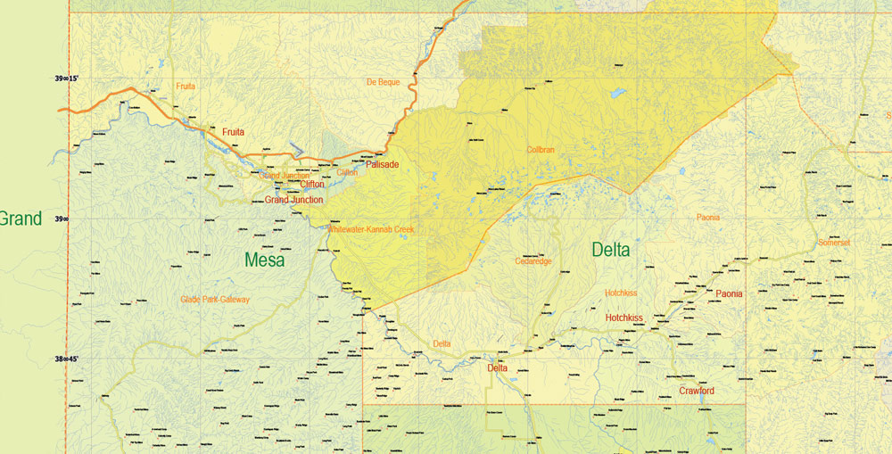
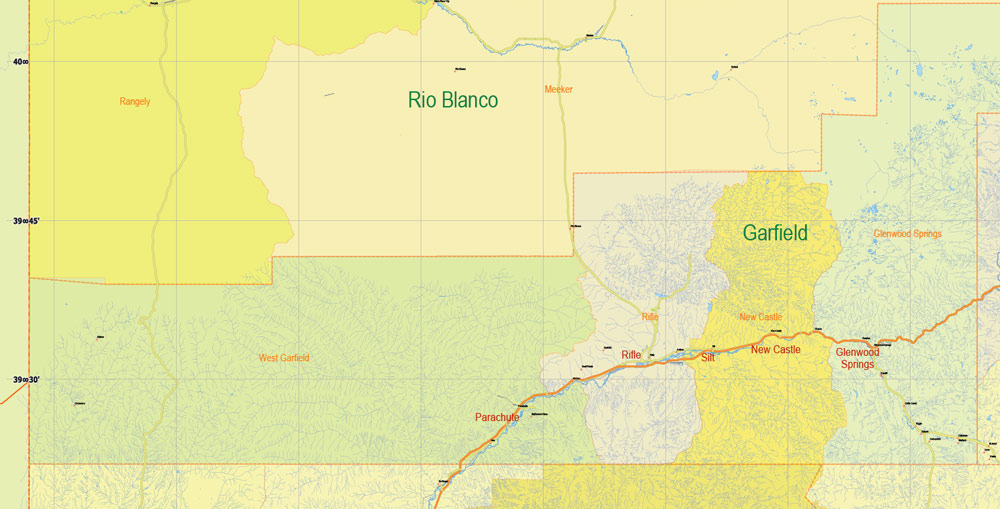
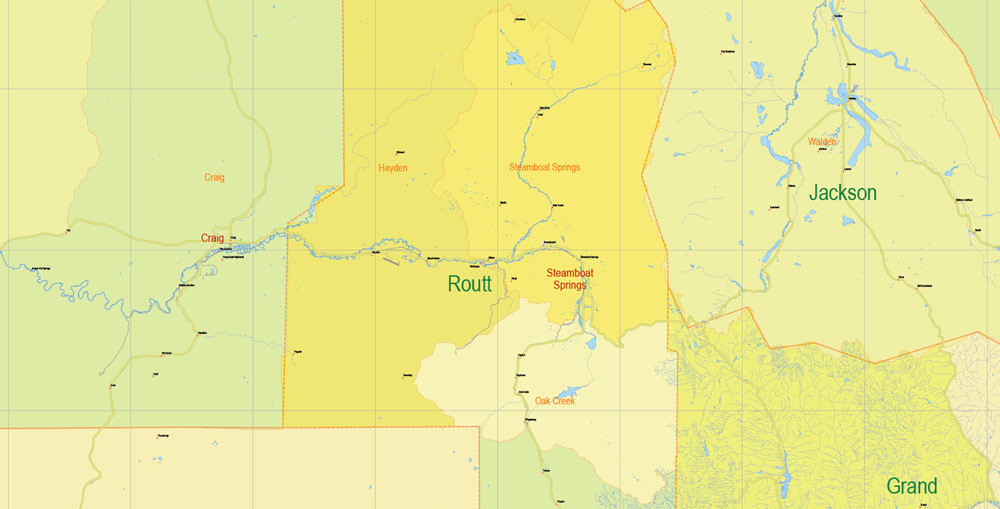
Main roads and railroads, water objects, admin areas, counties, all cities and towns.
Map for design, printing, arts, projects, presentations, for architects, designers and builders, business, logistics.
Layers: color_fills, streets_roads, main_roads, waterways, water_objects, names_counties, counties borders, names_admin_areas, admin_borders, labels_roads, cities_towns, names_all_cities_towns, names_places, grids.
The most exact and detailed map of the State Colorado.
For print LARGE (WALL) format.
You can edit this file by Adobe Illustrator, Adobe Acrobat, Corel Draw.
DWG, DXF, CDR and other formats – on request, same price, please, contact
Colorado state, USA.
This vector map of Colorado is used as a basis for design, editing, and further printing.
This is the most detailed, exact map of Colorado for high-quality printing and polygraphy. You can always clarify the map development date by contacting us.
For your convenience, all objects on Colorado vector map are divided into layers. And the editing is very easy – colors, lines, etc.
You can easily add any objects needed (e.g. shops, salons, sale points, gas station or attraction) on any layer of Colorado vector map.
Colorado is a state of the Western United States encompassing most of the southern Rocky Mountains as well as the northeastern portion of the Colorado Plateau and the western edge of the Great Plains. It is the 8th largest geographically and 21st most populous U.S. state. The estimated population of Colorado was 5,607,154 on July 1, 2017, an increase of 11.49% since the 2010 United States Census.
One of the advantages of Colorado vector maps of our production is the relevance of cartographic data, we constantly update all our products.
This vector map of Colorado is used by:
designers, layout designers, printers, advertisers and architects. Our product – vector maps – is designed for further editing and printing in large formats – from @Wall format (a few meters) to A-0 and A-1, A-2, A-3.
The Colorado map in vector format is used for design, urban planning, presentations and media visualizations.
The advertising and presentation map of Colorado (usually the final designer marks the routes, and puts the client’s objects (shops, saloons, gas stations etc.)
The undoubted advantage is that people will NEVER throw out this advertising product – the map. In fact, as an advertising medium, a map is the most “long-playing” of the well-known polygraphic advertising media, with the longest lifespan, and the maximum number of interactions with the customer.
The state was named for the Colorado River, which early Spanish explorers named the Río Colorado for the ruddy silt the river carried from the mountains. The Territory of Colorado was organized on February 28, 1861, and on August 1, 1876, U.S. President Ulysses S. Grant signed Proclamation 230 admitting Colorado to the Union as the 38th state. Colorado is nicknamed the “Centennial State” because it became a state one century after the signing of the United States Declaration of Independence.
For travelers, maps are sold at the airports and gas stations around the world. Often the source is our vector maps.
Take a look, who purchases our vector maps of Colorado in “Our Clients and Friends” page – these are large and small companies, from super-brands like Volvo and Starbucks, to small design studios and printing houses.
It’s very easy to work with vector maps of Colorado city, even for a not very experienced designer who can turn on and off the map layers, add new objects, change the colors of fill and lines according to customer requirements.
The undoubted advantage of Colorado vector maps in printing is an excellent and detailed visualization, when customer can expand a large paper map and instantly define his location, find a landmark, an object or address on map, unlike using the popular electronic formats of Google and Yandex maps for example.
Printable vector maps of Colorado are much more convenient and efficient than any electronic maps on your smartphone, because ALL DETAILS are displayed in the entire space of Colorado map.
Colorado is bordered by Wyoming to the north, Nebraska to the northeast, Kansas to the east, Oklahoma to the southeast, New Mexico to the south, Utah to the west, and touches Arizona to the southwest at the Four Corners. Colorado is noted for its vivid landscape of mountains, forests, high plains, mesas, canyons, plateaus, rivers, and desert lands. Colorado is part of the western and southwestern United States, and is one of the Mountain States.
Denver is the capital and most populous city of Colorado. Residents of the state are known as Coloradans, although the antiquated term “Coloradoan” is occasionally used.
Useful tips on working with vector maps of cities and countries in Adobe Illustrator.
«V» – launches the Selection tool (cursor, black arrow), which makes active any vector line.
«А» – launches the Direct Selection tool (white cursor), allows you to select curve elements and drag them to the desired place.
«R» – activates the Rotate tool, which helps you rotating selected objects around the center point by 360 degrees.
«E» – gives you the opportunity to use the Eraser tool and erase unnecessary parts.
«X» – switches between Fill and Stroke in the Tools section. Try to get used to this hot key and
you will quickly understand that you can’t live and work without it.
Guides are not limited to vertical and horizontal in Adobe Illustrator. You can also create a diagonal guide for example. Moreover, you can turn any contours into guides. Select the outline and go to View > Guides > Make Guides (Create Guides), or simply press Cmd/Ctrl + 5. You can also turn the guides back into an editable object. Go to menu, View > Guides > Unlock Guides (Release Guides), select the guide you want to edit and select View > Guides > Release Guides (Reset Guides), or just press Cmd/Ctrl + Option / Alt + 5).
You will probably want to change the color scheme used on our Colorado vector map.
To quickly and effectively play with colors.
Of course, you can do it manually, all objects in our Colorado vector map are divided according to types and layers, and you can easily change the color gamma of vector objects in groups and layers.
But there is more effective way of working with the whole VECTOR MAP of Colorado and all layers:
The overview dialog «Edit colors»/«Repaint Graphic Object» (this dialog box name can change depending on the context):
If you have selected a part or a layer of Colorado vector map and open the dialog box by clicking the icon in the Control panel, on the Samples palette or the Color Catalog, or if you choose Edit > Edit Colors> Repaint Graphic Object, then the «Repaint Graphic Object» dialog box appears, and you get access to «Assign» and «Edit» tabs.
If a picture or a map fragment is not selected, and you open the dialog box by clicking the icon in the Control panel, on the Samples palette or in the Color Catalog, the «Edit Colors» dialog box appears and you can only access the «Edit» tab.
Regardless of the name at the top of the dialog box, the right-hand side always displays the color group of the current document, as well as two default color groups: Print Color and Grayscale. These color groups can be selected and used any time.
Create and edit color groups of Colorado vector map, and also assign colors using the «Edit Colors»/ а «Repaint Graphic Object» dialog box.
A. Creating and editing of a color group on the «Edit» tab
B. Assigning colors on the «Assign» tab
C. Select a group of colors from the «Color groups» list
The option «Repaint a graphic object» in the lower part of the dialog box allows you to preview the colors on a selected layer of Vector map, or a group of elements, and specify whether its colors will be redefined when the dialog box is closed.
The main areas of the dialog box are:
«Edit»
The «Edit» tab is designed to create a new or edit the existing color groups.
The harmony rules Menu and the Color Wheel are used to conduct experiments with color harmonies. The color wheel shows how colors are related in color harmony, and the color bars allow you to view and manipulate an individual color values. In addition, you can adjust the brightness, add and remove colors, save color groups and view colors on the selected Vector Map of Colorado or a separated layers.
«Assign»
The «Assign» tab is used to view and control on how the original colors are replaced with colors from the color group like your corporate colors in the Vector Map of Colorado city.
The assign color ability is provided only if the entire map, layer or fragment is selected in the document. You can specify which of new colors replace the current colors, whether the spot colors should be preserved and how colors are replaced (for example, you can replace colors completely or changing the color tone while maintaining the brightness). The «Assign» tab allows you to redefine colors in the Vector Map of Colorado city, or in separate layers and fragments using the current color group or reducing the number of colors in the current Vector Map.
Color groups
Is a list of all saved color groups for current document (the same groups appear in the «Samples» palette). You can edit and delete the existing color groups, as well as creating a new ones using the list of “Color Groups” in the dialog box. All changes appear in the «Samples» palette.
The highlighted color group shows, which color group is currently edited.
Any color group can be selected and edited, or used to redefine the colors in the selected vector map of Colorado city, its fragments or elements.
Saving a color group adds this group to the specified list.
Opening the «Edit Colors»/«Repaint Graphic Object» dialog box.
Open the «Edit Colors»/«Repaint Graphic Object» dialog box using one of the following methods:
«Edit»> «Edit Colors»> «Repaint Graphic object» or «Repaint With Style».
Use these commands if you need to edit the colors in the selected vector map of Colorado city.
«Repaint Graphic object» button on the «Control» panel.
Use this button if you need to adjust colors of Colorado vector map using the а «Repaint graphic object» dialog box.
The specified button is available if the selected vector map or its fragment contains two or more colors.
Note. This color editing method is convenient for global color adjustment in a vector map, if global colors were not used when creating a Map of Colorado.
The «Edit colors» button or «Edit or apply colors» on the «Color Catalog» palette
Click this button if you need to edit colors on the «Color Catalog» palette or edit and then apply them to the selected Vector Map of Colorado or its fragment.
The «Edit color group» button or «Edit or apply color group» on the «Samples» palette.
Click this button if you need to edit the colors in the specific color group or edit and apply them to the selected Vector Map of Colorado or a group of its elements, for example, the whole layer “Streets and lines”. You can also double-click the color group in the Samples panel to open the dialog box.
If the map file is too large and your computer freezes or even can’t open it quickly:
1. Try to reduce the color resolution of the video card (display) to 256 colors while working with a large map.
2. Using Windows Task Manager, select all the application you don’t need, while working with map, just turn them off.
3. Launch Adobe Illustrator. (DO NOT OPEN the vector map file)
4. Start the Windows Task Manager using administrator rights > Find the “Illustrator” process > set the «real time» priority,
5. Open the file. When you see the LEGACY FONT popup window – click “OK” (do not update). You can restore the TEXT later.
6. Can also be useful: When file is opened – Edit > Settings > Basic Settings > disable smoothing. /// It looks scary, but works quickly)))
We recommend saving the file in Adobe Illustrator 10 version. It’s much more stable when working with VERY BIG size files.
Unlike its neighbors to the north, west and east, Colorado has been recognized as a strongly socially liberal state. Same-sex marriage in Colorado has been legal since 2014, and it was the second state in the U.S. (after Washington) to legalize recreational cannabis. The state is known for its progressive views on abortion and assisted suicide; Coloradans rejected a 2008 referendum that would have criminalized abortion, and approved a measure in 2016 that legalized assisted suicide in the state, and remains one of six states (along with the District of Columbia) to have legalized assisted suicide. In 2018, Colorado became the first state in the United States to elect an openly gay governor, Jared Polis, in the 2018 gubernatorial election.
Geography
Colorado is notable for its diverse geography, which includes alpine mountains, high plains, deserts with huge sand dunes, and deep canyons. In 1861, the United States Congress defined the boundaries of the new Territory of Colorado exclusively by lines of latitude and longitude, stretching from 37°N to 41°N latitude, and from 102°02’48″W to 109°02’48″W longitude (25°W to 32°W from the Washington Meridian). After 157 years of government surveys, the borders of Colorado are now officially defined by 697 boundary markers and 697 straight boundary lines. Colorado, Wyoming, and Utah are the only states that have their borders defined solely by straight boundary lines with no natural features. The southwest corner of Colorado is the Four Corners Monument at 36°59’56″N, 109°2’43″W. This is the only place in the United States where four states meet: Colorado, New Mexico, Arizona, and Utah.
The geography of the U.S. State of Colorado is diverse, encompassing both rugged mountainous terrain, vast plains, desert lands, desert canyons, and mesas. In 1861, the United States Congress defined the boundaries of the new Territory of Colorado exclusively by lines of latitude and longitude, stretching from 37°N to 41°N latitude, and from 102°02’48″W to 109°02’48″W longitude (25°W to 32°W from the Washington Meridian). Starting in 1868, official surveys demarcated the boundaries, deviating from the parallels and meridians in several places. Later surveys attempted to correct some of these mistakes but in 1925 the U.S. Supreme Court affirmed that the earlier demarcation was the official boundary. The borders of Colorado are now officially defined by 697 boundary markers connected by straight boundary lines. Colorado, Wyoming, and Utah are the only states that have their borders defined solely by straight boundary lines with no natural features. The southwest corner of Colorado is the Four Corners Monument at 36°59’56″N, 109°2’43″W. This is the only place in the United States where four states meet: Colorado, New Mexico, Arizona, and Utah.
The summit of Mount Elbert at 14,440 feet (4,401.2 m) elevation in Lake County is the state’s highest point and the highest point in the Rocky Mountains of North America. Colorado has approximately 550 mountain peaks that exceed 4000 meters elevation. Colorado is the only U.S. state that lies entirely above 1000 meters elevation. The state’s lowest elevation is 3,317 feet (1,011 m) at the point on the eastern boundary of Yuma County where the Arikaree River flows into the state of Kansas.
Regions
To the east of the Rocky Mountains in Colorado are the Colorado Eastern Plains/High Plains, the section of the Great Plains within Colorado at elevations ranging from 3,500 to 7,000 feet (1,100 to 2,100 metres). The Midwest states of Kansas and Nebraska border Colorado to the east and northeast.
The plains are sparsely settled with most population along the South Platte and the Arkansas rivers. Rainfall is meager, averaging about 15 inches (380 mm) annually. There is some irrigated farming, but much of the land is used for dryland farming or ranching. Winter wheat is a typical crop and most small towns in the region boast both a water tower and a grain elevator.
The bulk of Colorado’s population lives along the eastern edge of the Rocky Mountains in the Front Range Urban Corridor. This region is partially protected from prevailing storms by the high mountains to the west.
Snowpack accumulation at 14,255 feet (4345 m) on Longs Peak in Rocky Mountain National Park.
To the west lies the eastern slope of the Rocky Mountains with notable peaks such as Longs Peak, Mount Evans, Pikes Peak, and the Spanish Peaks near Walsenburg in the south. This area drains to the east, is forested, and partially urbanized. With urbanization, utilization of the forest for timbering and grazing resulted in accumulation of fuel. During the drought of 2002 devastating forest fires swept this area.
The Continental Divide stretches along the crest of the Rocky Mountains. To the west of the Continental Divide is the Western Slope. Water west of the Continental Divide drains west into the Pacific Ocean via the Colorado River. Western Colorado is made up of mountains, mesas, desert canyons, and desert lands.
Within the interior of the Rocky Mountains are several large parks or high broad basins. In the north, on the east side of the Continental Divide is North Park. North Park is drained by the North Platte River, which flows north into the northwest state of Wyoming. Just south but on the west side of the Continental Divide is Middle Park, drained by the Colorado River. South Park is the headwaters of the South Platte River. To the south lies the San Luis Valley, the headwaters of the Rio Grande, which drains into New Mexico. Across the Sangre de Cristo Range to the east of the San Luis Valley lies the Wet Mountain Valley. These basins, particularly the San Luis Valley, lie along the Rio Grande Rift, a major tectonic feature. See Rift.
The Rocky Mountains within Colorado contain 54 peaks that are 14,000 feet (4270 m) or higher, known as fourteeners. The mountains are timbered with conifers and aspen to the tree line, at an elevation of about 12,000 feet (3,650 m) in southern Colorado to about 10,500 feet (3,200 m) in northern Colorado; above this only alpine vegetation grows. The Rockies are snow-covered only in the winter; most snow melts by mid-August with the exception of a few small glaciers. The Colorado Mineral Belt, stretching from the San Juan Mountains in the southwest to Boulder and Central City on the front range, contains most of the historic gold and silver mining districts of Colorado.
The Western Slope is generally drained by the Colorado River and its tributaries. Notable to the south are the San Juan Mountains, an extremely rugged mountain range, and to the west of the San Juans, the Colorado Plateau, a high desert bordering Southern Utah. Grand Junction is the largest city on the Western Slope. Grand Junction is served by Interstate Highway I-70. To the southeast of Grand Junction is Grand Mesa, a large flat-topped desert mountain. Further east are the ski resorts of Aspen, Vail, Crested Butte, and Steamboat Springs.
From west to east, the state consists of desert basins, desert canyons and mesas, turning into desert plateaus, then alpine mountains, and then the grasslands of the High Plains. Mount Elbert is the highest peak in the Rocky Mountains of North America. The famous Pikes Peak is just west of Colorado Springs. Its lone peak is visible from near the Kansas border on clear days.
Colorado
US State
Colorado, a western U.S. state, has a diverse landscape of arid desert, river canyons and snow-covered Rocky Mountains, which are partly protected by Rocky Mountain National Park. Elsewhere, Mesa Verde National Park features Ancestral Puebloan cliff dwellings. Perched a mile above sea level, Denver, Colorado’s capital and largest city, features a vibrant downtown area.
Capital : Denver
Largest metro Denver-Aurora CSA
Area Ranked 8th
• Total 104,094 sq mi (269,837 km2)
• Width 380 miles (610 km)
• Length 280 miles (450 km)
• % water 0.36%
• Latitude 37°N to 41°N
• Longitude 102°03’W to 109°03’W
Population Ranked 21st
• Total 5,540,545 (2016 est.)
• Density 52.0/sq mi (19.9/km2) Ranked 37th
• Median household income $66,596 (10th)
Elevation
• Highest point Mount Elbert in Lake County 14,440 ft (4401.2 m)
• Mean 6,800 ft (2070 m)
• Lowest point Arikaree River at the Kansas border 3,317 ft (1011 m)

Free Download Vector Map US County and State Adobe Illustrator
Free_Vector_Map_US_States_County_Map.ai
Free Download Vector Map US County and State Adobe PDF
Free_Vector_Map_US_States_County_Map.pdf

Free Download Vector Map US With States Names, Adobe Illustrator
Free_Map_of_USA_with_state_names_en.ai
Free Download Vector Map US With States Names, Adobe PDF
Free_Map_of_USA_with_state_names_en.pdf
From WIKI
Free vector map World, Adobe Illustrator, download now maps vector clipart
Map for design, projects, presentation free to use as you like.
See also: TERMS & CONDITIONS: SOFTWARE LICENSE AGREEMENT FOR DIGITAL CARTOGRAPHIC DATA.
Need more USA Vector Maps, printable and editable?

 Author: Kirill Shrayber, Ph.D. FRGS
 editable Adobe Illustrator in layers")


