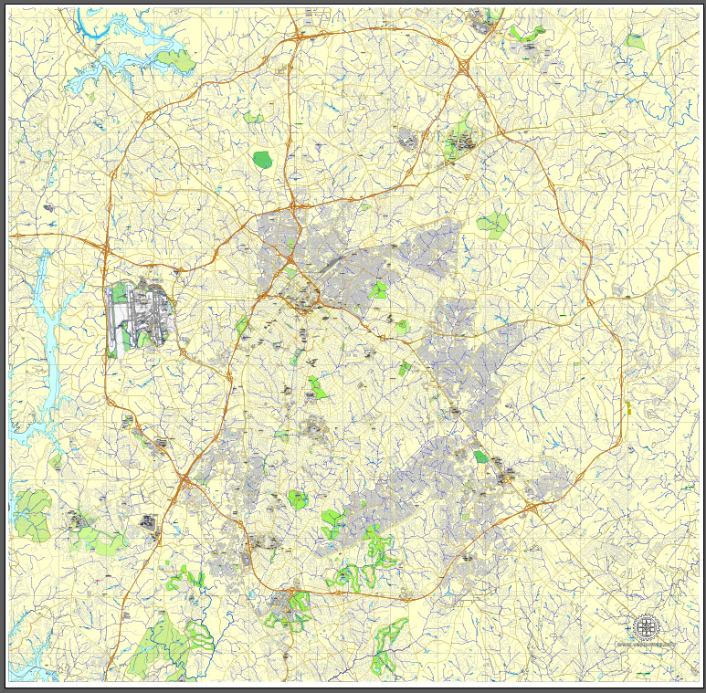
Charlotte, NC, Printable City Plan Map, US, Adobe Illustrator, full vector, V3.10. Scalable, editable, text layer of street names, 22 Mb ZIP.
All streets, buildings.
PDF, DXF and other formats – on demand, same price, please, contact.
Charlotte, North Carolina, USA.
This vector map of Charlotte is used as a basis for design, editing, and further printing.
This is the most detailed, exact map of Charlotte for high-quality printing and polygraphy. You can always clarify the map development date by contacting us.
For your convenience, all objects on Charlotte vector map are divided into layers. And the editing is very easy – colors, lines, etc.
You can easily add any objects needed (e.g. shops, salons, sale points, gas station or attraction) on any layer of Charlotte vector map.
Charlotte is the most populous city in the U.S. state of North Carolina. Located in the Piedmont, it is the county seat of Mecklenburg County. In 2017, the U.S. Census Bureau estimated the population was 859,035, making it the 17th-most populous city in the United States. The Charlotte metropolitan area’s population ranks 22nd in the U.S., and had a 2016 population of 2,474,314. The Charlotte metropolitan area is part of a sixteen-county market region or combined statistical area with a 2016 census-estimated population of 2,632,249.
One of the advantages of Charlotte vector maps of our production is the relevance of cartographic data, we constantly update all our products.
This vector map of Charlotte is used by:
designers, layout designers, printers, advertisers and architects. Our product – vector maps – is designed for further editing and printing in large formats – from @Wall format (a few meters) to A-0 and A-1, A-2, A-3.
Charlotte map in vector format is used for design, urban planning, presentations and media visualizations.
Advertising and presentation map of Charlotte (usually the final designer marks the routes, and puts the client’s objects (shops, saloons, gas stations etc.)
The undoubted advantage is that people will NEVER throw out this advertising product – the map. In fact, as an advertising medium, a map is the most “long-playing” of the well-known polygraphic advertising media, with the longest lifespan, and the maximum number of interactions with the customer.
For travelers, maps are sold at the airports and gas stations around the world. Often the source is our vector maps.
Take a look, who purchases our vector maps of Charlotte in “Our Clients and Friends” page – these are large and small companies, from super-brands like Volvo and Starbucks, to small design studios and printing houses.
It’s very easy to work with vector maps of Charlotte, even for a not very experienced designer who can turn on and off the map layers, add new objects, change the colors of fill and lines according to customer requirements.
The undoubted advantage of Charlotte vector maps in printing is an excellent and detailed visualization, when customer can expand a large paper map and instantly define his location, find a landmark, an object or address on map, unlike using the popular electronic formats of Google and Yandex maps for example.
Printable vector maps of Charlotte are much more convenient and efficient than any electronic maps on your smartphone, because ALL DETAILS are displayed in the entire space of Charlotte map.
Useful tips on working with vector maps of cities and countries in Adobe Illustrator.
«V» – launches the Selection tool (cursor, black arrow), which makes active any vector line.
«А» – launches the Direct Selection tool (white cursor), allows you to select curve elements and drag them to the desired place.
«R» – activates the Rotate tool, which helps you rotating selected objects around the center point by 360 degrees.
«E» – gives you the opportunity to use the Eraser tool and erase unnecessary parts.
«X» – switches between Fill and Stroke in the Tools section. Try to get used to this hot key and
you will quickly understand that you can’t live and work without it.
Guides are not limited to vertical and horizontal in Adobe Illustrator. You can also create a diagonal guide for example. Moreover, you can turn any contours into guides. Select the outline and go to View > Guides > Make Guides (Create Guides), or simply press Cmd/Ctrl + 5. You can also turn the guides back into an editable object. Go to menu, View > Guides > Unlock Guides (Release Guides), select the guide you want to edit and select View > Guides > Release Guides (Reset Guides), or just press Cmd/Ctrl + Option / Alt + 5).
You will probably want to change the color scheme used on our Charlotte vector map.
To quickly and effectively play with colors.
Of course, you can do it manually, all objects in our Charlotte vector map are divided according to types and layers, and you can easily change the color gamma of vector objects in groups and layers.
But there is more effective way of working with the whole VECTOR MAP of Charlotte and all layers:
The overview dialog «Edit colors»/«Repaint Graphic Object» (this dialog box name can change depending on the context):
If you have selected a part or a layer of Charlotte vector map and open the dialog box by clicking the icon in the Control panel, on the Samples palette or the Color Catalog, or if you choose Edit > Edit Colors> Repaint Graphic Object, then the «Repaint Graphic Object» dialog box appears, and you get access to «Assign» and «Edit» tabs.
If a picture or a map fragment is not selected, and you open the dialog box by clicking the icon in the Control panel, on the Samples palette or in the Color Catalog, the «Edit Colors» dialog box appears and you can only access the «Edit» tab.
Regardless of the name at the top of the dialog box, the right-hand side always displays the color group of the current document, as well as two default color groups: Print Color and Grayscale. These color groups can be selected and used any time.
Create and edit color groups of Charlotte vector map, and also assign colors using the «Edit Colors»/ а «Repaint Graphic Object» dialog box.
A. Creating and editing of a color group on the «Edit» tab
B. Assigning colors on the «Assign» tab
C. Select a group of colors from the «Color groups» list
The option «Repaint a graphic object» in the lower part of the dialog box allows you to preview the colors on a selected layer of Vector map, or a group of elements, and specify whether its colors will be redefined when the dialog box is closed.
The main areas of the dialog box are:
«Edit»
The «Edit» tab is designed to create a new or edit the existing color groups.
The harmony rules Menu and the Color Wheel are used to conduct experiments with color harmonies. The color wheel shows how colors are related in color harmony, and the color bars allow you to view and manipulate an individual color values. In addition, you can adjust the brightness, add and remove colors, save color groups and view colors on the selected Vector Map of Charlotte or a separated layers.
«Assign»
The «Assign» tab is used to view and control on how the original colors are replaced with colors from the color group like your corporate colors in the Vector Map of Charlotte.
The assign color ability is provided only if the entire map, layer or fragment is selected in the document. You can specify which of new colors replace the current colors, whether the spot colors should be preserved and how colors are replaced (for example, you can replace colors completely or changing the color tone while maintaining the brightness). The «Assign» tab allows you to redefine colors in the Vector Map of Charlotte, or in separate layers and fragments using the current color group or reducing the number of colors in the current Vector Map.
Color groups
Is a list of all saved color groups for current document (the same groups appear in the «Samples» palette). You can edit and delete the existing color groups, as well as creating a new ones using the list of “Color Groups” in the dialog box. All changes appear in the «Samples» palette.
The highlighted color group shows, which color group is currently edited.
Any color group can be selected and edited, or used to redefine the colors in the selected vector map of Charlotte , its fragments or elements.
Saving a color group adds this group to the specified list.
Opening the «Edit Colors»/«Repaint Graphic Object» dialog box.
Open the «Edit Colors»/«Repaint Graphic Object» dialog box using one of the following methods:
«Edit»> «Edit Colors»> «Repaint Graphic object» or «Repaint With Style».
Use these commands if you need to edit the colors in the selected vector map of Charlotte city.
«Repaint Graphic object» button on the «Control» panel.
Use this button if you need to adjust colors of Charlotte vector map using the а «Repaint graphic object» dialog box.
The specified button is available if the selected vector map or its fragment contains two or more colors.
Note. This color editing method is convenient for global color adjustment in a vector map, if global colors were not used when creating a Map of Charlotte.
The «Edit colors» button or «Edit or apply colors» on the «Color Catalog» palette
Click this button if you need to edit colors on the «Color Catalog» palette or edit and then apply them to the selected Vector Map of Charlotte or its fragment.
The «Edit color group» button or «Edit or apply color group» on the «Samples» palette.
Click this button if you need to edit the colors in the specific color group or edit and apply them to the selected Vector Map of Charlotte or a group of its elements, for example, the whole layer “Streets and lines”. You can also double-click the color group in the Samples panel to open the dialog box.
If the map file is too large and your computer freezes or even can’t open it quickly:
1. Try to reduce the color resolution of the video card (display) to 256 colors while working with a large map.
2. Using Windows Task Manager, select all the application you don’t need, while working with map, just turn them off.
3. Launch Adobe Illustrator. (DO NOT OPEN the vector map file)
4. Start the Windows Task Manager using administrator rights > Find the “Illustrator” process > set the «real time» priority,
5. Open the file. When you see the LEGACY FONT popup window – click “OK” (do not update). You can restore the TEXT later.
6. Can also be useful: When file is opened – Edit > Settings > Basic Settings > disable smoothing. /// It looks scary, but works quickly)))
We recommend saving the file in Adobe Illustrator 10 version. It’s much more stable when working with VERY BIG size files.
Between 2004 and 2014, Charlotte was ranked as the country’s fastest-growing metro area, with 888,000 new residents. Based on U.S. Census data from 2005 to 2015, it tops the 50 largest U.S. cities as the millennial hub. It is the second-largest city in the southeastern United States, just behind Jacksonville, Florida. It is the third-fastest-growing major city in the United States. It is listed as a “gamma-minus” global city by the Globalization and World Cities Research Network. Charlotte is the nation’s number one tech town. Residents are referred to as “Charlotteans”.
Charlotte is home to the corporate headquarters of Bank of America and the east coast operations of Wells Fargo, which along with other financial institutions has made it the second-largest banking center in the United States since 1995.
Among Charlotte’s many notable attractions, some of the most popular include the Carolina Panthers of the NFL, the Charlotte Hornets of the NBA, the Charlotte Checkers of the AHL, the Charlotte Independence of the USL, the Charlotte Hounds of Major League Lacrosse, two NASCAR Cup Series races and the NASCAR All-Star Race, the Wells Fargo Championship, the NASCAR Hall of Fame, the Charlotte Ballet, Carowinds amusement park, and the U.S. National Whitewater Center. Charlotte Douglas International Airport is a major international hub, and was ranked the 7th-busiest airport in the world by passenger traffic in 2018.
Charlotte has a humid subtropical climate. It is located several miles east of the Catawba River and southeast of Lake Norman, the largest man-made lake in North Carolina. Lake Wylie and Mountain Island Lake are two smaller man-made lakes located near the city.
Geography
According to the United States Census Bureau, the city has a total area of 305.4 square miles (791 km2), of which 304.8 square miles (789 km2) is land and 0.6 square miles (1.6 km2) is water. Charlotte lies at an elevation of 751 feet (229 m). Charlotte constitutes most of Mecklenburg County in the Carolina Piedmont. Charlotte center city sits atop a long rise between two creeks, Sugar Creek and Irwin Creek, and was built on the gunnies of the St. Catherine’s and Rudisill gold mines.
Though the Catawba River and its lakes lie several miles west, there are no significant bodies of water or other geological features near the city center. Consequently, development has neither been constrained nor helped by waterways or ports that have contributed to many cities of similar size. The lack of these obstructions has contributed to Charlotte’s growth as a highway, rail, and air transportation hub.
Free vector maps:

Free download Vector Map US Interstate roads, Adobe PDF, V.2 Free_Map_US_Interstates_Roads_2.pdf
Free download Vector Map US Interstate roads, Adobe Illustrator, V.2 Free_Map_US_Interstates_Roads_2.ai

Free Download Vector Map US County and State Adobe Illustrator
Free_Vector_Map_US_States_County_Map.ai
Free Download Vector Map US County and State Adobe PDF
Free_Vector_Map_US_States_County_Map.pdf

Free Vector Map US Census Data Top US Ancestries by County Adobe Illustrator
Free_Vector_Map_US_Census-Data-Top-US-Ancestries-by-County.ai
Free Vector Map US Census Data Top US Ancestries by County Adobe PDF
Free_Vector_Map_US_Census-Data-Top-US-Ancestries-by-County.pdf
See more Editable and printable vector maps of USA (United States of America)
For example: Phoenix PDF map, Arizona, US printable vector street City Plan map
Charleston, South Carolina, PDF Map
Charlotte, NC, Printable City Plan Map, US, Adobe Illustrator
PDF map Chicago: Printable City Plan Map
Small guide: How to work with the vector map?
You can: Mass select objects by type and color – for example, the objects type “building” (they are usually dark gray) – and remove them from the map, if you do not need them in your print or design project. You can also easily change the thickness of lines (streets), just bulk selection the road by the line color.
The streets are separated by type, for example, type “residential road” are usually white with a gray stroke. Highway usually orange with a brown or dark gray stroke.
All objects are divided by types: different types of roads and streets, polygons of buildings, landfills, urban areas, parks and more other.
It is easy to change the font of inscriptions, all or each individually. Also, just can be make and any other manipulation of objects on the vector map in Adobe illustrator format.
Important: All the proportions on the map are true, that is, the relative sizes of the objects are true, because Map is based on an accurate GPS projection, and It transated into the (usual for all) the Mercator projection.
You can easily change the color, stroke and fill of any object on the map, zoom without loss of quality Image Verification.
Select object

Bulk selection the same objects on the vector map

See the bulk selected objects on the vector map

Bulk delete buildungs from the vector map

Select residencial road (small street) on the vector map

Bulk selection the same lines (streets, roads) on the full map

Create fat lines of the streets on the vector maps (bulk action) 1

Create fat lines of the streets on the vector maps (bulk action) 2

Create fat lines of the streets on the vector maps (bulk action) 3

You can easily change the color, stroke and fill of any object on the map, zoom without loss of quality Image Verification.
Charlotte is the largest city in the state of North Carolina. It is the county seat of Mecklenburg County and the second largest city in the southeastern United States, just behind Jacksonville, Florida. Charlotte is the third fastest growing major city in the United States. In 2014, the estimated population of Charlotte according to the U.S. Census Bureau was 809,958, making it the 17th largest city in the United States based on population. The Charlotte metropolitan area ranks 22nd largest in the US and had a 2014 population of 2,380,314. The Charlotte metropolitan area is part of a sixteen-county market region or combined statistical area with a 2014 U.S. Census population estimate of 2,537,990. Residents of Charlotte are referred to as “Charlotteans”. It is listed as a “gamma-plus” global city by the Globalization and World Cities Research Network.
Charlotte is the largest city in the state of North Carolina. It is the county seat of Mecklenburg County and the second largest city in the southeastern United States, just behind Jacksonville, Florida. Charlotte is the third fastest growing major city in the United States. In 2014, the estimated population of Charlotte according to the U.S. Census Bureau was 809,958, making it the 17th largest city in the United States based on population. The Charlotte metropolitan area ranks 22nd largest in the US and had a 2014 population of 2,380,314. The Charlotte metropolitan area is part of a sixteen-county market region or combined statistical area with a 2014 U.S. Census population estimate of 2,537,990. Residents of Charlotte are referred to as “Charlotteans”. It is listed as a “gamma-plus” global city by the Globalization and World Cities Research Network.
Geography of Charlotte, North Carolina
According to the United States Census Bureau, the city has a total area of 297.68 square miles (771.0 km2), of which 297.08 square miles (769.4 km2) is land and 0.6 square miles (1.6 km2) is water. Charlotte lies at an elevation of 748 feet (228 m), as measured at Charlotte/Douglas International Airport.
Charlotte constitutes most of Mecklenburg County in the Carolina Piedmont. Charlotte center city sits atop a long rise between two creeks, Sugar Creek and Irwin Creek and was built on the gunnies of the St. Catherine’s and Rudisill gold mines.
Though the Catawba River and its lakes lie several miles west, there are no significant bodies of water or other geological features near the city center. Consequently, development has neither been constrained nor helped by waterways or ports that have contributed to many cities of similar size. The lack of these obstructions has contributed to Charlotte’s growth as a highway, rail, and air transportation hub.
Cityscape
See also: List of Charlotte neighborhoods and List of tallest buildings in Charlotte
Charlotte has 199 neighborhoods radiating in all directions from Uptown. Biddleville, the primary historic center of Charlotte’s African-American community, is west of Uptown, starting at the Johnson C. Smith University campus and extending to the airport. East of The Plaza and north of Central Avenue, Plaza-Midwood is known for its international population, including East Europeans, Greeks, Middle-Easterners, and Hispanics. North Tryon and the Sugar Creek area include several Asian-American communities. NoDa (North Davidson), north of Uptown, is an emerging center for arts and entertainment. Myers Park, Dilworth, and Eastover are home to some of Charlotte’s oldest and largest houses, on tree-lined boulevards, with Freedom Park, arguably the city’s favorite, nearby.
Little Sugar Creek Greenway in winter
In 2012, the urban section of Little Sugar Creek Greenway was completed. Inspired in part by the San Antonio River Walk, and integral to Charlotte’s extensive urban park system, it is “a huge milestone” according to Gwen Cook, greenway planner for Mecklenburg County Park and Recreation.
Charlotte’s SouthPark neighborhood
Park Road and the SouthPark area have an extensive array of shopping and dining offerings, with SouthPark essentially serving as a second urban core. Blossoming neighborhoods like Sedgefield, Dilworth and South End are great examples of that. A prominent feature of the SouthPark neighborhood is the 120 acre Park Road Park. Far South Boulevard is home to a large Hispanic community. Many students, researchers, and affiliated professionals live near UNC Charlotte in the northeast area known as University City.
The large area known as Southeast Charlotte is home to many golf communities, luxury developments, mega-churches, the Jewish community center, and private schools. As undeveloped land within Mecklenburg has become scarce, many of these communities have expanded into Weddington and Waxhaw in Union County. Ballantyne, far south Charlotte, and nearly every area on the I485 perimeter, have seen extensive growth over the past 10 years.
Since the 1980s in particular, Uptown Charlotte has undergone massive construction of buildings housing Bank of America, Wells Fargo, Hearst Corporation, Duke Energy, several hotels, and multiple condominium developments.
https://en.wikipedia.org/wiki/Charlotte,_North_Carolina#Geography

 Author: Kirill Shrayber, Ph.D. FRGS

