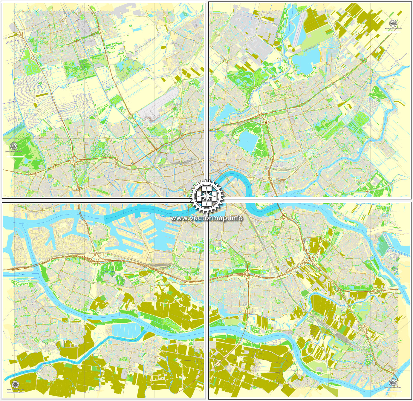
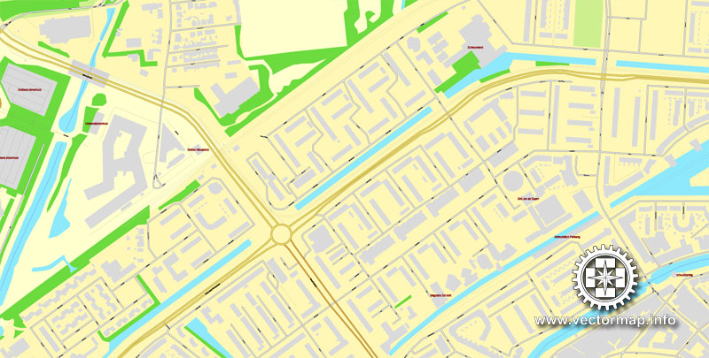
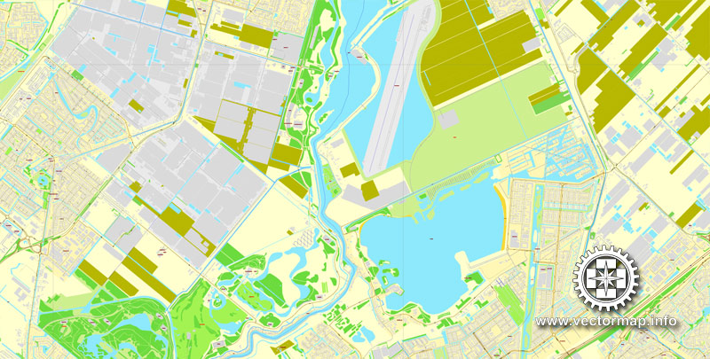
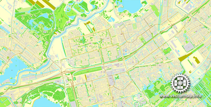
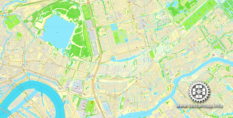
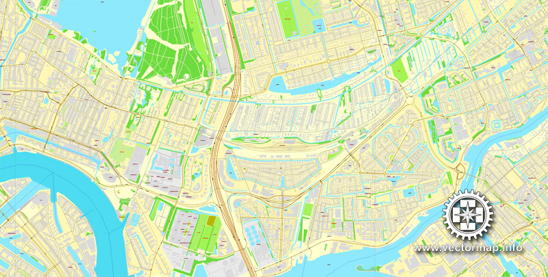
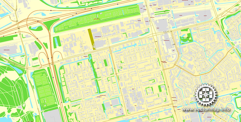
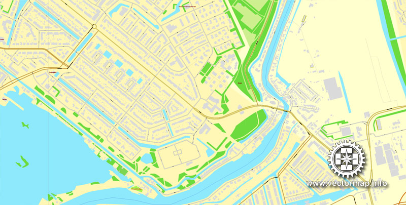
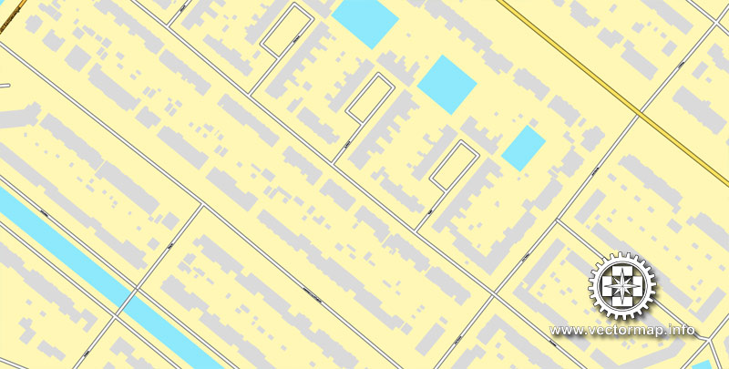
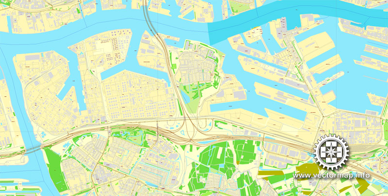
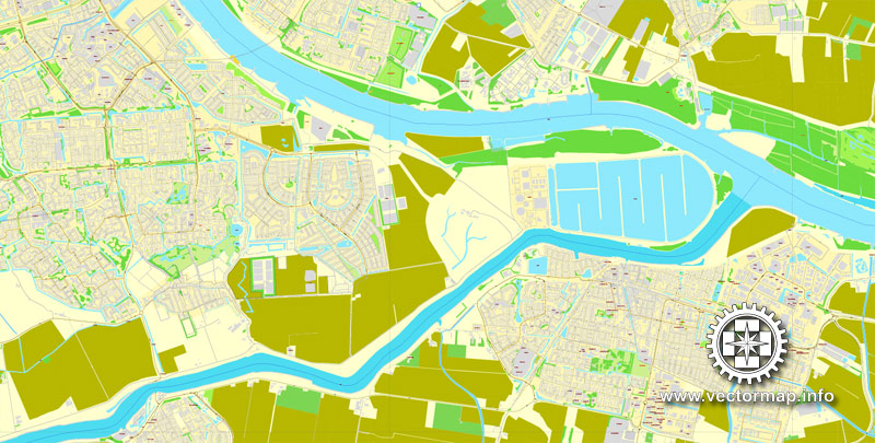
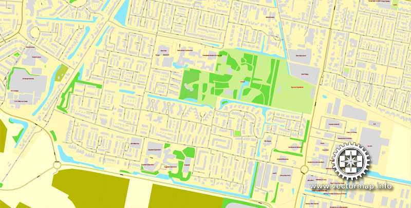
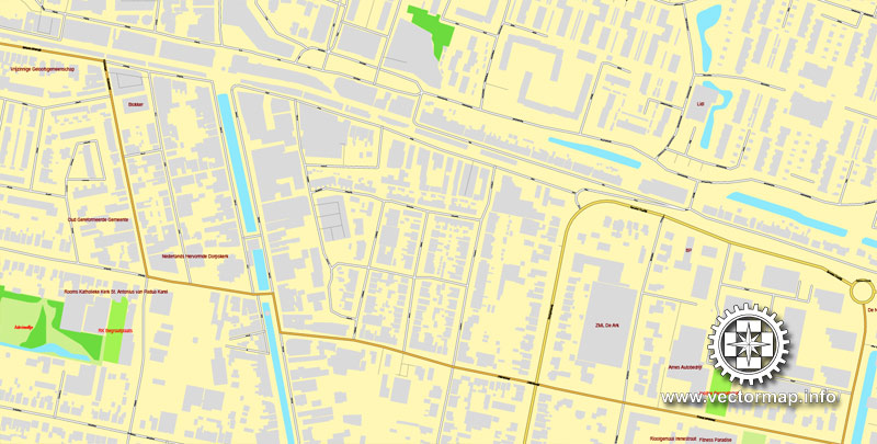
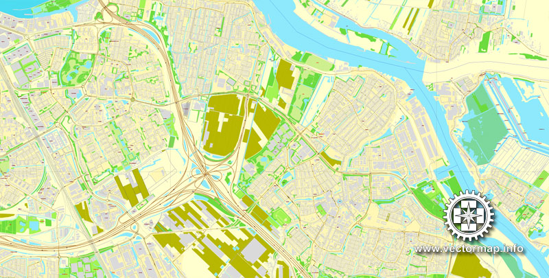
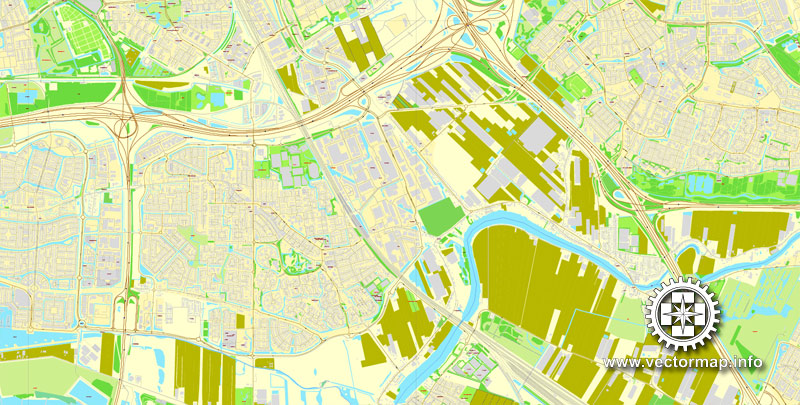
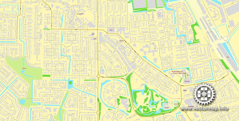
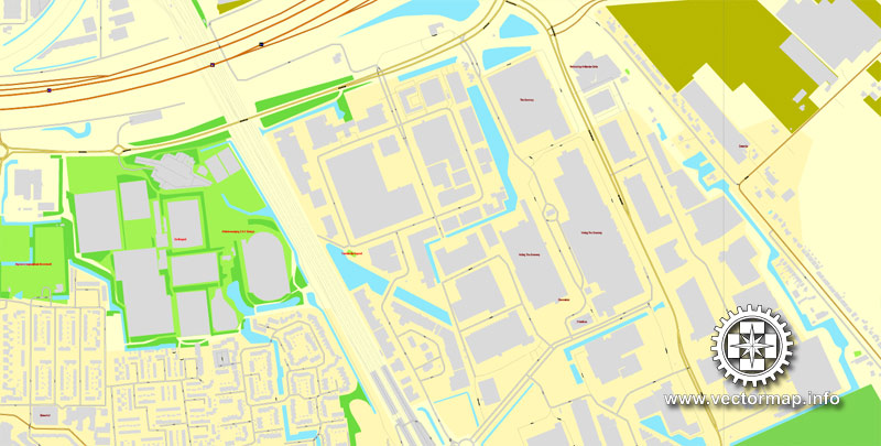
Rotterdam, Netherlands, printable vector street map, City Plan V.2 in 4 parts full editable, Adobe Illustrator, Royalty free, full vector, scalable, editable, text format street names, 48,9 mb ZIP
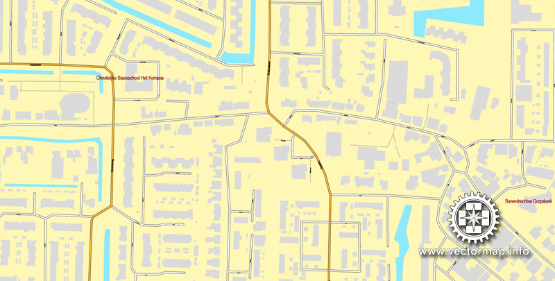
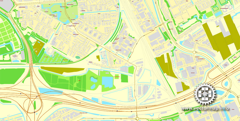
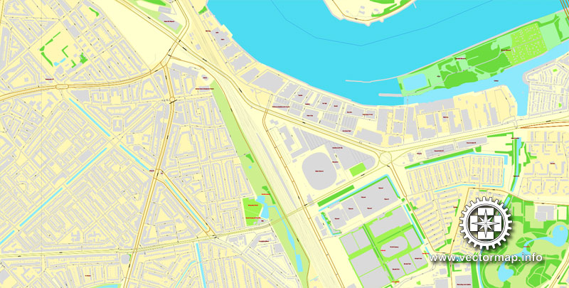
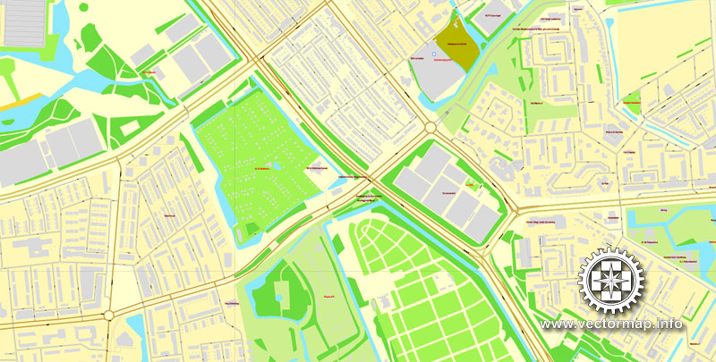
ALL streets, All Buildings.
Map for design, print, arts, projects, presentations, for architects, designers and builders.
The most accurate and detailed street map of the city.
Different font colors of the street names (black); object names by type (brown, red).
DXF, DWG, CDR and other formats – on request, same price, please contact us.
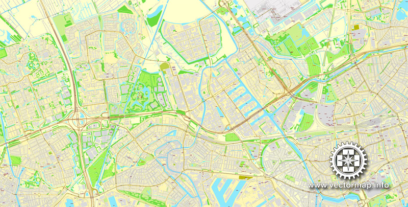
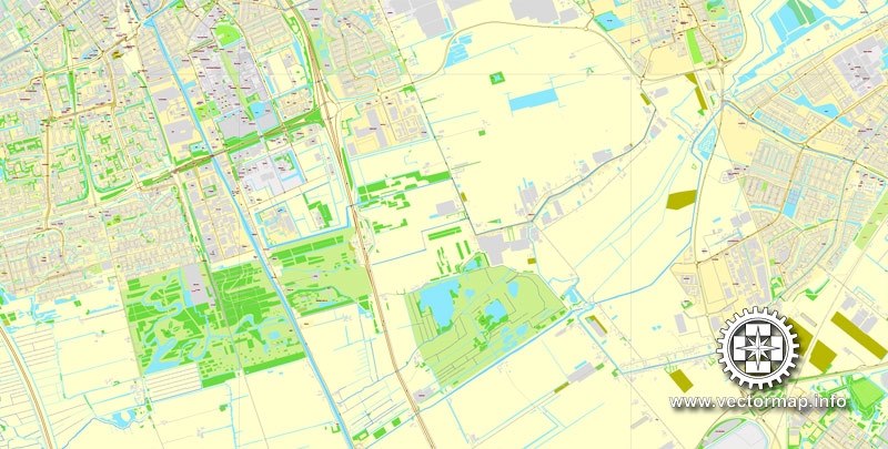
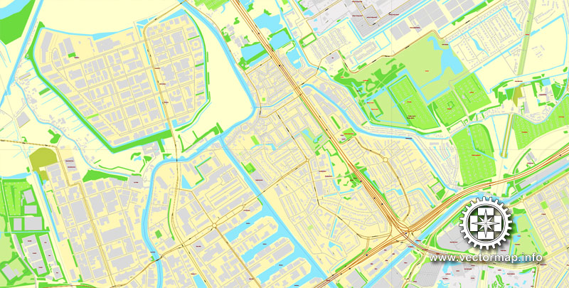
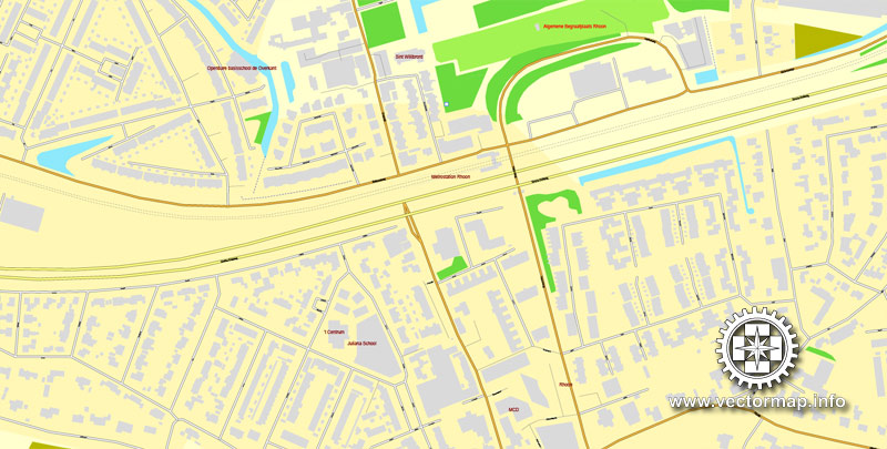
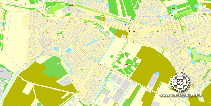
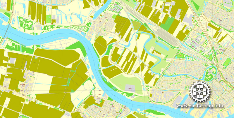
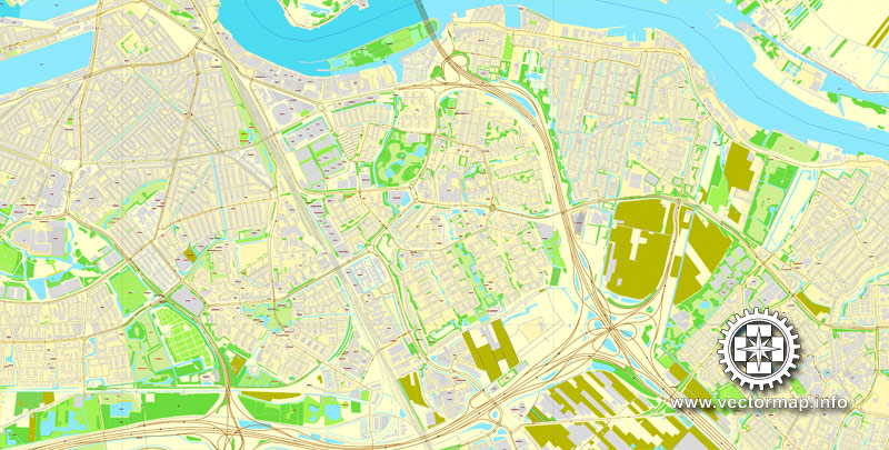
Rotterdam, Netherlands.
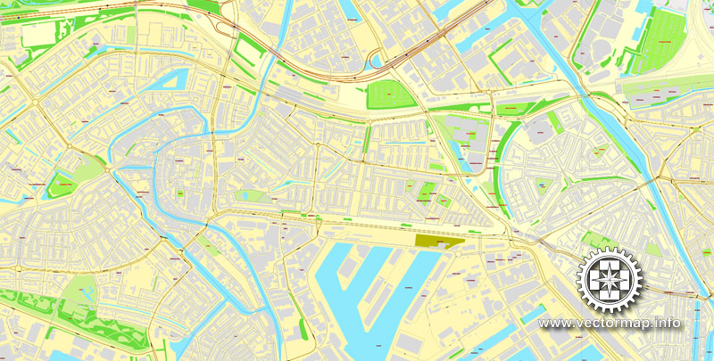
This vector map of Rotterdam is used as a basis for design, editing, and further printing.
This is the most detailed, exact map of Rotterdam for high-quality printing and polygraphy. You can always clarify the map development date by contacting us.
For your convenience, all objects on Rotterdam vector map are divided into layers. And the editing is very easy – colors, lines, etc.
You can easily add any objects needed (e.g. shops, salons, sale points, gas station or attraction) on any layer of Rotterdam vector map.
Rotterdam is the second-largest city and a municipality of the Netherlands. It is located in the province of South Holland, at the mouth of the Nieuwe Maas channel leading into the Rhine–Meuse–Scheldt delta at the North Sea. Its history goes back to 1270, when a dam was constructed in the Rotte, after which people settled around it for safety. In 1340, Rotterdam was granted city rights by the Count of Holland.
One of the advantages of Rotterdam vector maps of our production is the relevance of cartographic data, we constantly update all our products.
This vector map of Rotterdam is used by:
designers, layout designers, printers, advertisers and architects. Our product – vector maps – is designed for further editing and printing in large formats – from @Wall format (a few meters) to A-0 and A-1, A-2, A-3.
Rotterdam map in vector format is used for design, urban planning, presentations and media visualizations.
Advertising and presentation map of Rotterdam (usually the final designer marks the routes, and puts the client’s objects (shops, saloons, gas stations etc.)
The undoubted advantage is that people will NEVER throw out this advertising product – the map. In fact, as an advertising medium, a map is the most “long-playing” of the well-known polygraphic advertising media, with the longest lifespan, and the maximum number of interactions with the customer.
For travelers, maps are sold at the airports and gas stations around the world. Often the source is our vector maps.
Take a look, who purchases our vector maps of Rotterdam in “Our Clients and Friends” page – these are large and small companies, from super-brands like Volvo and Starbucks, to small design studios and printing houses.
A major logistic and economic centre, Rotterdam is Europe’s largest port. It has a population of 633,471 (2017). Rotterdam is known for its Erasmus University, its riverside setting, lively cultural life and maritime heritage. The near-complete destruction of the city centre in the World War II Rotterdam Blitz has resulted in a varied architectural landscape, including sky-scrapers (an uncommon sight in other Dutch cities) designed by renowned architects such as Rem Koolhaas, Piet Blom and Ben van Berkel.
It’s very easy to work with vector maps of Rotterdam, even for a not very experienced designer who can turn on and off the map layers, add new objects, change the colors of fill and lines according to customer requirements.
The undoubted advantage of Rotterdam vector maps in printing is an excellent and detailed visualization, when customer can expand a large paper map and instantly define his location, find a landmark, an object or address on map, unlike using the popular electronic formats of Google and Yandex maps for example.
Printable vector maps of Rotterdam are much more convenient and efficient than any electronic maps on your smartphone, because ALL DETAILS are displayed in the entire space of Rotterdam map.
Useful tips on working with vector maps of cities and countries in Adobe Illustrator.
«V» – launches the Selection tool (cursor, black arrow), which makes active any vector line.
«А» – launches the Direct Selection tool (white cursor), allows you to select curve elements and drag them to the desired place.
«R» – activates the Rotate tool, which helps you rotating selected objects around the center point by 360 degrees.
«E» – gives you the opportunity to use the Eraser tool and erase unnecessary parts.
«X» – switches between Fill and Stroke in the Tools section. Try to get used to this hot key and
you will quickly understand that you can’t live and work without it.
Guides are not limited to vertical and horizontal in Adobe Illustrator. You can also create a diagonal guide for example. Moreover, you can turn any contours into guides. Select the outline and go to View > Guides > Make Guides (Create Guides), or simply press Cmd/Ctrl + 5. You can also turn the guides back into an editable object. Go to menu, View > Guides > Unlock Guides (Release Guides), select the guide you want to edit and select View > Guides > Release Guides (Reset Guides), or just press Cmd/Ctrl + Option / Alt + 5).
You will probably want to change the color scheme used on our Rotterdam vector map.
To quickly and effectively play with colors.
Of course, you can do it manually, all objects in our Rotterdam vector map are divided according to types and layers, and you can easily change the color gamma of vector objects in groups and layers.
But there is more effective way of working with the whole VECTOR MAP of Rotterdam and all layers:
The overview dialog «Edit colors»/«Repaint Graphic Object» (this dialog box name can change depending on the context):
If you have selected a part or a layer of Rotterdam vector map and open the dialog box by clicking the icon in the Control panel, on the Samples palette or the Color Catalog, or if you choose Edit > Edit Colors> Repaint Graphic Object, then the «Repaint Graphic Object» dialog box appears, and you get access to «Assign» and «Edit» tabs.
If a picture or a map fragment is not selected, and you open the dialog box by clicking the icon in the Control panel, on the Samples palette or in the Color Catalog, the «Edit Colors» dialog box appears and you can only access the «Edit» tab.
Regardless of the name at the top of the dialog box, the right-hand side always displays the color group of the current document, as well as two default color groups: Print Color and Grayscale. These color groups can be selected and used any time.
Create and edit color groups of Rotterdam vector map, and also assign colors using the «Edit Colors»/ а «Repaint Graphic Object» dialog box.
A. Creating and editing of a color group on the «Edit» tab
B. Assigning colors on the «Assign» tab
C. Select a group of colors from the «Color groups» list
The option «Repaint a graphic object» in the lower part of the dialog box allows you to preview the colors on a selected layer of Vector map, or a group of elements, and specify whether its colors will be redefined when the dialog box is closed.
The main areas of the dialog box are:
«Edit»
The «Edit» tab is designed to create a new or edit the existing color groups.
The harmony rules Menu and the Color Wheel are used to conduct experiments with color harmonies. The color wheel shows how colors are related in color harmony, and the color bars allow you to view and manipulate an individual color values. In addition, you can adjust the brightness, add and remove colors, save color groups and view colors on the selected Vector Map of Rotterdam or a separated layers.
«Assign»
The «Assign» tab is used to view and control on how the original colors are replaced with colors from the color group like your corporate colors in the Vector Map of Rotterdam.
The assign color ability is provided only if the entire map, layer or fragment is selected in the document. You can specify which of new colors replace the current colors, whether the spot colors should be preserved and how colors are replaced (for example, you can replace colors completely or changing the color tone while maintaining the brightness). The «Assign» tab allows you to redefine colors in the Vector Map of Rotterdam, or in separate layers and fragments using the current color group or reducing the number of colors in the current Vector Map.
Color groups
Is a list of all saved color groups for current document (the same groups appear in the «Samples» palette). You can edit and delete the existing color groups, as well as creating a new ones using the list of “Color Groups” in the dialog box. All changes appear in the «Samples» palette.
The highlighted color group shows, which color group is currently edited.
Any color group can be selected and edited, or used to redefine the colors in the selected vector map of Rotterdam, its fragments or elements.
Saving a color group adds this group to the specified list.
Opening the «Edit Colors»/«Repaint Graphic Object» dialog box.
Open the «Edit Colors»/«Repaint Graphic Object» dialog box using one of the following methods:
«Edit»> «Edit Colors»> «Repaint Graphic object» or «Repaint With Style».
Use these commands if you need to edit the colors in the selected vector map of Rotterdam.
«Repaint Graphic object» button on the «Control» panel.
Use this button if you need to adjust colors of Rotterdam vector map using the а «Repaint graphic object» dialog box.
The specified button is available if the selected vector map or its fragment contains two or more colors.
Note. This color editing method is convenient for global color adjustment in a vector map, if global colors were not used when creating a Map of Rotterdam.
The «Edit colors» button or «Edit or apply colors» on the «Color Catalog» palette
Click this button if you need to edit colors on the «Color Catalog» palette or edit and then apply them to the selected Vector Map of Rotterdam or its fragment.
The «Edit color group» button or «Edit or apply color group» on the «Samples» palette.
Click this button if you need to edit the colors in the specific color group or edit and apply them to the selected Vector Map of Rotterdam or a group of its elements, for example, the whole layer “Streets and lines”. You can also double-click the color group in the Samples panel to open the dialog box.
If the map file is too large and your computer freezes or even can’t open it quickly:
1. Try to reduce the color resolution of the video card (display) to 256 colors while working with a large map.
2. Using Windows Task Manager, select all the application you don’t need, while working with map, just turn them off.
3. Launch Adobe Illustrator. (DO NOT OPEN the vector map file)
4. Start the Windows Task Manager using administrator rights > Find the “Illustrator” process > set the «real time» priority,
5. Open the file. When you see the LEGACY FONT popup window – click “OK” (do not update). You can restore the TEXT later.
6. Can also be useful: When file is opened – Edit > Settings > Basic Settings > disable smoothing. /// It looks scary, but works quickly)))
We recommend saving the file in Adobe Illustrator 10 version. It’s much more stable when working with VERY BIG size files.
The Rhine, Meuse and Scheldt give waterway access into the heart of Western Europe, including the highly industrialized Ruhr. The extensive distribution system including rail, roads, and waterways have earned Rotterdam the nicknames “Gateway to Europe” and “Gateway to the World”.
Geography
‘Rotterdam’ is divided into a northern and a southern part by the river Nieuwe Maas, connected by (from west to east): the Beneluxtunnel; the Maastunnel; the Erasmusbrug (‘Erasmus Bridge’); a subway tunnel; the Willemsspoortunnel (‘Willems railway tunnel’); the Willemsbrug (‘Willems Bridge’); the Koninginnebrug (‘Queen’s Bridge’); and the Van Brienenoordbrug (‘Van Brienenoord Bridge’). The former railway lift bridge De Hef (‘the Lift’) is preserved as a monument in lifted position between the Noordereiland (‘North Island’) and the south of Rotterdam.
The city centre is located on the northern bank of the Nieuwe Maas, although recent urban development has extended the centre to parts of southern Rotterdam known as De Kop van Zuid (‘the Head of South’, i.e. the northern part of southern Rotterdam). From its inland core, Rotterdam reaches the North Sea by a swathe of predominantly harbour area.
Built mostly behind dikes, large parts of the Rotterdam are below sea level. For instance, the Prins Alexander Polder in the northeast of Rotterdam extends 6 metres (20 ft) below sea level, or rather below Normaal Amsterdams Peil (NAP) or ‘Amsterdam Ordnance Datum’. The lowest point in the Netherlands (6.76 metres (22.2 ft) below NAP) is situated just to the east of Rotterdam, in the municipality of Nieuwerkerk aan den IJssel.
The Rotte river no longer joins the Nieuwe Maas directly. Since the early 1980s, when the construction of Rotterdam’s second subway line interfered with the Rotte’s course, its waters have been pumped through a pipe into the Nieuwe Maas via the Boerengat.
The 24 municipalities of the Rotterdam The Hague Metropolitan Area
Between the summers of 2003 and 2008, an artificial beach was created at the Boompjeskade along the Nieuwe Maas, between the Erasmus Bridge and the Willems Bridge. Swimming was not possible, digging pits was limited to the height of the layer of sand, about 50 cm (20 in). Alternatively people go the beach of Hoek van Holland (which is a Rotterdam district) or one of the beaches in Zeeland: Renesse or the Zuid Hollandse Eilanden: Ouddorp, Oostvoorne.
Rotterdam forms the centre of the Rijnmond conurbation, bordering the conurbation surrounding The Hague to the north-west. The two conurbations are close enough to be a single conurbation. They share the Rotterdam The Hague Airport and a light rail system called RandstadRail. Consideration is being given to creating an official Metropolitan region Rotterdam The Hague (Metropoolregio Rotterdam Den Haag), which would have a combined population approaching 2.5 million.
On its turn, the Rijnmond conurbation is part of the southern wing (the Zuidvleugel) of the Randstad, which is one of the most important economic and densely populated areas in the north-west of Europe. Having a population of 7.1 million, the Randstad is the sixth-largest urban area in Europe (after Moscow, London, Paris, Istanbul, and the Rhein-Ruhr Area). The Zuidvleugel, situated in the province of South Holland, has a population of around 3 million.
See more Netherland cities vector maps in Adobe Illustrator, PDF and Corel Draw format
PDF Map Rotterdam, Netherlands, printable vector street City Plan
PDF map The Hague / Den Haag, Netherlands
PDF Map Utrecht, Netherlands
Printable Map Amsterdam, Netherlands
Rotterdam
City in Netherlands
Rotterdam is a major port city in the Netherlands’ province of South Holland. The Maritime Museum’s vintage ships and exhibits trace the city’s seafaring history. The 17th-century Delfshaven neighborhood is home to canalside shopping and the Pilgrim Fathers Church, where pilgrims worshiped before sailing to America. After being almost completely reconstructed following WWII, the city is now known for its bold, modern architecture.
Area: 319.4 km²
Population: 610,386 (2011) UNdata
Province: South Holland
Area code: 010
Sports teams: Feyenoord, Sparta Rotterdam, S.B.V. Excelsior
Rotterdam is a city in the Netherlands, located in South Holland, within the Rhine–Meuse–Scheldt river delta at the North Sea. Its history goes back to 1270 when a dam was constructed in the Rotte river by people settled around it for safety. In 1340 Rotterdam was granted city rights by the Count of Holland and slowly grew into a major logistic and economic centre. Nowadays it is home to Europe’s largest port and has a population of 630,383 (2014, city proper), ranking second in the Netherlands. The Greater Rijnmond area is home to approximately 1.4 million people and the Rotterdam The Hague urban area makes for the 168th most populous urban area in the world. Rotterdam is part of the yet larger Randstad conurbation with a total population of 7,100,000.
The city of Rotterdam is known for the Erasmus University, riverside setting, lively cultural life and its maritime heritage. The near-complete destruction of Rotterdam’s city centre during World War II (known as the Rotterdam Blitz) has resulted in a varied architectural landscape including sky-scrapers, which are an uncommon sight in other Dutch cities. Rotterdam is home to some world-famous architecture from renowned architects like Rem Koolhaas, Piet Blom, Ben van Berkel and others. Recently Rotterdam was listed 8th in The Rough Guide Top 10 Cities to Visit and was voted 2015 European City of the Year by the Academy of Urbanism.
The port of Rotterdam is the largest cargo port in Europe and the 10th largest in the world. Rotterdam’s logistic success is based on its strategic location on the North Sea, directly at the mouth of the Nieuwe Maas (New Meuse) channel leading into the Rhine–Meuse–Scheldt delta. The rivers Rhine, Meuse, and Scheldt give waterway access into the heart of Western Europe, including the highly industrialized Ruhr region. The extensive distribution system including rail, roads and waterways have earned Rotterdam the nickname “Gateway to Europe”, and, conversely; “Gateway to the World” in Europe.
Source Wiki

Free vector map World, Adobe Illustrator, download now maps vector clipart Map for design, projects, presentation free to use as you like. World map vector, Vector world map, World vector map, Map western europe, West europe maps, Map of the world modifiable, High resolution world map, World map illustrator, World map PDF editable, World vector map download,
Free vector map World, Adobe Illustrator, download now maps vector clipart
Map for design, projects, presentation free to use as you like.
Free Download All World Vector Maps here >>>>>
See also: TERMS & CONDITIONS: SOFTWARE LICENSE AGREEMENT FOR DIGITAL CARTOGRAPHIC DATA
Small guide: How to work with the vector map?
You can: Mass select objects by type and color – for example, the objects type “building” (they are usually dark gray) – and remove them from the map, if you do not need them in your print or design project. You can also easily change the thickness of lines (streets), just bulk selection the road by the line color.
The streets are separated by type, for example, type “residential road” are usually white with a gray stroke. Highway usually orange with a brown or dark gray stroke.
All objects are divided by types: different types of roads and streets, polygons of buildings, landfills, urban areas, parks and more other.
It is easy to change the font of inscriptions, all or each individually. Also, just can be make and any other manipulation of objects on the vector map in Adobe illustrator format.
Important: All the proportions on the map are true, that is, the relative sizes of the objects are true, because Map is based on an accurate GPS projection, and It transated into the (usual for all) the Mercator projection.
You can easily change the color, stroke and fill of any object on the map, zoom without loss of quality Image Verification.
Select object

Bulk selection the same objects on the vector map

See the bulk selected objects on the vector map

Bulk delete buildungs from the vector map

Select residencial road (small street) on the vector map

Bulk selection the same lines (streets, roads) on the full map

Create fat lines of the streets on the vector maps (bulk action) 1

Create fat lines of the streets on the vector maps (bulk action) 2

Create fat lines of the streets on the vector maps (bulk action) 3

You can easily change the color, stroke and fill of any object on the map, zoom without loss of quality Image Verification.

 Author: Kirill Shrayber, Ph.D. FRGS


