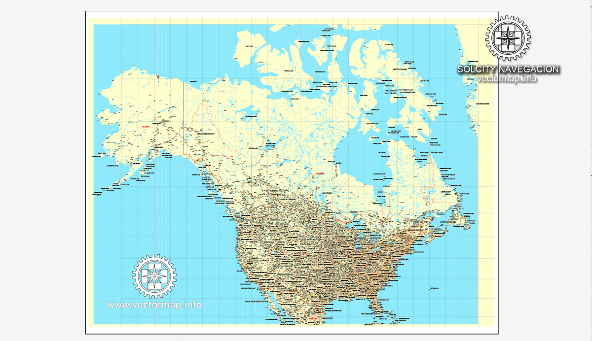
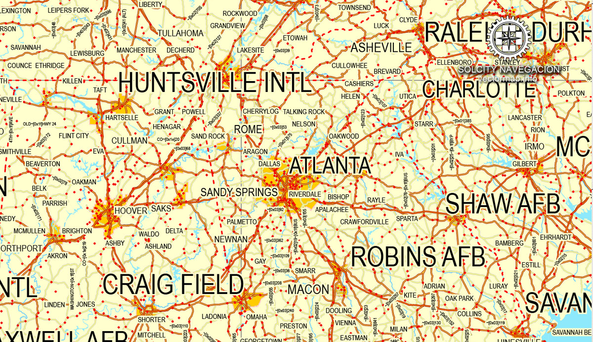
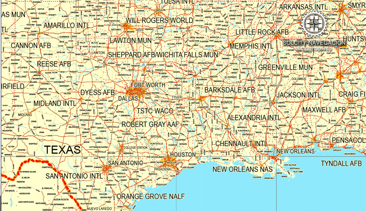
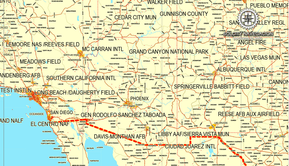
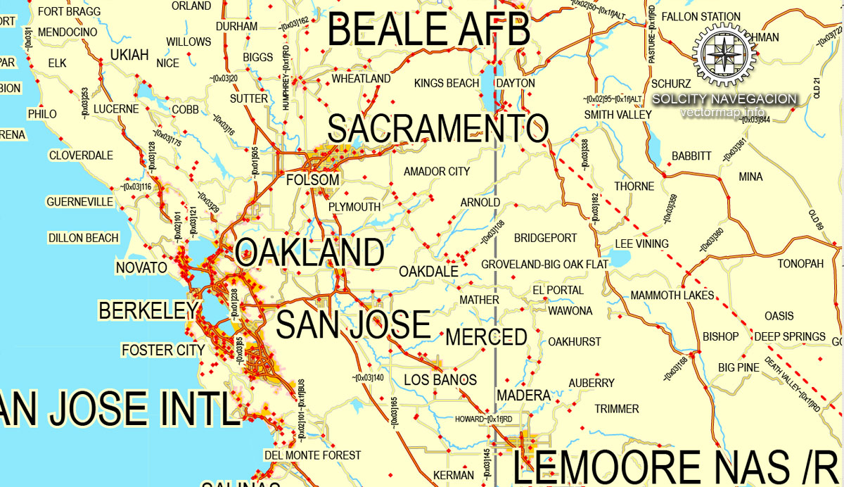
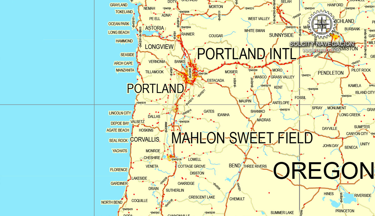
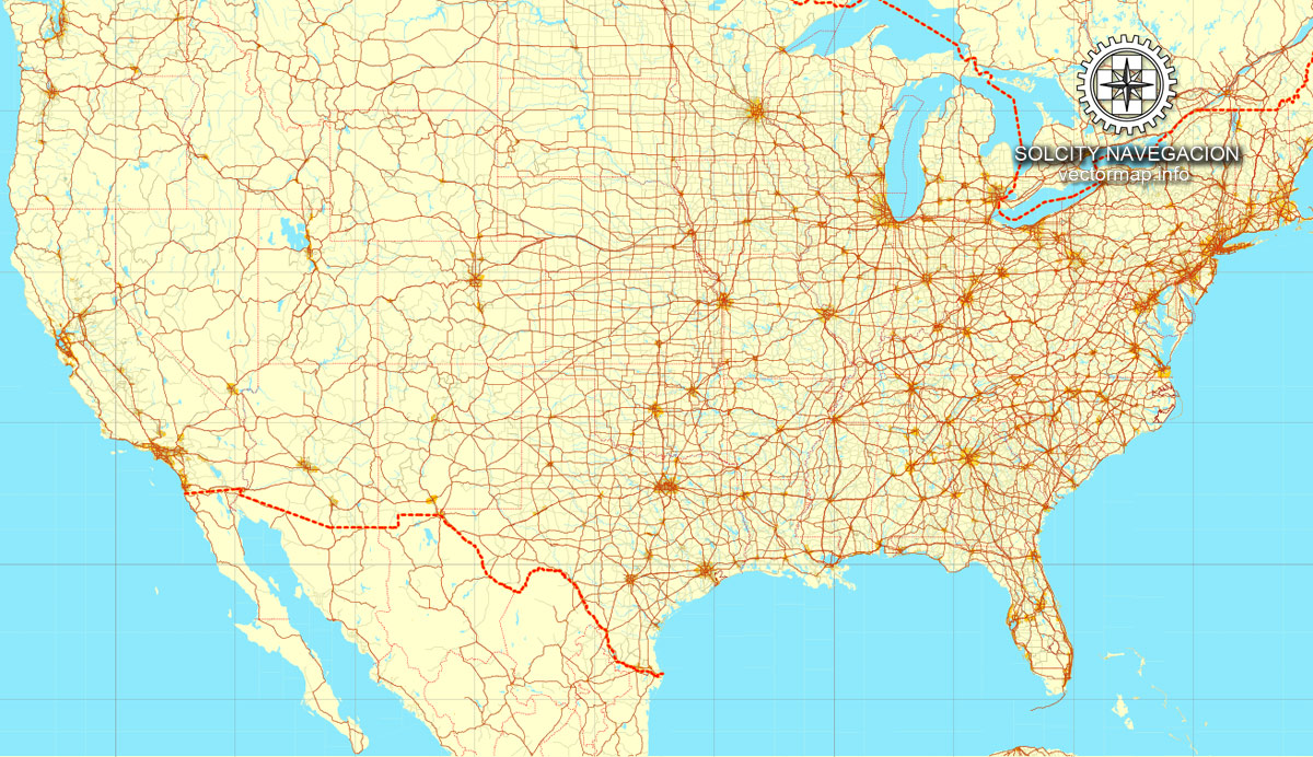
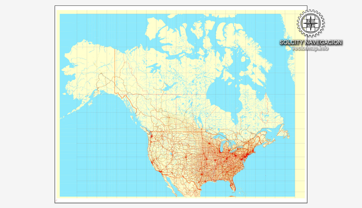
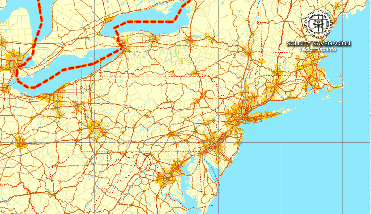
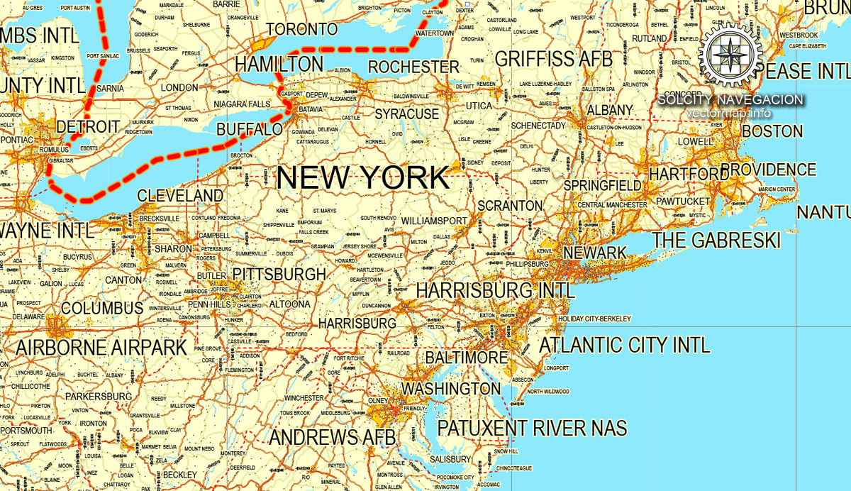
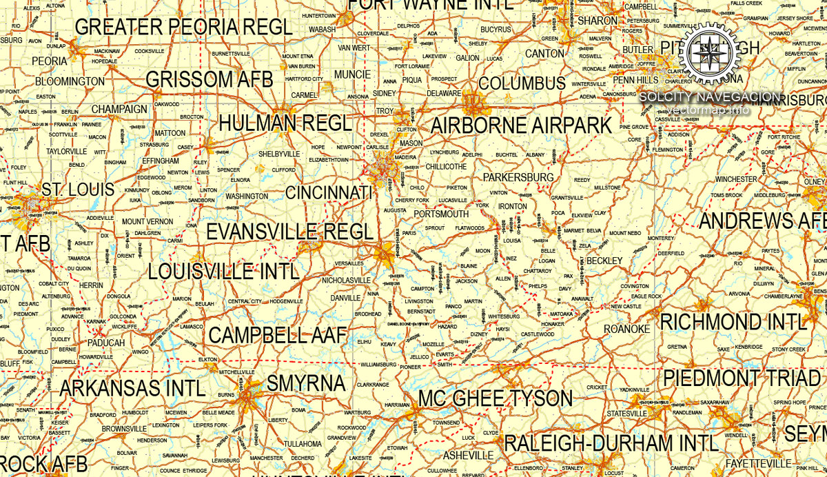
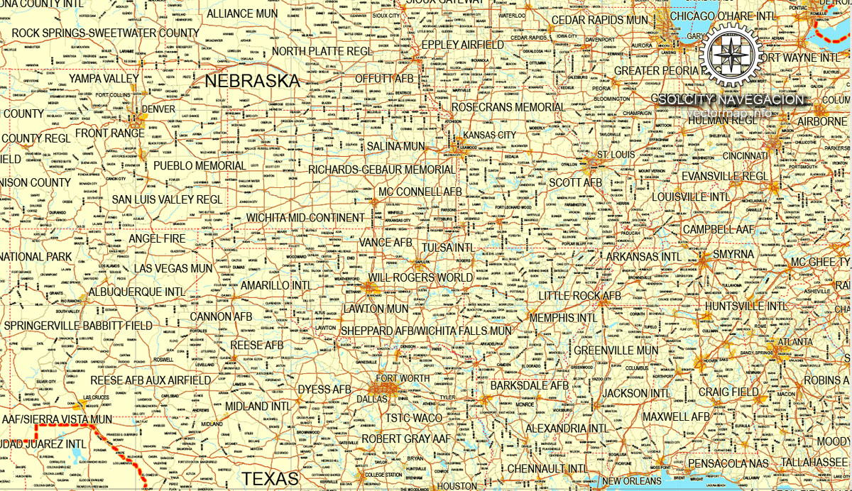
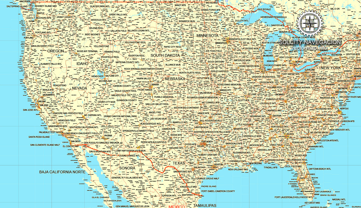
US + Canada, printable vector Counrty Road map, GPS correct Mercator Projection editable, Adobe illustrator, full vector, scalable, city names in text format, 9,6 Mb ZIP.
Separated text names layer with halo, all cities and small towns are named.
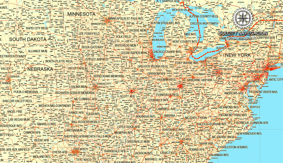
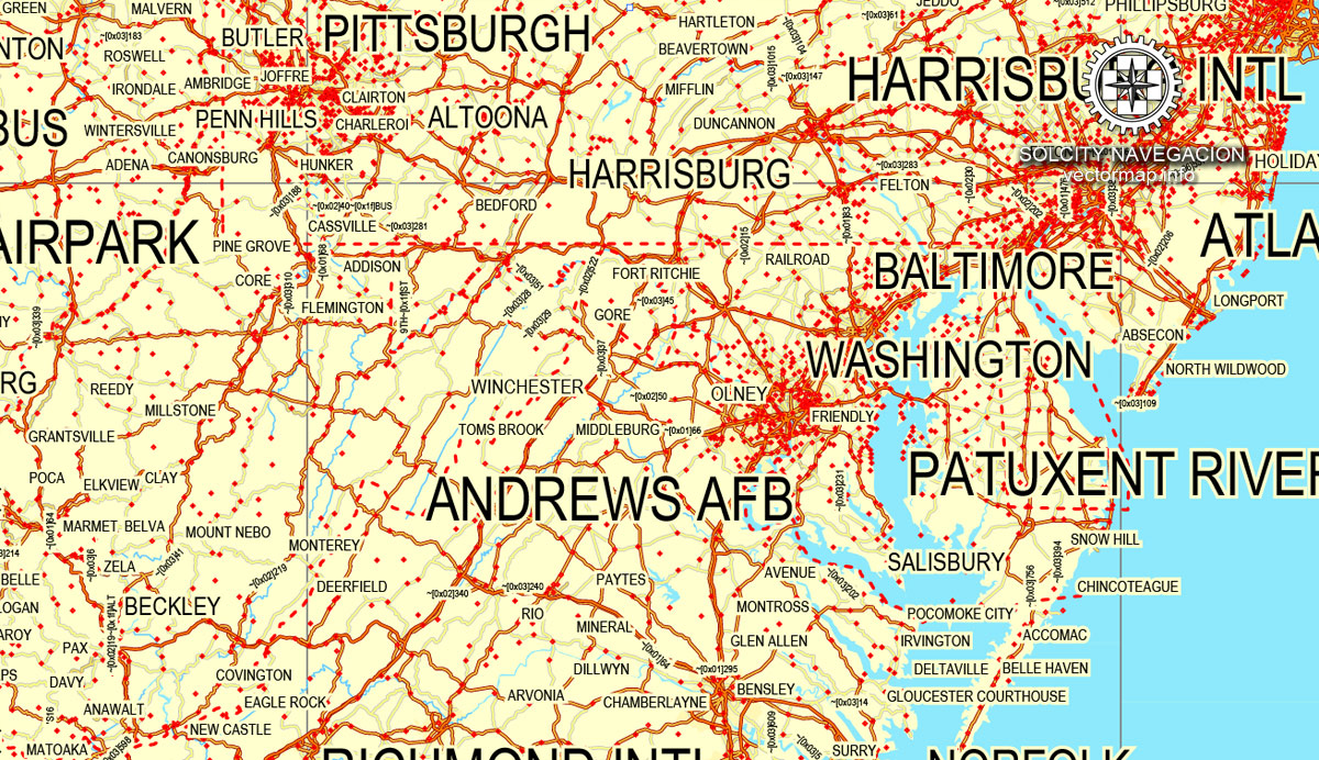
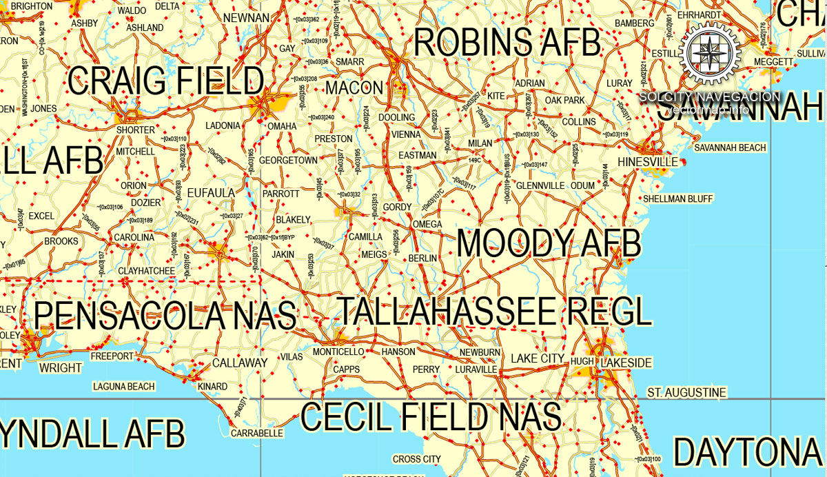
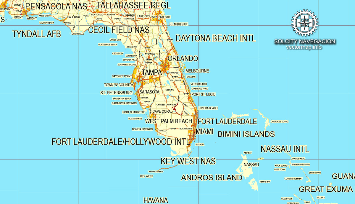
Cities, roads and boundaries. Map for design, print, arts, projects, presentations, for architects, designers and builders.
PDF, DXF, DWG, CDR and other formats – by request, same price, please, contact.
USA + CANADA.
The USA + CANADA map in vector format is used for design, urban planning, presentations and media visualizations.
The advertising and presentation map of USA + CANADA (usually the final designer marks the routes, and puts the client’s objects (shops, saloons, gas stations etc.)
The undoubted advantage is that people will NEVER throw out this advertising product – the map. In fact, as an advertising medium, a map is the most “long-playing” of the well-known polygraphic advertising media, with the longest lifespan, and the maximum number of interactions with the customer.
For travelers, maps are sold at the airports and gas stations around the world. Often the source is our vector maps.
Take a look, who purchases our vector maps of USA + CANADA in “Our Clients and Friends” page – these are large and small companies, from super-brands like Volvo and Starbucks, to small design studios and printing houses.
It’s very easy to work with vector maps of USA + CANADA city, even for a not very experienced designer who can turn on and off the map layers, add new objects, change the colors of fill and lines according to customer requirements.
The undoubted advantage of USA + CANADA vector maps in printing is an excellent and detailed visualization, when customer can expand a large paper map and instantly define his location, find a landmark, an object or address on map, unlike using the popular electronic formats of Google and Yandex maps for example.
Printable vector maps of USA + CANADA are much more convenient and efficient than any electronic maps on your smartphone, because ALL DETAILS are displayed in the entire space of USA + CANADA map.
Paleo-Indians migrated from Siberia to the North American mainland at least 15,000 years ago. European colonization began in the 16th century. The United States emerged from the thirteen British colonies established along the East Coast. Numerous disputes between Great Britain and the colonies following the French and Indian War led to the American Revolution, which began in 1775, and the subsequent Declaration of Independence in 1776. The war ended in 1783 with the United States becoming the first country to gain independence from a European power.
Useful tips on working with vector maps of cities and countries in Adobe Illustrator.
«V» – launches the Selection tool (cursor, black arrow), which makes active any vector line.
«А» – launches the Direct Selection tool (white cursor), allows you to select curve elements and drag them to the desired place.
«R» – activates the Rotate tool, which helps you rotating selected objects around the center point by 360 degrees.
«E» – gives you the opportunity to use the Eraser tool and erase unnecessary parts.
«X» – switches between Fill and Stroke in the Tools section. Try to get used to this hot key and
you will quickly understand that you can’t live and work without it.
Guides are not limited to vertical and horizontal in Adobe Illustrator. You can also create a diagonal guide for example. Moreover, you can turn any contours into guides. Select the outline and go to View > Guides > Make Guides (Create Guides), or simply press Cmd/Ctrl + 5. You can also turn the guides back into an editable object. Go to menu, View > Guides > Unlock Guides (Release Guides), select the guide you want to edit and select View > Guides > Release Guides (Reset Guides), or just press Cmd/Ctrl + Option / Alt + 5).
You will probably want to change the color scheme used on our USA + CANADA vector map.
To quickly and effectively play with colors.
Of course, you can do it manually, all objects in our USA + CANADA vector map are divided according to types and layers, and you can easily change the color gamma of vector objects in groups and layers.
But there is more effective way of working with the whole VECTOR MAP of USA + CANADA and all layers:
The overview dialog «Edit colors»/«Repaint Graphic Object» (this dialog box name can change depending on the context):
If you have selected a part or a layer of USA + CANADA vector map and open the dialog box by clicking the icon in the Control panel, on the Samples palette or the Color Catalog, or if you choose Edit > Edit Colors> Repaint Graphic Object, then the «Repaint Graphic Object» dialog box appears, and you get access to «Assign» and «Edit» tabs.
If a picture or a map fragment is not selected, and you open the dialog box by clicking the icon in the Control panel, on the Samples palette or in the Color Catalog, the «Edit Colors» dialog box appears and you can only access the «Edit» tab.
Regardless of the name at the top of the dialog box, the right-hand side always displays the color group of the current document, as well as two default color groups: Print Color and Grayscale. These color groups can be selected and used any time.
Create and edit color groups of USA + CANADA vector map, and also assign colors using the «Edit Colors»/ а «Repaint Graphic Object» dialog box.
A. Creating and editing of a color group on the «Edit» tab
B. Assigning colors on the «Assign» tab
C. Select a group of colors from the «Color groups» list
The option «Repaint a graphic object» in the lower part of the dialog box allows you to preview the colors on a selected layer of Vector map, or a group of elements, and specify whether its colors will be redefined when the dialog box is closed.
The current constitution was adopted in 1788, with the first ten amendments, collectively named the Bill of Rights, being ratified in 1791 to guarantee many fundamental civil liberties. The United States embarked on a vigorous expansion across North America throughout the 19th century, acquiring new territories, displacing Native American tribes, and gradually admitting new states until it spanned the continent by 1848. During the second half of the 19th century, the Civil War led to the abolition of slavery.
By the end of the century, the United States had extended into the Pacific Ocean, and its economy, driven in large part by the Industrial Revolution, began to soar. The Spanish–American War and World War I confirmed the country’s status as a global military power. The United States emerged from World War II as a global superpower, the first country to develop nuclear weapons, the only country to use them in warfare, and a permanent member of the United Nations Security Council. During the Cold War, the United States and the Soviet Union competed in the Space Race, culminating with the 1969 moon landing. The end of the Cold War and the collapse of the Soviet Union in 1991 left the United States as the world’s sole superpower.
The main areas of the dialog box are:
«Edit»
The «Edit» tab is designed to create a new or edit the existing color groups.
The harmony rules Menu and the Color Wheel are used to conduct experiments with color harmonies. The color wheel shows how colors are related in color harmony, and the color bars allow you to view and manipulate an individual color values. In addition, you can adjust the brightness, add and remove colors, save color groups and view colors on the selected Vector Map of USA + CANADA or a separated layers.
«Assign»
The «Assign» tab is used to view and control on how the original colors are replaced with colors from the color group like your corporate colors in the Vector Map of USA + CANADA city.
The assign color ability is provided only if the entire map, layer or fragment is selected in the document. You can specify which of new colors replace the current colors, whether the spot colors should be preserved and how colors are replaced (for example, you can replace colors completely or changing the color tone while maintaining the brightness). The «Assign» tab allows you to redefine colors in the Vector Map of USA + CANADA city, or in separate layers and fragments using the current color group or reducing the number of colors in the current Vector Map.
Color groups
Is a list of all saved color groups for current document (the same groups appear in the «Samples» palette). You can edit and delete the existing color groups, as well as creating a new ones using the list of “Color Groups” in the dialog box. All changes appear in the «Samples» palette.
The United States is the world’s oldest surviving federation. It is a federal republic and a representative democracy, “in which majority rule is tempered by minority rights protected by law”. The United States is a founding member of the United Nations, World Bank, International Monetary Fund, Organization of American States (OAS), and other international organizations. The United States is a highly developed country, with the world’s largest economy by nominal GDP and second-largest economy by PPP, accounting for approximately a quarter of global GDP. The U.S. economy is largely post-industrial, characterized by the dominance of services and knowledge-based activities, although the manufacturing sector remains the second-largest in the world. The United States is the world’s largest importer and the second largest exporter of goods, by value. Although its population is only 4.3% of the world total, the U.S. holds 33% of the total wealth in the world, the largest share of global wealth concentrated in a single country. The United States ranks among the highest nations in several measures of socioeconomic performance, including human development, per capita GDP, and productivity per person, while experiencing a substantial amount of income and wealth inequality. The United States is the foremost military power in the world, making up a third of global military spending, and is a leading political, cultural, and scientific force internationally.
The highlighted color group shows, which color group is currently edited.
Any color group can be selected and edited, or used to redefine the colors in the selected vector map of USA + CANADA city, its fragments or elements.
Saving a color group adds this group to the specified list.
Opening the «Edit Colors»/«Repaint Graphic Object» dialog box.
Open the «Edit Colors»/«Repaint Graphic Object» dialog box using one of the following methods:
«Edit»> «Edit Colors»> «Repaint Graphic object» or «Repaint With Style».
Use these commands if you need to edit the colors in the selected vector map of USA + CANADA city.
«Repaint Graphic object» button on the «Control» panel.
Use this button if you need to adjust colors of USA + CANADA vector map using the а «Repaint graphic object» dialog box.
The specified button is available if the selected vector map or its fragment contains two or more colors.
Note. This color editing method is convenient for global color adjustment in a vector map, if global colors were not used when creating a Map of USA + CANADA.
The «Edit colors» button or «Edit or apply colors» on the «Color Catalog» palette
Click this button if you need to edit colors on the «Color Catalog» palette or edit and then apply them to the selected Vector Map of USA + CANADA or its fragment.
The «Edit color group» button or «Edit or apply color group» on the «Samples» palette.
Click this button if you need to edit the colors in the specific color group or edit and apply them to the selected Vector Map of USA + CANADA or a group of its elements, for example, the whole layer “Streets and lines”. You can also double-click the color group in the Samples panel to open the dialog box.
If the map file is too large and your computer freezes or even can’t open it quickly:
1. Try to reduce the color resolution of the video card (display) to 256 colors while working with a large map.
2. Using Windows Task Manager, select all the application you don’t need, while working with map, just turn them off.
3. Launch Adobe Illustrator. (DO NOT OPEN the vector map file)
4. Start the Windows Task Manager using administrator rights > Find the “Illustrator” process > set the «real time» priority,
5. Open the file. When you see the LEGACY FONT popup window – click “OK” (do not update). You can restore the TEXT later.
6. Can also be useful: When file is opened – Edit > Settings > Basic Settings > disable smoothing. /// It looks scary, but works quickly)))
We recommend saving the file in Adobe Illustrator 10 version. It’s much more stable when working with VERY BIG size files.
Geography, climate, and environment
Main articles: Geography of the United States, Climate of the United States, and Environment of the United States
A composite satellite image of the contiguous United States and surrounding areas
Köppen climate classifications
The land area of the entire United States is approximately 3,800,000 square miles (9,841,955 km2), with the contiguous United States making up 2,959,064 square miles (7,663,940.6 km2) of that. Alaska, separated from the contiguous United States by Canada, is the largest state at 663,268 square miles (1,717,856.2 km2). Hawaii, occupying an archipelago in the central Pacific, southwest of North America, is 10,931 square miles (28,311 km2) in area. The populated territories of Puerto Rico, American Samoa, Guam, Northern Mariana Islands, and U.S. Virgin Islands together cover 9,185 square miles (23,789 km2). Measured by only land area, the United States is third in size behind Russia and China, just ahead of Canada.
The United States is the world’s third- or fourth-largest nation by total area (land and water), ranking behind Russia and Canada and just above or below China. The ranking varies depending on how two territories disputed by China and India are counted, and how the total size of the United States is measured. The Encyclopædia Britannica, for instance, lists the size of the United States as 3,677,649 square miles (9,525,067 km2), as they do not count the country’s coastal or territorial waters. The World Factbook, which includes those waters, gives 3,796,742 square miles (9,833,517 km2).
The coastal plain of the Atlantic seaboard gives way further inland to deciduous forests and the rolling hills of the Piedmont. The Appalachian Mountains divide the eastern seaboard from the Great Lakes and the grasslands of the Midwest. The Mississippi–Missouri River, the world’s fourth longest river system, runs mainly north–south through the heart of the country. The flat, fertile prairie of the Great Plains stretches to the west, interrupted by a highland region in the southeast.
The Rocky Mountains, at the western edge of the Great Plains, extend north to south across the country, reaching altitudes higher than 14,000 feet (4,300 m) in Colorado. Farther west are the rocky Great Basin and deserts such as the Chihuahua and Mojave. The Sierra Nevada and Cascade mountain ranges run close to the Pacific coast, both ranges reaching altitudes higher than 14,000 feet (4,300 m). The lowest and highest points in the contiguous United States are in the state of California, and only about 84 miles (135 km) apart. At an elevation of 20,310 feet (6,190.5 m), Alaska’s Denali (Mount McKinley) is the highest peak in the country and North America. Active volcanoes are common throughout Alaska’s Alexander and Aleutian Islands, and Hawaii consists of volcanic islands. The supervolcano underlying Yellowstone National Park in the Rockies is the continent’s largest volcanic feature. The United States has the most ecoregions out of any country in the world.
The United States, with its large size and geographic variety, includes most climate types. To the east of the 100th meridian, the climate ranges from humid continental in the north to humid subtropical in the south. The Great Plains west of the 100th meridian are semi-arid. Much of the Western mountains have an alpine climate. The climate is arid in the Great Basin, desert in the Southwest, Mediterranean in coastal California, and oceanic in coastal Oregon and Washington and southern Alaska. Most of Alaska is subarctic or polar. Hawaii and the southern tip of Florida are tropical, as are the populated territories in the Caribbean and the Pacific. Extreme weather is not uncommon—the states bordering the Gulf of Mexico are prone to hurricanes, and most of the world’s tornadoes occur within the country, mainly in Tornado Alley areas in the Midwest and South.
Canada
Canada is a country located in the northern part of North America. Its ten provinces and three territories extend from the Atlantic to the Pacific and northward into the Arctic Ocean, covering 9.98 million square kilometres (3.85 million square miles), making it the world’s second-largest country by total area. Canada’s southern border with the United States is the world’s longest bi-national land border. Its capital is Ottawa, and its three largest metropolitan areas are Toronto, Montreal, and Vancouver. As a whole, Canada is sparsely populated, the majority of its land area being dominated by forest and tundra. Consequently, its population is highly urbanized, with over 80 percent of its inhabitants concentrated in large and medium-sized cities, many near the southern border. Canada’s climate varies widely across its vast area, ranging from arctic weather in the north, to hot summers in the southern regions, with four distinct seasons.
Various indigenous peoples have inhabited what is now Canada for thousands of years prior to European colonization. Beginning in the 16th century, British and French expeditions explored, and later settled, along the Atlantic coast. As a consequence of various armed conflicts, France ceded nearly all of its colonies in North America in 1763. In 1867, with the union of three British North American colonies through Confederation, Canada was formed as a federal dominion of four provinces. This began an accretion of provinces and territories and a process of increasing autonomy from the United Kingdom. This widening autonomy was highlighted by the Statute of Westminster of 1931 and culminated in the Canada Act of 1982, which severed the vestiges of legal dependence on the British parliament, except for the power to amend its constitution.
Canada is a federal parliamentary democracy and a constitutional monarchy, with Queen Elizabeth II being the head of state. The country is a realm within the Commonwealth of Nations, a member of the Francophonie and officially bilingual at the federal level. It ranks among the highest in international measurements of government transparency, civil liberties, quality of life, economic freedom, and education. It is one of the world’s most ethnically diverse and multicultural nations, the product of large-scale immigration from many other countries. Canada’s long and complex relationship with the United States has had a significant impact on its economy and culture.
Canada is a developed country and has the fifteenth-highest nominal per capita income globally as well as the tenth-highest ranking in the Human Development Index. Its advanced economy is the tenth-largest in the world, relying chiefly upon its abundant natural resources and well-developed international trade networks. Canada is part of several major international and intergovernmental institutions or groupings including the United Nations, the North Atlantic Treaty Organization, the G7 (formerly G8), the Group of Ten, the G20, the North American Free Trade Agreement and the Asia-Pacific Economic Cooperation forum.
Geography and climate
Canada occupies much of the continent of North America, sharing land borders with the contiguous United States to the south, and the U.S. state of Alaska to the northwest. Canada stretches from the Atlantic Ocean in the east to the Pacific Ocean in the west; to the north lies the Arctic Ocean. Greenland is to the northeast and to the southeast Canada shares a maritime boundary with the Republic of France’s overseas collectivity of Saint Pierre and Miquelon, the last vestige of New France. By total area (including its waters), Canada is the second-largest country in the world, after Russia. By land area alone, however, Canada ranks fourth, the difference being due to it having the world’s largest proportion of fresh water lakes. Of Canada’s thirteen provinces and territories, only two are landlocked (Alberta and Saskatchewan) while the other eleven all directly border one of three oceans.
Canada is home to the world’s northernmost settlement, Canadian Forces Station Alert, on the northern tip of Ellesmere Island – latitude 82.5°N – which lies 817 kilometres (508 mi) from the North Pole. Much of the Canadian Arctic is covered by ice and permafrost. Canada has the longest coastline in the world, with a total length of 243,042 kilometres (151,019 mi); additionally, its border with the United States is the world’s longest land border, stretching 8,891 kilometres (5,525 mi). Three of Canada’s arctic islands, Baffin Island, Victoria Island and Ellesmere Island, are among the ten largest in the world.
Since the end of the last glacial period, Canada has consisted of eight distinct forest regions, including extensive boreal forest on the Canadian Shield. Canada has over 2,000,000 lakes—563 greater than 100 km2 (39 sq mi)—which is more than any other country, containing much of the world’s fresh water. There are also fresh-water glaciers in the Canadian Rockies and the Coast Mountains.
The Mount Meager massif as seen from the east near Pemberton. Summits left to right are Capricorn Mountain, Mount Meager and Plinth Peak.
Canada is geologically active, having many earthquakes and potentially active volcanoes, notably Mount Meager massif, Mount Garibaldi, Mount Cayley massif, and the Mount Edziza volcanic complex. The volcanic eruption of the Tseax Cone in 1775 was among Canada’s worst natural disasters, killing an estimated 2,000 Nisga’a people and destroying their village in the Nass River valley of northern British Columbia. The eruption produced a 22.5-kilometre (14.0 mi) lava flow, and, according to Nisga’a legend, blocked the flow of the Nass River.
Average winter and summer high temperatures across Canada vary from region to region. Winters can be harsh in many parts of the country, particularly in the interior and Prairie provinces, which experience a continental climate, where daily average temperatures are near −15 °C (5 °F), but can drop below −40 °C (−40 °F) with severe wind chills. In noncoastal regions, snow can cover the ground for almost six months of the year, while in parts of the north snow can persist year-round. Coastal British Columbia has a temperate climate, with a mild and rainy winter. On the east and west coasts, average high temperatures are generally in the low 20s °C (70s °F), while between the coasts, the average summer high temperature ranges from 25 to 30 °C (77 to 86 °F), with temperatures in some interior locations occasionally exceeding 40 °C (104 °F).
The geography of Canada describes the geographic features of Canada, the world’s second largest country in total area.
Situated in northern North America (constituting 41% of the continent’s area), Canada spans a vast, diverse territory between the North Pacific Ocean to the west and the North Atlantic Ocean to the east and the Arctic Ocean to the north (hence the country’s motto “From sea to sea”), with the United States to the south (contiguous United States) and northwest (Alaska). Greenland is to the northeast; off the southern coast of Newfoundland lies Saint-Pierre and Miquelon, an overseas collectivity of France. Since 1925, Canada has claimed the portion of the Arctic between 60°W and 141°W longitude to the North Pole; however, this claim is contested. While the magnetic North Pole lies within the Canadian Arctic territorial claim as of 2011, recent measurements indicate it is moving towards Siberia.
Covering 9,984,670 km2 or 3,855,100 sq mi (land: 9,093,507 km2 or 3,511,023 sq mi; freshwater: 891,163 km2 or 344,080 sq mi), Canada is slightly less than three-fifths as large as Russia and slightly smaller than Europe. In total area, Canada is slightly larger than both the U.S. and China; however, Canada ranks fourth in land area (i.e. total area minus the area of lakes and rivers)—China is 9,326,410 km2 (3,600,950 sq mi) and the U.S. is 9,161,923 km2 (3,537,438 sq mi).
The population of Canada, some 35,151,728 as of May 10, 2016, is concentrated in the south in proximity to its border with the contiguous U.S.; with a population density of 3.5 people per square kilometre (9.1/sq mi), it is one of the most sparsely populated countries in the world. The northernmost settlement in Canada—and in the world—is Canadian Forces Station (CFS) Alert (just north of Alert, Nunavut) on the northern tip of Ellesmere Island at 82°30′N 62°19′W, just 834 kilometres (518 mi) from the North Pole.

The USA is the world’s foremost economic and military power, with global interests and an unmatched global reach.
America’s gross domestic product accounts for close to a quarter of the world total, and its military budget is reckoned to be almost as much as the rest of the world’s defence spending put together.
The country is also a major source of entertainment: American TV, Hollywood films, jazz, blues, rock and rap music are primary ingredients in global popular culture.
The United States originated in a revolution which separated it from the British Crown. The constitution, drafted in 1787, established a federal system with a division of powers which has remained unchanged in form since its inception.
FACTS
The United States of America (USA), commonly referred to as the United States (U.S.) or America, is a federal republic composed of 50 states, a federal district, five major self-governing territories, and various possessions.[fn 1] Forty-eight of the fifty states and the federal district are contiguous and located in North America between Canada and Mexico. The state of Alaska is in the far northwestern corner of North America, with a land border to the east with Canada and separated by the Bering Strait from Russia. The state of Hawaii is an archipelago in the mid-Pacific. The territories are scattered about the Pacific Ocean and the Caribbean Sea. Nine time zones are covered. The geography, climate and wildlife of the country are extremely diverse.
At 3.8 million square miles (9.8 million km2) and with over 324 million people, the United States is the world’s fourth-largest country by total area (and fourth-largest by land area)[fn 2] and the third-most populous. It is one of the world’s most ethnically diverse and multicultural nations, and is home to the world’s largest immigration population. Urbanization climbed to over 80% in 2010 and leads to growing megaregions. The country’s capital is Washington, D.C. and its largest city is New York City; the other major metropolitan areas, all with around five million or more inhabitants, are Los Angeles, Chicago, San Francisco, Boston, Dallas, Philadelphia, Houston, Miami, and Atlanta.
Etymology
See also: Naming of America, Names for United States citizens, American (word), and Names of the United States
In 1507 the German cartographer Martin Waldseemüller produced a world map on which he named the lands of the Western Hemisphere “America” after the Italian explorer and cartographer Amerigo Vespucci (Latin: Americus Vespucius). The first documentary evidence of the phrase “United States of America” is from a letter dated January 2, 1776, written by Stephen Moylan, Esq., George Washington’s aide-de-camp and Muster-Master General of the Continental Army. Addressed to Lt. Col. Joseph Reed, Moylan expressed his wish to carry the “full and ample powers of the United States of America” to Spain to assist in the revolutionary war effort.
Canada is a country in the northern half of North America. Its ten provinces and three territories extend from the Atlantic to the Pacific and northward into the Arctic Ocean, covering 9.98 million square kilometres (3.85 million square miles), making it the world’s second-largest country by total area and the fourth-largest country by land area. Canada’s border with the United States is the world’s longest land border. The majority of the country has a cold or severely cold winter climate, but southerly areas are warm in summer. Canada is sparsely populated, the majority of its land territory being dominated by forest and tundra and the Rocky Mountains. About four-fifths of the country’s population of 36 million people is urbanized and live near the southern border. Its capital is Ottawa, its largest metropolis is Toronto; other major urban areas include Montreal, Vancouver, Calgary, Edmonton, Quebec City, Winnipeg and Hamilton.
Canada has been inhabited for millennia by various Aboriginal peoples. Beginning in the 16th century, British and French claims were made on the area, with the colony of Canada first being established by the French in 1537. As a consequence of various conflicts, the United Kingdom gained and lost territories within British North America until it was left, in the late 18th century, with what mostly geographically comprises Canada today. Pursuant to the British North America Act, on July 1, 1867, the colonies of Canada, New Brunswick, and Nova Scotia joined to form the semi-autonomous federal Dominion of Canada. This began an accretion of provinces and territories to the mostly self-governing Dominion to the present ten provinces and three territories forming modern Canada.
In 1931, Canada achieved near total independence from the United Kingdom with the Statute of Westminster 1931, and full sovereignty was attained when the Canada Act 1982 removed the last remaining ties of legal dependence on the Parliament of the United Kingdom. Canada is a federal parliamentary democracy and a constitutional monarchy, with Queen Elizabeth II being the head of state. The country is officially bilingual at the federal level. It is one of the world’s most ethnically diverse and multicultural nations, the product of large-scale immigration from many other countries. Its advanced economy is the eleventh largest in the world, relying chiefly upon its abundant natural resources and well-developed international trade networks. Canada’s long and complex relationship with the United States has had a significant impact on its economy and culture.
Canada is a developed country and has the tenth highest nominal per capita income globally as well as the ninth highest ranking in the Human Development Index. It ranks among the highest in international measurements of government transparency, civil liberties, quality of life, economic freedom, and education. Canada is a Commonwealth realm member of the Commonwealth of Nations, a member of the Francophonie, and part of several major international and intergovernmental institutions or groupings including the United Nations, the North Atlantic Treaty Organization, the G8, the Group of Ten, the G20, the North American Free Trade Agreement and the Asia-Pacific Economic Cooperation forum.
Small guide: How to work with the vector map?
You can: Mass select objects by type and color – for example, the objects type “building” (they are usually dark gray) – and remove them from the map, if you do not need them in your print or design project. You can also easily change the thickness of lines (streets), just bulk selection the road by the line color.
The streets are separated by type, for example, type “residential road” are usually white with a gray stroke. Highway usually orange with a brown or dark gray stroke.
It is easy to change the font of inscriptions, all or each individually. Also, just can be make and any other manipulation of objects on the vector map in Adobe illustrator format.
Important: All the proportions on the map are true, that is, the relative sizes of the objects are true, because Map is based on an accurate GPS projection, and It transated into the (usual for all) the Mercator projection.
You can easily change the color, stroke and fill of any object on the map, zoom without loss of quality Image Verification.
Select object

Bulk selection the same objects on the vector map

See the bulk selected objects on the vector map

Bulk delete buildungs from the vector map

Select residencial road (small street) on the vector map

Bulk selection the same lines (streets, roads) on the full map

Create fat lines of the streets on the vector maps (bulk action) 1

Create fat lines of the streets on the vector maps (bulk action) 2

Create fat lines of the streets on the vector maps (bulk action) 3

You can easily change the color, stroke and fill of any object on the map, zoom without loss of quality Image Verification.

 Author: Kirill Shrayber, Ph.D. FRGS

