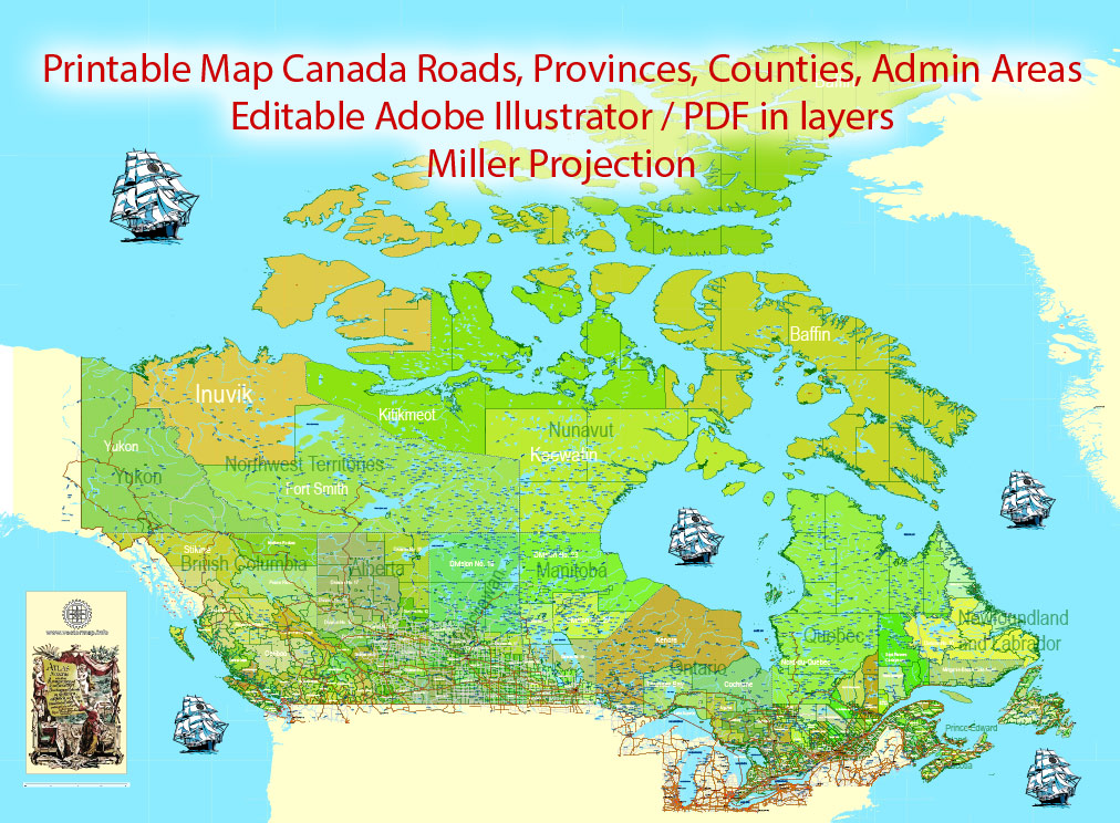
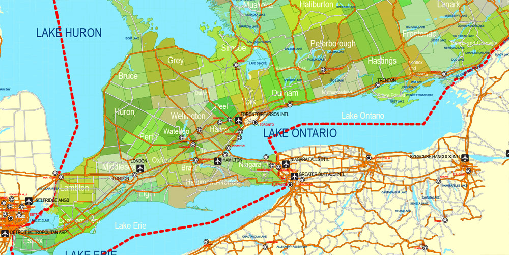
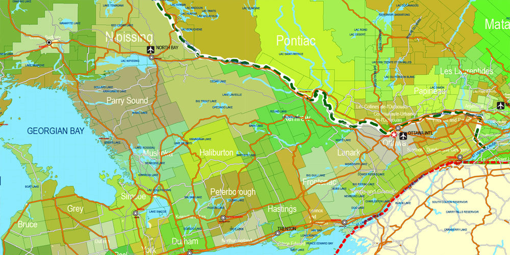
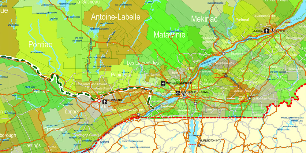
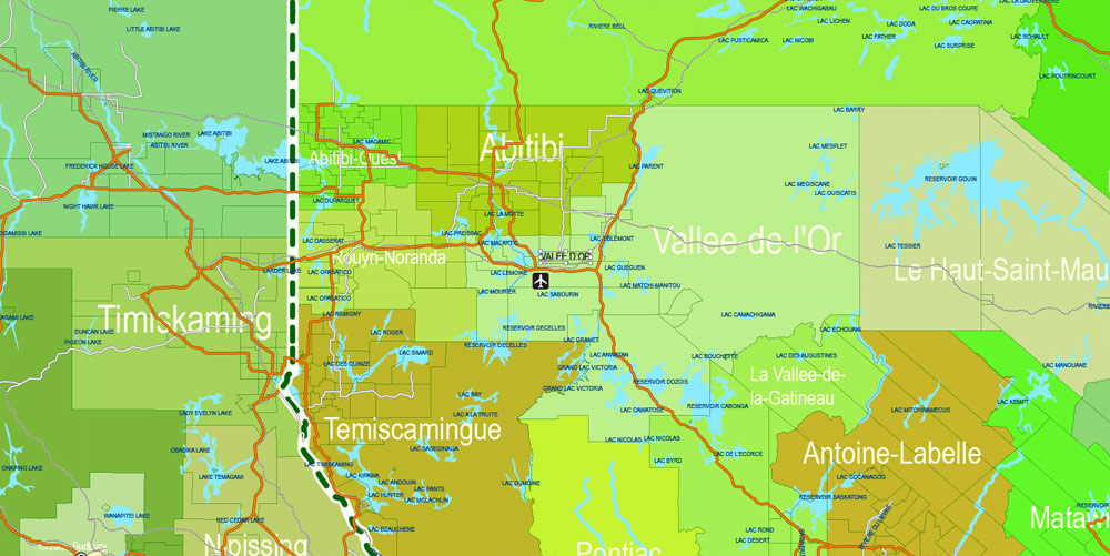
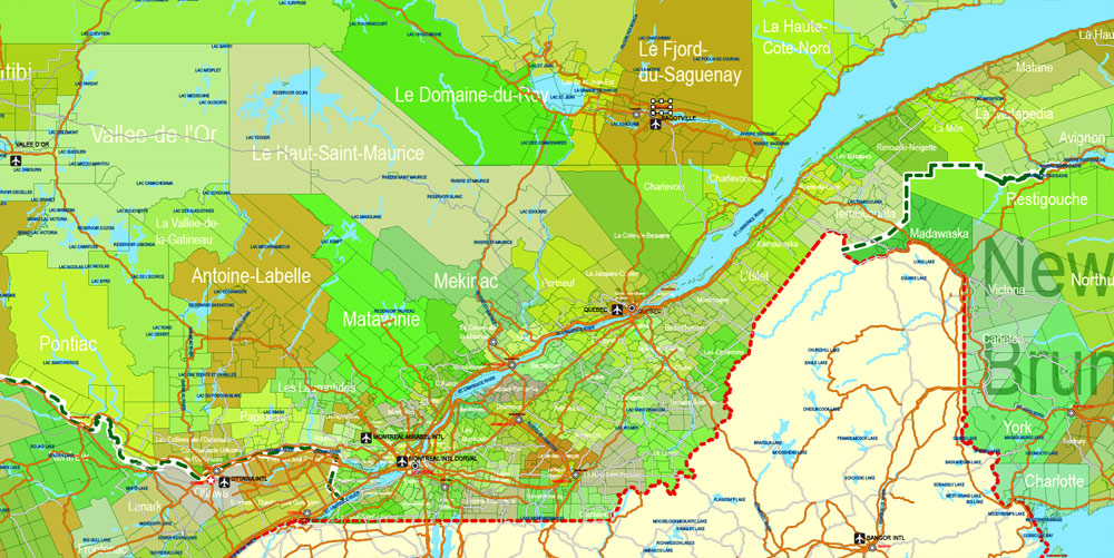
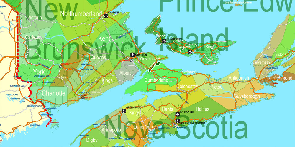
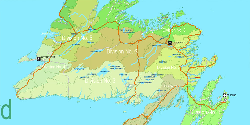
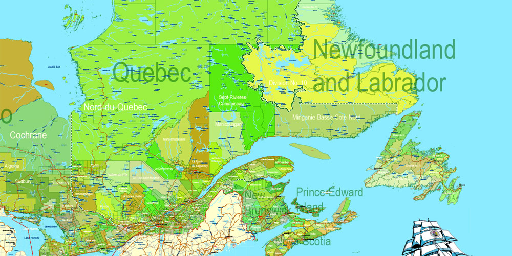
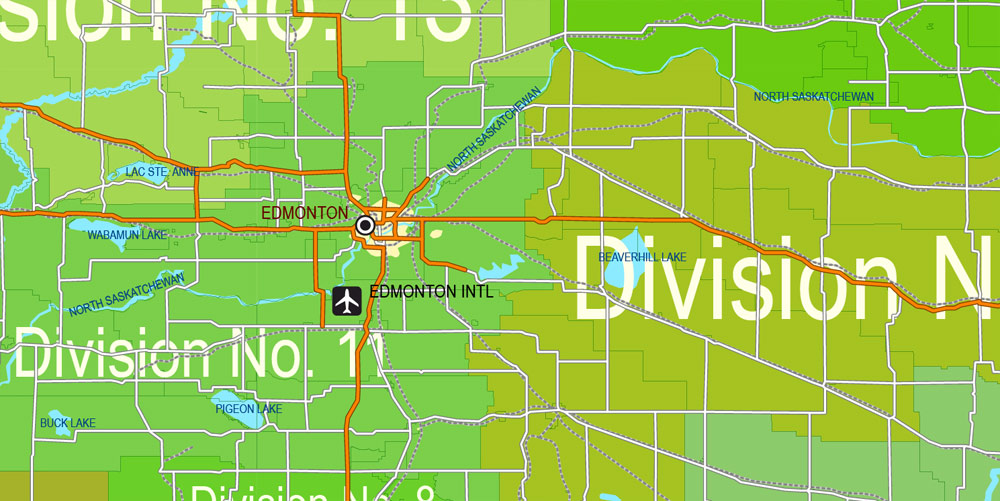
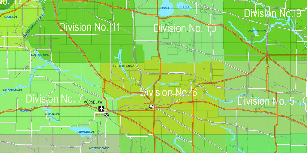
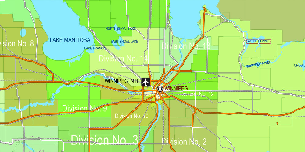
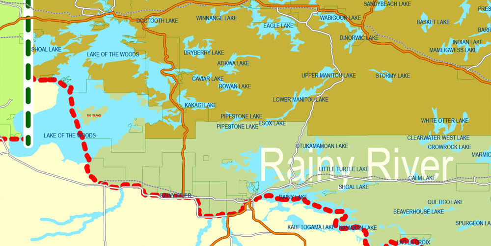
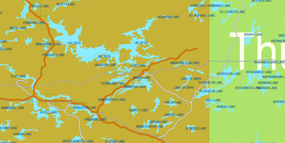
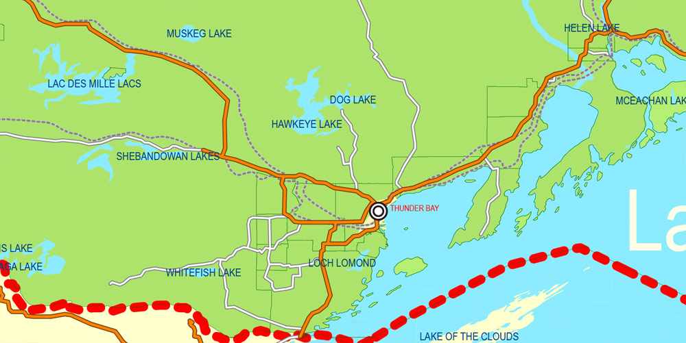
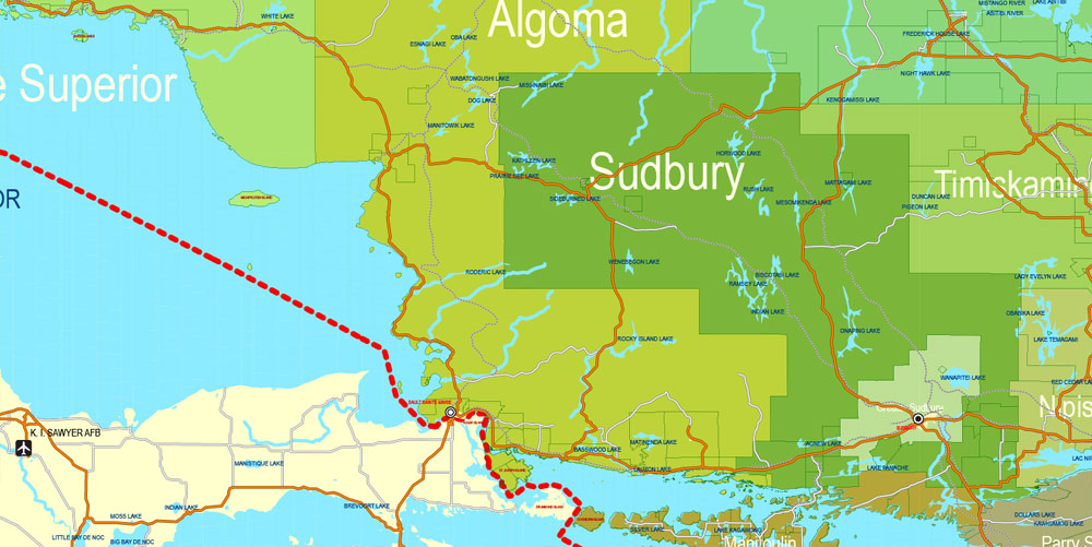
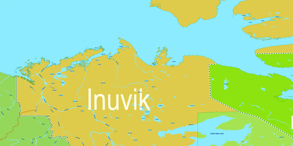
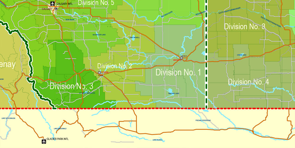
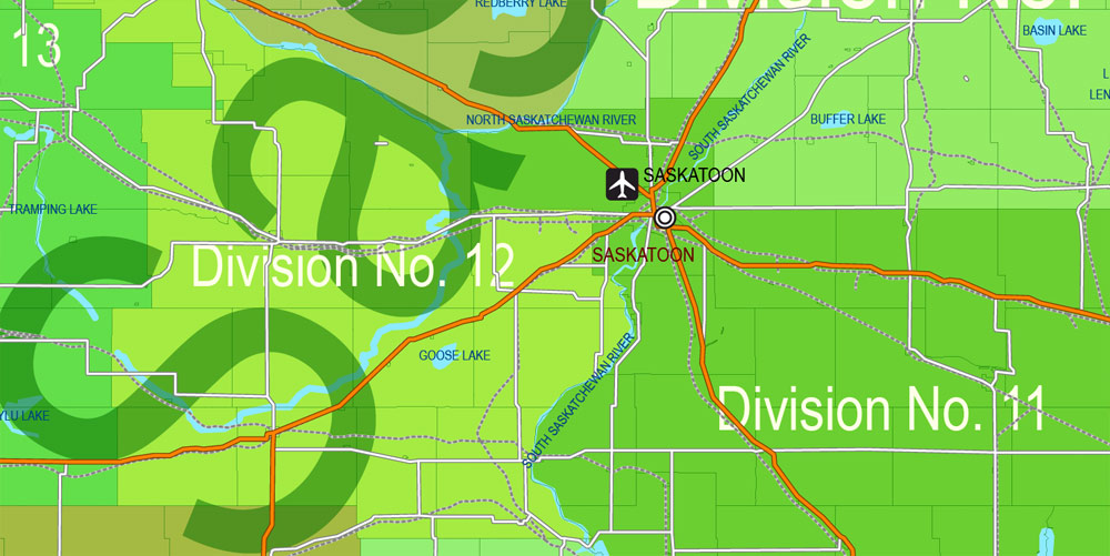
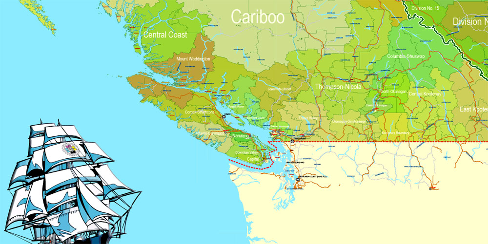
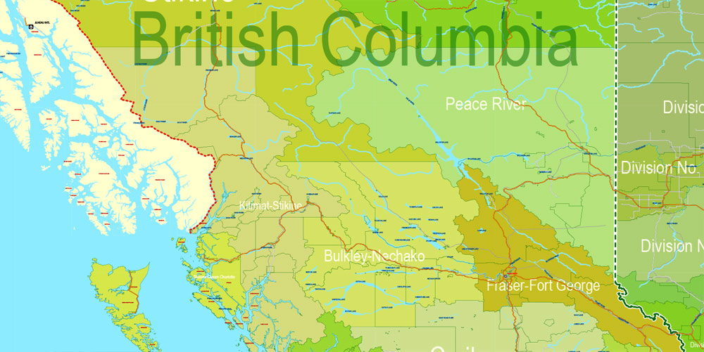
Printable Admin Road Map Canada Extra Detailed, Miller Projection, – Provinces, Counties, Admin Districts, Roads, Water, Cities, Airports, full editable, Adobe Illustrator, scalable, editable text format names, 154 Mb ZIP.
All provinces and counties named. Map for publishing, design, printing, publications, arts, projects, presentations, for architects, designers and builders, business, logistics. The most exact and detailed map of the Canada Admin Territories.
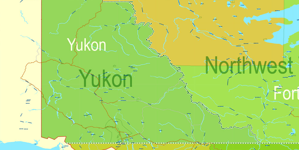
Separated layers: provinces, borders provinces, counties, admin areas, water objects, names_water, names provinces, urban_areas, names counties, grids, roads. railroads, Cities, airports
DWG, DXF, CDR and other formats – by request, same price, please contact.
Canada.
This vector map of Canada is used as a basis for design, editing, and further printing.
This is the most detailed, exact map of Canada for high-quality printing and polygraphy. You can always clarify the map development date by contacting us.
For your convenience, all objects on Canada vector map are divided into layers. And the editing is very easy – colors, lines, etc.
You can easily add any objects needed (e.g. shops, salons, sale points, gas station or attraction) on any layer of Canada vector map.
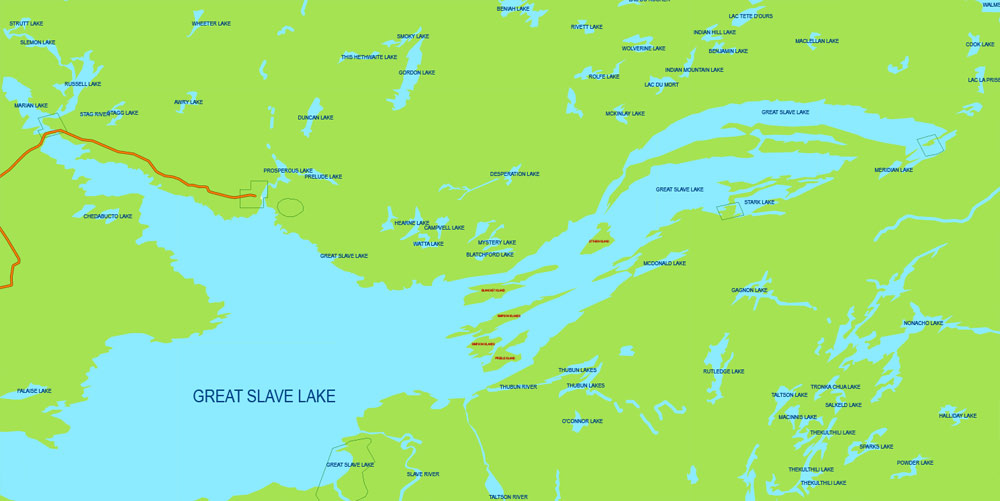
Canada is a country located in the northern part of North America. Its ten provinces and three territories extend from the Atlantic to the Pacific and northward into the Arctic Ocean, covering 9.98 million square kilometres (3.85 million square miles), making it the world’s second-largest country by total area. Canada’s southern border with the United States is the world’s longest bi-national land border. Its capital is Ottawa, and its three largest metropolitan areas are Toronto, Montreal, and Vancouver. As a whole, Canada is sparsely populated, the majority of its land area being dominated by forest and tundra. Consequently, its population is highly urbanized, with over 80 percent of its inhabitants concentrated in large and medium-sized cities, many near the southern border. Canada’s climate varies widely across its vast area, ranging from arctic weather in the north, to hot summers in the southern regions, with four distinct seasons.
One of the advantages of Canada vector maps of our production is the relevance of cartographic data, we constantly update all our products.
This vector map of Canada is used by:
designers, layout designers, printers, advertisers and architects. Our product – vector maps – is designed for further editing and printing in large formats – from @Wall format (a few meters) to A-0 and A-1, A-2, A-3.
The Canada map in vector format is used for design, urban planning, presentations and media visualizations.
The advertising and presentation map of Canada (usually the final designer marks the routes, and puts the client’s objects (shops, saloons, gas stations etc.)
The undoubted advantage is that people will NEVER throw out this advertising product – the map. In fact, as an advertising medium, a map is the most “long-playing” of the well-known polygraphic advertising media, with the longest lifespan, and the maximum number of interactions with the customer.
For travelers, maps are sold at the airports and gas stations around the world. Often the source is our vector maps.
Take a look, who purchases our vector maps of Canada in “Our Clients and Friends” page – these are large and small companies, from super-brands like Volvo and Starbucks, to small design studios and printing houses.
It’s very easy to work with vector maps of Canada city, even for a not very experienced designer who can turn on and off the map layers, add new objects, change the colors of fill and lines according to customer requirements.
The undoubted advantage of Canada vector maps in printing is an excellent and detailed visualization, when customer can expand a large paper map and instantly define his location, find a landmark, an object or address on map, unlike using the popular electronic formats of Google and Yandex maps for example.
Printable vector maps of Canada are much more convenient and efficient than any electronic maps on your smartphone, because ALL DETAILS are displayed in the entire space of Canada map.
Useful tips on working with vector maps of cities and countries in Adobe Illustrator.
«V» – launches the Selection tool (cursor, black arrow), which makes active any vector line.
«А» – launches the Direct Selection tool (white cursor), allows you to select curve elements and drag them to the desired place.
«R» – activates the Rotate tool, which helps you rotating selected objects around the center point by 360 degrees.
«E» – gives you the opportunity to use the Eraser tool and erase unnecessary parts.
«X» – switches between Fill and Stroke in the Tools section. Try to get used to this hot key and
you will quickly understand that you can’t live and work without it.
Guides are not limited to vertical and horizontal in Adobe Illustrator. You can also create a diagonal guide for example. Moreover, you can turn any contours into guides. Select the outline and go to View > Guides > Make Guides (Create Guides), or simply press Cmd/Ctrl + 5. You can also turn the guides back into an editable object. Go to menu, View > Guides > Unlock Guides (Release Guides), select the guide you want to edit and select View > Guides > Release Guides (Reset Guides), or just press Cmd/Ctrl + Option / Alt + 5).
You will probably want to change the color scheme used on our Canada vector map.
To quickly and effectively play with colors.
Of course, you can do it manually, all objects in our Canada vector map are divided according to types and layers, and you can easily change the color gamma of vector objects in groups and layers.
But there is more effective way of working with the whole VECTOR MAP of Canada and all layers:
The overview dialog «Edit colors»/«Repaint Graphic Object» (this dialog box name can change depending on the context):
If you have selected a part or a layer of Canada vector map and open the dialog box by clicking the icon in the Control panel, on the Samples palette or the Color Catalog, or if you choose Edit > Edit Colors> Repaint Graphic Object, then the «Repaint Graphic Object» dialog box appears, and you get access to «Assign» and «Edit» tabs.
If a picture or a map fragment is not selected, and you open the dialog box by clicking the icon in the Control panel, on the Samples palette or in the Color Catalog, the «Edit Colors» dialog box appears and you can only access the «Edit» tab.
Various indigenous peoples have inhabited what is now Canada for thousands of years prior to European colonization. Beginning in the 16th century, British and French expeditions explored, and later settled, along the Atlantic coast. As a consequence of various armed conflicts, France ceded nearly all of its colonies in North America in 1763. In 1867, with the union of three British North American colonies through Confederation, Canada was formed as a federal dominion of four provinces. This began an accretion of provinces and territories and a process of increasing autonomy from the United Kingdom. This widening autonomy was highlighted by the Statute of Westminster of 1931 and culminated in the Canada Act of 1982, which severed the vestiges of legal dependence on the British parliament, except for the power to amend its constitution.
Regardless of the name at the top of the dialog box, the right-hand side always displays the color group of the current document, as well as two default color groups: Print Color and Grayscale. These color groups can be selected and used any time.
Create and edit color groups of Canada vector map, and also assign colors using the «Edit Colors»/ а «Repaint Graphic Object» dialog box.
A. Creating and editing of a color group on the «Edit» tab
B. Assigning colors on the «Assign» tab
C. Select a group of colors from the «Color groups» list
The option «Repaint a graphic object» in the lower part of the dialog box allows you to preview the colors on a selected layer of Vector map, or a group of elements, and specify whether its colors will be redefined when the dialog box is closed.
The main areas of the dialog box are:
«Edit»
The «Edit» tab is designed to create a new or edit the existing color groups.
The harmony rules Menu and the Color Wheel are used to conduct experiments with color harmonies. The color wheel shows how colors are related in color harmony, and the color bars allow you to view and manipulate an individual color values. In addition, you can adjust the brightness, add and remove colors, save color groups and view colors on the selected Vector Map of Canada or a separated layers.
Canada is a federal parliamentary democracy and a constitutional monarchy, with Queen Elizabeth II being the head of state. The country is a realm within the Commonwealth of Nations, a member of the Francophonie and officially bilingual at the federal level. It ranks among the highest in international measurements of government transparency, civil liberties, quality of life, economic freedom, and education. It is one of the world’s most ethnically diverse and multicultural nations, the product of large-scale immigration from many other countries. Canada’s long and complex relationship with the United States has had a significant impact on its economy and culture.
«Assign»
The «Assign» tab is used to view and control on how the original colors are replaced with colors from the color group like your corporate colors in the Vector Map of Canada city.
The assign color ability is provided only if the entire map, layer or fragment is selected in the document. You can specify which of new colors replace the current colors, whether the spot colors should be preserved and how colors are replaced (for example, you can replace colors completely or changing the color tone while maintaining the brightness). The «Assign» tab allows you to redefine colors in the Vector Map of Canada city, or in separate layers and fragments using the current color group or reducing the number of colors in the current Vector Map.
Color groups
Is a list of all saved color groups for current document (the same groups appear in the «Samples» palette). You can edit and delete the existing color groups, as well as creating a new ones using the list of “Color Groups” in the dialog box. All changes appear in the «Samples» palette.
The highlighted color group shows, which color group is currently edited.
Any color group can be selected and edited, or used to redefine the colors in the selected vector map of Canada city, its fragments or elements.
Saving a color group adds this group to the specified list.
Opening the «Edit Colors»/«Repaint Graphic Object» dialog box.
Open the «Edit Colors»/«Repaint Graphic Object» dialog box using one of the following methods:
«Edit»> «Edit Colors»> «Repaint Graphic object» or «Repaint With Style».
Use these commands if you need to edit the colors in the selected vector map of Canada city.
«Repaint Graphic object» button on the «Control» panel.
Use this button if you need to adjust colors of Canada vector map using the а «Repaint graphic object» dialog box.
The specified button is available if the selected vector map or its fragment contains two or more colors.
Note. This color editing method is convenient for global color adjustment in a vector map, if global colors were not used when creating a Map of Canada.
Canada is a developed country and has the fifteenth-highest nominal per capita income globally as well as the tenth-highest ranking in the Human Development Index. Its advanced economy is the tenth-largest in the world, relying chiefly upon its abundant natural resources and well-developed international trade networks. Canada is part of several major international and intergovernmental institutions or groupings including the United Nations, the North Atlantic Treaty Organization, the G7 (formerly G8), the Group of Ten, the G20, the North American Free Trade Agreement and the Asia-Pacific Economic Cooperation forum.
The «Edit colors» button or «Edit or apply colors» on the «Color Catalog» palette
Click this button if you need to edit colors on the «Color Catalog» palette or edit and then apply them to the selected Vector Map of Canada or its fragment.
The «Edit color group» button or «Edit or apply color group» on the «Samples» palette.
Click this button if you need to edit the colors in the specific color group or edit and apply them to the selected Vector Map of Canada or a group of its elements, for example, the whole layer “Streets and lines”. You can also double-click the color group in the Samples panel to open the dialog box.
If the map file is too large and your computer freezes or even can’t open it quickly:
1. Try to reduce the color resolution of the video card (display) to 256 colors while working with a large map.
2. Using Windows Task Manager, select all the application you don’t need, while working with map, just turn them off.
3. Launch Adobe Illustrator. (DO NOT OPEN the vector map file)
4. Start the Windows Task Manager using administrator rights > Find the “Illustrator” process > set the «real time» priority,
5. Open the file. When you see the LEGACY FONT popup window – click “OK” (do not update). You can restore the TEXT later.
6. Can also be useful: When file is opened – Edit > Settings > Basic Settings > disable smoothing. /// It looks scary, but works quickly)))
We recommend saving the file in Adobe Illustrator 10 version. It’s much more stable when working with VERY BIG size files.
Geography and climate
Canada occupies much of the continent of North America, sharing land borders with the contiguous United States to the south, and the U.S. state of Alaska to the northwest. Canada stretches from the Atlantic Ocean in the east to the Pacific Ocean in the west; to the north lies the Arctic Ocean. Greenland is to the northeast and to the southeast Canada shares a maritime boundary with the Republic of France’s overseas collectivity of Saint Pierre and Miquelon, the last vestige of New France. By total area (including its waters), Canada is the second-largest country in the world, after Russia. By land area alone, however, Canada ranks fourth, the difference being due to it having the world’s largest proportion of fresh water lakes. Of Canada’s thirteen provinces and territories, only two are landlocked (Alberta and Saskatchewan) while the other eleven all directly border one of three oceans.
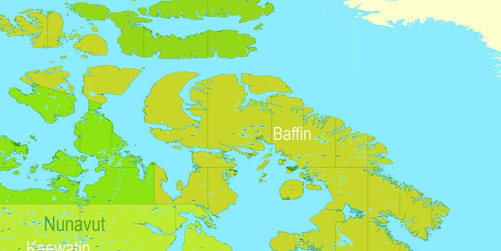
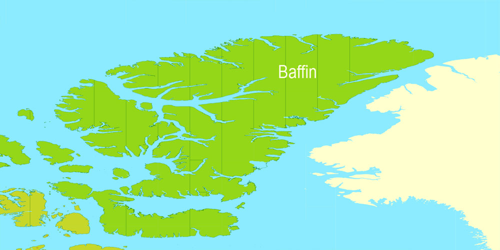
Canada is home to the world’s northernmost settlement, Canadian Forces Station Alert, on the northern tip of Ellesmere Island – latitude 82.5°N – which lies 817 kilometres (508 mi) from the North Pole. Much of the Canadian Arctic is covered by ice and permafrost. Canada has the longest coastline in the world, with a total length of 243,042 kilometres (151,019 mi); additionally, its border with the United States is the world’s longest land border, stretching 8,891 kilometres (5,525 mi). Three of Canada’s arctic islands, Baffin Island, Victoria Island and Ellesmere Island, are among the ten largest in the world.
Since the end of the last glacial period, Canada has consisted of eight distinct forest regions, including extensive boreal forest on the Canadian Shield. Canada has over 2,000,000 lakes—563 greater than 100 km2 (39 sq mi)—which is more than any other country, containing much of the world’s fresh water. There are also fresh-water glaciers in the Canadian Rockies and the Coast Mountains.
The Mount Meager massif as seen from the east near Pemberton. Summits left to right are Capricorn Mountain, Mount Meager and Plinth Peak.
Canada is geologically active, having many earthquakes and potentially active volcanoes, notably Mount Meager massif, Mount Garibaldi, Mount Cayley massif, and the Mount Edziza volcanic complex. The volcanic eruption of the Tseax Cone in 1775 was among Canada’s worst natural disasters, killing an estimated 2,000 Nisga’a people and destroying their village in the Nass River valley of northern British Columbia. The eruption produced a 22.5-kilometre (14.0 mi) lava flow, and, according to Nisga’a legend, blocked the flow of the Nass River.
Average winter and summer high temperatures across Canada vary from region to region. Winters can be harsh in many parts of the country, particularly in the interior and Prairie provinces, which experience a continental climate, where daily average temperatures are near −15 °C (5 °F), but can drop below −40 °C (−40 °F) with severe wind chills. In noncoastal regions, snow can cover the ground for almost six months of the year, while in parts of the north snow can persist year-round. Coastal British Columbia has a temperate climate, with a mild and rainy winter. On the east and west coasts, average high temperatures are generally in the low 20s °C (70s °F), while between the coasts, the average summer high temperature ranges from 25 to 30 °C (77 to 86 °F), with temperatures in some interior locations occasionally exceeding 40 °C (104 °F).
The geography of Canada describes the geographic features of Canada, the world’s second largest country in total area.
Situated in northern North America (constituting 41% of the continent’s area), Canada spans a vast, diverse territory between the North Pacific Ocean to the west and the North Atlantic Ocean to the east and the Arctic Ocean to the north (hence the country’s motto “From sea to sea”), with the United States to the south (contiguous United States) and northwest (Alaska). Greenland is to the northeast; off the southern coast of Newfoundland lies Saint-Pierre and Miquelon, an overseas collectivity of France. Since 1925, Canada has claimed the portion of the Arctic between 60°W and 141°W longitude to the North Pole; however, this claim is contested. While the magnetic North Pole lies within the Canadian Arctic territorial claim as of 2011, recent measurements indicate it is moving towards Siberia.
Covering 9,984,670 km2 or 3,855,100 sq mi (land: 9,093,507 km2 or 3,511,023 sq mi; freshwater: 891,163 km2 or 344,080 sq mi), Canada is slightly less than three-fifths as large as Russia and slightly smaller than Europe. In total area, Canada is slightly larger than both the U.S. and China; however, Canada ranks fourth in land area (i.e. total area minus the area of lakes and rivers)—China is 9,326,410 km2 (3,600,950 sq mi) and the U.S. is 9,161,923 km2 (3,537,438 sq mi).
The population of Canada, some 35,151,728 as of May 10, 2016, is concentrated in the south in proximity to its border with the contiguous U.S.; with a population density of 3.5 people per square kilometre (9.1/sq mi), it is one of the most sparsely populated countries in the world. The northernmost settlement in Canada—and in the world—is Canadian Forces Station (CFS) Alert (just north of Alert, Nunavut) on the northern tip of Ellesmere Island at 82°30′N 62°19′W, just 834 kilometres (518 mi) from the North Pole.
Canada
Country in North America
Canada is a North American country stretching from the U.S. in the south to the Arctic Circle in the north. Major cities include massive Toronto, west coast film centre Vancouver, French-speaking Montréal and Québec City, and capital city Ottawa. Canada’s vast swaths of wilderness include lake-filled Banff National Park in the Rocky Mountains. It’s also home to Niagara Falls, a famous group of massive waterfalls.
Capital: Ottawa
Area
• Total area
9,984,670 km2 (3,855,100 sq mi) (2nd)
• Water (%)
8.92
• Total land area
9,093,507 km2 (3,511,023 sq mi)
Population
• 2016 35,151,728 (38th)
• Density 3.92/km2 (10.2/sq mi) (228th)
Free vector maps:

Free download Vector Map US Interstate roads, Adobe PDF, V.2 Free_Map_US_Interstates_Roads_2.pdf
Free download Vector Map US Interstate roads, Adobe Illustrator, V.2 Free_Map_US_Interstates_Roads_2.ai

Free Download Vector Map US County and State Adobe Illustrator
Free_Vector_Map_US_States_County_Map.ai
Free Download Vector Map US County and State Adobe PDF
Free_Vector_Map_US_States_County_Map.pdf

Free Vector Map US Census Data Top US Ancestries by County Adobe Illustrator
Free_Vector_Map_US_Census-Data-Top-US-Ancestries-by-County.ai
Free Vector Map US Census Data Top US Ancestries by County Adobe PDF
Free_Vector_Map_US_Census-Data-Top-US-Ancestries-by-County.pdf

 Author: Kirill Shrayber, Ph.D. FRGS


