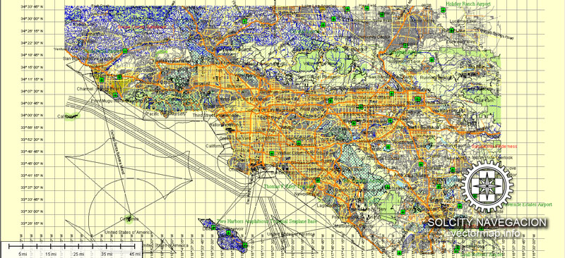
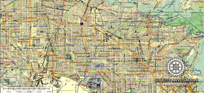
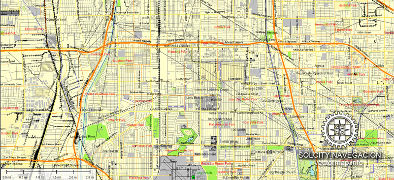
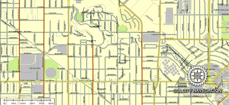
About Los Angeles vector map, USA
Archive size: 182 Mb .AI in ZIP
DPI: 300
License: Royalty Free
Content: Atlas 49 parts
[Available in PDF and other formats: .DWG; .AI; .EPS; .CDR; .PPT.]
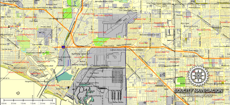
Los Angeles (.AI) vector map features (check the preview images please):
Highways with names,
Major streets with names,
Major Roads,
Dam,
Pipeline,
National Park Borders,
Airports,
Houses,
Railway lines with stops,
Minor Roads,
Private Roads,
Parking,
Cemeteries,
Big and small Rivers, small streams also,
Lake, ponds and other water bodies,
Landmark fill,
Recreation zones,
County Borders with fill,
Sidewalk/Walkway/Pedestrian roads,
Power Lines,
Parks.
CONTACT us, if some special POIs are needed to be inserted in vector maps of Los Angeles.
Los Angeles, California.
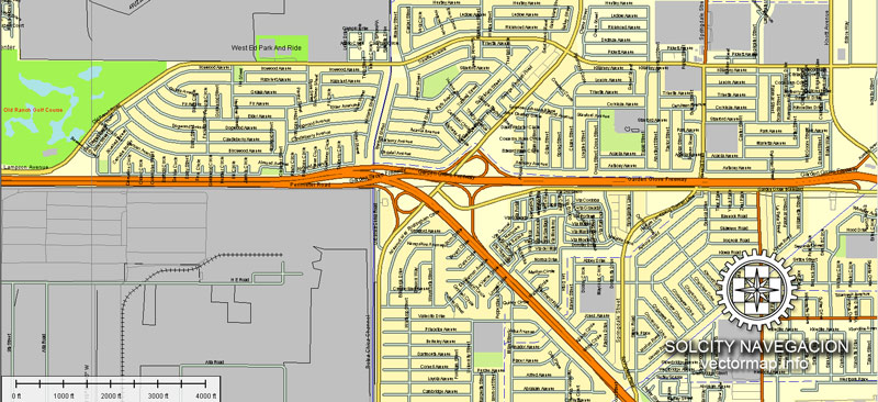
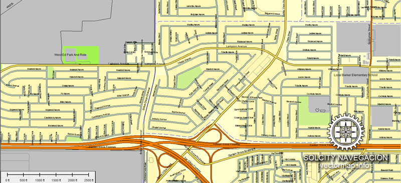
This vector map of Los Angeles city is used as a basis for design, editing, and further printing.
This is the most detailed, exact map of Los Angeles city for high-quality printing and polygraphy. You can always clarify the map development date by contacting us.
For your convenience, all objects on Los Angeles vector city map are divided into layers. And the editing is very easy – colors, lines, etc.
You can easily add any objects needed (e.g. shops, salons, sale points, gas station or attraction) on any layer of Los Angeles vector map.
Los Angeles officially the City of Los Angeles and known colloquially by its initials L.A., is the most-populous city in California. It is the second-most populous city in the United States, after New York City, and the largest and most populous city in the Western United States. With an estimated population of four million, Los Angeles is the cultural, financial, and commercial center of Southern California. Nicknamed the “City of Angels” partly because of its name’s Spanish meaning, Los Angeles is known for its Mediterranean climate, ethnic diversity, Hollywood and the entertainment industry, and sprawling metropolis.
One of the advantages of Los Angeles city vector maps of our production is the relevance of cartographic data, we constantly update all our products.
This vector map of Los Angeles city is used by:
designers, layout designers, printers, advertisers and architects. Our product – vector maps – is designed for further editing and printing in large formats – from @Wall format (a few meters) to A-0 and A-1, A-2, A-3.
The Los Angeles city map in vector format is used for design, urban planning, presentations and media visualizations.
The advertising and presentation map of Los Angeles city (usually the final designer marks the routes, and puts the client’s objects (shops, saloons, gas stations etc.)
The undoubted advantage is that people will NEVER throw out this advertising product – the map. In fact, as an advertising medium, a city map is the most “long-playing” of the well-known polygraphic advertising media, with the longest lifespan, and the maximum number of interactions with the customer.
Los Angeles is located in a large basin bounded by the Pacific Ocean on one side and by mountains as high as 10,000 feet (3,000 m) on the others. The city proper, which covers about 469 square miles (1,210 km2), is the seat of Los Angeles County, the most populated county in the country. Los Angeles is the principal city of the Los Angeles metropolitan area; with a population of 13.1 million residents it is the second largest in the United States after that of New York City. It is part of the Los Angeles-Long Beach combined statistical area, also the second most populous in the nation with a 2015 estimated population of 18.7 million.
For travelers, maps are sold at the airports and gas stations around the world. Often the source is our vector maps.
Take a look, who purchases our vector maps of Los Angeles city in “Our Clients and Friends” page – these are large and small companies, from super-brands like Volvo and Starbucks, to small design studios and printing houses.
It’s very easy to work with vector maps of Los Angeles city, even for a not very experienced designer who can turn on and off the map layers, add new objects, change the colors of fill and lines according to customer requirements.
The undoubted advantage of Los Angeles city vector maps in printing is an excellent and detailed visualization, when customer can expand a large paper map and instantly define his location, find a landmark, an object or address on map, unlike using the popular electronic formats of Google and Yandex maps for example.
Printable vector maps of Los Angeles city are much more convenient and efficient than any electronic maps on your smartphone, because ALL DETAILS are displayed in the entire space of Los Angeles city map.
Useful tips on working with vector maps of cities and countries in Adobe Illustrator.
«V» – launches the Selection tool (cursor, black arrow), which makes active any vector line.
«А» – launches the Direct Selection tool (white cursor), allows you to select curve elements and drag them to the desired place.
«R» – activates the Rotate tool, which helps you rotating selected objects around the center point by 360 degrees.
«E» – gives you the opportunity to use the Eraser tool and erase unnecessary parts.
«X» – switches between Fill and Stroke in the Tools section. Try to get used to this hot key and
you will quickly understand that you can’t live and work without it.
Los Angeles is one of the most substantial economic engines within the United States, with a diverse economy in a broad range of professional and cultural fields. Los Angeles is also famous as the home of Hollywood, a major center of the world entertainment industry. A global city, it has been ranked 6th in the Global Cities Index and 9th in the Global Economic Power Index. The Los Angeles combined statistical area also has a gross metropolitan product of $831 billion (as of 2008), making it the third-largest in the world, after the Tokyo and New York metropolitan areas. Los Angeles hosted the 1932 and 1984 Summer Olympics and will host the event for a third time in 2028. The city also hosted the Miss Universe pageant twice, in 1990 and 2006, and was one of 9 American cities to host the 1994 FIFA men’s soccer World Cup and one of 8 to host the 1999 FIFA women’s soccer World Cup, hosting the final match for both tournaments.
Guides are not limited to vertical and horizontal in Adobe Illustrator. You can also create a diagonal guide for example. Moreover, you can turn any contours into guides. Select the outline and go to View > Guides > Make Guides (Create Guides), or simply press Cmd/Ctrl + 5. You can also turn the guides back into an editable object. Go to menu, View > Guides > Unlock Guides (Release Guides), select the guide you want to edit and select View > Guides > Release Guides (Reset Guides), or just press Cmd/Ctrl + Option / Alt + 5).
You will probably want to change the color scheme used on our Los Angeles vector city map.
To quickly and effectively play with colors.
Of course, you can do it manually, all objects in our Los Angeles city vector map are divided according to types and layers, and you can easily change the color gamma of vector objects in groups and layers.
But there is more effective way of working with the whole VECTOR MAP of Los Angeles city and all layers:
The overview dialog «Edit colors»/«Repaint Graphic Object» (this dialog box name can change depending on the context):
If you have selected a part or a layer of Los Angeles city vector map and open the dialog box by clicking the icon in the Control panel, on the Samples palette or the Color Catalog, or if you choose Edit > Edit Colors> Repaint Graphic Object, then the «Repaint Graphic Object» dialog box appears, and you get access to «Assign» and «Edit» tabs.
If a picture or a map fragment is not selected, and you open the dialog box by clicking the icon in the Control panel, on the Samples palette or in the Color Catalog, the «Edit Colors» dialog box appears and you can only access the «Edit» tab.
Regardless of the name at the top of the dialog box, the right-hand side always displays the color group of the current document, as well as two default color groups: Print Color and Grayscale. These color groups can be selected and used any time.
Create and edit color groups of Los Angeles city vector map, and also assign colors using the «Edit Colors»/ а «Repaint Graphic Object» dialog box.
A. Creating and editing of a color group on the «Edit» tab
B. Assigning colors on the «Assign» tab
C. Select a group of colors from the «Color groups» list
The option «Repaint a graphic object» in the lower part of the dialog box allows you to preview the colors on a selected layer of Vector map, or a group of elements, and specify whether its colors will be redefined when the dialog box is closed.
The main areas of the dialog box are:
«Edit»
The «Edit» tab is designed to create a new or edit the existing color groups.
The harmony rules Menu and the Color Wheel are used to conduct experiments with color harmonies. The color wheel shows how colors are related in color harmony, and the color bars allow you to view and manipulate an individual color values. In addition, you can adjust the brightness, add and remove colors, save color groups and view colors on the selected Vector Map of Los Angeles city or a separated layers.
«Assign»
The «Assign» tab is used to view and control on how the original colors are replaced with colors from the color group like your corporate colors in the Vector Map of Los Angeles city.
The assign color ability is provided only if the entire map, layer or fragment is selected in the document. You can specify which of new colors replace the current colors, whether the spot colors should be preserved and how colors are replaced (for example, you can replace colors completely or changing the color tone while maintaining the brightness). The «Assign» tab allows you to redefine colors in the Vector Map of Los Angeles city, or in separate layers and fragments using the current color group or reducing the number of colors in the current Vector Map.
Color groups
Is a list of all saved color groups for current document (the same groups appear in the «Samples» palette). You can edit and delete the existing color groups, as well as creating a new ones using the list of “Color Groups” in the dialog box. All changes appear in the «Samples» palette.
The highlighted color group shows, which color group is currently edited.
Any color group can be selected and edited, or used to redefine the colors in the selected vector map of Los Angeles city, its fragments or elements.
Saving a color group adds this group to the specified list.
Opening the «Edit Colors»/«Repaint Graphic Object» dialog box.
Open the «Edit Colors»/«Repaint Graphic Object» dialog box using one of the following methods:
«Edit»> «Edit Colors»> «Repaint Graphic object» or «Repaint With Style».
Use these commands if you need to edit the colors in the selected vector map of Los Angeles city.
«Repaint Graphic object» button on the «Control» panel.
Use this button if you need to adjust colors of Los Angeles city vector map using the а «Repaint graphic object» dialog box.
The specified button is available if the selected vector map or its fragment contains two or more colors.
Note. This color editing method is convenient for global color adjustment in a vector map, if global colors were not used when creating a City Map of Los Angeles.
The «Edit colors» button or «Edit or apply colors» on the «Color Catalog» palette
Click this button if you need to edit colors on the «Color Catalog» palette or edit and then apply them to the selected Vector Map of Los Angeles city or its fragment.
The «Edit color group» button or «Edit or apply color group» on the «Samples» palette.
Click this button if you need to edit the colors in the specific color group or edit and apply them to the selected Vector Map of Los Angeles city or a group of its elements, for example, the whole layer “Streets and lines”. You can also double-click the color group in the Samples panel to open the dialog box.
If the map file is too large and your computer freezes or even can’t open it quickly:
1. Try to reduce the color resolution of the video card (display) to 256 colors while working with a large map.
2. Using Windows Task Manager, select all the application you don’t need, while working with map, just turn them off.
3. Launch Adobe Illustrator. (DO NOT OPEN the vector map file)
4. Start the Windows Task Manager using administrator rights > Find the “Illustrator” process > set the «real time» priority,
5. Open the file. When you see the LEGACY FONT popup window – click “OK” (do not update). You can restore the TEXT later.
6. Can also be useful: When file is opened – Edit > Settings > Basic Settings > disable smoothing. /// It looks scary, but works quickly)))
We recommend saving the file in Adobe Illustrator 10 version. It’s much more stable when working with VERY BIG size files.
Historically home to the Chumash and Tongva, Los Angeles was claimed by Juan Rodríguez Cabrillo for Spain in 1542 along with the rest of what would become Alta California. The city was officially founded on September 4, 1781, by Spanish governor Felipe de Neve. It became a part of Mexico in 1821 following the Mexican War of Independence. In 1848, at the end of the Mexican–American War, Los Angeles and the rest of California were purchased as part of the Treaty of Guadalupe Hidalgo, becoming part of the United States. Los Angeles was incorporated as a municipality on April 4, 1850, five months before California achieved statehood. The discovery of oil in the 1890s brought rapid growth to the city. The completion of the Los Angeles Aqueduct in 1913, delivering water from Eastern California, later assured the city’s continued rapid growth.
The city is divided into over 80 districts and neighborhoods, some of which were incorporated cities that merged with Los Angeles. These neighborhoods were developed piecemeal, and are well-defined enough that the city has signage marking nearly all of them.
Overview
The city’s street patterns generally follows a grid plan, with uniform block lengths and occasional roads that cut across blocks. However, this is complicated by rugged terrain, which has necessitated having different grids for each of the valleys that Los Angeles covers. Major streets are designed to move large volumes of traffic through many parts of the city; many of which are extremely long: Sepulveda Boulevard is 43 miles (69 km) long, while Foothill Boulevard is over 60 miles (97 km) long, reaching as far east as San Bernardino. Drivers in Los Angeles suffer from one of the worst rush hour periods in the world, according to an annual traffic index by navigation system maker, TomTom. L.A. drivers spend an additional 92 hours in traffic each year. During the peak rush hour there is 80% congestion, according to the index.
Los Angeles is often characterized by the presence of low-rise buildings. Outside of a few centers such as Downtown, Warner Center, Century City, Koreatown, Miracle Mile, Hollywood and Westwood, skyscrapers and high-rise buildings are not common. The few skyscrapers that are built outside of those areas often stand out above the rest of the surrounding landscape. Most construction is done in separate units, rather than wall-to-wall. That being said, Downtown Los Angeles itself has many buildings over 30 stories, with fourteen over 50 stories, and two over 70 stories. Also, Los Angeles is increasingly becoming a city of apartments rather than single family dwellings, especially in the dense inner city and Westside neighborhoods.
Topography
The Los Angeles Basin
The city of Los Angeles covers a total area of 502.7 square miles (1,302 km2), comprising 468.7 square miles (1,214 km2) of land and 34.0 square miles (88 km2) of water. The city extends for 44 miles (71 km) longitudinally and for 29 miles (47 km) latitudinally. The perimeter of the city is 342 miles (550 km).
Los Angeles is both flat and hilly. The highest point in the city proper is Mount Lukens at 5,074 ft (1,547 m), located at the northeastern end of the San Fernando Valley. The eastern end of the Santa Monica Mountains stretches from Downtown to the Pacific Ocean and separates the Los Angeles Basin from the San Fernando Valley. Other hilly parts of Los Angeles include the Mt. Washington area north of Downtown, eastern parts such as Boyle Heights, the Crenshaw district around the Baldwin Hills, and the San Pedro district.
Surrounding the city are much higher mountains. Immediately to the north lie the San Gabriel Mountains, which is a popular recreation area for Angelenos. Its high point is Mount San Antonio, locally known as Mount Baldy, which reaches 10,064 feet (3,068 m). Further afield, the highest point in the Greater Los Angeles area is San Gorgonio Mountain, with a height of 11,503 feet (3,506 m).
The Los Angeles River, which is largely seasonal, is the primary drainage channel. It was straightened and lined in 51 miles (82 km) of concrete by the Army Corps of Engineers to act as a flood control channel. The river begins in the Canoga Park district of the city, flows east from the San Fernando Valley along the north edge of the Santa Monica Mountains, and turns south through the city center, flowing to its mouth in the Port of Long Beach at the Pacific Ocean. The smaller Ballona Creek flows into the Santa Monica Bay at Playa del Rey.
Vegetation
Los Angeles is rich in native plant species partly because of its diversity of habitats, including beaches, wetlands, and mountains. The most prevalent plant communities are coastal sage scrub, chaparral shrubland, and riparian woodland. Native plants include: California poppy, matilija poppy, toyon, Ceanothus, Chamise, Coast Live Oak, sycamore, willow and Giant Wildrye. Many of these native species, such as the Los Angeles sunflower, have become so rare as to be considered endangered. Although it is not native to the area, the official tree of Los Angeles is the Coral Tree (Erythrina caffra) and the official flower of Los Angeles is the Bird of Paradise (Strelitzia reginae). Mexican Fan Palms, Canary Island Palms, Queen Palms, Date Palms, and California Fan Palms are common in the Los Angeles area, although only the last is native.
Geology
Los Angeles is subject to earthquakes because of its location on the Pacific Ring of Fire. The geologic instability has produced numerous faults, which cause approximately 10,000 earthquakes annually in Southern California, though most of them are too small to be felt. The strike-slip San Andreas Fault system is located at the boundary between the Pacific Plate and the North American Plate, and is vulnerable to the “big one”, a potentially large and damaging event after the San Francisco earthquake in 1906. The Los Angeles basin and metropolitan area are also at risk from blind thrust earthquakes. Major earthquakes that have hit the Los Angeles area include the 1933 Long Beach, 1971 San Fernando, 1987 Whittier Narrows, and the 1994 Northridge events. Nevertheless, all but a few are of low intensity and are not felt. The USGS has released the UCERF California earthquake forecast which models earthquake occurrence in California. Parts of the city are also vulnerable to tsunamis; harbor areas were damaged by waves from Aleutian Islands earthquake in 1946, Valdivia earthquake in 1960, Alaska earthquake in 1964, Chile earthquake in 2010 and Japan earthquake and Fukushima nuclear disaster in 2011.
Cities and counties near Los Angeles city vector map.
Simi Valley, Thousand Oaks, Malibu, Santa Monica, Burbank, Pasadena, San Fernando, Azusa, Covina, Pomona, Chino, Fontana, Riverside, Woodcrest, Anaheim, Orange, Santa Ana, Irvine, Long Beach, Torrance, Inglewood, Downey, Rancho Palos Verdes, El Segundo, Pomona.
Purchasing of AI vector map of Los Angeles
This is a Royalty Free license. It means you don`t have to pay extra for copying, editing or something else. You can edit, copy, print as many times as you need.
If you need a specific vector map of the city we don`t have – feel free to write us and we will prepare it as soon as possible: secreto@solcity.info.
We always have: unbeatable prices and quality. VectorMap.info


 Author: Kirill Shrayber, Ph.D. FRGS

