Extended Description of the Vector Map
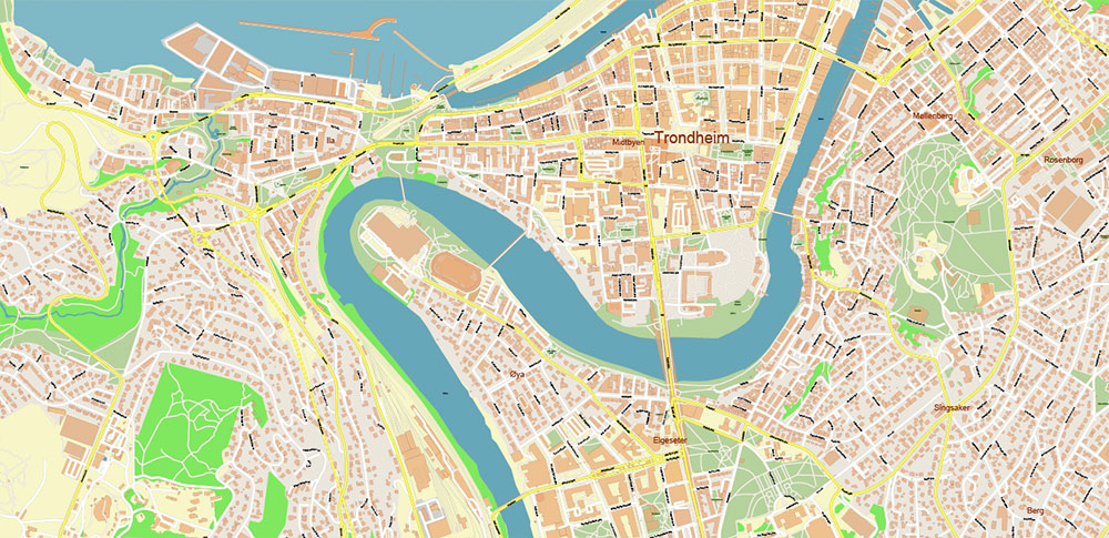
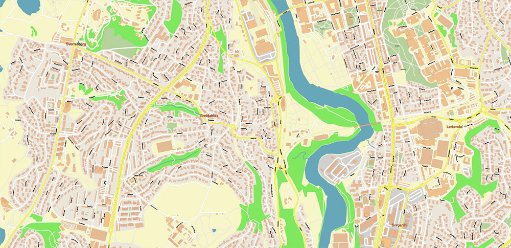
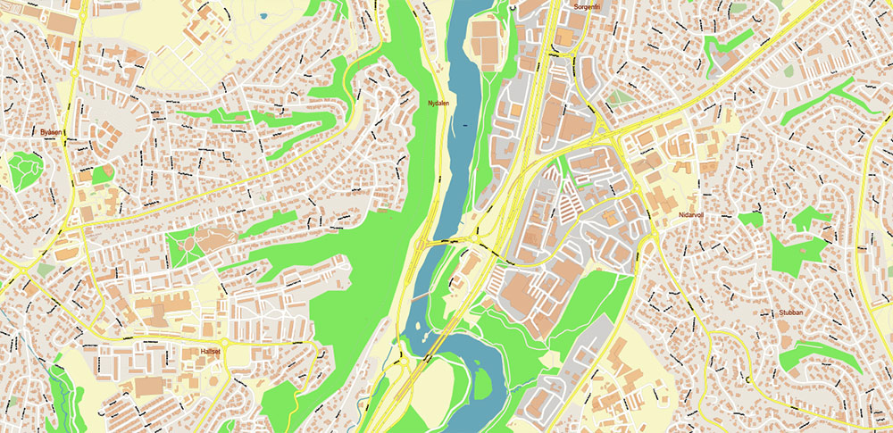
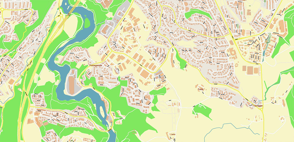
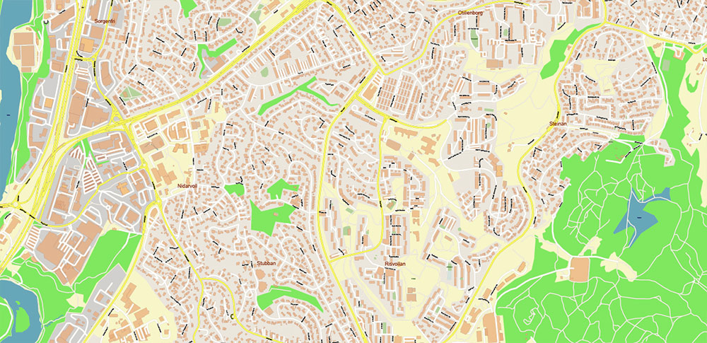
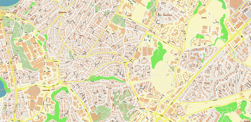
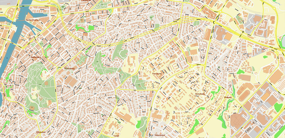
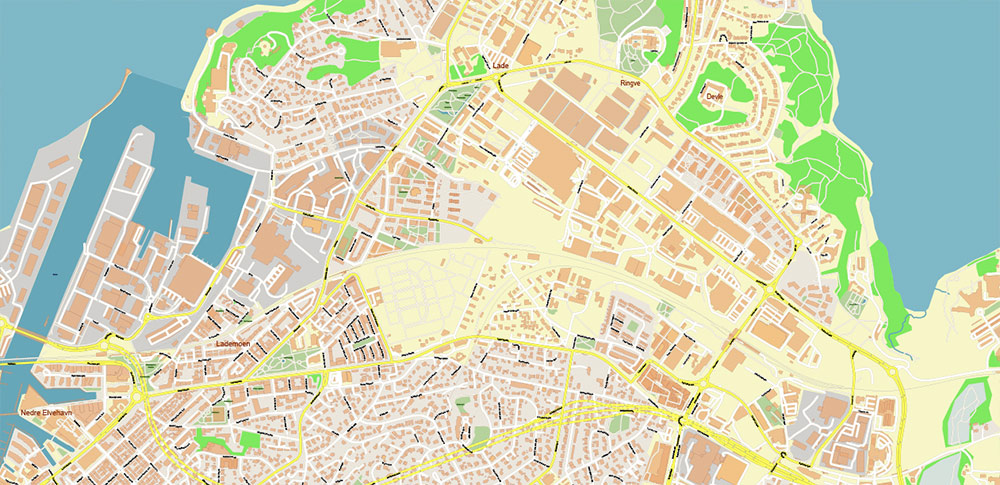
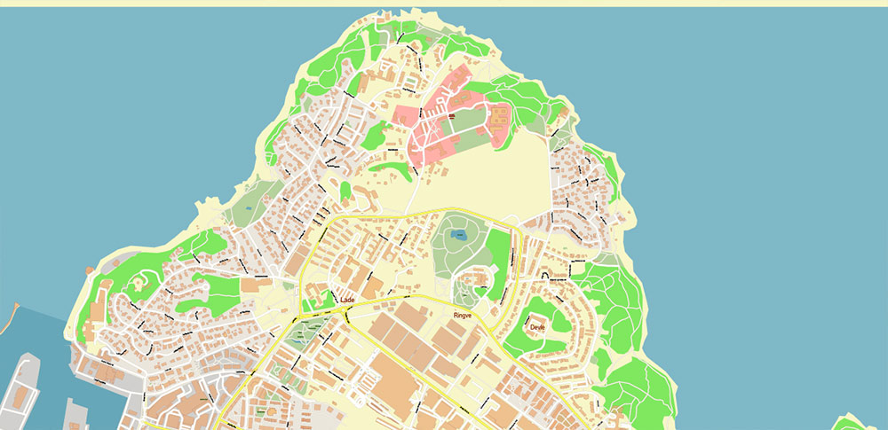
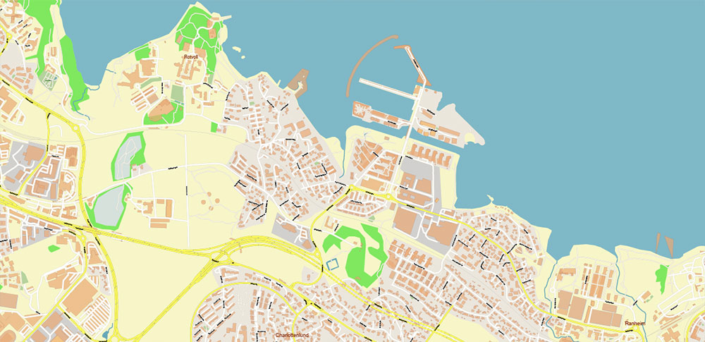
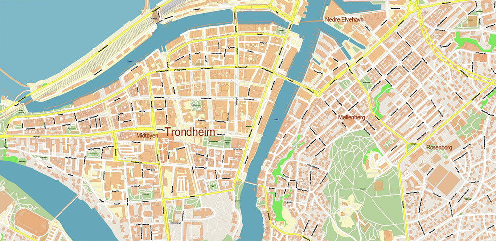
Printable Vector Map of Trondheim Norway detailed street map / city plan scale 1:2105 fully editable Layered Adobe PDF scalable, text format all names, 46 MB ZIP
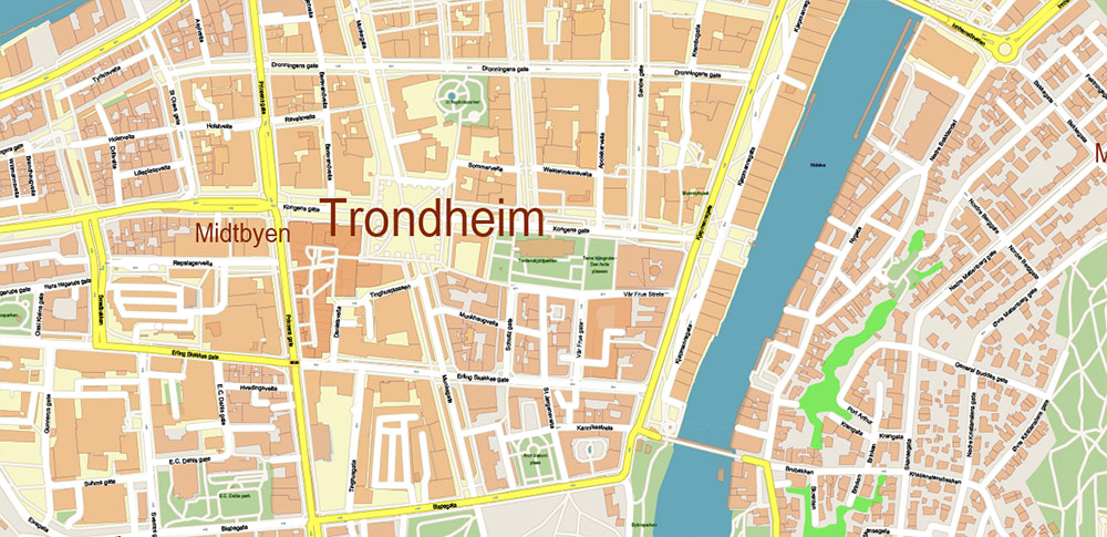
All street names, Main Objects, Buildings. Map for design, printing, arts, projects, presentations, for architects, designers, and builders, business, logistics.
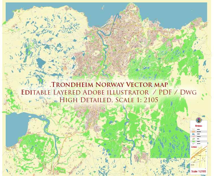
Trondheim Norway Vector Map High Detailed fully editable City Plan – Street Map Adobe Illustrator in layers
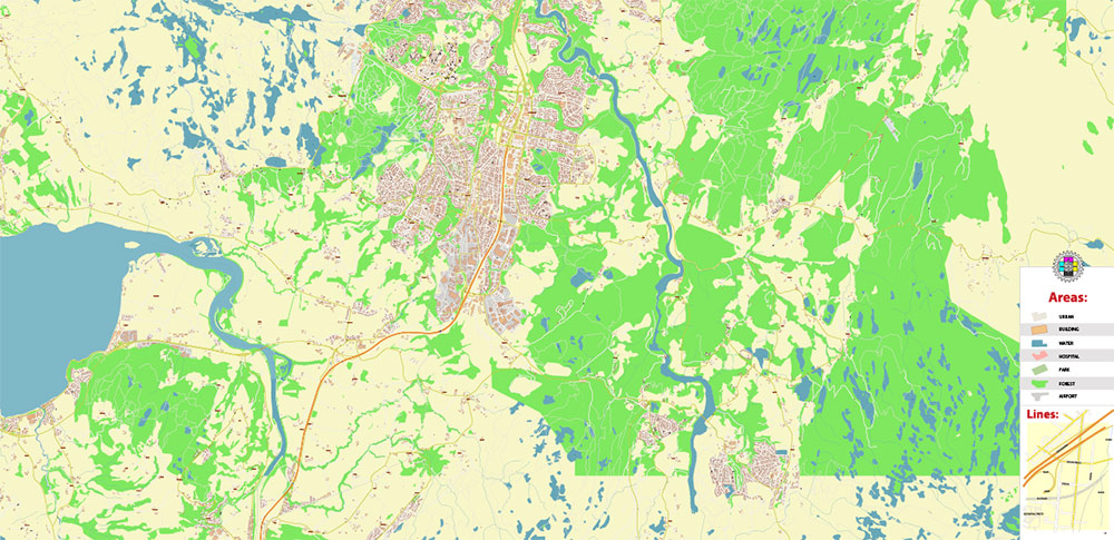
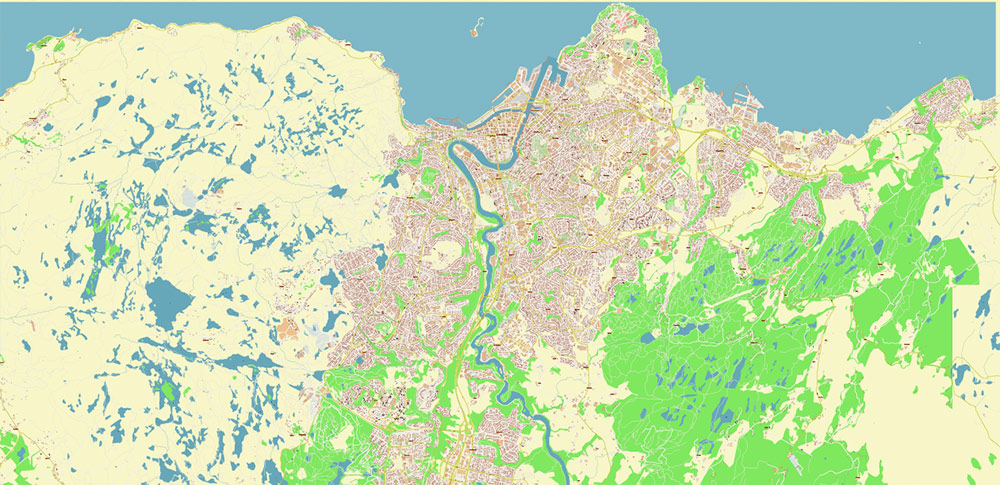
Layers list:
- Legend
- Grids
- Labels of roads
- Names of places (city, hamlet, etc.)
- Names of objects (parks, water)
- Names of main streets
- Names of residential streets
- Arrows of streets
- Main Streets, roads
- Residential streets
- Buildings
- Railroads
- Water objects (rivers, lakes, ponds)
- Waterways
- Color fills (parks, land use, etc.)
- Islands
- Sea
- Background
The most exact and detailed map of the city in scale.
For Editing and High-Quality Printing
Trondheim Norway Vector Map High Detailed fully editable City Plan – Street Map Adobe Illustrator in layers
Trondheim, Norway – Historical Overview
Trondheim (formerly Nidaros) is one of Norway’s oldest and most historically significant cities, founded in 997 AD by Viking King Olav Tryggvason. It served as Norway’s capital during the Viking Age and was a major religious, political, and trading hub in medieval Scandinavia.
Key Historical Periods & Events:
-
Viking Age (997–1030)
-
Founded as Nidaros (“Mouth of the River Nid”).
-
King Olav Tryggvason built a royal residence and a church here.
-
After King Olav Haraldsson (St. Olav) died in the Battle of Stiklestad (1030), his remains were buried in Nidaros, making the city a pilgrimage site.
-
Medieval Era (1030–1537)
-
Nidaros Cathedral construction began (1070) over St. Olav’s grave, becoming the northernmost medieval cathedral in Europe.
-
The Archdiocese of Nidaros (1152) made the city the religious center of Norway.
-
Hanseatic League merchants dominated trade, particularly along the riverfront.
-
Danish Rule & Decline (1537–1814)
-
After the Protestant Reformation (1537), the archdiocese was abolished, weakening Trondheim’s influence.
-
Fires (especially in 1681) destroyed much of the city, leading to a rebuild under General Johan Caspar von Cicignon with wider streets.
-
Modern Era (1814–Present)
-
Became a key city in independent Norway (post-1814).
-
Norwegian University of Science and Technology (NTNU) was established (1910), revitalizing the city as an educational hub.
Main Historical Objects & Landmarks
-
Nidaros Cathedral (Nidarosdomen)
-
Norway’s national cathedral, built over St. Olav’s tomb.
-
A masterpiece of Gothic architecture and the traditional coronation church for Norwegian kings.
-
Archbishop’s Palace (Erkebispegården)
-
Gamle Bybro (Old Town Bridge, 1681)
-
Stiftsgården (Royal Residence)
-
Kristiansten Fortress (1681–1685)
-
Munkholmen (“Monk’s Island”)
-
Bakklandet & Øvre Elvehavn
-
Ringve Museum (National Museum of Music)
-
The City’s Wharves (Bryggene)
-
Sverresborg Trøndelag Folk Museum
Why Trondheim Matters in Norwegian History
-
Religious Center: The heart of Norway’s Christianization.
-
Royal Legacy: Coronation site for Norwegian kings until 1906.
-
Trade & Hanseatic Influence: Key port in medieval Scandinavia.
-
Architectural Heritage: Mix of medieval, Baroque, and wooden architecture.
Trondheim Norway Vector Map High Detailed fully editable City Plan – Street Map Adobe Illustrator in layers
Trondheim Norway Vector Map High Detailed fully editable City Plan – Street Map Adobe Illustrator in layers
Trondheim Norway Vector Map High Detailed fully editable City Plan – Street Map Adobe Illustrator in layers
Trondheim Norway Vector Map High Detailed fully editable City Plan – Street Map Adobe Illustrator in layers
Trondheim Norway Vector Map High Detailed fully editable City Plan – Street Map Adobe Illustrator in layers
Trondheim Norway Vector Map High Detailed fully editable City Plan – Street Map Adobe Illustrator in layers
Trondheim Norway Vector Map High Detailed fully editable City Plan – Street Map Adobe Illustrator in layers
Trondheim Norway Vector Map High Detailed fully editable City Plan – Street Map Adobe Illustrator in layers
Trondheim Norway Vector Map High Detailed fully editable City Plan – Street Map Adobe Illustrator in layers
Trondheim Norway Vector Map High Detailed fully editable City Plan – Street Map Adobe Illustrator in layers
Trondheim Norway Vector Map High Detailed fully editable City Plan – Street Map Adobe Illustrator in layers
Trondheim Norway Vector Map High Detailed fully editable City Plan – Street Map Adobe Illustrator in layers
Trondheim Norway Vector Map High Detailed fully editable City Plan – Street Map Adobe Illustrator in layers

 Author: Kirill Shrayber, Ph.D. FRGS

