Extended Description of the Vector Map
Printable Vector Map of Trondheim Norway detailed street map / city plan scale 1:2105 fully editable Layered Adobe Illustrator scalable, text format all names, 87 MB ZIP
All street names, Main Objects, Buildings. Map for design, printing, arts, projects, presentations, for architects, designers, and builders, business, logistics.
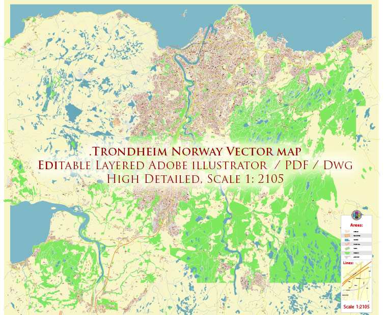
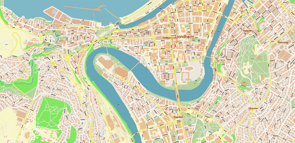
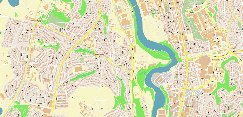
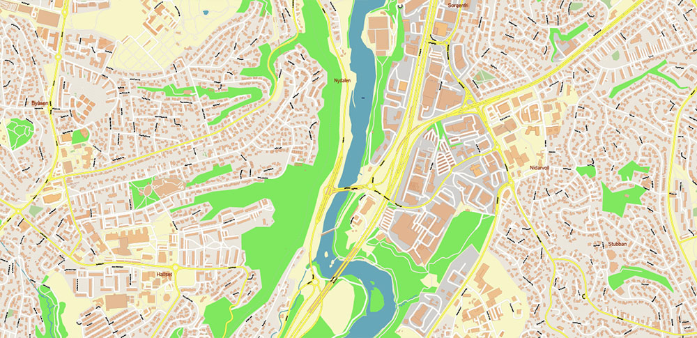
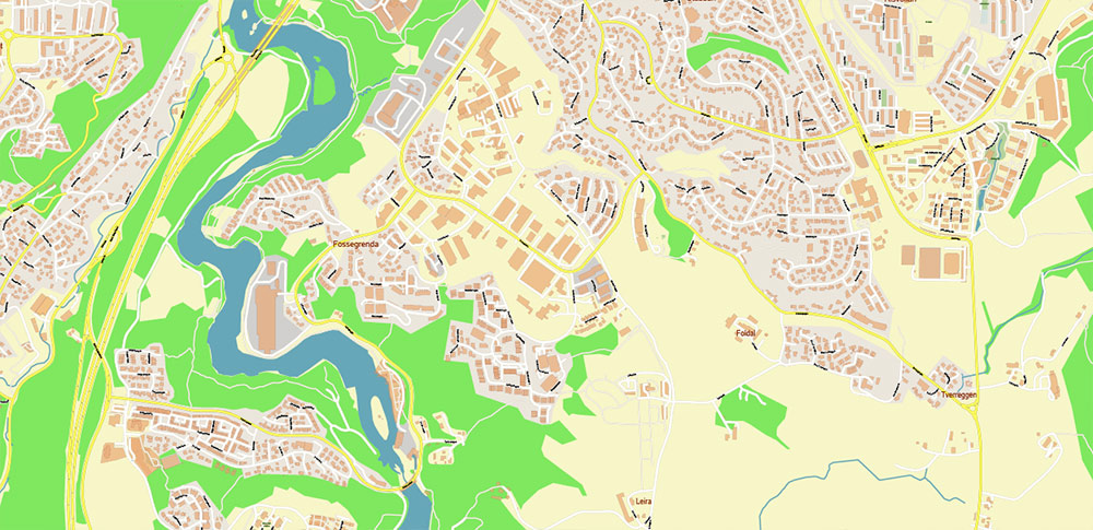
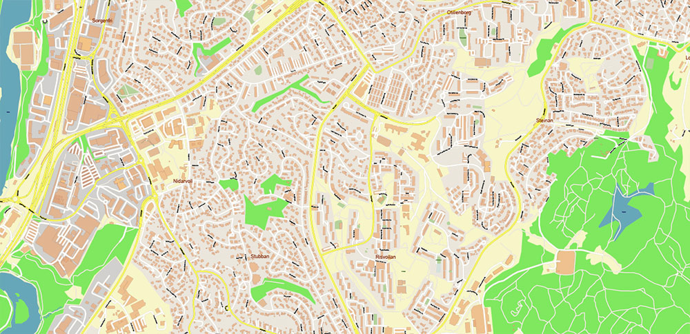
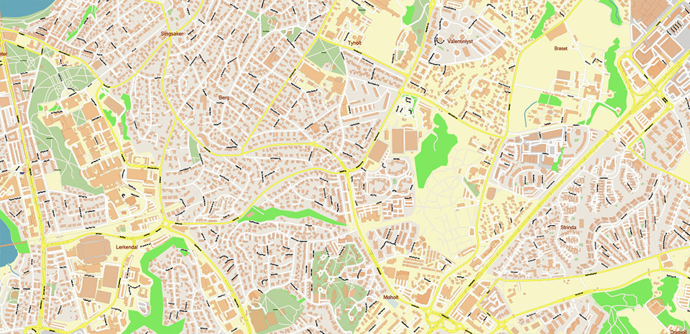
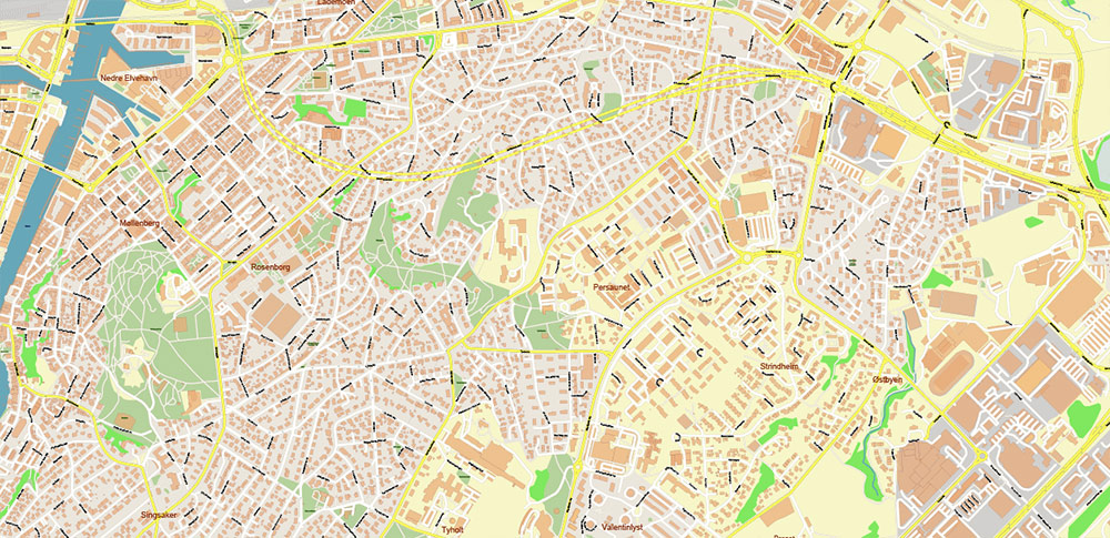
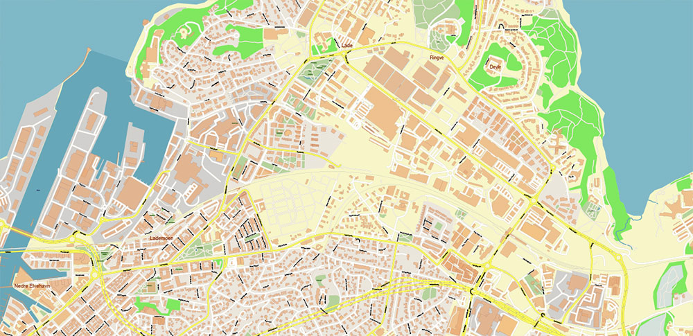
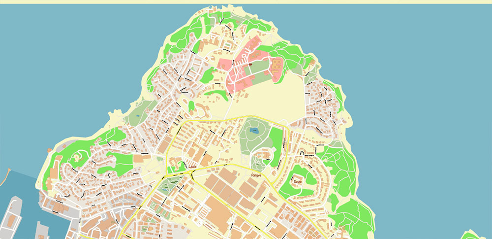
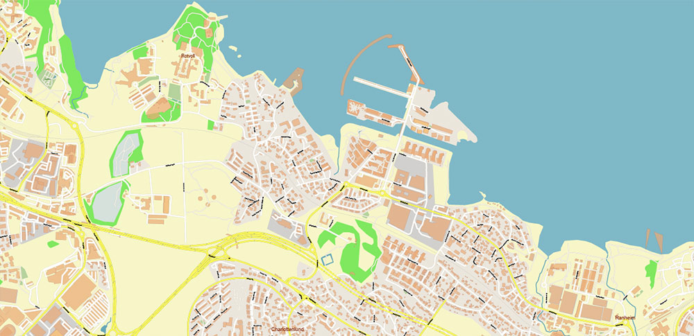
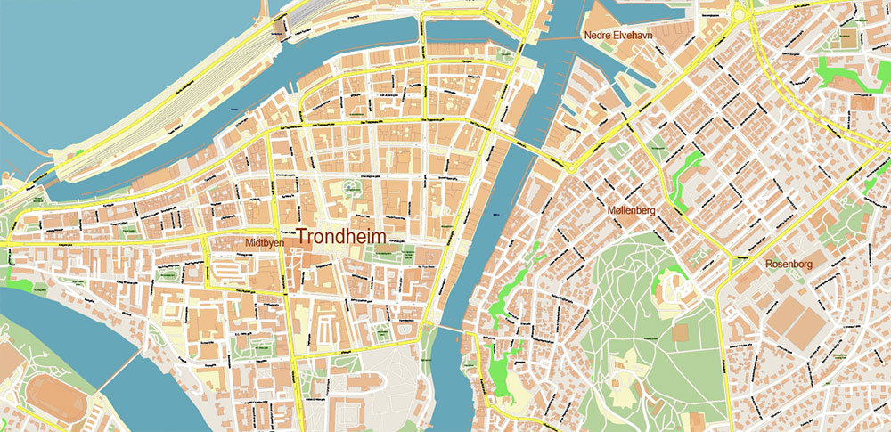
Trondheim Norway Vector Map High Detailed fully editable City Plan – Street Map Adobe Illustrator in layers
Layers list:
- Legend
- Grids
- Labels of roads
- Names of places (city, hamlet, etc.)
- Names of objects (parks, water)
- Names of main streets
- Names of residential streets
- Arrows of streets
- Main Streets, roads
- Residential streets
- Buildings
- Railroads
- Water objects (rivers, lakes, ponds)
- Waterways
- Color fills (parks, land use, etc.)
- Islands
- Sea
- Background
The most exact and detailed map of the city in scale.
For Editing and High-Quality Printing
Trondheim Norway Vector Map High Detailed fully editable City Plan – Street Map Adobe Illustrator in layers
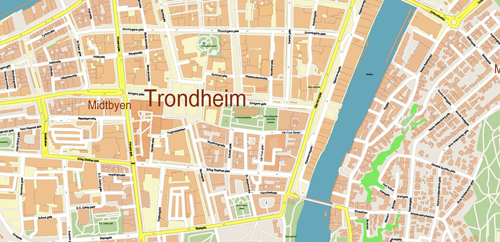
Detailed geographical Description Trondheim, Norway. + main streets this city
Key Geographical Features:
-
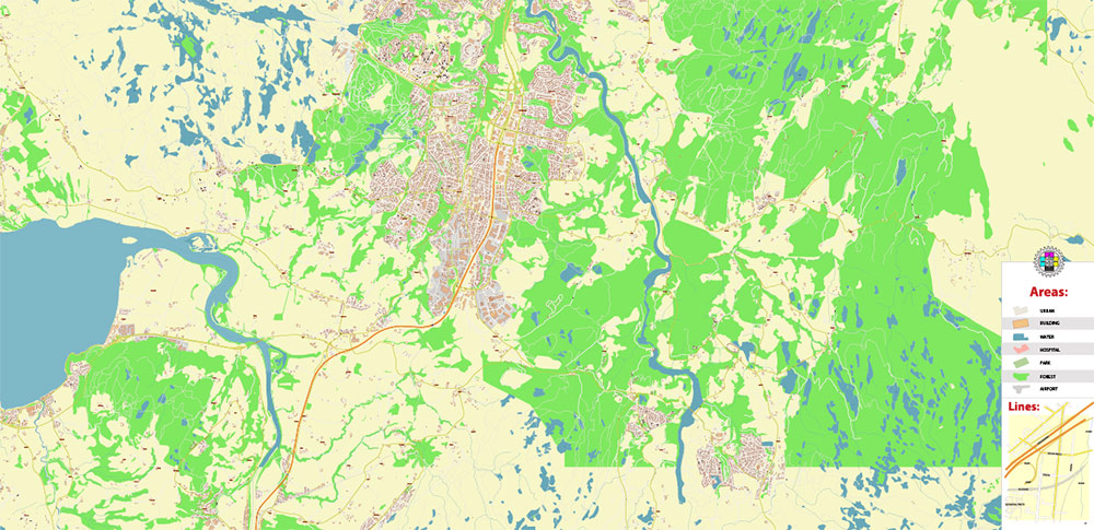
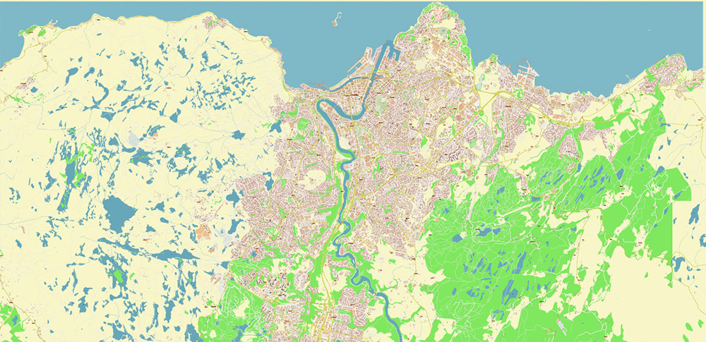
Nidelva River: Flows through the city center, dividing it into northern and southern parts.
-
Trondheimsfjord: A major fjord connecting the city to the Norwegian Sea.
-
Hills & Elevations: The city is built on slopes, with notable viewpoints like Utsikten and Tyholt Tower offering panoramic views.
-
Munkholmen: A small island in the fjord, historically used as a monastery, fortress, and prison.
Main Streets in Trondheim:
-
Kjøpmannsgata – One of the oldest streets, running parallel to the river, filled with historic buildings.
-
Nordre gate – A bustling pedestrian street with shops, cafés, and restaurants.
-
Olav Tryggvasons gate – A central street named after the Viking king, leading to the main square (Torvet).
-
Munkegata – A major thoroughfare connecting the city center to key landmarks like Nidaros Cathedral.
-
Prinsens gate – A lively street with bars, nightlife, and cultural spots.
-
Kongens gate – Another historic street, home to old merchant houses and modern businesses.
-
Søndre gate – Runs along the river, offering scenic views and trendy eateries.
-
Thomas Angells gate – A quieter street with charming architecture and boutique shops.
-
Brattørkaia – Near the harbor, part of the developing Brattøra district with modern architecture.
-
Ila – A picturesque area with wooden houses and cobbled streets near Bymarka.
Key Landmarks Along These Streets:
-
Nidaros Cathedral (Nidarosdomen) – Norway’s national sanctuary, built over the burial site of St. Olav.
-
Gamle Bybro (Old Town Bridge) – A historic wooden bridge offering postcard views of colorful riverside warehouses.
-
Bakklandet – A charming old district with cobbled streets and wooden houses, now a hub for cafés and boutiques.
-
Trondheim Torg (Main Square) – The central plaza hosting markets and events.
-
Rockheim – Norway’s national museum of popular music, located near Brattøra.
Trondheim Norway Vector Map High Detailed fully editable City Plan – Street Map Adobe Illustrator in layers
Trondheim Norway Vector Map High Detailed fully editable City Plan – Street Map Adobe Illustrator in layers
Trondheim Norway Vector Map High Detailed fully editable City Plan – Street Map Adobe Illustrator in layers
Trondheim Norway Vector Map High Detailed fully editable City Plan – Street Map Adobe Illustrator in layers
Trondheim Norway Vector Map High Detailed fully editable City Plan – Street Map Adobe Illustrator in layers
Trondheim Norway Vector Map High Detailed fully editable City Plan – Street Map Adobe Illustrator in layers
Trondheim Norway Vector Map High Detailed fully editable City Plan – Street Map Adobe Illustrator in layers
Trondheim Norway Vector Map High Detailed fully editable City Plan – Street Map Adobe Illustrator in layers
Trondheim Norway Vector Map High Detailed fully editable City Plan – Street Map Adobe Illustrator in layers
Trondheim Norway Vector Map High Detailed fully editable City Plan – Street Map Adobe Illustrator in layers
Trondheim Norway Vector Map High Detailed fully editable City Plan – Street Map Adobe Illustrator in layers
Trondheim Norway Vector Map High Detailed fully editable City Plan – Street Map Adobe Illustrator in layers
Trondheim Norway Vector Map High Detailed fully editable City Plan – Street Map Adobe Illustrator in layers

 Author: Kirill Shrayber, Ph.D. FRGS

