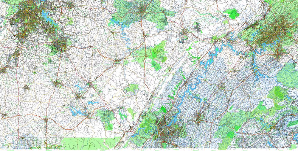
Printable Shaded Relief Vector Map of Tornado Area: part of Kentucky and Tennessee states US High Detailed Road Map fully editable Adobe Illustrator Road and Counties Map in layers, scalable, text/curves format all names, 778 MB ZIP
All streets and roads, All Cities and Towns, Airports and Heliports, Main Objects, Counties, raster Shaded Relief HD. Map for design, printing, arts, projects, presentations, for architects, designers, and builders, business, logistics.
The most exact and detailed map of the state in scale.
For Editing and High-Quality Printing, Royalty free
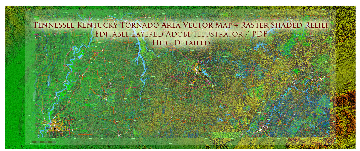
Tornado Area Vector Map: part of Kentucky and Tennessee states US high detailed road map + Shaded Relief editable Adobe Illustrator
Layers list:
- Legend – Scale in miles
- Names of places (city, hamlet, etc.)
- Points of the Cities and Towns
- Names of objects
- Names of Counties
- Principal Streets and Roads
- Residential streets and roads
- Railroads
- Airports and Heliports runways
- Water objects (rivers, lakes, ponds)
- Waterways
- Land Use Areas
- Counties areas
- Shader Relief Raster JPG HD
- Background
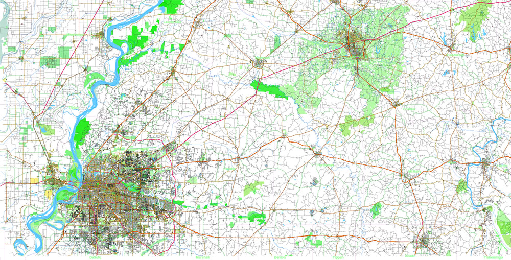
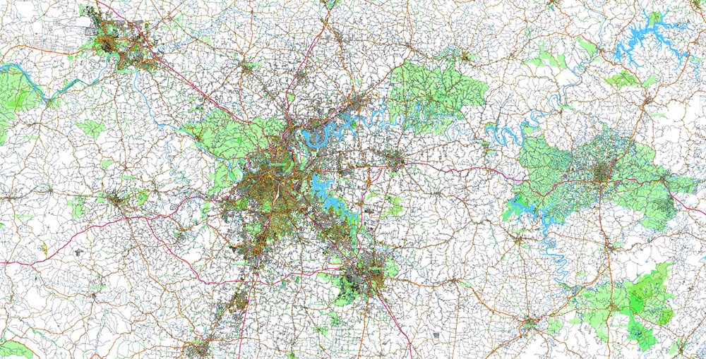
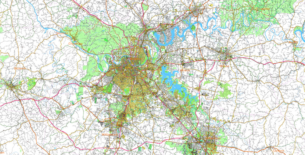
Geographic Overview: Southern Kentucky – Northwestern Tennessee Region
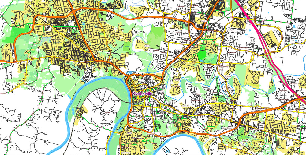
This map covers the transitional landscape of the southern portion of Kentucky and the northwestern section of Tennessee, a region characterized by gently rolling uplands, extensive river systems, and a well-developed network of transportation corridors connecting the Midwestern and Southeastern United States.
Terrain and Landscape
The terrain consists primarily of low hills and broad upland plateaus, forming part of the western margin of the Appalachian foothills and the Interior Low Plateaus physiographic region. Elevations generally range from 120 to 350 meters (400–1,150 ft) above sea level.
The landscape is shaped by:
-
rolling agricultural uplands
-
shallow valleys and river basins
-
forested ridges and limestone plateaus
-
large reservoir shorelines and river floodplains
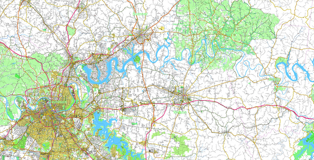
Karst geology is common in the northern portion of the region, particularly in southern Kentucky, where limestone formations create sinkholes, caves, and underground drainage systems.
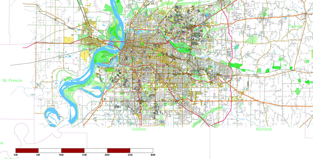
Major Rivers and Water Systems
The hydrology of the region is dominated by several major river systems that drain westward toward the Mississippi River basin.
Key water features include:
-
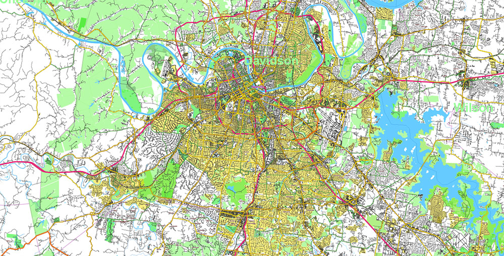
Cumberland River — a major navigable river flowing through Nashville and northern Tennessee before entering Kentucky.
-
Tennessee River — a large river forming major reservoirs and transportation corridors to the west.
-
Kentucky Lake — one of the largest man-made reservoirs in the United States, created by the Tennessee Valley Authority.
-
Lake Barkley — another large reservoir paralleling Kentucky Lake and connected by canals.
-
Numerous tributaries, including the Red River, Green River, and Harpeth River systems.
These waterways create a complex shoreline structure with bays, peninsulas, and floodplain wetlands.
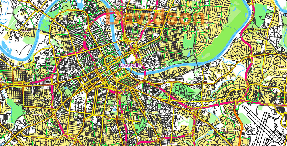
Urban Centers and Settlements
The region includes several mid-sized cities and many smaller towns that serve as regional service centers.
Major urban areas include:
-
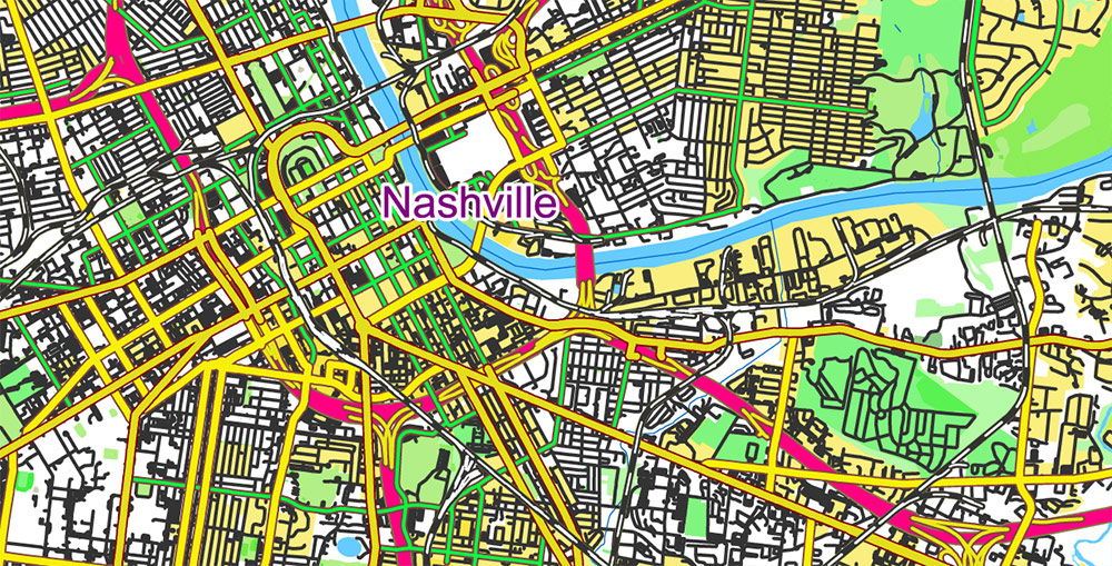
Nashville, Tennessee — the largest metropolitan center in the region
-
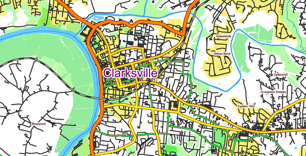
Clarksville, Tennessee — a major city along the Cumberland River
-
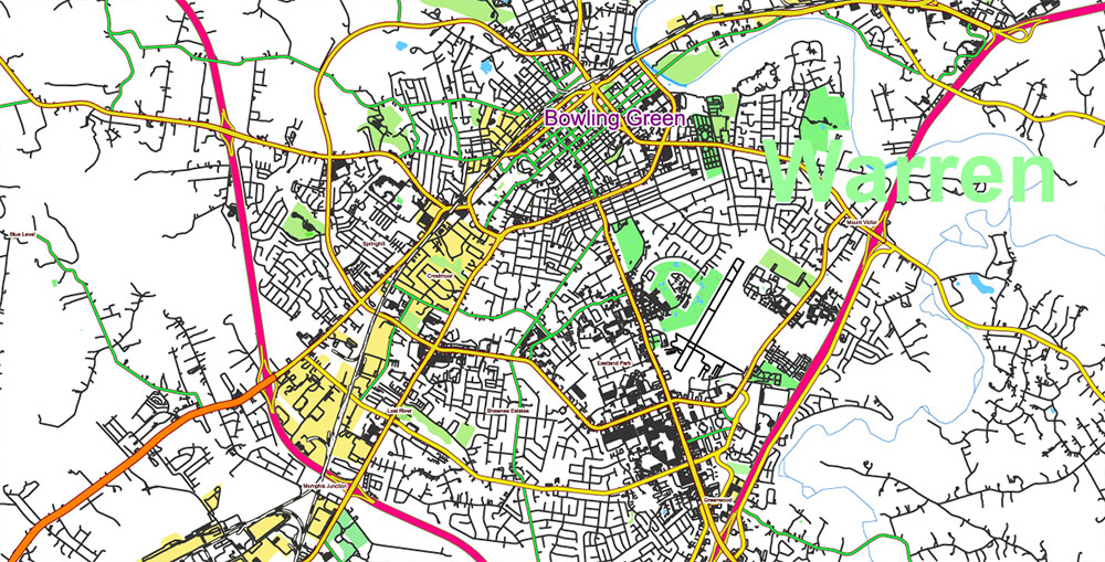
Bowling Green, Kentucky — a significant economic hub in southern Kentucky
Other important towns include:
-
Gallatin
-
Lebanon
-
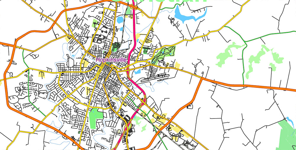
Hopkinsville
-
Murray
-
Cookeville
-
Columbia
Settlement patterns are typical of the American interior: dense urban clusters connected by highways and surrounded by rural farmland and forested land.
Transportation Network
The region is served by a well-developed highway system linking major Midwestern and Southeastern corridors.
Key transportation routes include:
-
Interstate 24 — running northwest–southeast between Illinois, Kentucky, and Tennessee
-
Interstate 65 — a major north–south corridor connecting Nashville with Louisville and the Midwest
-
Interstate 40 — crossing Tennessee east–west through the southern portion of the map
-
US Highway 41
-
US Highway 68
-
US Highway 79
-
US Highway 231
Secondary state highways form a dense regional road network connecting rural communities, agricultural areas, and reservoir shorelines.
Rail corridors parallel several highway routes and connect the region to national freight networks.
Land Use and Vegetation
Land use in the region is a mixture of:
-
agricultural farmland
-
pastureland and livestock operations
-
hardwood forests
-
expanding suburban development around Nashville and Clarksville
-
recreation areas along major reservoirs
Forests consist mainly of oak–hickory hardwood ecosystems, with riparian vegetation along river valleys.
Climate
The region has a humid subtropical climate, characterized by:
Annual precipitation averages 1,200–1,350 mm (47–53 inches) and supports extensive vegetation and agricultural production.
Geographic Character
Overall, this region represents a transition zone between the upland interior of the eastern United States and the Mississippi River basin, combining:
-
gently rolling terrain
-
large navigable rivers and reservoirs
-
dense transportation corridors
-
a mix of urban centers and rural landscapes.
The resulting geography creates a complex and highly structured landscape well suited for detailed cartographic representation of roads, waterways, relief, and settlement patterns.
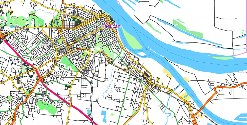
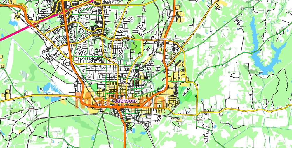
Tornado Area Vector Map: part of Kentucky and Tennessee states US high detailed road map + Shaded Relief editable Adobe Illustrator
Tornado Area Vector Map: part of Kentucky and Tennessee states US high detailed road map + Shaded Relief editable Adobe Illustrator
Tornado Area Vector Map: part of Kentucky and Tennessee states US high detailed road map + Shaded Relief editable Adobe Illustrator
Tornado Area Vector Map: part of Kentucky and Tennessee states US high detailed road map + Shaded Relief editable Adobe Illustrator
Tornado Area Vector Map: part of Kentucky and Tennessee states US high detailed road map + Shaded Relief editable Adobe Illustrator
Tornado Area Vector Map: part of Kentucky and Tennessee states US high detailed road map + Shaded Relief editable Adobe Illustrator
Tornado Area Vector Map: part of Kentucky and Tennessee states US high detailed road map + Shaded Relief editable Adobe Illustrator
Tornado Area Vector Map: part of Kentucky and Tennessee states US high detailed road map + Shaded Relief editable Adobe Illustrator
Tornado Area Vector Map: part of Kentucky and Tennessee states US high detailed road map + Shaded Relief editable Adobe Illustrator
Tornado Area Vector Map: part of Kentucky and Tennessee states US high detailed road map + Shaded Relief editable Adobe Illustrator
Tornado Area Vector Map: part of Kentucky and Tennessee states US high detailed road map + Shaded Relief editable Adobe Illustrator
Tornado Area Vector Map: part of Kentucky and Tennessee states US high detailed road map + Shaded Relief editable Adobe Illustrator
Tornado Area Vector Map: part of Kentucky and Tennessee states US high detailed road map + Shaded Relief editable Adobe Illustrator
Tornado Area Vector Map: part of Kentucky and Tennessee states US high detailed road map + Shaded Relief editable Adobe Illustrator
Tornado Area Vector Map: part of Kentucky and Tennessee states US high detailed road map + Shaded Relief editable Adobe Illustrator
Tornado Area Vector Map: part of Kentucky and Tennessee states US high detailed road map + Shaded Relief editable Adobe Illustrator
Tornado Area Vector Map: part of Kentucky and Tennessee states US high detailed road map + Shaded Relief editable Adobe Illustrator
Tornado Area Vector Map: part of Kentucky and Tennessee states US high detailed road map + Shaded Relief editable Adobe Illustrator

 Author: Kirill Shrayber, Ph.D. FRGS
 + Admin Areas editable Adobe Illustrator in layers")
 + Admin Areas + Relief Shaded Raster, editable Adobe Illustrator in layers")
