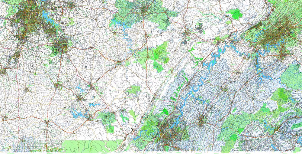
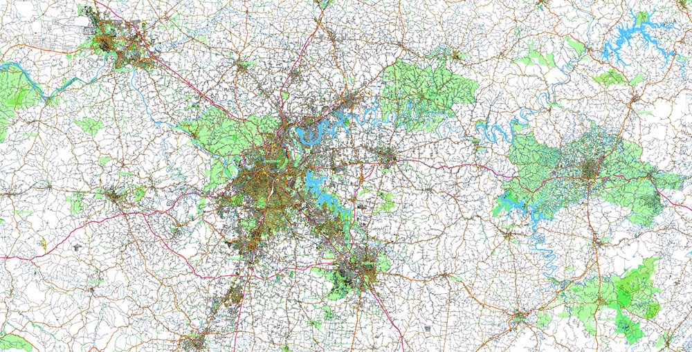
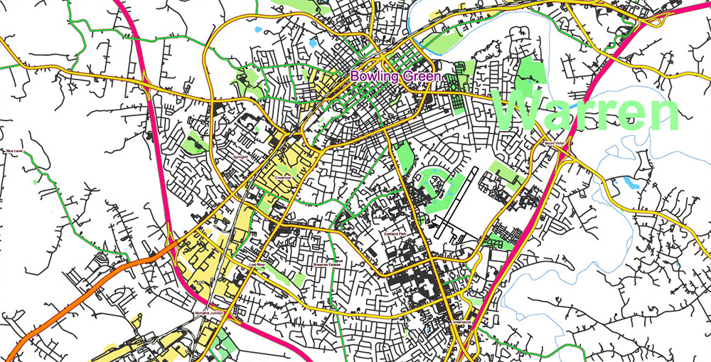
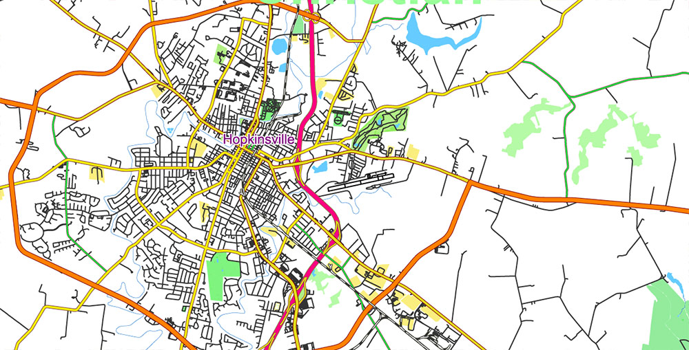
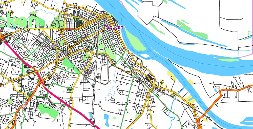
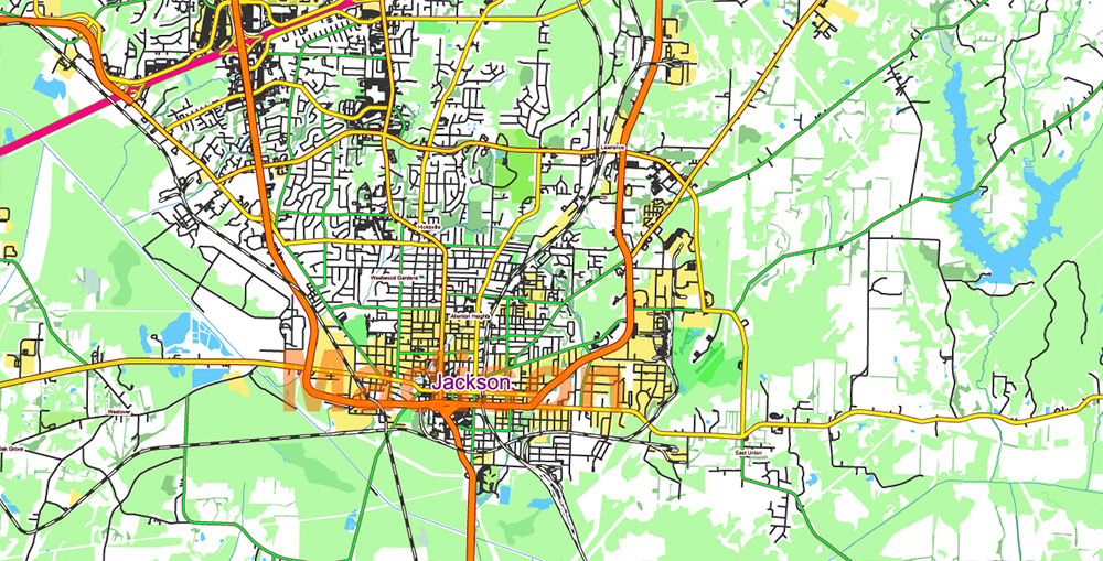
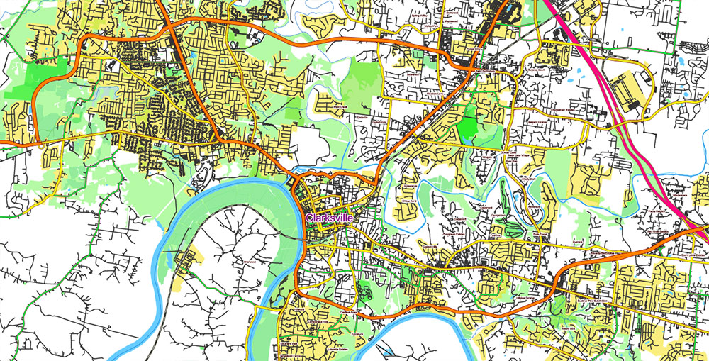
Printable Shaded Relief PDF Vector Map of Tornado Area: part of Kentucky and Tennessee states US High Detailed Road Map fully editable Adobe PDF Road and Counties Map in layers, scalable, text/curves format all names, 1.620 MB ZIP
All streets and roads, All Cities and Towns, Airports and Heliports, Main Objects, Counties, raster Shaded Relief HD. Map for design, printing, arts, projects, presentations, for architects, designers, and builders, business, logistics.
The most exact and detailed map of the state in scale.
For Editing and High-Quality Printing, Royalty free
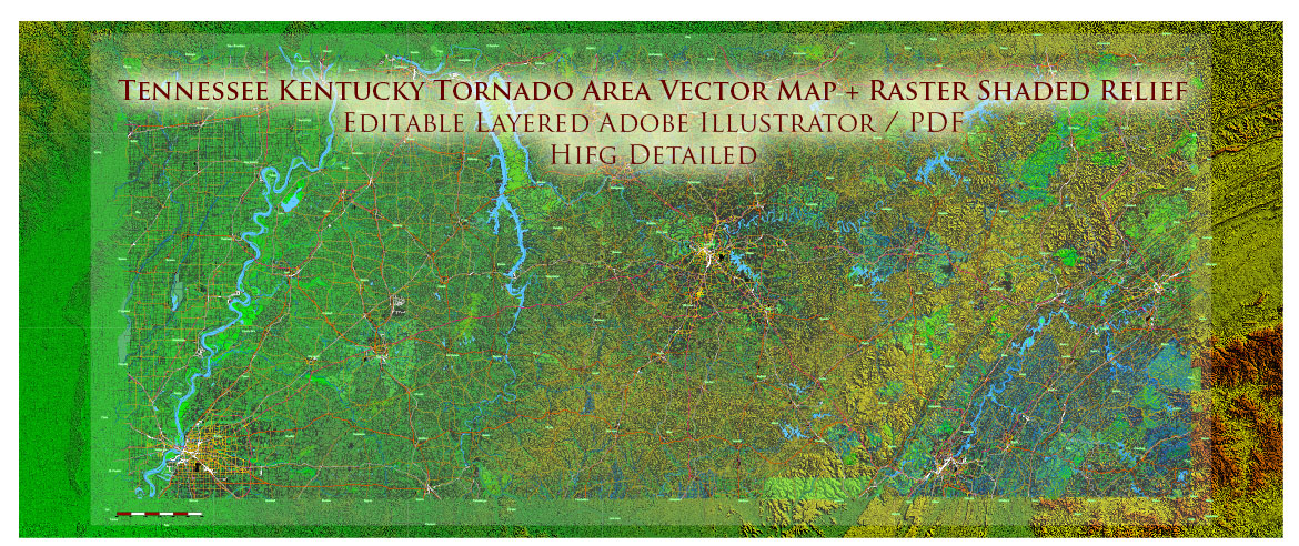
Tornado Area PDF Vector Map: part of Kentucky and Tennessee states US high detailed road map + Shaded Relief editable Adobe PDF
Layers list:
- Legend – Scale in miles
- Names of places (city, hamlet, etc.)
- Points of the Cities and Towns
- Names of objects
- Names of Counties
- Principal Streets and Roads
- Residential streets and roads
- Railroads
- Airports and Heliports runways
- Water objects (rivers, lakes, ponds)
- Waterways
- Land Use Areas
- Counties areas
- Shader Relief Raster JPG HD
- Background
AO BRIEF
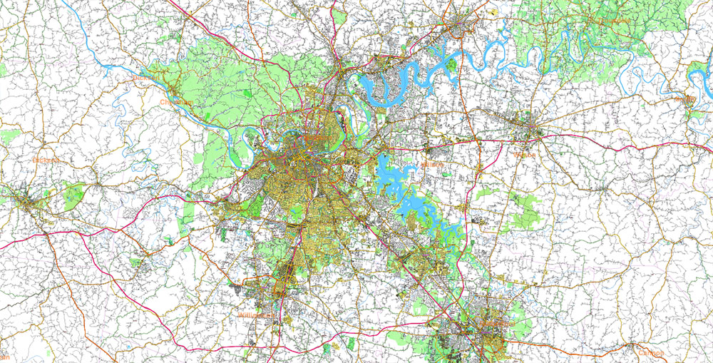
Southern Kentucky – Northwestern Tennessee
Interior Plateau Operational Geography
Overview
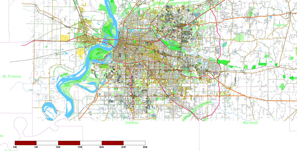
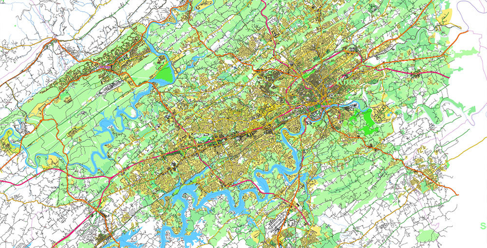
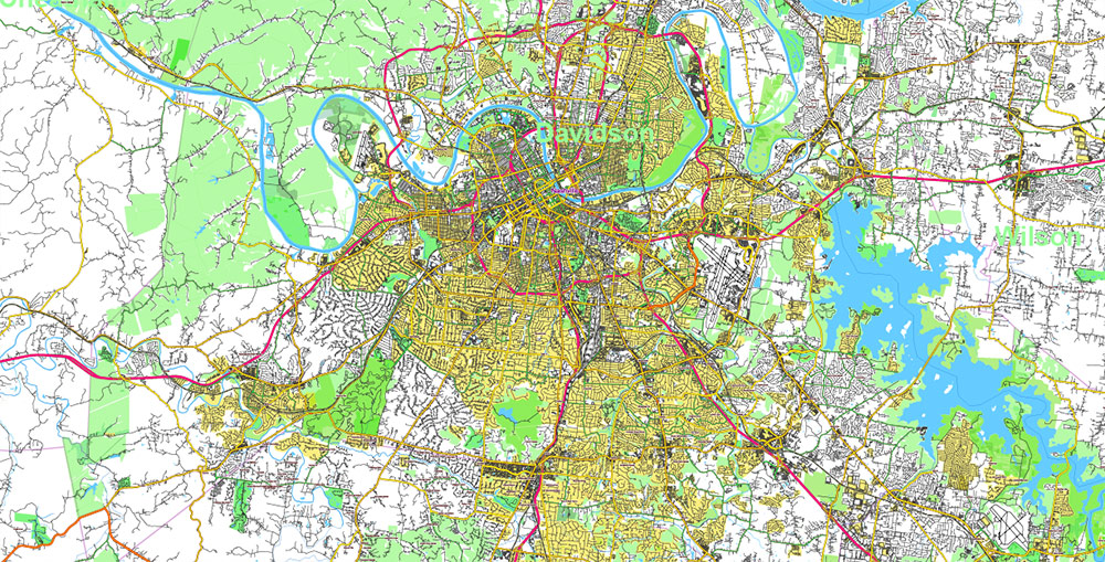
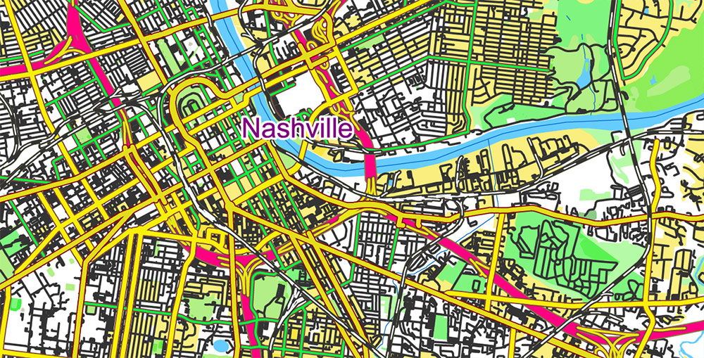
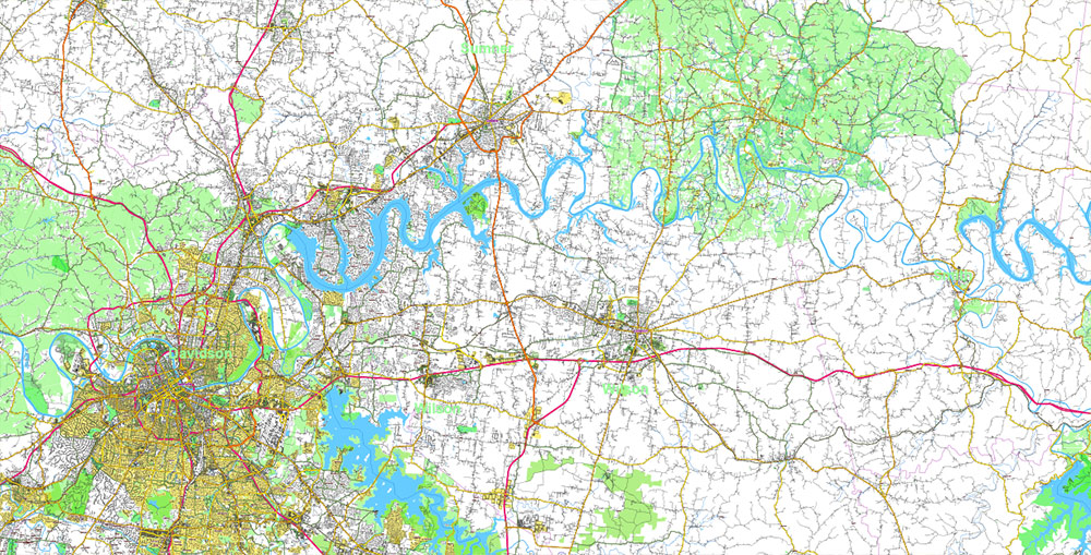
Area of operations covers the southern portion of Kentucky and the northwestern sector of Tennessee, centered on the Cumberland River basin and the Nashville regional corridor.
The region represents a transition zone between the Appalachian Interior Plateau and the Mississippi River drainage system, characterized by rolling uplands, dissected river valleys, and large artificial reservoirs.
Terrain is generally moderately rugged but highly navigable, supporting dense road networks and dispersed settlement patterns.
Elevation range:
-
120–350 m (400–1,150 ft) above sea level
-
broad uplands separated by shallow valleys
-
limestone plateau topography with karst features in northern sectors
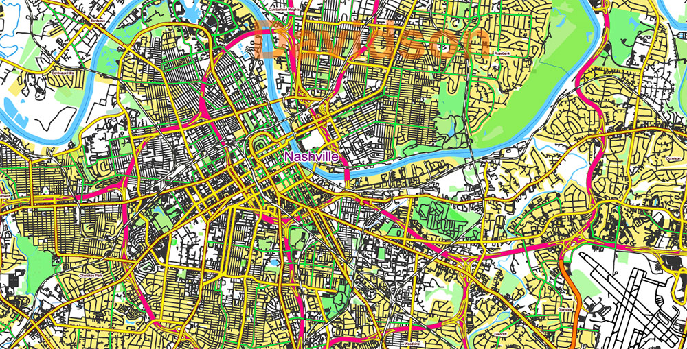
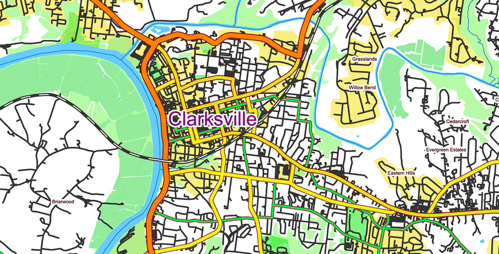
Major metropolitan node: Nashville, Tennessee
Secondary regional hubs: Clarksville, Bowling Green
Key Lines of Communication
Interstate Highways
Primary strategic corridors:
-
I-65 — north–south axis connecting Nashville to Louisville and the Midwest
-
I-24 — northwest–southeast corridor linking Illinois, Kentucky, and central Tennessee
-
I-40 — major east–west continental transport route south of the AO
These corridors support heavy freight traffic and high-capacity civilian transport flows.
US Highways
Regional mobility supported by multiple federal routes:
-
US-41
-
US-68
-
US-79
-
US-231
-
US-31W
These highways connect medium towns, agricultural regions, and reservoir recreation zones.
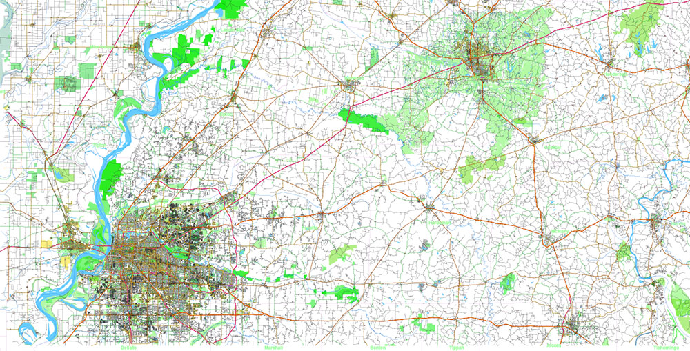
Secondary Road Network
The region contains a dense lattice of state highways and county roads, typical of the American interior agricultural belt.
Road characteristics:
Mobility across the terrain is high in all seasons.
Water Systems
Hydrology dominates the western portion of the AO.
Major waterways include:
Cumberland River
-
primary navigable river crossing the region
-
flows through Nashville and Clarksville
-
controlled by dams and navigation locks
Tennessee River System
Located west of the AO boundary.
Key reservoirs:
-
Kentucky Lake
-
Lake Barkley
These are large TVA reservoirs with extensive shorelines and branching bays.
Additional tributaries:
Water features create complex shoreline geometry, narrow peninsulas, and drowned valleys.
Terrain and Relief
The region lies within the Interior Low Plateaus physiographic province.
Dominant landforms:
-
rolling upland plateaus
-
dissected limestone hills
-
river valleys and reservoir basins
-
low ridges and wooded slopes
Typical slope gradients are moderate, allowing easy road construction and agricultural use.
Karst terrain in southern Kentucky produces:
-
sinkholes
-
cave systems
-
underground drainage
Demography and Human Terrain
Population concentrated in urban corridors.
Major population centers:
-
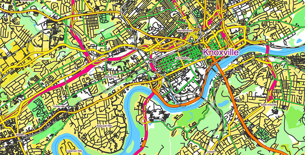
Nashville — major metropolitan area, economic and logistics hub
-
Clarksville — regional city along Cumberland River
-
Bowling Green — industrial and university center
Secondary towns:
-
Gallatin
-
Lebanon
-
Hopkinsville
-
Murray
-
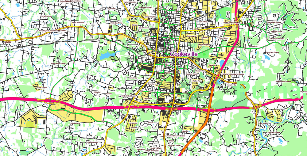
Cookeville
-
Columbia
Rural landscape dominated by agriculture, pastureland, and forest patches.
Settlement pattern:
small towns spaced along highways and river valleys.
Climate and Seasonality
Climate classification: humid subtropical.
Typical conditions:
Annual precipitation:
1,200–1,350 mm (47–53 inches).
Vegetation:
Seasonal weather variability is high due to interaction of Gulf moisture and continental air masses.
Strategic Geographic Character
The region forms a transport and settlement corridor between the Midwest and the Deep South, combining:
-
navigable rivers
-
high-capacity highway routes
-
fertile agricultural uplands
-
expanding metropolitan development around Nashville
Geographically the AO presents:
-
high terrain accessibility
-
dense road infrastructure
-
complex river and reservoir shorelines
-
mixed rural-urban landscape
These characteristics make the area well suited for detailed cartographic representation of transportation networks, hydrography, relief, and settlement distribution.
Tornado Area PDF Vector Map: part of Kentucky and Tennessee states US high detailed road map + Shaded Relief editable Adobe PDF
Tornado Area PDF Vector Map: part of Kentucky and Tennessee states US high detailed road map + Shaded Relief editable Adobe PDF
Tornado Area PDF Vector Map: part of Kentucky and Tennessee states US high detailed road map + Shaded Relief editable Adobe PDF
Tornado Area PDF Vector Map: part of Kentucky and Tennessee states US high detailed road map + Shaded Relief editable Adobe PDF
Tornado Area PDF Vector Map: part of Kentucky and Tennessee states US high detailed road map + Shaded Relief editable Adobe PDF
Tornado Area PDF Vector Map: part of Kentucky and Tennessee states US high detailed road map + Shaded Relief editable Adobe PDF
Tornado Area PDF Vector Map: part of Kentucky and Tennessee states US high detailed road map + Shaded Relief editable Adobe PDF
Tornado Area PDF Vector Map: part of Kentucky and Tennessee states US high detailed road map + Shaded Relief editable Adobe PDF
Tornado Area PDF Vector Map: part of Kentucky and Tennessee states US high detailed road map + Shaded Relief editable Adobe PDF
Tornado Area PDF Vector Map: part of Kentucky and Tennessee states US high detailed road map + Shaded Relief editable Adobe PDF
Tornado Area PDF Vector Map: part of Kentucky and Tennessee states US high detailed road map + Shaded Relief editable Adobe PDF
Tornado Area PDF Vector Map: part of Kentucky and Tennessee states US high detailed road map + Shaded Relief editable Adobe PDF
Tornado Area PDF Vector Map: part of Kentucky and Tennessee states US high detailed road map + Shaded Relief editable Adobe PDF
Tornado Area PDF Vector Map: part of Kentucky and Tennessee states US high detailed road map + Shaded Relief editable Adobe PDF
Tornado Area PDF Vector Map: part of Kentucky and Tennessee states US high detailed road map + Shaded Relief editable Adobe PDF
Tornado Area PDF Vector Map: part of Kentucky and Tennessee states US high detailed road map + Shaded Relief editable Adobe PDF
Tornado Area PDF Vector Map: part of Kentucky and Tennessee states US high detailed road map + Shaded Relief editable Adobe PDF
Tornado Area PDF Vector Map: part of Kentucky and Tennessee states US high detailed road map + Shaded Relief editable Adobe PDF

 Author: Kirill Shrayber, Ph.D. FRGS
 + Admin Areas editable Adobe Illustrator in layers")
 + Admin Areas + Relief Shaded Raster, editable Adobe Illustrator in layers")
