Extended Description of the Vector Map
The main city of New Mexico, named after Francis of Assisi, Santa Fe is located about 90 km north of Albuquerque. He is very old (by US standards) and very handsome (by any standards). There are many museums, art galleries, and centers of traditional Indian culture and art. In addition, Santa Fe hosts a monstrous number of different holidays. This is a real paradise for tourists. In addition, and in a criminal sense, the city is quite safe. And those who do not like historical monuments and are not interested in architecture, are attracted here by the nuclear laboratory located very close — the first in the country and the world.
Since the 9th century, there were Indian villages in this place, which for a long time did not interest anyone. But at the end of the 16th century, the local places began to colonize. In 1610, the city of Santa Fe was founded at the foot of the mountains, and in the same year, it was made the capital of the province. Thus, Santa Fe is the oldest capital city in the United States. In addition, it is also the second oldest city in North America, which was founded by colonizers from Europe. However, at the end of the 17th century, the city was pretty deserted due to Indian invasions. Anyway, after the war with Mexico for independence, the city began to grow: Texas declared it its territory. However, even then the city did not become particularly interesting to Americans: it was considered a boring and unpromising province. Nevertheless, today Santa Fe in America has become a very promising tourist destination: it is an old city with a rich history, charming architecture, and a rich modern cultural life.
The full name of Santa Fe is La Villa Real de la Santa Fe de San Francisco de Asis. That is, “the royal city of the holy faith of St. Francis of Assisi“.
In addition to the status of “the oldest capital” and “the oldest city of the colonists”, Santa Fe also boasts the position of “the highest capital”. It stands at an altitude of more than 2,100 meters above sea level higher than the central cities of any other states.
Santa Fe tourist attractions
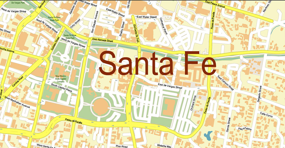
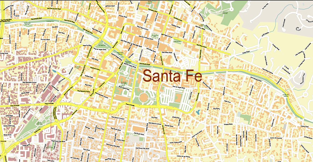
The very center of Santa Fe is not so big, but it is very lively. Quite a few of its buildings are listed on the National Register of Historic Places. It is better to start exploring them from the Plaza, the central city square, which in itself is already one of these places. At least four dozen similar objects can be viewed in the area of the main square. Also in the Old Town, there are several extremely photogenic churches, the main of which, of course, is the Cathedral of St. Francis. Its impressive appearance is complemented by a beautiful interior.
The main facade of the cathedral faces west, so this is a rare occasion in Santa Fe when the best photos are taken in the middle of the day; especially at noon.
The Santa Fe Capitol is one of the strangest capitol buildings in the country. The Capitol is colloquially called the “Round House” — for obvious reasons. It is open to tourists during business hours for free, and guided tours of the building can also be arranged upon prior request.
Mission San Miguel is considered the oldest surviving mission in the United States. The structure is simple but pretty. Behind the mission is a narrow alley, passing through it, you can get to a small building, which its owners call the oldest house in the country. The house was built by Europeans.
Santuario de Guadalupe is an excellent modern concert venue and at the same time an excellent example of Spanish colonial architecture. An excellent collection of religious art can still be seen inside. And the Scottish Wright Temple, to the north of the city center, is an interesting bright pink structure in the Moorish style, built clearly in the image and likeness of the Spanish Alhambra.
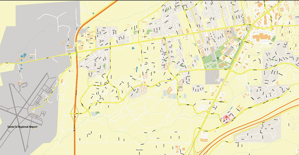
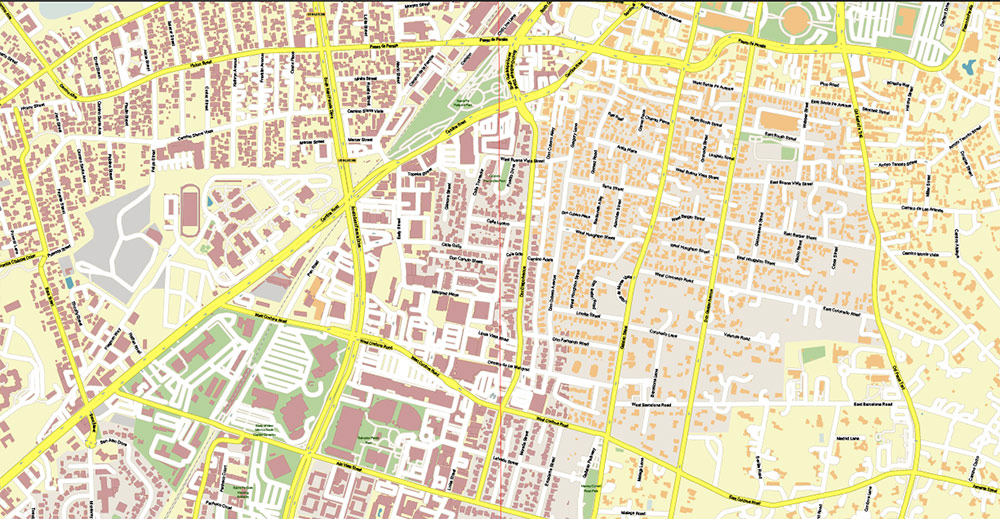
Printable PDF Vector Map of Santa Fe New Mexico US detailed City Plan scale 1:3816 full editable Adobe PDF Street Map in layers, scalable, text format all names, 17 MB ZIP
All street names, Main Objects, Buildings. Map for design, printing, arts, projects, presentations, for architects, designers, and builders, business, logistics.
Included: Additional layers (buildings 2), boundaries of lots (parts), parts of roads as polygon, simple map of New Mexico.
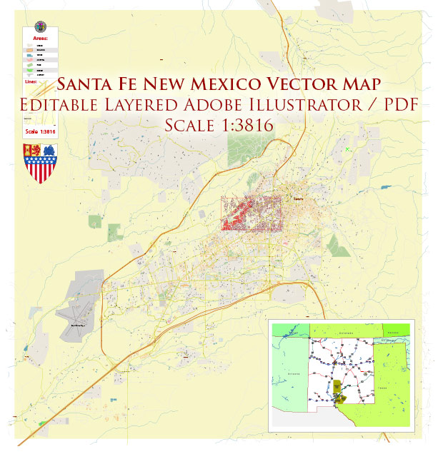
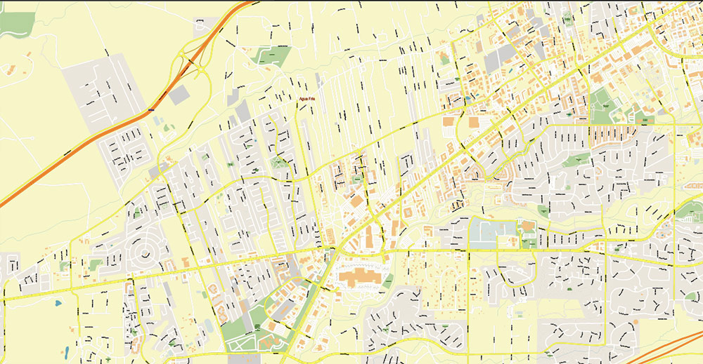
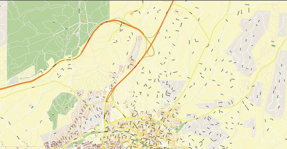
Santa Fe New Mexico US PDF Vector Map Exact City Plan High Detailed Street Map editable Adobe PDF in layers
Layers list:
- Legend
- Grids
- Labels of roads
- Names of places (city, hamlet, etc.)
- Names of objects (hospitals, parks, water)
- Names of main streets
- Names of civil streets
- Main Streets, roads
- Civil streets
- Railroads
- Buildings
- Buildings 2
- Boundaries of lots (part)
- Streets and roads polygons (part)
- Airports and heliports
- Water objects (rivers, lakes, ponds)
- Waterways
- Color fills (parks, hospital areas, land use, etc.)
- Background
Santa Fe New Mexico US PDF Vector Map Exact City Plan High Detailed Street Map editable Adobe PDF in layers
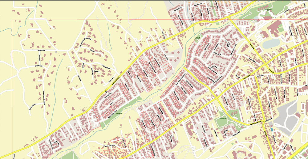
Santa Fe New Mexico US PDF Vector Map Exact City Plan High Detailed Street Map editable Adobe PDF in layers
Santa Fe New Mexico US PDF Vector Map Exact City Plan High Detailed Street Map editable Adobe PDF in layers
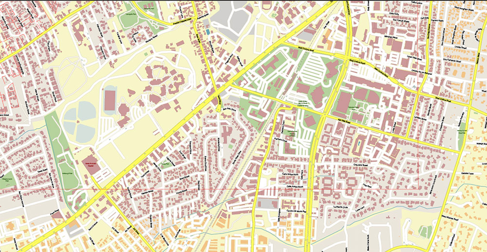
Santa Fe New Mexico US PDF Vector Map Exact City Plan High Detailed Street Map editable Adobe PDF in layers
Santa Fe New Mexico US PDF Vector Map Exact City Plan High Detailed Street Map editable Adobe PDF in layers
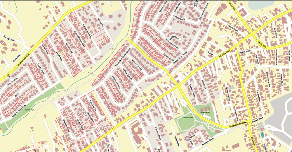
Santa Fe New Mexico US PDF Vector Map Exact City Plan High Detailed Street Map editable Adobe PDF in layers
Santa Fe New Mexico US PDF Vector Map Exact City Plan High Detailed Street Map editable Adobe PDF in layers
Santa Fe New Mexico US PDF Vector Map Exact City Plan High Detailed Street Map editable Adobe PDF in layers
Santa Fe New Mexico US PDF Vector Map Exact City Plan High Detailed Street Map editable Adobe PDF in layers
Santa Fe New Mexico US PDF Vector Map Exact City Plan High Detailed Street Map editable Adobe PDF in layers
Santa Fe New Mexico US PDF Vector Map Exact City Plan High Detailed Street Map editable Adobe PDF in layers

 Author: Kirill Shrayber, Ph.D. FRGS

