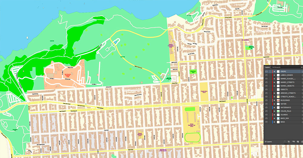
Extended Description of the Vector Map
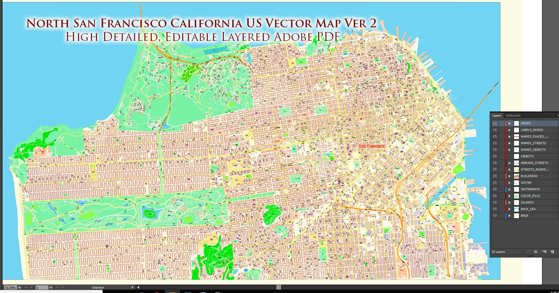
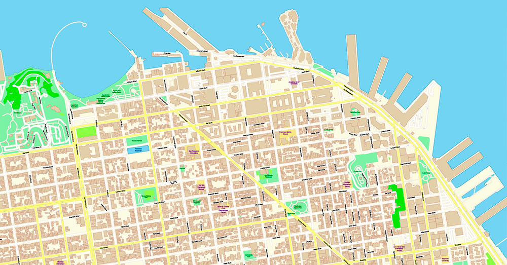
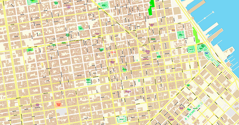
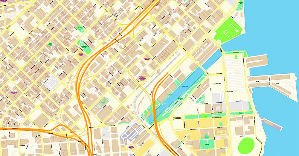
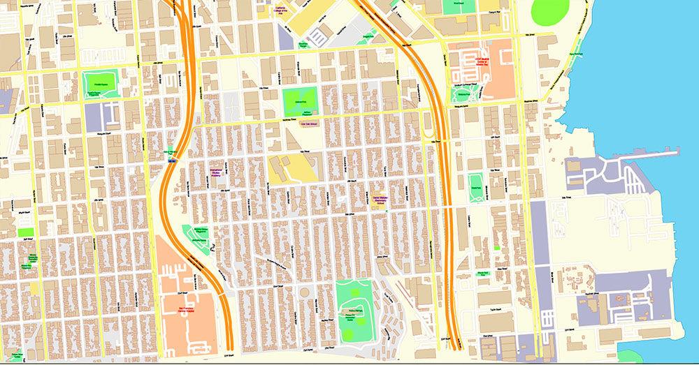
Printable Vector Maps 2 of San Francisco North Part Map Vector California US high and low detailed versions fully editable Adobe PDF Street Road Map in layers, scalable, text format all names, 49 MB ZIP
All street names, Main Objects, Buildings. 2 maps in 1 archive. Map for design, printing, arts, projects, presentations, for architects, designers, and builders, business, logistics.
The most exact and detailed map of this area in scale.
For Editing and High-Quality Printing
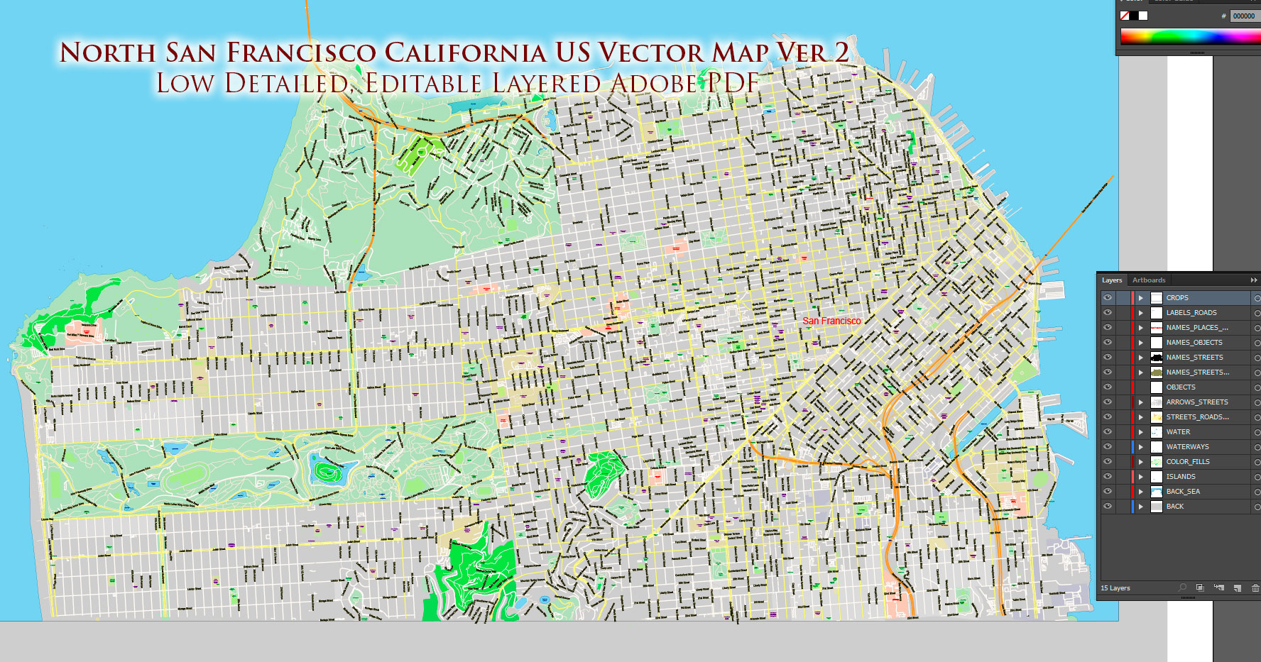
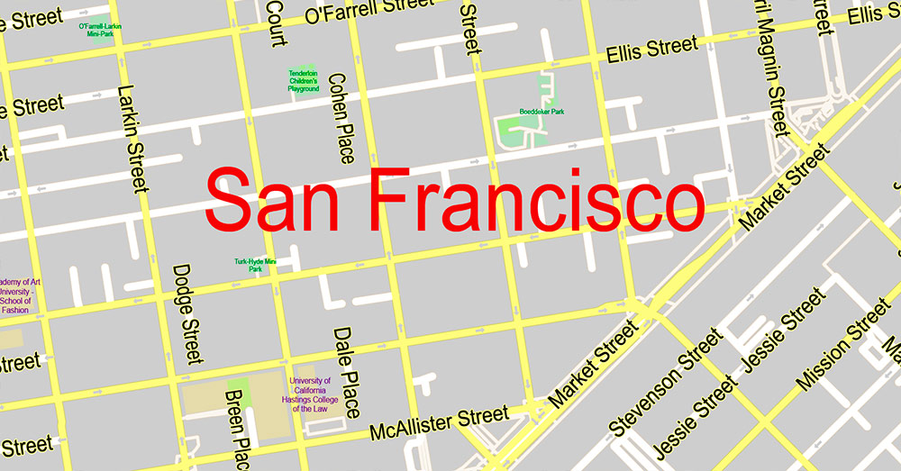
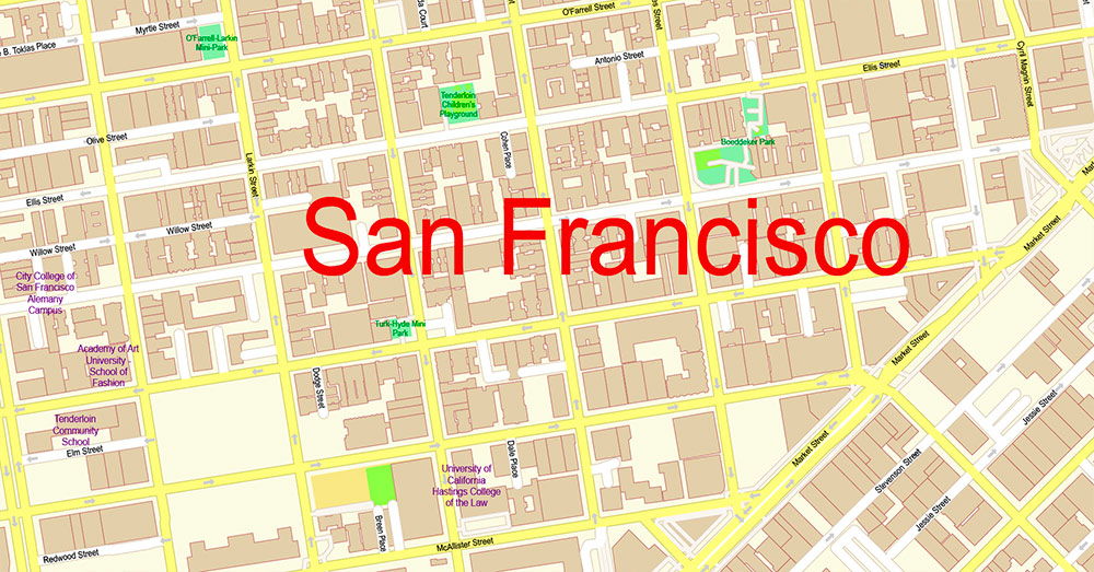
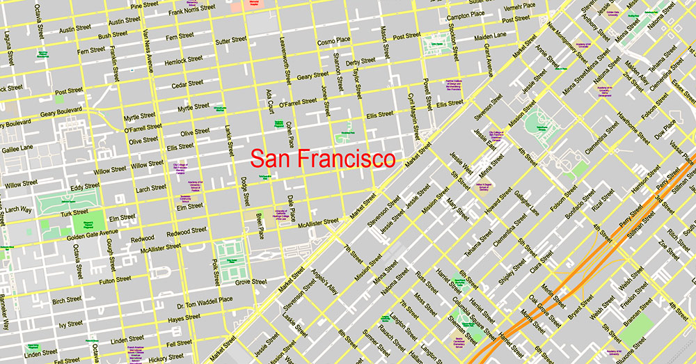
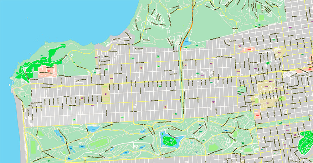
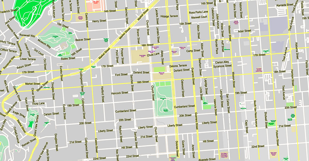
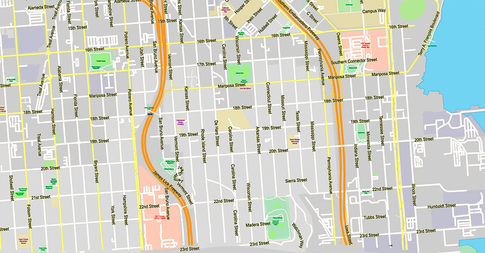
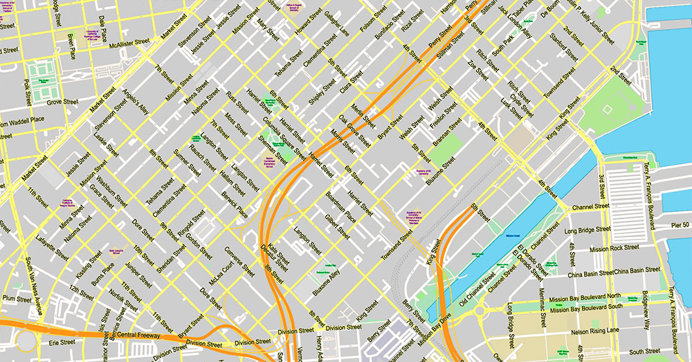
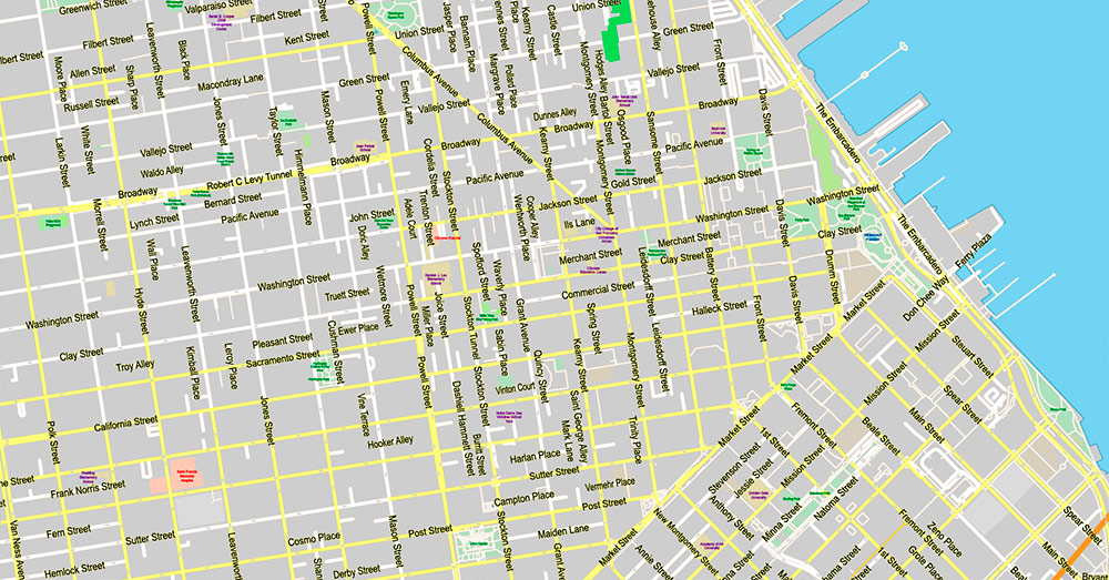
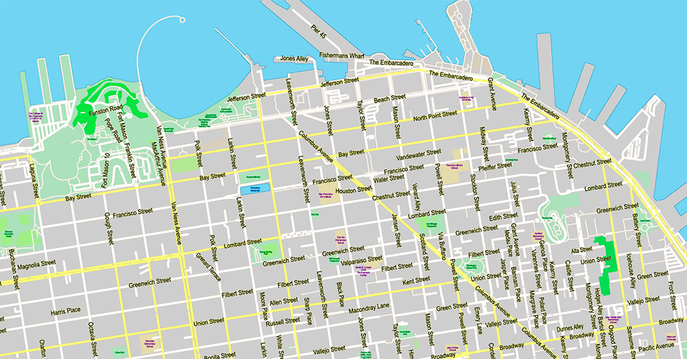
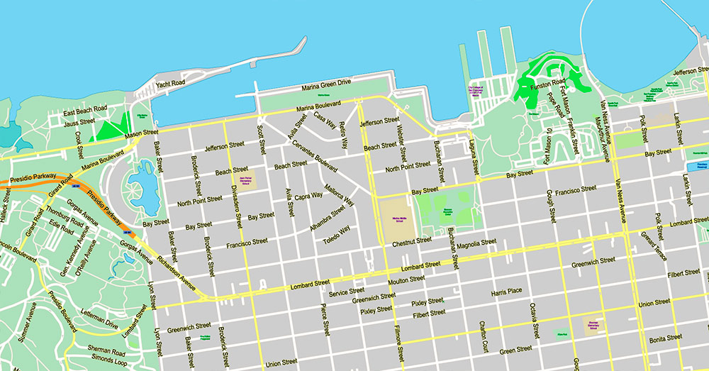
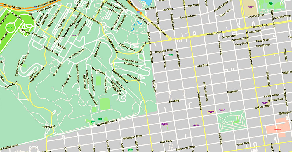
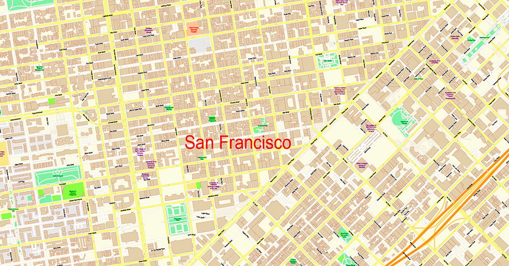
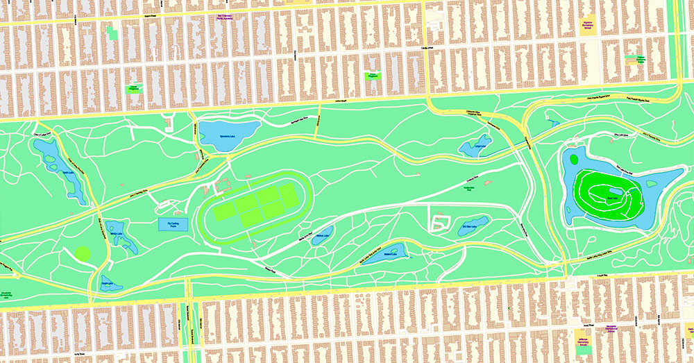
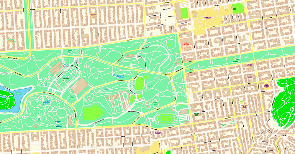
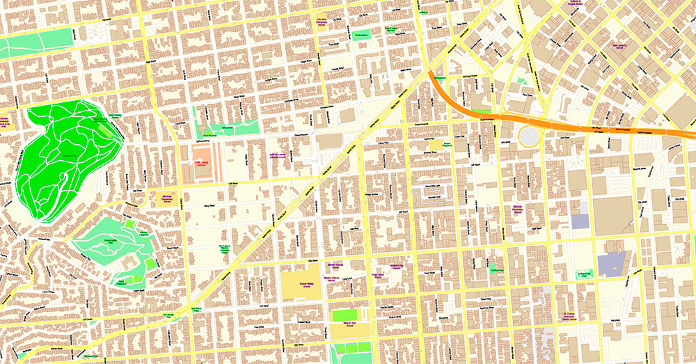
San Francisco North Part Map Vector California US Exact high and low detailed Street Road Maps 2 editable Adobe PDF in layers
San Francisco North Part Map Vector California US Exact high and low detailed Street Road Maps 2 editable Adobe PDF in layers
Layers list:
- Road labels
- Names of places (city, hamlet, etc.)
- Names of objects (parks, hospital, water)
- Names of streets
- Arrows of the street directions
- Streets, roads
- Buildings
- Water objects (rivers, lakes, ponds)
- Waterways
- Color fills (parks, land use, etc.)
- Background and sea
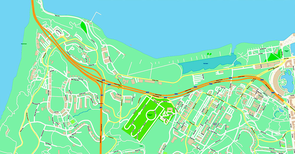
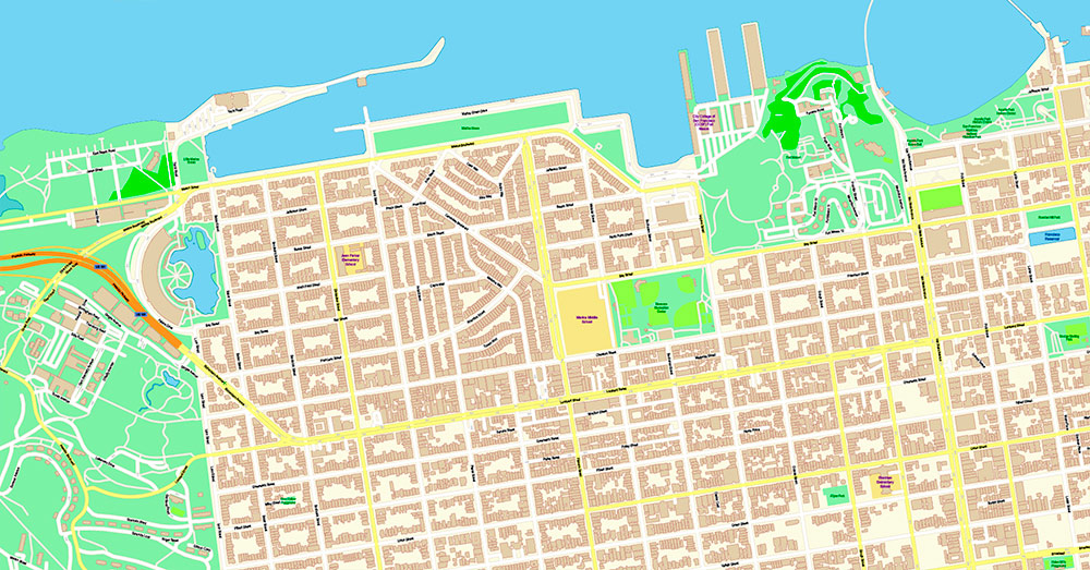
NORTHERN SAN FRANCISCO, CALIFORNIA — RECON BRIEF
(Scope: generally north of Market Street, from the Embarcadero to the Pacific, including Marina, North Beach, Russian Hill, Pacific Heights, Presidio, Fisherman’s Wharf, Chinatown)
1. Strategic Geography
-
Location: Northern sector of San Francisco, bordered by San Francisco Bay to the north and east, and the Pacific Ocean to the northwest.
-
Terrain: Highly hilly urban terrain with sharp elevation changes (Russian Hill, Nob Hill, Pacific Heights). Coastal flats near the Marina; rugged bluffs and green space in the Presidio.
-
Natural Constraints: Limited land access (peninsula city), dense development, frequent fog intrusion from the Pacific, strong coastal winds near open water.
-
Strategic Features:
2. Key Streets & Road Network
Primary East–West Axes
-
Lombard Street: Major cross-north artery; connects Presidio → Marina → Russian Hill.
-
Chestnut Street / Union Street: Commercial-residential spines in Marina and Cow Hollow.
-
Broadway: Links Pacific Heights, Russian Hill, North Beach.
Primary North–South Axes
-
Van Ness Avenue: Major arterial and transit corridor, critical for north–south movement.
-
Columbus Avenue: Diagonal artery through North Beach into downtown core.
-
Embarcadero: Waterfront boulevard along the Bay, high pedestrian and tourist density.
Regional Access
3. Landmarks & Points of Interest
-
Golden Gate Bridge: Iconic suspension bridge; critical infrastructure and tourism magnet.
-
Presidio of San Francisco: Large former military base turned national park; forests, trails, and institutional campuses.
-
Fisherman’s Wharf / Pier 39: High-density tourist zone; retail, hospitality, waterfront access.
-
North Beach: Historic Italian-American district; nightlife and cultural venues.
-
Chinatown: One of the oldest and densest Chinese enclaves in North America.
-
Coit Tower: Elevated observation landmark with panoramic city and bay views.
4. Demographics
-
Population Profile:
-
Mix of affluent professionals, long-term residents, immigrants, and transient populations.
-
Northern districts skew higher-income and older (Pacific Heights, Marina) compared to citywide average.
-
Ethnic Composition:
-
Significant Asian (Chinese) population in Chinatown and adjacent areas.
-
Predominantly White population in Marina, Russian Hill, Pacific Heights.
-
Household Patterns:
-
Day vs Night Population:
5. Business & Economy
6. Culture & Social Dynamics
7. Operational Summary
-
Advantages:
-
Constraints:
-
Key Risks:
Northern San Francisco is a high-value, high-density coastal urban sector combining historic terrain, critical transport corridors, affluent residential zones, and intense cultural and economic activity.
San Francisco North Part Map Vector California US Exact high and low detailed Street Road Maps 2 editable Adobe PDF in layers
San Francisco North Part Map Vector California US Exact high and low detailed Street Road Maps 2 editable Adobe PDF in layers
San Francisco North Part Map Vector California US Exact high and low detailed Street Road Maps 2 editable Adobe PDF in layers
San Francisco North Part Map Vector California US Exact high and low detailed Street Road Maps 2 editable Adobe PDF in layers
San Francisco North Part Map Vector California US Exact high and low detailed Street Road Maps 2 editable Adobe PDF in layers
San Francisco North Part Map Vector California US Exact high and low detailed Street Road Maps 2 editable Adobe PDF in layers
San Francisco North Part Map Vector California US Exact high and low detailed Street Road Maps 2 editable Adobe PDF in layers
San Francisco North Part Map Vector California US Exact high and low detailed Street Road Maps 2 editable Adobe PDF in layers
San Francisco North Part Map Vector California US Exact high and low detailed Street Road Maps 2 editable Adobe PDF in layers
San Francisco North Part Map Vector California US Exact high and low detailed Street Road Maps 2 editable Adobe PDF in layers
San Francisco North Part Map Vector California US Exact high and low detailed Street Road Maps 2 editable Adobe PDF in layers
San Francisco North Part Map Vector California US Exact high and low detailed Street Road Maps 2 editable Adobe PDF in layers
San Francisco North Part Map Vector California US Exact high and low detailed Street Road Maps 2 editable Adobe PDF in layers
San Francisco North Part Map Vector California US Exact high and low detailed Street Road Maps 2 editable Adobe PDF in layers
San Francisco North Part Map Vector California US Exact high and low detailed Street Road Maps 2 editable Adobe PDF in layers
San Francisco North Part Map Vector California US Exact high and low detailed Street Road Maps 2 editable Adobe PDF in layers
San Francisco North Part Map Vector California US Exact high and low detailed Street Road Maps 2 editable Adobe PDF in layers
San Francisco North Part Map Vector California US Exact high and low detailed Street Road Maps 2 editable Adobe PDF in layers
San Francisco North Part Map Vector California US Exact high and low detailed Street Road Maps 2 editable Adobe PDF in layers
San Francisco North Part Map Vector California US Exact high and low detailed Street Road Maps 2 editable Adobe PDF in layers
San Francisco North Part Map Vector California US Exact high and low detailed Street Road Maps 2 editable Adobe PDF in layers
San Francisco North Part Map Vector California US Exact high and low detailed Street Road Maps 2 editable Adobe PDF in layers
San Francisco North Part Map Vector California US Exact high and low detailed Street Road Maps 2 editable Adobe PDF in layers

 Author: Kirill Shrayber, Ph.D. FRGS

