Location and geography of Puerto Rico
The state of Puerto Rico, with an area of 8,870 square kilometers, occupies the island of the same name, located between the Caribbean Sea and the Atlantic Ocean. In addition, the country owns coral reefs and several small adjacent islands. The capital of Puerto Rico is San Juan. The closest neighbor of the country in the east is the unincorporated territory of the United States – the US Virgin Islands, in the west-the Dominican Republic. The territory of the island of Puerto Rico has a mountainous landscape. In the Central areas, there is a massif with the highest point of 1338 meters (Mount Cerro de Punta).
The population of Puerto Rico
The country is home to about 4 million people who have American citizenship and all the relevant rights. The majority are Puerto Ricans-80%, African Americans-10%, Europeans-5%, Chinese-2%.
Nature of Puerto Rico
On the territory of the country grow wet and dry tropical forests, the coast is covered with mangroves. The wet forests are home to many species of birds, reptiles, and frogs. Some are endangered species and are protected by the state, such as the “koki” frog, known for its ability to make unnaturally loud sounds. A small colony of such creatures as “croak” can stun an adult healthy person.
Climate conditions
Puerto Rico has a tropical, maritime climate. The average annual temperature is +28°C, with slight variations depending on the season and altitude. For recreation, the winter months are ideal, as in the summer there are often hurricanes.
Language
The official languages in Puerto Rico are Spanish and English. Most of the population of large cities knows both languages.
Kitchen
Traditional Puerto Rican cuisine is characterized by a variety of meat recipes, especially beef, and veal. There is even a “Puerto Rican beef” – a fragrant, hearty treat with onions, peppers, olives, and potatoes. Fried veal brains with a spicy sauce are very popular. The meal is not complete without seafood, it is worth trying beer soup of shrimp and lobster, baked crabs, fish with vegetables.
Religion
The majority of the country’s population is Catholic-48%, Protestant-38%, Jehovah’s Witnesses-10%, Jews-2%.
Holidays
On July 25, the country celebrates Constitution Day. On March 22, Emancipation Day is celebrated, named after the abolition of slavery, and on November 11, war veterans are honored. Along with other US citizens, Puerto Ricans celebrate July 4 as Independence Day.
Currency of Puerto Rico
The currency in the country is the US dollar.
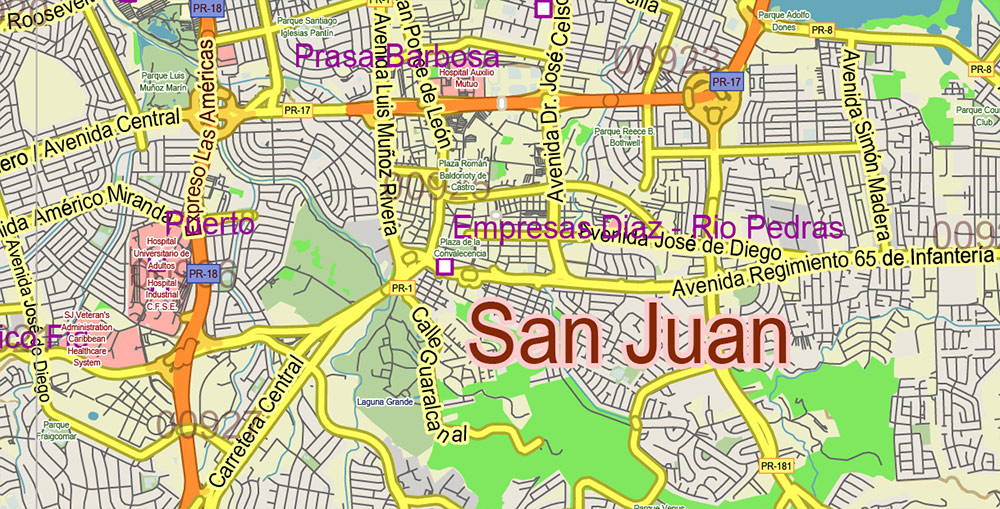
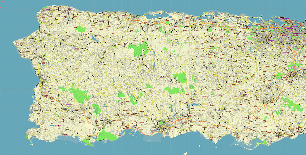
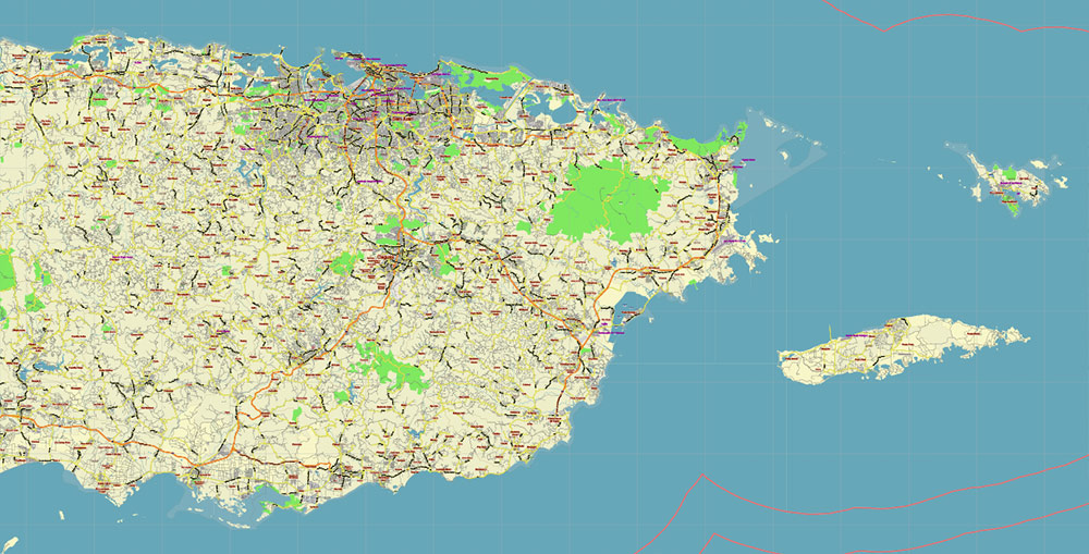
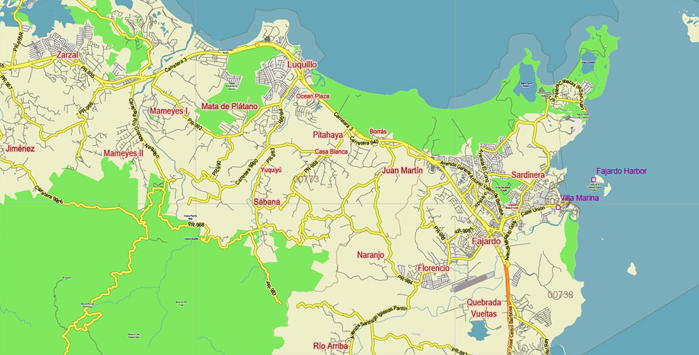
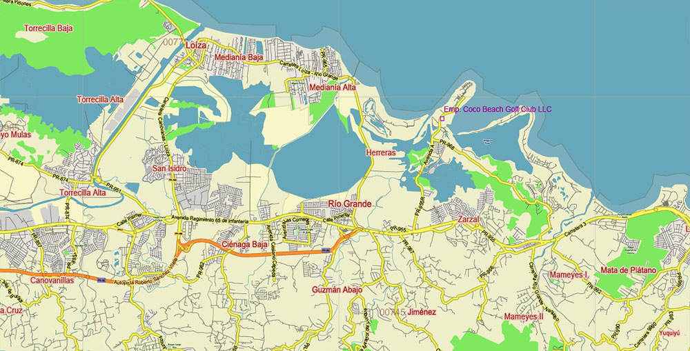
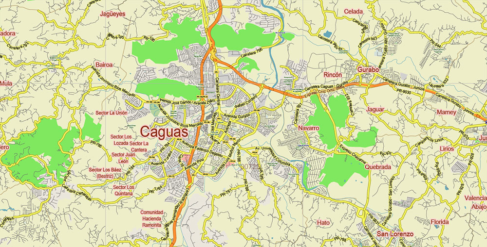
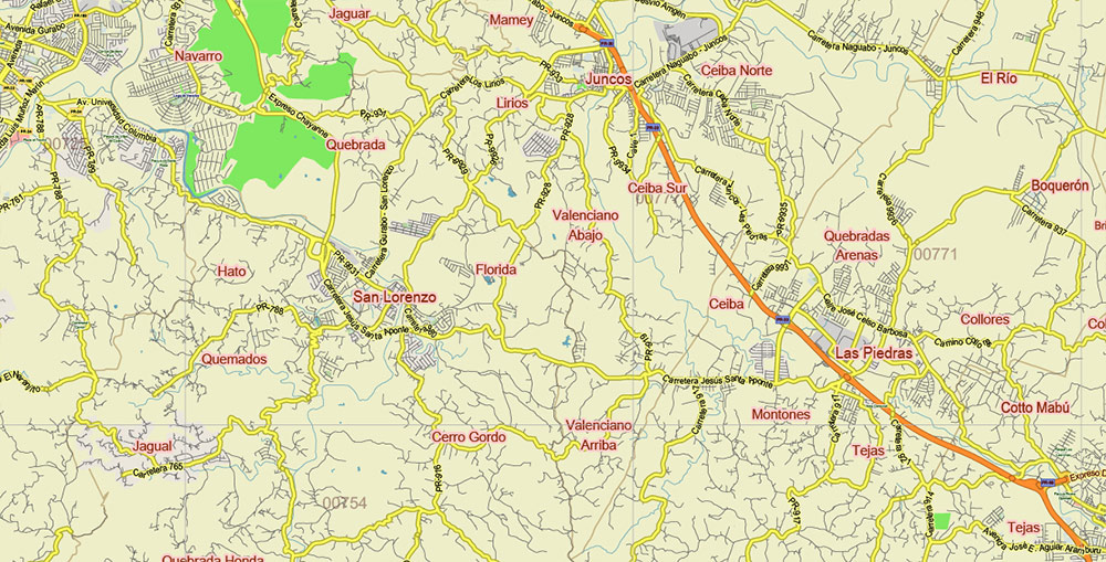
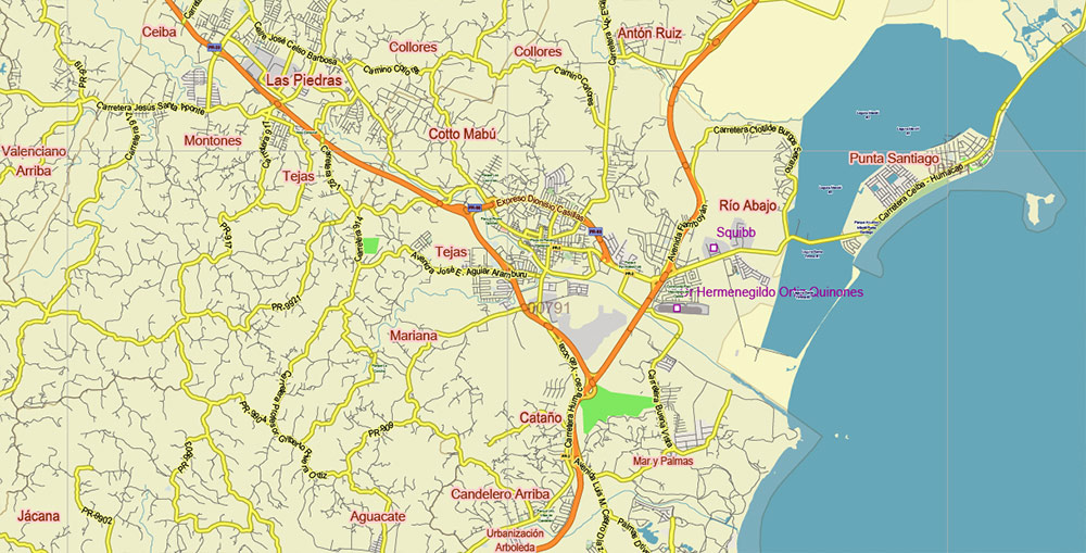
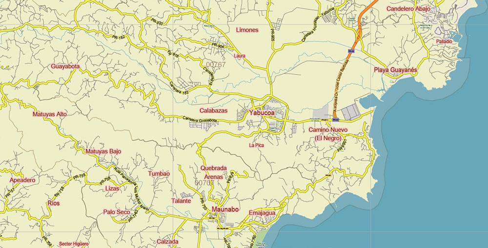
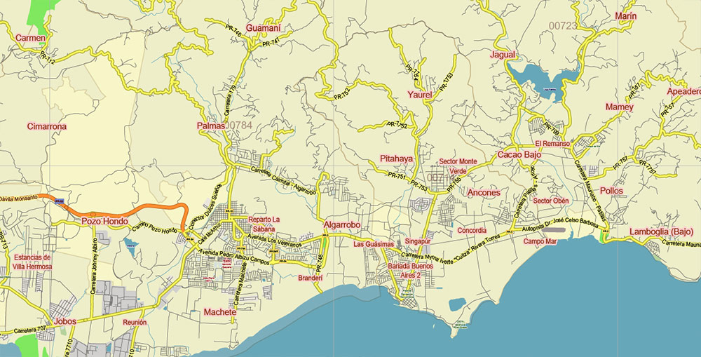
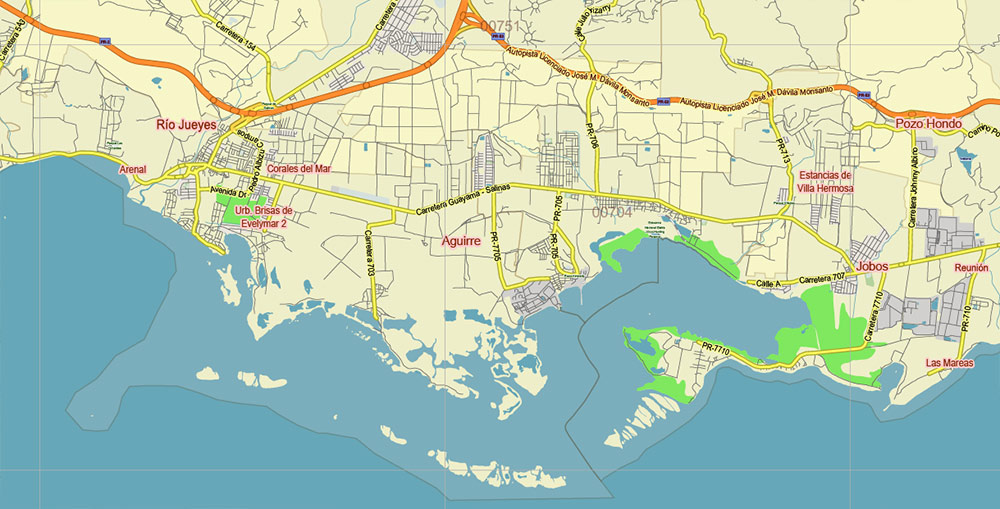
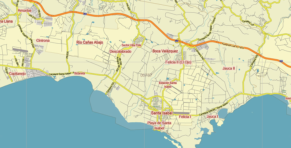
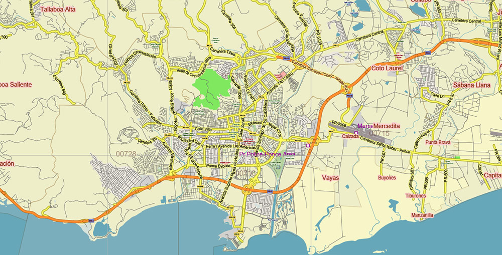
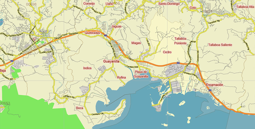
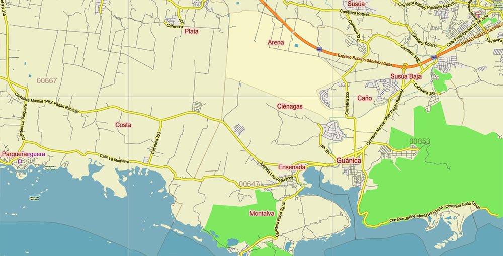
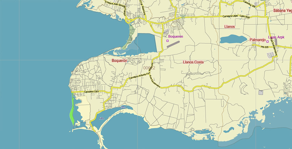
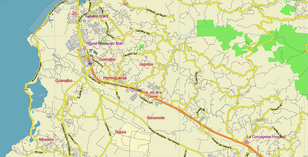
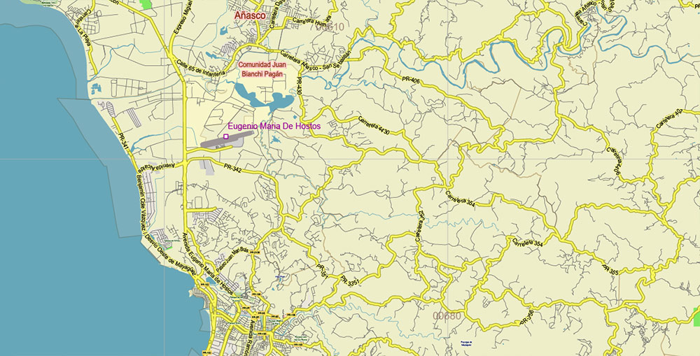
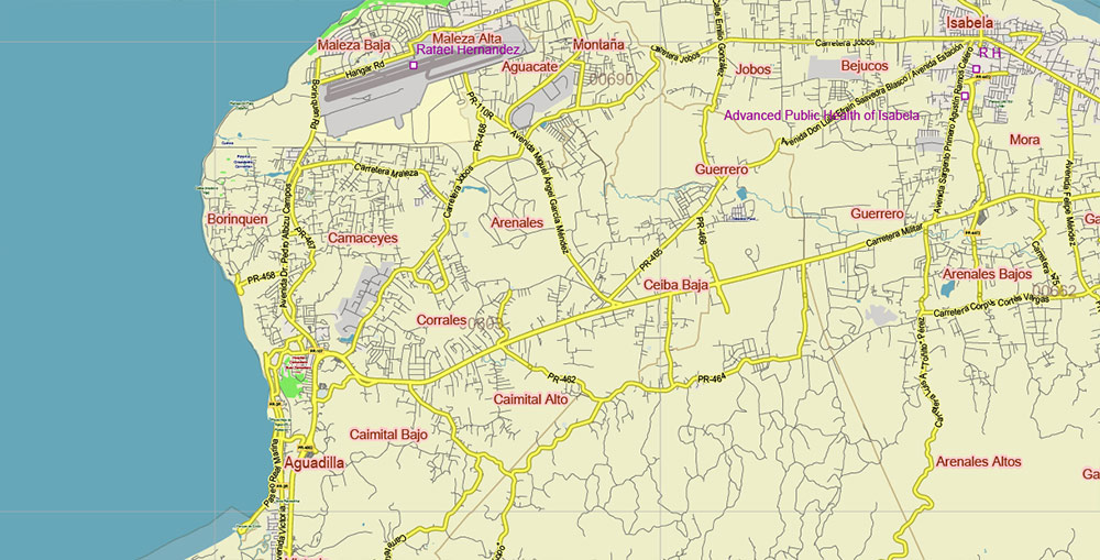
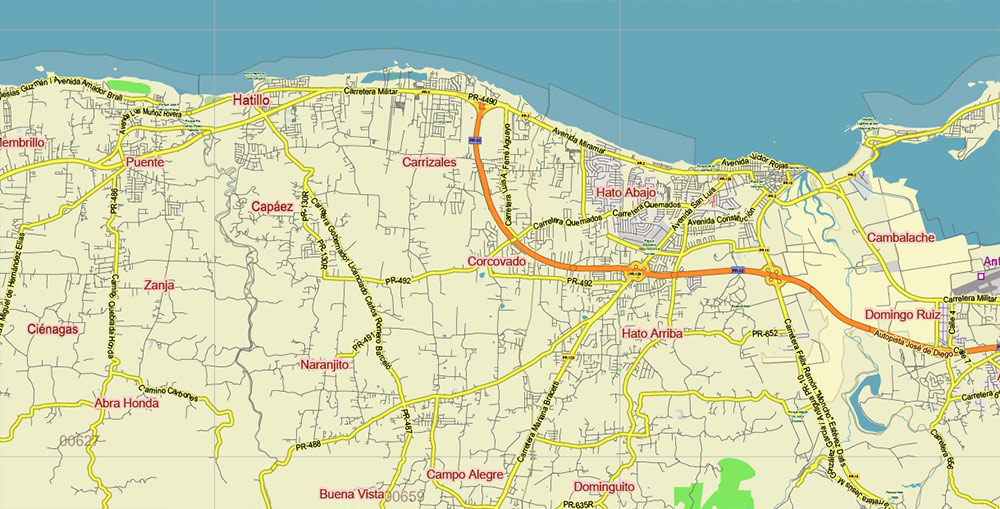
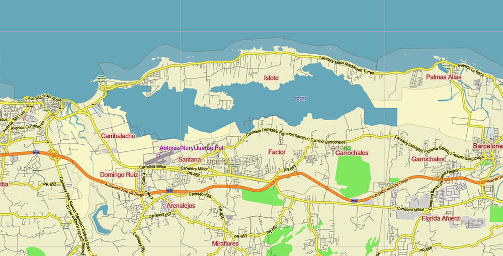
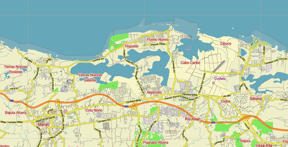
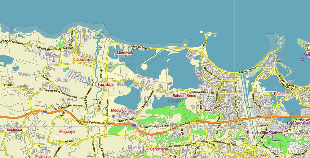
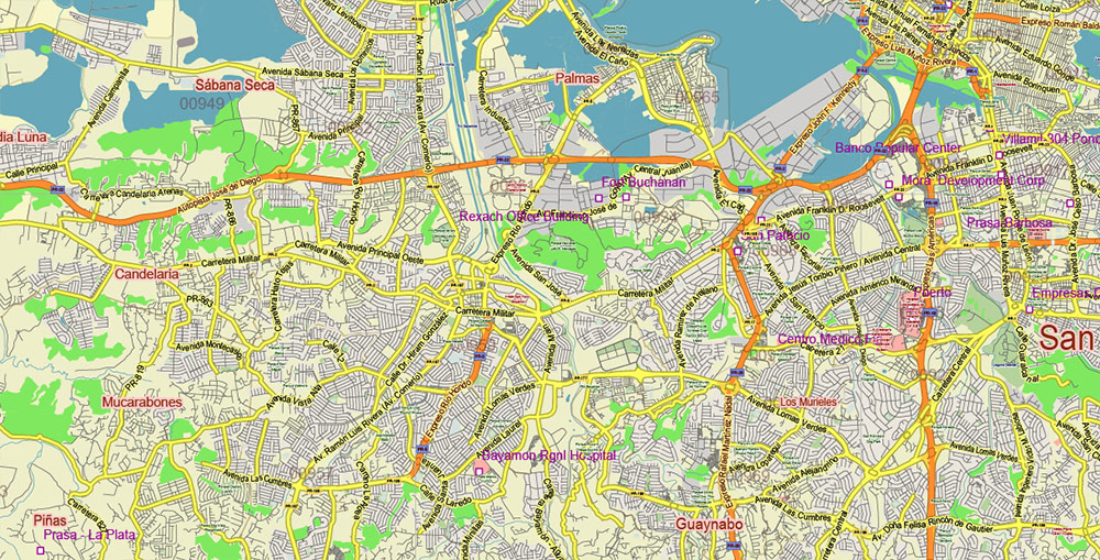
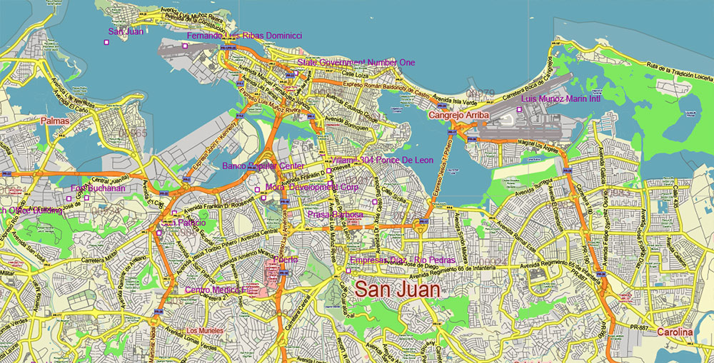
Printable PDF Vector Map of Puerto Rico Full State, US: All Streets and Roads + ZIP (postal) codes areas, fully editable Adobe PDF Map in layers, scalable, 60 MB ZIP
Scale: 1:71390
All streets and roads, Names of Principal streets, All Cities and Towns, airports, and heliports. Map for design, printing, arts, projects, presentations, for architects, designers, and builders, business, logistics.
ATTN! All objects are located on separate layers by type. The preview shows them all together. When you work with this map, just turn off or delete those layers that are not needed for your project.
For Editing and High-Quality Printing, Royalty free
Need AutoCAD DWG / DXF, CDR, or any other format? Please, contact us!
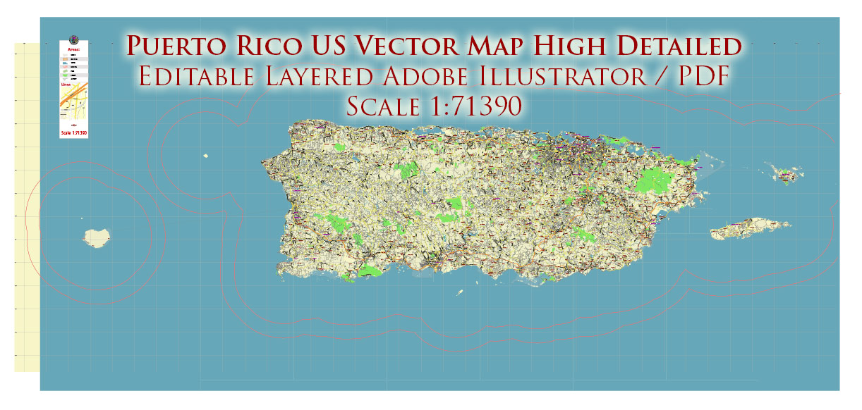
Puerto Rico Full State US PDF Vector Map: Full Extra High Detailed (all roads, zipcodes, airports) editable Adobe PDF in layers
Layers list:
- Legend
- Grids
- Labels of roads (numbers) – highways, interstate
- Names places: Names of all Cities, towns, villages, and hamlets
- Names of the Airports and Heliports
- Points of the Airports and Heliports
- Numbers of ZIP codes
- Names of objects (water, park, hospital)
- Names of the Main Streets
- Major Roads and Streets – Highways
- Minor Roads and residential streets
- Railroads
- Water objects (rivers, lakes, ponds, swamps, reefs)
- Waterways
- Ground objects (urban areas, parks, hospitals, etc.)
- ZIP-codes areas
- Islands
- Sea
- Background
Puerto Rico Full State US PDF Vector Map: Full Extra High Detailed (all roads, zipcodes, airports) editable Adobe PDF in layers
Puerto Rico Full State US PDF Vector Map: Full Extra High Detailed (all roads, zipcodes, airports) editable Adobe PDF in layers
Puerto Rico Full State US PDF Vector Map: Full Extra High Detailed (all roads, zipcodes, airports) editable Adobe PDF in layers
Puerto Rico Full State US PDF Vector Map: Full Extra High Detailed (all roads, zipcodes, airports) editable Adobe PDF in layers
Puerto Rico Full State US PDF Vector Map: Full Extra High Detailed (all roads, zipcodes, airports) editable Adobe PDF in layers
Puerto Rico Full State US PDF Vector Map: Full Extra High Detailed (all roads, zipcodes, airports) editable Adobe PDF in layers
Puerto Rico Full State US PDF Vector Map: Full Extra High Detailed (all roads, zipcodes, airports) editable Adobe PDF in layers
Puerto Rico Full State US PDF Vector Map: Full Extra High Detailed (all roads, zipcodes, airports) editable Adobe PDF in layers
Puerto Rico Full State US PDF Vector Map: Full Extra High Detailed (all roads, zipcodes, airports) editable Adobe PDF in layers
Puerto Rico Full State US PDF Vector Map: Full Extra High Detailed (all roads, zipcodes, airports) editable Adobe PDF in layers
Puerto Rico Full State US PDF Vector Map: Full Extra High Detailed (all roads, zipcodes, airports) editable Adobe PDF in layers
Puerto Rico Full State US PDF Vector Map: Full Extra High Detailed (all roads, zipcodes, airports) editable Adobe PDF in layers
Puerto Rico Full State US PDF Vector Map: Full Extra High Detailed (all roads, zipcodes, airports) editable Adobe PDF in layers
Puerto Rico Full State US PDF Vector Map: Full Extra High Detailed (all roads, zipcodes, airports) editable Adobe PDF in layers
Puerto Rico Full State US PDF Vector Map: Full Extra High Detailed (all roads, zipcodes, airports) editable Adobe PDF in layers
Puerto Rico Full State US PDF Vector Map: Full Extra High Detailed (all roads, zipcodes, airports) editable Adobe PDF in layers
Puerto Rico Full State US PDF Vector Map: Full Extra High Detailed (all roads, zipcodes, airports) editable Adobe PDF in layers
Puerto Rico Full State US PDF Vector Map: Full Extra High Detailed (all roads, zipcodes, airports) editable Adobe PDF in layers
Puerto Rico Full State US PDF Vector Map: Full Extra High Detailed (all roads, zipcodes, airports) editable Adobe PDF in layers
Puerto Rico Full State US PDF Vector Map: Full Extra High Detailed (all roads, zipcodes, airports) editable Adobe PDF in layers
Puerto Rico Full State US PDF Vector Map: Full Extra High Detailed (all roads, zipcodes, airports) editable Adobe PDF in layers
Puerto Rico Full State US PDF Vector Map: Full Extra High Detailed (all roads, zipcodes, airports) editable Adobe PDF in layers
Puerto Rico Full State US PDF Vector Map: Full Extra High Detailed (all roads, zipcodes, airports) editable Adobe PDF in layers
Puerto Rico Full State US PDF Vector Map: Full Extra High Detailed (all roads, zipcodes, airports) editable Adobe PDF in layers
Puerto Rico Full State US PDF Vector Map: Full Extra High Detailed (all roads, zipcodes, airports) editable Adobe PDF in layers

 Author: Kirill Shrayber, Ph.D. FRGS
 editable Adobe PDF + CDR CorelDraw in layers")
 editable Adobe PDF + CDR CorelDraw in layers")
 editable Adobe Illustrator in layers")

