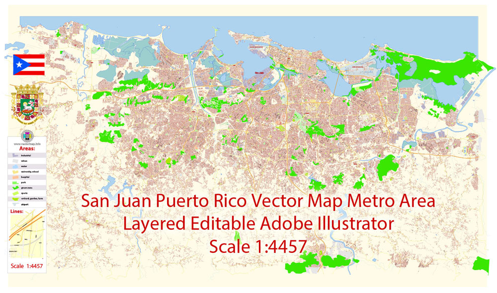
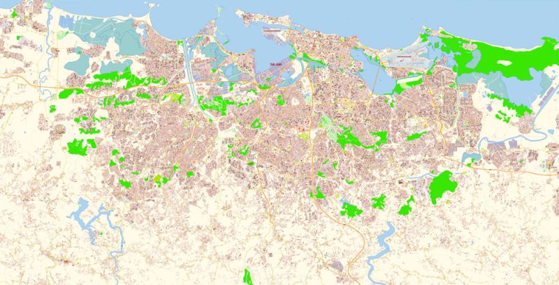
Printable PDF Vector Map Metro Area of San Juan Puerto Rico detailed City Plan scale 1:4457 full editable Adobe PDF Street Map in layers, scalable, text format all names, 73 mb ZIP
All streets names, Main Objects, Buildings. Map for design, printing, arts, projects, presentations, for architects, designers, and builders, business, logistics.
Layers: color_fills, water, streets_roads, labels_roads, names_objects, names_streets, names_places, water, buildings, legend, etc.
The most exact and detailed map of the city in scale.
For Editing and High-Quality Printing
DWG, DXF, and other formats – on request, the same price, please, contact
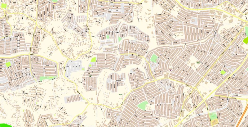
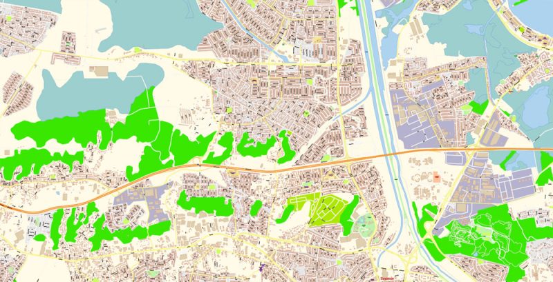
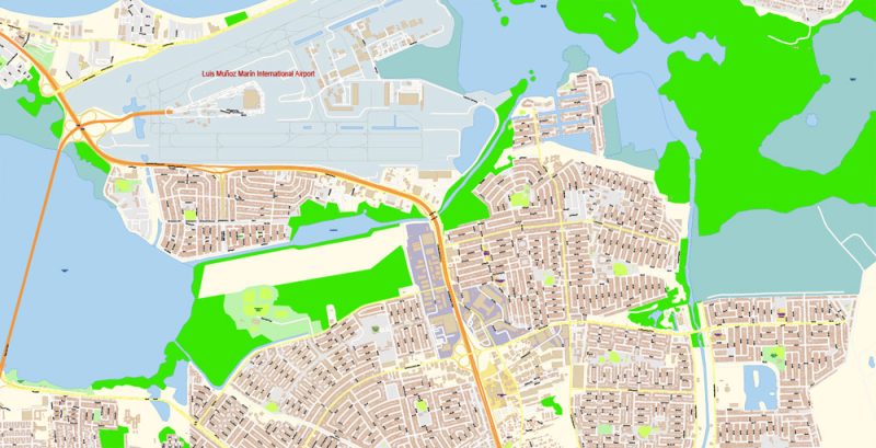
Urban plan San Juan metro area Puerto Rico: Digital Cartography
San Juan is the oldest city in the United States founded by Europeans, it traces its history back to 1508, when one of the first settlements on the shores of the New World was founded in its place. Moreover, it was founded by the legendary Juan Ponce de Leon, who owns the right to discover Florida and who, as the legend says, found the Source of Eternal Youth (on a small island near Puerto Rico). But the city received its name only in 1521 in honor of John the Baptist.
San Juan is very lucky: despite the long history of colonial wars, pirate raids, uprisings and looting, the old city has been perfectly preserved. Ancient forts and wonderful examples of colonial architecture create an extraordinary historical atmosphere, which rare cities in America can boast of.
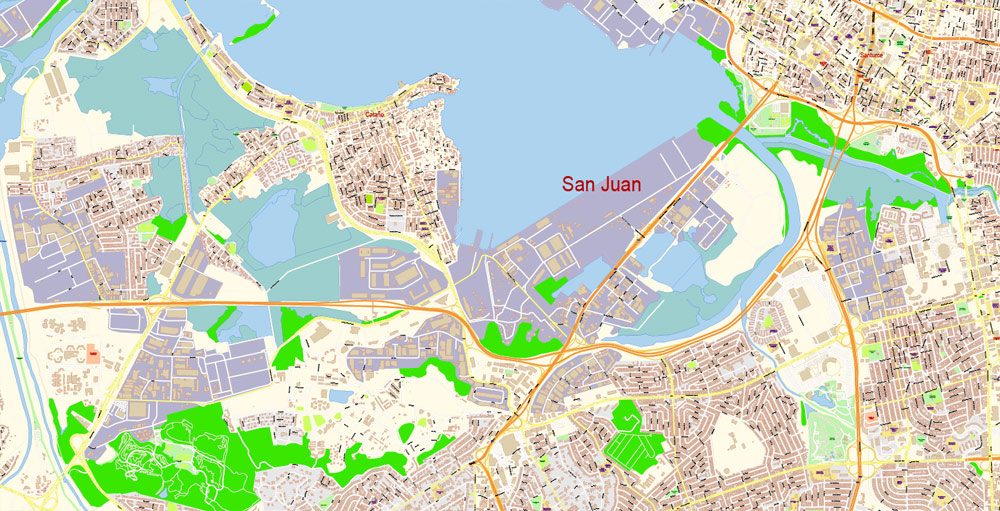
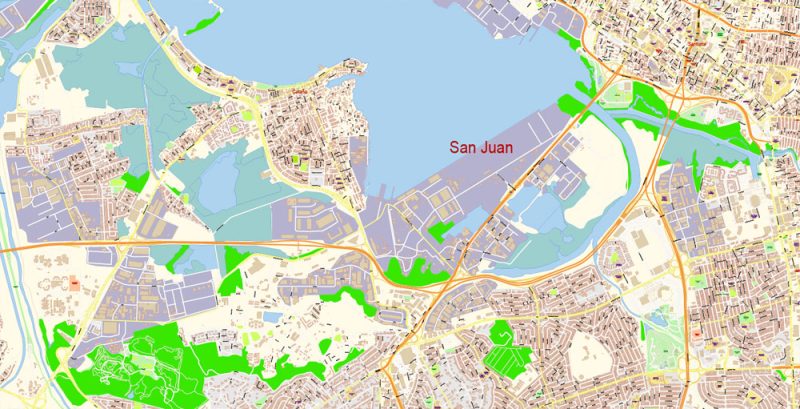
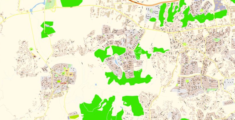
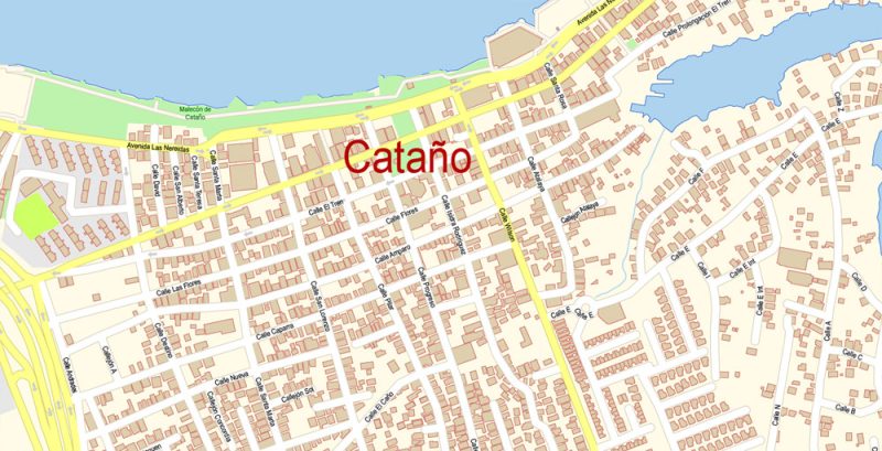
San Juan is divided into 18 administrative districts (barrios). The main area is considered to be the Old Town. Old San Juan is located on the western tip of the peninsula at the mouth of San Juan Bay. This area is the main historical area and resembles an open-air museum. Here you can see the main historical and cultural attractions: buildings of the Spanish colonial era, fortress walls, and forts. And also – to walk along the narrow cobbled streets and mentally go back several centuries.
If you move east of Old San Juan, you can get into the lively tourist area of Condado. There are magnificent beaches here, such as Ocean Park, Condado, and others. Swimmers, surfers, and outdoor enthusiasts often come here. There are also many hotels, restaurants, walking and entertainment areas in this area.
Miramar is a prestigious residential area located south of the Condado Lagoon. There are business centers, a large port and a wide picturesque embankment connecting the area with the Old Town. And yet, it was here that the first airport of San Juan was built – Isla Grande. In 2005, Miramar was designated a Puerto Rico Historic District.

Isla Verde is an area of wide beaches with snow-white sand and green palm trees. The territory is also famous for its well-developed tourist infrastructure and a wide range of entertainment for every taste. Thanks to the many shops, restaurants, bars, hotels, comfortable and picturesque places to relax, this area have become a favorite of many tourists.
A large number of multi-story buildings and business centers are concentrated in the Ato-Ray area. In addition to high-rise buildings, there is the Luis Munoz Marina Park with bicycle and jogging paths, ponds and picnic areas. Among the entertainment facilities, the tourist will find many restaurants and bars here, as well as a cinema and a cable car.
Rio Piedras is an area that boasts many shopping areas, shops, and picturesque walking areas. The largest university of Puerto Rico and the Roosevelt Bell Tower are located here. Another asset of Rio Piedras is the Botanical Garden, where you can see hundreds of species of tropical plants.

Population
The population of San Juan is about 400 thousand people. The racial composition of the city is numerically dominated by Latinos, African Americans, and representatives of the Caucasian race. The majority of local residents are Catholics, but religious freedom for all faiths is guaranteed in the territory of the city and the country.
History
In 1508, the Spanish conquistador Juan Ponce de Leon founded a settlement, which he named Caparo. A year later, it was moved to a place that was then called Puerto Rico (in Spanish – “rich port”). In 1521, the new settlement was officially named Puerto Rico de San Juan Bautista.
At the beginning of the XVI century, San Juan was the starting point for Spanish expeditions to unexplored parts of the New World. The city survived the attacks of the British, led by Francis Drake in 1595 and George Clifford in 1598. Fort San Juan’s artillery repelled Drake’s attack, but Clifford managed to land his troops and besiege the city.
Various circumstances, including liberalized trade with Spain, the opening of the island to immigrants, and colonial revolutions, led to the expansion of San Juan and other Puerto Rican colonies in the late XVIII and early XIX centuries.
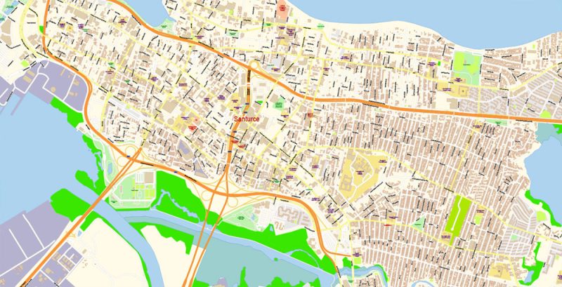
In the 20th century, the city expanded beyond the walls known as Old San Juan to include the suburban territories of Miramar, Santurce, Condado, Ato Rey and Rio Piedras.
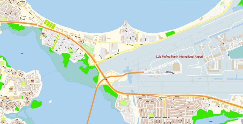
Today, San Juan is one of the largest natural ports in the Caribbean and one of the oldest cities in America.

Related Images “Urban plan San Juan metro area Puerto Rico”:
This vector map of San Juan city is used as a basis for design, editing, and further printing.
This is the most detailed, exact map of San Juan city for high-quality printing and polygraphy. You can always clarify the map development date by contacting us.For your convenience, all objects on San Juan vector city map are divided into layers, and the editing is very easy – colors, lines, etc.

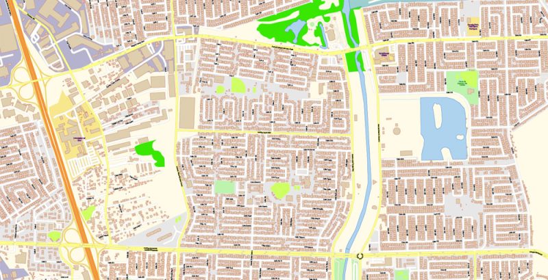
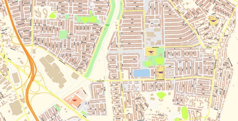
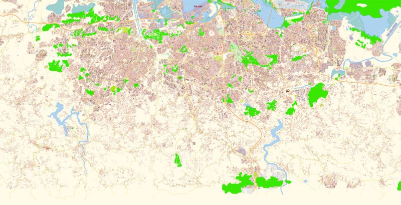
San Juan Metro Area Map Vector Exact City Plan Puerto Rico detailed Street Map editable Adobe Illustrator in layers
You can easily add any objects needed (e.g. shops, salons, sale points, gas station or attraction) on any layer of San Juan vector map.
One of the advantages of San Juan city vector maps of our production is the relevance of cartographic data, we constantly update all our products.
San Juan Metro Area Map Vector Exact City Plan Puerto Rico detailed Street Map editable Adobe Illustrator in layers
This vector map of San Juan city is used by:
designers, layout designers, printers, advertisers and architects. Our product – vector maps – is designed for further editing and printing in large formats – from @Wall format (a few meters) to A-0 and A-1, A-2, A-3.
San Juan Metro Area Map Vector Exact City Plan Puerto Rico detailed Street Map editable Adobe Illustrator in layers
The San Juan city map in vector format is used for design, urban planning, presentations and media visualizations.
The advertising and presentation map of San Juan city (usually the final designer marks the routes, and puts the client’s objects (shops, saloons, gas stations etc.)
The undoubted advantage is that people will NEVER throw out this advertising product – the map. In fact, as an advertising medium, a city map is the most “long-playing” of the well-known polygraphic advertising media, with the longest lifespan, and the maximum number of interactions with the customer.
San Juan Metro Area Map Vector Exact City Plan Puerto Rico detailed Street Map editable Adobe Illustrator in layers
For travelers, maps are sold at the airports amd gas stations around the world. Often the source is our vector maps.
Take a look, who purchases our vector maps of San Juan city in “Our Clients and Friends” page – these are large and small companies, from super-brands like Volvo and Starbucks, to small design studios and printing houses.
It’s very easy to work with vector maps of San Juan city, even for a not very experienced designer who can turn on and off the map layers, add new objects, change the colors of fill and lines according to customer requirements.
San Juan Metro Area Map Vector Exact City Plan Puerto Rico detailed Street Map editable Adobe Illustrator in layers
The undoubted advantage of San Juan city vector maps in printing is an excellent and detailed visualization, when customer can expand a large paper map and instantly define his location, find a landmark, an object or address on map, unlike using the popular electronic formats of Google and Yandex maps for example.
Printable vector maps of San Juan city is much more convenient and efficient than any electronic maps on your smartphone, because ALL DETAILS are displayed in the entire space of San Juan city map.
San Juan Metro Area Map Vector Exact City Plan Puerto Rico detailed Street Map editable Adobe Illustrator in layers
Useful tips on working with vector map San Juan City in Adobe Illustrator.
«V» – launches the Selection tool (cursor, black arrow), which makes active any vector line.
«А» – launches the Direct Selection tool (white cursor), allows you to select curve elements and drag them to the desired place.
«R» – activates the Rotate tool, which helps you rotating selected objects around the center point by 360 degrees.
«E» – gives you the opportunity to use the Eraser tool and erase unnecessary parts.
«X» – switches between Fill and Stroke in the Tools section. Try to get used to this hot key and
you will quickly understand that you can’t live and work without it.
San Juan Metro Area Map Vector Exact City Plan Puerto Rico detailed Street Map editable Adobe Illustrator in layers
Guides are not limited to vertical and horizontal in Adobe Illustrator. You can also create a diagonal guide for example. Moreover, you can turn any contours into guides. Select the outline and go to View > Guides > Make Guides (Create Guides), or simply press Cmd/Ctrl + 5. You can also turn the guides back into an editable object. Go to menu, View > Guides > Unlock Guides (Release Guides), select the guide you want to edit and select View > Guides > Release Guides (Reset Guides), or just press Cmd/Ctrl + Option / Alt + 5).
You will probably want to change the color scheme used on our San Juan vector city map.
To quickly and effectively play with colors.
Of course, you can do it manually, all objects in our San Juan city vector map are divided according to types and layers, and you can easily change the color gamma of vector objects in groups and layers.
San Juan Metro Area Map Vector Exact City Plan Puerto Rico detailed Street Map editable Adobe Illustrator in layers
But there is more effective way of working with the whole VECTOR MAP of San Juan city and all layers:
The overview dialog «Edit colors»/«Repaint Graphic Object» (this dialog box name can change depending on the context):
If you have selected a part or a layer of San Juan city vector map and open the dialog box by clicking the icon in the Control panel, on the Samples palette or the Color Catalog, or if you choose Edit > Edit Colors> Repaint Graphic Object, then the «Repaint Graphic Object» dialog box appears, and you get access to «Assign» and «Edit» tabs.
If a picture or a map fragment is not selected, and you open the dialog box by clicking the icon in the Control panel, on the Samples palette or in the Color Catalog, the «Edit Colors» dialog box appears and you can only access the «Edit» tab.
Regardless of the name at the top of the dialog box, the right-hand side always displays the color group of the current document, as well as two default color groups: Print Color and Grayscale. These color groups can be selected and used any time.
San Juan Metro Area Map Vector Exact City Plan Puerto Rico detailed Street Map editable Adobe Illustrator in layers
Create and edit color groups of San Juan city vector map, and also assign colors using the «Edit Colors»/ а «Repaint Graphic Object» dialog box.
A. Creating and editing of a color group on the «Edit» tab
B. Assigning colors on the «Assign» tab
C. Select a group of colors from the «Color groups» list
The option «Repaint a graphic object» in the lower part of the dialog box allows you to preview the colors on a selected layer of Vector map, or a group of elements, and specify whether its colors will be redefined when the dialog box is closed.
The main areas of the dialog box are:
«Edit»
The «Edit» tab is designed to create a new or edit the existing color groups.
The harmony rules Menu and the Color Wheel are used to conduct experiments with color harmonies. The color wheel shows how colors are related in color harmony, and the color bars allow you to view and manipulate an individual color values. In addition, you can adjust the brightness, add and remove colors, save color groups and view colors on the selected Vector Map of San Juan city or a separated layers.
San Juan Metro Area Map Vector Exact City Plan Puerto Rico detailed Street Map editable Adobe Illustrator in layers
«Assign»
The «Assign» tab is used to view and control on how the original colors are replaced with colors from the color group like your corporate colors in the Vector Map of San Juan city.
The assign color ability is provided only if the entire map, layer or fragment is selected in the document. You can specify which of new colors replace the current colors, whether the spot colors should be preserved and how colors are replaced (for example, you can replace colors completely or changing the color tone while maintaining the brightness). The «Assign» tab allows you to redefine colors in the Vector Map of San Juan city, or in separate layers and fragments using the current color group or reducing the number of colors in the current Vector Map.
San Juan Metro Area Map Vector Exact City Plan Puerto Rico detailed Street Map editable Adobe Illustrator in layers
«Color groups»
Is a list of all saved color groups for current document (the same groups appear in the «Samples» palette). You can edit and delete the existing color groups, as well as creating a new ones using the list of “Color Groups” in the dialog box. All changes appear in the «Samples» palette.
The highlighted color group shows, which color group is currently edited. Any color group can be selected and edited, or used to redefine the colors in the selected vector map of San Juan city, its fragments or elements.
Saving a color group adds this group to the specified list.
San Juan Metro Area Map Vector Exact City Plan Puerto Rico detailed Street Map editable Adobe Illustrator in layers
Opening the «Edit Colors»/«Repaint Graphic Object» dialog box.
Open the «Edit Colors»/«Repaint Graphic Object» dialog box using one of the following methods:
«Edit»> «Edit Colors»> «Repaint Graphic object» or «Repaint With Style».
Use these commands if you need to edit the colors in the selected vector map of San Juan city.
«Repaint Graphic object» button on the «Control» panel.
Use this button if you need to adjust colors of San Juan city vector map using the а «Repaint graphic object» dialog box.
The specified button is available if the selected vector map or its fragment contains two or more colors.
Note. This color editing method is convenient for global color adjustment in a vector map, if global colors were not used when creating a City Map of San Juan.
San Juan Metro Area Map Vector Exact City Plan Puerto Rico detailed Street Map editable Adobe Illustrator in layers
The «Edit colors» button or «Edit or apply colors» on the «Color Catalog» palette
Click this button if you need to edit colors on the «Color Catalog» palette or edit and then apply them to the selected Vector Map of San Juan city or its fragment.
The «Edit color group» button or «Edit or apply color group» on the «Samples» palette.
Click this button if you need to edit the colors in the specific color group or edit and apply them to the selected Vector Map of San Juan city or a group of its elements, for example, the whole layer “Streets and lines”. You can also double-click the color group in the Samples panel to open the dialog box.
——
If the map file is too large and your computer freezes or even can’t open it quickly:
1. Try to reduce the color resolution of the video card (display) to 256 colors while working with a large map.
2. Using Windows Task Manager, select all the application you don’t need, while working with map, just turn them off.
3. Launch Adobe Illustrator. (DO NOT OPEN the vector map file)
4. Start the Windows Task Manager using administrator rights > Find the “Illustrator” process > set the «real time» priority,
5. Open the file. When you see the LEGACY FONT popup window – click “OK” (do not update). You can restore the TEXT later.
6. ???? Can also be useful: ???? When the file is opened – Edit > Settings > Basic Settings > disable smoothing. /// It looks scary, but works quickly)))
We recommend saving the file in Adobe Illustrator 10 version. It’s much more stable when working with VERY BIG size files.
—
You are welcome, if you need any assistance
San Juan Metro Area Map Vector Exact City Plan Puerto Rico detailed Street Map editable Adobe Illustrator in layers
San Juan Metro Area Map Vector Exact City Plan Puerto Rico detailed Street Map editable Adobe Illustrator in layers
San Juan Metro Area Map Vector Exact City Plan Puerto Rico detailed Street Map editable Adobe Illustrator in layers
San Juan Metro Area Map Vector Exact City Plan Puerto Rico detailed Street Map editable Adobe Illustrator in layers
San Juan Metro Area Map Vector Exact City Plan Puerto Rico detailed Street Map editable Adobe Illustrator in layers


 Author: Kirill Shrayber, Ph.D. FRGS
 editable Adobe PDF + CDR CorelDraw in layers")
 editable Adobe Illustrator in layers")
 editable Adobe PDF + CDR CorelDraw in layers")

