Puerto Rico is an island in the Caribbean. Tourists are attracted by the many beaches, the colonial architecture in San Juan and other cities, the jungle with waterfalls, and three coves with glowing plankton.
The country does not have a large flow of tourists, and the local flavor is preserved. This is a good option for exploring the Caribbean without the crowds and pestering (as in the neighboring Dominican Republic) and the crazy prices (as in the smaller Caribbean islands).
Puerto Rico is suitable for independent travelers who want not just to lie in the pool and eat too much, but to explore different beaches and attractions.
Puerto Rico is famous for its beaches (for swimming and surfing/kitesurfing), the colonial capital of San Juan, the famous Arecibo Observatory, and coves with glowing plankton.
In English and Spanish – Puerto Rico (translated from Spanish as a Rich Port).
Capital of the state: the city of San Juan.
The population of Puerto Rico: 3.2 million (slightly less than Bosnia and slightly more than Albania).
Land area: 9,104 km2 (slightly larger than the Canary Islands, and 5 times smaller than the neighboring Dominican Republic).
Official languages: English and Spanish. In tourist places, everyone speaks at least some English, in more remote places only Spanish.
Once at a gas station, I tried to speak English, but the cashier did not understand. Then I switched to Spanish. She was very surprised: “Why didn’t you speak Spanish right away?”. Then we just started speaking Spanish everywhere :)
UNESCO sites in Puerto Rico: The Fortress of La Fortaleza and the historic part of the city of San Juan.
Puerto Rico is a territory dependent on the United States. The locals dream of becoming the 51st state, but the US is still in no hurry to accept Puerto Ricans into its ranks. But it is worth noting that all the locals have American citizenship, and the US just helps Puerto Ricans a lot, and they have a common currency and defense.
Before the arrival of Europeans and colonization, the island of Puerto Rico was inhabited by the Taíno Indians. In 1493, the island was discovered by Christopher Columbus himself during his second trip to America. He named the island San Juan de Bautista (after John the Baptist). The capital was also called San Juan. Since 1508, the island has been actively colonized by the Spaniards. In order not to be confused with the names of the island and the capital, we decided to leave the name of the city as it is, and the island was renamed Puerto Rico (i.e., a Rich Port).
From the 16th to the 19th century, many African slaves were brought here, so the local population is a mix of Taino Indians, Europeans, and Africans.
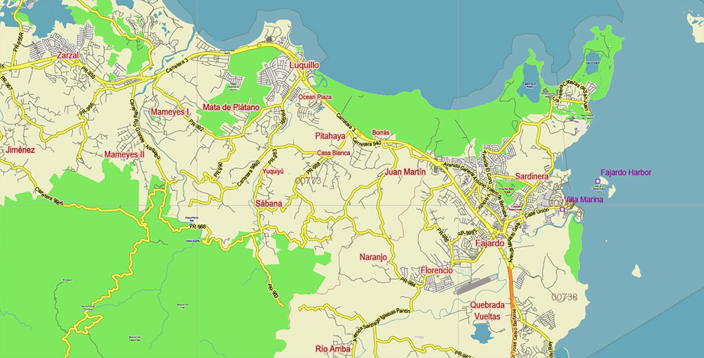
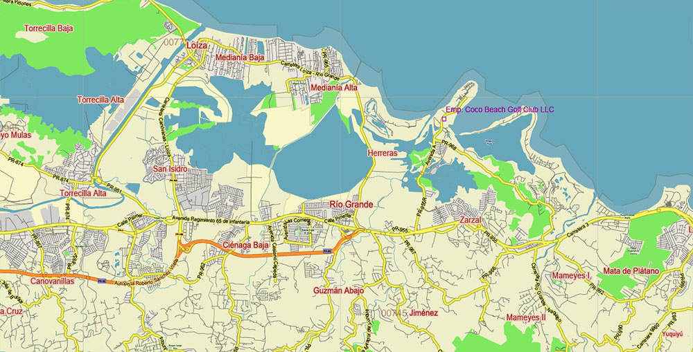
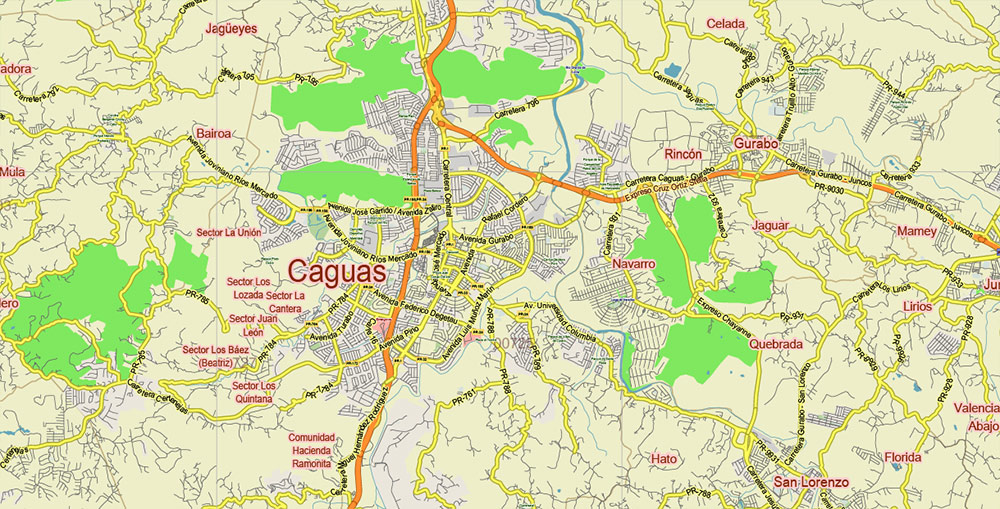
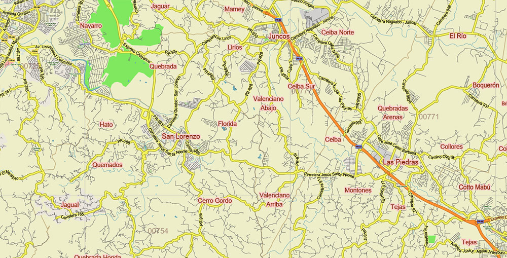
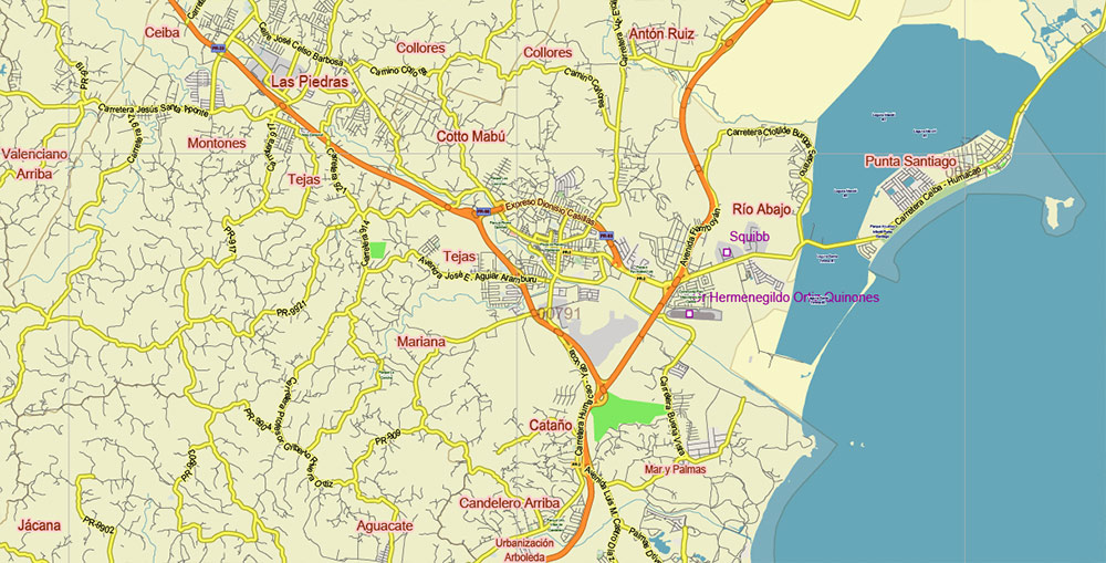
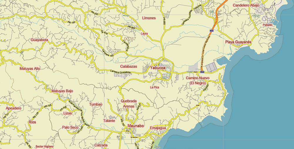
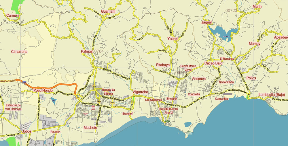
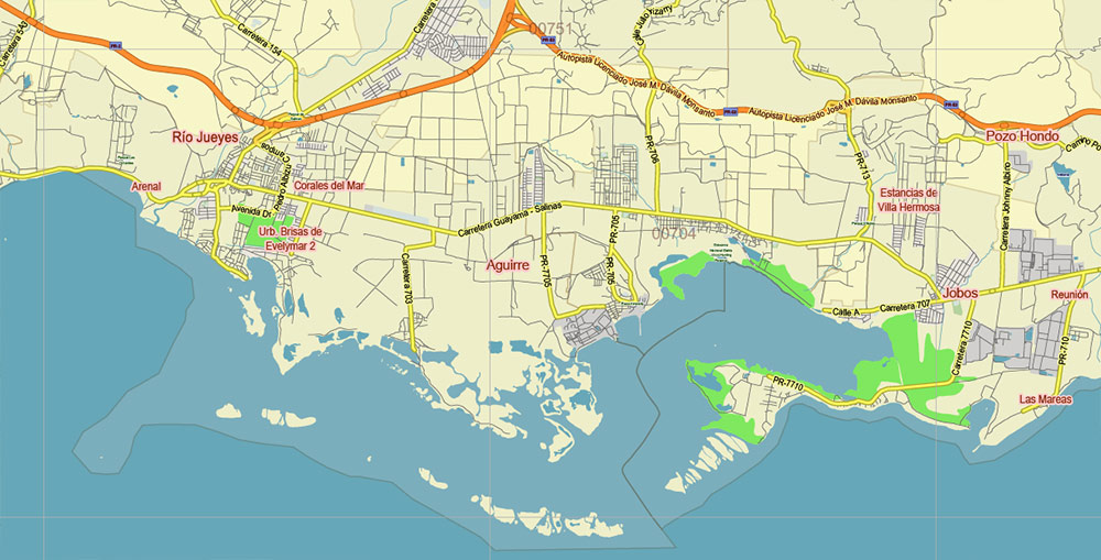
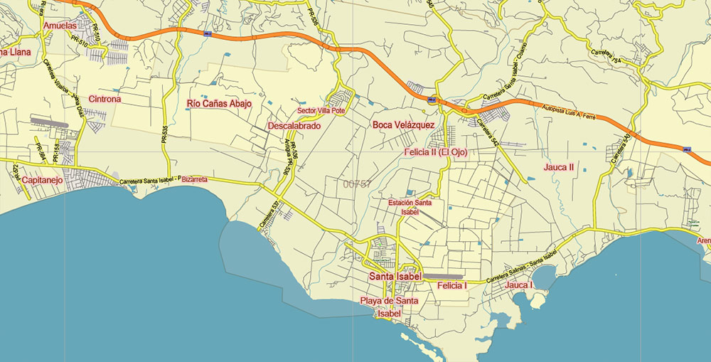
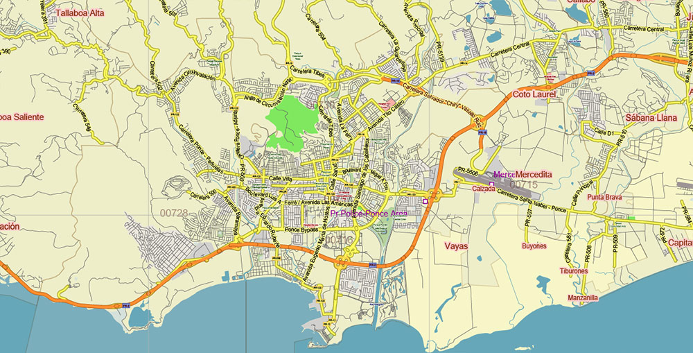
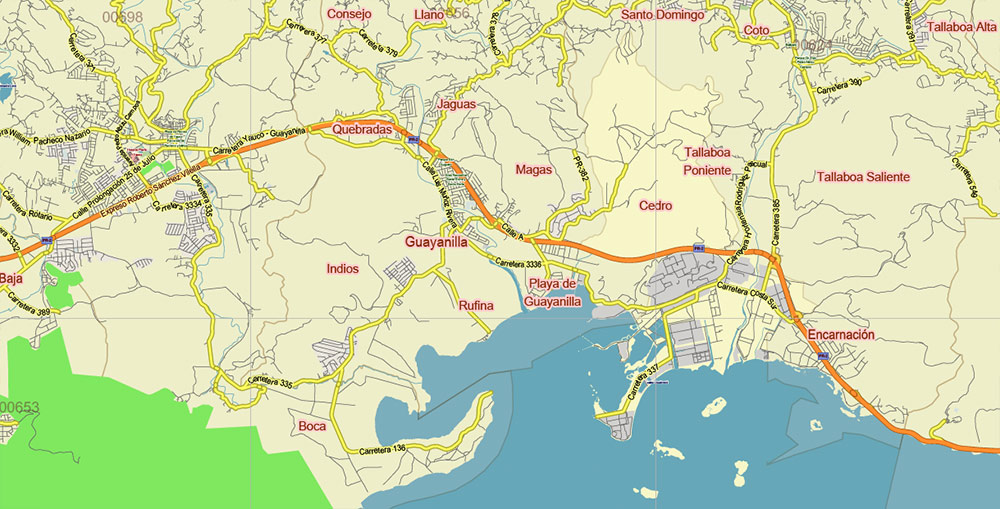
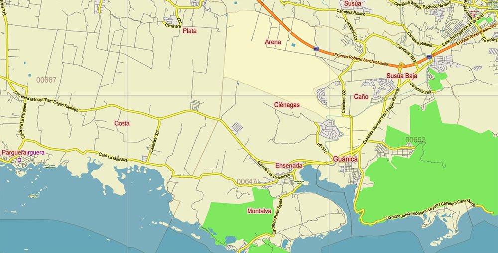
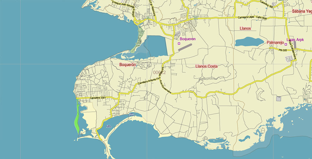
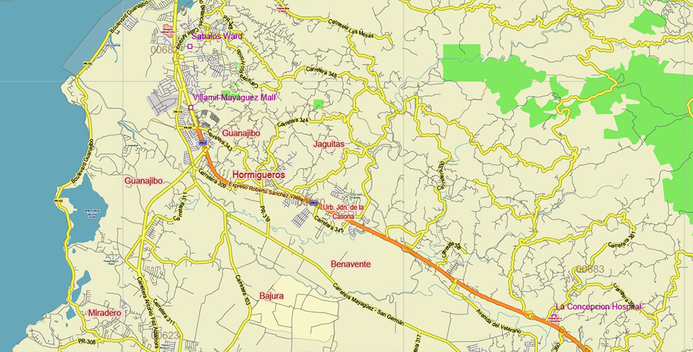
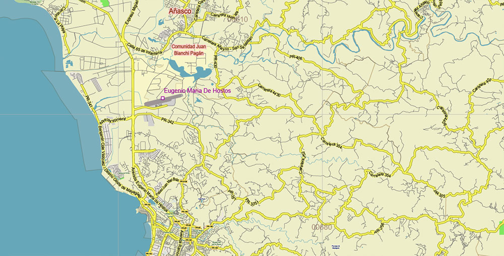
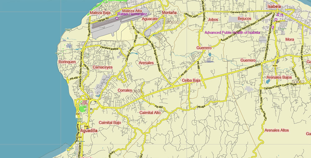
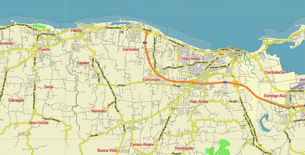
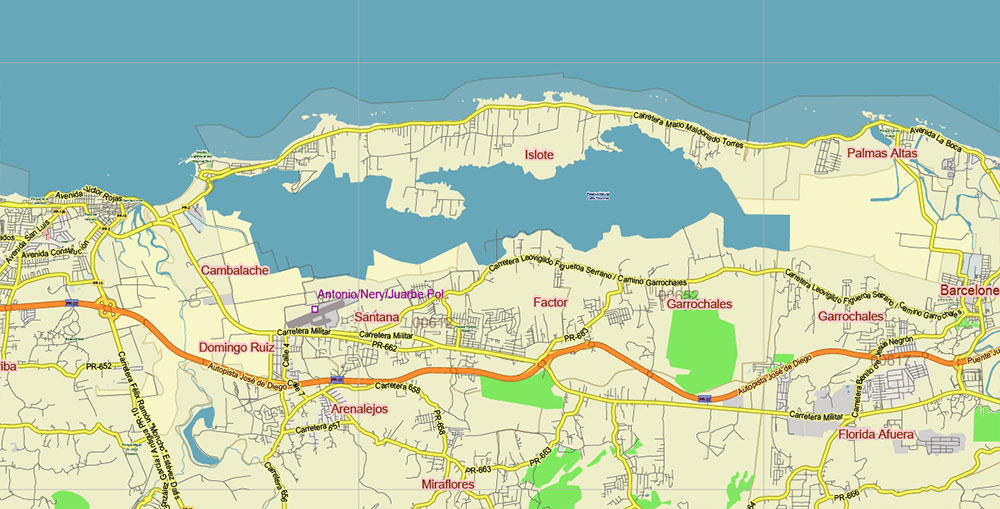
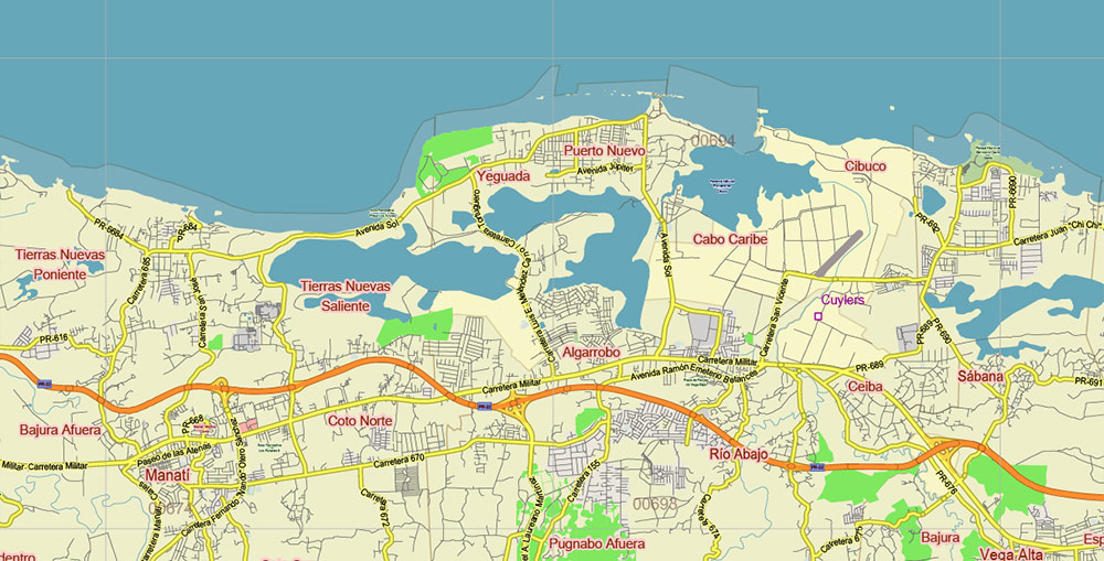
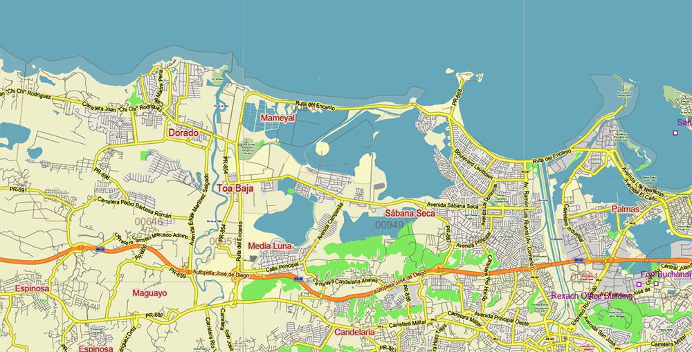
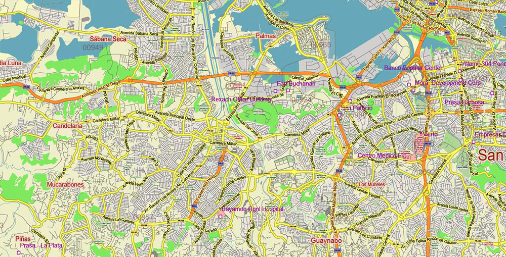
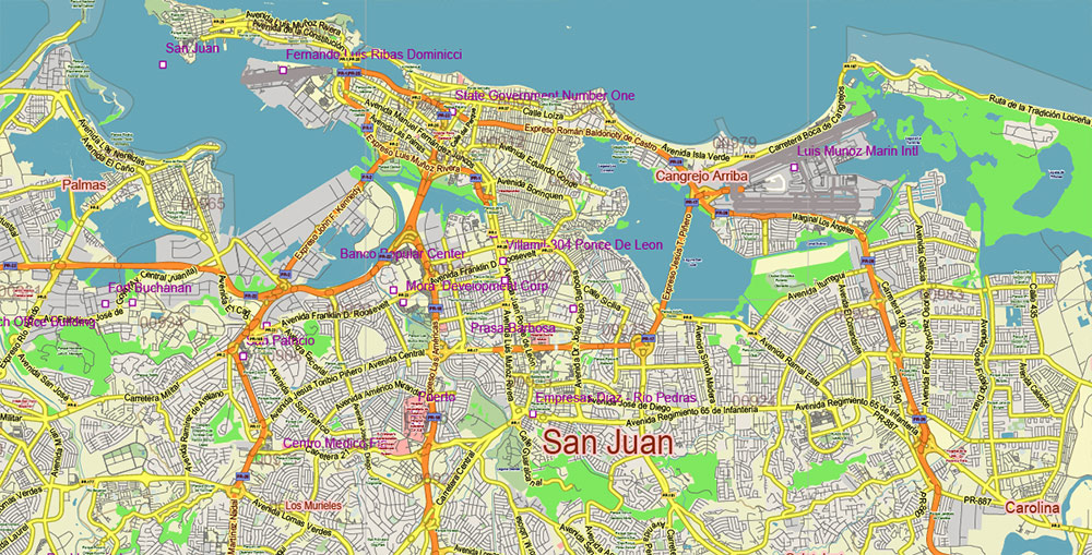
Printable Vector Map of Puerto Rico Full State, US: All Streets and Roads + ZIP (postal) codes areas, fully editable Adobe Illustrator Map in layers, scalable, 25 MB ZIP
Scale: 1:71390
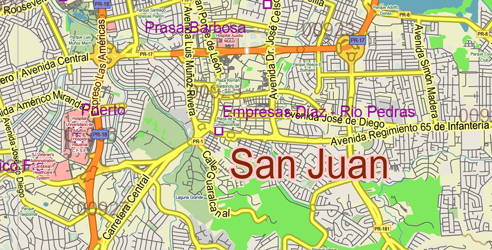
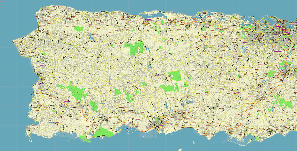
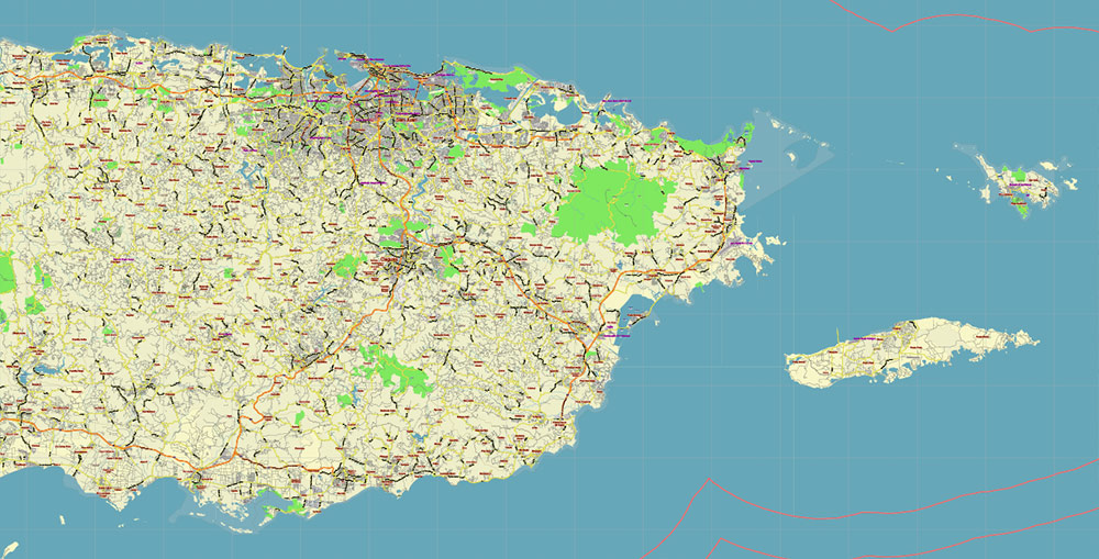
All streets and roads, Names of Principal streets, All Cities and Towns, airports, and heliports. Map for design, printing, arts, projects, presentations, for architects, designers, and builders, business, logistics.
ATTN! All objects are located on separate layers by type. The preview shows them all together. When you work with this map, just turn off or delete those layers that are not needed for your project.
For Editing and High-Quality Printing, Royalty free
Need AutoCAD DWG / DXF, CDR, or any other format? Please, contact us!
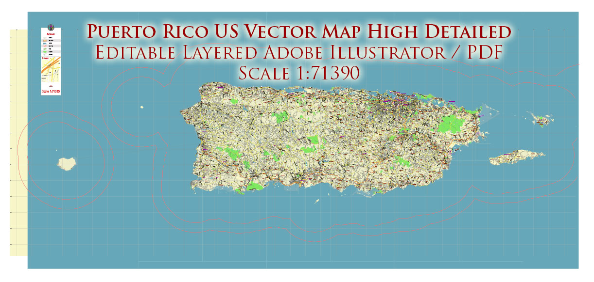
Puerto Rico Full State US Vector Map: Full Extra High Detailed (all roads, zipcodes, airports) editable Adobe Illustrator in layers
Layers list:
- Legend
- Grids
- Labels of roads (numbers) – highways, interstate
- Names places: Names of all Cities, towns, villages, and hamlets
- Names of the Airports and Heliports
- Points of the Airports and Heliports
- Numbers of ZIP codes
- Names of objects (water, park, hospital)
- Names of the Main Streets
- Major Roads and Streets – Highways
- Minor Roads and residential streets
- Railroads
- Water objects (rivers, lakes, ponds, swamps, reefs)
- Waterways
- Ground objects (urban areas, parks, hospitals, etc.)
- ZIP-codes areas
- Islands
- Sea
- Background
Puerto Rico Full State US Vector Map: Full Extra High Detailed (all roads, zipcodes, airports) editable Adobe Illustrator in layers
Puerto Rico Full State US Vector Map: Full Extra High Detailed (all roads, zipcodes, airports) editable Adobe Illustrator in layers
Puerto Rico Full State US Vector Map: Full Extra High Detailed (all roads, zipcodes, airports) editable Adobe Illustrator in layers
Puerto Rico Full State US Vector Map: Full Extra High Detailed (all roads, zipcodes, airports) editable Adobe Illustrator in layers
Puerto Rico Full State US Vector Map: Full Extra High Detailed (all roads, zipcodes, airports) editable Adobe Illustrator in layers
Puerto Rico Full State US Vector Map: Full Extra High Detailed (all roads, zipcodes, airports) editable Adobe Illustrator in layers
Puerto Rico Full State US Vector Map: Full Extra High Detailed (all roads, zipcodes, airports) editable Adobe Illustrator in layers
Puerto Rico Full State US Vector Map: Full Extra High Detailed (all roads, zipcodes, airports) editable Adobe Illustrator in layers
Puerto Rico Full State US Vector Map: Full Extra High Detailed (all roads, zipcodes, airports) editable Adobe Illustrator in layers
Puerto Rico Full State US Vector Map: Full Extra High Detailed (all roads, zipcodes, airports) editable Adobe Illustrator in layers
Puerto Rico Full State US Vector Map: Full Extra High Detailed (all roads, zipcodes, airports) editable Adobe Illustrator in layers
Puerto Rico Full State US Vector Map: Full Extra High Detailed (all roads, zipcodes, airports) editable Adobe Illustrator in layers
Puerto Rico Full State US Vector Map: Full Extra High Detailed (all roads, zipcodes, airports) editable Adobe Illustrator in layers
Puerto Rico Full State US Vector Map: Full Extra High Detailed (all roads, zipcodes, airports) editable Adobe Illustrator in layers
Puerto Rico Full State US Vector Map: Full Extra High Detailed (all roads, zipcodes, airports) editable Adobe Illustrator in layers
Puerto Rico Full State US Vector Map: Full Extra High Detailed (all roads, zipcodes, airports) editable Adobe Illustrator in layers
Puerto Rico Full State US Vector Map: Full Extra High Detailed (all roads, zipcodes, airports) editable Adobe Illustrator in layers
Puerto Rico Full State US Vector Map: Full Extra High Detailed (all roads, zipcodes, airports) editable Adobe Illustrator in layers
Puerto Rico Full State US Vector Map: Full Extra High Detailed (all roads, zipcodes, airports) editable Adobe Illustrator in layers
Puerto Rico Full State US Vector Map: Full Extra High Detailed (all roads, zipcodes, airports) editable Adobe Illustrator in layers
Puerto Rico Full State US Vector Map: Full Extra High Detailed (all roads, zipcodes, airports) editable Adobe Illustrator in layers
Puerto Rico Full State US Vector Map: Full Extra High Detailed (all roads, zipcodes, airports) editable Adobe Illustrator in layers
Puerto Rico Full State US Vector Map: Full Extra High Detailed (all roads, zipcodes, airports) editable Adobe Illustrator in layers
Puerto Rico Full State US Vector Map: Full Extra High Detailed (all roads, zipcodes, airports) editable Adobe Illustrator in layers
Puerto Rico Full State US Vector Map: Full Extra High Detailed (all roads, zipcodes, airports) editable Adobe Illustrator in layers

 Author: Kirill Shrayber, Ph.D. FRGS
 editable Adobe PDF + CDR CorelDraw in layers")
 editable Adobe Illustrator in layers")
 editable Adobe PDF + CDR CorelDraw in layers")

