Extended Description of the Vector Map
Philadelphia Museums
The Philadelphia Museum of Art is perhaps the most famous not only in the city and state but also one of the most famous in the United States. There are about 225 thousand different works of art: paintings, sculptures created by recognized masters, including artists such as Picasso, Renoir, Rousseau. Some of them are exhibited in more than 200 galleries. There are 72 stone steps leading up to the Museum of Art, offering beautiful views of Philadelphia.
In addition, these steps are called “Rocky steps“: Sylvester Stallone’s character Rocky Balboa ran on them during training. He became so popular with the public that a bronze statue of the character is installed next to the museum.
Address: 26th Street and Benjamin Franklin Parkway, phone: +1 (215) 763-81-00. A visit to the main building of the museum for adults will cost 20 USD, students, children over 12 years old, seniors over 65 years old — 18 USD, children under 12 years old – free of charge.
The Mutter Museum of Medical History — is a museum of medical pathologies, ancient medical equipment, and biological exhibits. The museum’s somewhat grotesque collection includes skulls, a 12.5 cm-long human intestine, a woman’s corpse that has been turned into soap, as well as preserved organs and skeletons. Address: 19 South 22nd St.; tel.: 215-563-3737, opening hours: Monday-Friday-10: 00-17:00, Saturday-Sunday — 10:00-17: 00. Admission — 18 USD; 6-17, 65+ years old, military, students-15 USD, college graduates and children under 6 years old-free of charge.
Interesting is the Museum of Archaeology and Anthropology of the University of Pennsylvania, which in the early 20th century organized several important archaeological expeditions to Egypt, Mesopotamia, Africa, East Asia, and Latin America. From where he brought almost all of his collection. Address: 3260 South Street, tel.: 215-898-4001. Working hours: Tuesday-Saturday-10: 00-16:30, Sunday — 13:00-17: 00. Admission — 15 USD, 65+ – 13 USD, children 6-17 years — 10 USD. The museum has a Pay-what-you-want system.) from Tuesday to Saturday after 15: 30 and on Sunday after 16: 00.
The Independence Seaport Museum is located on the Delaware River Embankment. The museum complex includes the cruiser Olympia and the submarine Berkun. The vessels are moored near the shore and are open to the public. The address of the museum: S Columbus Blvd., 211; phone: 215-925-5439.
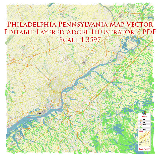
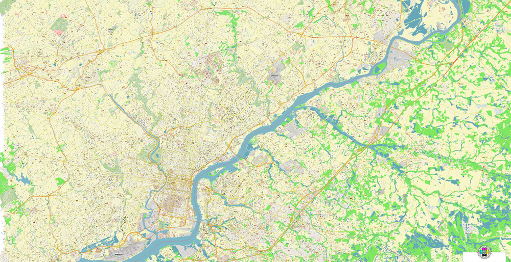
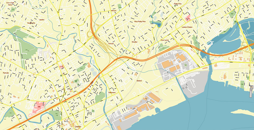
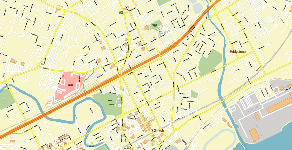
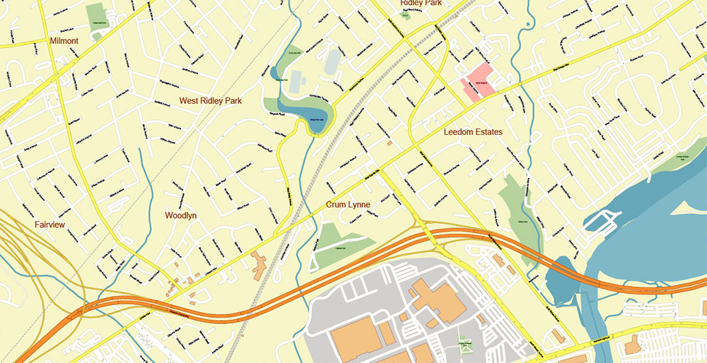
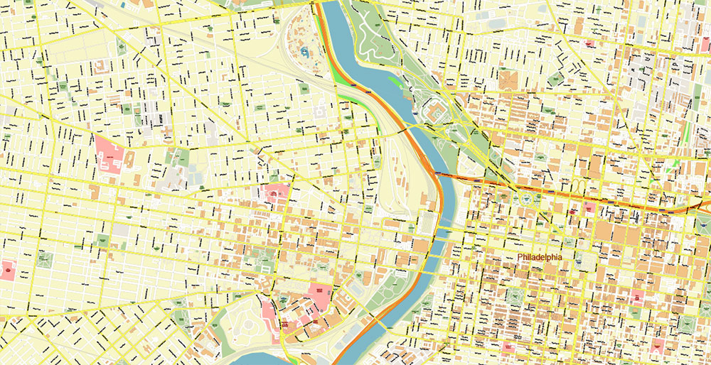
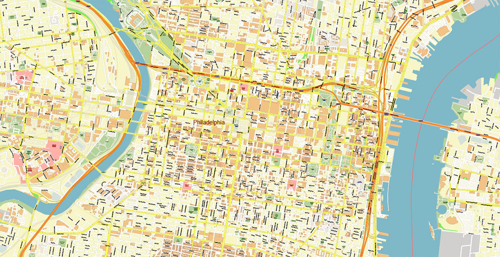
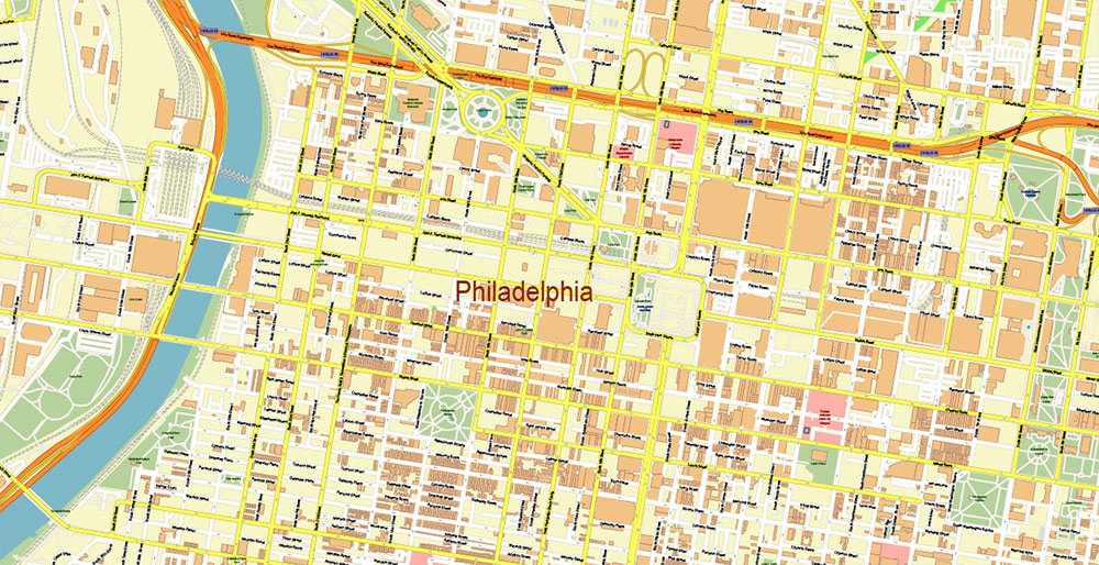
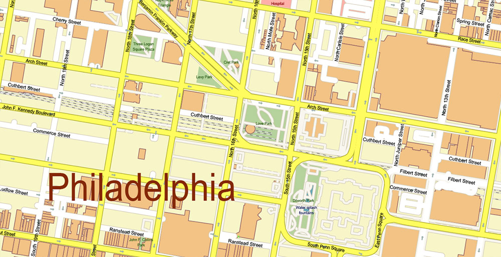
Printable Vector Map of Philadelphia Pennsylvania US detailed City Plan (with neighborhood) scale 1:3597 full editable Adobe Illustrator Street Map in layers, scalable, text format all names, 59 MB ZIP
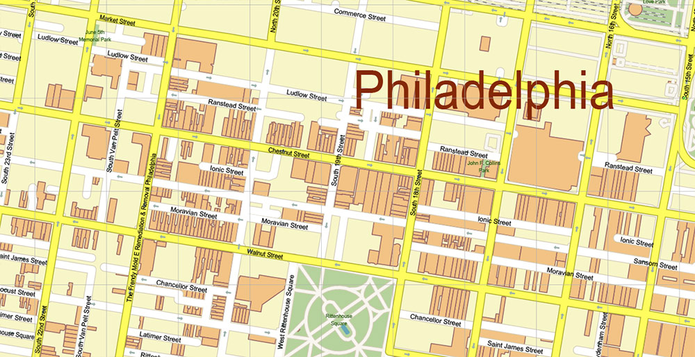
All street names, Main Objects, Buildings. Map for design, printing, arts, projects, presentations, for architects, designers, and builders, business, logistics.
Also: We can add the ZIP (postal) codes areas with numbers (additiona layer for this map), and other objects for you. It’s free for our customers.
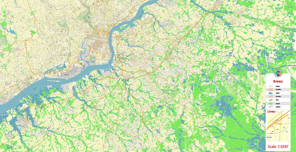
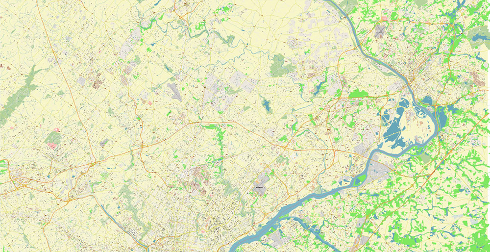
Map covered area:
Layers list:
- Legend
- Grids
- Labels of roads
- Names of places (city, hamlet, etc.)
- Names of objects (hospitals, parks, water)
- Names of main streets
- Names of civil streets
- Main Streets, roads
- Civil streets
- Railroads
- Buildings
- Airports and heliports
- Water objects (rivers, lakes, ponds)
- Waterways
- Color fills (parks, hospital areas, land use, etc.)
- Background
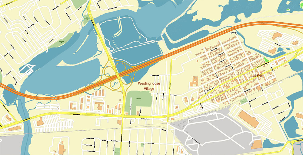
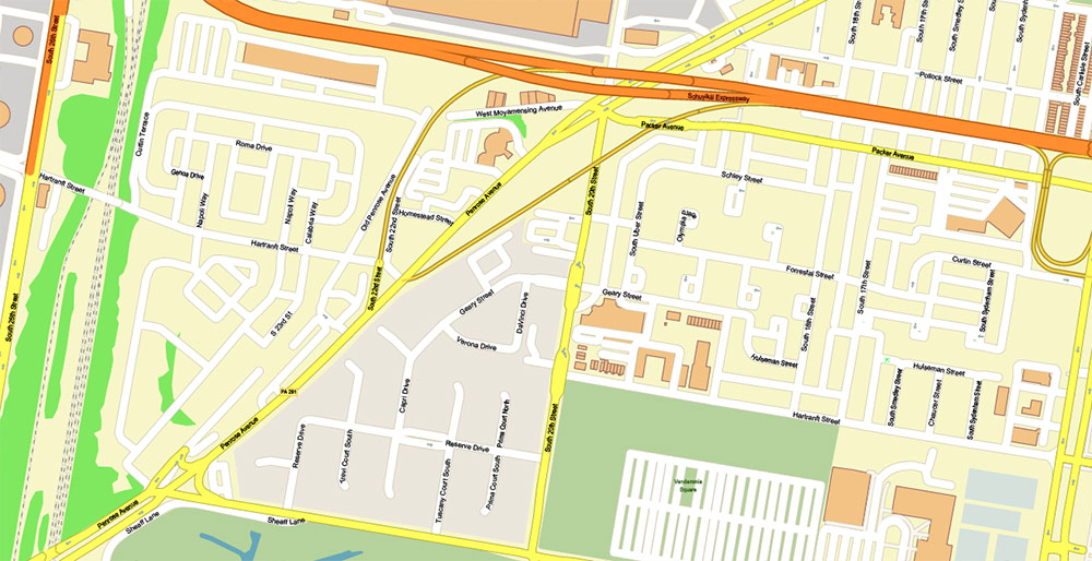
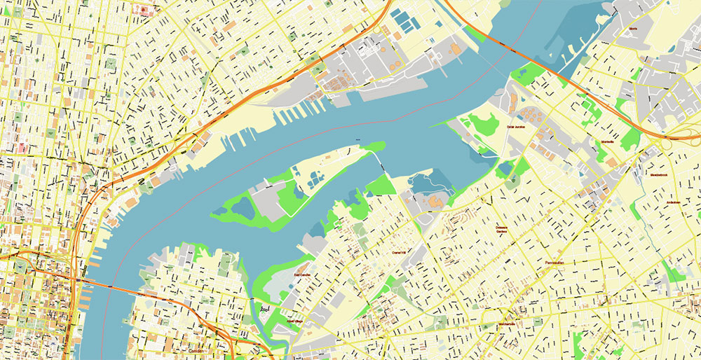
Philadelphia Pennsylvania US Map Vector Exact City Plan High Detailed Street Map editable Adobe Illustrator in layers
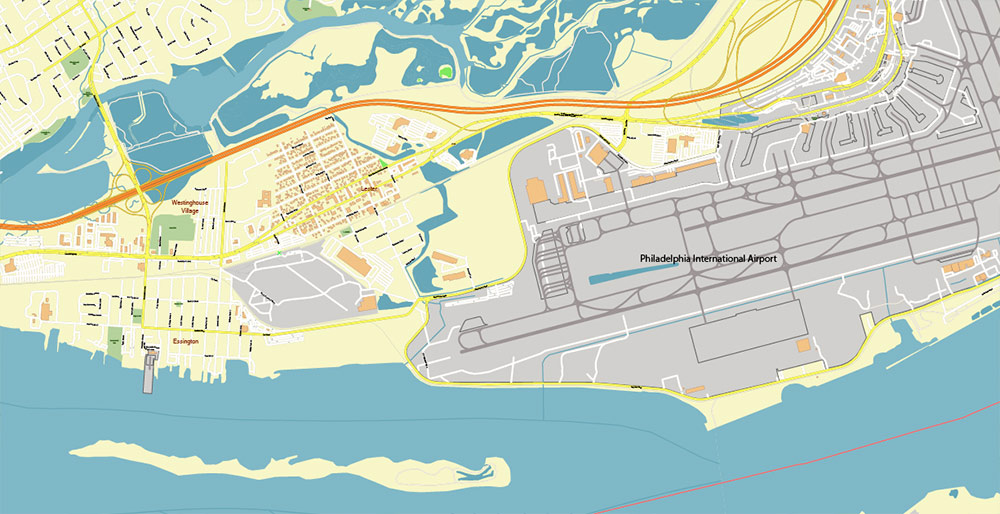
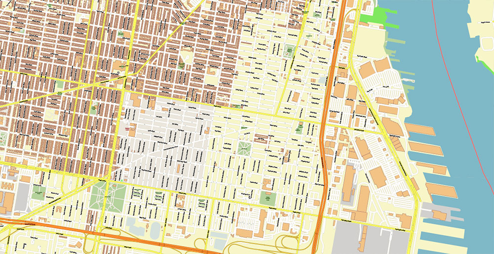
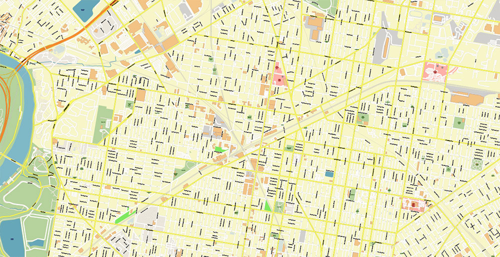
Philadelphia Pennsylvania US Map Vector Exact City Plan High Detailed Street Map editable Adobe Illustrator in layers
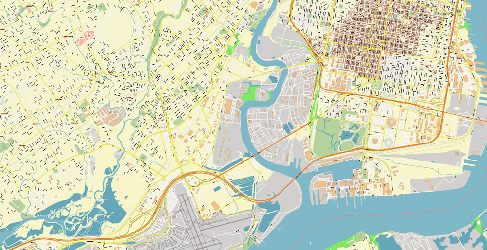
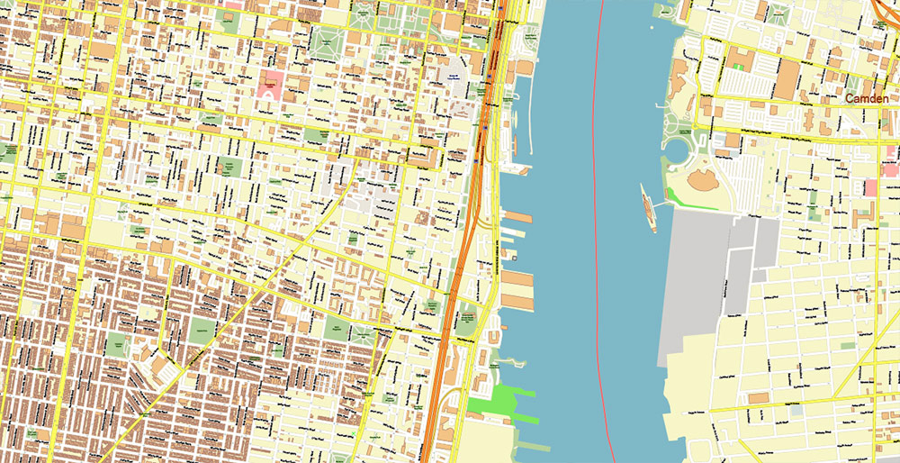
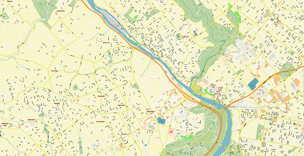
Philadelphia Pennsylvania US Map Vector Exact City Plan High Detailed Street Map editable Adobe Illustrator in layers
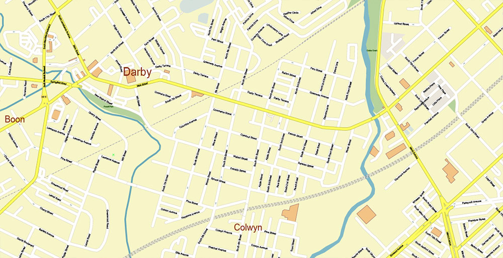
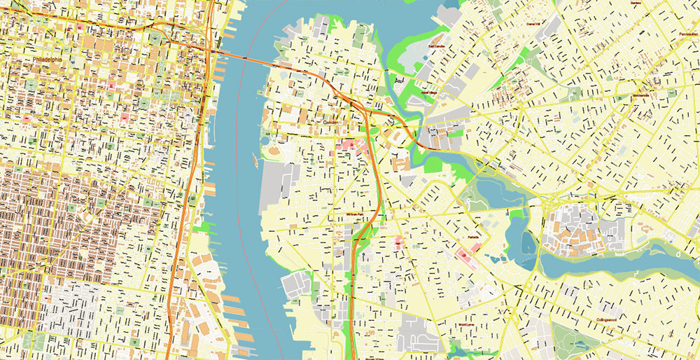
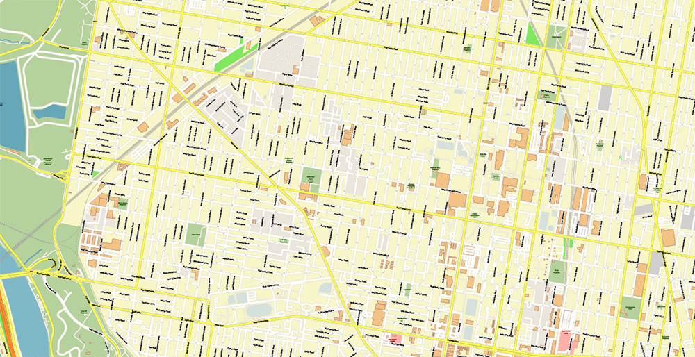
Philadelphia Pennsylvania US Map Vector Exact City Plan High Detailed Street Map editable Adobe Illustrator in layers
Philadelphia Pennsylvania US Map Vector Exact City Plan High Detailed Street Map editable Adobe Illustrator in layers
Philadelphia Pennsylvania US Map Vector Exact City Plan High Detailed Street Map editable Adobe Illustrator in layers
Philadelphia Pennsylvania US Map Vector Exact City Plan High Detailed Street Map editable Adobe Illustrator in layers
Philadelphia Pennsylvania US Map Vector Exact City Plan High Detailed Street Map editable Adobe Illustrator in layers
Philadelphia Pennsylvania US Map Vector Exact City Plan High Detailed Street Map editable Adobe Illustrator in layers
Philadelphia Pennsylvania US Map Vector Exact City Plan High Detailed Street Map editable Adobe Illustrator in layers
Philadelphia Pennsylvania US Map Vector Exact City Plan High Detailed Street Map editable Adobe Illustrator in layers
Philadelphia Pennsylvania US Map Vector Exact City Plan High Detailed Street Map editable Adobe Illustrator in layers
Philadelphia Pennsylvania US Map Vector Exact City Plan High Detailed Street Map editable Adobe Illustrator in layers
Philadelphia Pennsylvania US Map Vector Exact City Plan High Detailed Street Map editable Adobe Illustrator in layers
Philadelphia Pennsylvania US Map Vector Exact City Plan High Detailed Street Map editable Adobe Illustrator in layers
Philadelphia Pennsylvania US Map Vector Exact City Plan High Detailed Street Map editable Adobe Illustrator in layers
Philadelphia Pennsylvania US Map Vector Exact City Plan High Detailed Street Map editable Adobe Illustrator in layers
Philadelphia Pennsylvania US Map Vector Exact City Plan High Detailed Street Map editable Adobe Illustrator in layers
Philadelphia Pennsylvania US Map Vector Exact City Plan High Detailed Street Map editable Adobe Illustrator in layers
Philadelphia Pennsylvania US Map Vector Exact City Plan High Detailed Street Map editable Adobe Illustrator in layers
Philadelphia Pennsylvania US Map Vector Exact City Plan High Detailed Street Map editable Adobe Illustrator in layers
Philadelphia Pennsylvania US Map Vector Exact City Plan High Detailed Street Map editable Adobe Illustrator in layers
Philadelphia Pennsylvania US Map Vector Exact City Plan High Detailed Street Map editable Adobe Illustrator in layers
Philadelphia Pennsylvania US Map Vector Exact City Plan High Detailed Street Map editable Adobe Illustrator in layers

 Author: Kirill Shrayber, Ph.D. FRGS


